


Hiking Mount Agamenticus, York, Maine
Trail Description: The Mount Agamenticus Conservation Region is located in Southern Maine. The Mount Agamenticus Loop is a popular trail that provides 360 degree views at the summit of the surrounding mountains in the distance.
Trail Info:
Where: York, ME Distance: 1.8m (1 hour) Difficulty: Easy toModerate Trail Type: Loop Features: Views, Mountains, Valley
How to get there:
Typing the location “Mount Agamenticus Trailhead” into Google Maps will take you to the parking lot. You can’t miss it. There is a lot of parking. It’s $2/hr to park and there is a barcode to scan for the app to use to pay. It was easy peasy in my opinion. And, worth the money based on how well they keep up with everything.
Coordinates: 43.21720438450835, -70.69198787482621
Link to google maps location here.
Hiking Tips
I suggest caution if it rained days prior. The trails in the forest are mostly roots and rock. Dry it’s no biggie but wet I don’t think it would be as enjoyable.
Download a copy of the trail map here.
There are multiple trail options. This guide is for the loop via Blueberry Bluff, Witch Hazel, and Ring Trail. The Big A trail has separate parking and is a 1 mile loop that’s mostly gravel & an easier option (stroller and wheelchair friendly).
The trail and parking lots are well maintained and great facilities. Nicest outhouse bathrooms I ever been in!

The Hike
Once parked at the Mountain Road parking lot, the beginning of the trail head is visible with markers at end of the parking lot.

There will be trail signs promptly upon starting the hike at a fork. Stay right and hop on the Ring Trail, which is the white marked trail.

As stated prior, the trail is very well marked. However, the trail is mostly rocks and roots. I saw some reviews mentioning that it was muddy and unpleasant after a rainstorm. And, I totally understand what they meant. The rocks and roots could be slippery. For us, it was dry and there were no issues.

There isn’t much of an elevation gain, only about 340 feet. But there is a small incline as you make your way to the top. Hiking along the Ring Trail, at almost 0.7m, there will be a small foot bridge with a path to the left at the end. This is the Witch Hazel trail. I did not see signs but based on the trail map, this was the way to go.

The Witch Hazel trail is brief. Only a few minutes to reach the Big A Trail. There will also be a small foot bridge.

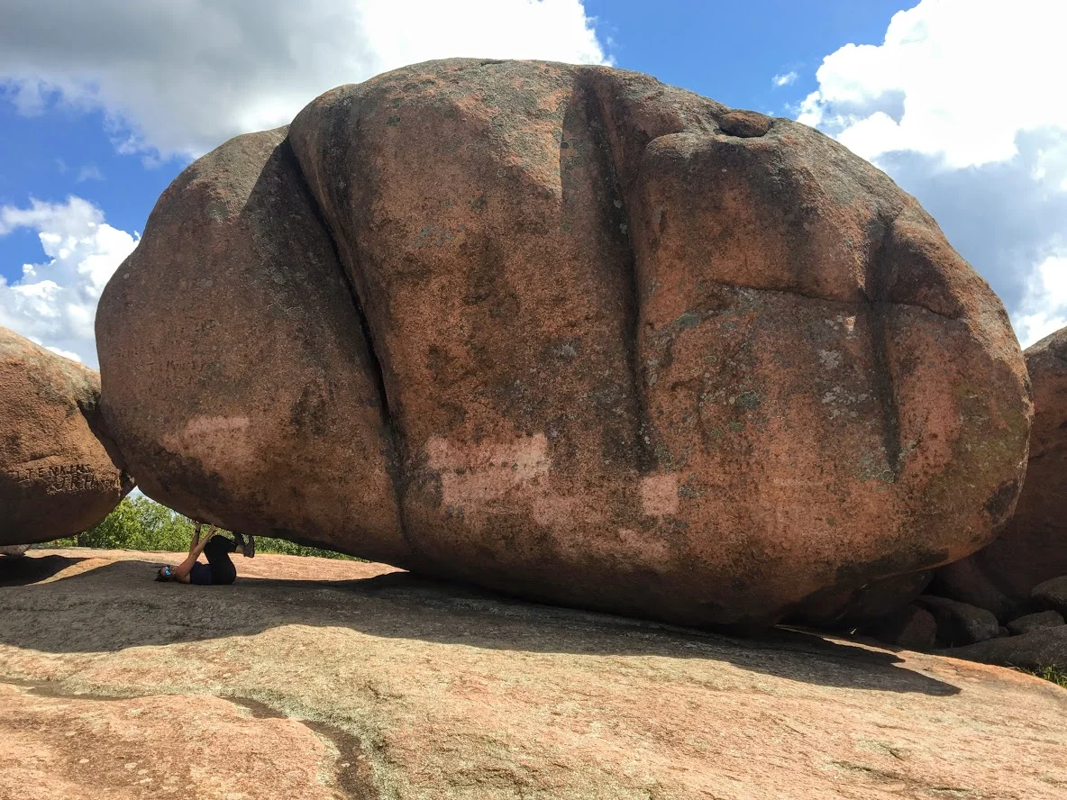
And following the Big A trail at the top is where the first lookout platform is to take in all the views.

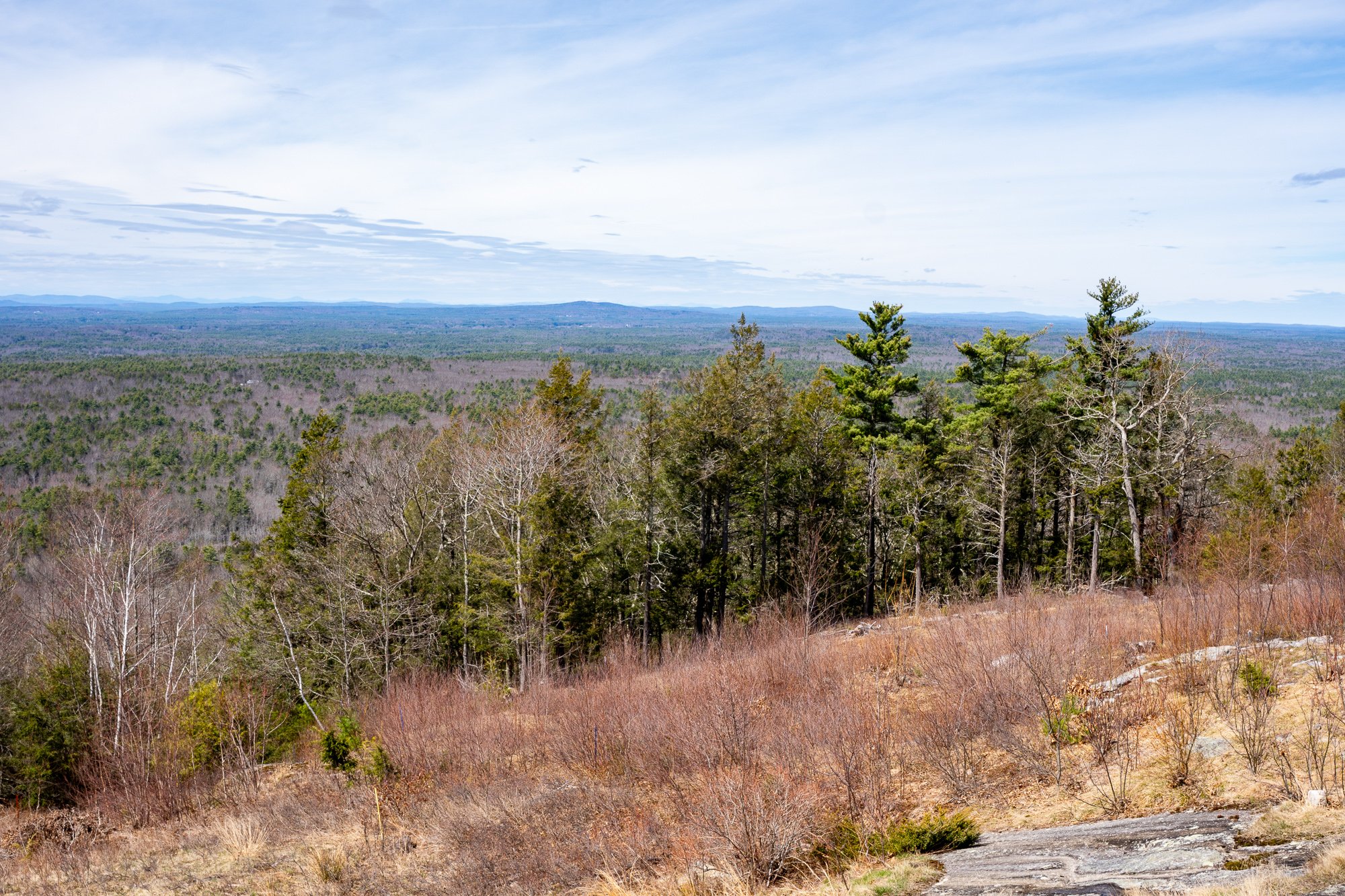
There is another lookout platform with stairs where you can see even higher out into the valley. There is also a fire tower, but it is fenced out and cannot be climbed.


Follow the Big A Trail out until it connects to the Blueberry Bluff, which is marked red. There is also an additional viewpoint here before the Blueberry Bluff.

Continue down the Blueberry Bluff back to the Ring Trail. Take a left at the sign back to the parking lot. You will cross the road at the end to get back to your car.

Southern Maine is tracking to be one of our favorite areas to visit and this was a great first hike in the area. Good hike to get the heart going and see some cool views. The platforms are a cool feature for viewing on the summit. And, the trails and parking lots are so well maintained. I cannot speak highly enough on that. I was not able to find a great guide with details for this hike so I am hopeful this will be helpful for others. It’s also good to see directions/steps before you go to get comfortability. Not a hard hike to follow but I understand where folks can get tripped up. I still do it many times. Luckily, my wife is always the voice of direction.
POST HIKE ACTIVITIES: The fun doesn’t have to stop here. Lots to do in the area. We stopped by the 90s themed brewery, Odd by Nature Brewing, for some post hike beers and nosh, which is about 8 minutes from the trailhead. And, the Nubble Lighthouse is roughly 15 minutes or so away. Definitely a trip to view. Cape Neddick is really cool. Many restaurants in the area as well. No matter what you decide to do, there is a lot to plan for a great weekend or day trip.


HIKING FOR DONUTS
Hi, I’m Mark. I live in Connecticut. I take new trips every chance I get. A good trip has a great hike, great food, and something fun to do. My goal is to search out new trips and share them to inspire others to try something new and exciting.
If you are looking for posts in a particular place, search City or State here.
SEE OTHER POSTS IN ARCHIVE
Archive
RECOMMENDED POSTS


RECENT POSTS


See the latest on Instagram and follow @HIKINGFORDONUTS
Lone Elk Park, St. Louis County, Missouri
Lone Elk Park is located in St. Louis County, Missouri. This park is only 35 minutes from downtown St. Louis and is a must visit bucket list. This park offers you a great nature adventure without needing to get out of your car. I never thought I would find elks and bison roaming in Missouri. This was an fun and exciting adventure. Read more about this in my latest blog!
I bet if I were to tell you, within a 35 minute drive from downtown St. Louis you would find a park that was reminiscent of Yellowstone National Park; you would think I am out of my mind. Lone Elk Park gives you that type of experience. Don’t get me wrong, it is nowhere near the size of Yellowstone, it is pretty small in comparison (only 2600 acres). Nor does it offer any of the landscape of Yellowstone. However, being able to drive among wild animals in nature from your car is a very cool experience that reminded me of when I was in Yellowstone. Again, at a very smaller scale. But come on, this is in Missouri!!! Who would of thought? As the name of the park states, you will see a huge elk population roaming. In addition, you will see bison, wild turkey, waterfowl, and deer. Essentially, you drive a loop around the park that takes about 30 minutes and hope to see some animals walking around. And, the park is totally free!
Entrance to the park. Veer left.
The park is tucked away in Valley Park, around Hwy 44 and Hwy 141. It is very easy to get to via gps. The park opens around 7am in the summer and *am in the winter. After doing some research online, I read the best time to see animals out is early in the morning or late at night before the park closes (sunset). Pretty good advice.
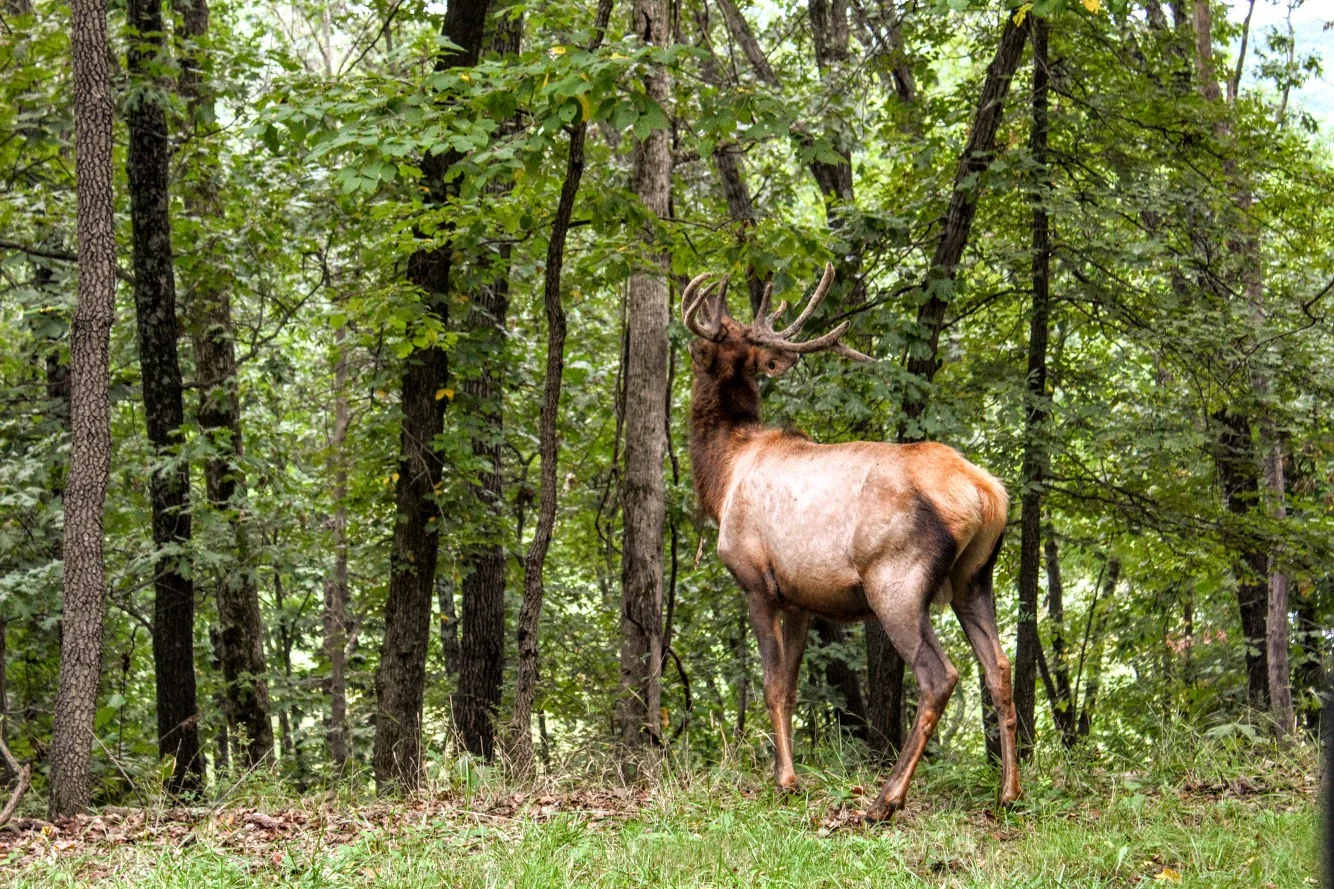
ELk butt.
We drove in from our hotel and got there around 8am. We pulled up to the park entrance. There is a bird sanctuary to your right if that is what you like. You will see the caution signs to stay in your car. Within the first 20 seconds of driving in, Nichole says to me, “Umm…is that fake?” And I responded, “Oh snap. That is as real as it gets”. The first animal we see in the middle of the road was a massive male elk with huge antlers. It honestly did look like a statue from far away. We crawled slowly past the elk and it was almost arm’s length away from the car. We made sure not to make to make it angry. We had a small rental car and this guy would tear it up.
this is real. First Elk we saw. Massive.


Great view of the lake and ELk.
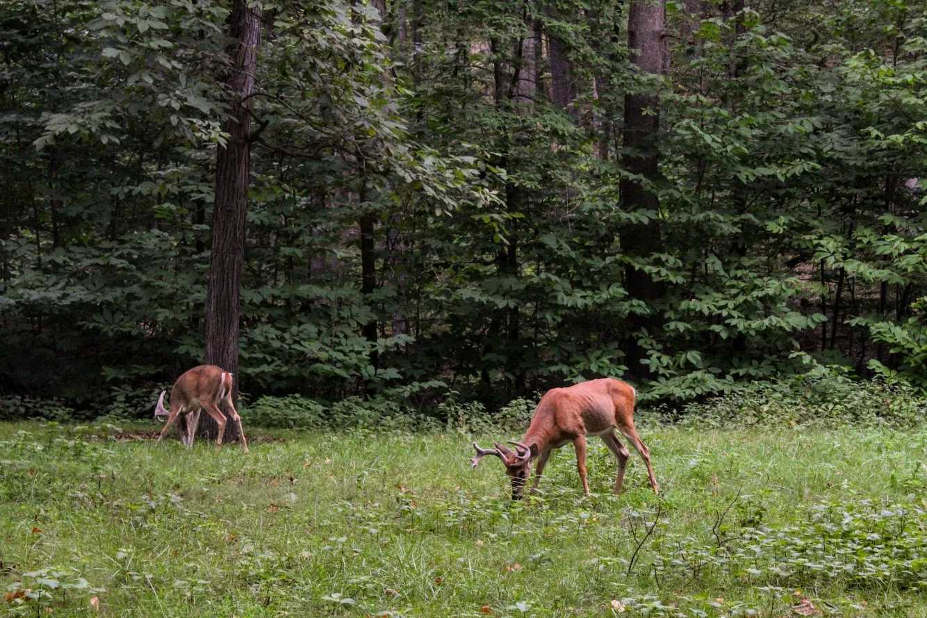
As we proceeded, we saw more elk in the woods and a herd to our left as we saw a full view of the lake. We continued to drive along the loop and we started seeing more deer and wild turkeys. The deer here were big guys. We passed the lake and once that was behind us, we started to enter the bison area. You we see more signs here as they want to make sure no one gets out of the car. On this morning, we did catch a few bison out in the fields but they were further away. Not as close as the elks. After that, there isn’t much to the drive and the exit was upon us.


The great thing about this park is you can keep driving around as many times as you want. We wanted to take one more loop to see if more animals came out. Unfortunately, they moved further away the second time. But worth a shot. Also, the park does have hiking trails where you can be out in the open and potentially cross paths with the animals. On your feet or in your car, be careful. Bison and elk will gore you or your car.
Second time around the elk went to down the water. The model stayed put.
That’s where they went.
MOre of the big elk in the lake.
This was first time Nichole has seen wildlife like this so close. It was a cool experience. Note, if you want pictures, make sure you are driver side. I went in the back seat. No way was I driving, too excited! Definitely glad we came across this place in our research and made the drive. If you are visiting, this is a must add to your list. It is a great opportunity to get in touch with nature and you don’t even have to leave your car.
Lake views from the top of the hill.
I don’t trust turkeys.
HIKING FOR DONUTS
A blog for the outdoors foodie enthusiast
Hi, I’m Mark. I live in Connecticut. I take new trips every chance I get. A good trip has a great hike, great food, and something fun to do. My goal is to search out new trips and share them to inspire others to try something new and exciting.
If you are looking for posts in a particular place, search by city or state here.
EXPLORE OTHER POSTS IN THE ARCHIVE
Archive
RECOMMENDED POSTS
MOST RECENT POSTS
See where I have been recently on Instagram. Follow @HIKINGFORDONUTS


