Hudson Valley Hikes

Bull Hill (Mt Taurus) Hike, Cold Spring, NY

Trail Description: Bull Hill (Mt Taurus) is a loop trail that offers amazing views of the Hudson River and surrounding mountains in the Hudson Highlands such as Storm King and Breakneck Ridge.

Trail Info:

Where: Cold Spring, NY Distance: 5.4m (3-4 hours) Difficulty: Moderate to Difficult Trail Type: Loop Features: Views, Mountains, Valley, River, Ruins

How to get there:

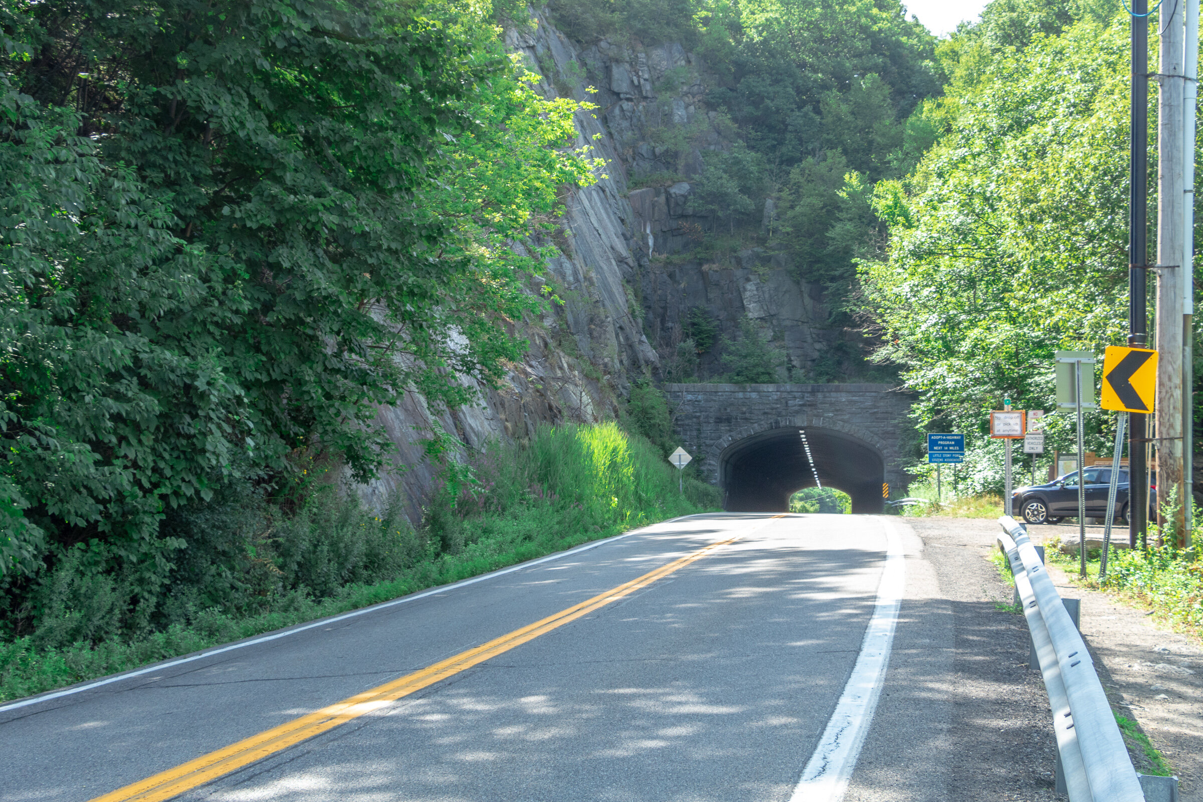
The trailhead is north of Cold Spring village along Route 9D by about a mile. The parking is shared with Little Stony Point. The location you may see searching on google map will be the Washburn Trail, which is where the hike begins.

Click here for parking lot coordinates

Hiking Tips

  • There are multiple trails, can choose short or long route.

  • Stick to a loop trail and connecting to other trails to get back. The terrain is steep going up, probably not fun going down…unless that is your thing!

  • Parking lot is small, fills up very quick on weekends!

The Hike

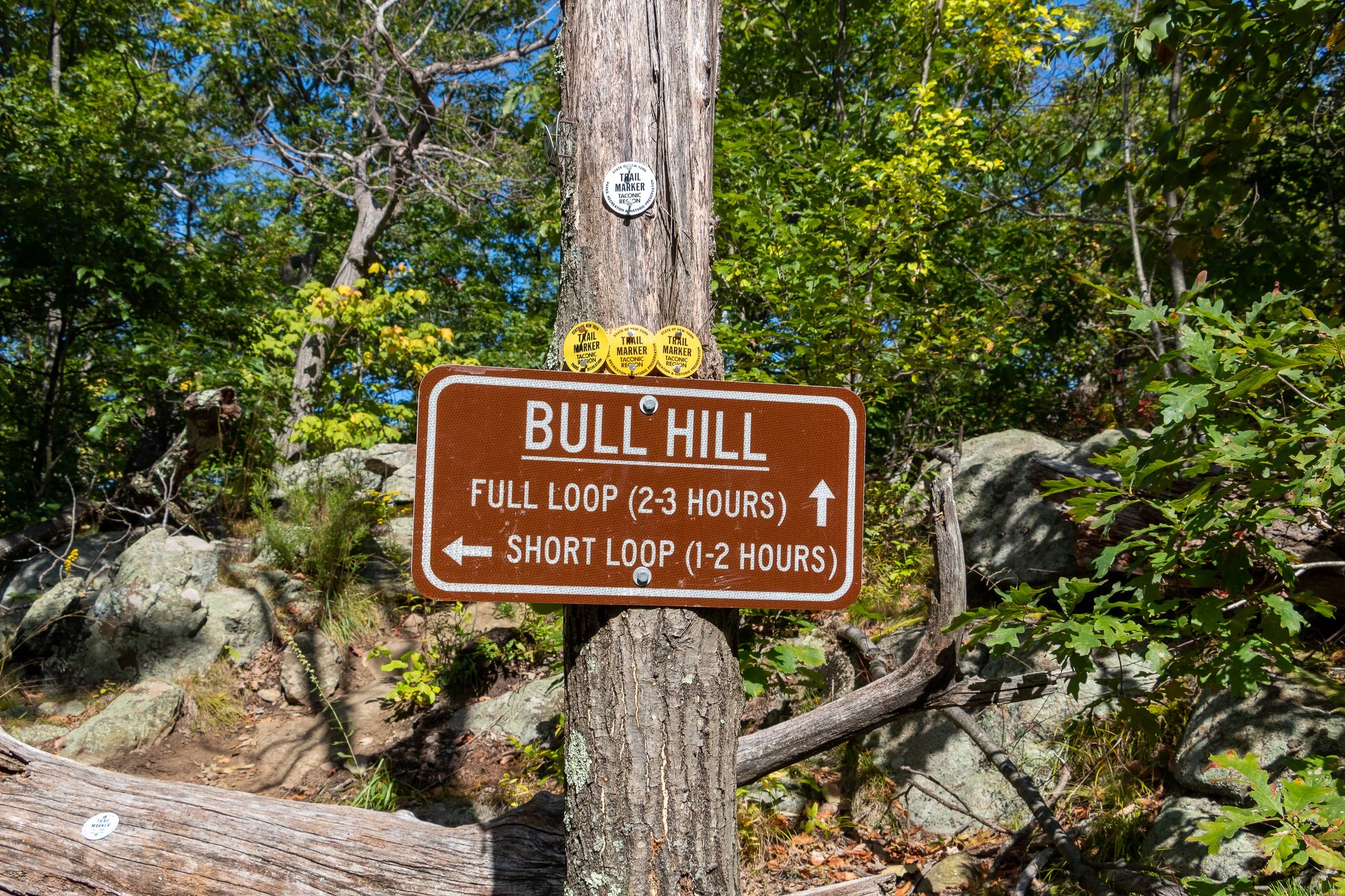
Starting at the parking area, you have a decision. How long do you want to hike? To be completely honest, my intention was to take the short route but I ended up hiking about the same as the full loop somehow. So, this is the short loop with a little twist. To begin, start trekking on the right to the white marked trail, the Washburn Trail.

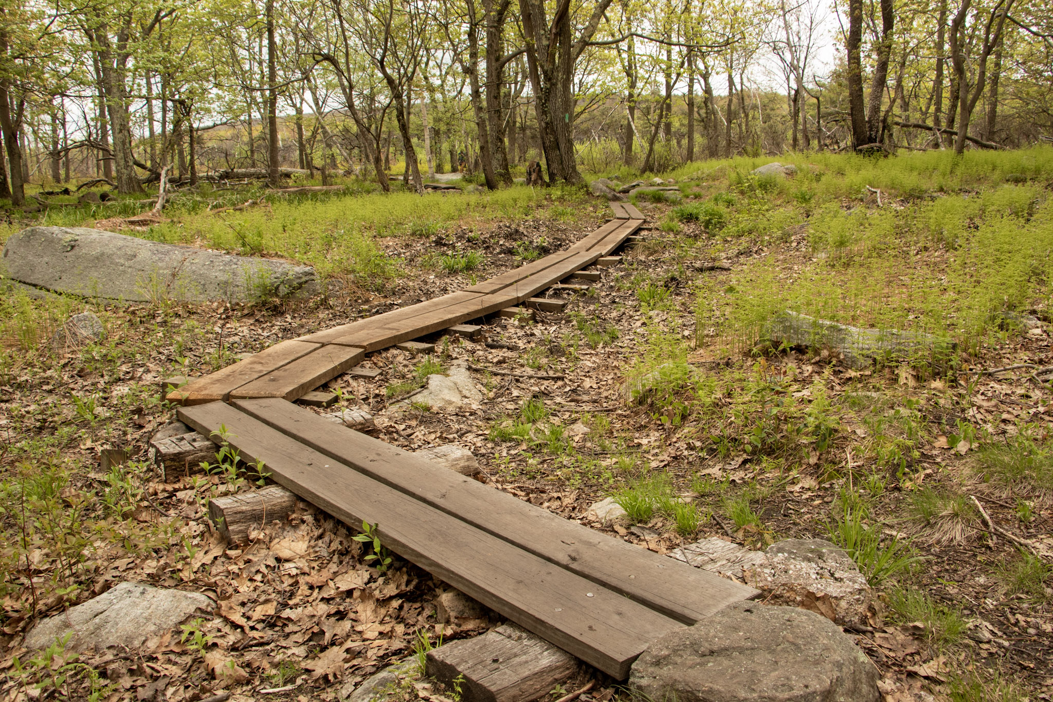
The trail follows through the woods along a road at first with a gradual incline. This will lead to an open area with a sign to take a sharp right to continue on the trail.


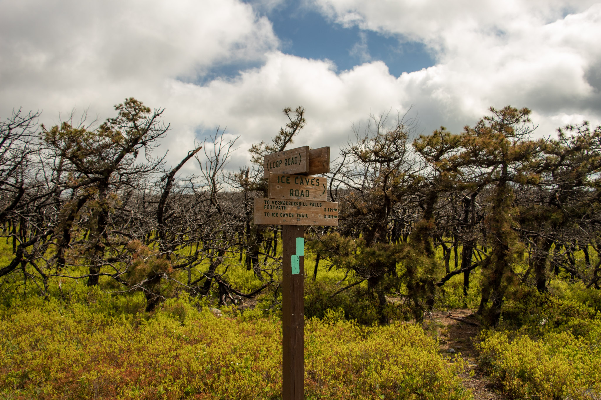
This is a well marked trail and there are many signs for all the viewpoints.

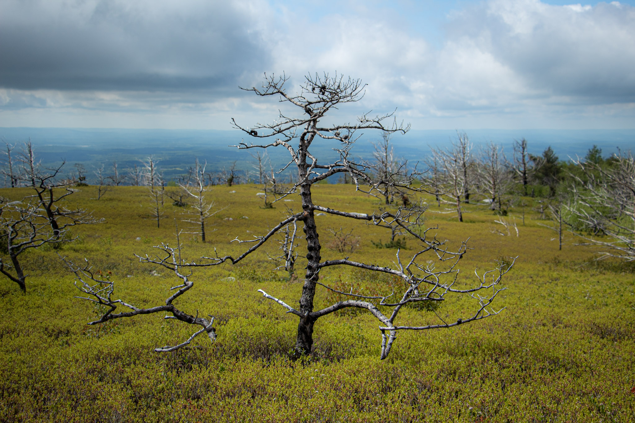
The first few miles are pretty steep before you reach some viewpoints.


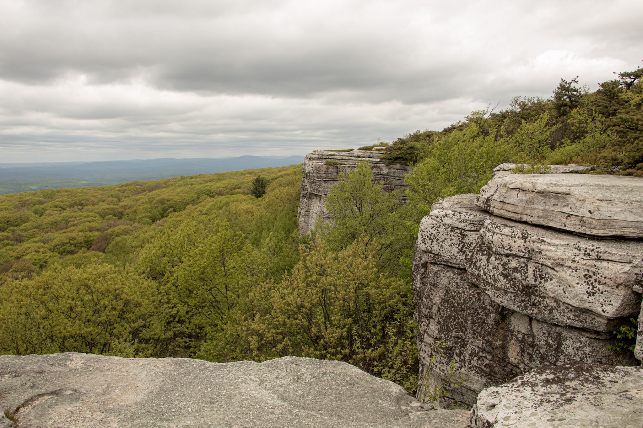
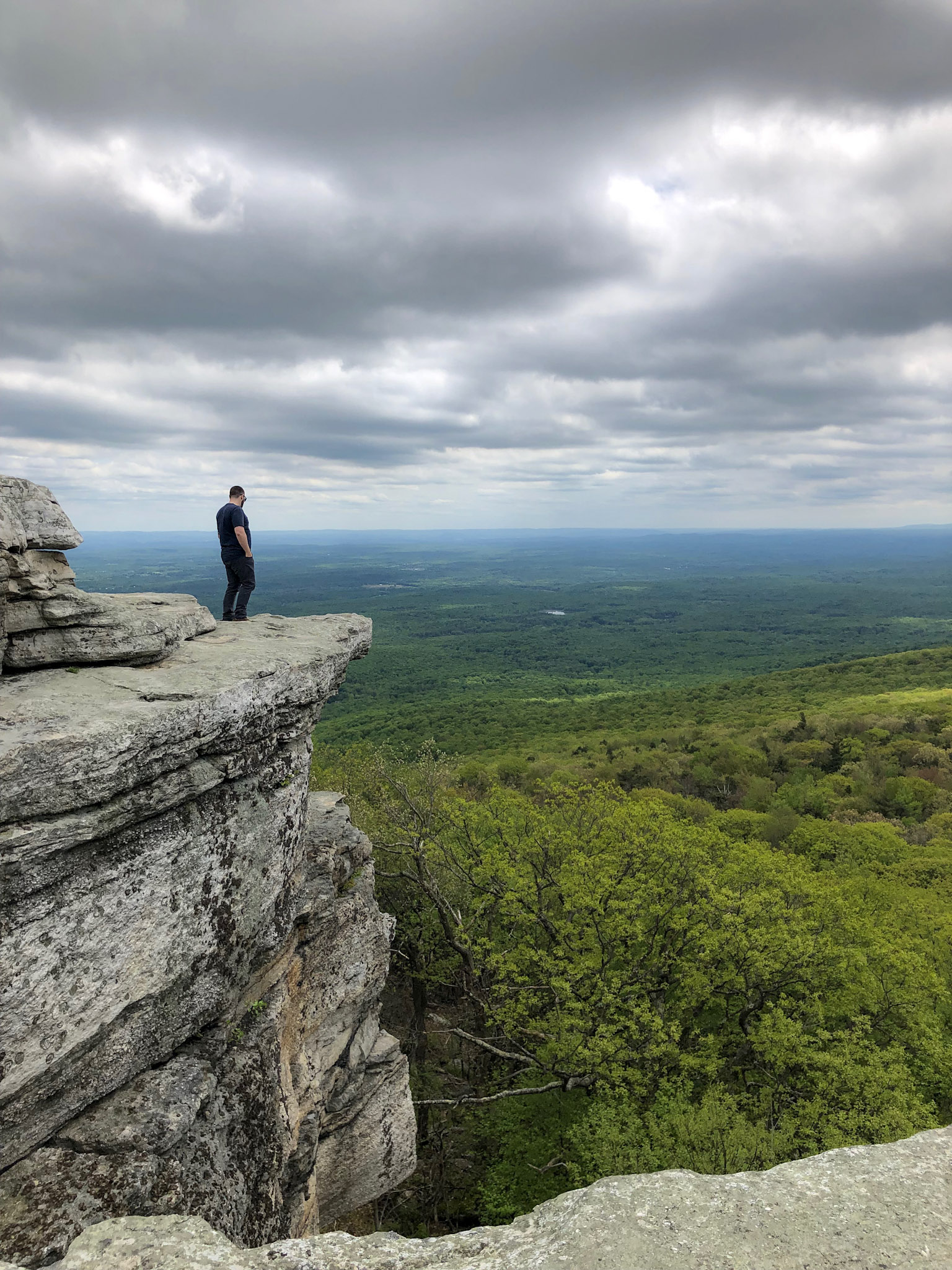
The first viewpoint will be a view of the Hudson River with Breakneck & Storm King Mountain in the background. Shortly after, the second viewpoint provides views of Cold Spring & West Point in the distance.

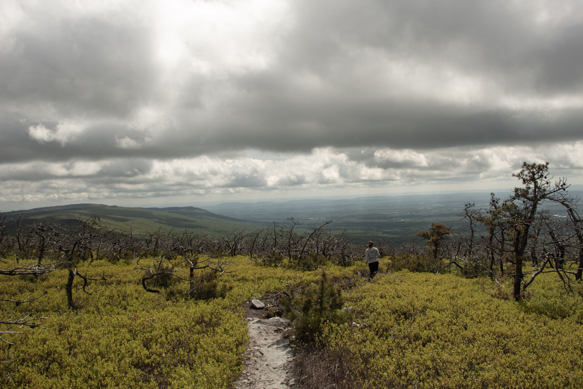
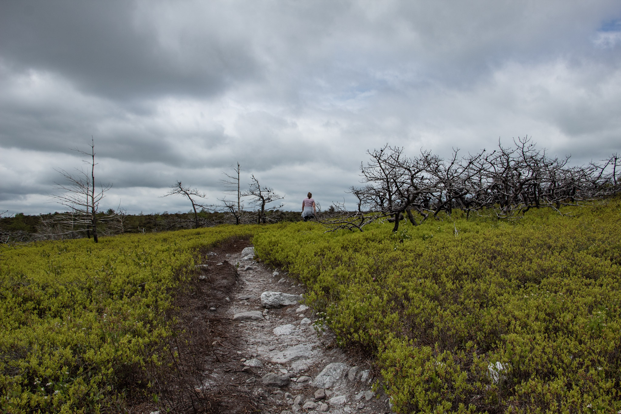
Continue along the white trail markers as the trail incline increases. There will be more views to take in. Eventually, the trail reaches an intersection. The short loop will be to your left following the yellow marker and the full loop is straight ahead following the white trail. I wanted to reach the summit view of Mt Taurus so I went straight here. Continue on this trail and you will notice some rocks with the word “View” painted with arrows pointing up. This will lead to the astonishing views from Bull Hill (Mt Taurus).

From here, I retraced my steps back down to the intersection and hopped on the yellow marked trail (Short Loop). You could continue on the long loop as well.

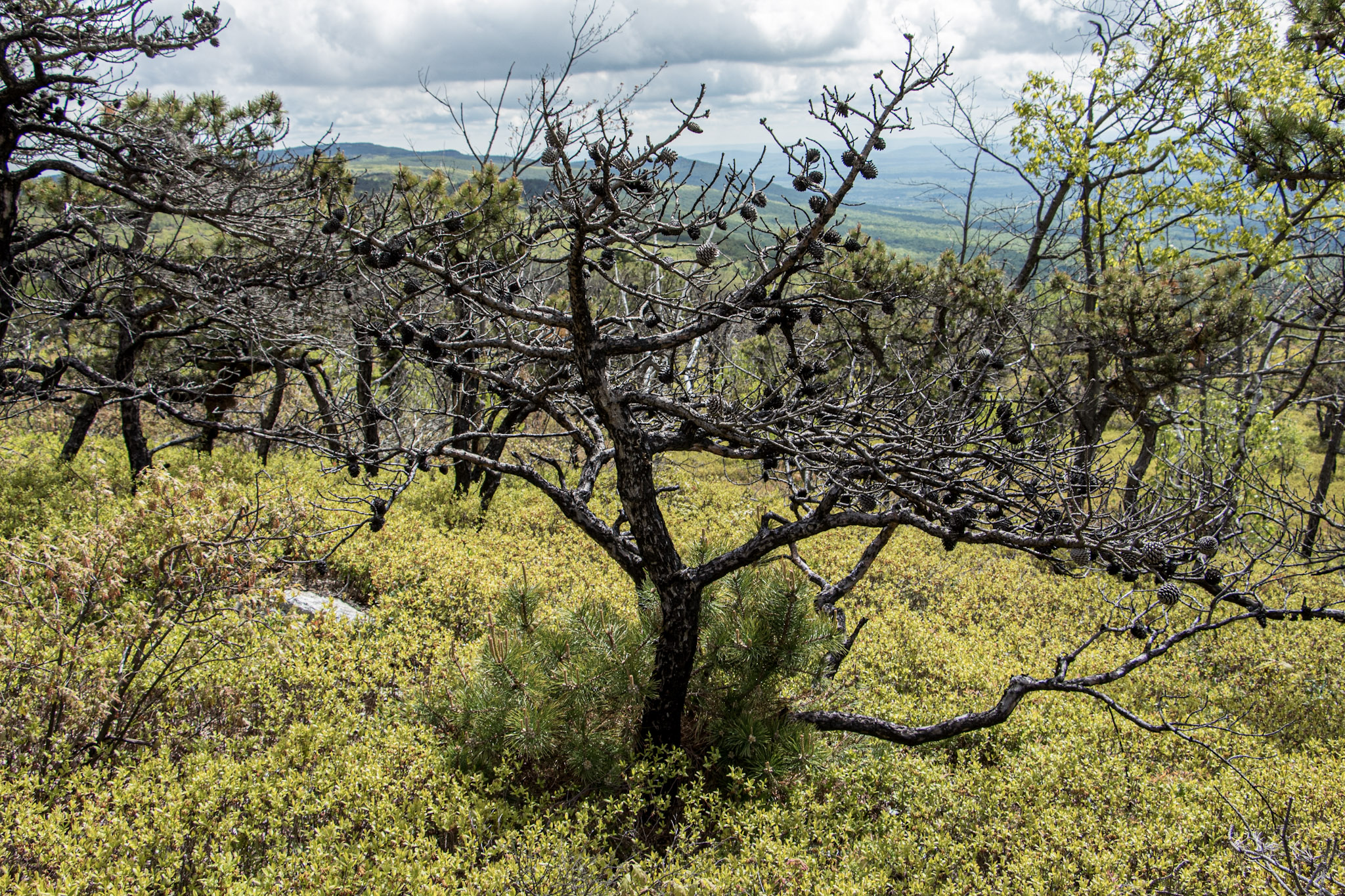
Once on the yellow marked trail, there continues to be awesome views such a clear shot of Storm King Mountain.

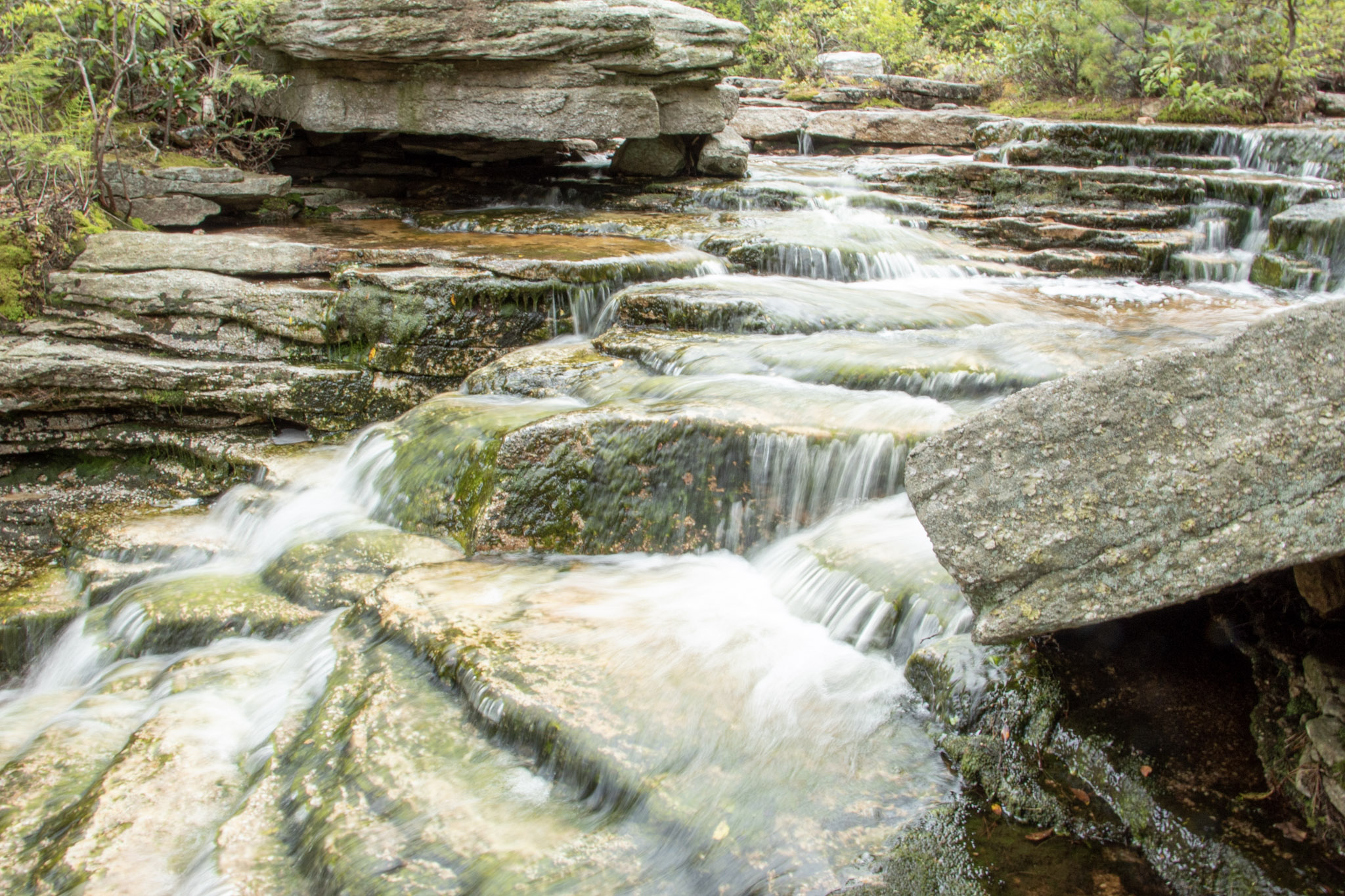
Follow the yellow marked trail until reaching signage for the red marked trail to connect to. There will be a stream to your right and a bridge to pass. Follow that and the blue marked trail will connect quickly and this will lead you all the way to the parking lot. There will be gradual decline in switchbacks and will become flat pavement for the last mile or so. Along the blue trail, the ruins of the Cornish Estate can be explored as well but this was a very crowded day so I decided to skip that.

This is a fun hike with so many viewpoints and exploration. It is certainly not easy with a lot of steep inclines the first few miles but the views are nonstop you won’t even notice the difficulty. This is definitely one of the better marked trails and there are many trail options to make the hike your own. Fantastic day hike!

HIKING FOR DONUTS

Hi, I’m Mark. I live in Connecticut. I take new trips every chance I get. A good trip has a great hike, great food, and something fun to do. My goal is to search out new trips and share them to inspire others to try something new and exciting.

If you are looking for posts in a particular place, search City or State here.

SEE OTHER POSTS IN ARCHIVE

RECOMMENDED POSTS

RECENT POSTS

See the latest on Instagram and follow @HIKINGFORDONUTS

Ferncliff Forest Fire Tower, Rhinebeck, NY

Trail Description: This is a short hike that brings you to a fire tower with stunning panoramic views of the Catskill Mountains.

Trail Info:

Where: Rhinebeck, NY Distance: 1.4 miles (1 hour) Difficulty: Easy Trail Type: Out & Back Features: Views, Mountains, Water, Pond, River, Fire Tower

How to get there:

68 Mt. Rutsen Road Rhinebeck, NY 12572

https://goo.gl/maps/cXzcj8ZLTL8BxYBh7

Hiking Tips

  • A busy spot for nice weather and fall foliage. 

  • There are multiple hiking trails in this park, plan your route.

The Hike

From the parking lot, there is a kiosk where you can view the trail map. The yellow-blazed trail starts past the gate. Proceed with the yellow-blazed trail as it inclines gradually along the gravel road. The signage is pretty good on this trail and there are signs to the fire tower.

In about 5 minutes, the trail reaches a pond and there will be a cabin with a sign marked “TOWER” .

And, once you pass the cabin, there is a lean-to that points to the right to continue on the yellow-blazed trail marked “TOWER”. That is the trail you want to be on.

The path continues to climb slowly. There will be another lean-to on the trail and at about another 0.6 miles, the fire tower will be on the left. There are multiple paths that lead to the tower. This is the shortest route. Once my wife and I arrived, there was already a line to go up to the tower. Only 10 people can fit at a time and even that is a stretch. Only family and friend groups were going up.


Once we got up to the top, the panoramic views were amazing! Views of the Hudson River, Catskills, and the Kingston-Rhinecliff Bridge. The fall colors were really popping. This is a great spot for sunset or sunrise. We didn’t get to spend as much time as we wanted up top as we wanted to be considerate to others waiting in line. We returned the same way we came but you could get back to the parking lot a different way.

HIKING FOR DONUTS

Hi, I’m Mark. I live in Connecticut. I take new trips every chance I get. A good trip has a great hike, great food, and something fun to do. My goal is to search out new trips and share them to inspire others to try something new and exciting.

If you are looking for posts in a particular place, search City or State here.

SEE OTHER POSTS IN ARCHIVE

RECOMMENDED POSTS

RECENT POSTS

See the latest on Instagram and follow @HIKINGFORDONUTS

Hiking the Breakneck Ridge Trail, New York

Trail Description: The Breakneck Ridge hike is one of the most challenging trails in the Hudson Valley. The mountain is known for rocky terrain, steep rock scrambling, and beautiful views of the Hudson Valley. This trail is immensely popular due to its easy access.

Trail Info:

Where: Cold Spring, NY Distance: 3.7 miles (3.5-4.5 hours) Difficulty: Strenuous Trail Type: Loop Features: Views, River, Mountains, Rock Scrambling

How to get there:

Typing the location “Breakneck Ridge Trailhead” into Google Maps will take you near the parking areas. There are multiple parking spots along State Road 9D, just park where you can north of the tunnel. There is a small lot near the trailhead and a larger lot further down.

Click here for coordinates

For those concerned about parking/driving, this hike is accessible via train. There is a MTA to the Breakneck Ridge train station that is within walking distance to the trail on weekends only.

Hiking Tips

  • Go on a weekday to avoid the crowds, if possible. Go early on weekends. 

  • Be prepared to rock scramble & use your hands to scale the cliff.

  • Not dog friendly (unless small dog that you can carry or your dog is a mountain climber)

The Hike

After parking, make sure you are walking along the right hand side of the road. The trailhead starts to the right of the tunnel, where there is trail signage and maps. 

There are 3 trail route options for Breakneck Ridge. There is a sign explaining this at the beginning of the trail. The options consist of the short loop (2 hours) ,the regular/classic loop (3 hours), or the trail back to Cold Spring (4 hours). This guide will be the option we took which is the full classic loop.

There is a set of rock stairs that will bring you to the sharp ascent. Follow the white trail markers and start climbing! The terrain on the trail is pretty hard right away. There is a very steep ascent and I needed my hands and knees to get me through this portion of the hike. If you did bring hiking poles, I would suggest securing the poles to your backpack here as they will not be helpful. Depending on your level of climbing up, this can be anywhere from 30 minutes to an hour. 

IMG_2114.jpg

Keep climbing until you reach the flagpole. You will see Pollepel Island with Bannerman’s Castle to your right, along with views of Storm King Mountain straight ahead across the river.

IMG_9565.jpg

After taking in the views and enjoying a break, continue to follow the white markers as the incline continues. This part is less intense but still some rock scrambling. There is an area in the trail where you can choose to go steeper or take the easier ascent marked with X with an arrow pointing left & right. The easier route was definitely welcomed after the steep climb.

IMG_2148.jpg

Continue to climb higher and there is another viewpoint with the flagpole far in the distance from above.

IMG_2172.jpg
IMG_9638.jpg

Keep climbing until there are no more bluffs and cannot continue further.This is where you head into the forest. The next few miles are much, much easier. You could go back down the way you came but it’s a tough way down and you will be greeted with a traffic jam of many hikers ascending up.

Continue on white markers &  ignore the yellow marked trail for now.

There will be a fork eventually. Look for a turn off to the red marked trail (tough to miss red marking on rock). Follow red trail down a gradual descent through woods.

IMG_9659.jpg

Depending on your pace, the red trail will dead end in about 30-60 minutes where you take left onto yellow trail (Wilkinson Memorial Trail) and keep going downhill and follow all the way to the parking area.

IMG_2203.jpg
IMG_9666.jpg

HIKING FOR DONUTS

Hi, I’m Mark. I live in Connecticut. I take new trips every chance I get. A good trip has a great hike, great food, and something fun to do. My goal is to search out new trips and share them to inspire others to try something new and exciting.

If you are looking for posts in a particular place, search City or State here.

SEE OTHER POSTS IN ARCHIVE

RECOMMENDED POSTS

RECENT POSTS

See the latest on Instagram and follow @HIKINGFORDONUTS

Poets’ Walk Park, Red Hook, NY

Trail Description: Poets’ Walk Park is an easy jaunt through scenic meadows that offers wonderful views of the Hudson River and Catskills.

Trail Info:

Where: Red Hook, NY Distance: 2.4m (1.5 hours) Difficulty: Easy Trail Type: Loop Features: Views, Mountains, Water, River, Bridge

How to get there:

776 River Road, (County Road 103) Red Hook, NY

https://goo.gl/maps/y9V6GaXcWxRzqd6P9

Hiking Tips

  • Walk the entire loop. Many see the views of the bridge initially and turn around.

  • Not great phone service, so make sure to screenshot a map. Or my guide!

  • For trail map, click HERE.

The Hike

As I continue to look for the best bang for your buck views, I really don’t think it gets better than taking a stroll through Poets’ Walk Park in the fall.  The Hudson Valley is full of amazing landscape and mountainous views. Most of those views require challenging hiking. However, a leisurely stroll in Poets’ Walk Park offers stunning views of the Catskills and the Kingston-Rhinecliff Bridge.

From the parking lot, begin walking on the gravel road by the trail signage. Continuing straight through the open field will lead you to a gazebo structure. Walking through the gazebo, there is the first “oh snap” view of the Kingston-Rhinecliff Bridge with the Catskills looming in the background. There is a neat little wooden bench to take a seat and enjoy the views.

The trail will split from here, where the loop begins. Either direction will bring you back to this spot. We chose left heading toward the river. Some great views of Catskills to the right and a closer view of the bridge to the left. The loop will begin on the right and suddenly you will find myself thwarted into the woods. There will be a few bridges to cross. If you need a moment of solitude, the Summerhouse gazebo area is a good spot to take a seat and look out into the mountains above the river.

From the Summerhouse structure, just retrace your steps back to the trail split and head on back to the parking lot. Easy peasy. The skies cleared on our the way back and the fall colors really popped. Just incredible views.

Depending on how long you choose to explore, take pictures, and enjoy the benches, this shouldn’t take more than an hour and half, give or take. Definitely one of those places I considered keeping to myself but the place was crazy packed. There is no secret here. It’s a spectacular park to visit for stunning views.


HIKING FOR DONUTS

Hi, I’m Mark. I live in Connecticut. I take new trips every chance I get. A good trip has a great hike, great food, and something fun to do. My goal is to search out new trips and share them to inspire others to try something new and exciting.

If you are looking for posts in a particular place, search City or State here.

SEE OTHER POSTS IN ARCHIVE

RECOMMENDED POSTS

RECENT POSTS

See the latest on Instagram and follow @HIKINGFORDONUTS

Sam’s Point and Verkeerderkill Falls Trail, New York

Trail Description: Sam’s Point Reserve offers panoramic views of the Shawangunk Ridge along with exploring a 180 foot waterfall. 

Trail Info:

Where: Ellenville, NY Distance: 6.2 miles (3-4 hours) Difficulty: Moderate Trail Type: Out and Back Features: Views, Mountains, Valley, Waterfall, Ice Caves (optional) 

How to get there:

400 Sams Point Rd Cragsmoor, NY 12420 

This will take you right to the parking lot. Parking costs $10. There is a kiosk to pay near the visitor center.

 Hiking Tips

  • Parking lot opens at 9am. If parking lot is full, you have to wait until someone leaves. Plan accordingly as parking is limited.

  • Did not include the Ice Caves on this day. Would add an additional 1.1 miles to the hike.

  • Use bug spray for ticks and sunscreen when sun is out. Most of the hike is the open.

The Hike

The next hike in the Hudson Valley to check off my list is Sam’s Point. I anticipated great views but there was much more to this hike than I thought. Until I researched recently, I didn’t realize a waterfall was part of the hike. Veerkeerderkill Falls is the tallest waterfall in the Shawangunk Mountains at 180 feet. And, there are even ice caves on this trail. Sam’s Point is part of Minnewaska State Park, but the parking is located at a different location than the park’s entrance. We left early in time to beat the 9am opening and there were already quite a few cars in line. Once parked, there is a kiosk to pay for parking and there is a visitor center at this lot, where there are 2 restrooms.

After packing up our gear, we headed toward the trailhead. Walking around the gate took us on the main trail, Loop Road. There is an intersection almost immediately to choose from, veering right will take you to Sam’s Point. The other option is the Huckleberry Pickers’ shacks. Tempting but we will pass on that. Heading up the fragmented road, there is a slight incline as altitude gains up the switchbacks. In short time, we came up to a massive rock with a cliff above, which we learned later is the top of Sam’s Point. At about a half mile, the first view was on our left on top of a rocky platform.

Loop Road will even out and we had an option to keep straight toward the waterfall or turn left toward the short trail to check out the view from Sam’s Point. It was pretty crowded and I just wanted to beat everyone to the waterfall so we saved Sam’s Point for the end. A short distance off Loop Road, we saw signs on our left to head toward Verkeerderkill Falls on the aqua blazed trail. If you wanted to check out the Ice Caves, continue straight from here. We couldn’t fit those in today, so we headed toward the waterfall.

 I did not anticipate the cool landscape we would be hiking through on this hike. Strolling along the trail you will the see rare dwarf pine trees offering very unique scenery. In addition, there are wide views of the Northern Shawangunk Ridge along this part of the trail. The trail will head downhill slightly. This isn’t terrible but the fact that it gets rockier, makes it a bit more challenging. As you get closer to the waterfall, there is a steep descend down.

Eventually, we came upon a stream above the falls. Depending how high the water is on a given day, you may have to follow upstream to cross. We made our way to the cliff overlook and we were greeted with a large crowd. Then, I turned around and saw the amazing view of Verkeerderkill Falls! The water was flowing pretty well on this day. This is nice spot to take a break and relax.  However with the crowd and popularity of the hike, we absorbed the fall briefly and started retracing our steps back.


We finally made our way over to Sam’s Point. The views are outstanding. From the cliffs, you can see the Shawangunk Ridge and Wallkill Valley. Lots of space to take in all the scenery, grab a snack, or take a selfie. There were lots of selfies going on around us. Before we left, I had one thing left to do. I was waiting for the perfect moment. Mostly, I was waiting out the 20 plus Cub Scout group that were yelling and running around.  In addition, there was this one kid (like in his 20s) with his mom who kept taking selfies and would NOT leave until he got the perfect one for Instagram. Come on dude. Once they left, I saw my opening and proposed to my amazing girlfriend! Even though I made her trek 6 miles on her birthday and endure 20 minutes of freezing wind atop Sam’s Point, she said yes. I didn’t realize how packed this overlook would be at all times. Sorta risky move. No backup plan. But in the end, everything went as planned. Then, we joyously made our way back down to the parking lot.


This hike has a lot of meaning for me going forward but this was a dynamite hike. When you can explore different landscapes and come across multiple features that this trail offers, there is not much more you can ask for in a hike. This is a great place to visit to spend the day.

MORE PICTURES BELOW:

HIKING FOR DONUTS

Hi, I’m Mark. I live in Connecticut. I take new trips every change I get. A good trip has a great hike, great food, and something fun to do. My goal is to search out new trips and share them to inspire others to try something new and exciting.

If you are looking for posts in a particular place, search City or State here.

SEE OTHER POSTS IN ARCHIVE

RECOMMENDED POSTS

RECENT POSTS

See the latest on Instagram and follow @HIKINGFORDONUTS

Mount Beacon Fire Tower, Beacon, NY

Mount Beacon Fire Tower, Beacon, NY

Mount Beacon is one of the most popular trails along the Hudson River. It offers different terrain for a good workout, old railway landmarks, and incredible views of the Hudson Valley as well as the Catskills and NYC on a clear day. Most people will hike to the top of the mountain overlooking Beacon. However, adding the fire tower to this hike is worth it. Check out the blog for details and pictures!

Storm King Mountain, New York

Storm King Mountain, New York

If you are looking for a great hike with awesome views in the Hudson Valley, Storm King Mountain is one of the best hikes in the area. Located in upstate New York, the trail will get your heart pumping but you will be amazed at the summit view from the top.

Minnewaska State Park Reserve

Minnewaska State Park Reserve

Minnewaska State Park Reserve is located in Kerhonkson, NY on the Shawangunk Ridge. The park is full of numerous awesome hiking trails to spend hours exploring. This post will cover Awosting Falls, Lake Minnewaska, and Kempton Ledge. Great picturesque views through out the hiking trails. A great visit visit to Minnewaska State Park reserve. Hiking for Donuts approved.

Ninham Mountain Fire Tower Hike

Ninham Mountain Fire Tower Hike

Hiking Ninham Mountain Fire Tower in NY. Another great Hudson Valley, NY hike. Easy hike, beautiful views.