


Rattlesnake Mountain to Pinnacle Rock via Metacomet Trail, Farmington, CT
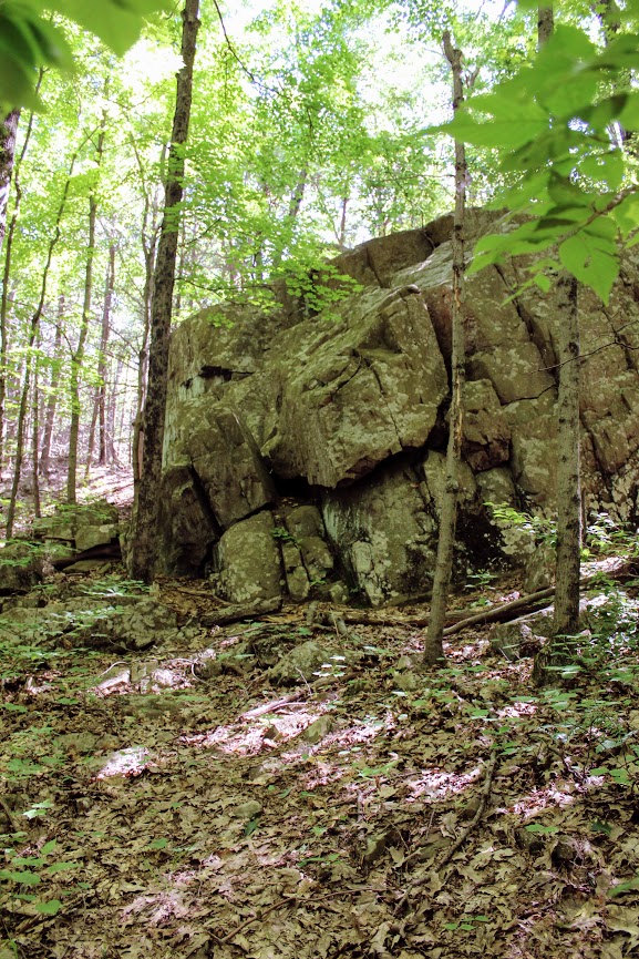
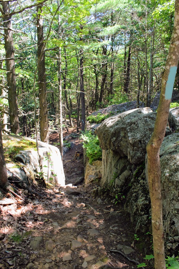
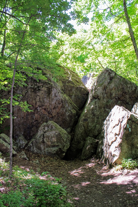
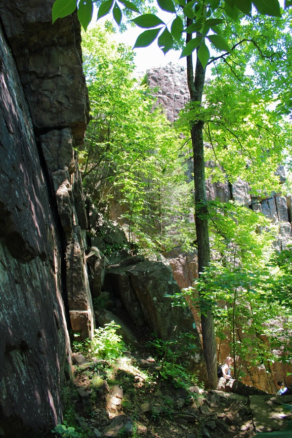
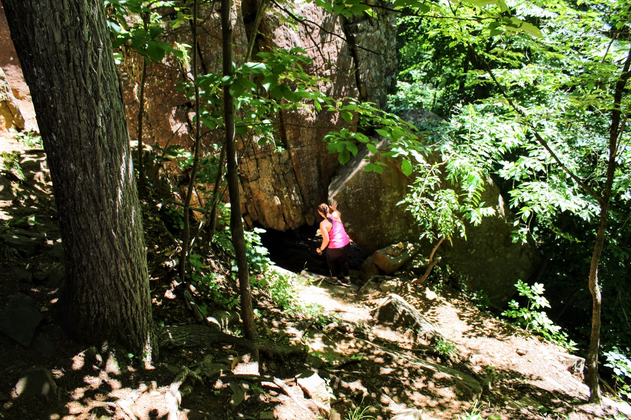
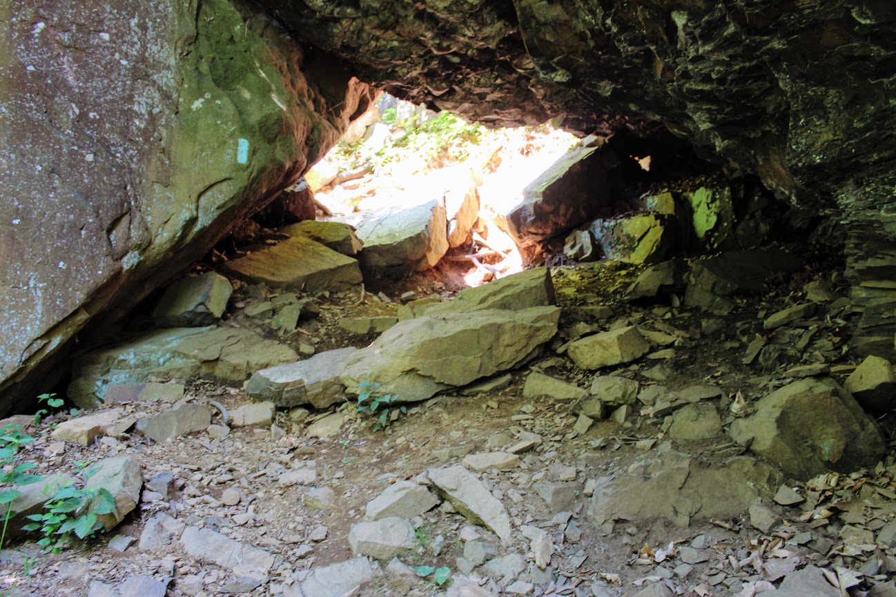
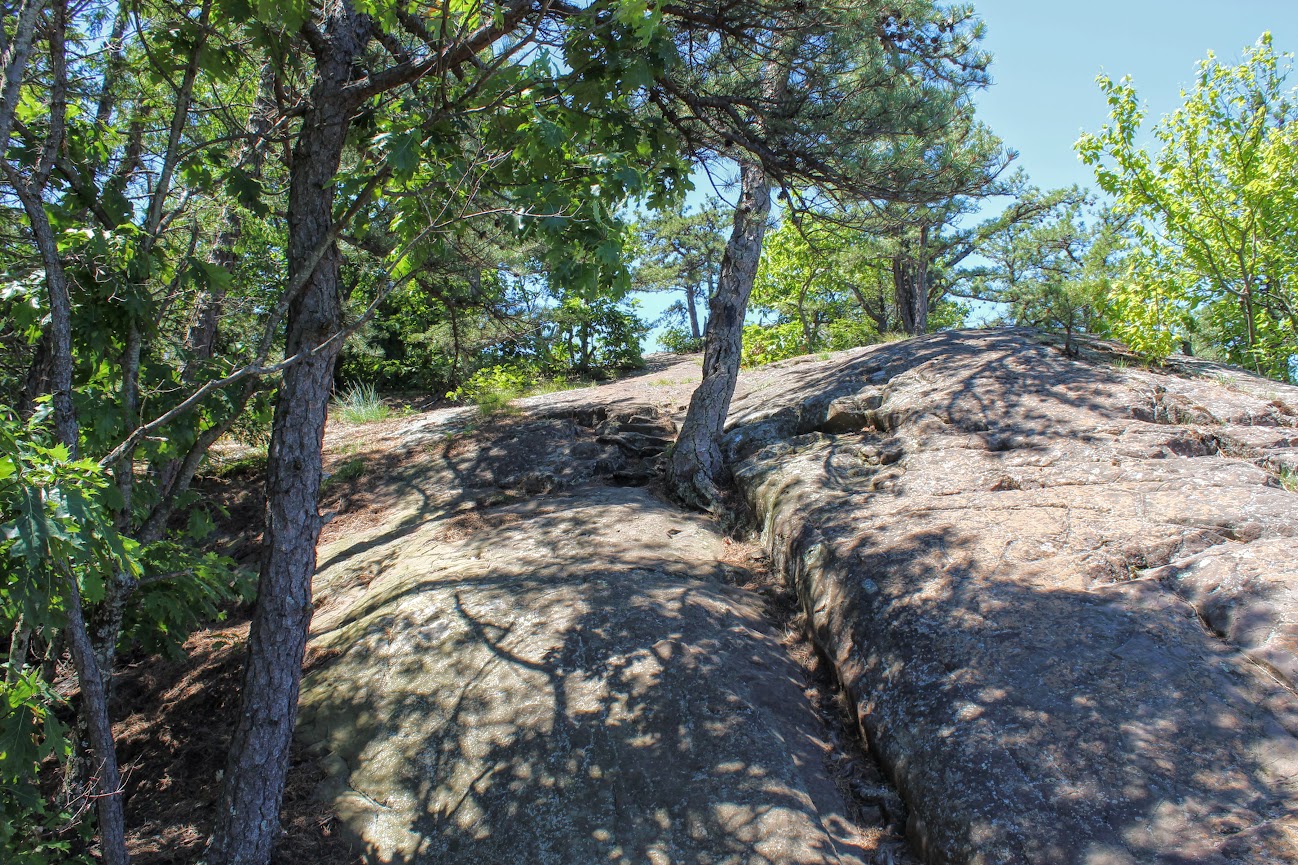
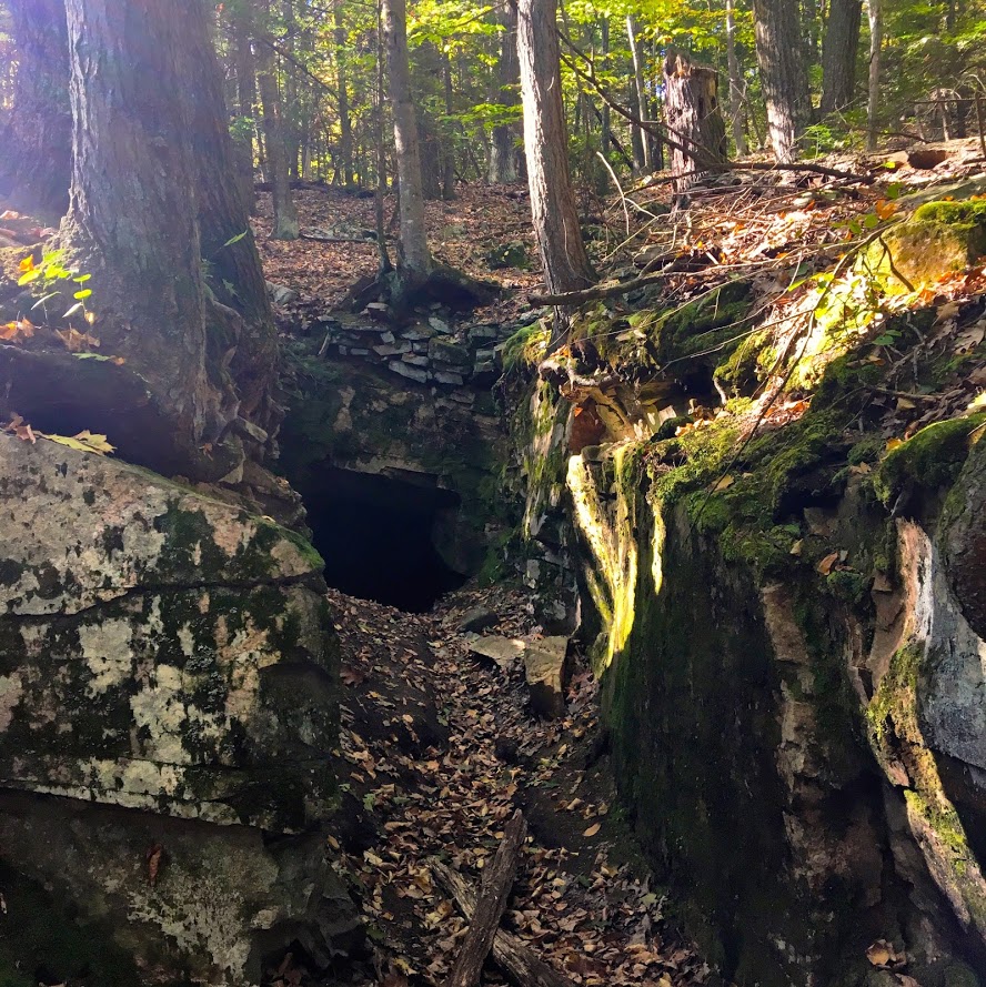
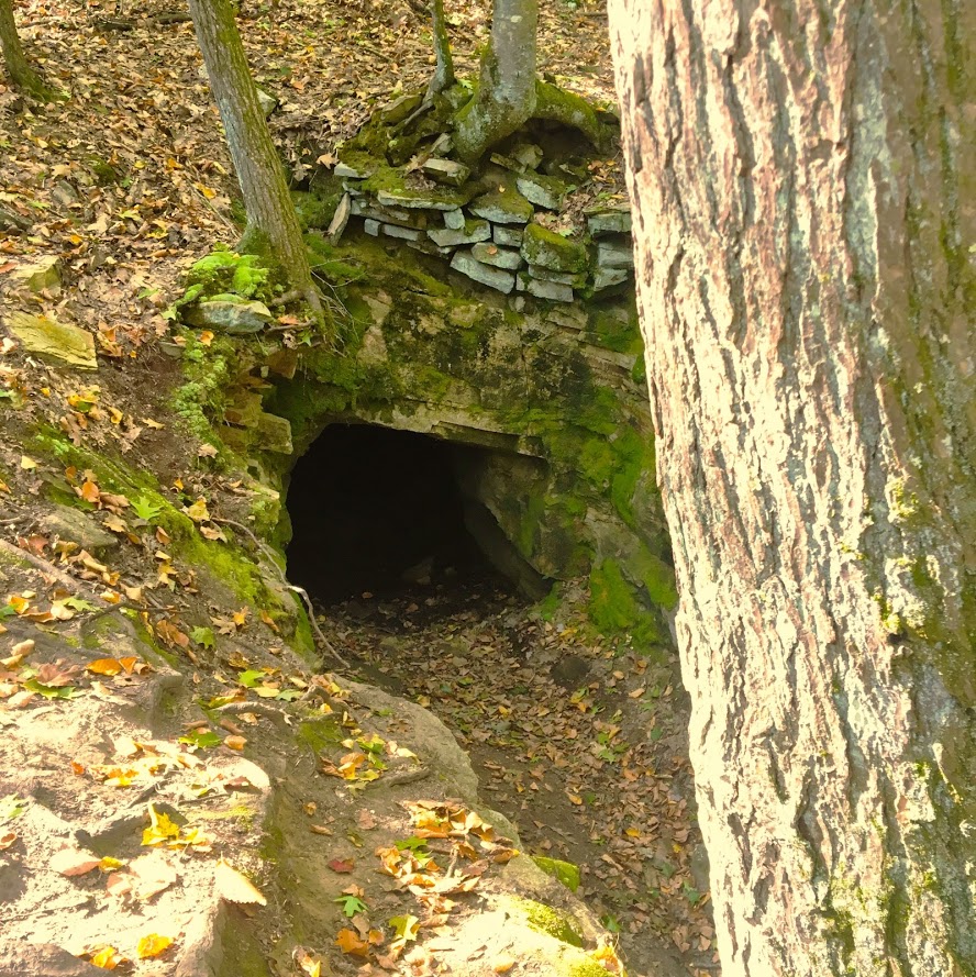
We headed on the trail to our left toward the Rattlesnake Cliffs. The trail starts out flat then begins to switchback up the side of the mountain. After a half mile in, the trail will ascend uphill and the terrain is rockier. We passed lots of large rock boulders as we got closer to the cliffs. This particular trail was very well-marked. We eventually came across the boulder rock cave known as Will Warren’s Den, which I later found out was a historical site.
Looking for a good hike in Connecticut? Well, I stumbled upon a hidden gem right under my nose. Rattlesnake Mountain to Pinnacle Rock trails are located in Farmington, CT and crosses over to Plainville, CT. This is part of the New England/Metacomet Trail. Finding the parking area can be tricky. There are 2 areas where you could start. Blue trail markers can be accessed from Pinnacle Street in Plainville. The GPS wasn’t picking this option up so my girlfriend and I chose to drive on RT 6 in Farmington. There is a small parking area on your right where the trail starts. If you GPS 200 Colt Hwy Farmington, CT 06032, that should find it.


Parking area off route 6.
From here, you can hike to the Rattlesnake Cliffs, which is a 2.6m out and back loop. Or you can continue to hike another 2 miles out and back to Pinnacle Rock. Thus, it will be 4.6m total for this hike.
HIKING FOR DONUTS
A blog for the outdoors foodie enthusiast
Hi, I’m Mark. I live in Connecticut. I take new trips every chance I get. A good trip has a great hike, great food, and something fun to do. My goal is to search new trips and share them to inspire others to try something new and exciting.
If you are looking for posts in a particular place, search by City or State here.
Explore other posts in the archive.
Archive
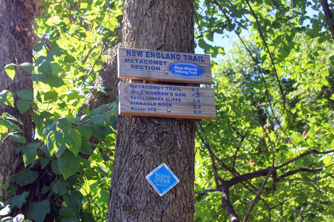
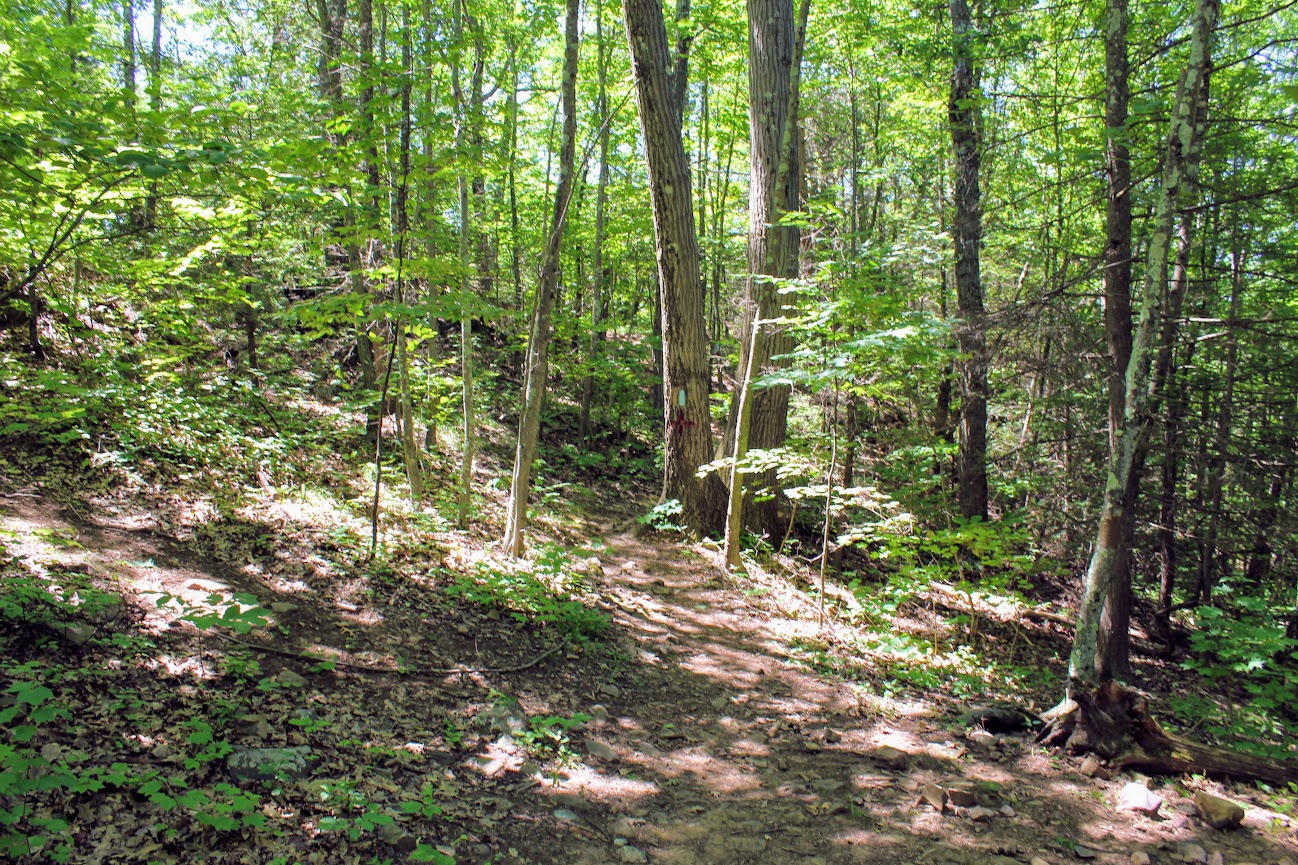
Start of trail
Once parked, we headed on the trail to our left toward the Rattlesnake Cliffs. The trail starts out flat then begins to switchback up the side of the mountain. After a half mile in, the trail will ascend uphill and the terrain is rockier. We passed lots of large rock boulders as we got closer to the cliffs. This particular trail was very well-marked. We eventually came across the boulder rock cave known as Will Warren’s Den, which I later found out was a historical site.
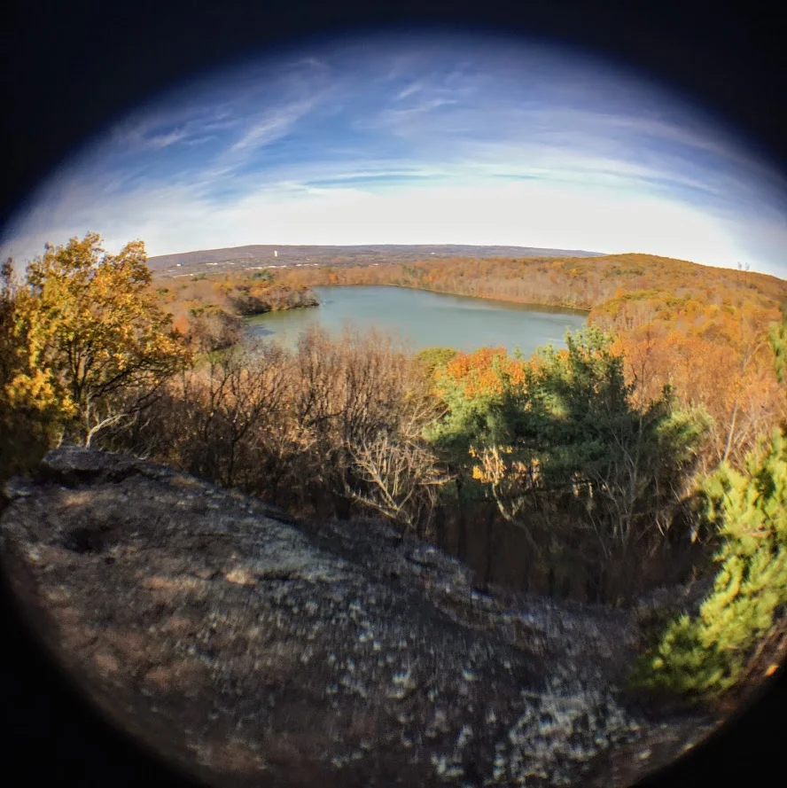
Not long after this, we reached the Rattlesnake Cliffs. Wow, what a spectacular view. I was absolutely stunned. On our left, we could see as far as the city of Hartford. And the sky was clear, so we could visibly see the biggest buildings in downtown Hartford. On our right, we could see the East and West Peak at Hubbard Park in Meriden and the Pinnacle Rock in Plainville. Great views all around. How did I not know this view existed? If this was all we did, I would have still ranked this hike very high on my list of CT hikes.

Views from Rattlesnake Cliffs.

hartford views to the left from the cliffs.

On your RIght from the cliffs.....

PANO VIEW FROM RATTLESNAKE MOUNTAIN CLIFFS.
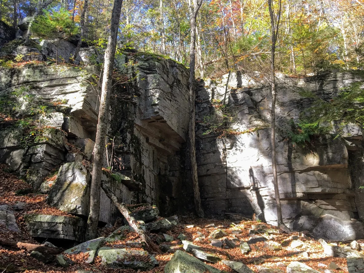
We hopped back on the blue trail down Pinnacle Rock and started making a steep descent. We witnessed other hikers take a wrong turn here by going straight down. We were able to stay on track. We continued hiking along the bottom of Rattlesnake Mountain and noticed a small tunnel formed by the rocks. We decided to climb through and found ourselves blue markers on the other side. Note, this is how you to get to Pinnacle Rock. There is a quite a bit of climbing on and over rocks for this section.
And, this trail is not as well-marked. There were areas we lost the blue markers. Sometimes the blue marker was faded on rocks and we didn’t notice until we got closer. If you do not come across blue after 5 min or so, I suggest turning around.

If you can't find blue markers, they may be on the rocks.
We reached the bottom and crossed an area under power lines that led us climbing up to the other side. We reached a dirt paved road and we saw a tree marked with blue and red. This took us to the final section before we reached Pinnacle Rock. You will be going uphill and start climbing the rock on your right to the peak of Pinnacle Rock.
The view of Pinnacle Rock is nice. But Rattlesnake Mountain has a higher wow factor. The view from Pinnacle Rock is not as appealing as you will see mostly homes. This is a big rock climber’s paradise and I did see a few people doing so. I will hike all day. But climbing isn’t for me.
RECOMMENDED POSTS


RECENT POSTS


See where I’ve been recently on Instagram, follow @HIKINGFORDONUTS


Crazy guy climbing up pinnacle rock.

VIew from the pinnacle Rock summit.

Top of pinnacle Rock with railings and rock seating to enjoy the views.
We headed back the same way we came. Took another peek from the Rattlesnake Cliffs before we headed back to the car. Such a great view. That is one of best views in CT. I was very impressed by this hike. This is easily one of my favorites now. It is very challenging. I would say it’s a moderate hike. Lots of different terrain and some climbing. Round trip is 4.6 miles but I feel like it’s closer to 5 miles. Definitely suggest hiking boots and a pack for this one. This took us about 3 hours. This is one New Englanders should add to their hiking list!
The review:
Rattlesnake MT to Pinnancle rock (farmington, CT), ~4.6m: 4.5 out of 5.

Castle Craig and East Slope Trail, Meriden, CT
Castle Craig is a popular destination in Meriden, CT. There are awesome views from the top. Hiking the East Slope Trail, check out my review!
Spring is finally here to stay. Another beautiful weekend for outdoors. This weekend’s hike was an oldie but goodie. I have hiked up to Castle Craig a few times in the past. The hiking trails are pretty good and there are excellent views at the top. Also, there is an actual castle/tower, which can be climbed via stairs to the top inside the tower. Castle Craig is located in Hubbard Park in Meriden, CT. The park itself is fairly nice, covered with gorgeous daffodils and a large pond with fountains. There are various trails that take you up to the Castle Craig tower. This particular blog will be on the East Peak using the white/red/blue trails. The trail map I used can be found here.
Upon arriving at Hubbard Park, we drove straight until we saw a small lot to our left where the trail head starts.

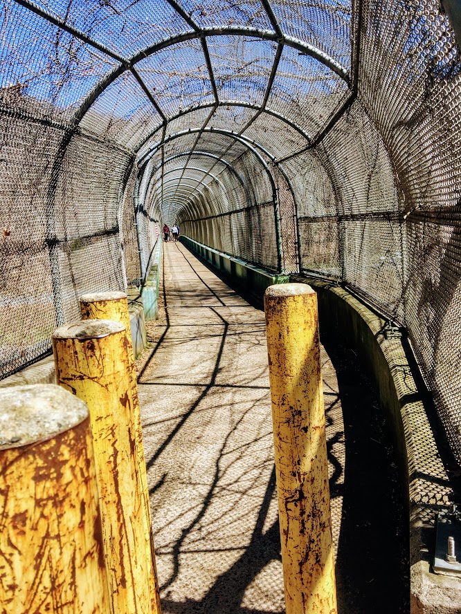
From here we followed the white blazed trail through the walking tunnel over I-691.
Shortly after, we reached the small foot bridge that passes over a creek.

Continuing on the white trail led us to the Beehive Spring landmark.

From here we continued straight on the red blazed trail for a short distance until we saw the first blue blazed trail. This part of the hike got pretty steep.

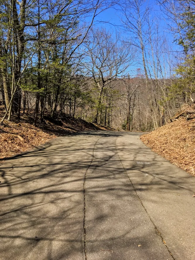
The end of the steep ascend took us to the paved road. You have options here. Use the paved road up to the peak or continue along the blue trail to see overlooks of the town and cross the parking lot. We just went up the road.
At the end of the road, we reached our destination of the East Peak. Castle Craig tower sits atop the East Peak at 976 feet. The skies were absolutely clear and the views were spectacular. We reached the top to only find a few people but within minutes the peak began to fill out, which is typical.


After making more donut eating boomerang videos, climbing the stairs to the top of the tower, and taking as many pics as possible, we made our descend down the East Peak following the white trail. The downhill is steep at first but then becomes flat. I will say, I was disappointed to find a ton of broken glass at this section of the hike. This is a good hike. And, many families include young children and dogs frequently travel the trails. Take care of the trails! Who would smash bottles?!???! Not cool.

Eventually, the white trail led us down carriage road to the Halfway House.
We passed this landmark and continued to follow the white trail to Merimere Reservoir. Again, the skies were clear and got another great view. We continued alongside of the reservoir until we reached the pave road. We took a right walking down the paved road and took another right on the next road, Notch Road. Passing under 691, this lead us back to where we parked.


Hubbard Park is a great area. The park is generally very populated. On nice days, the hiking trails can be crowded. We had pretty good timing on our hike but did get overwhelmed once we reached the peak. I would suggest doing this during the week, after work if possible. If not, this is still worth the hike when crowded. The Castle Craig tower is unique and the views are fulfilling. I would rate this hike moderate for the average hiker. If you are not use to steep uphill, you may need some breaks. Like most Connecticut hikes, gym shoes are probably ok but hiking boots are best. This hike took my group about just over 2 hours and was 3.5 miles based on the way we took. I have done this hike 4x so far. Definitely recommend for a good Connecticut hike.

HIKING FOR DONUTS
A blog for the outdoors foodie enthusiast
Hi, I’m Mark. I live in Connecticut. I take new trips every chance I get. A good trip has a great hike, great food, and something fun to do. My goal is to search out new trips and share them to inspire others to try something new and exciting.
If you are looking for posts in a particular place, search by city or state here.
EXPLORE OTHER POSTS IN THE ARCHIVE
Archive
RECOMMENDED POSTS
MOST RECENT POSTS
See where I have been recently on Instagram. Follow @HIKINGFORDONUTS

Hancock Brook Trail, Waterbury, CT
Spring weather is finally upon us. As summer approaches, I look forward to finding new hiking trails. I came across Hancock Brook on Instagram and the hike surprised me. And, no it's not closed. Read up on my advice to make sure you complete this trail!


It has been a long, very long winter in the Northeast. The weather finally felt like spring and that means it was time to find some new trails to hike. I came across the Hancock Brook Trail in Waterbury, CT on Instagram from some fellow CT hikers I follow. I never heard of it and the views looked cool. However, my research displayed this trail was closed including sites like Alltrails. After seeing recent posts and finding one actual site with directions on this trail, I felt comfortable enough to give it a go. And, I can confirm the trail is NOT closed. People are giving up too easily. Yes, there is a rotted bridge but the trail can be accessed elsewhere. For directions, plug into your GPS: Sheffield St., Waterbury, CT, 060704. Drive all the way down until you hit the quarry and there is a small parking lot to your right.
The Hancock Brook Trail is a blue-blaze trail along the edge of the Mattatuck State Forest. This hike is a 2.8 mile loop. The terrain does get quite rocky, which includes steep uphill and downhill portions and some climbing. The trail was covered in leaves on this day and was quite slippery because of that. I would consider this a moderately difficult hike for the average hiker.

Onto to the infamous bridge I kept reading about. Ignore the bridge.

From the parking area, you will start walking up the side of the quarry and look for the first Blue marker. Upon entering the woods, the trail splits and the trail to the right with one blue marker will take you along Hancock Brook. The first half mile or so will give views of the stream and its rapids. The trail is fairly narrow and gets unpleasant as you reach the inclines where the bushes have grown into the trail.


You will reach a spot in the trail where you hear lots of trucks and work on the quarry. There will be a sign to stay on the blazed trail on a tree with the Blue marker.

Continue this direction and go straight. This is a tricky part of the trail. The markings are not great until you reach the peak. You will want to veer right but that will take you the wrong way. There is a like a raised branch signaling not to go this way. If not, you will reach a small pond and you will see a very sketchy trailer. Do not go there. That is not part of the trail. You will be too close for comfort. Turn around. I just envisioned all the crazy TV shows I saw with a crazy dude coming out of a trailer and chasing me.

If you went the right way, you will reach the pond and see the trailer across far enough away. You need to make an abrupt left into the woods to start the incline. Once you do not see blue markings, stop and just turn around. We walked by it as well. I took pictures for guidance. The blue marker was covered by trees.
The trail will get tougher at this stage as you enter a pine forest. There is a mini pond with a bunch of trees down as you get closer to the ascend uphill. Keep an eye out for the blue markings. They are a little too far apart in this area. Once you pass this pond, the steep uphill will begin and there will be some switchbacks.

This tough stretch will be worth it as you will reach a beautiful lookout spot for views. The rock formation is called Lion Head and is the peak at 660 feet. This is a great spot to stop and soak in nature. Have a snack and fuel up on water. Maybe eat a donut.


The climb down was tough at first but got pretty easy as we kept going. And, the trail markings were way better. The spots where they were too far apart, I suggest going the way that made sense and you will find them. You will pass a few more lookout points to enjoy more views along the way.


At the end of trail, there will be a steep downhill section before you reach the quarry where you started. And, somehow we completely missed the waterfall coming in, or the water started to come down from melting while we hiked. Before we left, we took a closer look at what is called Hancock Cascades. This was to the left at the end of the final descend.


This was a surprisingly good hike. This took us about 2 hours and that is with stopping for 20 minutes. I don’t think I would have found it without Instagram. The hike was fun and didn’t take too much time. I would just be careful of the markers. There were times where it was lacking and you really had to keep an eye out. And, stay away from the Breaking Bad looking trailer!
Trail Review:
Hancock Brook Trail, Waterbury, CT (2.8m): 3 out of 5


HIKING FOR DONUTS
A blog for the outdoors foodie enthusiast
Hi, I’m Mark. I live in Connecticut. I take new trips every chance I get. A good trip has a great hike, great food, and something fun to do. My goal is to search out new trips and share them to inspire others to try something new and exciting.
If you are looking for posts in a particular place, search by city or state here.
EXPLORE OTHER POSTS IN THE ARCHIVE
Archive
RECOMMENDED POSTS
MOST RECENT POSTS
See where I have been recently on Instagram. Follow @HIKINGFORDONUTS

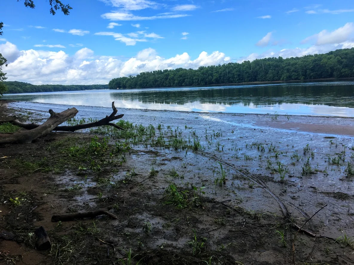
Sunset Rock State Park, Crescent Lake, Southington, CT
Check out the Crescent Lake trail in Southington, CT. This was a confusing trail but well worth the views. Enjoy!
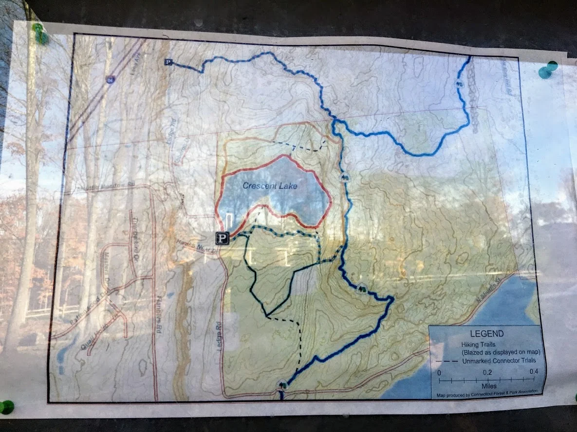
Trail Description: Sunset Rock State Park offers a scenic hike around Crescent Lake that connects to the Metacomet Trail.
Trail Info:
Where: Southington, CT Distance 3.2 miles (2-2.5 hrs) Difficulty: Easy to Moderate Trail Type: Loop Features: Views, Lake, Water
How to get there:
Address to GPS: 357 Shuttle Meadow Rd, Plainville, CT 06062. Parking lot is easy to find.
Hiking Tips
Three trails to choose from. The Blue to Orange trail takes you above the lake and is rockier and steeper. Much better views.
Be mindful if you lose the trail markings or end up on a different trail. There is a lack of trail markings. And, some confusing areas where trail markers change colors.
The Hike
On this brisk fall weekend, we decided to hike the Crescent Lake Trail in Southington, CT. This is one of those trails that there isn’t the best information online and it is poorly marked. I will do my best explaining but my advice is always have the map handy and make sure someone is good at directions!
The parking lot is easy to get to, it is off Shuttle Meadow Road. Once you park you will see the lake right in front of you and potentially some people fishing. There are 3 trails. The Red trail is the lower level trail which is mostly flat. This is to your far left from the lot. This is roughly 2m. The blue -orange trails takes you the upper levels to get good views above the lake and this is rockier and steeper. This trail is to your right from the lot. This is about 3.2m and this connects to the Red at the end once you descend down. There is also a green trail, but not sure where that takes you. It appeared to be just a woodsy hike.
We got lost a few times but Nichole is really good with reading trail maps. The issue is lack of markings/incorrect markings. And, the Metacomet Trail connects so you have to be very careful when the colors change. We took the upper trail followed blue-orange markers until we saw just orange then to red. There we were some tough sections where you could choose 3 directions but there are big orange arrows on trees along the way so be mindful of those. There is also an intersection where you see trail arrows for the Metacomet at the top, keep going toward the blue orange and you will pass a camp fire pit. Minus the confusion, it was a cool hike and the view was awesome from the top. I could of took pictures for an hour….luckily, Nichole stopped me. The upper trail I would suggest hiking boots. It was a moderate hike for beginner to intermediate. Some of the inclines got our hearts beating and needing some water. I think this would be a good spot to snowshoe. I hope to keep the fall hikes going. Another local spot in the books, glad we decided to try it even though the reviews were suspect.
Review:
Cresent Lake Trail, 3.2m (Southington, CT): 4 out of 5


HIKING FOR DONUTS
A blog for the outdoors foodie enthusiast
Hi, I’m Mark. I live in Connecticut. I take new trips every chance I get. A good trip has a great hike, great food, and something fun to do. My goal is to search out new trips and share them to inspire others to try something new and exciting.
If you are looking for posts in a particular place, search by city or state here.
EXPLORE OTHER POSTS IN THE ARCHIVE
Archive
RECOMMENDED POSTS
MOST RECENT POSTS
See where I have been recently on Instagram. Follow @HIKINGFORDONUTS

Mine Hill Preserve Trail, Roxbury, CT
More fun fall hikes in CT! The fall colors are really showing now. I decided to hike a new trail this time. I chose Mine Hill Reserve Trail in Roxbury, CT. The trail was unique and offered cool historic features. Check it out for great leaf peeper pics.
Trail Description: The Mine Hill Preserve trail is part of the Roxbury Land Trust as a national historical landmark. Venturing on this trail will take you through scenic woodlands, rocky terrain, mine tunnels, bat caves, and old furnace structures from the 19th century.
Trail Info:
Where: Roxbury, CT
Distance 3.6 miles (2 hrs)
Difficulty: Easy to Moderate
Trail Type: Loop
Features: Water, Bat Caves, Quarry, Bridge, Mine Tunnels, Old Furnaces
How to get there:
6 Mine Hill Road, Roxbury, CT 06783
The GPS lost signal as I got on Mine Hill Road, but just follow the signs on the gravel road to the parking lot.
Hiking Tips
Download a map of the trail, http://www.roxburylandtrust.org/MapMineHill.pdf.
Veer left to start with the more difficult section toward the Donkey Trail. The latter part of the trail is more like a brisk nature walk on flat ground.
The Hike
This past weekend’s hike was recommended by a friend. Nichole and I took a ride out to Roxbury, CT to the Mine Hill Preserve Trail. This trail offers some unique features where you will see various mines and old furnace stoves from the 19th century. This is definitely off the beaten path. There is a very small parking lot where the trail heads start. There are only two trails here. There is a 3.6m loop (blue trail- Mine Hill Preserve) and an additional 2m loop can be added (red trail – Carter Reserve). Due to time constraints, we just did the blue trail loop. The maps online for this area are very helpful too. I would suggest downloading here prior to the hike. The trails are a short walk from the parking lot. If you really wanted to just see the old furnace structures, this is only a 10 minute walk from the start if you veer right. Prior to hiking, I read the veering to the left would get the difficult portion of the hike done and that is what we chose.

In this direction, you pass a small pond to your right.

The main loop ascends up the Donkey Trail and here you will pass two mine tunnels.


The terrain was pretty interesting and varied. This side of the loop was by far the most challenging. It was very rocky and had some steep uphill areas. As you keep hiking , you will cross paths with multiple bat cages that serve as entry ways for the caves inside them.


The trails begins to descend and you will meet at the Old Quarry bridge which joins a dirt road that will lead you to the other side of the loop. The other side of the loop was more of a nature path. It was flat the whole way, roughly 1.5m. This was less interesting until the end where you will find the old forge site. The fall colors kept me attentive along the way.


Overall, the historic points of the trail offered a different features you don’t get on hikes generally. The trail was very maintained and marked well. The hike would be good for anyone beginner to advanced. I would recommend hiking boots since the terrain can be rocky. The loop didn’t take us too long, about 1 hr 45 min. Next time, I would leave more time and add the additional 2m loop. Pretty good recommendation!
Review:
Mine Hill Reserve Trail, 3.6m (Roxbury, CT): 3.5 out of 5

HIKING FOR DONUTS
A blog for the outdoors foodie enthusiast
Hi, I’m Mark. I live in Connecticut. I take new trips every chance I get. A good trip has a great hike, great food, and something fun to do. My goal is to search out new trips and share them to inspire others to try something new and exciting.
If you are looking for posts in a particular place, search by city or state here.
EXPLORE OTHER POSTS IN THE ARCHIVE
Archive
RECOMMENDED POSTS


MOST RECENT POSTS
See where I have been recently on Instagram. Follow @HIKINGFORDONUTS