

Chauncey Peak Trail, Giuffrida Park, Meriden, CT
Trail Description: Located in Guiffrida Park, the Chauncey Peak Trail offers a scenic hike with beautiful ridge line views of Bradley Hubbard Reservoir.
Trail Info:
Where: Guiffrida Park, Meriden, CT Distance: 2.8 miles (2-2.5 hrs) Difficulty: Moderate Trail Type: Loop Features: Views, Reservoir, Lake, Peak
How to get there:
This is fairly easy. Just GPS Guiffrida Park and the address should be 800 Westfield Rd, Meriden, CT 06450. Once you pull in, you will see the parking lot.
Hiking Tips
Start the hike to the right of the parking lot into the forest. Much easier route going up and down.
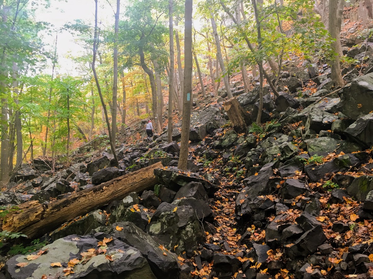
The trail has been updated and re-routed. Be sure to follow the blue trail around Chauncey Peak and past the landfill. Look for the Blue markings.
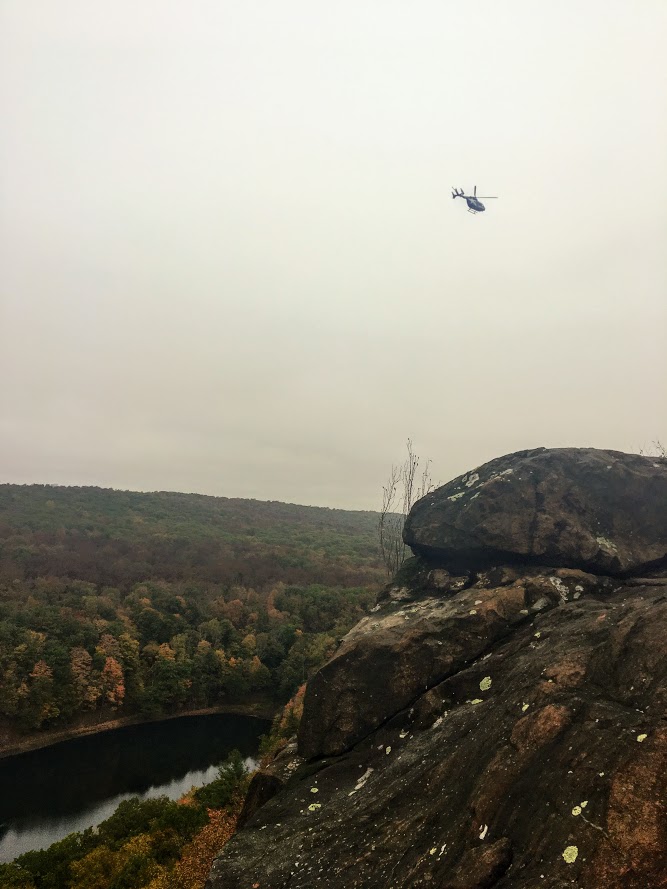
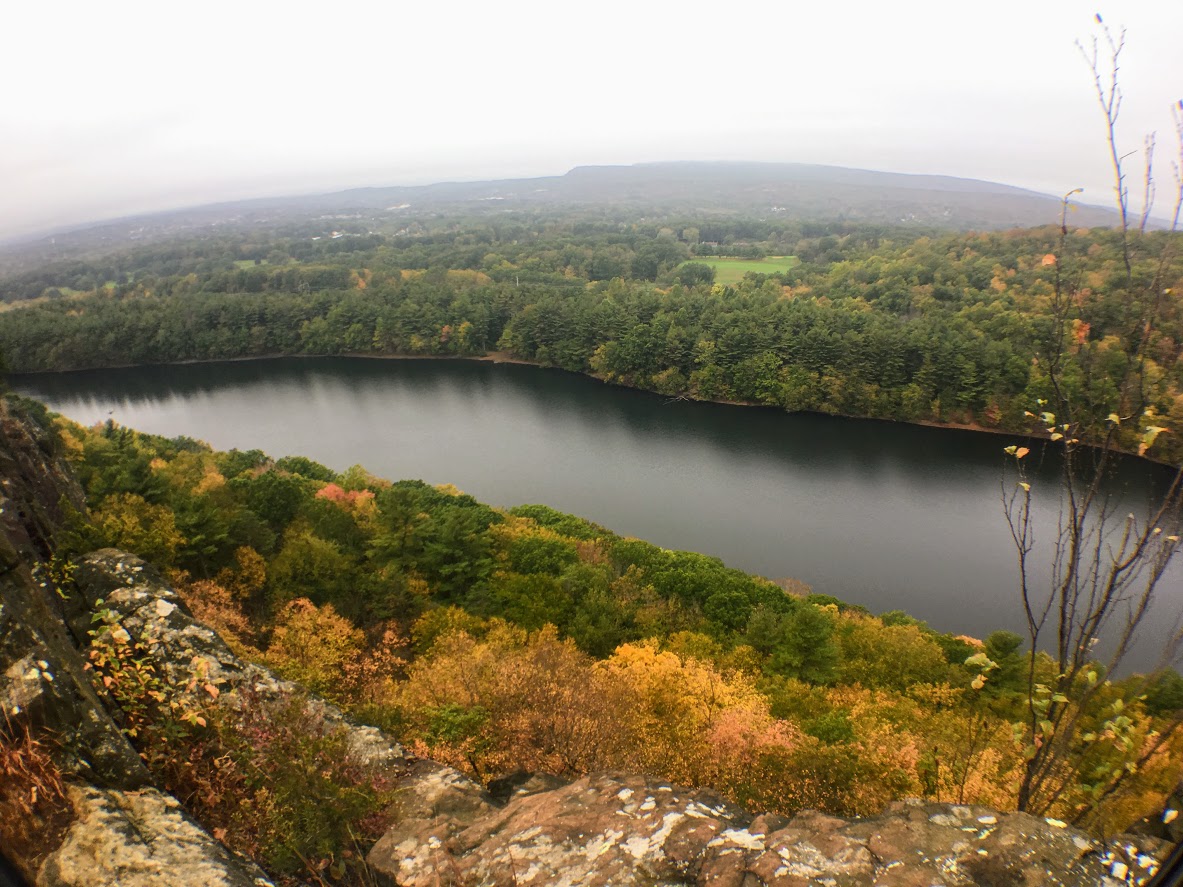
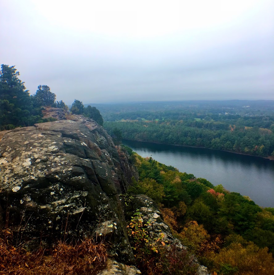
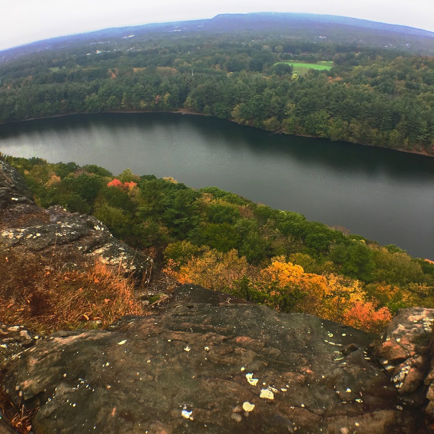
There are many great views from the ridge line, be sure to take them all in.
The Hike
It is officially fall. It is chilly in the morning, the leaves are changing, and it is getting darker out earlier. Time to get out there and be a leaf peeper. Sounds kind of sketchy…..But seriously, fall hikes are the best. I slacked a little bit this summer with hiking, but I intend to take advantage of the fall weather.
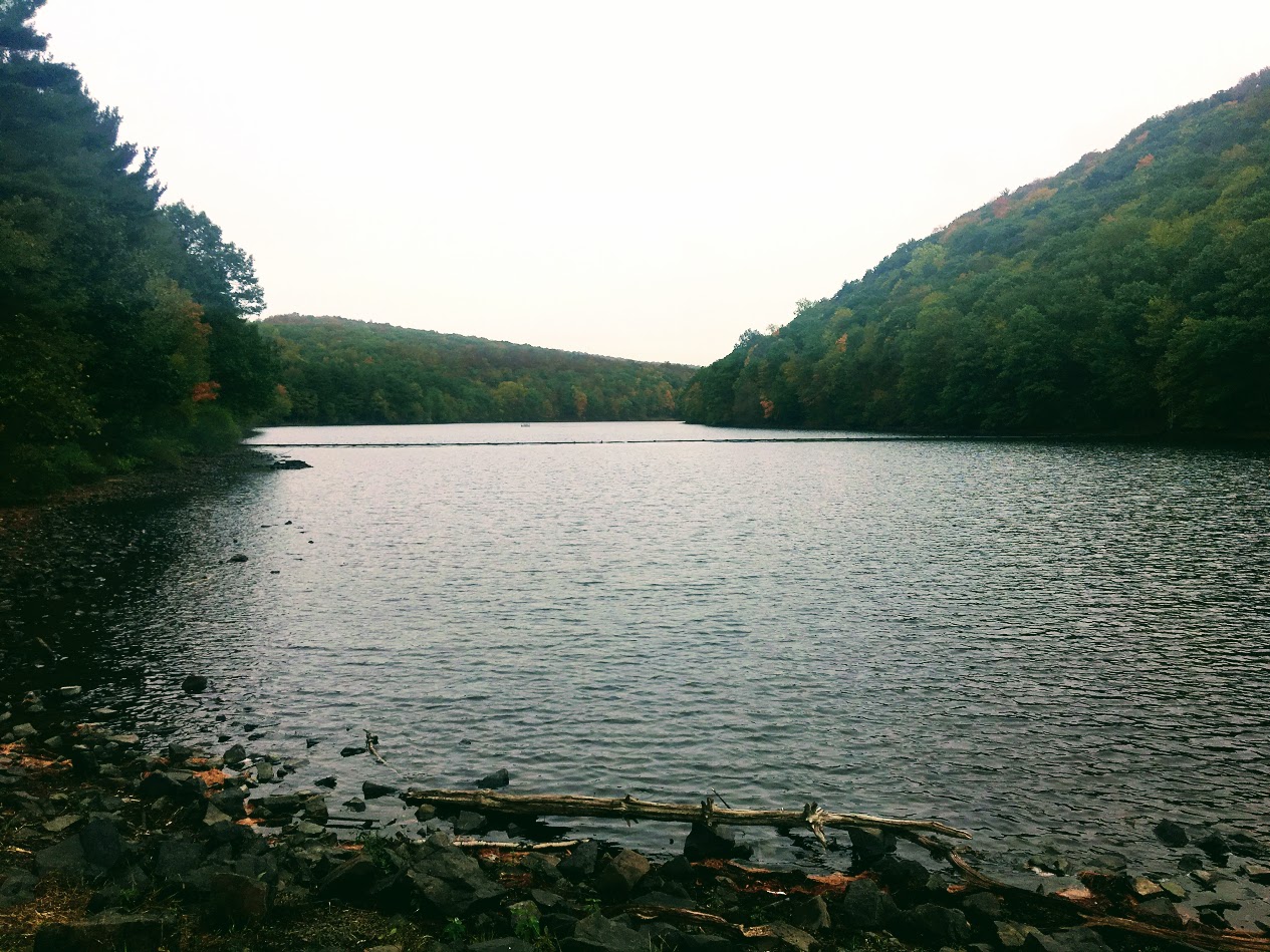
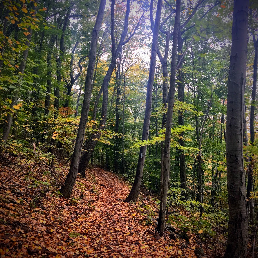
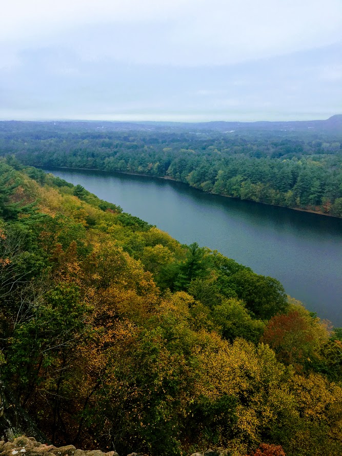
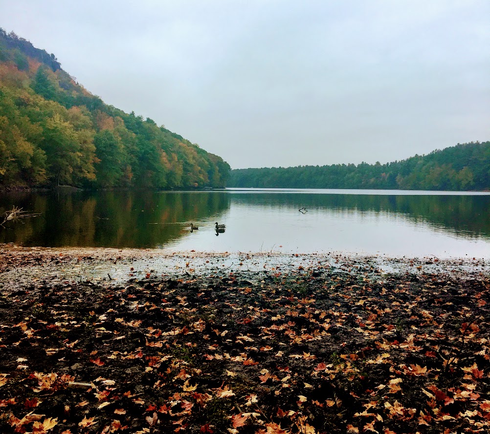
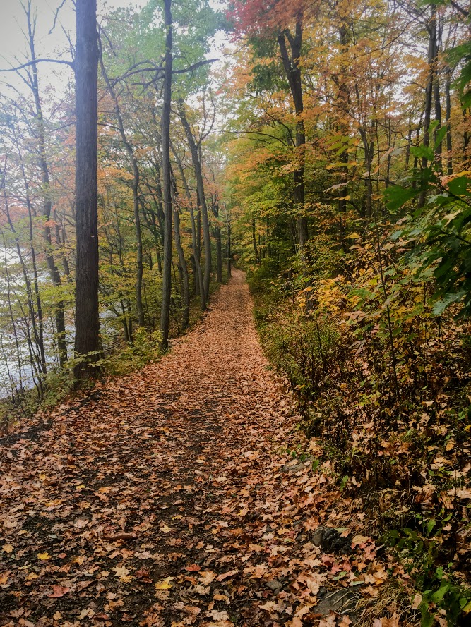
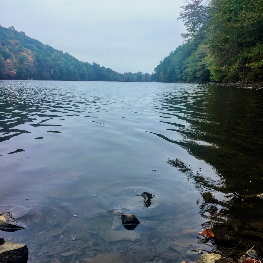
For my first fall hike, I chose the Chauncey Peak Trail at Giuffrida Park in Meriden, CT. This is my favorite hike in the Hartford area, hands down. I have hiked this trail multiple times and I enjoy it just as much each time. This is a very fun hike with great scenic views and a variety of terrains overlooking Bradley Hubbard Reservoir. Unfortunately, due to the fog on this day, it was tough to get that view in. I like to start the hike veering to the right under the trees into the woods on the Blue trail. You will get the strenuous part of the hike done in the beginning. You will immediately be on the incline ascent up the peak, this will be steep and rocky stretch. This won’t last too long. Once you get to the top, you will keep following the blue trail and this will bring you to the ridge line for great panoramic views. Once you are done taking hundreds of pictures, you will descend down until you meet a footbridge that takes you to the bottom of the reservoir. You will follow out the blue trail to the white trail along the water’s edge to the parking lot. This part will be flat and serves as a nice cool down.
The trail is well marked. They are taking great care of it. When I hiked this originally I got lost but since then the markings have greatly improved.I would consider this a moderate hike. You need hiking boots. Depending on the weather, it can be very slippery. I was slipping on the leaves and loose rocks myself due to some wetness. I finished hiking under 2 hrs. If you want a nice short day hiking with challenge and rewarding views, I highly recommend this trail.
Review:
Chauncey Peak Trail, 2.8m (Meriden, CT): 4.5 out of 5

HIKING FOR DONUTS
A blog for the outdoors foodie enthusiast
Hi, I’m Mark. I live in Connecticut. I take new trips every chance I get. A good trip has a great hike, great food, and something fun to do. My goal is to search out new trips and share them to inspire others to try something new and exciting.
If you are looking for posts in a particular place, search by city or state here.
EXPLORE OTHER POSTS IN THE ARCHIVE
Archive
RECOMMENDED POSTS


MOST RECENT POSTS


See where I have been recently on Instagram. Follow @HIKINGFORDONUTS


