


South Mountain Loop Trail in Berlin, CT: Reservoir Views and a Hidden Ridgeline
South Mountain Trail, Berlin CT: Complete Hiking Guide
Hike the South Mountain Loop from Chamberlain Highway in Berlin, Connecticut, for views of Merimere Reservoir, Mine Island, East Peak, and downtown Meriden.
South Mountain is a hidden gem to me. I don’t see this mentioned too often online so exposing it I am conflicted. However, I also want my fellow hikers and followers to know this awesome hike resides in CT! With that said, hikers etiquette as always and leave not trace behind please. I would have never thought a hike like this existed off the side of a road. This trails begins aside Chamberlain Highway that initially feels more like a walk through the woods than a scenic mountain hike.
Once you reach the ridgeline, South Mountain delivers some seriously impressive views. The highlights include Merimere Reservoir, Mine Island, East Peak, Castle Craig, downtown Meriden, and the surrounding traprock hills.
This loop also feels much quieter than the more popular trails inside Hubbard Park. The parking area can be difficult to spot and parts of the route are poorly marked, but the views make the extra navigation effort worth it.
South Mountain connects with the blue-blazed Metacomet Trail, a 62-mile trail that follows Connecticut’s traprock ridges from the Hanging Hills north to the Massachusetts border. The Metacomet is also part of the larger New England National Scenic Trail.
Trail Description: The South Mountain Loop is a moderate hike that passes Elmere Reservoir before gradually climbing South Mountain. Several overlooks along the ridgeline provide views of Merimere Reservoir, Mine Island, East Peak, Castle Craig, downtown Meriden, and the commercial area near Interstate 691.
Trail Info:
Location: Berlin, CT (See link below)
Distance: Approximately 3.6 miles
Difficulty: Moderate
Trail Type: Loop
Highlights: Reservoir views, traprock cliffs, Mine Island, Castle Craig, and downtown Meriden
Dog Friendly: Yes
How to get there:
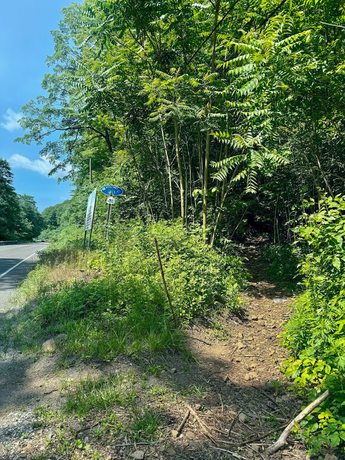
The trail begins where the blue-blazed Metacomet Trail crosses Chamberlain Highway, also known as Route 71, in Berlin.
Parking coordinates: 41.562803, -72.809665
This is not a traditional trailhead parking lot. There are only a few roadside spaces near the trail crossing, and the entrance can be easy to miss while driving along Route 71. Slow down as you approach and look for blue trail blazes on both sides of the road.
Do not block the roadway or park in the travel lane. When the closest spaces are occupied, additional roadside parking may be available a short distance south of the trail crossing.
Hiking Tips
Download park map, click here.
Parking is extremely limited, so an early start is a good idea on weekends.
Pay close attention at every major intersection. There are several unofficial or unblazed trails in the area, including routes toward Anderson Pond.
Nearby Things to Do:
Downtown Berlin for pre or post hike eats.
Donuts of course!
Post Hike Brews: Coles Roads Brewing

Panoramic Views
Parking Information
Drive slow as approaching this area as the parking area is small and can be missed.
South Mountain Trailhead
The Hike
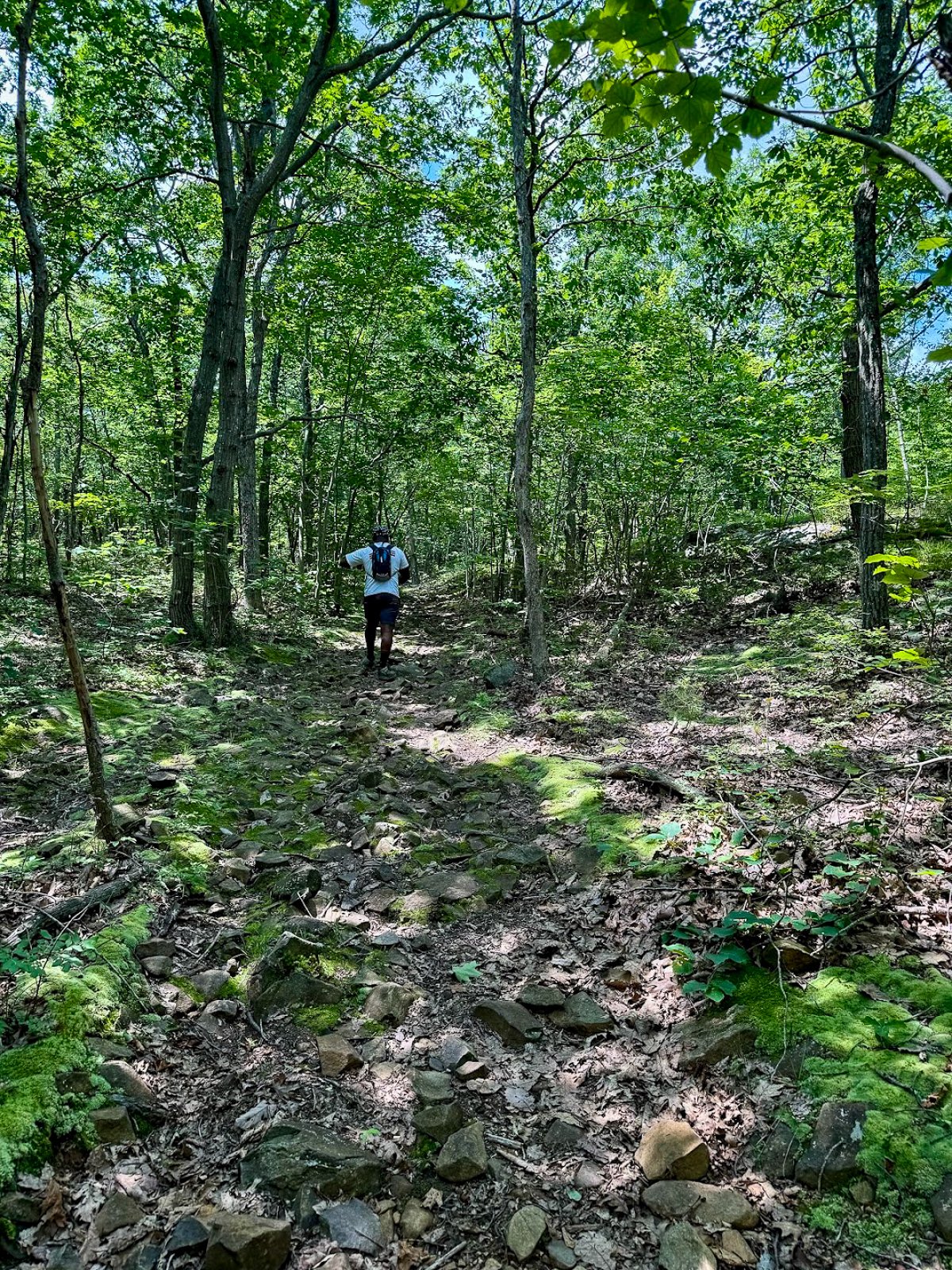
From Chamberlain Highway, enter the woods and begin following the blue blazes of the Metacomet Trail.
The opening section is relatively easy. You will soon pass a large water tank before arriving at Elmere Reservoir. It is not the dramatic mountain scenery you came for, but the reservoir provides a peaceful start to the hike.
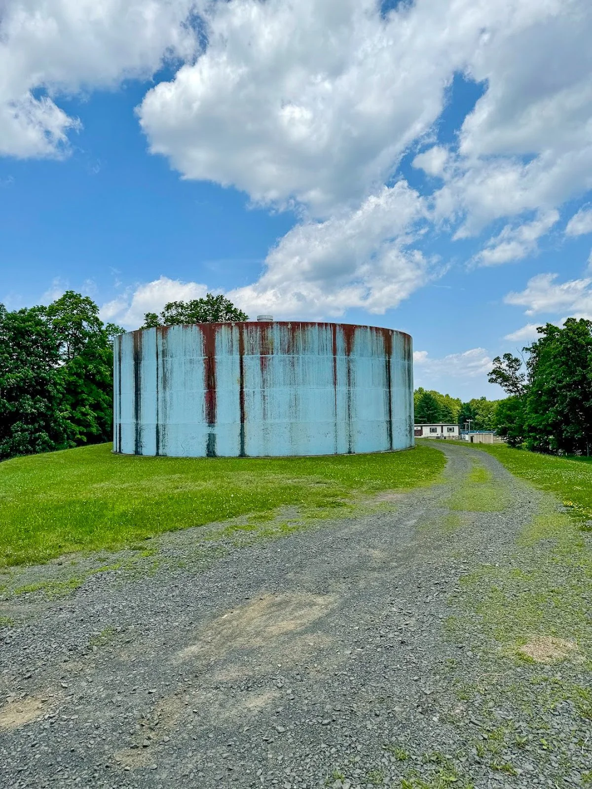
Water tank at start of hike
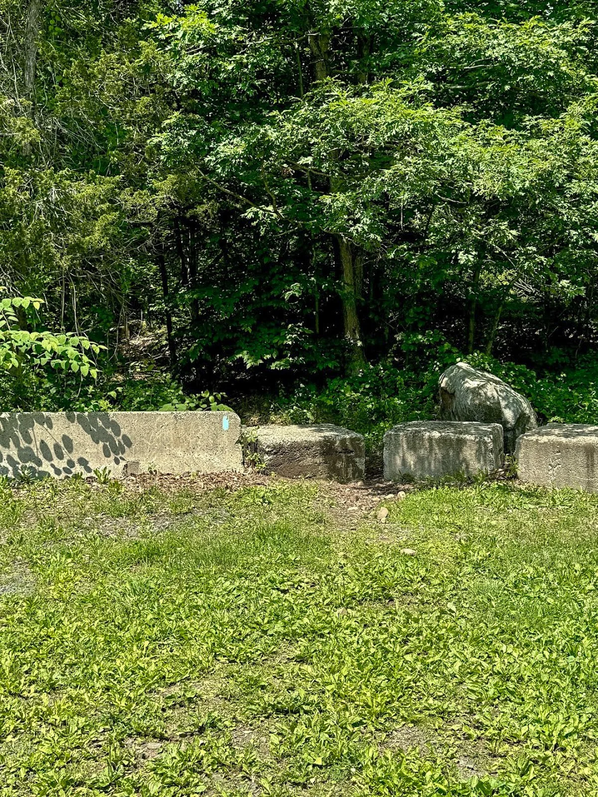
Continue beyond the reservoir and climb a small embankment near several concrete blocks. You will reach an intersection with an unblazed woods road. One direction leads toward Anderson Pond, while the other will eventually become your return route from the South Mountain cliffs.
For this route, remain on the blue-blazed trail.
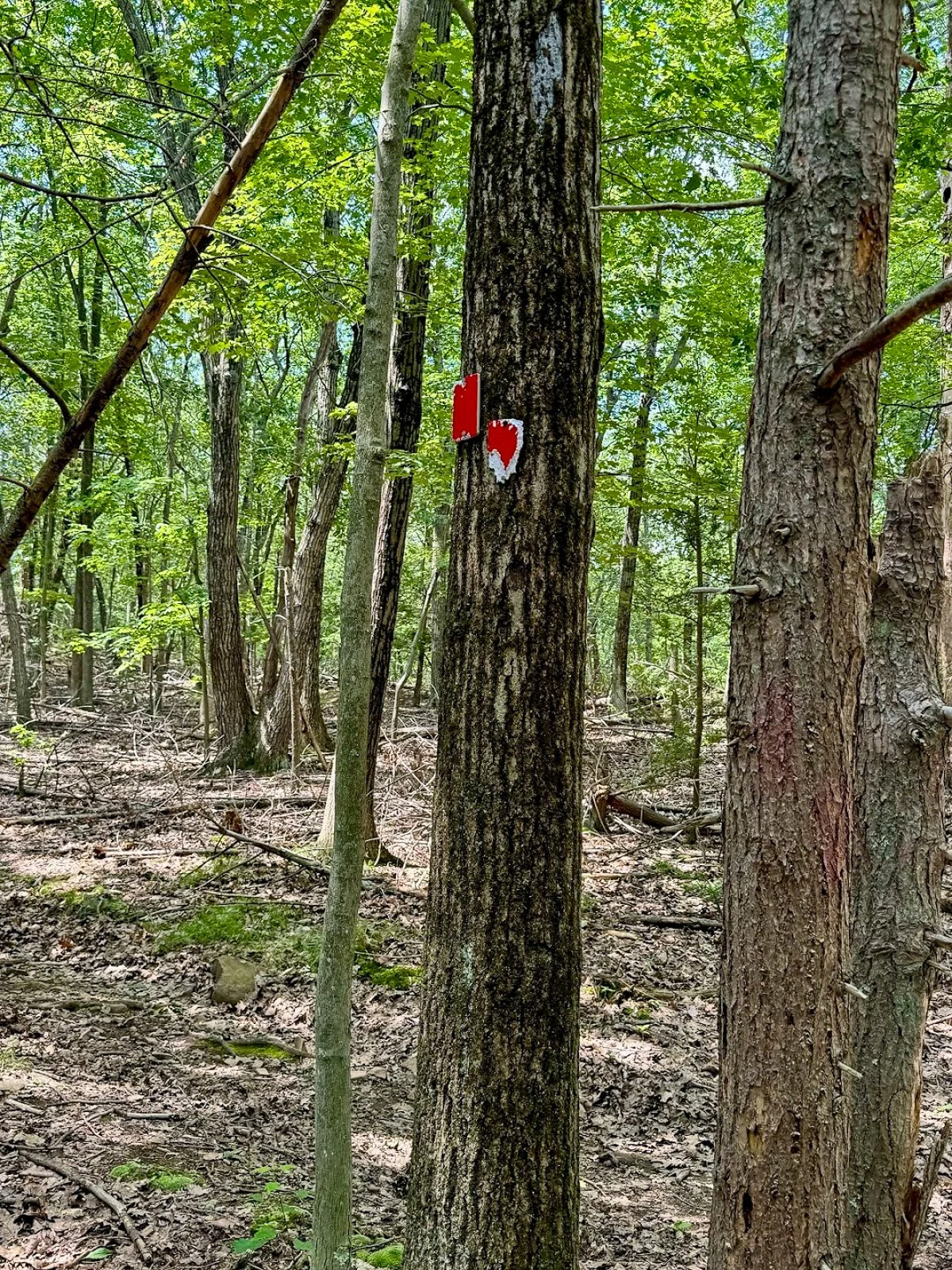
The trail may be rocky or wet through this section. Continue for a short distance until reaching another obvious intersection with a woods road on the left. Look carefully for faded or occasional red blazes.
Turn left here.
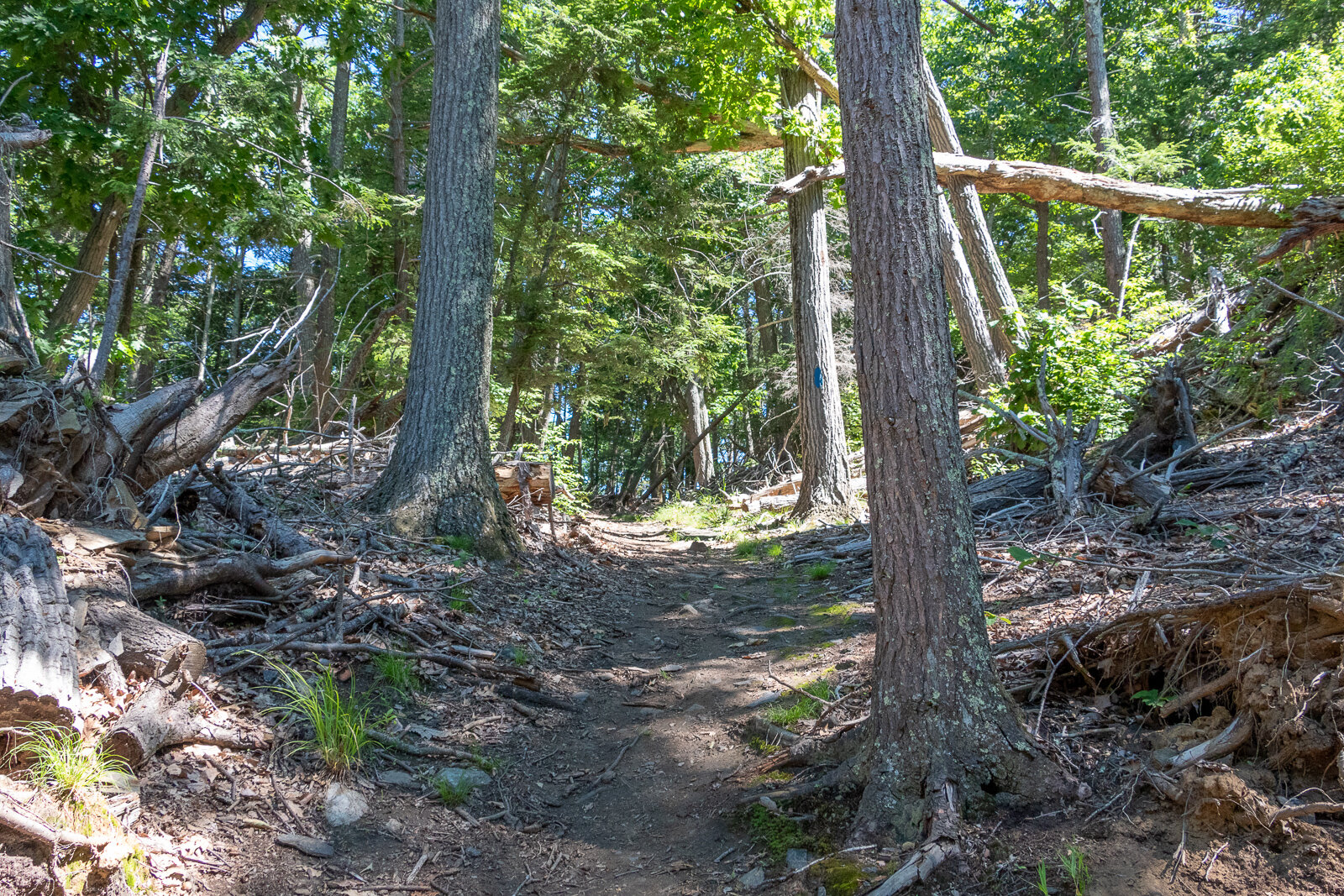
Climbing South Mountain
The red-blazed woods road begins a steady but manageable climb toward South Mountain. The incline is gradual rather than brutally steep, but it is enough to get the heart going.
The trail markings become less reliable as you gain elevation. Stay on the most established woods road and check your map whenever you reach a questionable intersection.
As you approach the top, watch for a poorly marked side trail on the right. This short path leads to one of the best viewpoints on the entire hike.
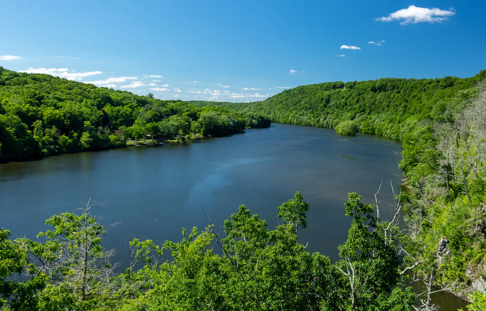
Merimere Reservoir Overlook
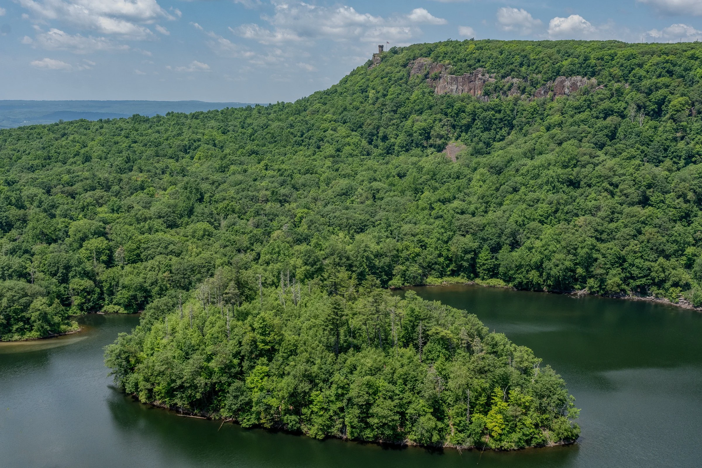
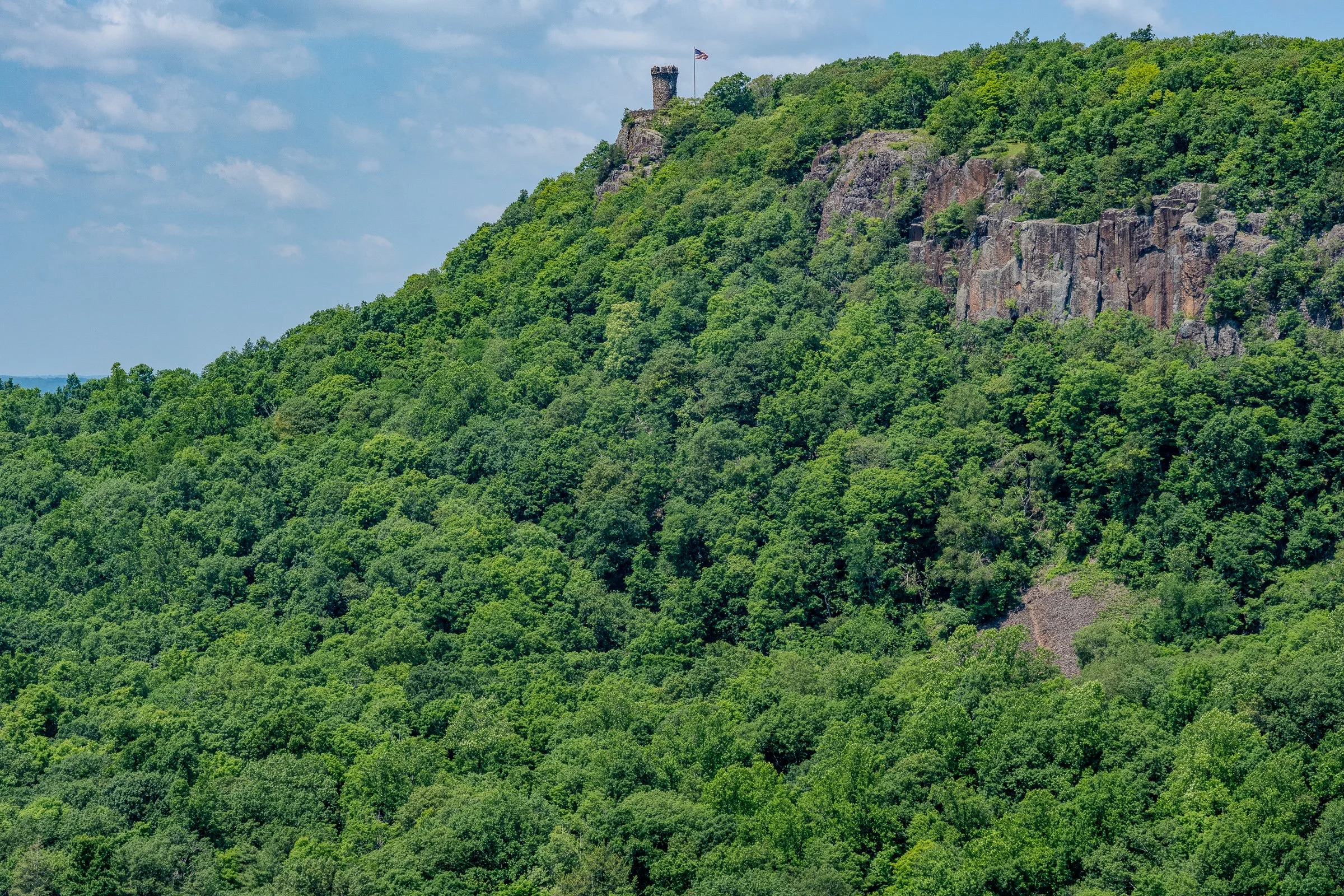
The first major overlook provides a gorgeous view across Merimere Reservoir.
Mine Island sits prominently in the water, with East Peak rising behind it. Castle Craig may also be visible along the ridgeline. This is the money-shot view of the hike and a great place to stop, catch your breath, and take a ridiculous number of pictures.
The open ridgeline provides a wide view across the reservoir and surrounding Hanging Hills. It feels like a much bigger mountain experience than you might expect from central Connecticut.
South Mountain rises to approximately 767 feet, while the reservoir and surrounding valleys sit several hundred feet below the cliffs.
Downtown Meriden Overlook
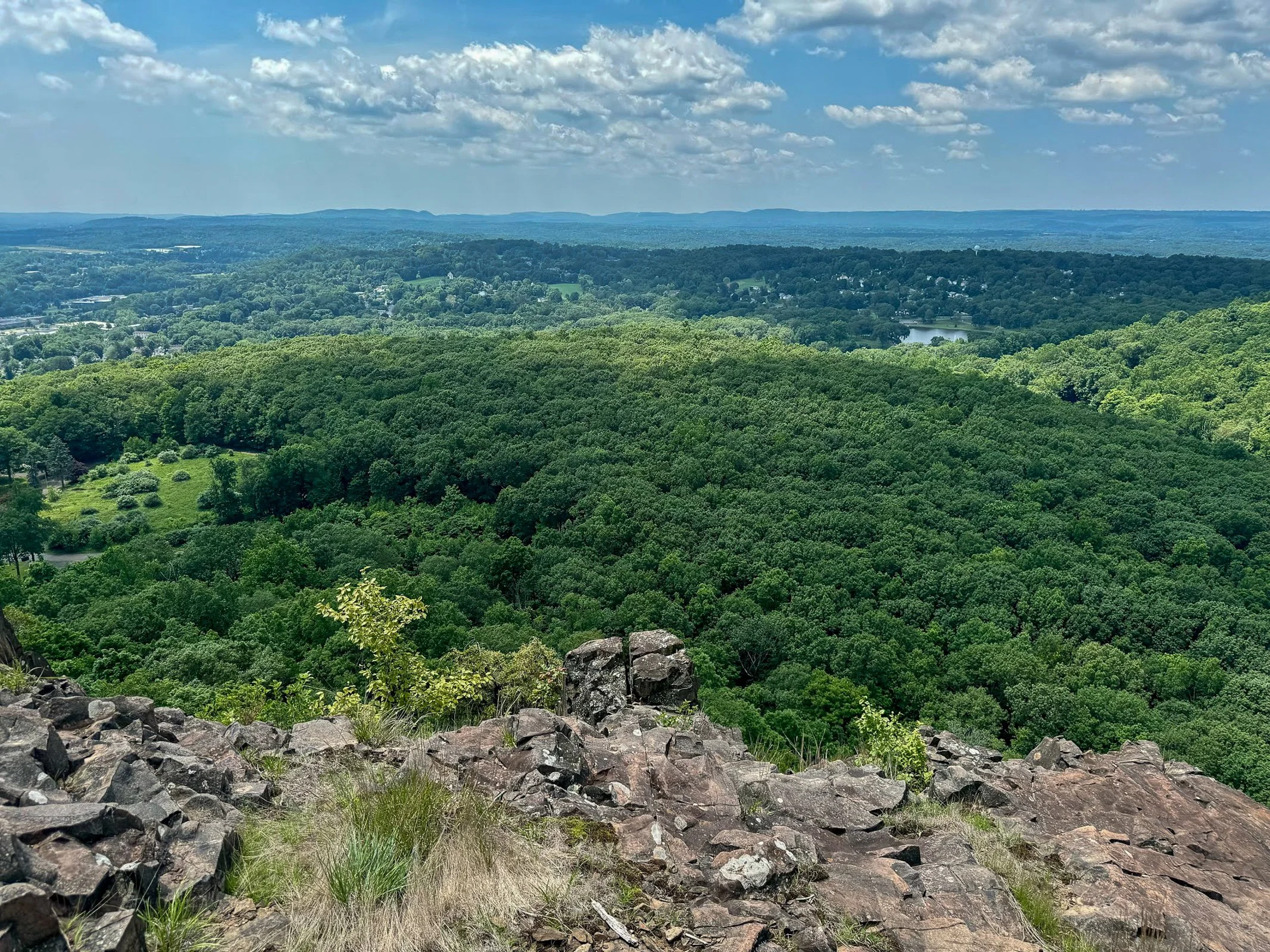
After taking in the reservoir views, return to the main loop trail and continue along the ridge.
The woods road dips and climbs gently before reaching another open viewpoint. This side of South Mountain provides a dramatic look toward downtown Meriden and the developed areas surrounding Hubbard Park.
The contrast is interesting. One minute you are looking across a quiet reservoir toward Castle Craig, and the next you are standing above the city.
Continue following the ridgeline through the open woods. Trail markings may still be inconsistent, but the main route is usually easy enough to identify.
Target View and the Return Route
As the trail curves around the mountain, you will reach the east-facing cliffs sometimes referred to as the Target View. The shopping area sits directly below, with Interstate 691 and several additional traprock ridges visible in the distance.
It may not be the classic wilderness view, but it shows just how suddenly South Mountain rises above the surrounding city.

Continue descending on the woods road. This portion completes the loop and eventually returns to the earlier intersection near Elmere Reservoir.
Once you reconnect with the blue-blazed Metacomet Trail, turn right and retrace the opening section of the hike. Pass Elmere Reservoir and the water tank before returning to Chamberlain Highway.
Nearby Things to Do
It would not be Hiking for Donuts without a post-hike treat. Swiches & Coffee Donuts is a good option in town. After this hike, me and my buddy went to the local brewery, Coles Road Brewing. Also, Kensington Pizza is a big spot locally. Downtown Berlin has been getting new restaurants so be sure to stop in town.
Neil’s Donuts in Wallingford is a solid option as well after exploring South Mountain. It is not too far away for some amazing donuts.
Other Connecticut Hikes Nearby
Looking for more scenic Connecticut hikes?
Follow Hiking For Donuts on Instagram for more New England hiking adventures.

HIKING FOR DONUTS
Hi, I’m Mark. I live in Connecticut. I take new trips every chance I get. A good trip has a great hike, great food, and something fun to do. My goal is to search out new trips and share them to inspire others to try something new and exciting.
If you are looking for posts in a particular place, search City or State here.
SEE OTHER POSTS IN ARCHIVE
Archive
RECOMMENDED POSTS


RECENT POSTS


See the latest on Instagram and follow @HIKINGFORDONUTS

Haystack Mountain Trail, Connecticut: Fire Tower Hike With Epic Views
Haystack Mountain State Park Trail Guide (Norfolk, CT)
Haystack Mountain State Park might be one of Connecticut's best "bang for your buck" hikes. Less than a mile round trip gets you to a stone fire tower with sweeping views across four states.
Haystack Mountain State Park in Norfolk, Connecticut is one of the best short hikes in New England. This quick out-and-back trail leads to a historic stone fire tower with sweeping 360-degree views into Connecticut, Massachusetts, New York, and Vermont.
At less than a mile round trip from the upper parking area, this is an excellent beginner-friendly hike with a huge scenic payoff. If you’re looking for an easy Connecticut hike with mountain views, this trail deserves a spot on your list.
Trail Description: Haystack Mountain Trail contains an impressive stone fire tower with stunning views of the mountains in Connecticut, Massachusetts, New York, and Vermont.
Trail Info:
Location: Norfolk, CT (See link below)
Distance: 0.8 mile (30-45 min) Round Trip
Difficulty: Moderate
Trail Type: Out and Back
Highlights: Views, Mountains, Valley, Fire Tower, Panoramic Views
Dog Friendly: Yes
How to get there:
Haystack Mountain State Park - On Rte. 272 Norfolk, CT 06058
Trailhead parking location here.
Easy to find off Route 272. The road goes halfway up Haystack Mountain to a parking lot, where the shortest trail starts. The parking lot can hold about 10 cars.
Hiking Tips
Download park map, click here.
Cell phone service is spotty. Hike carefully.
There can be seasonal closures of the park.
Nearby Things to Do:
Yellow Trail: Longer 1.8 Mile Hike (starts at the beginning of park road at the gate entrance)
Nearby Hikes: Litchfield County area has some great short hikes you could pair with this one.
Post Hike Brews: NorBrook Farm Local Brewery

Panoramic Views
Haystack Mountain Trail Guide
Haystack Mountain State Park in Norfolk, Connecticut is one of the best short hikes in New England.
At less than a mile round trip from the upper parking area, this is an excellent beginner-friendly hike with a huge scenic payoff. If you’re looking for an easy Connecticut hike with mountain views, this trail deserves a spot on your list.
This guide will be for the shortest trail route at 0.8 miles from the top parking lot of Haystack Mountain. These days my time is a bit limited and the best bang for your buck is what is more appealing. If you want to make it a longer hike, there is the Yellow Trail that starts near the beginning of park road at the gate entrance. This will be 1.8 miles, out and back. Both of these options will be great hikes to get to the main attraction, the amazing tower views.
Trail Overview

Haystack Mountain Trailhead
Parking Information
Once you have parked at the top parking, which is about a mile once you enter the park, the trail is to the left to begin the summit.

Haystack Mountain Trail
The Hike to the Fire Tower
This trail is fairly straightforward. It is well-maintained and clearly marked. The first 0.2 miles are flat and easy breezy. The next 0.2 miles will get your heart pumping as the trail bends to the left and starts a quick incline with 200 feet of elevation. Those quads might be on fire but it is all worth it once you see the bad ass tower at the top.
Check out my Instagram reel for a video walkthrough of the Haystack Mountain Trail and the fire tower views here.

Haystack Mountain Trail Incline
Now, it’s time to climb the 34 foot stone tower up to the top for the 360 views at 1,683 feet of elevation.
Tower Views and What You’ll See

Haystack Mountain Fire Tower
Definitely some of the best views you will have in Connecticut. It was a bit overcast and cloudy for me, but still impressive views nonetheless. On a clear day, there is visibility of the Riga Plateau in Northwest Connecticut, the Berkshires in Massachusetts, the Catskills in New York, and the Green Mountains of Vermont. That is quite a combination of views.

View at the Top

Haystack Mountain Trail Views

Nearby Breweries and Things to Do
This would be great to pair with some other short hikes in the Litchfield County area. In addition, there are great local breweries as well such as NorBrook Farm for post hike brews.
Things to Do Nearby:
Yellow Trail: Longer 1.8 Mile Hike (starts at the beginning of park road at the gate entrance)
Nearby Hikes: Litchfield County area has some great short hikes you could pair with this one.
Post Hike Brews: NorBrook Farm Local Brewery
Other Connecticut Hikes Nearby
Looking for more scenic Connecticut hikes? Check out these links to other trail guides for hikes in Litchfield County:
Follow Hiking For Donuts on Instagram for more New England hiking adventures.
HIKING FOR DONUTS
Hi, I’m Mark. I live in Connecticut. I take new trips every chance I get. A good trip has a great hike, great food, and something fun to do. My goal is to search out new trips and share them to inspire others to try something new and exciting.
If you are looking for posts in a particular place, search City or State here.
SEE OTHER POSTS IN ARCHIVE
Archive
RECOMMENDED POSTS
RECENT POSTS
See the latest on Instagram and follow @HIKINGFORDONUTS

Enders Falls, Granby, CT
Trail Description: Enders Falls is a quick out and back trail with multiple picturesque waterfalls.
Trail Info:
Where: Granby, CT Distance: 1 mile (30-45 min) Difficulty: Easy Trail Type: Out & Back Features: Views, Waterfalls, Water, Brook
How to get there:
Enders State Forest Granby, CT 06035
Click here for coordinates from GoogleMaps.
Hiking Tips
Bring bug spray for the applicable season.
There are a few trails off from the parking lot heading down to Enders Brook that will converge.
The Hike
Waterfalls can be hit or miss for me. Sometimes they all just feel the same. Generally, my first inclination is to find a hike with cool summit views. However, things done changed, and that can’t always be the case. I have a toddler and many toddler nieces/nephews. I want to still get out in nature and show them all how awesome it is. And, waterfalls are a great hiking option for this. There are many in Connecticut that are accessible. I am behind on my CT waterfall game but that will likely change.
Enders Falls is an easy trail with 4-5 visible waterfalls that vary in size and look. The trail is very popular but we picked a great day and had the trail to ourselves. My wife had my daughter in a carrier and I had my nephew in my backpack carrier. And on we went to enjoy a day of nature.
From the parking lot, I definitely did not take the best course of action but we got back on track easily enough. The best start would be starting at the gravel in the far right corner by the porta potty.
There will be Purple markers (look pink to me) on the gravel trail and follow downstream to the staircase along the ravine. It seems this has been updated recently with steps of granite, fortified railings, and wooden fencing for safety purposes. It appears there were some accidents but it is very safe and well constructed. And, you can still get great views on some of the falls.

There is a good view of the 2nd waterfall and cliff area from the small viewing platform.

At the end of the staircase, there are stone steps that lead back to the gravel trail back to the parking lot for about a half mile.

HIKING FOR DONUTS
Hi, I’m Mark. I live in Connecticut. I take new trips every chance I get. A good trip has a great hike, great food, and something fun to do. My goal is to search out new trips and share them to inspire others to try something new and exciting.
If you are looking for posts in a particular place, search City or State here.
SEE OTHER POSTS IN ARCHIVE
Archive
RECOMMENDED POSTS


RECENT POSTS
See the latest on Instagram and follow @HIKINGFORDONUTS

Horse Guard State Park, Avon, CT
Trail Description: Horse Guard State Park has one trail that is relatively quick to hike that is easy for the most part until the climb up the side of rocks that leads to stunning views of mostly trees and the Northwest hills. Fall offers a spectacular colorful viewpoint.
Trail Info:
Where: Avon, CT Distance: 1.2 miles (1 hour) Difficulty: Moderate Trail Type: Out & Back Features: Views, Mountains, Valley, Rock Scramble
How to get there:
245 W Avon Rd, Avon, CT 06001
Drive slow as you approach, the lot will come up suddenly. Depending what route you are taking, you will see a big red house, the Derrin House, right before the parking lot. The parking lot can fit maybe 8-10 cars.
Hiking Tips
I would suggest hiking boots due to the muddy section and rock scramble climb. Maybe some hiking poles for the way down if not comfortable going down on the rocks.
Follow the white trail. If you see two trail markers, one slightly higher on the left it means make a left turn. If you see two trail markers, one slightly higher on the right, it means make a right turn.
It is a small park, there are no bathrooms. Close by to popular areas for post hike activities such as food and drink.
Trail Map here.
The Hike
There is only one way to go so this guide will be a quick one. The white marked trail is the only trail at Horse Guard State Park.


Once parked, it is pretty clear where to hop on the trail and there is a trail map right before the trail begins.


The white trail is well-marked and easy to identify. Also, the trails are very wide.
It is an easy hike up until the rock scramble. There is a section that will be quite muddy but you can go around it if you choose wisely. I did not the first time and my foot definitely submerged into the mud.
This is such a beautiful park in the fall just walking through the forest.
At about 0.4 miles, you will start approaching the rock scramble portion of the hike. This will be 0.2 miles of about 500 feet elevation. This is what makes the hike a moderate one to me. The rock scramble is short, but like a straight up ascent. It definitely gets the blood going and is not easy. Coming down was way harder. There may be markings for the proper direction to go up but I just went for it.
At the top of the rock scramble, there will be a small narrow trail to the left to take. After a short walk, you reach two lookouts. The first one is an appetizer.
The next lookout is literally a few steps over and that is just….boom. Fall colors to the face! Just an unbelievable view of the open forest covered by trees everywhere and rolling hills in the background.
Most people stop here but I saw some hikers continue on a very narrow and not clear trail. This short walk actually led to another view where you can see the Heublein Tower on Talcott Mountain in the distance. Also, it appears you are on a cliff above someone’s house. I prefer the other views but this was a bonus. From here, just return the way you came and down the rock scramble to the parking lot.
As mentioned above, this is close to a popular area in Avon, CT. There is a brewery about 5 min or so close by, Hopmeadow Brewing Company. My wife and I stopped there for some post hike beers and there was a delicious food truck there as well. The beers were great, I highly recommend visiting.


HIKING FOR DONUTS
Hi, I’m Mark. I live in Connecticut. I take new trips every chance I get. A good trip has a great hike, great food, and something fun to do. My goal is to search out new trips and share them to inspire others to try something new and exciting.
If you are looking for posts in a particular place, search City or State here.
SEE OTHER POSTS IN ARCHIVE
Archive
RECOMMENDED POSTS
RECENT POSTS
RECENT POSTS
See the latest on Instagram and follow @HIKINGFORDONUTS

Lovers Leap State Park, New Milford, CT
Trail Description: Lovers Leap State Park has multiple hiking trails with views of the Housatonic River and other structural landmarks such as the popular Lovers Leap Bridge.
Trail Info:
Where: New Milford, CT Distance: 1.8 miles (1.5 hours) Difficulty: Moderate Trail Type: Loop Features: Views, Valley, Bridge, Lake, River
How to get there:
178 Short Woods Rd, New Milford, CT 06776
https://goo.gl/maps/4FUFjzSinExpgzHfA
Hiking Tips
Be cautious switching trails. If markers cannot be found, turn back to retrace steps. Also, the blue trail appears to have a fake marking on top of the hill toward the wrong direction.
Don’t just hike up to the popular scenic view & leave. There is another cool view from the East on the Blue trail.
The Hike
Lovers Leap State Park is pretty easy to find. The parking lot is pretty big as this does seem like a busy hike. The wife and I caught a good time of day as the lot was almost empty. From the parking lot, we headed towards Lovers Leap Bridge. The bridge will appear pretty immediately. The structure is interesting. The lighting was spotty with shadows so I did not successfully get the best picture for the insta. Darn it!

We crossed the bridge and got the first view of the Housatonic River. Taking a right off the bridge took us down a gravel road, also known as the Lovers Leap Trail. Within 0.3 miles of some incline, the money shot picture awaits. This scenic view offers the best one in the park overlooking Lake Lillinonah. From here, you could take your donut and go home, but there is some more hiking to be had at this park.
There are some interesting features and landmarks on some of the other trails. We decided to trace back our footsteps on the gravel road until we noticed the red markers for the Castle Trail on the right. Have a map handy, we had an issue finding. Pretty sure we did not go the way intended but it worked. The red blazed was a pretty good incline. Got my lungs working. Within a short distance, we came upon the castle ruin, which was just its foundation and a tall chimney. And, across from this was a castle-like turret. As I try to sit here explaining it, here’s a picture. If you must know more, I suggest the google machine.


In between the castle features, there is a trail we took that connects the red blazed trail to the blue blazed trail, known as the Falls Mountain Trail. We took a right from the red to the blue. This took us up a steeper hill.
Once we reached the top of the hill, we saw a blue marker to the left but that was not correct. We met just bushes and the end of a ledge. It appears that it was painted incorrectly as a joke perhaps. That could be very dangerous if you are not paying attention. This is why we can’t have nice things. That person sucks who did that. Fortunately, we found other lost hikers and we noticed the view was behind us and we needed to retrace our steps and keep going straight and the ridge is on the right. From the ridge line, there is an open area view from the east that is pretty nice. From here, we retraced our steps down the blue to the red trail back to the gravel road.

Bonus Foodie Find:
After hiking, the post meal is important. Not all hikes are near donut shops unfortunately. However, other great food spots can be found. This hike is close to the downtown area of New Milford, CT. We stopped at Johana’s Restaurant for a brunchy meal. Great menu. I got the English Scramble - eggs, bacon, scallions, cheddar cheese in a skillet with home fries. Hell yes. And, my wife got the corn cheddar pancakes. That’s how we get down. Everything was delicious. Also, if you go in the warmer months, check out the farmers market. There’s an awesome bread company there.


HIKING FOR DONUTS
Hi, I’m Mark. I live in Connecticut. I take new trips every chance I get. A good trip has a great hike, great food, and something fun to do. My goal is to search out new trips and share them to inspire others to try something new and exciting.
If you are looking for posts in a particular place, search City or State here.
SEE OTHER POSTS IN ARCHIVE
Archive
RECOMMENDED POSTS


RECENT POSTS
See the latest on Instagram and follow @HIKINGFORDONUTS


People State Forest, Barkhamsted, CT
Located in Northwest Connecticut, the Jessie Gerard Trail is one of many exciting trails that wander through the 3000-acre Peoples State Forest. This fairly unknown hike is challenging with various terrain and magnificent views of Grand Vista Overlook and Chaugham Lookout. A great hike in the fall for amazing views.
Trail Description: The Jessie Gerard Trail is one of many exciting trails that wander through the 3000-acre Peoples State Forest. This fairly unknown hike is challenging with various terrain and magnificent views of Grand Vista Overlook and Chaugham Lookout.
Trail Info:
Where: People State Forest, Barkhamsted, CT Distance: 3.3 miles (2.5-3 hours) Difficulty: Moderate Trail Type: Loop Features: Waterfall, Valley, Views
How to get there:
Typing in Jessie Gerard Trail in your GPS will lead you to East River Road, Barkhamsted, CT. Once you get onto East River Road, drive a few miles and you will see a small parking lot on your left. The trail starts directly across from the lot.
Hiking Tips:
Take a DEEP People State Forest map at the kiosk in the beginning. This will be very useful.
Start with the Falls Cut Off Trail to your left (blue/red marked trail). Much easier to go up this section (than down). If it rained recently, the first 0.1m will be slippery up the rocks.
Pay attention to the markers changing colors

The Hike
The hike begins up the Falls Cut Off Trail (blue/red markers) on the left. The beginning of the trail is difficult and there is an immediate steep incline up past the falls. The beginning of the trail is difficult and there is an immediate steep incline up past the falls. There was a huge rain storm the day before so the waterfalls were roaring. An awesome visual after 10 minutes into the hike. Though, the rocks were really slippery. Once reaching the top of the falls, turn left on the double marked Blue and Blue/Yellow markers, which is the Jessie Gerard Trail. Continuing straight ahead on the Blue/Yellow,do not veer toward Warner Road. After another half mile, boom shakalaka we emerged into the Grand Vista outlook. Magnificent views with all the fall colors. We continued following the Blue/Yellow for another half mile to the Chaughum Lookout for more awesome views.
From here, stay on the Blue/Yellow Trail. We went between the 2 Veeder glacial erratics aka big boulder rocks. Shortly after, take a right onto Greenwoods Road. This is where the Jessie Gerard Trail ends. Then turn left on the Charles Pack Trail, also Blue/Yellow markings.
Another half mile later, turn onto Beaver Brook Road. This is where things got interesting. Following the road, the map says turn right onto the Blue/Orange, Agnes Bowen Trail, on your right after a half mile. When we came up to this, it was nothing but forest. No sign of a trail. We walked up and down and this was the spot. However, I don’t know where the trail would connect. We decided to keep walking up Beaver Brook Road and take a right up the road. Eventually, we caught up with the Blue/Orange trail where we would have come out to the road.
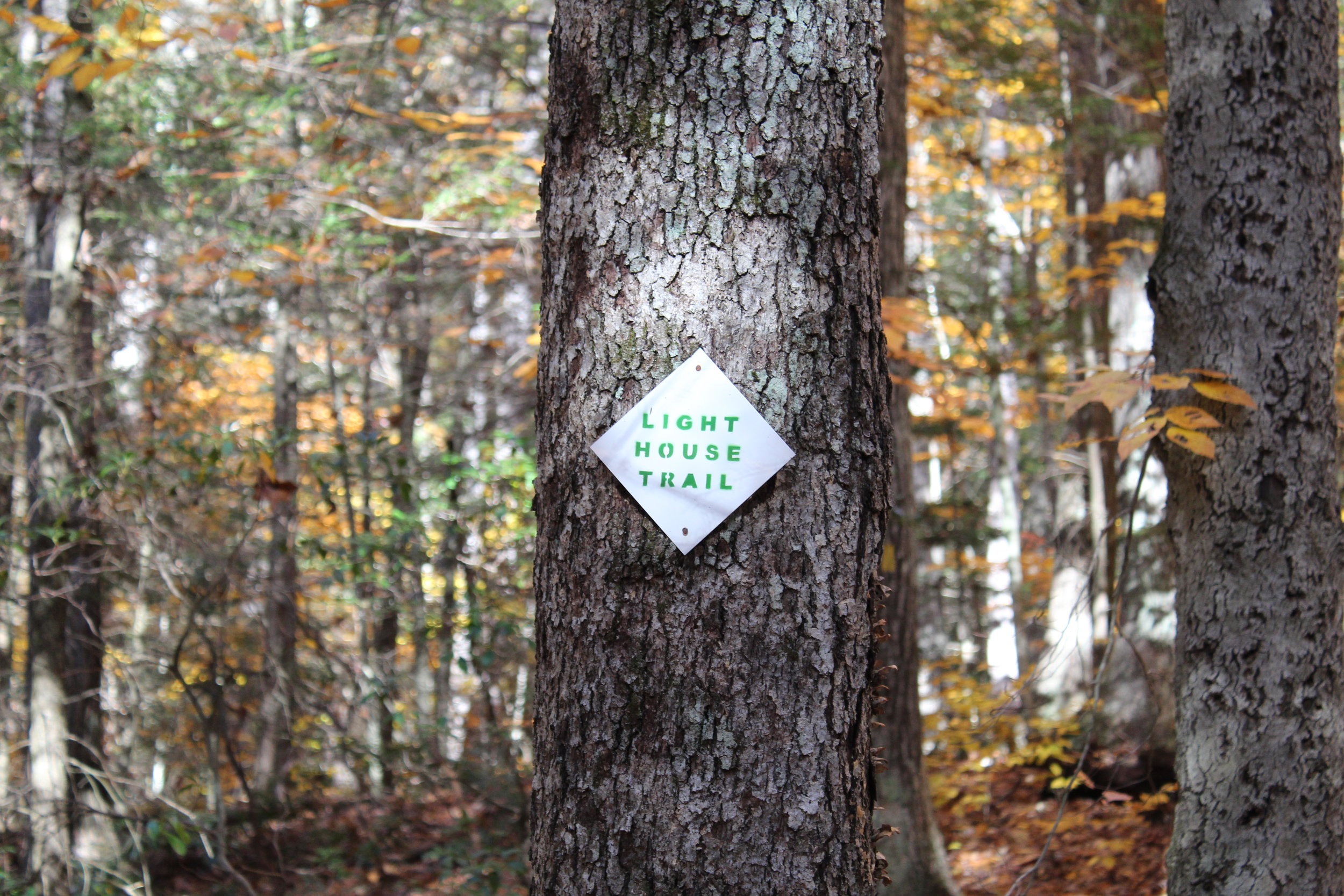
We jumped on the Blue/Orange to the left until we reached the Robert Ross Trail (Blue markers). Turn right here onto the Blue. The trail we will begin to ascend and descend. A tough part of the hike but way better than going down the other way. Keep your eye out on the colors on the trees. We got a little stumped here as the Blue/Yellow connects with the Blue. However, staying straight on the Blue the trail switchbacks downhill to the Lighthouse Trail (Yellow). Of course, another trail. Fortunately, this was the home stretch. We passed a few kiosks with educational info but we were ready for the post hike meal. This will take you back to the Blue/Red and right to the parking lot.


HIKING FOR DONUTS
A blog for the outdoors foodie enthusiast
Hi, I’m Mark. I live in Connecticut. I take new trips every chance I get. A good trip has a great hike, great food, and something fun to do. My goal is to search out new trips and share them to inspire others to try something new and exciting.
If you are looking for posts in a particular place, search by city or state here.
EXPLORE OTHER POSTS IN THE ARCHIVE
Archive
RECOMMENDED POSTS
MOST RECENT POSTS
SEE THE LATEST ON INSTAGRAM AND FOLLOW @HIKINGFORDONUTS