


Castle Craig and East Slope Trail, Meriden, CT
Castle Craig is a popular destination in Meriden, CT. There are awesome views from the top. Hiking the East Slope Trail, check out my review!
Spring is finally here to stay. Another beautiful weekend for outdoors. This weekend’s hike was an oldie but goodie. I have hiked up to Castle Craig a few times in the past. The hiking trails are pretty good and there are excellent views at the top. Also, there is an actual castle/tower, which can be climbed via stairs to the top inside the tower. Castle Craig is located in Hubbard Park in Meriden, CT. The park itself is fairly nice, covered with gorgeous daffodils and a large pond with fountains. There are various trails that take you up to the Castle Craig tower. This particular blog will be on the East Peak using the white/red/blue trails. The trail map I used can be found here.
Upon arriving at Hubbard Park, we drove straight until we saw a small lot to our left where the trail head starts.

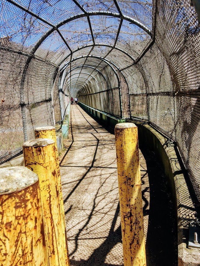
From here we followed the white blazed trail through the walking tunnel over I-691.
Shortly after, we reached the small foot bridge that passes over a creek.

Continuing on the white trail led us to the Beehive Spring landmark.

From here we continued straight on the red blazed trail for a short distance until we saw the first blue blazed trail. This part of the hike got pretty steep.

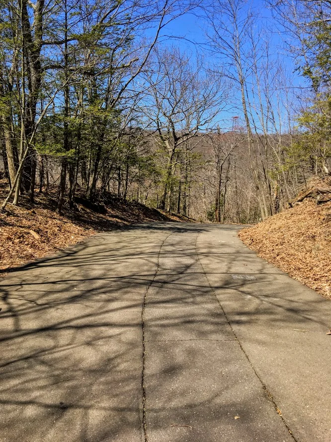
The end of the steep ascend took us to the paved road. You have options here. Use the paved road up to the peak or continue along the blue trail to see overlooks of the town and cross the parking lot. We just went up the road.
At the end of the road, we reached our destination of the East Peak. Castle Craig tower sits atop the East Peak at 976 feet. The skies were absolutely clear and the views were spectacular. We reached the top to only find a few people but within minutes the peak began to fill out, which is typical.


After making more donut eating boomerang videos, climbing the stairs to the top of the tower, and taking as many pics as possible, we made our descend down the East Peak following the white trail. The downhill is steep at first but then becomes flat. I will say, I was disappointed to find a ton of broken glass at this section of the hike. This is a good hike. And, many families include young children and dogs frequently travel the trails. Take care of the trails! Who would smash bottles?!???! Not cool.

Eventually, the white trail led us down carriage road to the Halfway House.
We passed this landmark and continued to follow the white trail to Merimere Reservoir. Again, the skies were clear and got another great view. We continued alongside of the reservoir until we reached the pave road. We took a right walking down the paved road and took another right on the next road, Notch Road. Passing under 691, this lead us back to where we parked.


Hubbard Park is a great area. The park is generally very populated. On nice days, the hiking trails can be crowded. We had pretty good timing on our hike but did get overwhelmed once we reached the peak. I would suggest doing this during the week, after work if possible. If not, this is still worth the hike when crowded. The Castle Craig tower is unique and the views are fulfilling. I would rate this hike moderate for the average hiker. If you are not use to steep uphill, you may need some breaks. Like most Connecticut hikes, gym shoes are probably ok but hiking boots are best. This hike took my group about just over 2 hours and was 3.5 miles based on the way we took. I have done this hike 4x so far. Definitely recommend for a good Connecticut hike.

HIKING FOR DONUTS
A blog for the outdoors foodie enthusiast
Hi, I’m Mark. I live in Connecticut. I take new trips every chance I get. A good trip has a great hike, great food, and something fun to do. My goal is to search out new trips and share them to inspire others to try something new and exciting.
If you are looking for posts in a particular place, search by city or state here.
EXPLORE OTHER POSTS IN THE ARCHIVE
Archive
RECOMMENDED POSTS


MOST RECENT POSTS


See where I have been recently on Instagram. Follow @HIKINGFORDONUTS


Mount Lafayette, New Hampshire
The White Mountains in New Hampshire is one of my favorites areas to hike. On this day, I conquered Mount Lafayette. What a hike!
Trail Description: Mount Lafayette is the highest peak in the Franconia Ridge at 5,260 feet. The summit offers amazing 360 views of the Pemigewasset Wilderness Area.
Trail Info:
Where: Lincoln, NH Distance: 8.0 miles (7-8 hrs) Difficulty: Hard Trail Type: Out and Back Features: Views, Peaks, Mountains, Greenleaf Hut
How to get there:
The parking lot for this hike is located in Franconia Notch on I-93. You can park on either side of the Interstate. Traveling north, you can park in the trailhead lot for the Falling Waters and Old Bridle Path trails. Traveling south, take exit 34b at Lafayette Place Campground. Follow the foot tunnel that goes under I-93 to the parking lot the opposite side of the highway to start the trail.
Hiking Tips
Bring lots of water, wear your best boots, hiking poles, and pack snacks.
Suggest doing the loop version of this hike along the Franconia Ridge trail to see Mount Lincoln and Little Haystack for more views.
Due to the popularity, the trail can be very crowded.
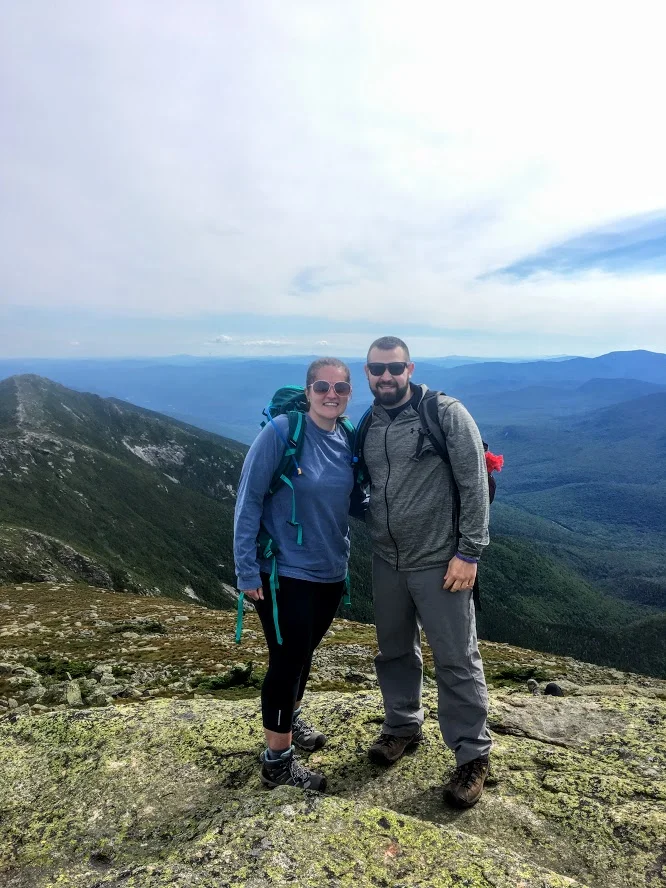
The White Mountains in New Hampshire are one of my favorite areas to visit and go hiking. It is one of the coolest areas in the Northeast and makes me feel like I’m in a different part of Unites States. It has a pacific coast mountainous look. I try to do a few hikes a year in New Hampshire. A large group of my friends rent houses in the area a few times a year to hang out. Even better, my best friend recently purchased a vacation home close to this area, about 15 minutes from Franconia. I bought new hiking boots and figured I wanted to do a fun, difficult hike in the White Mountains. More specifically, a hike I have not done. The one hike I really wanted to do was the Mount Lafayette summit. My friend said it was “easier” than Mount Washington but still hard. Lies. It was really freakin’ difficult. And, a terrible decision to wear new boots.
By the time we got there, it was near 11am and my friend suggested shaving a mile off the hike by skipping the trails where you would see Mt Lincoln and Little Haystack. I was against this decision but I was overruled. Disclaimer: This is a very popular hike. One of the best New England has to offer. There were cars lined up the side of the roads and the lots were full. This created a very tight hiking path. There was a lot of stopping and waiting for other hikers as the paths can be very narrow. For a summer hike, the weather was perfect, mid-70s and the skies were sunny and clear. We made our way to the trail which begins to the right of the information sign (there are bathrooms as well). Most hikers choose to go up the Falling Waters Trail as it is recommended by the trail guides. Another reason we chose to go up the Old Bridle Path as this was less crowded. After a good 1.5 miles into the trail you will seeing some great scenic views.


This path is 2.9 miles that will lead you to the AMC Greenleaf Hut. The hut is where hikers can use the restroom, eat, and enjoy the views. The hut also has some lodging options for those hikers who choose to do so.

From here, you will begin the rocky assent for another 1.1 miles to the top of Mount Lafayette, about 5,260 feet above elevation. We came down the same way we went up. The total hike was 8 miles.


Unfortunately for myself, the trail down wasn’t too fun as I sprained my ankle pretty bad. This hike is no joke and I would recommend using caution. For the inexperienced, I would prepare for a 8-9 hour hike. With my ankle issue, the hike took us over 8 hours. I would suggest using hiking poles, good boots and bring lots of H2O. I saw a couple wearing sandals. I can’t tell you how bad an idea that is. You will keep asking yourself, this isn’t a mile, 2, 3, 4? Given the incline, the hike will feel a lot longer. It was well worth it. The views are awesome. It leaves a very good sense of accomplishment. I will definitely go back another year to complete the Franconia Ridge Trail.

Review:
Bridle Path to Mount Lafayette Summit Trail (Franconia, NH, 8 miles): 5 out of 5!!!

HIKING FOR DONUTS
A blog for the outdoors, foodie enthusiast
Hi, I’m Mark. I live In Connecticut. I take new trips every chance I get. A good trip has a great hike, great food, and something fun to do. My goal is to search out new trips and share them to inspire others to try something new and exciting.
If you are trying to find posts about a particular place, search by city or state here.
Explore other posts in the archive
Archive
RECOMMENDED POSTS


RECENT POSTS
See where I’ve been recently on Instagram. Follow @HIKINGFORDONUTS.