


Hiking the Breakneck Ridge Trail, New York
Trail Description: The Breakneck Ridge hike is one of the most challenging trails in the Hudson Valley. The mountain is known for rocky terrain, steep rock scrambling, and beautiful views of the Hudson Valley. This trail is immensely popular due to its easy access.
Trail Info:
Where: Cold Spring, NY Distance: 3.7 miles (3.5-4.5 hours) Difficulty: Strenuous Trail Type: Loop Features: Views, River, Mountains, Rock Scrambling
How to get there:
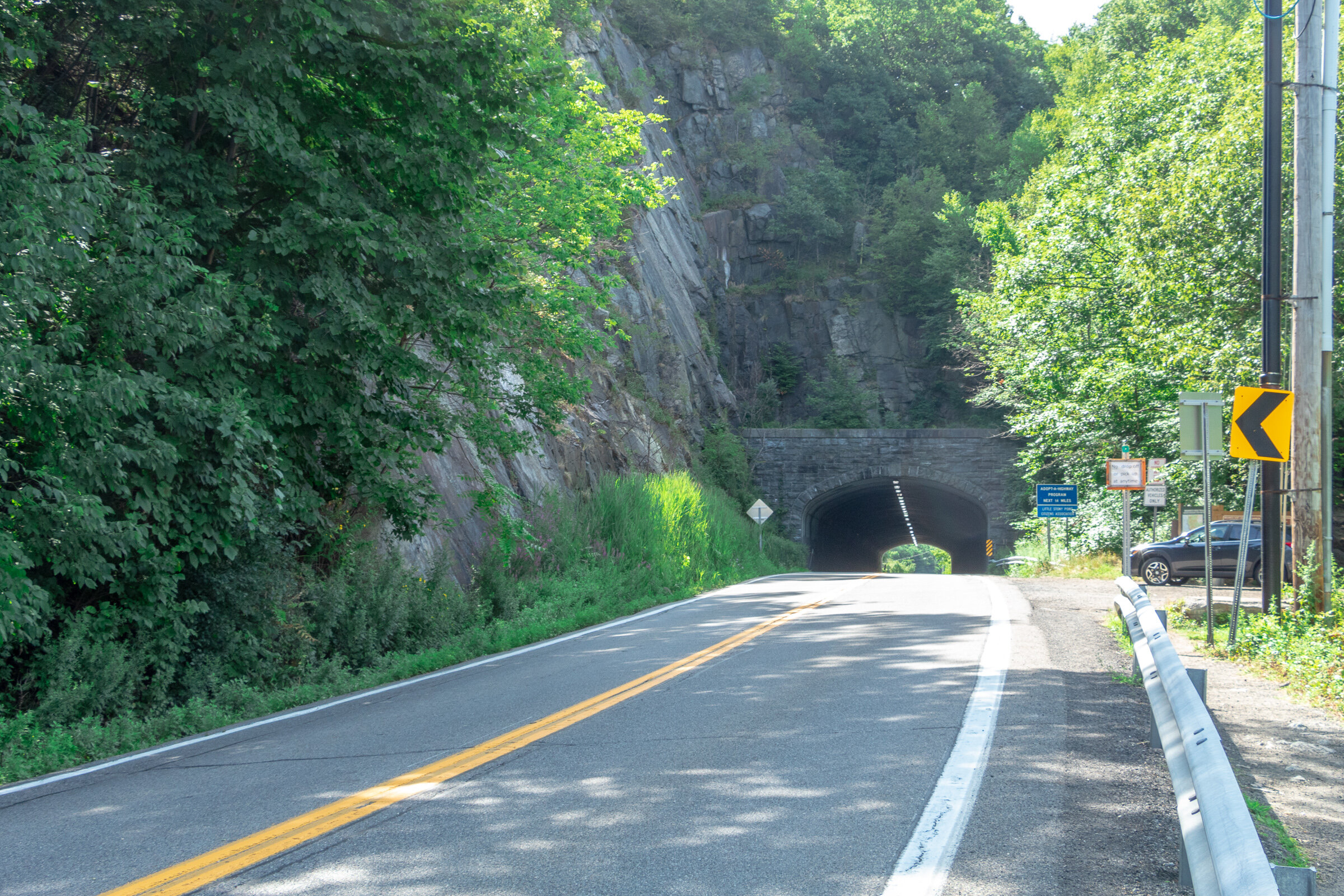
Typing the location “Breakneck Ridge Trailhead” into Google Maps will take you near the parking areas. There are multiple parking spots along State Road 9D, just park where you can north of the tunnel. There is a small lot near the trailhead and a larger lot further down.
For those concerned about parking/driving, this hike is accessible via train. There is a MTA to the Breakneck Ridge train station that is within walking distance to the trail on weekends only.
Hiking Tips
Go on a weekday to avoid the crowds, if possible. Go early on weekends.
Be prepared to rock scramble & use your hands to scale the cliff.
Not dog friendly (unless small dog that you can carry or your dog is a mountain climber)
The Hike
After parking, make sure you are walking along the right hand side of the road. The trailhead starts to the right of the tunnel, where there is trail signage and maps.
There are 3 trail route options for Breakneck Ridge. There is a sign explaining this at the beginning of the trail. The options consist of the short loop (2 hours) ,the regular/classic loop (3 hours), or the trail back to Cold Spring (4 hours). This guide will be the option we took which is the full classic loop.
There is a set of rock stairs that will bring you to the sharp ascent. Follow the white trail markers and start climbing! The terrain on the trail is pretty hard right away. There is a very steep ascent and I needed my hands and knees to get me through this portion of the hike. If you did bring hiking poles, I would suggest securing the poles to your backpack here as they will not be helpful. Depending on your level of climbing up, this can be anywhere from 30 minutes to an hour.

Keep climbing until you reach the flagpole. You will see Pollepel Island with Bannerman’s Castle to your right, along with views of Storm King Mountain straight ahead across the river.


After taking in the views and enjoying a break, continue to follow the white markers as the incline continues. This part is less intense but still some rock scrambling. There is an area in the trail where you can choose to go steeper or take the easier ascent marked with X with an arrow pointing left & right. The easier route was definitely welcomed after the steep climb.

Continue to climb higher and there is another viewpoint with the flagpole far in the distance from above.


Keep climbing until there are no more bluffs and cannot continue further.This is where you head into the forest. The next few miles are much, much easier. You could go back down the way you came but it’s a tough way down and you will be greeted with a traffic jam of many hikers ascending up.

Continue on white markers & ignore the yellow marked trail for now.
There will be a fork eventually. Look for a turn off to the red marked trail (tough to miss red marking on rock). Follow red trail down a gradual descent through woods.

Depending on your pace, the red trail will dead end in about 30-60 minutes where you take left onto yellow trail (Wilkinson Memorial Trail) and keep going downhill and follow all the way to the parking area.


HIKING FOR DONUTS
Hi, I’m Mark. I live in Connecticut. I take new trips every chance I get. A good trip has a great hike, great food, and something fun to do. My goal is to search out new trips and share them to inspire others to try something new and exciting.
If you are looking for posts in a particular place, search City or State here.
SEE OTHER POSTS IN ARCHIVE
RECOMMENDED POSTS


RECENT POSTS


See the latest on Instagram and follow @HIKINGFORDONUTS


Elephant Rocks State Park
Elephant Rock State Park
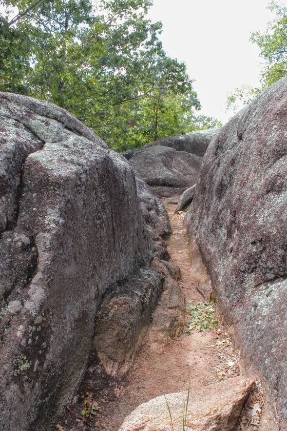
Trail Description: Located in Southeast Missouri, Elephants Rocks State Park has a unique attraction. The trail will lead you to large granite boulders which resemble a train of pink circus elephants.
Trail Info:
Where: Elephant Rocks State Park, Belleview, MO Distance: 1.4 miles (1 hour or until you are done exploring) Difficulty: Easy Trail Type: Out and Back Features: Boulders, Water, Quarry
How to get there:
The park was easy to find via GPS. However, you may lose cell signal nearby so make sure your map is up already. Here’s the address to put in your GPS:
7406 MO-21, Belleview, MO 63623
Hiking Tips:
This is a very popular destination. Prepare for crowds.
The Engine House Ruins Trail is less crowded and worth hiking.
The Hike
My trip to Missouri continued to mystify my original thoughts of the state. Prior to my visit to St. Louis, I stumbled upon online Elephant Rocks State Park. The main attraction for this park is there is the line of giant, 1.5 billion year old granite boulders that stand end-to-end, like a train of circus elephants. The pics looked intriguing online.This is a 2 hour drive south from St. Louis. I wasn’t sure if it was worth the drive. However, it just so happens, I chose another hike nearby and figured why not throw this in afterwards. Smart decision, always go all in on exploring in new areas. This park did not disappoint me.
Park entrance sign.
Elephant Rocks State Park is located in the St. Francois Mountains in Belleview, Missouri. The park was easy to find via GPS. Being labor day weekend, the park was packed. There is ample parking for lots of people. Picnic tables are scattered before the trail begins. There are bathroom facilities. Families can have picnics, enjoy the outside, and take their kids for some fun exploring the boulders. This is definitely a tourist hotspot.
Parking area , Boulders, And aMerica.
There are two trails to explore through the park. The main trail is called the Braille Trail. This is a self-guiding trail that winds among the rocks and takes you throughout the park. This is paved and accessible for people with disabilities, physical or visual. At different areas of the trail, we noticed interpretive signage with information of the landscape and the history of the park. The trail is one mile and marked as red. There are various viewpoints and we kept walking off the trail to explore more of the boulders.


Once we reached the old engine ruin house, we noticed the blue marker trail to our left for the Engine House Ruins Trail. The terrain is more rugged but still easy. This added another 0.4 miles, which leads around the back side of the old quarry that connected us back to the Braille Trail. We followed the blue arrows on the trees and did our thing. There is some fun climbing that can be done on this section. Along with views beyond the bluff. Not many people tend to add this section of the hike so it was a nice break from the crowd.
old engine ruin house


pretty cool, this is in the middle of the park.
views from the top.
taking it all in. the best part.
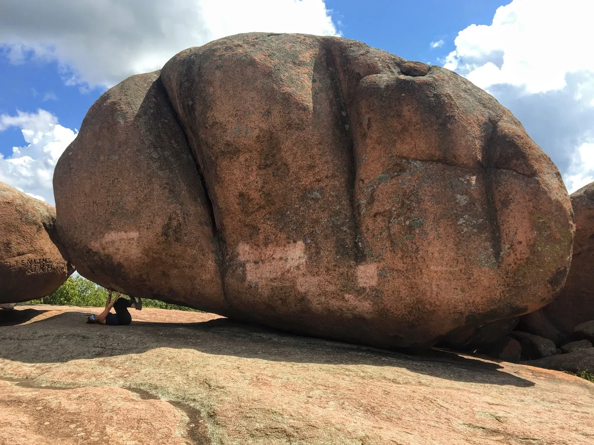
After connecting back to the Braille Trail, we slithered through the rocks and made our way to the giant boulders. Once I got the full view, I understood where the name of the park was derived. I could see the elephant like figure. Due to the crowd, it was tough to capture how breathtaking it was in person. Everyone was climbing between the boulder and snapping selfies. Children are fascinated by the size of the boulders as they enjoyed climbing. I found myself scaling the boulders and didn’t want to leave!


Trying to get a good picture amongst the crowd.
The elephant’s trunk rock.
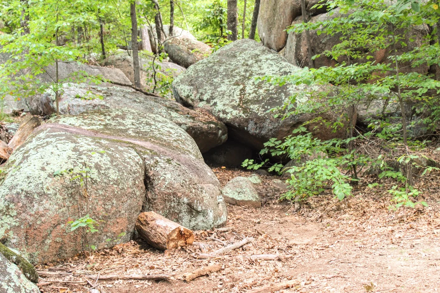
rocks.
more exploring.
We ended up spending about an hour and half enjoying the park. That is about all you need. Very easy, go at your own pace and enjoy type of hike. And, if you want, you can throw in some climbing. When I booked a trip to St. Louis, did I anticipate incredible landscapes and geological boulders in the heart of Missouri? Heck no. But I am sure glad I got to experience them. The fun part about traveling is finding gems like Elephant Rock State Park.
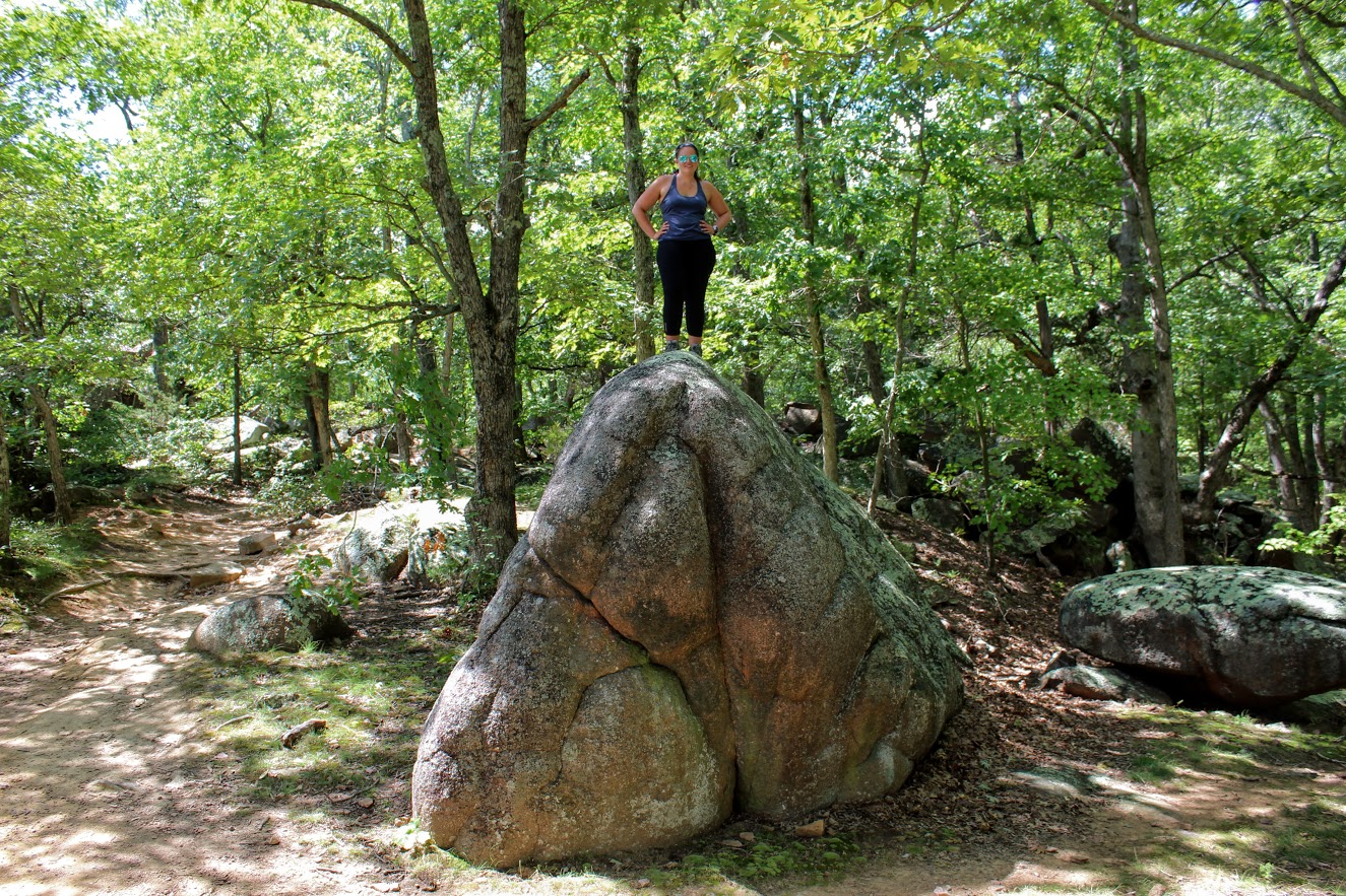
Wow so strong!
Well….hello there. Just doin’ some climbing.

HIKING FOR DONUTS
A blog for the outdoors foodie enthusiast
Hi, I’m Mark. I live in Connecticut. I take new trips every chance I get. A good trip has a great hike, great food, and something fun to do. My goal is to search out new trips and share them to inspire others to try something new and exciting.
If you are looking for posts in a particular place, search by city or state here.
EXPLORE OTHER POSTS IN THE ARCHIVE
RECOMMENDED POSTS
MOST RECENT POSTS
See where I have been recently on Instagram. Follow @HIKINGFORDONUTS