

What to eat at the Big E Fair, West Springfield, MA
It's almost fall time and it is fair season here in the Northeast. I haven't been to the Big E in over 5 years. I think it was time to make a trip and show off all the good food I ate!

It’s September. Almost fall time. Everything is pumpkin flavored. And, that means lots fairs and festivals. And, it just so happens the Big E is close to me. I initially wrote this guide a few years back but since the Big E is ever changing, I will update this every time I visit. There were be some oldies and but goodies. And, then some updates of new food I recommend from 2022.

Here are some of my past crowd pleasers I would recommend.
Waffle Chicken Bites at The Deep South Food Company.

Tots-a-Lot, inside gate 9A. They had various gourmet tater tots choices from loaded to buffalo to chicken pot pie. The group wanted to try the chicken pot pie tater tots. Feedback was a big thumbs up.

Perusing through the state houses, I heard the stuffed clams were pretty good from the Rhode Island house. I would definitely agree with that.

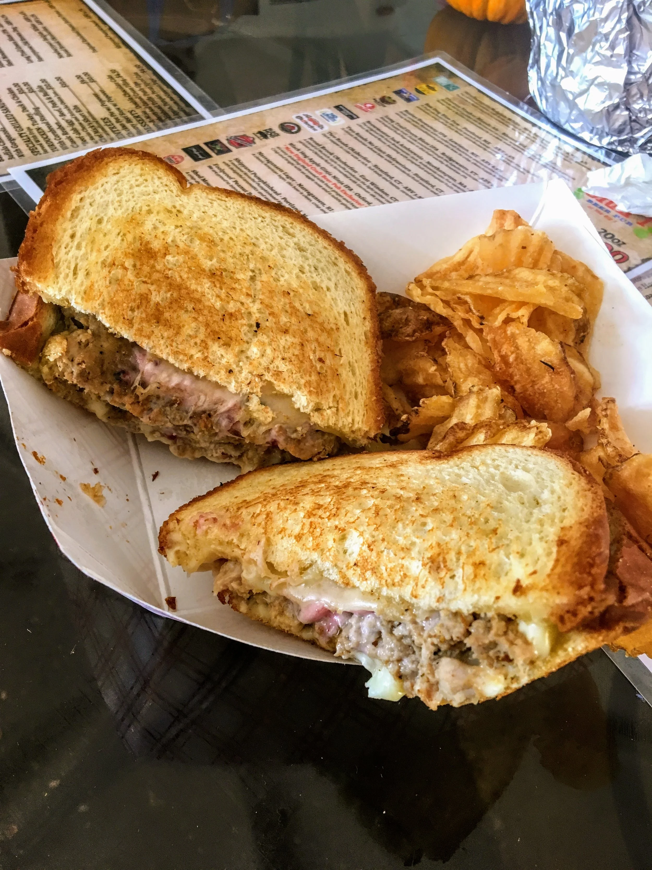
The Turducken Sandwich from New England Craft Beer Pub on the Avenue of the States. It was more a meatloaf sandwich consisting of ground turkey, chicken, and duck with cornbread stuffing and cranberry mayo. Overall, really tasty.
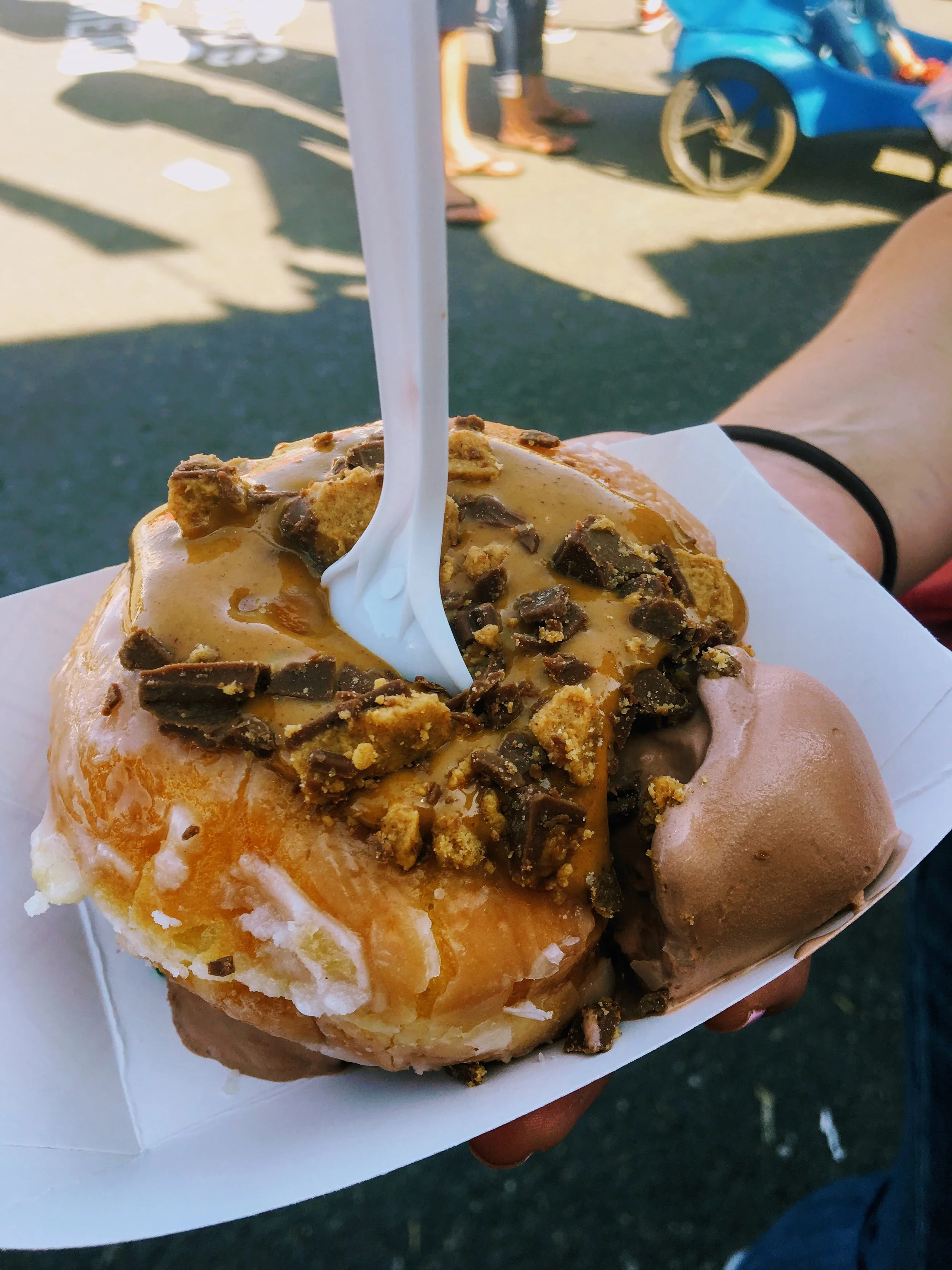
We stopped at Moo-Licious, which turned out to be the best decision. Located on Springfield Road. My wife wanted to try the Blueberry Pierogi Sundae. They also have a smash a pie option where they give you a big piece of pie with scoops of ice cream. They have a build your own ice cream doughnut sandwich called a Moo-Nut. And, that is exactly what I got. It was amazing! It was a perfect glazed donut with chocolate soft serve ice cream in the middle topped with peanut butter sauce and Reese's cups.

2022 Updates
Most Big E trips consist of stops at the Sam Adams Beer Garden for Octoberfest beer but this year they had an intriguing new food option. General Tso’s Pizza. I have to say I was impressed how close the flavors were and all the elements of the chicken, mozzarella, scallions, and sesame seed just worked. And, the general tso’s sauce was used as the actual sauce under the cheese.
Not new to me but my wife’s favorite she has to have each time is the Dilly Dog. A giant corn dog but the hot dog is shoved inside a pickle and then battered and fried. This is found on West Road/East Road in the back corner.
Next up, the Chompers Food Truck on New England Ave. I have to go each year and try their special. All of their offerings are great. This year’s special was Chicken Pot Pie with a side of chicken gravy.
My favorite item right now, it is so underrated. The BBQ sundae at Porky’s Palace on Commonwealth Ave. I have had the brisket and this year the pulled pork layered with coleslaw, baked beans, and cornbread. It is so, so good and such a great play on the ingredients.
As my wife said, people order mozzarella stick and don’t blink. So, ordering massive chunks of fried cheddar is the same thing. And, that is what we did for the first time at the Wisconsin Cheese truck on Springfield Road. As you can guess, delicious.
Lastly, I scoured the fair to find one of the newest offerings this year, the Arancini Rice Balls truck. This was off of Springfield Road by Midway. They had a few interesting flavors to choose from aside from the classic and I had to try the Big Mac arancini. It did indeed taste like a Big Mac trenched in the special sauce.

HIKING FOR DONUTS
A blog for the outdoors foodie enthusiast
Hi, I’m Mark. I live in Connecticut. I take new trips every chance I get. A good trip has a great hike, great food, and something fun to do. My goal is to search out new trips and share them to inspire others to try something new and exciting.
If you are looking for posts in a particular place, search by city or state here.
EXPLORE OTHER POSTS IN THE ARCHIVE
RECOMMENDED POSTS

MOST RECENT POSTS


See where I have been recently on Instagram. Follow @HIKINGFORDONUTS
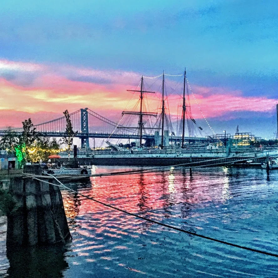
How to spend a weekend in Burlington, VT: Food & Breweries
Burlington, VT is a great long weekend destination. Lots of food and breweries in walking distance. Check out my blog post on the best food and drink spots in Burlington, VT.
My first trip to Burlington, VT was a few years ago. I couldn't believe I hadn't made a trip to this great city. There are lots of breweries, food, and outdoor activities. You could walk pretty much everywhere. In the summer, there are farmers markets and food trucks. I really enjoyed my stay but it was short. My girlfriend, Nichole, had never been and I thought it was a great weekend trip idea. Also, I have been wanting to stay at Hotel Vermont and they have a sweet black friday deal. And, it is a perfect location to walk around and Lake Champlain is across the street. Hotel Vermont was only a mile or two from everywhere we went, it was a great central location to stay. If you read the blog, you know we really get after it when we travel to new cities. And, Burlington was no different. We went to as many breweries as possible and ate our faces off. I did all the work for you! Here is a list of the best places to eat and drink in Burlington. If I missed any, please comment. I will be back.
The Food
Farmhouse Tap & Grill was the first meal we had in Burlington. This was the typical fancier local restaurant. It is always super busy. We had to wait over an hour for a table, given it was a Friday night. They have a great beer menu. The food is actually pretty good, especially the burgers. However, it is a bit pricey to me. There is a big farm to table presence in Burlington and that drives the price up.


The Swingin' Pinwheel Café Bakery was the surprise of the weekend. Do not pass up this breakfast when you walk by. The hostess was hilarious and friendly. The menu has so many good options. It is a smaller spot so be mindful. The decor definitely had that western and cowboy feel. They are known for their Wafflini, which is a waffle made with pastry dough and pressed like a panini, and they have multiple types. We had to get one and it was phenomenal. We started with a popover and ate it so fast, I didn't even get a picture!


Red Onion was recommended to me by someone from the area. They told me, the sandwiches sound weird but go with it. It was quite an interesting little spot on Church Street (main area for shops/restaurants). I ordered the Red Onion sandwich, which consisted of turkey, vt cheddar, red onion, granny smith apple slices, and sun-dried tomato mayo on honey oat bread. The bread was like an inch thick! Nichole got the spinach melt. This consisted of a TON of fresh baby spinach, mushrooms, red onions, sharp cheddar, and garlic mayo on honey oat. They were both delicious. If you need a quick bite, I definitely would suggest the Red Onion.

There is surprisingly a fair amount of Mexican dishes and restaurants in Burlington. For that reason we were craving Mexican and chose El Cortijo Taqueria Y Cantina as it was the closest with the best ratings. And, they were a sister company of the Farmhouse Tap & Grill. This is a very small location. Luckily, we got seated right away but the dinner crowd hit and the front of the restaurant was overly crowded and flowed near the tables. It was a bit uncomfortable eating with people on top of you waiting to be called. And, the food was just ok. Nichole enjoyed her margarita but the rest was less memorable.
And you know we hit up Ben & Jerry's for dessert.

Monarch and the Milkweed was another great breakfast find. This was a quaint, trendy shop in the town center that fits maybe 15-20 people. One of the reasons I chose there was because they make donuts, mini but I don't discriminate. The donuts were ehh but the breakfast was awesome. I had the fried chicken sandwich with gruyère cheese, red onions, and some aoli that reminded me of Big Mac sauce. Nichole had the pancake stack and they were really good and cooked perfectly.
Fortunately, on the way home, we made a surprising delicious stop, only 20 minutes outside of Burlington. We mentioned to some people we met along the way, we were going to Fiddlehead Brewing. Every person said you have to go to the pizza place next door, and that was Folino's Wood Fire Pizza. No one has to twist my arm to have some pizza. This place gets really packed from the Fiddlehead crowd. You will be seated by someone but you have to do everything else, get your own plates, order at the cashier, etc. Aside from that tidbit, the pizza was awesome. Maybe the best buffalo chicken pizza I have ever had. Everything just worked. Make this part of your to-do list.
The Breweries
On the way up from CT, our first beer stop was at Burlington Beer Company. This was only 20 minutes or so outside of Burlington. This was in a cool industrial location. The inside was cool and trendy. They had old school video game systems. They offer a lengthy list of beers, including IPAs, Porters, and Stouts. The beer was good. A little hoppier for my taste but I see why they are popular. They fit into the craft beer scene perfectly.
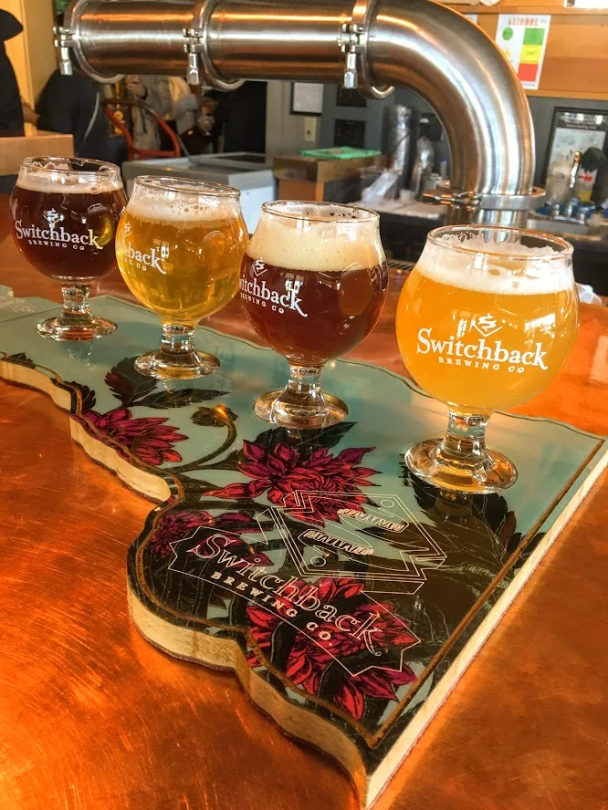
Switchback Brewery was first on the list of our brewery crawl and the furthest, 2 mile walk but it actually wasn't bad. I have been before and really like their beers. Their Connector IPA is my favorite. The inside is pretty nice and feels inviting. And, the world's largest filing cabinet is on the way! Seriously, it exists.


Queen City Brewery was our favorite brewery. I don't recall seeing it last time I was here. It was tucked away behind a local printing business. It is close to Zero Gravity. They had a big wall of beers and there was an old truck on the the very top of the bar once inside. They had 13 beers to choose from and I liked most of them. My favorite was a tripel Belgian named Monk of Underhill. This isn't a place if you want hoppy beers. They had mostly porters, stouts, and lagers. I am not even a porter guy and I enjoyed their version of that. The bartender was really nice and it was just a good atmosphere.


This isn't a brewery but a cidery counts. Citizen Cider is one of my favorite ciders. Last time I came here, I had a blast. They had quite a bit of options as usual to try out. I really like what they do with their ciders. They aren' t just sweet and one taste. Definitely a staple to visit when in Burlington.


Ah, the new popular guy. Foam Brewery wasn't opened last time I was here. Since then, I have heard a lot about this brewery from friends. We made our way there as the last stop and the location is great. It is right off the water. In warmer weather, it must be even more busy than it was. However, they do not have flights of beers as an option and the beer was pricier than other breweries. And, the beer was super hoppy...almost too much. Again, that is not for me. I preferred other breweries.
The weekend of breweries was not quite over yet. The last stop on the ride home was Fiddlehead Brewery. I had their beers before and really enjoyed them. I had to stop in and check it out. At this location in Shelburne, VT, you can only buy beer that is canned, sample what they have available that day and get growlers. It is very small and can get crowded quick. We went as it opened and the lot quickly filled up and cars were coming and going. I liked what they had on tap and I ended up getting a growler and buying cans. We did make a few other stops for beverages.
Vermont Pub & Brewery was pretty average. It is really big and they have basic food options to please the generic eater. Seems like the place all tourists go when other places are busy. And, the beer wasn't great. They are a bit behind the other breweries in the beer department. The other bar we did go to was Archives. This was a bar filled with arcade games and a pretty good beer, cocktails, and wine menu. If you are into old video games like pacman, street fighter, pin ball, and other oldies, this is the spot for you.
Bonus: A Winery?
Not only did Fiddlehead Brewery have an awesome pizza spot next door but there was also a Winery across the street! By far, the happiest Nichole was all weekend as she likes wine way more than beer. Of course, we kept the ball rollin' at Shelburne Winery and did a tasting. This consisted of 10 wines and they were not shy with the pours. I also liked they gave a list of the wine with a marker so you could keep track of what you liked and they had a funny comment & description about each wine. I do not like wine that much but I did like a few of the white wines and a red that had chocolate in it. Nichole ended up buying two bottles. This was a great way to the end the trip. Beer, wine, & pizza. We accomplished a lot and I think we did a good job finding some good go to spots. I hope you enjoyed reading and will try out some of my suggestions. Cheers to beers & delicious food!


HIKING FOR DONUTS
A blog for the outdoors foodie enthusiast
Hi, I’m Mark. I live in Connecticut. I take new trips every chance I get. A good trip has a great hike, great food, and something fun to do. My goal is to search out new trips and share them to inspire others to try something new and exciting.
If you are looking for posts in a particular place, search by city or state here.
EXPLORE OTHER POSTS IN THE ARCHIVE
RECOMMENDED POSTS
MOST RECENT POSTS
See where I have been recently on Instagram. Follow @HIKINGFORDONUTS


Grand Prismatic Springs & Geysers, Yellowstone National Park
Yellowstone National Park is one of the most popular national parks in the U.S. There is so much to explore. This post will focus on some of the sights such as Old Faithful and Grand Prismatic Springs. A must visit.

In the summer of 2013, my best friends from college, Nancy and Corey, and myself decided to take our adventures out West and visit Yellowstone National Park. This was one of 3 national park we visited on this particular trip. We gave ourselves 3 days to explore Yellowstone. Once we arrived, we knew were going to see lots of wildlife. Buffaloes are everywhere! But don’t be that person who stops every 5 minutes to take a picture. You will have many chances, don’t start traffic. Before we got more familiar with the park and tested our luck with the animals, we got the more touristy stops out of the way. Old Faithful, Grand Prismatic Springs, and the Geyser basins are pretty cool and must visits. Mammoth Hot Springs was another great spot if you want to see more hot springs.

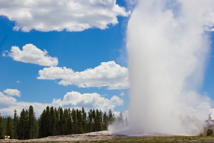
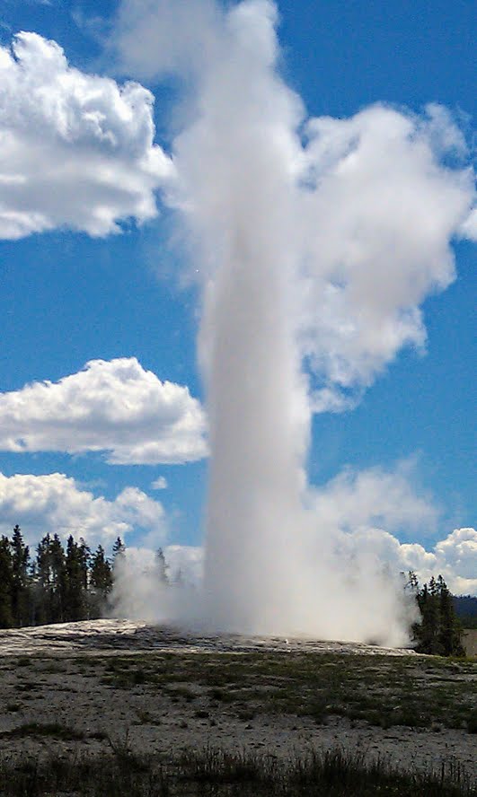
Old Faithful
If you want to see geysers, go to the Old Faithful Visitor Center. You can tour the Geyser basins and watch Old Faithful geyser erupt. Once you get there is a schedule when Old Faithful will erupt, which is between every 60-90 minutes. It’s one of those things you have to see but it was mostly anti climatic. This was by far the most crowded area of the park.
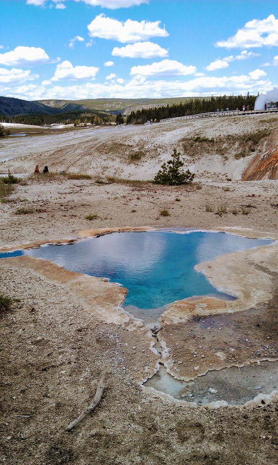
Grand Prismatic Spring
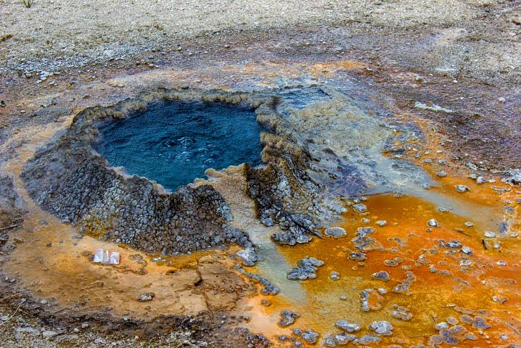
Geysers and hot springs can get old quick, but Grand Prismatic Springs is absolutely beautiful. This is the largest hot spring in the U.S located at Midway Geyser Basin. The colors are fascinating. It is one of those visuals you see online or on TV and once you get there, it actually lives up to your expectations and more.


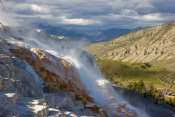
Mammoth Hot Springs
As if we couldn’t see anymore hot springs, the last stop was Mammoth Hot Springs. These hot springs were different than all the rest. You walk up a few flights of stairs that bring you to boardwalks above the steaming hydrothermal springs. The views were very different as the hot springs were located on a hill of a travertine.


HIKING FOR DONUTS
A blog for the outdoors foodie enthusiast
Hi, I’m Mark. I live in Connecticut. I take new trips every chance I get. A good trip has a great hike, great food, and something fun to do. My goal is to search out new trips and share them to inspire others to try something new and exciting.
If you are looking for posts in a particular place, search by city or state here.
EXPLORE OTHER POSTS IN THE ARCHIVE
RECOMMENDED POSTS


MOST RECENT POSTS
See where I have been recently on Instagram. Follow @HIKINGFORDONUTS
Day Trip to New York City
NYC has so much to do. And, sooo much more to eat. Here is what a day in NYC looks like for me. I was able to get around quite a bit and stuff my face the entire way! Do you agree with my foodie picks?
I haven’t visited New York City much in my life until recently. New York City can be so crowded and overwhelming. However, there are so many great places to visit, see, and eat. I went this past May and I became more intrigued to go back. Nichole and myself wanted to go during the holiday season but time did not permit until after Christmas. We hoped it would be less crowded and would still be able to enjoy the holiday décor. Even with the temperatures in the teens, we made our way to the train station and hopped on to Grand Central. We had a lot of sights in mind, but let’s be honest this trip was more for the food.
Once we got off the train, we went to Rockerfeller Center first and went to look at the Christmas tree. Most people go to the city just for that purpose. I took one obligatory picture and I was set. I was more into all the buildings and other décor around that area. Since we were close by, we walked over to Times Square to get some more sightseeing in and checked out the Hershey's store. It’s cool to see the massive candy bars but that place is way overpriced.
From there, we went to the Bryant Park Winter Village which includes 176 vendors, an ice skating rink and merry-go-round. Many popular restaurants and food trucks set up shop for the holiday season, bring lots of deliciousness to one spot! The scenery is surreal with the feel of a small village in the middle of one of the busiest cities in the world. This was my type of spot to say the least,


First up, Wafels & Dinges. Their specialty was Belgian waffles with various toppings and flavors to choose from. So many decisions but we went with the S’mores waffle which consisted of marshmallows, speculoos spread and Belgian chocolate fudge. This was a splendid first treat/breakfast.
Once we got breakfast in our bellies, we walked around Bryant Park a bit more and Nichole found our next must have...mini donuts! I can’t pass up on some mini donuts. Doughtnuttery was on my donut list for NYC. They have pretty intriguing flavors. Each donut was tossed in sugary goodness. While the flavors didn’t really taste like what they said, they were still pretty good. The flavors we got consisted of vanilla, lavender, & pistachio and rosemary, roasted cornmeal, & fig.


The Flatiron District was our main destination for the afternoon. After ubering around, I was ready for more donuts. Number one on my donut research was Dough. Fortunately, they did have a location in the Flatiron District. Needless to say, Dough was phenomenal. Some of the best donuts I have had. Definitely blog worthy. If you want see more, check out my previous blog post, here.
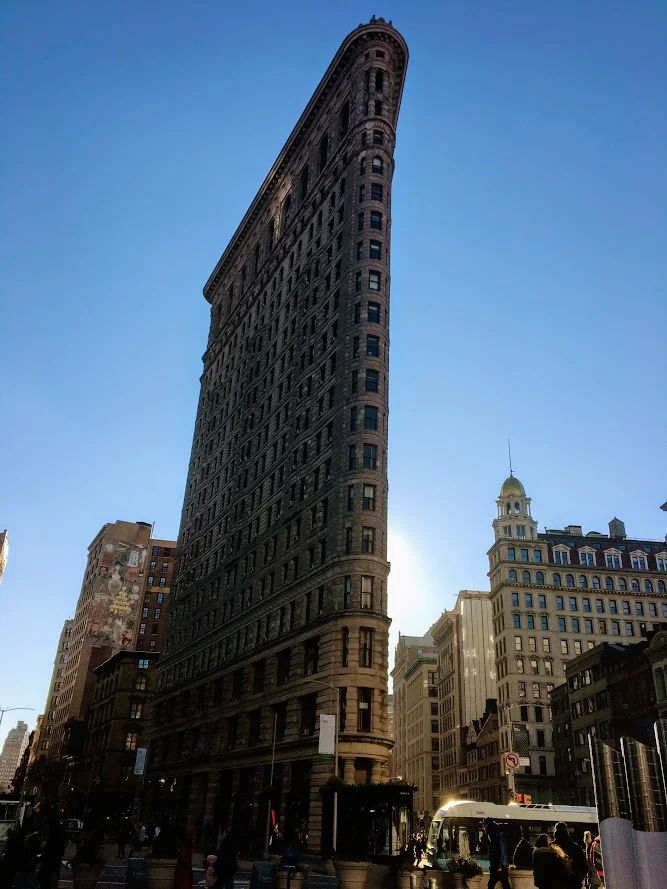
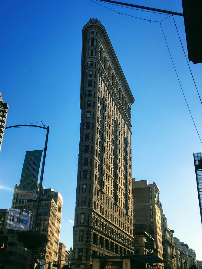
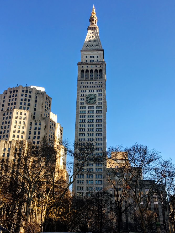
The buildings and skyscrapers in NYC are breathtaking. The Flatiron Building is a triangular 22 story steel-framed building in Manhattan. My hands were frozen, my phone kept shutting off, I couldn’t stop taking pictures. You don’t see buildings like that every day. If you get a chance, go see it!
A late lunch was in store as the donuts wore off. Eataly was our food destination of choice. This large marketplace consisted of a variety of restaurants, bakeries, retail shops to buy fresh pasta & cheese, Nutella cafe, and even a cooking school. Everything Italian. You name it, they had it. You could get yourself a fresh cannoli, a lean cut of meat, or a drink at the bar.


Prior to the trip, we noticed there was a pop up restaurant on the 14th floor of Eataly, called Baita. This was an Italian Alps themed restaurant. I was sold on that. Once we were seated, I noticed the retractable roof and the intricate heaters throughout to keep that cozy vibe. There was a view of the city skyline depending where you sat. A lot of the décor resembled what you would find in a ski lodge. I liked the idea behind it. However, the menu wasn’t the best. And, the food was really pricey. I saw the portion sizes people were eating and they were pretty small. Ordering just appetizers was our best bet. Polenta was a popular item on the menu so we tried their “Zucca” which consisted of polenta, squash, thyme & parmesan reggiano. The other intriguing items we ordered were wagyu beef skewers seasoned in olive oil and the beer battered fried piave cheese. The beef skewers were awesome. The Polenta was just okay and the fried cheese was pretty greasy so I stopped eating them not to get sick. In hindsight, we should have just had a drink at the bar. The atmosphere wasn’t worth the disappointing meal. We were still hungry!


The great part about NYC is that food is literally everywhere. The bad meal didn’t hold us down. I had to find a can’t miss bite. Who doesn’t like grilled cheese!?!?! There was a Melt Shop nearby and this hit the spot. Me and Nichole shared a pepper jack buffalo chicken grilled cheese and a wonderful milkshake. We couldn’t decide what flavor so the server just combined both for us, Nutella and Oreo. Absolute heaven.


For the cherry on top, you can’t leave New York City without a slice of pizza. Before we hopped back on the train at Grand Central, we stopped at Previti’s Pizza. The reviews were not lying. Great slice of pizza. That was a nice way to end our adventurous and gluttonous day in the city. And, our last trip of 2017. I can’t wait for more adventures and exploration in 2018.

HIKING FOR DONUTS
A blog for the outdoors foodie enthusiast
Hi, I’m Mark. I live in Connecticut. I take new trips every chance I get. A good trip has a great hike, great food, and something fun to do. My goal is to search out new trips and share them to inspire others to try something new and exciting.
If you are looking for posts in a particular place, search by city or state here.
EXPLORE OTHER POSTS IN THE ARCHIVE
RECOMMENDED POSTS
MOST RECENT POSTS
See where I have been recently on Instagram. Follow @HIKINGFORDONUTS
Best places to eat in Nashville, TN
Nashville is a really fun and vibrant city. Full of music and history. Aside from that, I was excited to try some Nashville food. I tried to find really good local spots. Enjoy my reviews!
Aside from the bar hopping downtown and exploring a new state, I looked forward to eating in Nashville. It was an interesting trip food wise.. I have never been to a heavy, southern food area. I am not the best with spicy food but I was open to trying what Nashville had to offer. It was Labor Day weekend so it was packed everywhere. Also, we had a group of 8 so waiting in lines less than 30 minutes just wasn’t happening.
Like everyone else in Nashville, we wanted to try Biscuit Love. This was by far the most popular brunch spot in the area. Unfortunately, the line was insane.

However, when one door closes, another opens. Browsing to see what brunch places were nearby and calling to see who would accommodate 8 of us, we came across Party Fowl. Yes, you read that correctly. And, it was a great find. The group was really about the boozy brunch and this spot was it. They had various drink specials including spicy Bloody Mary’s. I am not a fan but everyone else was on board with it. As for the food, this was the best place to have Nashville hot chicken and biscuits. The biscuits were so good and they served them as appetizers with this awesome apple butter. Everyone at the table ordered the “Loaded Chicken Biscuit”, which consisted of an open-faced buttermilk biscuit topped with hot chicken (southern fried, mild, medium, Nashville Hot, or Poultrygeist), sawmill gravy, two eggs prepared your way, and lyonnaise potatoes. I didn’t mess around and I went southern fried. And, that was spicy to me. Nichole had to be the only one get something different but it was damn good! She got the smoked chicken frittata. This consisted pulled smoked chicken & caramelized onion frittata topped with melted gruyere cheese.


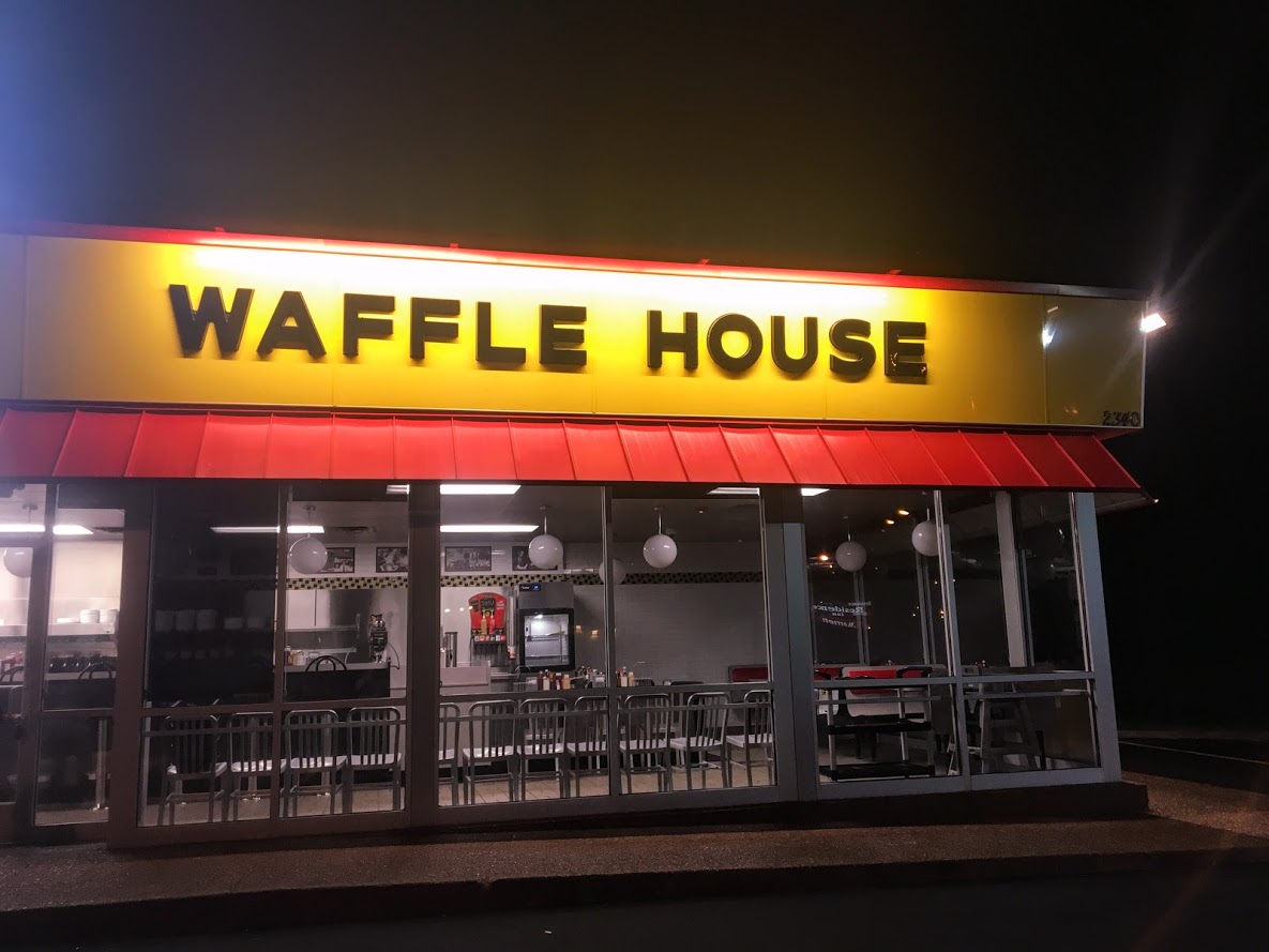
The trip wouldn’t have been complete without a Waffle House late night feeding. We don’t have them in the Northeast and I have never been to one. It took us two different locations to find one open (not 24 hours...lies). The meal was as expected. It wasn’t bad but it was sketchy….and the roach I noticed crawling around on the floor tied my experience with a bow. Check that off the list.

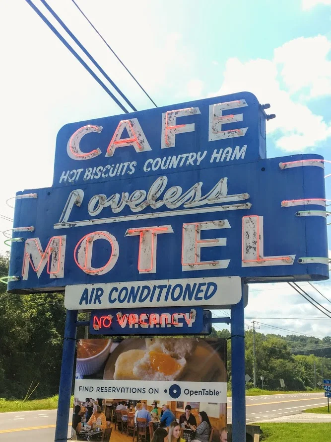
The Loveless Cafe is a pretty popular location. It is about 30 minutes outside of downtown Nashville on Highway 100. This was a motel converted into shops, markets, and a restaurant. It is like it’s own little mini mall. It is definitely cool. However, it is really crowded. The wait was almost 2 hours! Luckily, Nichole found out we can just get take out and eat on the benches and picnic tables. The food was so good. We got a little of everything. We got the pulled pork, fried green tomato with pimento cheese, and fried chicken biscuit sliders along with a side of mac & cheese and hashbrown casserole. And, a slice of coconut pie. The fried green tomato and pimento cheese combo was by the far the best. The biscuits were on point too. This was worth the price of the rental car.


The other noteworthy place we ate was in the Indigo Hotel called The District Bar & Kitchen. The menu looked good and we were spot on with our choice. For starters, we had a buffalo chicken egg roll and fried green tomatoes with pimento cheese and five pepper jelly. This combo blew my mind the whole trip. Would've never expected fried green tomatoes plus pimento cheese to be absolute heaven...lesson learned. For the entree, I had the Indigo wrap which consisted of pulled pork, country ham, swiss cheese, dijon, bread & butter pickles. Nichole got a good eye. She went with a dish called the Four Way. This was a bed of rigatoni with cheddar cheese covered with tortilla chips and chili. Another good find in downtown Nashville.


Lastly, I can't forget about the ice cream. On the last night, we went to Mike's Ice Cream in the downtown area. They had many ice cream options and a variety of cone options. I got a scoop of red velvet and a scoop of butter pecan in a chocolate chip cookie cone. Oh yea...pure gluttonous.

We got to eat in popular locations and some unknown locations. All in all, another successful trip of eating. There is a lot more food in Nashville to try. Until next time!

HIKING FOR DONUTS
A blog for the outdoors foodie enthusiast
Hi, I’m Mark. I live in Connecticut. I take new trips every chance I get. A good trip has a great hike, great food, and something fun to do. My goal is to search out new trips and share them to inspire others to try something new and exciting.
If you are looking for posts in a particular place, search by city or state here.
EXPLORE OTHER POSTS IN THE ARCHIVE
RECOMMENDED POSTS
MOST RECENT POSTS
See where I have been recently on Instagram. Follow @HIKINGFORDONUTS
Honky Tonk Hiking in Nashville, TN!
Spent the long labor day weekend hiking in Nashville, TN! Aside from bars, music & food, I was able to enjoy some great outdoor activities. Got a hike in and explored a lake. Nashville hikes.

It has been a busy month….and a very busy summer. The last trip on my agenda for the summer was Nashville, TN. I have never been there before and I hear lots of great things. My girlfriend, Nichole, has been there 4 times now. She was tasked with showing me the ropes. Aside from the food and the bars, we made time for some outdoors activities and adventuring. I did some research found some cool parks nearby such as The Warner Parks. We decided to rent a car for the day and made our trek ready to sweat off the beers, biscuits, and hot chicken.
We stayed in downtown Nashville and made the 20 minute drive to Edwin Warner Park first. Here is where we started with a nice refreshing hike. The weather held up for us and was perfect. The park was easy to get to and there is ample parking. There is a nature center for water and bathrooms also.

We decided to take the Harpeth Woods Trail, which was roughly a 2.5 mile loop. There are three trailheads in Edwin Warner Park which access the trail: Owl Hollow, Natchez Trace Trailhead, or the Nature Center Trailhead. We walked further down from the Nature Center and started at the Natchez Trace Trailhead. The Harpeth Woods Trail is the blue trail. The trail is very well marked, all we needed to do is follow the blue arrows. Please note, this is a very popular park. We were there on Labor Day but there isn’t a lot of options in the metro Nashville area.


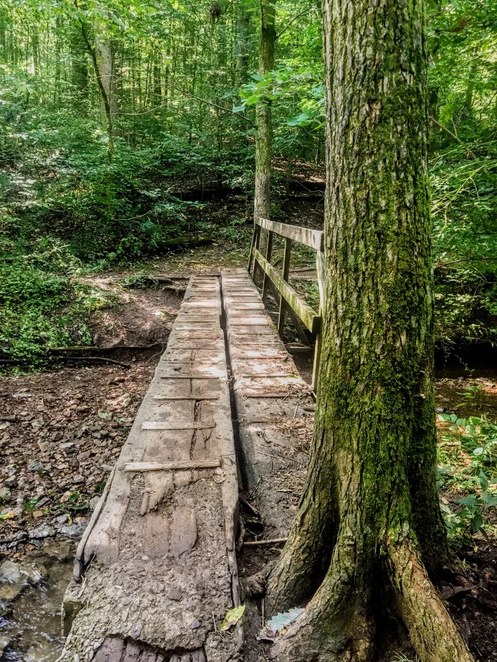
This particular hike was a typical woodsy trail. No scenic views but a good hike. There were some cool rocks formations and bridges to cross. There was a small part of the hike that was a nice incline but that was maybe 1/10 of a mile. In my opinion, this was an easy hike based on my abilities. I wore Nike training shoes and have a bum ankle still. However, I can see this being moderate for others. I did my best to take unique pics.


After the hike, we decided to venture to Percy Warner Park as well since it was only a mile away. At this location, there is a cool landmark known as the Percy Warner Park Stairs. This gives you a nice burn going up and a view from the top from where the trail heads start.


The last stop was Radnor Lake. This location was only 20 minutes from the Warner Parks. Since we had the rental car, we figured we would try to get in as much as possible. This area was very, very busy and parking was an issue. There are two parking entrances. One lot was completely full. However, it is was a really nice ride to both entrances. We got to see pretty nice houses and scenic views. Nichole even questioned some houses, "I wonder if someone famous lives here." Once we got a parking space, we just quickly perused the lake and went on the bridge to see some views. It’s cool for the area and I understand the traffic. This sums up our labor day in Nashville. I didn’t anticipate getting this much outdoors in so close to the city.


HIKING FOR DONUTS
A blog for the outdoors foodie enthusiast
Hi, I’m Mark. I live in Connecticut. I take new trips every chance I get. A good trip has a great hike, great food, and something fun to do. My goal is to search out new trips and share them to inspire others to try something new and exciting.
If you are looking for posts in a particular place, search by city or state here.
EXPLORE OTHER POSTS IN THE ARCHIVE
RECOMMENDED POSTS
MOST RECENT POSTS
See where I have been recently on Instagram. Follow @HIKINGFORDONUTS
Best places to eat in Philadelphia, PA
Philly has some unbelievable food options.Here's my guide to eating awesome food in Philly....
Philadelphia is loaded with food options. From brunch to bagels to cheesesteaks galore to ice cream to donuts to burgers to pretzels, the choices are endless. I would need a good month to get it all in. Unfortunately, I had only had the weekend to get in as much as possible. After a significant amount of research, I succeeded. Here are some options to guide you on how to eat a weekend in Philly.
Breakfast & Brunch
Bagels were a priority on this trip. My girlfriend is from New York and, therefore, she is a bagel snob. Philly has about over 20 bagel shops to choose from. Most of them have unique types of bagel flavors, unconventional cream cheese spreads, and delicious sandwich options. We chose Chestnut Street Bagels on the way to Rittenhouse Square. The options for type of bagel and spreads were extensive. In addition, there are a good amount of intriguing options for sandwiches. The only downside would be that you have to order and leave. The shop is small and they have an inside bench that can seat at most 4 people. Luckily, we got there before it got too busy and were able to snag a spot. I selected the french toast bagel with a honey pecan cream cheese and my girlfriend went with the everything bagel and cheddar horseradish spread. The bagels were fresh and hit the spot!


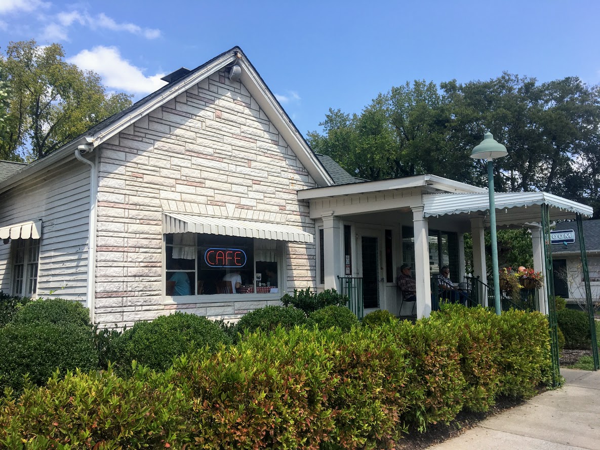
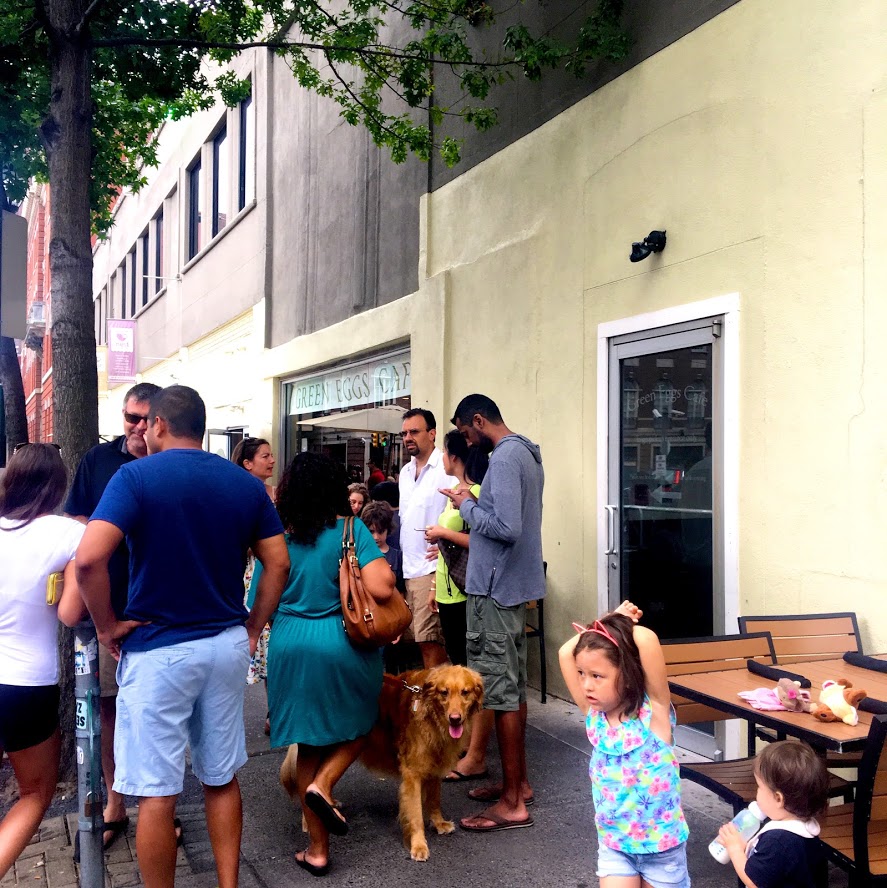
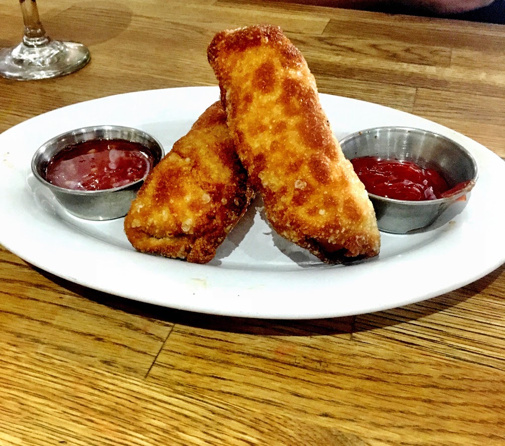
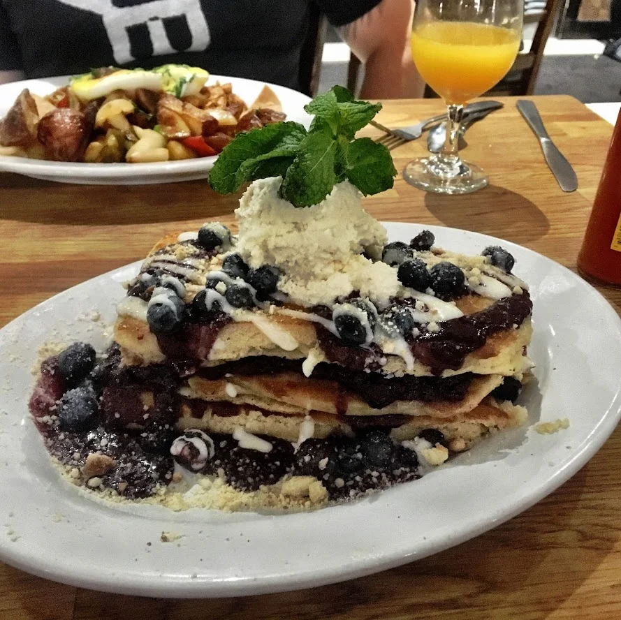
I need to breathe a second before I write about the Brunch we had….. I’m ready. I came here the last time I was in Philly and I felt the same way. If there is one place in Philly you have to go, it is Green Eggs Cafe. Everything on the menu sounds dynamite. And, the specials each time sound even better. Both my meals here, I have to put in my top 5 all time breakfasts. We started with some boozy drinks, my girlfriend had a peach bellini and mine was an orange 'creamsicle' mimosa. The specials included breakfast egg rolls stuffed with bacon, sausage, scrambled eggs, and cheddar cheese served with a chili thai sauce. No brainer selection. I had the “Mexican Benedict” that consisted of 2 poached eggs & chipotle braised chicken with tortilla chips served on a cheese quesadilla with chipotle hollandaise sauce. My girlfriend went on the sweeter side, there was a special for a stack of blueberry pie pancakes. Note, there is always a line but it goes fast. Later you go in the morning, the longer the wait. And, they are cash only.

Lunch & Dinner
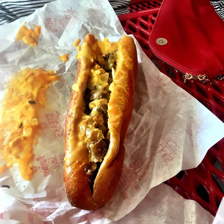
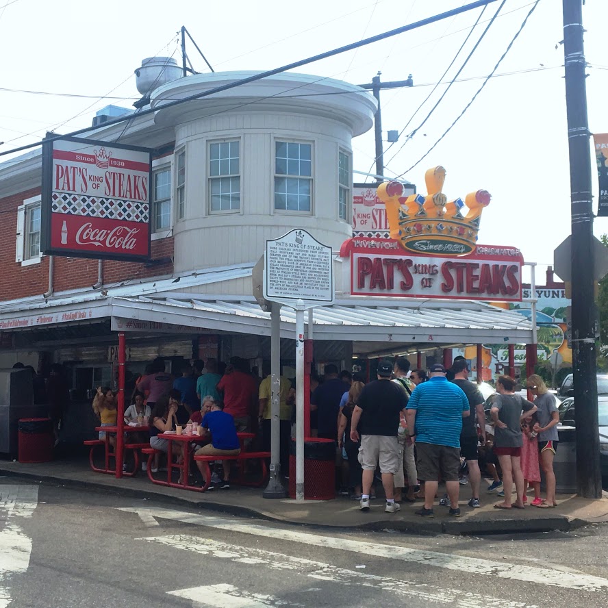
Decisions...decisions...decisions. Two of the most popular cheesesteak shops sit directly across from each other. A 15 minute uber ride from downtown will take you to the location of Pat’s King of Steaks and Geno’s Steaks. Both shops have lines in the streets at all times. They are both open 24 hours. We went with Pat’s. Boy, do they have this down to a science. There is no waiting once you are at the ordering windows. Customers quickly put in their order, pay, and cheesesteaks in hand. I went with provolone on mine and my girlfriend got the cheese whiz. Cheese whiz won. They both were good cheesesteaks. Also, they had pizza fries which were french fries with a red sauce and cheese on them. As simple as it may sound, they were amazing.


As in most of my travels, I try to venture to local food spots as seen on Diners,Drive-Ins, & Dives. Guy Fieri knows exactly where Flavortown is! On this trip, there were many on this list and we went with the Good Dog Bar. This cool little spot was very welcoming. To my surprise, there were pictures of dogs all along the walls of the bar. We were very hungry and started with the cheesesteak empanada and fried pickles. THe fried pickles were average but the goat cheese ranch sauce was phenomenal. I could use jars of that weekly. I even saved what we had left for fries later on. The cheesesteak empanadas were really good. However, the sauce that came with that was a watery, gravy taste. We used the ranch dip instead. For the main course, I ordered the brisket grilled cheese on sourdough bread with cheddar cheese. My girlfriend had the shrimp po’ boy tossed in buffalo sauce with blue cheese sauce on a baguette. Both were good and the cool thing I liked here is that they mix their fries between regular and sweet potato. They had good beer & drink options. The service was also fantastic here.


Reading Terminal Market
If you want to spend a whole day eating somewhere, the Reading Terminal Market is the place to be. There is a plethora of food options for breakfast, lunch, dinner and dessert. Many different ethnic cuisines are represented at this market. Be sure to check the hours as most days it is closed by 5-6pm. And, if you have your heart set on something by Dutch related vendors, they tend to close earlier and they take Sundays off. I made that mistake on Sunday. No donuts or pretzels for us. However, we still got our fair share in.
The first stop was at Franks A Lot. The go to here was their classic Polish pierogies.

Beck’s Cajun Cafe was next. There were a lot of tasty items on the menu. We ordered the fried mac and cheese balls. They weren’t too greasy and not overly cheesy, which was a good thing. I could of ate 20.

The last meal we could fit in was at Sang Kee Peking Duck. I ordered the Duck Lo Mein. The duck was a little fatty as expected, but flavorful and tender. The noodles tasted very fresh.

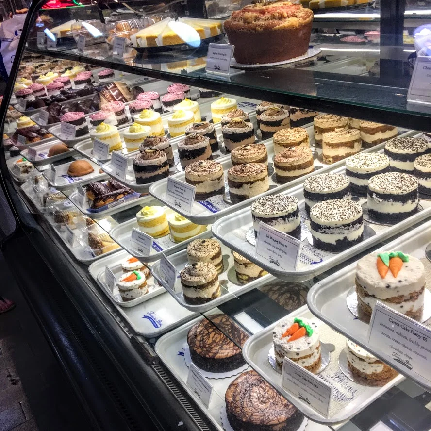
At this point, it was time for some desserts. I had my eyes on some cookies. The Famous 4th Street Cookie Company had plenty of options. I couldn’t pass up a black and white cookie. The last stop was Bassetts Ice Cream. A good trip always ends with some ice cream.


IMG_4562
The Reviews:
Green Eggs Cafe: 5 out of 5
Chestnut Street Bagels: 3.5 out of 5
Good Dog Bar: 3.5 out of 5
Pat's King of Steaks: 3.5 out of 5

HIKING FOR DONUTS
A blog for the foodie outdoor enthusiast
Hi, I’m Mark. I live In Connecticut. I take new trips every chance I get. A good trip has a great hike, great food, and something fun to do. My goal is to search out new trips and share them to inspire others to try something new and exciting.
If you are looking for posts in a particular place, search by city or state here.
EXPLORE OTHER POSTS IN THE ARCHIVE
RECOMMENDED POSTS
RECENT POSTS
See where I’ve been recently on Instagram. Follow @HIKINGFORDONUTS.
Weekend in Philadelphia: Top Activities and Must-Visit Spots
The summer is a great time to visit Philadelphia. Check out my travels for the best places to go in Philadelphia. Hiking For Donuts style - places to eat, visit, drink, and donuts of course.

Philadelphia is quickly becoming a favorite destination of mine. I made the trip for the first time 2 winters ago and was itching to go back. My girlfriend has never been and once I saw an available weekend and some hotel deals, it was time to go back. I feel like there is so much to do and eat of course. The food alone deserves it’s own post. And, I shall provide that. With this trip, I really wanted to enjoy what Philly has to offer for the summer. And, boy did we really pack our schedule. The research really paid off.We got to downtown Philly late Friday afternoon, checked in, showered, and began the fun filled weekend. Our main attraction for the night was Spruce Street Harbor Park. I can’t even take credit for this one. My girlfriend got skills finding awesome spots I wouldn't even come across. SSHP includes a beachfront meets carnival ambiance along a boardwalk off the Delaware River. Entering the park at night you will see about 100 hammocks hanging from the trees under a thousand colorful LED lights. Not only does it provide beautiful views but there lots of popular food trucks, beer garden, outside games like boccie ball, arcade games, rides, and even a roller skating rink. There was a giant connect four game for the kids. I was pretty jealous. This is definitely a very popular spot. The uber ride was only 10-15 minutes from downtown. I would say this was our favorite part of the trip. The park is only open from May through end of September. If you are in Philly during that time, I highly recommend.

Spruce Street Harbor Park views at night.


The next day we really hit the ground running. We decided to walk to Rittenhouse Square in the morning. One of the original space parks by William Penn is a one-square-park. If you are looking for an outdoor farmers market, this would be the place for fresh flowers, produce, and Philly specialties. After this, we decided to walk through Independence Historic National Park to see the Liberty Bell and Independence Hall. If you are a history buff, this area is for you. Also, the Liberty Bell is quite the attraction so there are long lines in tourist seasons. In the fall/winter may be best if you don’t want to wait. You can actually see it from the outside instead of going inside. We walked through a couple historic buildings and walked to the oldest bank in the US.


Side note, the weather was scorching on this weekend. All the walking got us a little parched. Bringing us to our next stop, 2nd Story Brewing Company. This was the second time I have been here. They have a large variety of beers. One that stands out is their “Better Hef”. This is a Bavarian Hefeweizen with a banana aroma with a subtle bubblegum flavor and hint of clove. You can taste the soft note of banana. Also, they had a specialty beer on this day called “Stoop Session” referencing Stoop Boy from “Hey Arnold!” tv show. The brewery is very rustic and has a cool atmosphere. I haven’t had the food but it looks promising.


Another cool little historic spot in Philly is Elfreth’s Alley, the oldest residential street in the nation. Since we were close to the Old City neighborhood, we took a walk over. There was a museum located in two of the houses and residents still live here to this day. And, to my surprise, one of the resident’s was selling baked goods right out of her living room!


I had purchased Phillies tickets prior to the trip and the weather forecast called for thunderstorms this night. However, the weather was holding up and our next stop was cheesesteaks! The next venture was all about cheesesteaks. Waiting for the uber, my girlfriend got her research on and found a garage turned bar directly across the street from Pat’s and Geno’s. There were lots of good reviews on yelp and looked like they had a very large selection of beers. Once we got there, I was pumped about the decision. This was an awesome spot. They had arts and crafts being sold when you walked in. There were skeetball games in the back. You could bring in your own food and there are 3 big coolers of specialty craft beers. They also had some beers on tap. They give you a thick binder book to choose from and they break down by brewery name and the type of beer. They did a good job of keeping up with their inventory of beers. If they were out or had new shipments of beer, they had a paper copy for that. The bartender was really nice and helpful. It took me about 15 minutes to go through the book. Another good discovery I didn’t see in my research. After some beers, it was cheesesteak time. We chose Pat’s and it was delicious.

Amid thunderstorm warnings, the weather was holding up and we arrived at Citizens Bank Park. This was directly across from Lincoln Financial field, where the Philadelphia Eagles play. In between the stadiums, there is the “Xfinity Live!” complex that had multiple bars and dining options including beer hall and an outside area for live music. Essentially, you can tailgate inside if it’s too hot or too cold. Given it was about 95 degrees, we gladly went inside and enjoyed a beer at the Victory Beer Hall. Prior to the game starting, it was meet the team night. Everyone got to walk onto the field and take pictures with all the players. I am a huge baseball fan but I haven’t really kept up with most teams recently so I couldn’t tell you who most players were. Once they made everyone clear the field, they put the tarps down and not even 20 minutes later, there was a massive down pour. I thought our night was over but the rain stopped suddenly and the game went on as planned. We watched most of the game and walked around the stadium looking for food options. There are a lot of food options for sure. I had ice cream in a helmet and the Chickie’s & Pete’s crab fries. I wasn’t impressed, really salty.


On the last day of the trip, it was all about the Reading Terminal Market. It was right behind the hotel we stayed at downtown. If you don’t know already, this place is amazing. This is an indoor farmers market offering fresh produce, groceries, ice cream, baked goods, candy, crafts, books, and other specialty food options. If you are hungry, this is the place to be. The market hours are generally open 8am through 6pm. Sundays hours are different and any dutch vendors will be closed. Don’t make the same amateur mistake I did. However, it was nice to be able to walk with freedom. The last visit I came on a Saturday and it was very packed. It was hard to walk around or finding seating to eat. All in all, another successful trip in Philadelphia. The summer is a fun time to visit. For the foodies, you will have to wait another post. I will not disappoint!


HIKING FOR DONUTS
A blog for the outdoors foodie enthusiast
Hi, I’m Mark. I live In Connecticut. I take new trips every chance I get. A good trip has a great hike, great food, and something fun to do. My goal is to search out new trips and share them to inspire others to try something new and exciting.
If you are looking for posts in a particular place, search by city and state here.
EXPLORE OTHER POSTS IN THE ARCHIVE
RECOMMENDED POSTS
RECENT POSTS
SEE WHERE I’VE BEEN RECENTLY ON INSTAGRAM. FOLLOW @HIKINGFORDONUTS
First Trip to the Adirondacks: Hiking in Upstate New York
My first trip hiking in the Adirondacks in Upstate New York. Adirondacks Travel Guide. I was able to wake up to Paradox Lake each day, hike Mount Severance, and check out Paradox Brewery. Moderate hike, amazing views along the way!
Trail Description: Planning your first trip to the Adirondacks? Discover beginner-friendly hikes, breathtaking views, and tips for exploring New York's stunning wilderness.
Trail Info:
Where: Schroon Lake, NY Click here for directions. Distance: 2.4 miles Difficulty: Moderate Trail Type: Out and Back Trail Features: Picturesque views of Schroon Lake and Pharaoah Lake Wilderness
How to get there:
The parking lot for the hike was easy to find. It is right off State Route 9. However, my gps got confused and made us go out of the way. Once parked, the trailhead is right in front of you through the tunnels under the I-87.
Hiking Tips:
Put your name in the Sign In chart once you arrive.
This hike could easily been done in normal gym shoes.
Adirondacks Weekend Travel Guide Recommendation: Mount Severance Hike and Paradox Brewery
The warm weather is finally here to stay in the northeast. Summer of 2017 looks pretty darn good. I have been planning as many trips as my wallet can handle. My weekends are booked up through almost October. There will be many adventures and lots of food. The first real travel this summer was thanks to friends of mine. They have a friend who owns a house on Paradox Lake. It was a good opportunity to check out some hiking in upstate New York. It was my first trip to the Adirondacks. The house was legit right on the lake. We had our own little beach area and dock. The house was pretty remote so there was no internet connection. It is good sometimes to go without the need of checking your phone on social media and enjoy where you are and who you are with. However, the second I had internet it was game on! It was absolutely, awesome views to see the sun rise and see the sun set. I tried to get good pictures, but I always get distracted by food. I couldn’t help it. My friend’s family always goes all out. It was a weekend of relaxing, filet mignons and tasty ribs.
I have never ventured to this part of New York. The Adirondacks has been on my list of areas to see for a while. When I saw the house was nestled in the Adirondacks Park, I quickly said, “I’m in!”. The first night we hung out at the house and settled in. The next day we did some swimming and soaking in the beauty of the lake. The weather was exceptional. Sun was out with a cool breeze. In the afternoon we headed into the town of Schroon Lake, which was about a 10 minute ride. It was a nice little town area full of small businesses such as ice cream shops, restaurants, and stores. Our mission on this afternoon was beer. We researched a local brewery prior to our stay and it turned out pretty good. It was called Paradox Brewery. All of the seating and bar taps were located outside. There was a food truck and corn hole boards. More importantly, the beer was good. They had a selection of 7 different beers consisting of IPAs, Pilsner, Rye Ale, Saisons, Sour and Stout options. They had one cider from another brewery, Awestruck, which was extremely delish. My favorite beers were the Double IPA and surprisingly the Sour. Sours aren't usually my thing but this one was so good I got a growler. The tartness I did taste was the mix of melons, limes, and citrus. It is a kettle sour aptly named "Oats and Gose". The brewery was a good find to have beers and hang out. I would give it a shot if you are in the area.
Paradox Brewery in Schrron Lake, NY.
The last day I was there, I had to get a hike in. There were a handful of hikes within 30 minutes or so of our location. The one that caught my eye was Mount Severance in Schroon Lake, NY. It was only about 10 minutes from the house rental. The parking lot for the hike was easy to find. It is right off State Route 9. However, my gps got confused and made us go out of the way since the beginning of the hike starts under I-87. Once you were parked, the trailhead is right in front of you through the tunnels under the I-87. One thing that stood out to me, there was a sign-in chart for hikers. I have never seen that before and I thought that was a great idea if people were to get lost or injured. For a longer or more strenuous hikes, I would like to see more of these. For this hike, it was very well marked and and a quick trip to the summit. I can see why this is a popular hike. It was roughly 2 .4 miles round trip and the summit offers picturesque views of Schroon Lake and Pharaoah Lake Wilderness. The terrain wasn’t bad although we got caught in a little rain storm. There were some steep inclines and rocky areas but I would consider this a moderate hike. This hike could easily been done in normal gym shoes. I really enjoyed it. Everything you want in a hike – good photo opportunities, optimal summit location, and fun. I would hike this again given the chance.


HIKING FOR DONUTS
A blog for the outdoors foodie enthusiast
Hi, I’m Mark. I live in Connecticut. I take new trips every chance I get. A good trip has a great hike, great food, and something fun to do. My goal is to search out new trips and share them to inspire others to try something new and exciting.
If you are looking for posts in a particular place, search by city or state here.
EXPLORE OTHER POSTS IN THE ARCHIVE
RECOMMENDED POSTS
MOST RECENT POSTS
SEE THE LATEST ON INSTAGRAM AND FOLLOW @HIKINGFORDONUTS
Ready to plan your trip? Let us know your favorite Adirondacks hike in the comments!