


Kaaterskill Falls Trail, The Catskills, New York
Trail Description: The Kaaterskill Falls Trail is short hike to a stunning waterfall in the Catskills.
Trail Info:
Where: Haines Falls, NY Distance: 2.3m (1.5-2 hours) Difficulty: Moderate Trail Type: Out and Back Features: Views, Mountains, Waterfall
How to get there:
Note, you will lose service as you get closer. I put in my GPS:
103 Laurel House Road, Palenville, NY 12463
Depending which direction you are coming from, you will turn onto N Lake Rd off RT 23A and follow up to Laurel House Road. In roughly 2 miles, turn right on Laurel House Road where you will find the upper trail parking lot.
Hiking Tips
Start at the upper parking lot.
Make sure to check out the views from the platform.
Summer water levels may be low and rainy periods may be muddy.
Be safe. Multiple people have got hurt jumping in the falls, or worst, fallen off the top of the fall and died.
The Hike
A trip to the Catskill Mountains in New York has been on my immediate bucket list. The abundance of hikes and mountain peaks to be seen caught my eye. Since this is not a long drive for my fiancé and me, we picked a weekend, laced our boots, and hiked until we couldn’t any longer. The one obvious choice to hike is the ever popular Kaaterskill Falls Trail. Being mid-July and not much rain, the fall wasn’t going to be as cool as in the rain season. But this was the only weekend we could go and it was still worth the hike. I always do my research ahead of time and noticed there were multiple parking lots. The more popular lot seems to be the lower which looked like a train wreck. We drove by it. The parking is miserable with tons of cars in the highway on a narrow strip parked in the road. I would be concerned walking back to my car. The better option is the upper falls lot off Laurel House Road, where there is a platform you can see the falls from above. As long you can there before 10-11am on the weekend, there should be enough parking. The other thing in my mind was the crowd. I suggest doing this hike very early on weekends or if you can on a weekday. The lower falls are popular for swimming in summers. We started this around 9am and it was pretty crowded, especially at the lower trail.


Once we parked in the lot on Laurel House road, there is a gravel path to the kiosk of trail info where the hike begins. From here, we proceeded to take the Yellow Trail on our left. In short time, the Blue Trail will be on the left. We continued on the Yellow Trail to the right heading to upper platform for views of the falls. This portion of trail was developed and improved in 2016 to make it safer for everyone to hike. While this may be manmade, I think that was essential for this trail. If not for all the new steps and paths, people would get hurt and there is way more to offer on this trail for everyone. And, the platform offers a new perspective with remarkable views of Kaaterskill Falls. I am glad I did not start from the lower trail!
After checking out the platform, we retraced our steps back to find the intersection for the Blue Trail. This will lead to a bridge crossing that will lead to another intersection. From here, turn right toward the Lower Falls. This is where difficulty of the trail increases but not too bad. To proceed along to the Lower Falls, we proceeded to head on the Yellow Trail. There will be more signposts to veer onto other trails if you want to adventure but we just wanted to see the falls. As we descended closer to waterfall, you can hear the crowd of people below as you get closer on this hot summer day. There was a side trail venturing to our right where the falls are up close. You could actually get in the water and take a picture under them.


We returned back to the fork and proceeded to descend down the steps to lower part of the waterfall. Once we reached the bottom, you can see both sections of Kaaterskill Falls. We climbed up on some rocks to get closer. And, of course I hiked with a donut. Hence, obligatory donut and waterfall shot. We stopped at a local donut shop about 10 minutes away from
The crowd was a lot to deal with. We headed back retracing our steps back onto the Yellow Trail until we reached the bridge again. Then take the path toward the parking lot. As I mentioned previously, this was non-rain season so the fall was not as robust. However, it is one of the must hike locations in the Catkskills. I ensured my first trip included Kaaterskill Falls.

HIKING FOR DONUTS
Hi, I’m Mark. I live in Connecticut. I take new trips every change I get. A good trip has a great hike, great food, and something fun to do. My goal is to search out new trips and share them to inspire others to try something new and exciting.
If you are looking for posts in a particular place, search City or State here.
SEE OTHER POSTS IN ARCHIVE
Archive
RECOMMENDED POSTS


RECENT POSTS


See the latest on Instagram and follow @HIKINGFORDONUTS


Elephant Rocks State Park
Elephant Rock State Park
Trail Description: Located in Southeast Missouri, Elephants Rocks State Park has a unique attraction. The trail will lead you to large granite boulders which resemble a train of pink circus elephants.
Trail Info:
Where: Elephant Rocks State Park, Belleview, MO Distance: 1.4 miles (1 hour or until you are done exploring) Difficulty: Easy Trail Type: Out and Back Features: Boulders, Water, Quarry
How to get there:
The park was easy to find via GPS. However, you may lose cell signal nearby so make sure your map is up already. Here’s the address to put in your GPS:
7406 MO-21, Belleview, MO 63623
Hiking Tips:
This is a very popular destination. Prepare for crowds.
The Engine House Ruins Trail is less crowded and worth hiking.
The Hike
My trip to Missouri continued to mystify my original thoughts of the state. Prior to my visit to St. Louis, I stumbled upon online Elephant Rocks State Park. The main attraction for this park is there is the line of giant, 1.5 billion year old granite boulders that stand end-to-end, like a train of circus elephants. The pics looked intriguing online.This is a 2 hour drive south from St. Louis. I wasn’t sure if it was worth the drive. However, it just so happens, I chose another hike nearby and figured why not throw this in afterwards. Smart decision, always go all in on exploring in new areas. This park did not disappoint me.
Park entrance sign.
Elephant Rocks State Park is located in the St. Francois Mountains in Belleview, Missouri. The park was easy to find via GPS. Being labor day weekend, the park was packed. There is ample parking for lots of people. Picnic tables are scattered before the trail begins. There are bathroom facilities. Families can have picnics, enjoy the outside, and take their kids for some fun exploring the boulders. This is definitely a tourist hotspot.
Parking area , Boulders, And aMerica.
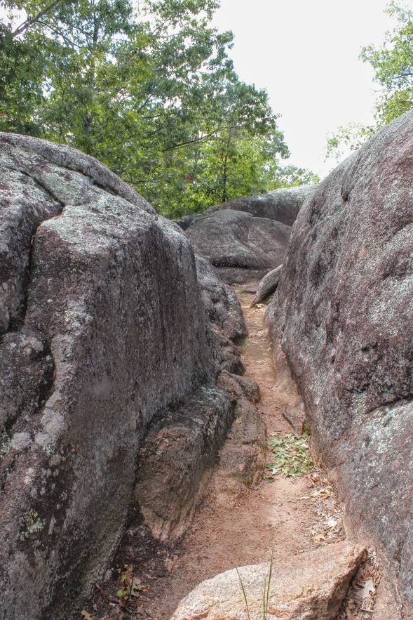
There are two trails to explore through the park. The main trail is called the Braille Trail. This is a self-guiding trail that winds among the rocks and takes you throughout the park. This is paved and accessible for people with disabilities, physical or visual. At different areas of the trail, we noticed interpretive signage with information of the landscape and the history of the park. The trail is one mile and marked as red. There are various viewpoints and we kept walking off the trail to explore more of the boulders.
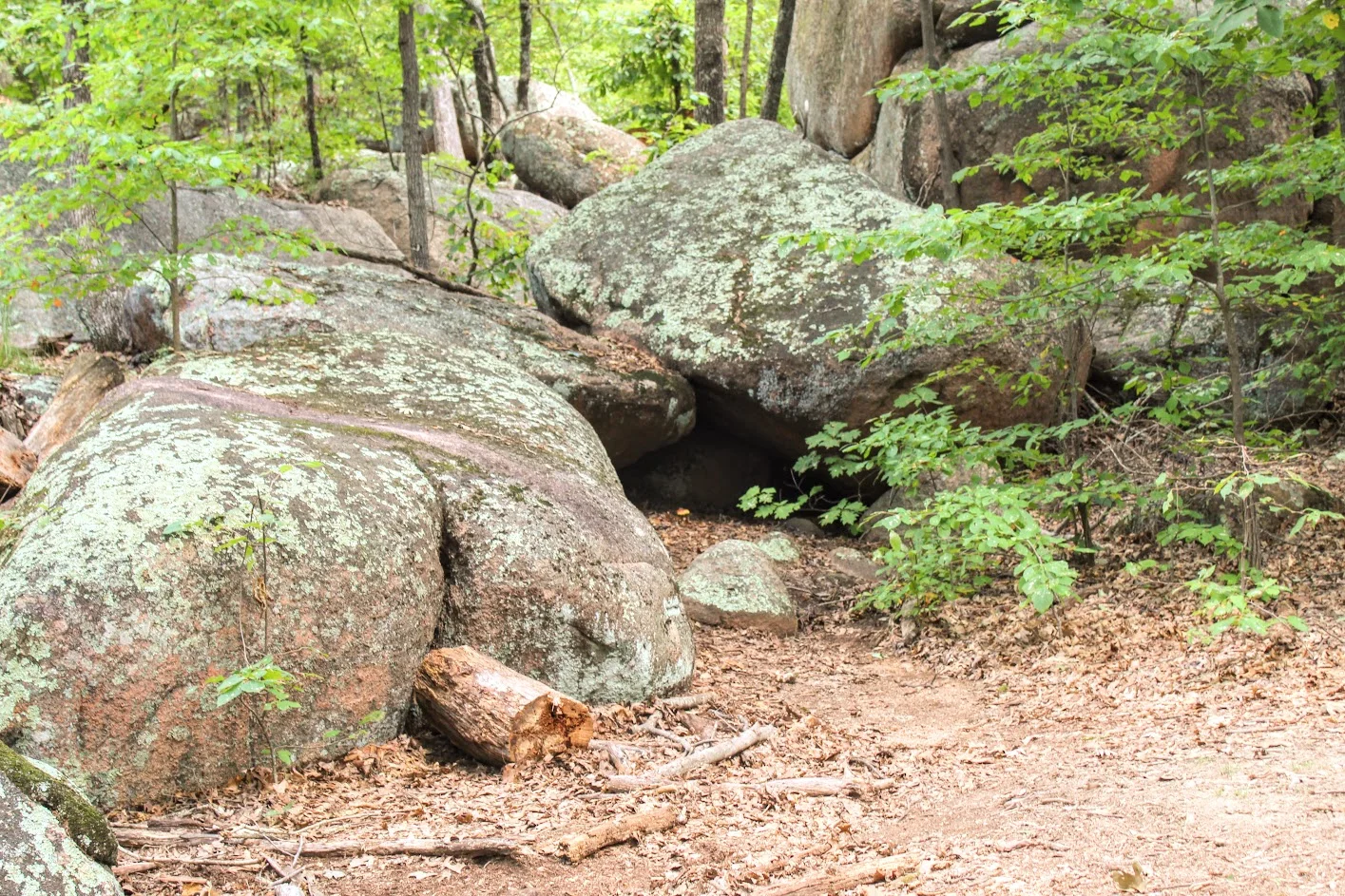


Once we reached the old engine ruin house, we noticed the blue marker trail to our left for the Engine House Ruins Trail. The terrain is more rugged but still easy. This added another 0.4 miles, which leads around the back side of the old quarry that connected us back to the Braille Trail. We followed the blue arrows on the trees and did our thing. There is some fun climbing that can be done on this section. Along with views beyond the bluff. Not many people tend to add this section of the hike so it was a nice break from the crowd.
old engine ruin house


pretty cool, this is in the middle of the park.
views from the top.
taking it all in. the best part.
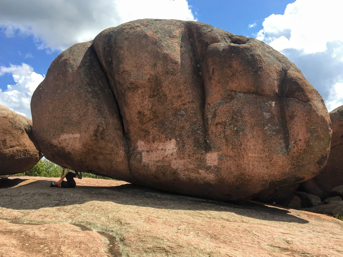
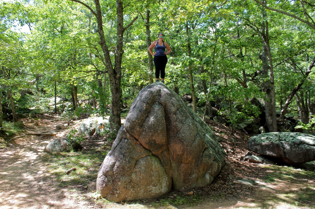
After connecting back to the Braille Trail, we slithered through the rocks and made our way to the giant boulders. Once I got the full view, I understood where the name of the park was derived. I could see the elephant like figure. Due to the crowd, it was tough to capture how breathtaking it was in person. Everyone was climbing between the boulder and snapping selfies. Children are fascinated by the size of the boulders as they enjoyed climbing. I found myself scaling the boulders and didn’t want to leave!


Trying to get a good picture amongst the crowd.
The elephant’s trunk rock.
rocks.
more exploring.
We ended up spending about an hour and half enjoying the park. That is about all you need. Very easy, go at your own pace and enjoy type of hike. And, if you want, you can throw in some climbing. When I booked a trip to St. Louis, did I anticipate incredible landscapes and geological boulders in the heart of Missouri? Heck no. But I am sure glad I got to experience them. The fun part about traveling is finding gems like Elephant Rock State Park.
Wow so strong!
Well….hello there. Just doin’ some climbing.

HIKING FOR DONUTS
A blog for the outdoors foodie enthusiast
Hi, I’m Mark. I live in Connecticut. I take new trips every chance I get. A good trip has a great hike, great food, and something fun to do. My goal is to search out new trips and share them to inspire others to try something new and exciting.
If you are looking for posts in a particular place, search by city or state here.
EXPLORE OTHER POSTS IN THE ARCHIVE
Archive
RECOMMENDED POSTS
MOST RECENT POSTS
See where I have been recently on Instagram. Follow @HIKINGFORDONUTS