

Lone Elk Park, St. Louis County, Missouri
Lone Elk Park is located in St. Louis County, Missouri. This park is only 35 minutes from downtown St. Louis and is a must visit bucket list. This park offers you a great nature adventure without needing to get out of your car. I never thought I would find elks and bison roaming in Missouri. This was an fun and exciting adventure. Read more about this in my latest blog!
I bet if I were to tell you, within a 35 minute drive from downtown St. Louis you would find a park that was reminiscent of Yellowstone National Park; you would think I am out of my mind. Lone Elk Park gives you that type of experience. Don’t get me wrong, it is nowhere near the size of Yellowstone, it is pretty small in comparison (only 2600 acres). Nor does it offer any of the landscape of Yellowstone. However, being able to drive among wild animals in nature from your car is a very cool experience that reminded me of when I was in Yellowstone. Again, at a very smaller scale. But come on, this is in Missouri!!! Who would of thought? As the name of the park states, you will see a huge elk population roaming. In addition, you will see bison, wild turkey, waterfowl, and deer. Essentially, you drive a loop around the park that takes about 30 minutes and hope to see some animals walking around. And, the park is totally free!
Entrance to the park. Veer left.
The park is tucked away in Valley Park, around Hwy 44 and Hwy 141. It is very easy to get to via gps. The park opens around 7am in the summer and *am in the winter. After doing some research online, I read the best time to see animals out is early in the morning or late at night before the park closes (sunset). Pretty good advice.
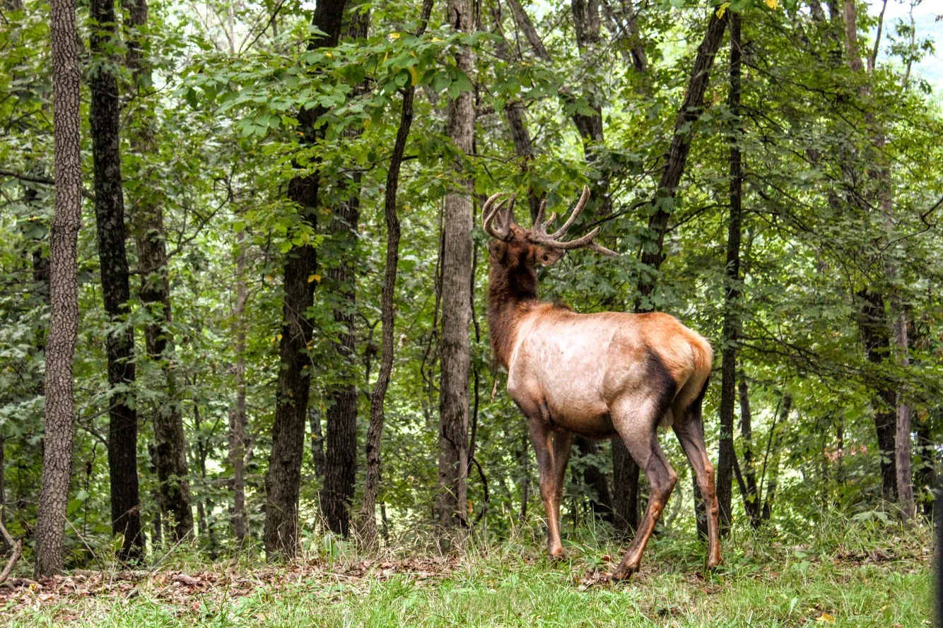
ELk butt.
We drove in from our hotel and got there around 8am. We pulled up to the park entrance. There is a bird sanctuary to your right if that is what you like. You will see the caution signs to stay in your car. Within the first 20 seconds of driving in, Nichole says to me, “Umm…is that fake?” And I responded, “Oh snap. That is as real as it gets”. The first animal we see in the middle of the road was a massive male elk with huge antlers. It honestly did look like a statue from far away. We crawled slowly past the elk and it was almost arm’s length away from the car. We made sure not to make to make it angry. We had a small rental car and this guy would tear it up.
this is real. First Elk we saw. Massive.


Great view of the lake and ELk.
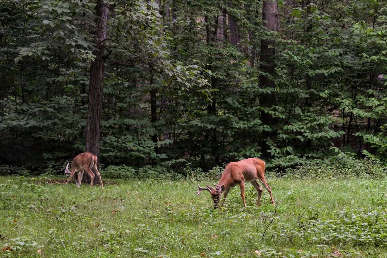
As we proceeded, we saw more elk in the woods and a herd to our left as we saw a full view of the lake. We continued to drive along the loop and we started seeing more deer and wild turkeys. The deer here were big guys. We passed the lake and once that was behind us, we started to enter the bison area. You we see more signs here as they want to make sure no one gets out of the car. On this morning, we did catch a few bison out in the fields but they were further away. Not as close as the elks. After that, there isn’t much to the drive and the exit was upon us.


The great thing about this park is you can keep driving around as many times as you want. We wanted to take one more loop to see if more animals came out. Unfortunately, they moved further away the second time. But worth a shot. Also, the park does have hiking trails where you can be out in the open and potentially cross paths with the animals. On your feet or in your car, be careful. Bison and elk will gore you or your car.
Second time around the elk went to down the water. The model stayed put.
That’s where they went.
MOre of the big elk in the lake.
This was first time Nichole has seen wildlife like this so close. It was a cool experience. Note, if you want pictures, make sure you are driver side. I went in the back seat. No way was I driving, too excited! Definitely glad we came across this place in our research and made the drive. If you are visiting, this is a must add to your list. It is a great opportunity to get in touch with nature and you don’t even have to leave your car.
Lake views from the top of the hill.
I don’t trust turkeys.

HIKING FOR DONUTS
A blog for the outdoors foodie enthusiast
Hi, I’m Mark. I live in Connecticut. I take new trips every chance I get. A good trip has a great hike, great food, and something fun to do. My goal is to search out new trips and share them to inspire others to try something new and exciting.
If you are looking for posts in a particular place, search by city or state here.
EXPLORE OTHER POSTS IN THE ARCHIVE
Archive
RECOMMENDED POSTS
MOST RECENT POSTS


See where I have been recently on Instagram. Follow @HIKINGFORDONUTS


Old Furnace State Park, Killingly, CT
Old Furnace State Park is located in Killingly near Rhode Island. This is a great park for hiking, biking, and fishing. Exploring new areas is always fun, even if you get lost on the trails. Check out the blog to make sure you stay on the trails!


Scrolling through the list of the 2018 Sky’s Limit Hiking Challenge in Connecticut, I wanted to explore unknown parts of the state that would be new to me. I haven’t spent much time in the Windham County area, neighboring Rhode Island. I really had no idea where I was going and there was not too much info on the park online. But, I convinced my girlfriend to drive over an hour with a promise of beers and off we went.
Old Furnace State Park is located in Killingly, CT. You will find the park entrance off Route 6 via Route 395. Ross Pond State Park is fairly close so my GPS took me there instead. If yours does the same, just keep going past that until you can take a left onto South Frontage Road and the park will be there on your left. The blue-blazed trail of this park runs about 3 miles. This particular hiking challenge calls for 2 miles round trip until you reach the overlook from the cliffs at 200 feet over Half Hill Pond. With this view you get a great look of valley stretching into Rhode Island.

We finally found the parking lot and noticed there was mountain biking event going on. Apparently, this is a big mountain biking trail. I didn’t expect to see anyone. The hiking trail starts at the parking lot. I used the trail located at ct.gov here . The path instantaneously takes you into the woods.

As we began, we crossed a small brook that led us to crossing a small footbridge.


The trail was fairly wide open until we reached an unmarked section ducking through a brush of bushes. We found ourselves questioning our direction. Eventually, a blue marker did appear.


From here the ascent started to get steep. About a mile into the hike, we saw the path break into two. Unfortunately, we kept going straight and that was not correct and saw some brown marked trails.


Thus, we circled back and took the path to the left which was the ridge along the pond. And, finally we found ourselves at the cliffs overlooking Half Hill Pond. The pond was completely filled with water lilies.


We stopped here because the trail was pretty buggy and I didn’t think the rest of the trail would offer much. But if you want to continue, this will lead you down to the parking lot and boat ramp at Ross Pond to Squaw Rock Road where you turn around and come back. If you are not from the area, the directions to the park could be difficult and the trail itself has areas that should be marked better. The hike itself was not hard. I would rate it easy. I would bring bug spray and pay very close attention for the blue markers. Looks like a good area to fish and maybe kayak as well. I’m sure this is a nice spot for locals but one time is probably enough for me.
The Review
Old Furnace State Park, Blue Trail, Killingly, CT (~2m): 2.5 out of 5.

HIKING FOR DONUTS
A blog for the outdoors foodie enthusiast
Hi, I’m Mark. I live in Connecticut. I take new trips every chance I get. A good trip has a great hike, great food, and something fun to do. My goal is to search out new trips and share them to inspire others to try something new and exciting.
If you are looking for posts in a particular place, search by city or state here.
EXPLORE OTHER POSTS IN THE ARCHIVE
Archive
RECOMMENDED POSTS


MOST RECENT POSTS
See where I have been recently on Instagram. Follow @HIKINGFORDONUTS
River Highlands State Park, Cromwell, CT
This is the first hiking trail review on the Connecticut hiking challenge trails. Check out the blog to learn more about the challenge!
Trail Description: A view 150 feet up of the Connecticut River can be seen from the White Blazed Trail in the River Highlands State Park. In addition, there is water front with picnic tables to enjoy.
Trail Info:
Where: River Highlands State Park, Cromwell, CT Distance 1.5 miles (1 hr) Difficulty: Easy Trail Type: Loop Features: Views, River, Water
How to get there:
Directions in detail can be found here,https://www.ct.gov/deep/cwp/view.asp?a=2716&q=434748&deepNav_GID=1650.
River Highlands State Park, Field Rd, Cromwell, CT 06416
Hiking Tips
Good beginner hike or weekday hike after work.
Super buggy area. Bring bug spray.

The Hike
Finding good hikes in Connecticut is becoming less a challenge. And, that is a good thing. Most people just dismiss how much is truly out there. Recently my friend told me there is a hiking challenge in CT. I can’t believe I haven’t come across this. Of course, I googled and found Sky’s the Limit Hiking Challenge by the CT Department of Electric & Environment Protection (DEEP). They list 14 lesser known trails to encourage more hiking in CT state parks. There are rules and info here. You can win some prizes too. I think it is a great idea. I haven’t heard of most of the trails. I smell some new blog material. I am definitely on-board and will be joining in on the fun.
With that said, here in my very first hike of the Sky’s the Limit challenge. A rare weekday hike but if it is 90 degrees in May in CT, you get outside. Nichole and I went to River Highlands State Park in Cromwell, CT. This was an easier and quick hike. The hike offers views of the Connecticut River from 150 feet above the water. I would use this link for the trail maps. Directions can be found on the CT DEEP link above.


The park consists of multiple color trails. You can go multiple different directions. The biggest loop will take you about 2 miles but you can connect to many different trails and adventure as much as you want. The trails are very well marked and the terrain is pretty level. Maybe one or 2 short, steep sections. We chose the white trail from the parking lot. This takes you directly to the high bluffs overlooking the Connecticut River.

More river views.
From there we took the yellow trail down to the camping site. Typically, you can go to the bottom and walk out to get more views of the river. However, due to all the rain we had recently, the water was really high. Trees and picnic tables were covered. It is probably best to do this hike in the summer. Luckily, I did this a few years ago when the water was low.


After trying to snap some good IG pics, we continued to follow the yellow trail out to the parking lot. There are quite a bit of small bridges to cross over. And, this particular area is swampy and gets very buggy. Tons of mosquitoes. I suggest Deep Woods spray for this hike.


We did do some adventuring off the trails mentioned but it shouldn’t be more than 1.5 miles if you use the white to yellow marked trails. Barely took us an hour. This is a very good beginner hike. You don’t need boots but it is a wetlands area so it can be very muddy. It’s a good, quick hike for those locally.

HIKING FOR DONUTS
A blog for the outdoors foodie enthusiast
Hi, I’m Mark. I live in Connecticut. I take new trips every chance I get. A good trip has a great hike, great food, and something fun to do. My goal is to search out new trips and share them to inspire others to try something new and exciting.
If you are looking for posts in a particular place, search by city or state here.
EXPLORE OTHER POSTS IN THE ARCHIVE
Archive
RECOMMENDED POSTS


MOST RECENT POSTS
See where I have been recently on Instagram. Follow @HIKINGFORDONUTS