


Zealand Falls Hut to Zeacliffs, New Hampshire
Zealand Hut Trail to Zeacliffs Trail Guide (Bethelum, NH)
Check out the new blog post an epic day hike in the White Mountains of New Hampshire. This hike follows the Zealand Trail to the Zealand Fall Hut, and eventually to the Zeacliffs overlook. From here, there are incredible views of Zealand Notch and the Pemigewasset Wilderness.
Trail Description: The Zealand Falls Hut Trail will lead you through the forest up to the AMC hut. Along the way you will pass various wetlands. Hiking beyond the hut to the Zeacliffs, there is a stunning view of the Pemigewasset Wilderness.
Trail Info:
Where: Zealand Trail, Bethlehem, NH Distance: 8.2 miles (5-6 hours) Difficulty: Difficult Trail Type: Out and back Features: Wetlands, River, Brook, Pond, Waterfall, AMC Hut, Zeacliff Outlook, Mountain
How to get there:
Trailhead and parking area are located at the end of Zealand Road, Bethlehem, NH. That is what we put in the GPS. Zealand Road will be off Rt 302. Drive about 3.5 miles all way down the road until you see the parking area on the left. The parking lot is small but there is additional parking off to the right.
Hiking Tips
Be careful hiking on the rocks (may be wet)
Bring lots of water and lunch for the view at the top
The Hike
Hiking in New Hampshire is quite an experience. Every time I hike in or around the White Mountains, I never feel like I am in the northeast. The landscape is so unique and breathe taking. The views truly put you in a state of euphoria. I try to hike a few times a year in New Hampshire. One of best friends, Corey, has a place out there now, so that’s pretty convenient. On my last visit, Corey decided to lead a group of our friends on a day hike. Now, I’ve known Corey for almost 15 years. We have hiked all over together. I know when he says 3 miles it will NOT be 3 miles. While discussing our hike options, we decided for a longer hike in the 5-6 mile range. He mentioned reading about the Zealand Trail and how there are awesome views off cliffs right before Zealand Mountain. Although I was skeptical of his mileage number, I knew that Corey would lead us to some great views. Located in Bethlehem, NH, the hike follows the Zealand Trail to the Zealand Fall Hut, and eventually to the Zeacliffs overlook. From here, there are incredible views of Zealand Notch and the Pemigewasset Wilderness.


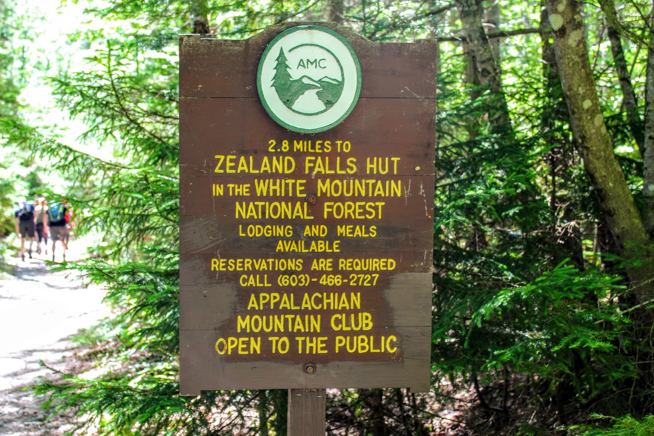
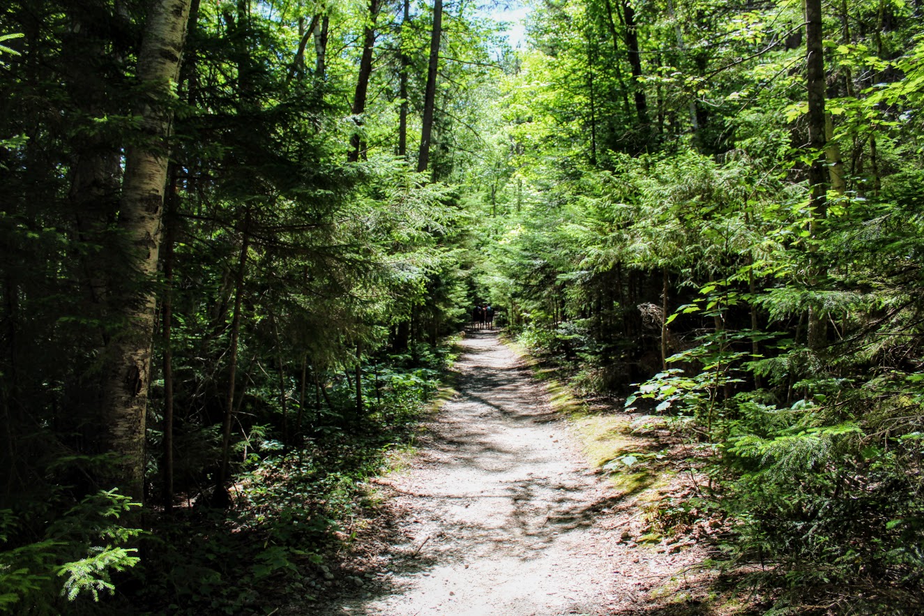
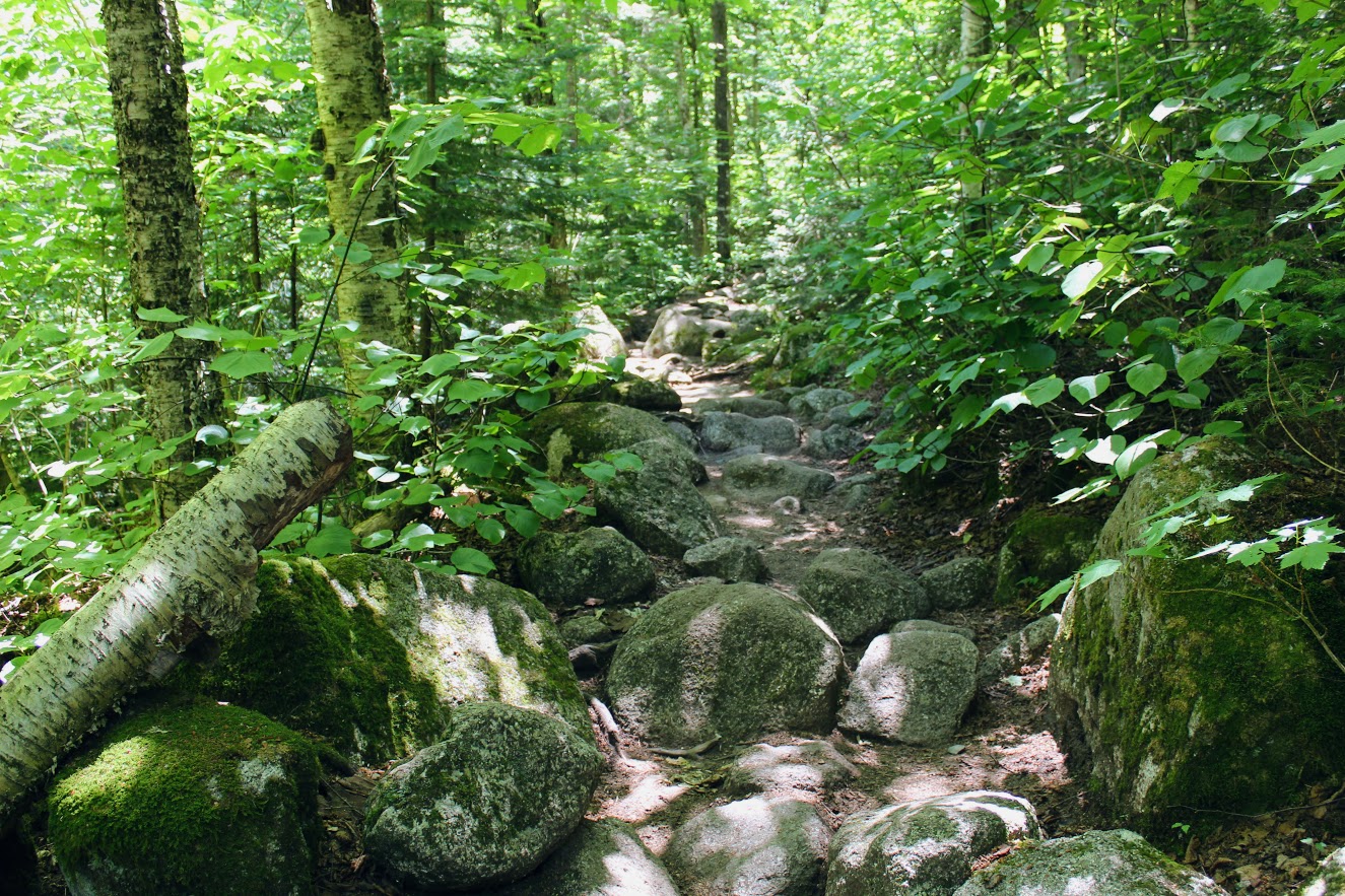
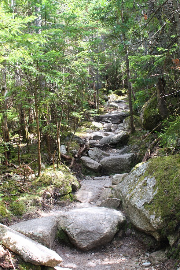
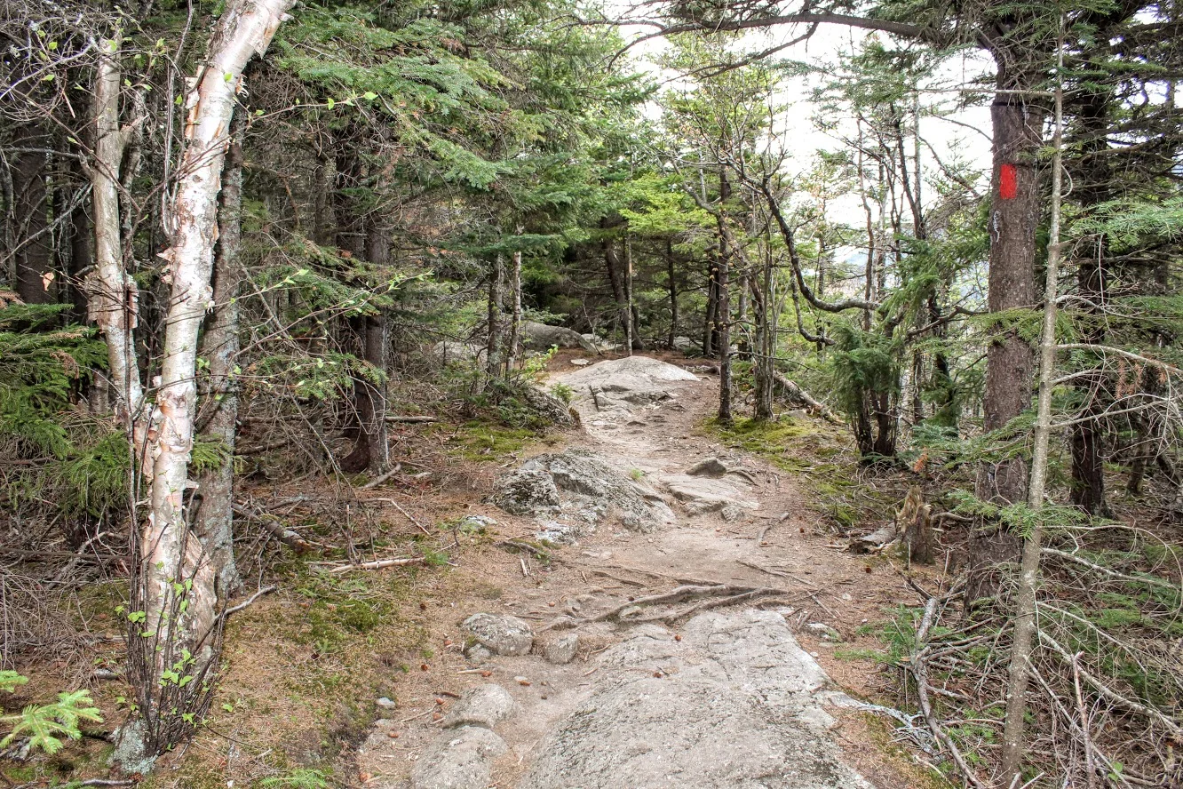
From the parked area, we saw the Zealand Falls Hut sign and began our way up the Zealand Trail using the blue-blazed trail. The trail starts off easy with good footing as it follows an old rail road bed. Soon after, we were thrown into the forest and the terrain became extremely rocky. Ah, those New Hampshire trails.
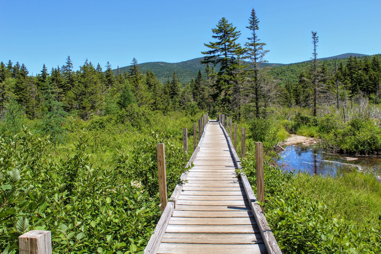
The first mile or so offers a few brooks and streams to cross leading up to the Zealand River. The trail is a gradual climb from the woods to a beaver pond and marsh area. This where we reached a sturdy wooded boardwalk (formerly known as the Z-bridge) crossing the wetland area.
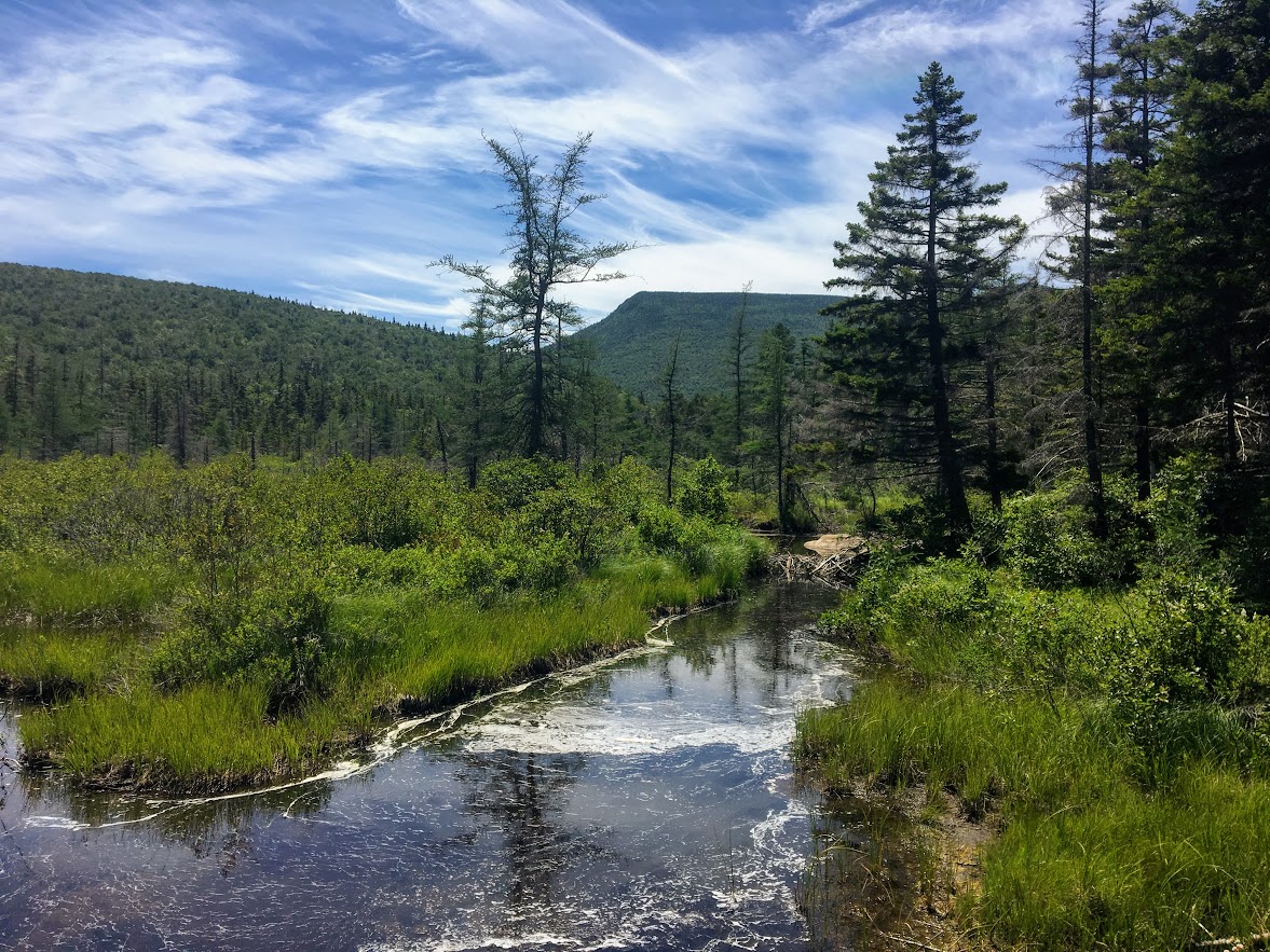
A half-mile after this section, the trail veers to the left; continuing on the Zealand Trail. The trail flattens out and we crossed another footbridge over Zealand Pond. After a few paces, the trail brought us to the shoreline of the pond at a small opening in the trees.

I lost my friends as I typically do to stop for pictures. I was marching along by myself and I saw a white creature appear from the grassy meadow. Of course, my only reaction was that’s definitely a dire wolf from Game of Thrones. Unfortunately, I was incorrect. Two big dogs were ahead of their group. I was like “Cool dogs” and they were “Hey, cool shirt. We love donuts.” This was the first hike I wore my Hiking for Donuts shirt and I got a lot of reactions to it. The shirt is a great conversation starter. Lots of fun banter. My friends actually had a pretty serious donut debate for 30 minutes at one point in the hike. If you see my shirt on the trails, say hello!

tell me you don’t think that’s ghost from Game of thrones at a quick glance!
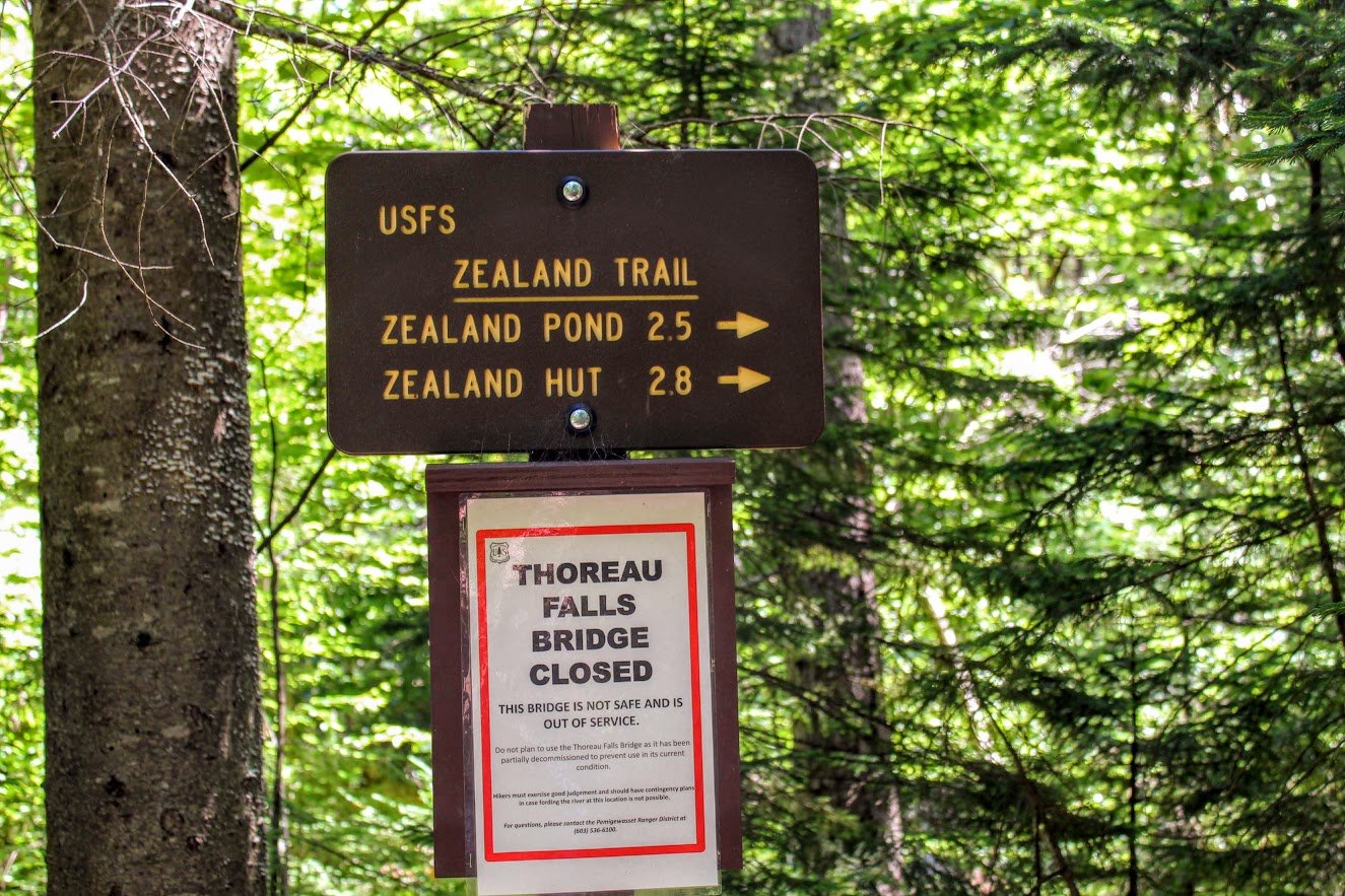
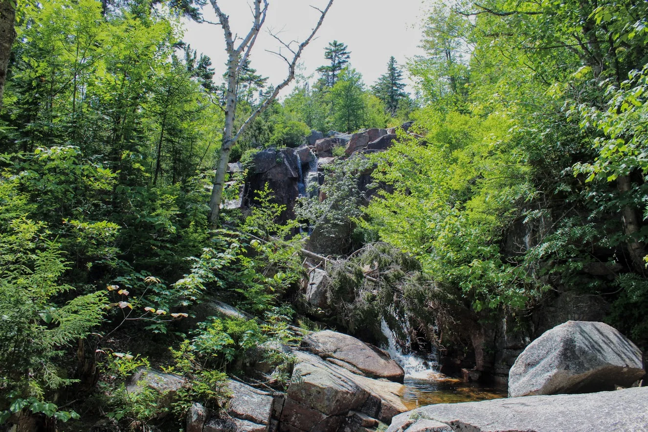
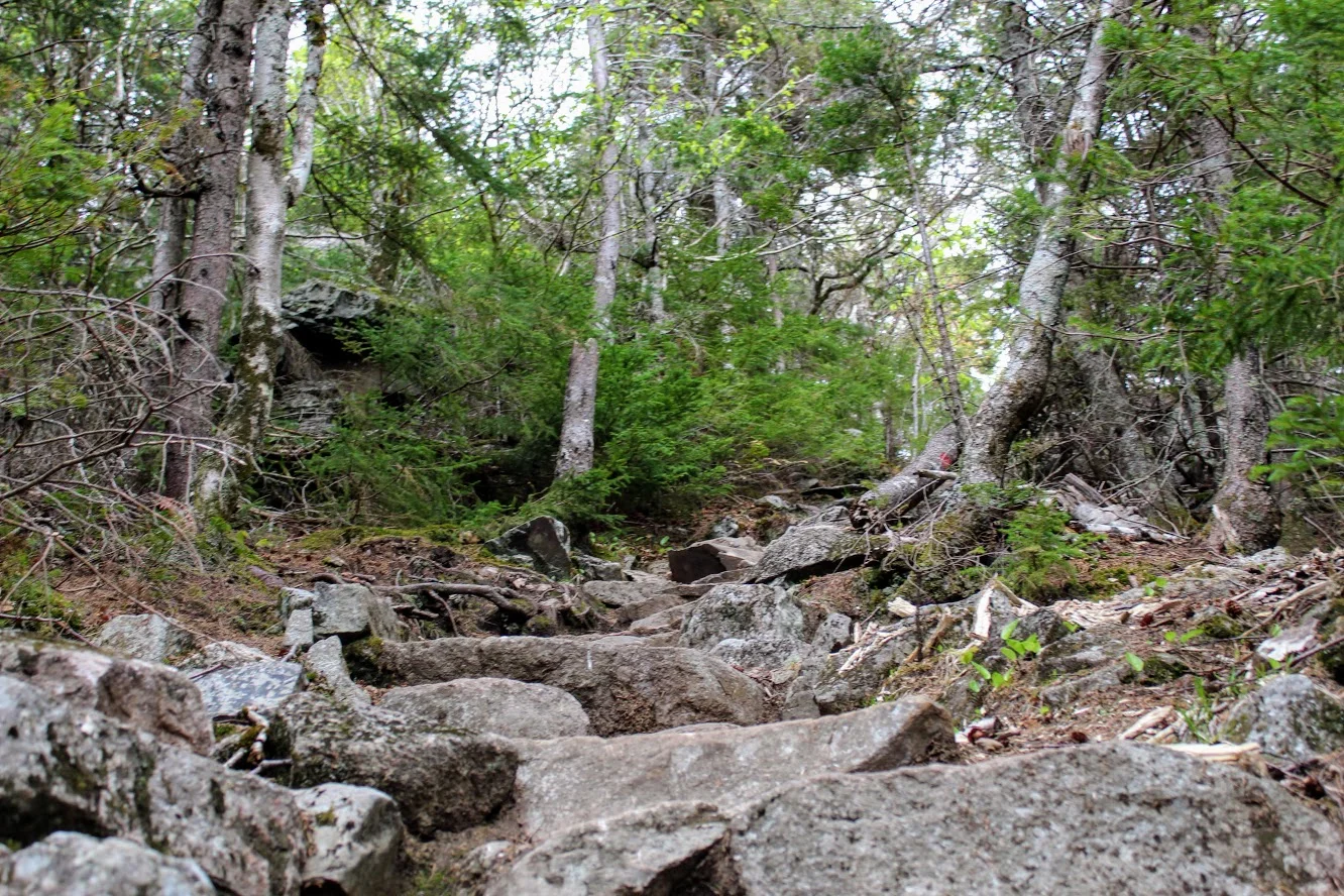
Hiking further just beyond this point, the Zealand Trail ends as it becomes the Twinway Trail (part of the Appalachian Trail). This was around 2.5 miles into the hike. And, now the really tough stuff begins. The ascent is real. The terrain will kick it up a notch. It was a pretty hot day and I haven’t hiked in this terrain in a while. I was struggling a bit. However, I like the challenge. And, I had goals of amazing views so I pushed ahead slow and steady. I could hear the falls. Five minutes later, I saw the sign for the Zealand Falls. This detour will be on your left and I highly suggest taking a view of the 25 foot falls. Given this was during the summer, the falls didn’t have much water but still impressive.
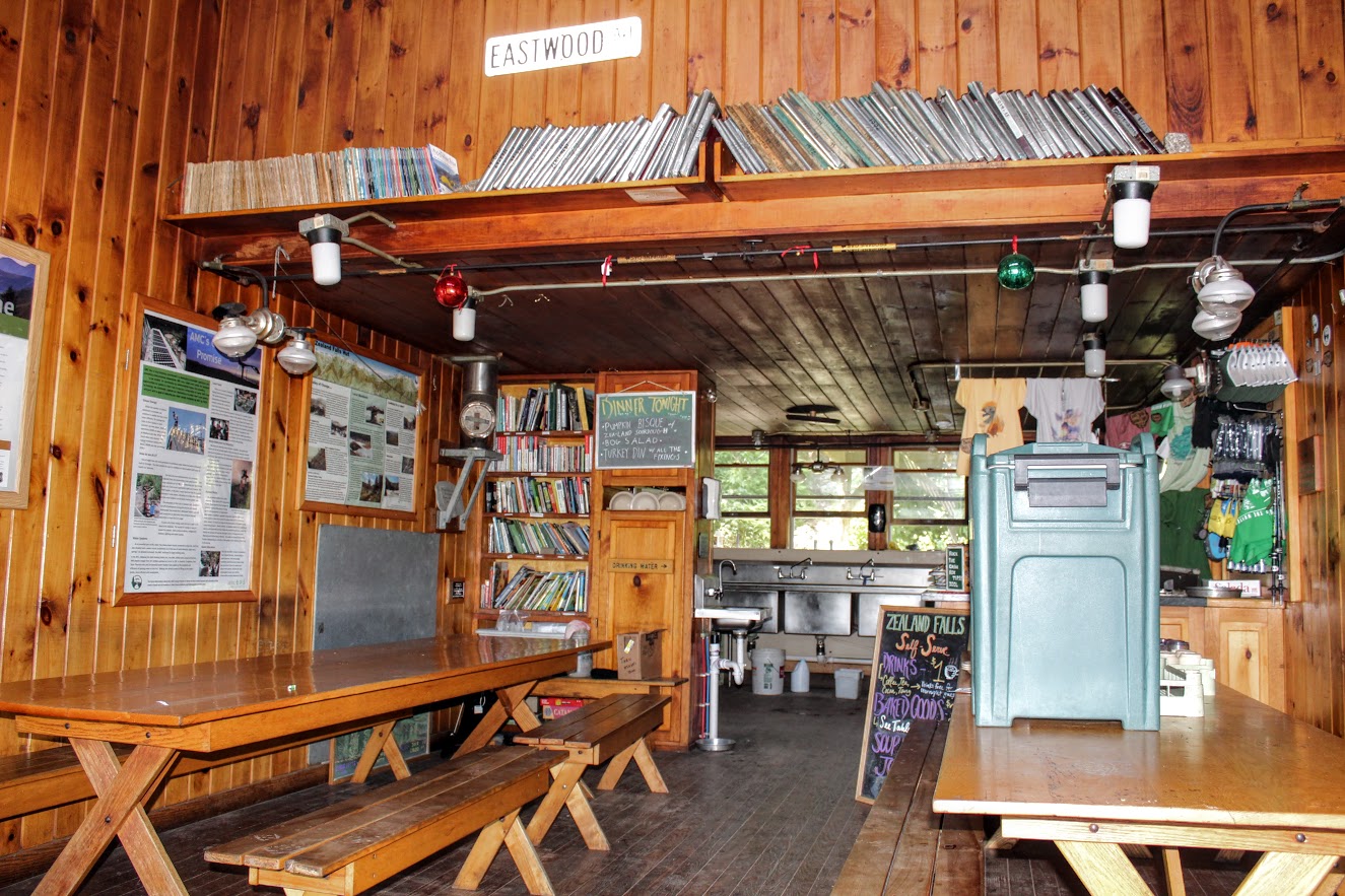
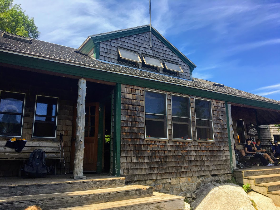
Not long after, I followed main path up the stone steps and caught up with my group at the hut. The hut is hidden by the woods. Once I reached the top, the hut just appeared. I can see my friends sitting on steps. I turned around and was welcomed with panoramic views. As with most AMC huts, this one is pretty cool. This hut sits hillside with a medium size stream bedside it that flows down to the falls. The inside is nice and can accommodate 36 people year round. This was a nice little break to enjoy the views from all angles.
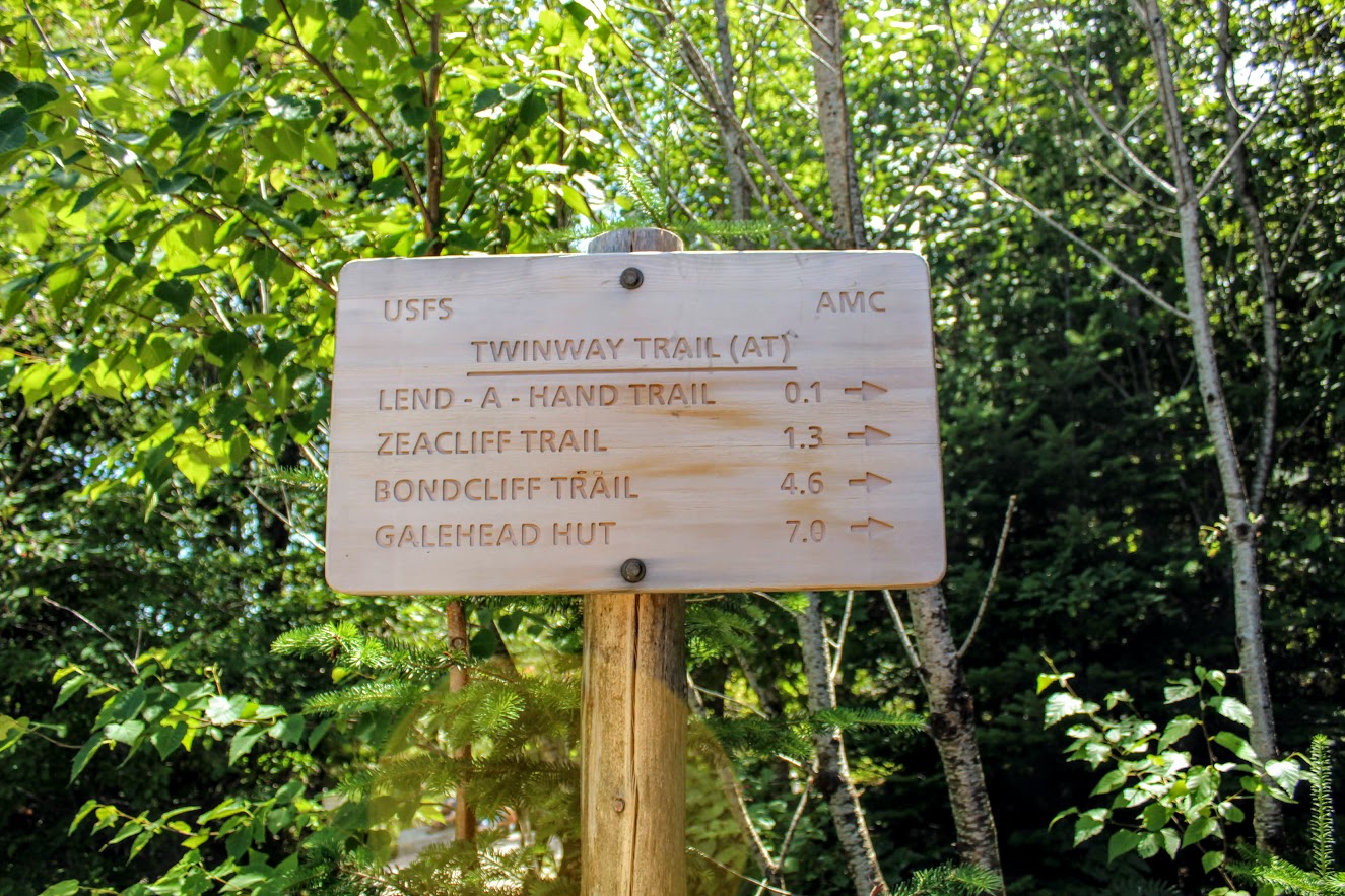
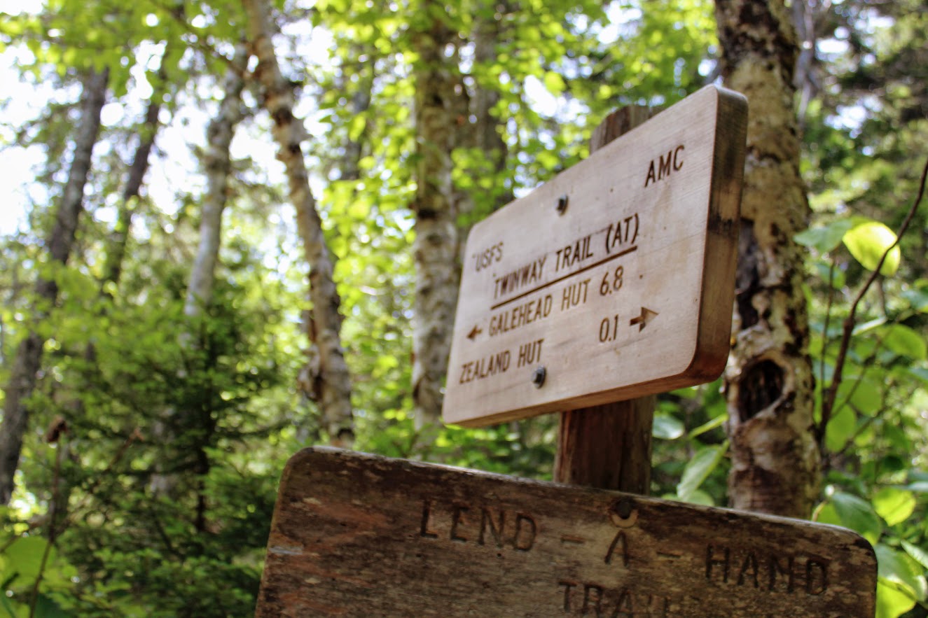
here is a sign by the stream that shows another 1.3 miles to the Zeacliffs. And, accordingly to my calculations, the hike will be 8.2 miles long. I was duped again by Corey. Heading away from the hut, turn left when arriving at the Lend-A-Hand Trail junction to stay on the Twinway Trail. The steep ascend continues from the Zealand Hut. We heard some odd noise ahead about 100 yards from the hut. We discovered the noise was from a water pump that drew water from the Whitewall Brook down to the hut.
As the 1.3 mileage got closer, we all were urgently asking, “Are we there yet?” Finally, the trail leveled off and we saw a small sign on the left labeled , “View”. We made it! And, boy was it completely worth it. The sweeping vista over the Pemigewasset Wilderness was spectacular. The area was pretty crowded but we waited out for the prime spot to take pictures and take a lunch break. I was truly in awe and the skies were clear as day.
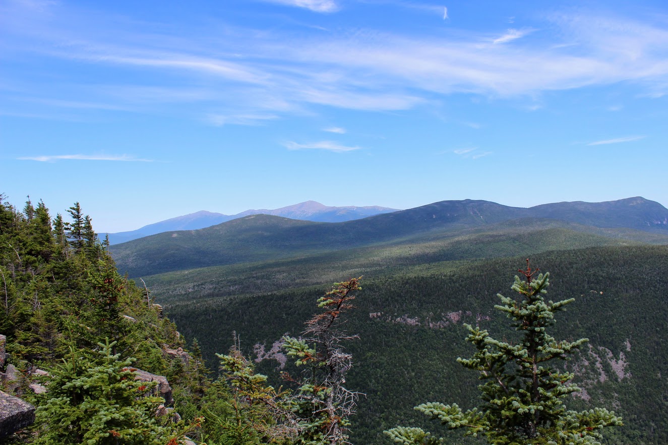

The Zeacliffs are the best views I have seen in the White Mountains to date. After soaking in all the views, it was time to go. We had another 4.1 miles to get back to the cars. If you wanted to reach the summit of Zealand Mountain, that would be another 1.6 miles from this spot. I read the views there are not as good but it would count towards the 48 4K footers. We were all ready to head back.

The descent on the way down was difficult until the path evened out. I took a tumble myself, fell right on my right buttocks, and my camera went flying. No one happened to catch that Kodak moment. Some rocks were very slippery. Always be cautious with a rocky environment. I would bring hiking poles for this hike and wear your best boots. And, keep a mental note of your surroundings. I was in the back of the group mostly on this hike by myself. A few times I came across some decisions that were questionable, but here I am writing this post today. Toward the very end, you will need to decide between two paths. I did not remember which one we took going up. Fortunately, they both take you to the parking lot.

The Zealand Trail to the Zeacliffs offers many types of scenery such as brooks, ponds, waterfalls, AMC hut, marshes, and some outstanding mountain views. Definitely one of my favorite New Hampshire hikes. The round trip took us about 6 hours. The trail was definitely crowded. But, the trails were wide enough where you wouldn’t be on top of other hikers. As I mentioned, this particular hike is 7.8 miles. Corey hoodwinked us yet again on the mileage but he did not disappoint with the hike. I would do it over again in a heartbeat. The challenging hikes stand out more and offer the best memories.

HIKING FOR DONUTS
A blog for the outdoors foodie enthusiast
Hi, I’m Mark. I live in Connecticut. I take new trips every chance I get. A good trip has a great hike, great food, and something fun to do. My goal is to search out new trips and share them to inspire others to try something new and exciting.
If you are looking for posts in a particular place, search by city or state here.
EXPLORE OTHER POSTS IN THE ARCHIVE
Archive
RECOMMENDED POSTS
MOST RECENT POSTS


See where I have been recently on Instagram. Follow @HIKINGFORDONUTS


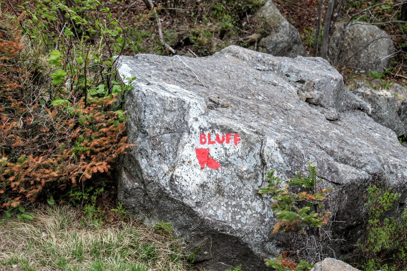
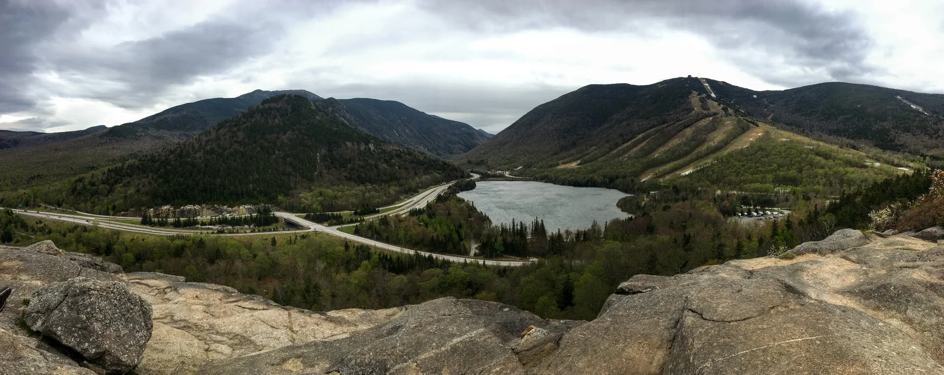
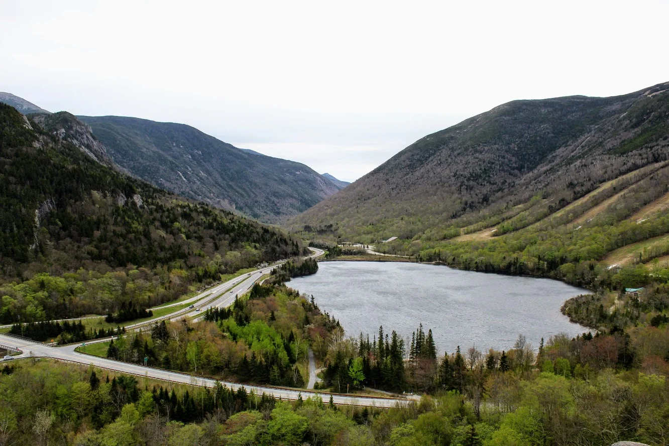
Artists Bluff Trail, Franconia Notch State Park
Artists Bluff is one of my favorite trails in the White Mountains of New Hampshire located in Franconia Notch State Park. This trail checks off all boxes for a great hike. The views are spectacular. Check it out!
Trail Description: The Artists Bluff Trail is a short hike that offers some of the best views of Cannon Mountain and Franconia Notch.
Trail Info:
Where: Franconia Notch State Park, Franconia, NH Distance: 1.5 miles (1-1.5 hrs) Difficulty: Easy to Moderate Trail Type: Out and Back Features: Views, Valley, Lake, Forest
How to get there:
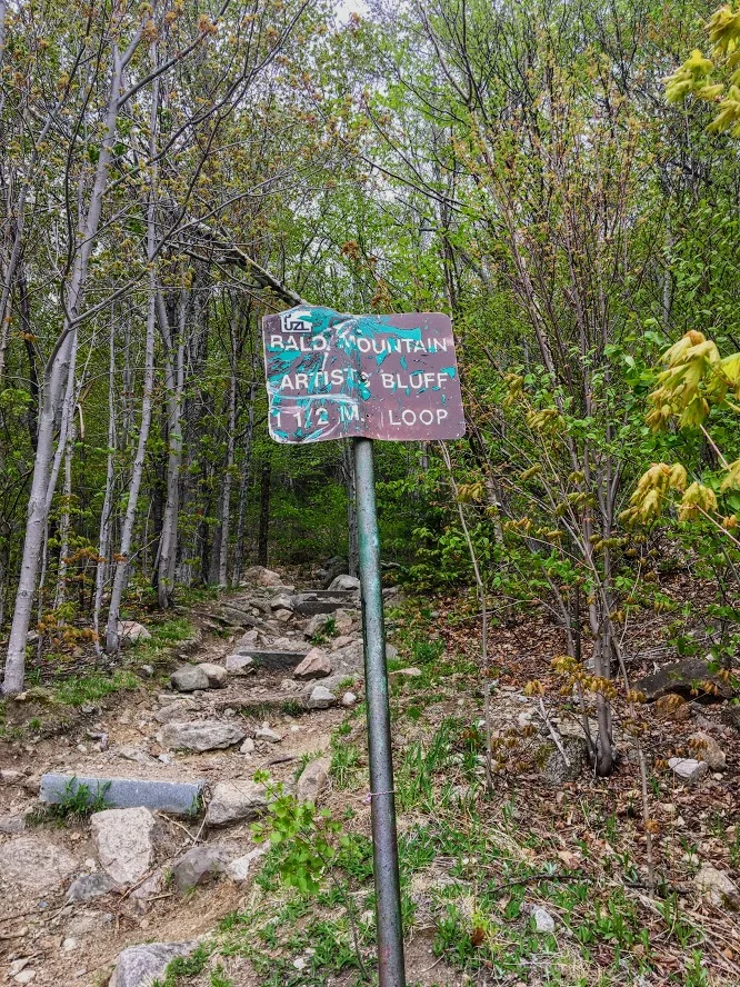
From I-93 (Franconia Notch Parkway) get off on Exit 34C toward the Cannon Mountain Ski Resort and head west on NH 18. Go up roughly a half mile where you see a large parking area on your right. Walking across the empty lot in front of you will lead to the signs for the Artists Bluff and Bald Mountain.
Hiking Tips
Shortly along the trail, there’s a fork in the path that not clear which direction to go. Stay to your right to follow the Artist Bluff Trail. The other option will take you on the Bald Mountain Trail and will take you longer to get to Artists Bluff.
Great fall hike with amazing foliage.
The Hike
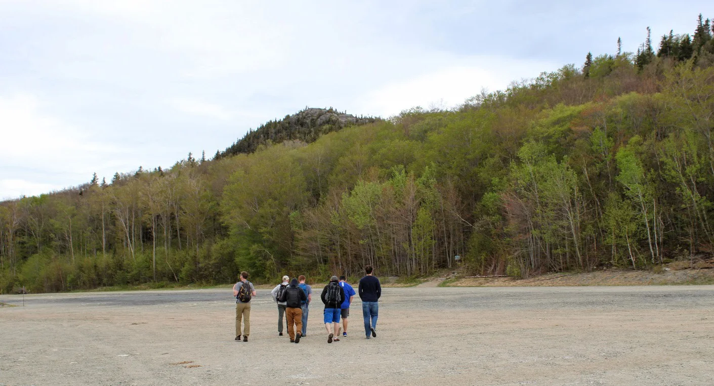
If you are looking for a great trail with amazing views that is relatively quick in New Hampshire, the Artists Bluff Trail in Franconia Notch State Park is exactly that. My friend owns a house close by and about 10 of us drove up for the weekend. After having too many beverages the night before, we wanted something relatively short on this morning. And, we wanted to beat the rain that was inevitable. We have hiked Artists Bluff in the past but it is a great hike and it is very satisfying. The loop is only 1.5 miles but it is challenging with steep sections. And, the trail will lead you to amazing views of Cannon Mountain and Franconia Notch.
Upon arriving we saw the parking lot off Route 18 on your right across from the Cannon Peabody slopes. We walked across the empty lot in front of us that led us to the signs of the start of trail for Artists Bluff and Bald Mountain.

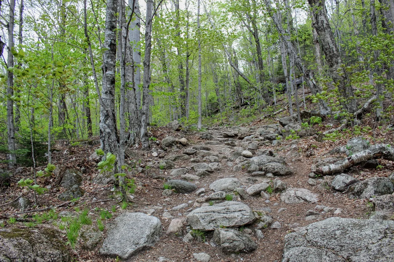
We followed the Red marked trails to get to the bluffs. The trail starts off pretty easy then you have some steep inclines and declines as you get closer to the bluffs.


About .25 miles or so into the hike we saw split in the path to hike up to the summit of Bald Mountain on our left. This will add .5 miles to the hike. As we wanted to beat the rain, we stayed the course toward Artists Bluffs.

The trail eventually broke into the open and I saw views of Cannon Mountain. There was a storm recently in the Northeast and there were actually quite a bit of trees knocked down. I came across volunteers doing some maintenance to the trail and trying to clean up. After passing the volunteers, I came up to the rock that points to the direction of the bluffs.

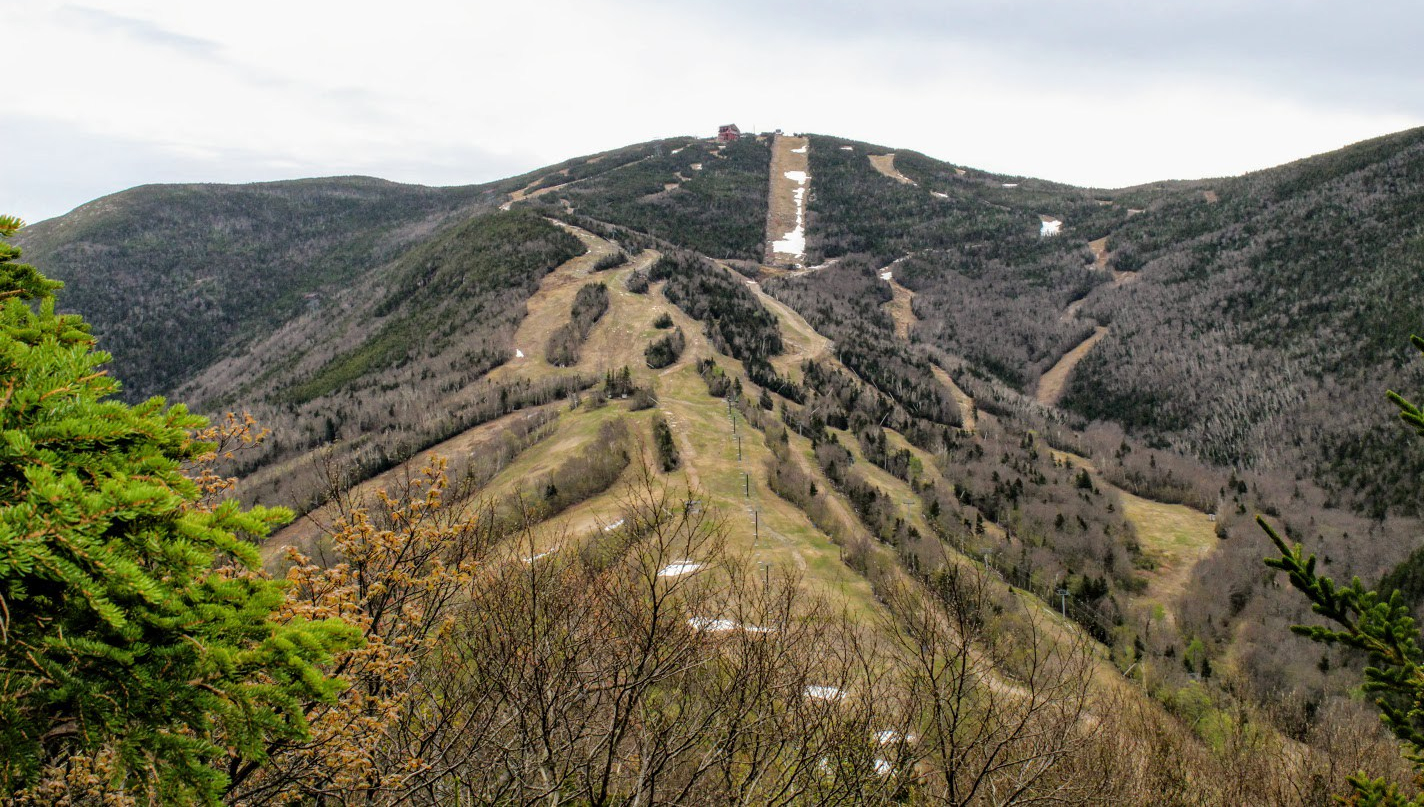
Artists Bluff stands at 2,368 feet high. The views at the top are amazing. You get a great outlook of the Franconia Notch. We hung out for about a half hour at the top reminiscing and questioning prior nights beverage consumption. And, then we decided to head back. The initial descend was pretty tough and rocky but the trail got easier as the path took us along Route 18 across from Echo Lake. And, this took us to where we originally started.

I would do this hike again and likely many more times. Each season of the year I am sure you get different views. Fall foliage would be the best. The trail is well marked and the forest is beautiful. Even though this is close to the highway, it is still far enough away and quiet as you hike. For a hike in the White Mountains, I would say this was an easy level hike. However, I could see this trail being moderate for others due to some the steeper sections. The hike will only take about an hour. But you will always add 20-30 minutes at the top taking in the views. The only thing that would have made this better is if I had some donuts with me!

HIKING FOR DONUTS
A blog for the outdoors foodie enthusiast
Hi, I’m Mark. I live in Connecticut. I take new trips every chance I get. A good trip has a great hike, great food, and something fun to do. My goal is to search out new trips and share them to inspire others to try something new and exciting.
If you are looking for posts in a particular place, search by city or state here.
EXPLORE OTHER POSTS IN THE ARCHIVE
Archive
RECOMMENDED POSTS
MOST RECENT POSTS
See where I have been recently on Instagram. Follow @HIKINGFORDONUTS

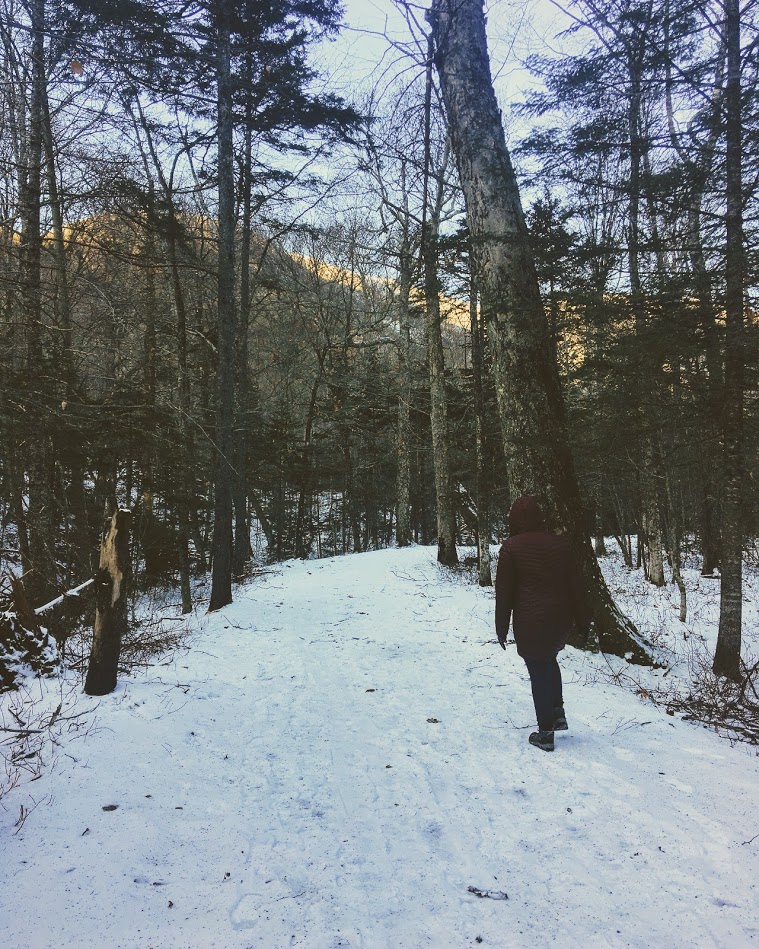
Winter is here...in the Basin
Fun weekend back in New Hampshire. This time I made a trip back to Franconia Notch State Park and hiked to the Basin. A pretty, cool spot that is very accessible.

It was time for another trek up to New Hampshire. After a few brewery stops, we finally made it up to my friend’s house. And, there was snow on the ground! Even though weather was in 20s, we still wanted to enjoy the outdoors New Hampshire has to offer. My friend decided The Basin in Franconia Notch State Park would be a good “jaunt” for the 5 of us and our friend’s puppy. The trail and parking lot is right off the highway off I-93. We parked at the visitor center and just hopped on the trail towards the Basin. This trail was mostly flat but due to the snow and ice, it was more tricky. In nicer weather, this is a very easy walk, paved most of the way and offers handicapped accessible viewing as well. We walked over a few bridges and eventually came across some cool waterfalls. We then made our way to The Basin, which offers rushing waters that has eroded the rock into a smooth, circular cave-like formation. After seeing that we walked a little further before the Pemi Trail and started our way back to the cars. Our hike was roughly 3.5 miles. Even though it was quite cold, it was a beautiful day to be outside. We enjoyed our mascot keeping us on our toes. Always fun to see a pup’s first time in the snow. Another reminder to get out there and enjoy time with friends!


HIKING FOR DONUTS
A blog for the outdoors foodie enthusiast
Hi, I’m Mark. I live in Connecticut. I take new trips every chance I get. A good trip has a great hike, great food, and something fun to do. My goal is to search out new trips and share them to inspire others to try something new and exciting.
If you are looking for posts in a particular place, search by city or state here.
EXPLORE OTHER POSTS IN THE ARCHIVE
Archive
RECOMMENDED POSTS
MOST RECENT POSTS
See where I have been recently on Instagram. Follow @HIKINGFORDONUTS

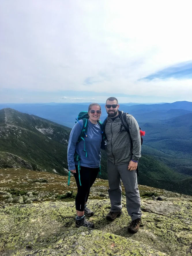
Mount Lafayette, New Hampshire
The White Mountains in New Hampshire is one of my favorites areas to hike. On this day, I conquered Mount Lafayette. What a hike!
Trail Description: Mount Lafayette is the highest peak in the Franconia Ridge at 5,260 feet. The summit offers amazing 360 views of the Pemigewasset Wilderness Area.
Trail Info:
Where: Lincoln, NH Distance: 8.0 miles (7-8 hrs) Difficulty: Hard Trail Type: Out and Back Features: Views, Peaks, Mountains, Greenleaf Hut
How to get there:
The parking lot for this hike is located in Franconia Notch on I-93. You can park on either side of the Interstate. Traveling north, you can park in the trailhead lot for the Falling Waters and Old Bridle Path trails. Traveling south, take exit 34b at Lafayette Place Campground. Follow the foot tunnel that goes under I-93 to the parking lot the opposite side of the highway to start the trail.
Hiking Tips
Bring lots of water, wear your best boots, hiking poles, and pack snacks.
Suggest doing the loop version of this hike along the Franconia Ridge trail to see Mount Lincoln and Little Haystack for more views.
Due to the popularity, the trail can be very crowded.
The White Mountains in New Hampshire are one of my favorite areas to visit and go hiking. It is one of the coolest areas in the Northeast and makes me feel like I’m in a different part of Unites States. It has a pacific coast mountainous look. I try to do a few hikes a year in New Hampshire. A large group of my friends rent houses in the area a few times a year to hang out. Even better, my best friend recently purchased a vacation home close to this area, about 15 minutes from Franconia. I bought new hiking boots and figured I wanted to do a fun, difficult hike in the White Mountains. More specifically, a hike I have not done. The one hike I really wanted to do was the Mount Lafayette summit. My friend said it was “easier” than Mount Washington but still hard. Lies. It was really freakin’ difficult. And, a terrible decision to wear new boots.
By the time we got there, it was near 11am and my friend suggested shaving a mile off the hike by skipping the trails where you would see Mt Lincoln and Little Haystack. I was against this decision but I was overruled. Disclaimer: This is a very popular hike. One of the best New England has to offer. There were cars lined up the side of the roads and the lots were full. This created a very tight hiking path. There was a lot of stopping and waiting for other hikers as the paths can be very narrow. For a summer hike, the weather was perfect, mid-70s and the skies were sunny and clear. We made our way to the trail which begins to the right of the information sign (there are bathrooms as well). Most hikers choose to go up the Falling Waters Trail as it is recommended by the trail guides. Another reason we chose to go up the Old Bridle Path as this was less crowded. After a good 1.5 miles into the trail you will seeing some great scenic views.


This path is 2.9 miles that will lead you to the AMC Greenleaf Hut. The hut is where hikers can use the restroom, eat, and enjoy the views. The hut also has some lodging options for those hikers who choose to do so.

From here, you will begin the rocky assent for another 1.1 miles to the top of Mount Lafayette, about 5,260 feet above elevation. We came down the same way we went up. The total hike was 8 miles.


Unfortunately for myself, the trail down wasn’t too fun as I sprained my ankle pretty bad. This hike is no joke and I would recommend using caution. For the inexperienced, I would prepare for a 8-9 hour hike. With my ankle issue, the hike took us over 8 hours. I would suggest using hiking poles, good boots and bring lots of H2O. I saw a couple wearing sandals. I can’t tell you how bad an idea that is. You will keep asking yourself, this isn’t a mile, 2, 3, 4? Given the incline, the hike will feel a lot longer. It was well worth it. The views are awesome. It leaves a very good sense of accomplishment. I will definitely go back another year to complete the Franconia Ridge Trail.

Review:
Bridle Path to Mount Lafayette Summit Trail (Franconia, NH, 8 miles): 5 out of 5!!!

HIKING FOR DONUTS
A blog for the outdoors, foodie enthusiast
Hi, I’m Mark. I live In Connecticut. I take new trips every chance I get. A good trip has a great hike, great food, and something fun to do. My goal is to search out new trips and share them to inspire others to try something new and exciting.
If you are trying to find posts about a particular place, search by city or state here.
Explore other posts in the archive
Archive
RECOMMENDED POSTS
RECENT POSTS
See where I’ve been recently on Instagram. Follow @HIKINGFORDONUTS.