


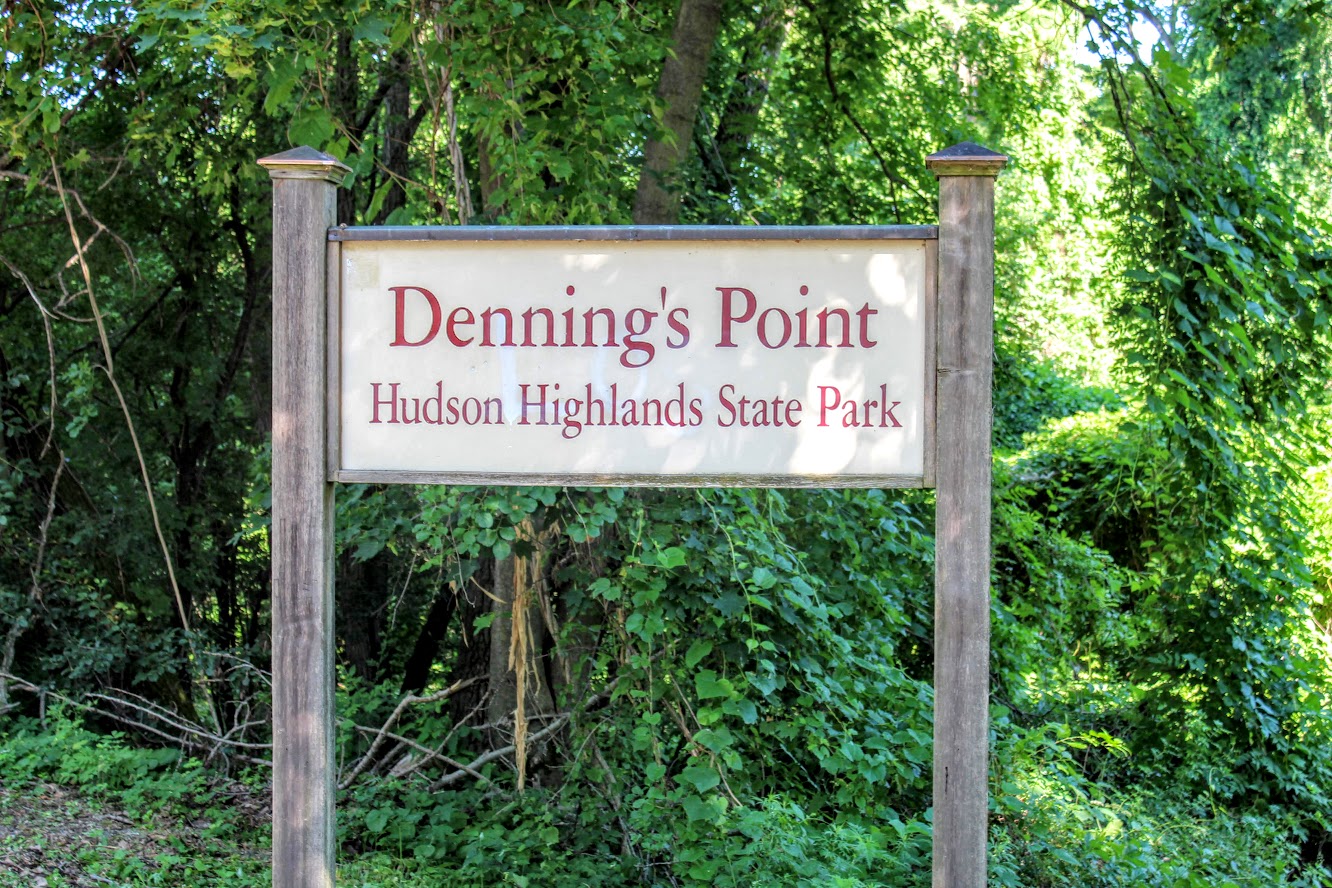
Dennings Point, Long Dock Park, Beacon, NY
Lock Dock Park Beacon, New York: Klara Sauer Trail to Dennings Point Trail
Trail Description: The Klara Sauer Trail is a flat walk until you meet up with the Dennings Point Trail along the shoreline. There are short access trails for views of the Hudson River and a beach with mountainous lookouts, where kayakers will often stop by onshore.
Trail Info:
Where: Long Dock Park, Beacon, NY Distance: 2.8 miles (1.5-2 hrs) Difficulty: Easy Trail Type: Out and Back Features: Bridge, Water, Mountains, Beach, River
How to get there:
GPS this address below. Easy to find.
23 Long Dock Rd Beacon, NY 12508
Hiking Tips:
At the time of my hike, storm damage caused trees to block the trail paths. If this is the case, turn around and go back the same way.
Make sure to stop at all access trails for additional views. Including the beach!
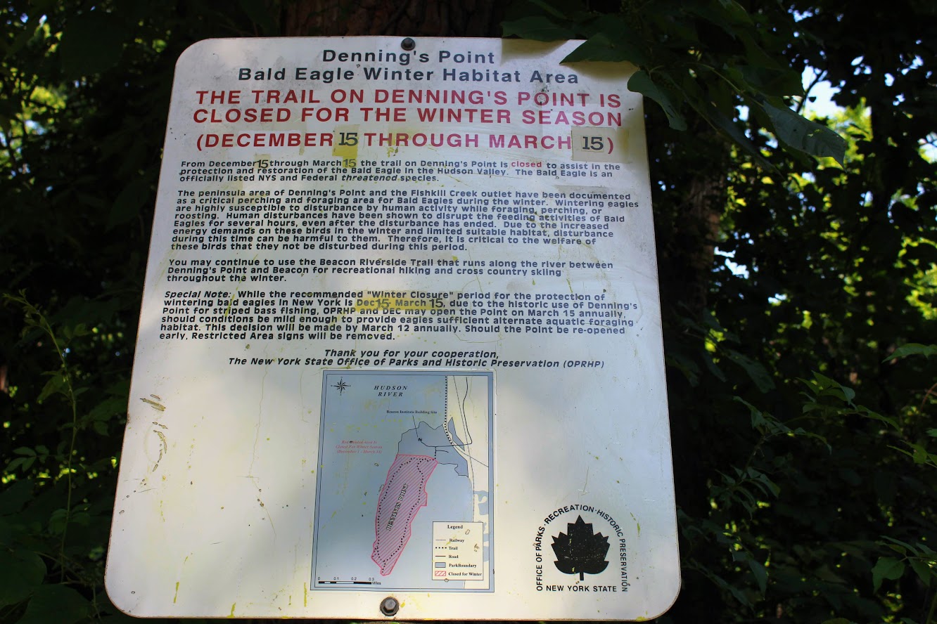
Denning’s Point Trail is closed December 15th to March 18th.
The Hike
Sometimes it is good to go for a nice leisurely walk, with an awesome view. The Hudson Valley is full of satisfying and challenging hiking trails with beautiful views. I am learning more and more about the area. There is a lot to offer if you are looking for outdoor activities. Short on time and looking for something easy, my girlfriend introduced me to a very cool spot located in Beacon, NY, called Long Dock Park.
path from the parking lot to the pier.
Upon arriving, I could see the fantastic view of the Hudson River as we parked. There is a good amount of parking but I can see this area being very busy. As we walked toward the pier, you will see trail maps within the park. Many people we saw were jogging, bike riding, and walking their dogs on the trails. You can also rent a kayak or paddleboard for the day. We walked out to the dock which is to the right of the parking lot. There are stools and fishing rod holders. A few fishermen were out bright and early on this day. From the dock, you get a fantastic view of the town across the river, including the bridge Beacon to Newburgh. This would be a good location to see the sunrise or sunset. The park has a very relaxing atmosphere.

Newburgh bridge from beacon.

View from the pier across the river.
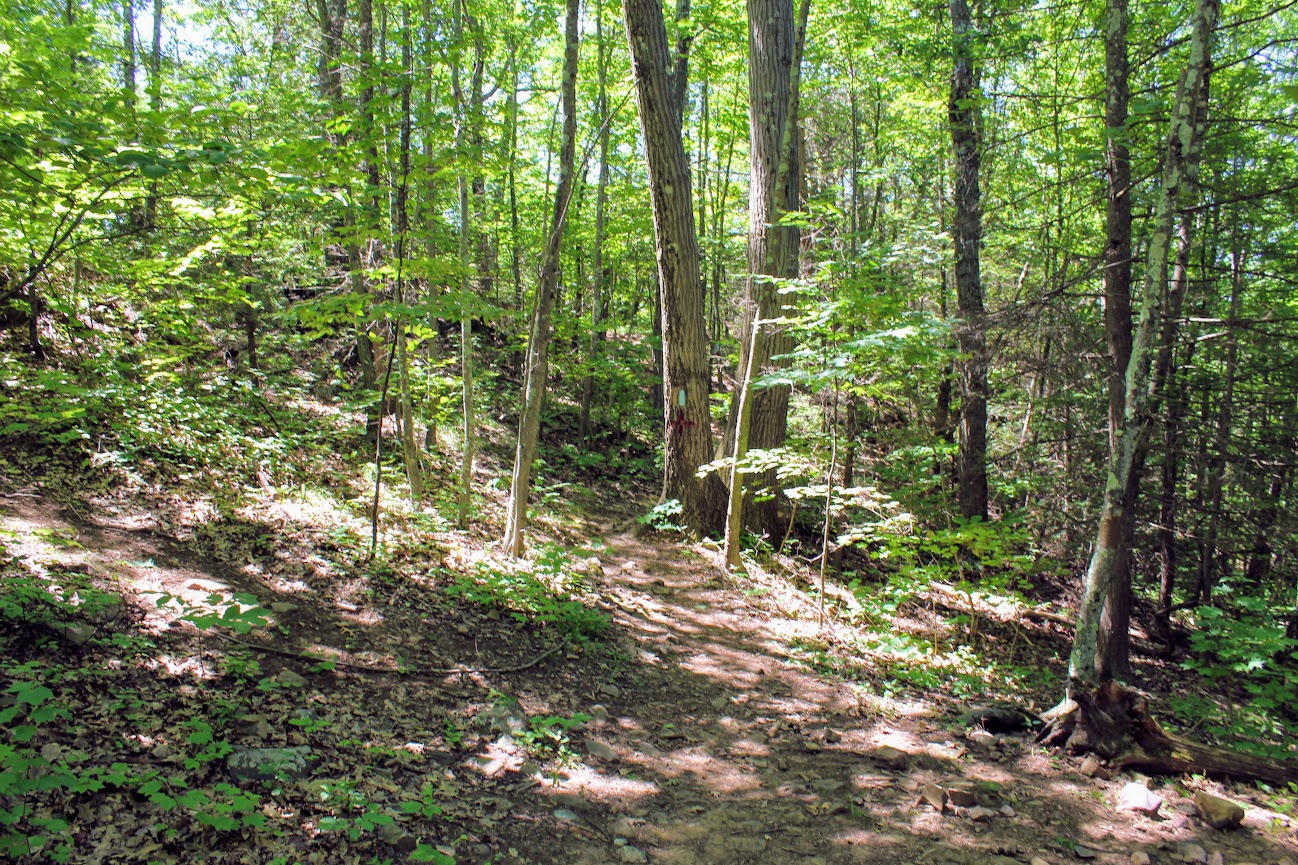
Long Dock Park is connected to the Hudson Highlands State Park by a train track turned trail. Dennings Point is the northernmost area of the Hudson Highlands State Park, and is a peninsula that extends out in the Hudson River. That was our goal destination of the day. After checking out the views from the dock, we started our walk on the Klara Sauer Trail. This flat and easy trail will lead along the shoreline of Dennings Point. There are access trails to venture and see better views of the river along the way. Some lookouts were muddy so I am glad I had my hiking boots on.
Views from some of the access point along the klara sauer trail.
Ducklings going for a swim.
Hudson river view with some mountains.
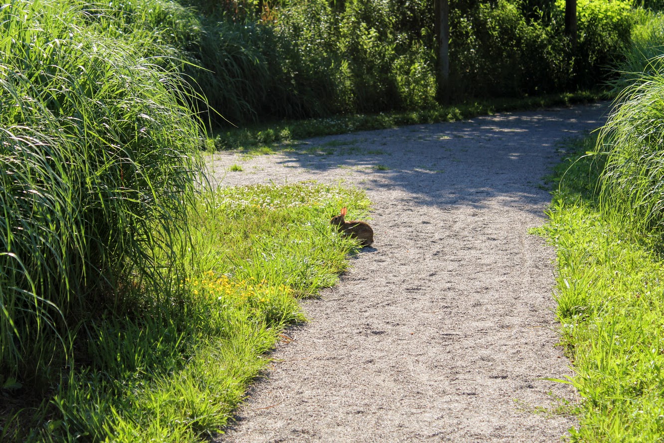
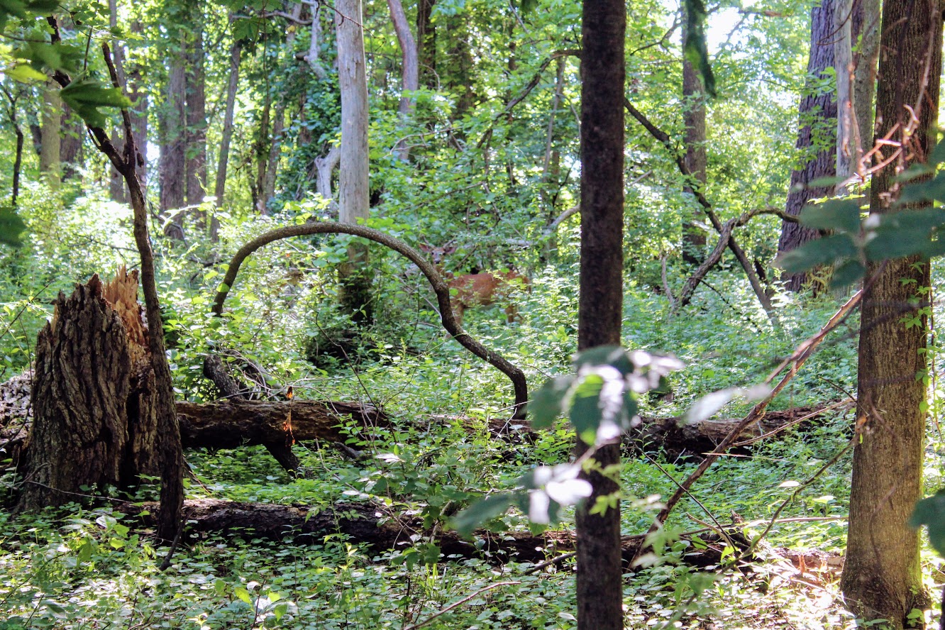
Unexpectedly, we did see more wildlife than anticipated. Peter Rabbit and Bambi made appearances.
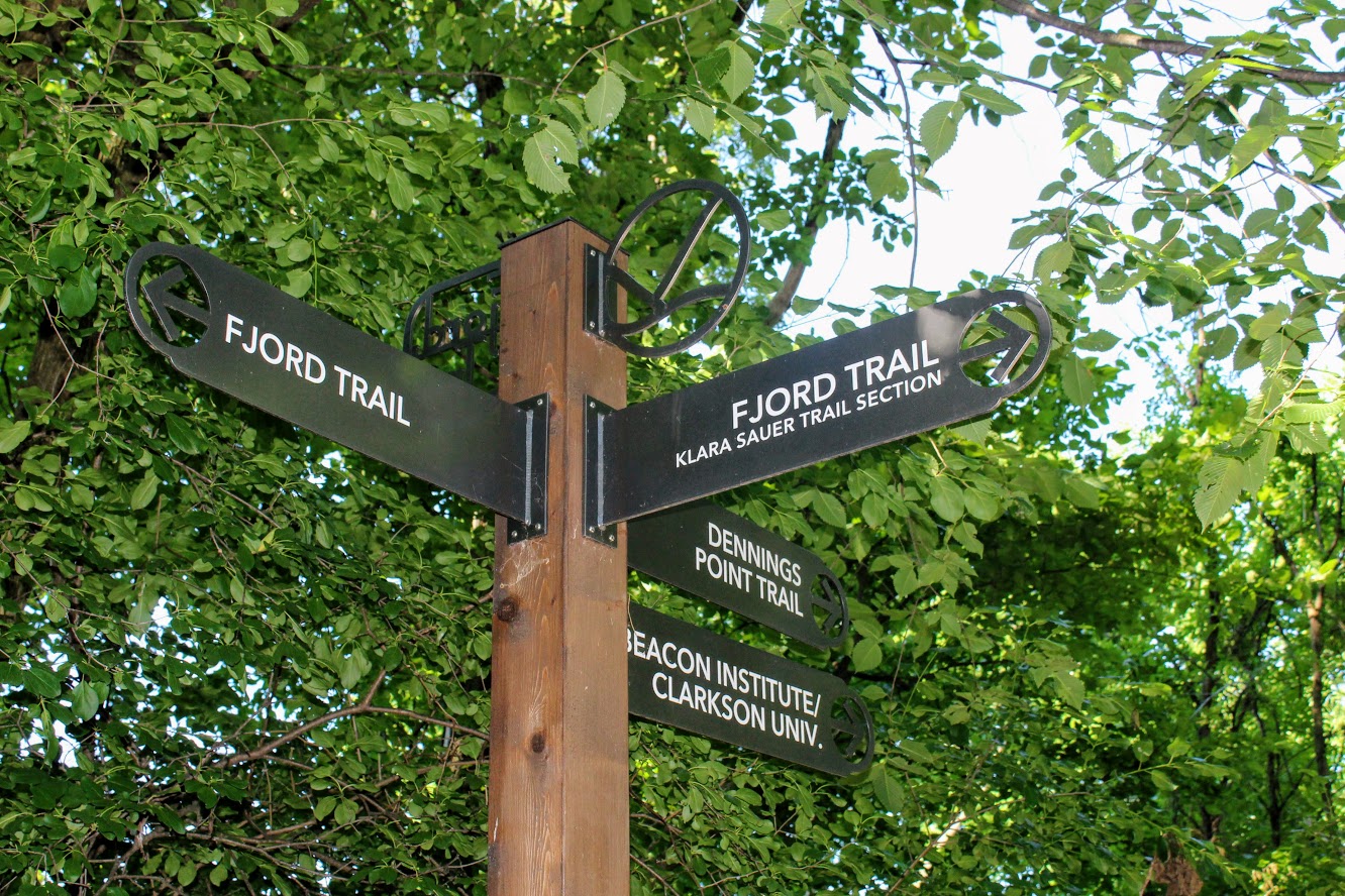
At the end of the Klara Sauer trail, we saw signs for the Dennings Point trail at the T intersection. Dennings Point trail was to our right. We did take a detour to our left on the Fjord trail to see the railroads tracks and caught a train going by under the bridge.
Railroads track if you veer on the trail to look for a train passing.
We circled back to follow the Dennings Point trail into the woods. We passed an abandoned building covered in tree branches where there was a brick factory many years ago. There will be a beach area path, where kayakers will stop for breaks, on your right. The beach front offered some impressive mountain views. Note, this trail is typically a loop but we reached an area that says to turn around due to the recent storm damage. We just turned around went back the same way.
when you run into this turn around the way you came!
views of kayakers and mOuntains.
views from the beach area of dennings point.
Great views.
This was a nice break from intense hiking. This was still great exercise. I would definitely come back. We walked about 2.8 miles and took us under 90 minutes. We got to see some great views. Long Dock Park is a great spot to kayak the Hudson River, do some fishing (may need a license), or just picnic with the friends and family.
love the views of the woods. trees down from storms on Dennings Point trail.

HIKING FOR DONUTS
A blog for the outdoors foodie enthusiast
Hi, I’m Mark. I live in Connecticut. I take new trips every chance I get. A good trip has a great hike, great food, and something fun to do. My goal is to search out new trips and share them to inspire others to try something new and exciting.
If you are looking for posts in a particular place, search by city or state here.
EXPLORE OTHER POSTS IN THE ARCHIVE
Archive
RECOMMENDED POSTS


MOST RECENT POSTS


See where I have been recently on Instagram. Follow @HIKINGFORDONUTS


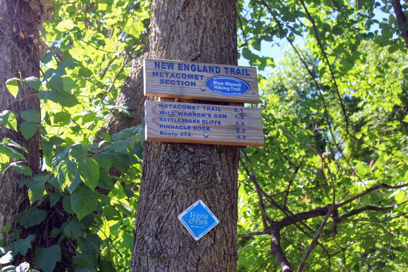
Rattlesnake Mountain to Pinnacle Rock via Metacomet Trail, Farmington, CT
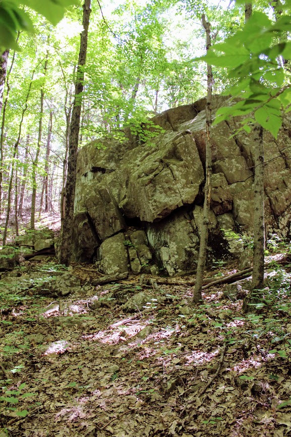
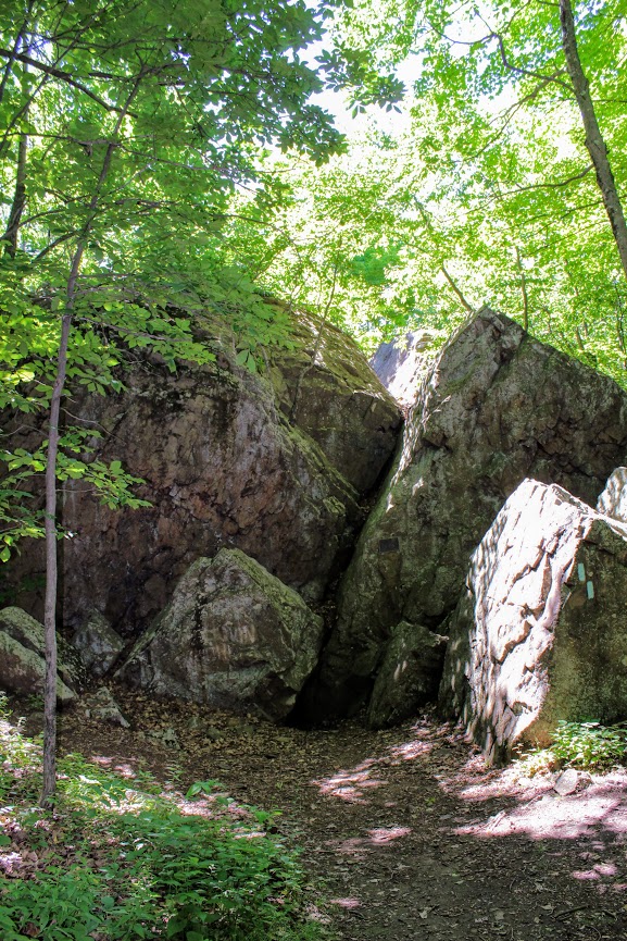
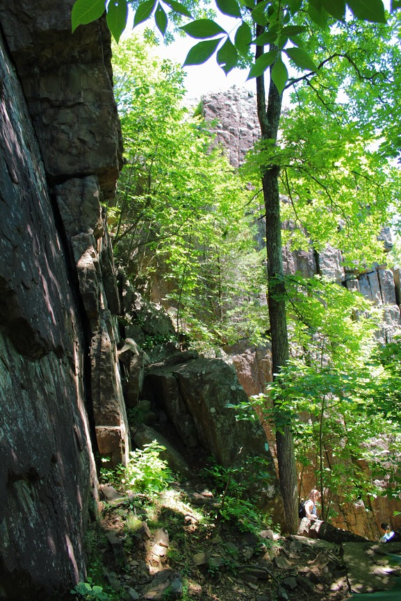
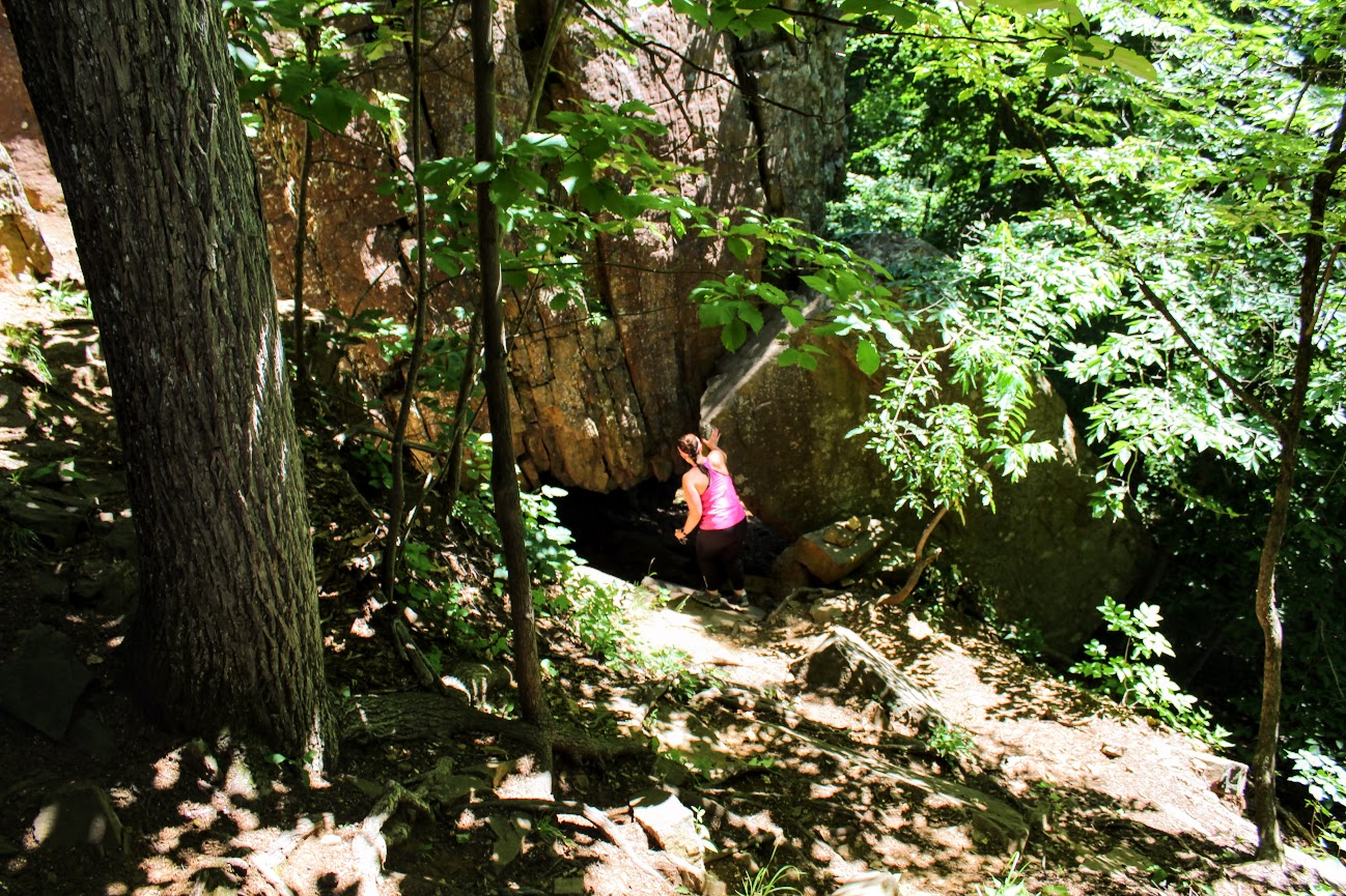
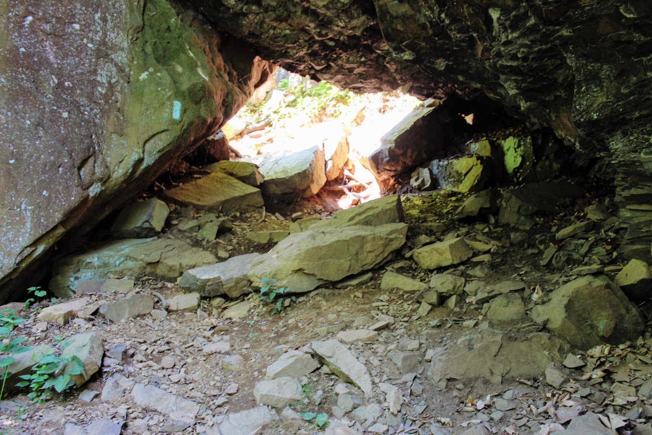
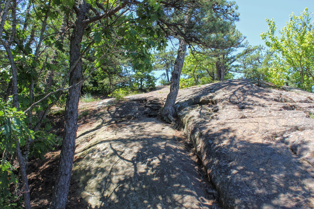
We headed on the trail to our left toward the Rattlesnake Cliffs. The trail starts out flat then begins to switchback up the side of the mountain. After a half mile in, the trail will ascend uphill and the terrain is rockier. We passed lots of large rock boulders as we got closer to the cliffs. This particular trail was very well-marked. We eventually came across the boulder rock cave known as Will Warren’s Den, which I later found out was a historical site.
Looking for a good hike in Connecticut? Well, I stumbled upon a hidden gem right under my nose. Rattlesnake Mountain to Pinnacle Rock trails are located in Farmington, CT and crosses over to Plainville, CT. This is part of the New England/Metacomet Trail. Finding the parking area can be tricky. There are 2 areas where you could start. Blue trail markers can be accessed from Pinnacle Street in Plainville. The GPS wasn’t picking this option up so my girlfriend and I chose to drive on RT 6 in Farmington. There is a small parking area on your right where the trail starts. If you GPS 200 Colt Hwy Farmington, CT 06032, that should find it.


Parking area off route 6.
From here, you can hike to the Rattlesnake Cliffs, which is a 2.6m out and back loop. Or you can continue to hike another 2 miles out and back to Pinnacle Rock. Thus, it will be 4.6m total for this hike.
HIKING FOR DONUTS
A blog for the outdoors foodie enthusiast
Hi, I’m Mark. I live in Connecticut. I take new trips every chance I get. A good trip has a great hike, great food, and something fun to do. My goal is to search new trips and share them to inspire others to try something new and exciting.
If you are looking for posts in a particular place, search by City or State here.
Explore other posts in the archive.
Archive
Start of trail
Once parked, we headed on the trail to our left toward the Rattlesnake Cliffs. The trail starts out flat then begins to switchback up the side of the mountain. After a half mile in, the trail will ascend uphill and the terrain is rockier. We passed lots of large rock boulders as we got closer to the cliffs. This particular trail was very well-marked. We eventually came across the boulder rock cave known as Will Warren’s Den, which I later found out was a historical site.
Not long after this, we reached the Rattlesnake Cliffs. Wow, what a spectacular view. I was absolutely stunned. On our left, we could see as far as the city of Hartford. And the sky was clear, so we could visibly see the biggest buildings in downtown Hartford. On our right, we could see the East and West Peak at Hubbard Park in Meriden and the Pinnacle Rock in Plainville. Great views all around. How did I not know this view existed? If this was all we did, I would have still ranked this hike very high on my list of CT hikes.

Views from Rattlesnake Cliffs.

hartford views to the left from the cliffs.

On your RIght from the cliffs.....

PANO VIEW FROM RATTLESNAKE MOUNTAIN CLIFFS.
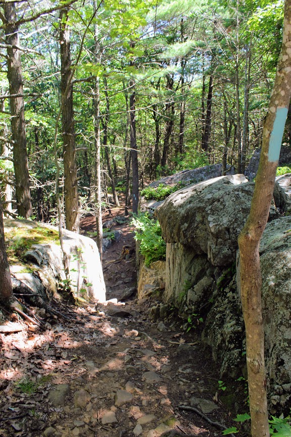
We hopped back on the blue trail down Pinnacle Rock and started making a steep descent. We witnessed other hikers take a wrong turn here by going straight down. We were able to stay on track. We continued hiking along the bottom of Rattlesnake Mountain and noticed a small tunnel formed by the rocks. We decided to climb through and found ourselves blue markers on the other side. Note, this is how you to get to Pinnacle Rock. There is a quite a bit of climbing on and over rocks for this section.
And, this trail is not as well-marked. There were areas we lost the blue markers. Sometimes the blue marker was faded on rocks and we didn’t notice until we got closer. If you do not come across blue after 5 min or so, I suggest turning around.

If you can't find blue markers, they may be on the rocks.
We reached the bottom and crossed an area under power lines that led us climbing up to the other side. We reached a dirt paved road and we saw a tree marked with blue and red. This took us to the final section before we reached Pinnacle Rock. You will be going uphill and start climbing the rock on your right to the peak of Pinnacle Rock.
The view of Pinnacle Rock is nice. But Rattlesnake Mountain has a higher wow factor. The view from Pinnacle Rock is not as appealing as you will see mostly homes. This is a big rock climber’s paradise and I did see a few people doing so. I will hike all day. But climbing isn’t for me.
RECOMMENDED POSTS


RECENT POSTS


See where I’ve been recently on Instagram, follow @HIKINGFORDONUTS

Crazy guy climbing up pinnacle rock.

VIew from the pinnacle Rock summit.

Top of pinnacle Rock with railings and rock seating to enjoy the views.
We headed back the same way we came. Took another peek from the Rattlesnake Cliffs before we headed back to the car. Such a great view. That is one of best views in CT. I was very impressed by this hike. This is easily one of my favorites now. It is very challenging. I would say it’s a moderate hike. Lots of different terrain and some climbing. Round trip is 4.6 miles but I feel like it’s closer to 5 miles. Definitely suggest hiking boots and a pack for this one. This took us about 3 hours. This is one New Englanders should add to their hiking list!
The review:
Rattlesnake MT to Pinnancle rock (farmington, CT), ~4.6m: 4.5 out of 5.

Old Furnace State Park, Killingly, CT
Old Furnace State Park is located in Killingly near Rhode Island. This is a great park for hiking, biking, and fishing. Exploring new areas is always fun, even if you get lost on the trails. Check out the blog to make sure you stay on the trails!


Scrolling through the list of the 2018 Sky’s Limit Hiking Challenge in Connecticut, I wanted to explore unknown parts of the state that would be new to me. I haven’t spent much time in the Windham County area, neighboring Rhode Island. I really had no idea where I was going and there was not too much info on the park online. But, I convinced my girlfriend to drive over an hour with a promise of beers and off we went.
Old Furnace State Park is located in Killingly, CT. You will find the park entrance off Route 6 via Route 395. Ross Pond State Park is fairly close so my GPS took me there instead. If yours does the same, just keep going past that until you can take a left onto South Frontage Road and the park will be there on your left. The blue-blazed trail of this park runs about 3 miles. This particular hiking challenge calls for 2 miles round trip until you reach the overlook from the cliffs at 200 feet over Half Hill Pond. With this view you get a great look of valley stretching into Rhode Island.

We finally found the parking lot and noticed there was mountain biking event going on. Apparently, this is a big mountain biking trail. I didn’t expect to see anyone. The hiking trail starts at the parking lot. I used the trail located at ct.gov here . The path instantaneously takes you into the woods.

As we began, we crossed a small brook that led us to crossing a small footbridge.


The trail was fairly wide open until we reached an unmarked section ducking through a brush of bushes. We found ourselves questioning our direction. Eventually, a blue marker did appear.


From here the ascent started to get steep. About a mile into the hike, we saw the path break into two. Unfortunately, we kept going straight and that was not correct and saw some brown marked trails.


Thus, we circled back and took the path to the left which was the ridge along the pond. And, finally we found ourselves at the cliffs overlooking Half Hill Pond. The pond was completely filled with water lilies.


We stopped here because the trail was pretty buggy and I didn’t think the rest of the trail would offer much. But if you want to continue, this will lead you down to the parking lot and boat ramp at Ross Pond to Squaw Rock Road where you turn around and come back. If you are not from the area, the directions to the park could be difficult and the trail itself has areas that should be marked better. The hike itself was not hard. I would rate it easy. I would bring bug spray and pay very close attention for the blue markers. Looks like a good area to fish and maybe kayak as well. I’m sure this is a nice spot for locals but one time is probably enough for me.
The Review
Old Furnace State Park, Blue Trail, Killingly, CT (~2m): 2.5 out of 5.

HIKING FOR DONUTS
A blog for the outdoors foodie enthusiast
Hi, I’m Mark. I live in Connecticut. I take new trips every chance I get. A good trip has a great hike, great food, and something fun to do. My goal is to search out new trips and share them to inspire others to try something new and exciting.
If you are looking for posts in a particular place, search by city or state here.
EXPLORE OTHER POSTS IN THE ARCHIVE
Archive
RECOMMENDED POSTS


MOST RECENT POSTS
See where I have been recently on Instagram. Follow @HIKINGFORDONUTS