


24 Hours in the Black Canyon at the Gunnison National Park
The Black Canyon of the Gunnison National Park is one of the least known national parks and that is a travesty. I admit, I wasn’t too familiar with this park myself. Located in western Colorado, the Black Canyon of the Gunnison did not gain National Park status until 1999, making it the second youngest national park in the U.S. The Black Canyon is named so because the walls are often covered in shadows making them appear black. These steep walls were formed over 1.7 billion years ago. Another awesome note on this park is that it contains 12 out of the 48 mile-long canyon of the Gunnison River.
For most national park or outdoors enthusiast, you want to experience as much as possible in your travels. Planning trips can be difficult and offer time restraints. Exploring most national parks you need anywhere from 3 days to two weeks. On my recent Colorado road trip, I planned for one day at the Black Canyon of the Gunnison National Park. There is a North and South Rim. This guide will be for the South Rim only. This rim is more developed and accessible. Can you explore the entire South Rim in 24 hours? The answer is yes. The best time to visit is April to November. We stayed in Montrose, which is about 15 minutes from the park. The downtown is pretty cool. Oh, and there is an amazing donut shop, Montrose Donut and Deli Shop. The best donuts I had in Colorado. Get the biscuit donut. I digress…..
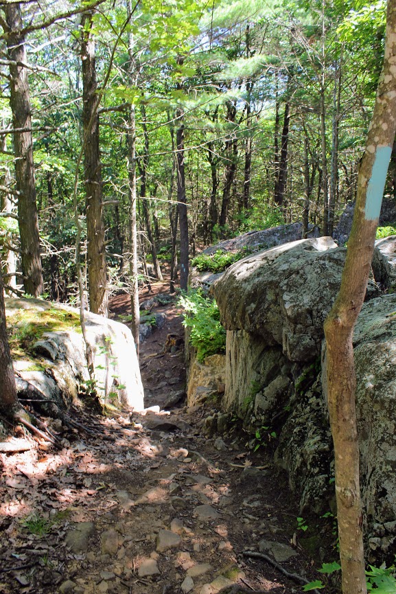
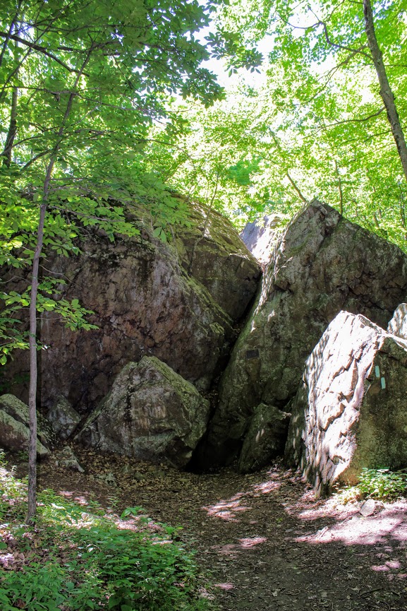
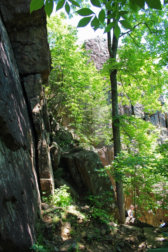
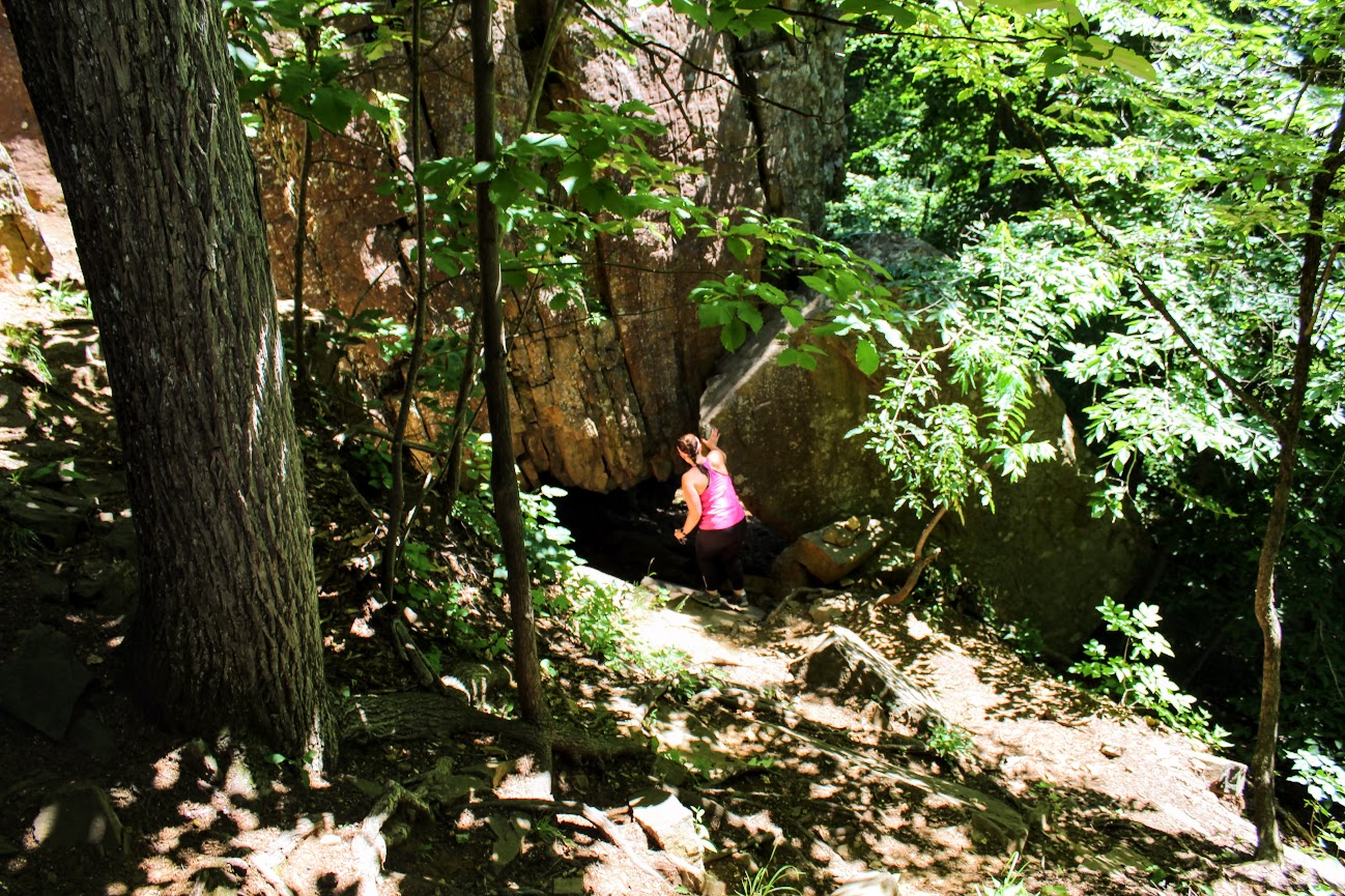
The South Rim is comprised of a modest 7 mile loop with 12 spectacular overlooks. I suggest to stop at each overlook. A lot of the overlooks do require walking a short trail but nothing strenuous. I would not miss out on Painted Wall, Cedar Point and Sunset View. There are multiple hikes on the South Rim. I went out of my way to do them all and to be honest, if you are stressing for time, skip the hikes. If camping is your thing, there are campgrounds here. Lastly, do NOT leave the park without driving down East Portal Road. I cannot recommend that enough. There is no crowd concern at this park. I counted maybe 30 people on a Friday in mid-May. I read the peak of the visitors stroll through in July. There are even less visitors on the North Rim, which is a 3 hour drive from the South Rim. However, the views are even more dramatic from the North Rim. The scenic driving was amazing. This park should be way more popular. The views were ridiculous. One of the best experiences I had in a national park. Here’s my guide to the South Rim of the Black Canyon of the Gunnison.
How to get there
Black Canyon’s South Rim is about 14 miles from Montrose and 63 miles from Gunnison. To get there from Montrose, travel 7 miles north on CO Highway 347 from the intersection with U.S. Highway 50 east of the city.
Viewpoints (South Rim)
The first viewpoint that visitors will see entering the park is Tomichi Point. This is right off the side of the road, no hiking needed. The second viewpoint, Gunnison Point, is located right behind the visitor center. A short path down some steps leads views of the canyon facing northwards. The view is more vivid than Tomichi Point and there is sneak peak of the ravine.


The next viewpoint is about two miles down the road at Pulpit Rock Overlook. There is a 134 yard trail leading to this area. The canyon really opens here with the river in view as it curves around a 90 degree bend. Cross Fissure View offers a different a unique look at the canyon. The river is not visible and most of the canyon is hidden. There is a view of overlapping ridges and crevasses from multiple angles. This viewpoint is a 357 yard walk.


Rock Point is a less traveled path at 294 yards. The longer the path the less visitors you will see. Devils Lookout is the longest path at 607 yards. This path goes right the edge of the rims for great views including the river and the valley. Both this and Rock Point lie above the narrowest part of the entire canyon.


Chasm View is one of those jaw dropping views. This is a very short path off the road above the steepest part of the whole canyon. Painted Wall View is almost adjacent to Chasm View. This may be the most well-known viewpoint. Painted Wall is the highest cliff in Colorado at 2,250 feet and a half mile across.


Every viewpoint from here on is a must see. Cedar Point is a 303 yard path overlooking the lower canyon. This is a spectacular view as you can see 1.5 miles of the river, flowing rapids, and some greenery below. Next up, Dragon Point offers very similar views. The widening ravine enclosing colorful waters of the river. This can be reached by a path of 300 yards.


Sunset View was one of my favorites. This is the westernmost viewpoint along the South Rim road. There is large parking area along with restrooms and picnic tables. This a great place to soak in amazing views of the canyon. This is the longest stretch of V shaped canyon. The last viewpoint is another mile down the road, High Point. There’s not much to this but you have to pass this in order to turn around and head back.


The Hikes (South Rim)
At the end of South Rim road, there is a parking lot where the Warner Point Trail begins. This a 1.5 mile out and back that takes you to the furthest overlook on the South Rim. The trail starts flat with views of green fields 1,000 feet above Bostwick Park. The trail begins to climb slowly then drops and ascends again before reaching the final viewpoint. This overlook offers stunning views of the San Juan Mountains, West Elk Mountains, Uncompahgre Valley, and the canyon. If you choose a hike in the South Rim, this would be the one I suggest.
Warner Point
The Oak Flat Loop begins by the visit center. The trail is narrow and traverses down a steep slope. This offers a peek at the landscape below the canyon’s rim. This is the most challenging hike in the South Rim with steep uphill and downhill portions. In total, the loop is 2 miles.
Rim Rock Nature Trail starts at the visit center or the Campground Loop C entrance. You can even hop on this trail from Tomichi Point. This relatively flat hike takes you along the rim of the canyon for views of the Gunnison River and sheer walls of the gorge below. This can be between 1-2 miles.


East Portal Road River Access
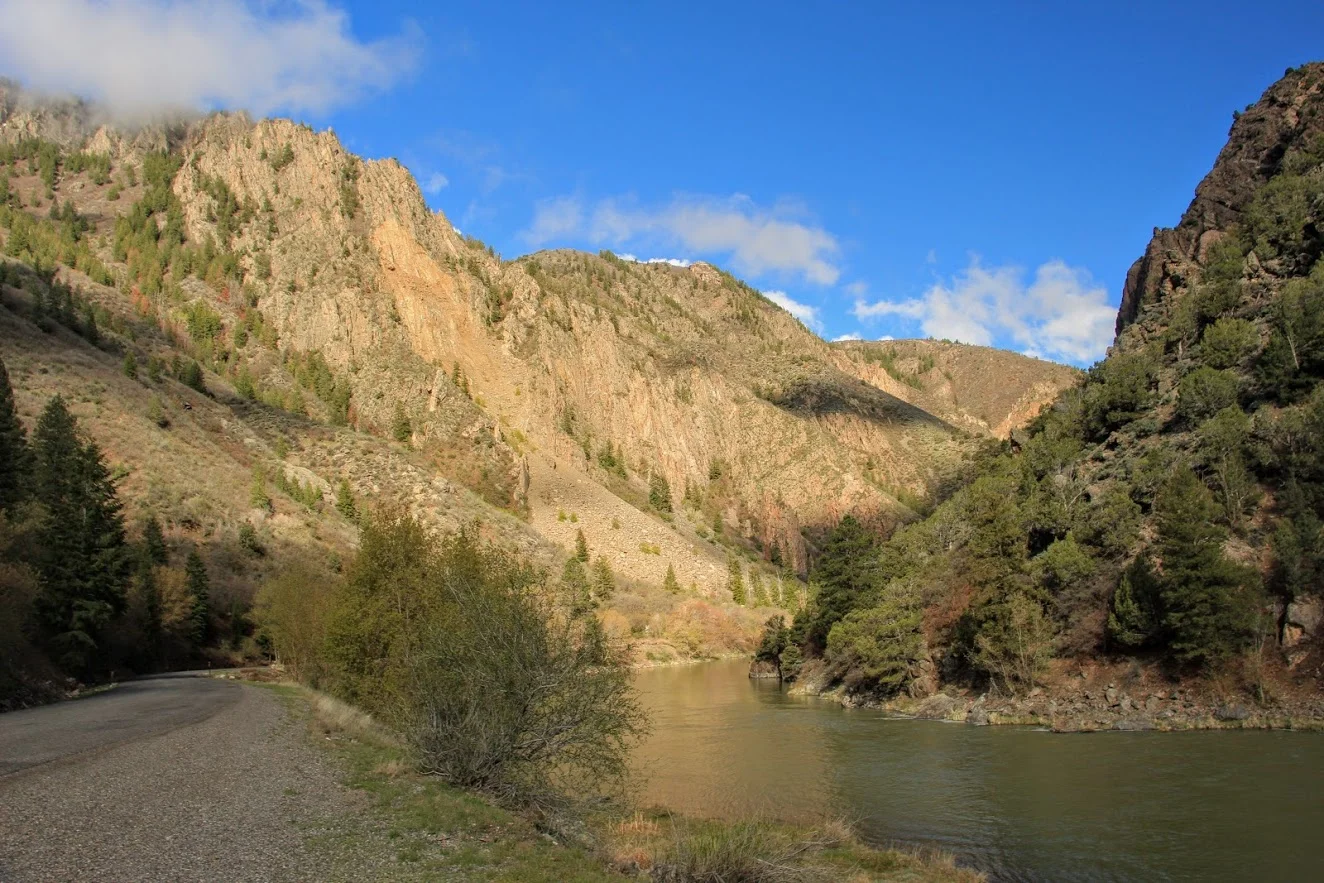
Located right at the entrance/exit to the park, you will see the access for East Portal Road. This is a 5 mile road with a significant decline (16% grade) with hairpin turns taking your car to the base of Black Canyon. This is the only way to get down into the canyon. Once arriving at the bottom, the views from down below are gorgeous. The picturesque surroundings of the beautiful lake and the cliff walls of the canyon from up above are majestic. By far the coolest experience I had in the park. I was just in awe. I read a lot of things online and it made it sound dramatic and dangerous to drive down. Any car/van can handle it. Vehicles with an overall length (including trailer) greater than 22 feet are prohibited. Trailers may be left unhitched and left at a parking area at the campground entrance. This road is closed in the winter. Just be smart about driving down. It took us about 30 minutes. This is a bucket list type event. Don’t chicken out!
The drive down into the canyon.


HIKING FOR DONUTS
Hi, I’m Mark. I live in Connecticut. I take new trips every change I get. A good trip has a great hike, great food, and something fun to do. My goal is to search out new trips and share them to inspire others to try something new and exciting.
If you are looking for posts in a particular place, search City or State here.
SEE OTHER POSTS IN ARCHIVE
Archive
RECOMMENDED POSTS


RECENT POSTS


See the latest on Instagram and follow @HIKINGFORDONUTS


Elephant Rocks State Park
Elephant Rock State Park
Trail Description: Located in Southeast Missouri, Elephants Rocks State Park has a unique attraction. The trail will lead you to large granite boulders which resemble a train of pink circus elephants.
Trail Info:
Where: Elephant Rocks State Park, Belleview, MO Distance: 1.4 miles (1 hour or until you are done exploring) Difficulty: Easy Trail Type: Out and Back Features: Boulders, Water, Quarry
How to get there:
The park was easy to find via GPS. However, you may lose cell signal nearby so make sure your map is up already. Here’s the address to put in your GPS:
7406 MO-21, Belleview, MO 63623
Hiking Tips:
This is a very popular destination. Prepare for crowds.
The Engine House Ruins Trail is less crowded and worth hiking.
The Hike
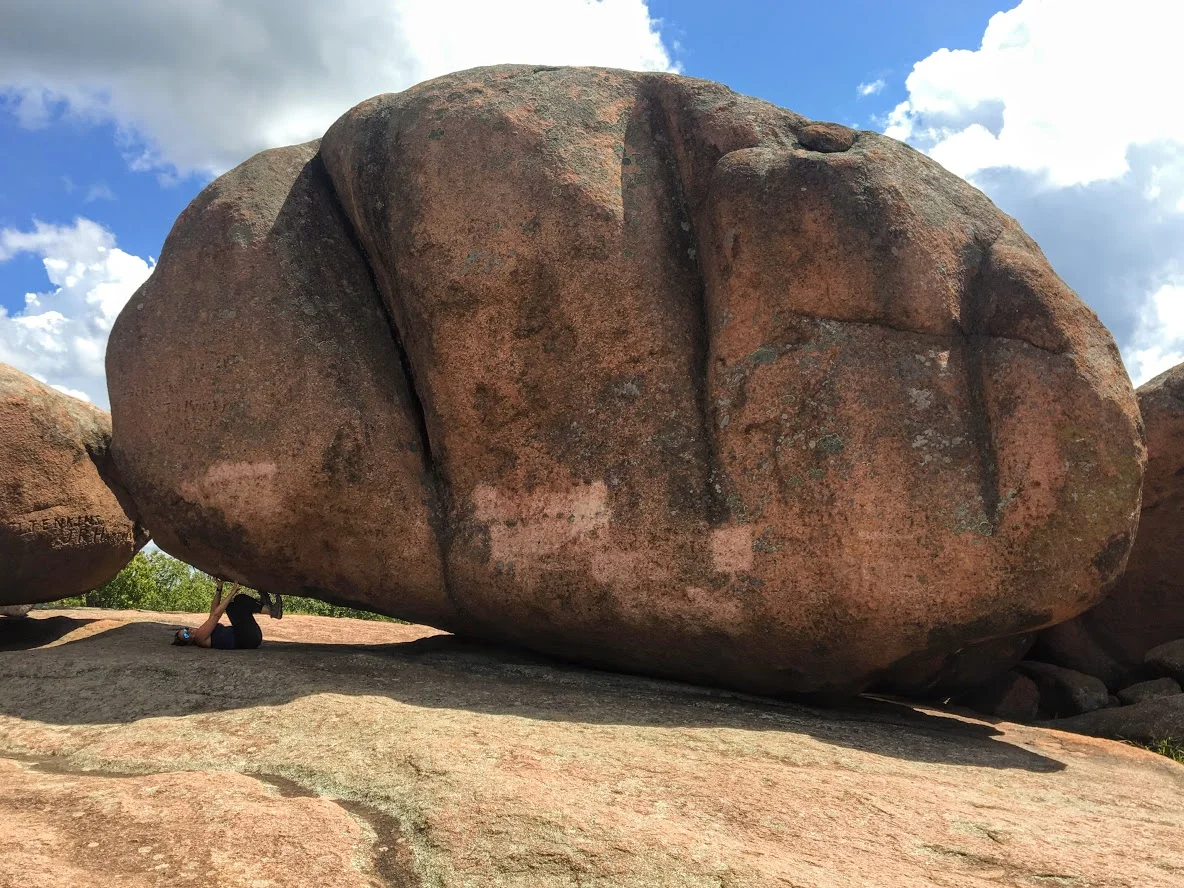
My trip to Missouri continued to mystify my original thoughts of the state. Prior to my visit to St. Louis, I stumbled upon online Elephant Rocks State Park. The main attraction for this park is there is the line of giant, 1.5 billion year old granite boulders that stand end-to-end, like a train of circus elephants. The pics looked intriguing online.This is a 2 hour drive south from St. Louis. I wasn’t sure if it was worth the drive. However, it just so happens, I chose another hike nearby and figured why not throw this in afterwards. Smart decision, always go all in on exploring in new areas. This park did not disappoint me.
Park entrance sign.
Elephant Rocks State Park is located in the St. Francois Mountains in Belleview, Missouri. The park was easy to find via GPS. Being labor day weekend, the park was packed. There is ample parking for lots of people. Picnic tables are scattered before the trail begins. There are bathroom facilities. Families can have picnics, enjoy the outside, and take their kids for some fun exploring the boulders. This is definitely a tourist hotspot.
Parking area , Boulders, And aMerica.
There are two trails to explore through the park. The main trail is called the Braille Trail. This is a self-guiding trail that winds among the rocks and takes you throughout the park. This is paved and accessible for people with disabilities, physical or visual. At different areas of the trail, we noticed interpretive signage with information of the landscape and the history of the park. The trail is one mile and marked as red. There are various viewpoints and we kept walking off the trail to explore more of the boulders.
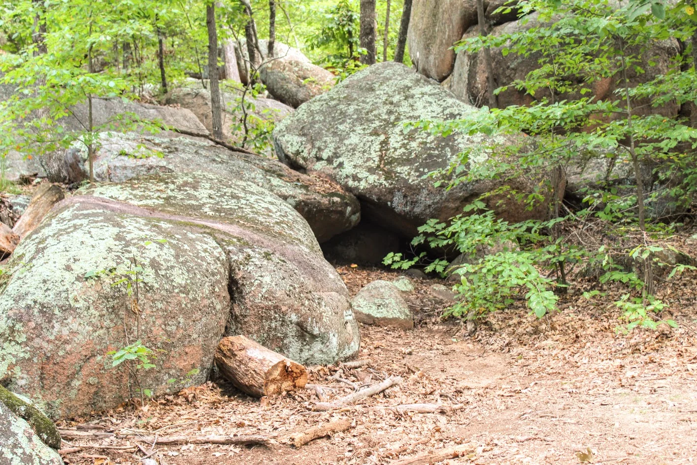


Once we reached the old engine ruin house, we noticed the blue marker trail to our left for the Engine House Ruins Trail. The terrain is more rugged but still easy. This added another 0.4 miles, which leads around the back side of the old quarry that connected us back to the Braille Trail. We followed the blue arrows on the trees and did our thing. There is some fun climbing that can be done on this section. Along with views beyond the bluff. Not many people tend to add this section of the hike so it was a nice break from the crowd.
old engine ruin house


pretty cool, this is in the middle of the park.
views from the top.
taking it all in. the best part.
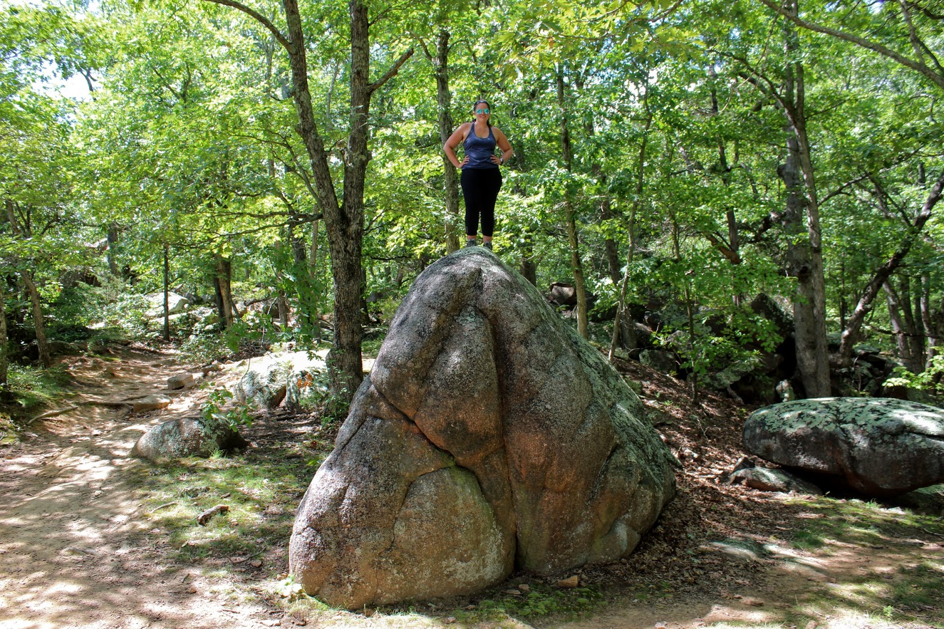
After connecting back to the Braille Trail, we slithered through the rocks and made our way to the giant boulders. Once I got the full view, I understood where the name of the park was derived. I could see the elephant like figure. Due to the crowd, it was tough to capture how breathtaking it was in person. Everyone was climbing between the boulder and snapping selfies. Children are fascinated by the size of the boulders as they enjoyed climbing. I found myself scaling the boulders and didn’t want to leave!


Trying to get a good picture amongst the crowd.
The elephant’s trunk rock.
rocks.
more exploring.
We ended up spending about an hour and half enjoying the park. That is about all you need. Very easy, go at your own pace and enjoy type of hike. And, if you want, you can throw in some climbing. When I booked a trip to St. Louis, did I anticipate incredible landscapes and geological boulders in the heart of Missouri? Heck no. But I am sure glad I got to experience them. The fun part about traveling is finding gems like Elephant Rock State Park.
Wow so strong!
Well….hello there. Just doin’ some climbing.

HIKING FOR DONUTS
A blog for the outdoors foodie enthusiast
Hi, I’m Mark. I live in Connecticut. I take new trips every chance I get. A good trip has a great hike, great food, and something fun to do. My goal is to search out new trips and share them to inspire others to try something new and exciting.
If you are looking for posts in a particular place, search by city or state here.
EXPLORE OTHER POSTS IN THE ARCHIVE
Archive
RECOMMENDED POSTS
MOST RECENT POSTS
See where I have been recently on Instagram. Follow @HIKINGFORDONUTS

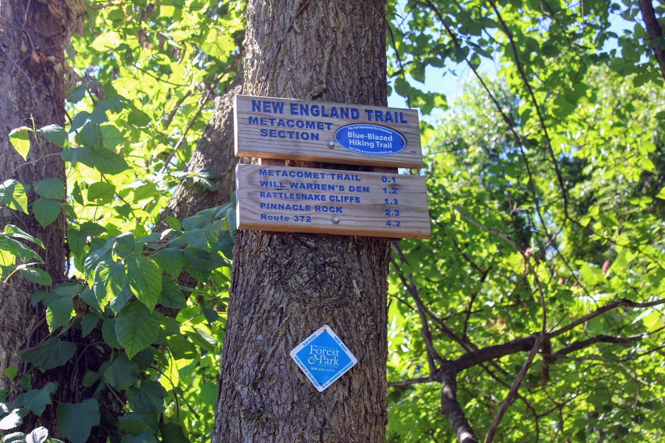
Rattlesnake Mountain to Pinnacle Rock via Metacomet Trail, Farmington, CT
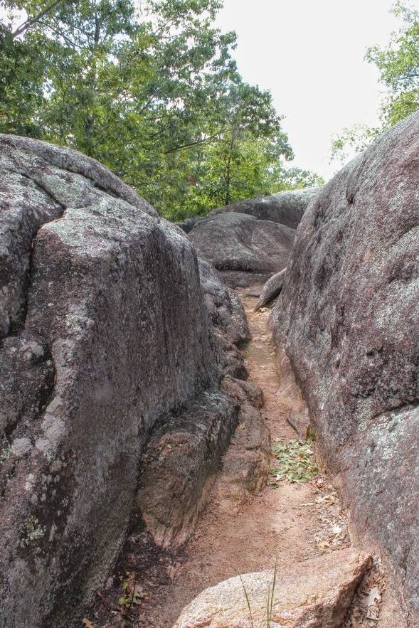
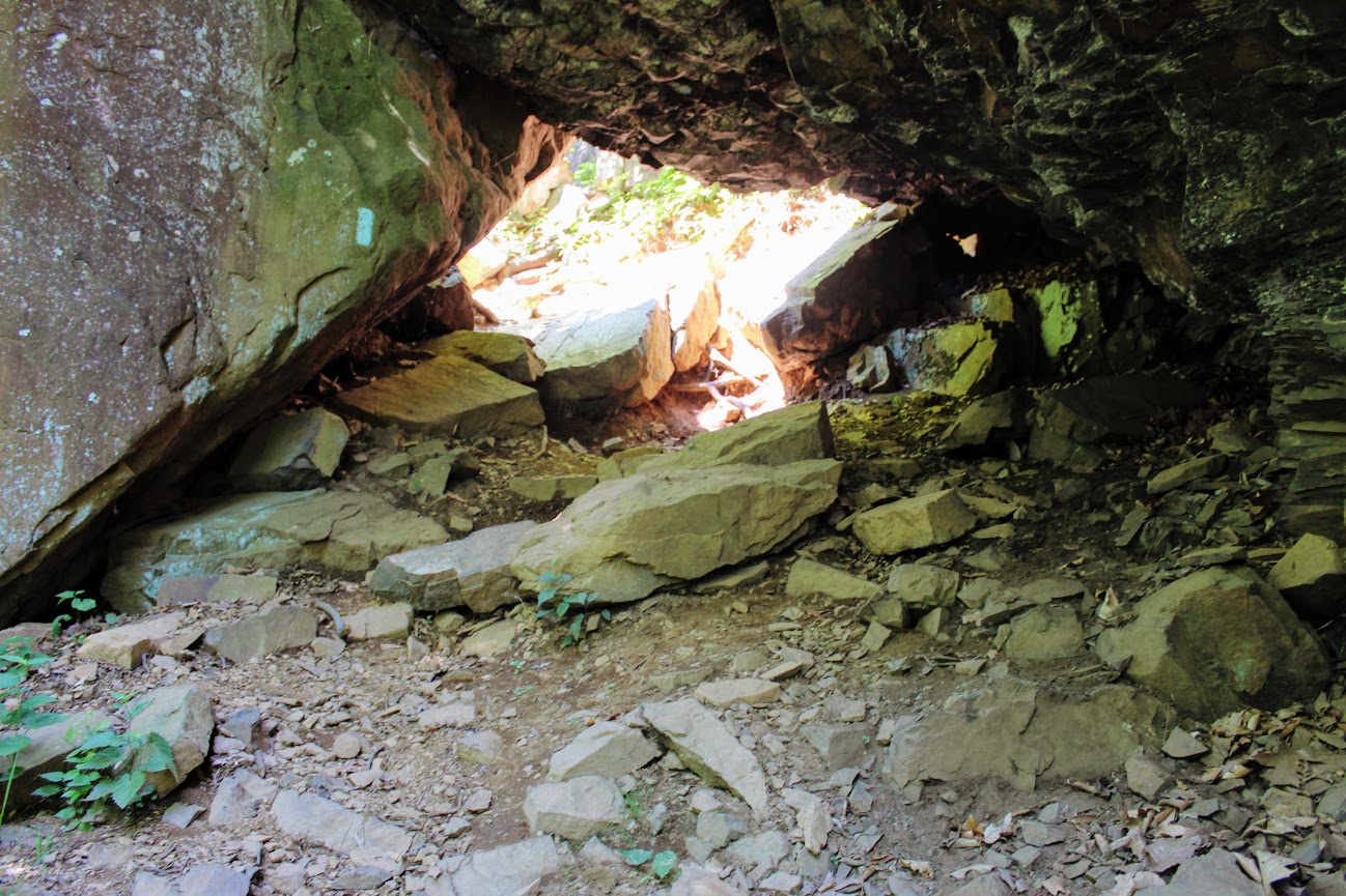
We headed on the trail to our left toward the Rattlesnake Cliffs. The trail starts out flat then begins to switchback up the side of the mountain. After a half mile in, the trail will ascend uphill and the terrain is rockier. We passed lots of large rock boulders as we got closer to the cliffs. This particular trail was very well-marked. We eventually came across the boulder rock cave known as Will Warren’s Den, which I later found out was a historical site.
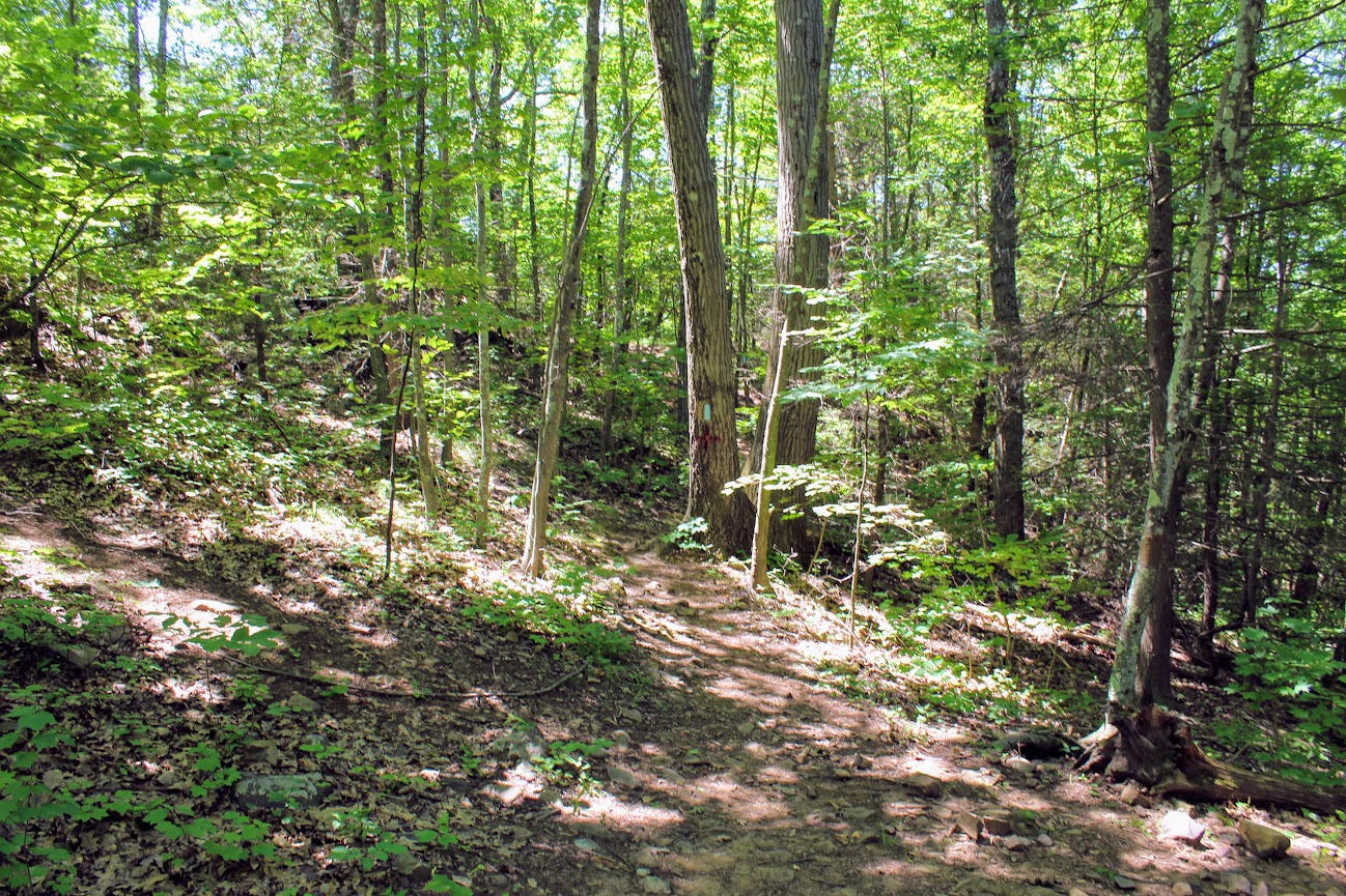
Looking for a good hike in Connecticut? Well, I stumbled upon a hidden gem right under my nose. Rattlesnake Mountain to Pinnacle Rock trails are located in Farmington, CT and crosses over to Plainville, CT. This is part of the New England/Metacomet Trail. Finding the parking area can be tricky. There are 2 areas where you could start. Blue trail markers can be accessed from Pinnacle Street in Plainville. The GPS wasn’t picking this option up so my girlfriend and I chose to drive on RT 6 in Farmington. There is a small parking area on your right where the trail starts. If you GPS 200 Colt Hwy Farmington, CT 06032, that should find it.


Parking area off route 6.
From here, you can hike to the Rattlesnake Cliffs, which is a 2.6m out and back loop. Or you can continue to hike another 2 miles out and back to Pinnacle Rock. Thus, it will be 4.6m total for this hike.
HIKING FOR DONUTS
A blog for the outdoors foodie enthusiast
Hi, I’m Mark. I live in Connecticut. I take new trips every chance I get. A good trip has a great hike, great food, and something fun to do. My goal is to search new trips and share them to inspire others to try something new and exciting.
If you are looking for posts in a particular place, search by City or State here.
Explore other posts in the archive.
Archive
Start of trail
Once parked, we headed on the trail to our left toward the Rattlesnake Cliffs. The trail starts out flat then begins to switchback up the side of the mountain. After a half mile in, the trail will ascend uphill and the terrain is rockier. We passed lots of large rock boulders as we got closer to the cliffs. This particular trail was very well-marked. We eventually came across the boulder rock cave known as Will Warren’s Den, which I later found out was a historical site.
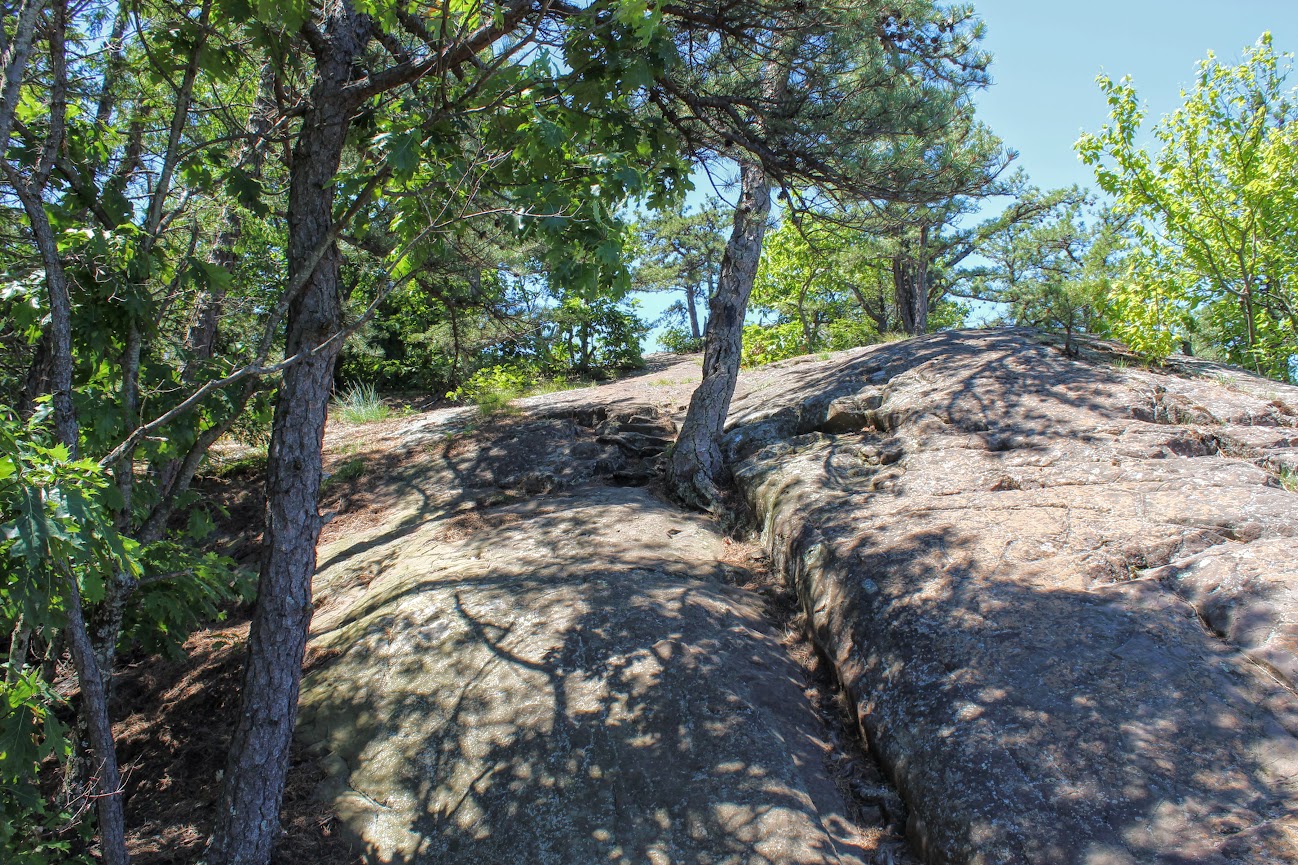
Not long after this, we reached the Rattlesnake Cliffs. Wow, what a spectacular view. I was absolutely stunned. On our left, we could see as far as the city of Hartford. And the sky was clear, so we could visibly see the biggest buildings in downtown Hartford. On our right, we could see the East and West Peak at Hubbard Park in Meriden and the Pinnacle Rock in Plainville. Great views all around. How did I not know this view existed? If this was all we did, I would have still ranked this hike very high on my list of CT hikes.

Views from Rattlesnake Cliffs.

hartford views to the left from the cliffs.

On your RIght from the cliffs.....

PANO VIEW FROM RATTLESNAKE MOUNTAIN CLIFFS.
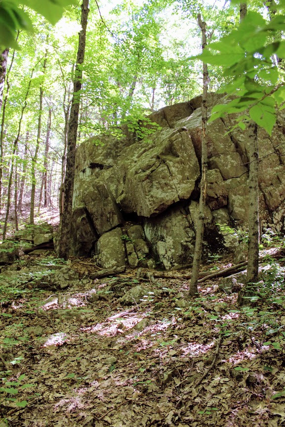
We hopped back on the blue trail down Pinnacle Rock and started making a steep descent. We witnessed other hikers take a wrong turn here by going straight down. We were able to stay on track. We continued hiking along the bottom of Rattlesnake Mountain and noticed a small tunnel formed by the rocks. We decided to climb through and found ourselves blue markers on the other side. Note, this is how you to get to Pinnacle Rock. There is a quite a bit of climbing on and over rocks for this section.
And, this trail is not as well-marked. There were areas we lost the blue markers. Sometimes the blue marker was faded on rocks and we didn’t notice until we got closer. If you do not come across blue after 5 min or so, I suggest turning around.

If you can't find blue markers, they may be on the rocks.
We reached the bottom and crossed an area under power lines that led us climbing up to the other side. We reached a dirt paved road and we saw a tree marked with blue and red. This took us to the final section before we reached Pinnacle Rock. You will be going uphill and start climbing the rock on your right to the peak of Pinnacle Rock.
The view of Pinnacle Rock is nice. But Rattlesnake Mountain has a higher wow factor. The view from Pinnacle Rock is not as appealing as you will see mostly homes. This is a big rock climber’s paradise and I did see a few people doing so. I will hike all day. But climbing isn’t for me.
RECOMMENDED POSTS


RECENT POSTS
See where I’ve been recently on Instagram, follow @HIKINGFORDONUTS

Crazy guy climbing up pinnacle rock.

VIew from the pinnacle Rock summit.

Top of pinnacle Rock with railings and rock seating to enjoy the views.
We headed back the same way we came. Took another peek from the Rattlesnake Cliffs before we headed back to the car. Such a great view. That is one of best views in CT. I was very impressed by this hike. This is easily one of my favorites now. It is very challenging. I would say it’s a moderate hike. Lots of different terrain and some climbing. Round trip is 4.6 miles but I feel like it’s closer to 5 miles. Definitely suggest hiking boots and a pack for this one. This took us about 3 hours. This is one New Englanders should add to their hiking list!
The review:
Rattlesnake MT to Pinnancle rock (farmington, CT), ~4.6m: 4.5 out of 5.