


Sam’s Point and Verkeerderkill Falls Trail, New York
Trail Description: Sam’s Point Reserve offers panoramic views of the Shawangunk Ridge along with exploring a 180 foot waterfall.
Trail Info:
Where: Ellenville, NY Distance: 6.2 miles (3-4 hours) Difficulty: Moderate Trail Type: Out and Back Features: Views, Mountains, Valley, Waterfall, Ice Caves (optional)
How to get there:
400 Sams Point Rd Cragsmoor, NY 12420
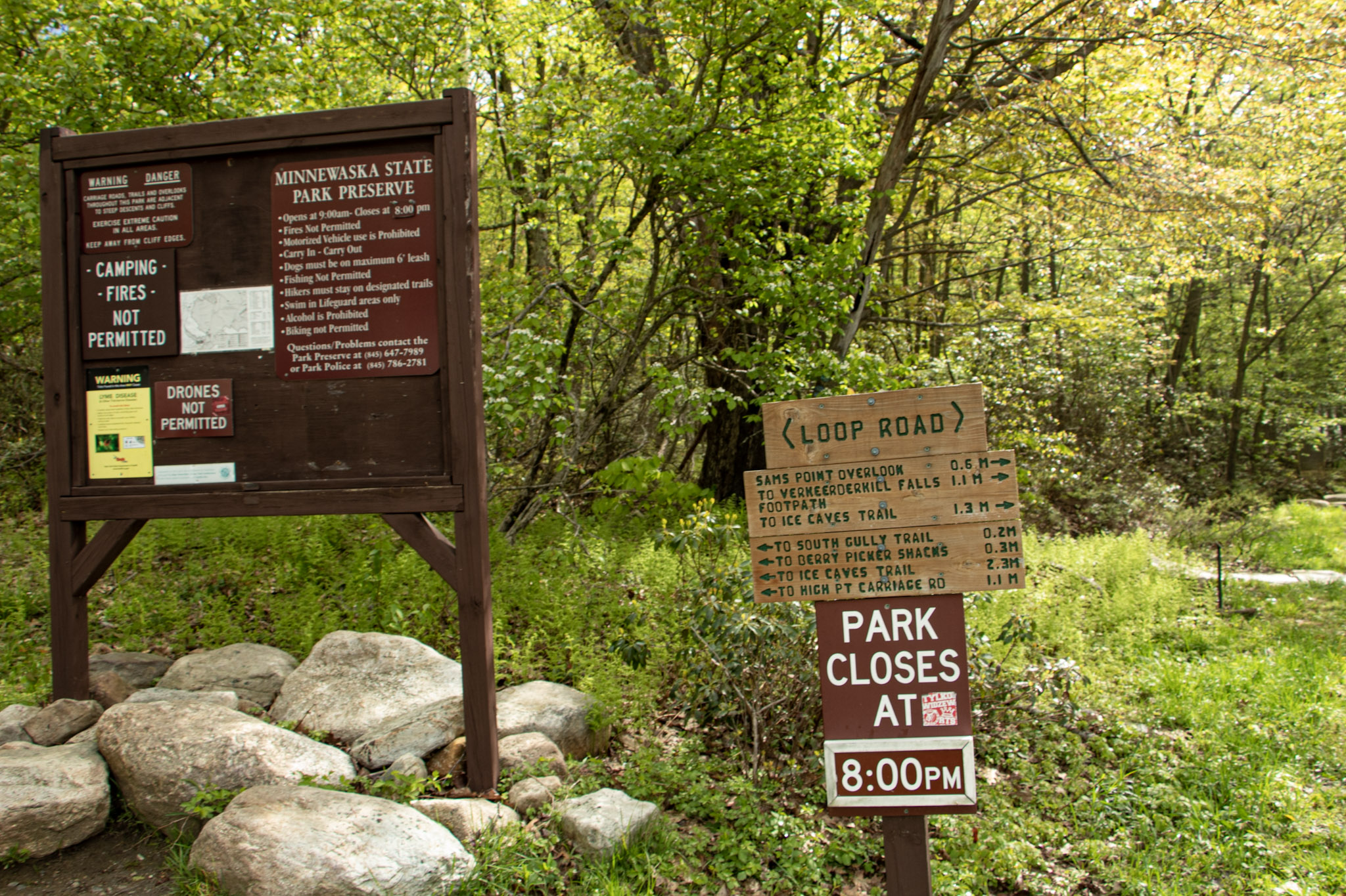
This will take you right to the parking lot. Parking costs $10. There is a kiosk to pay near the visitor center.
Hiking Tips
Parking lot opens at 9am. If parking lot is full, you have to wait until someone leaves. Plan accordingly as parking is limited.
Did not include the Ice Caves on this day. Would add an additional 1.1 miles to the hike.
Use bug spray for ticks and sunscreen when sun is out. Most of the hike is the open.
The Hike
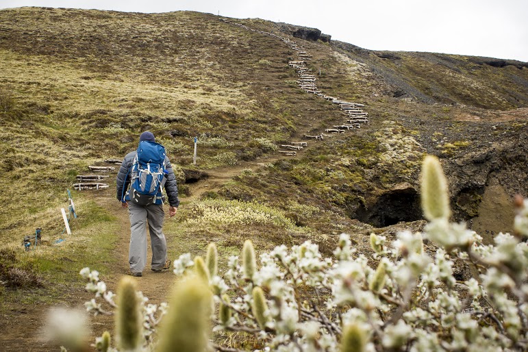
The next hike in the Hudson Valley to check off my list is Sam’s Point. I anticipated great views but there was much more to this hike than I thought. Until I researched recently, I didn’t realize a waterfall was part of the hike. Veerkeerderkill Falls is the tallest waterfall in the Shawangunk Mountains at 180 feet. And, there are even ice caves on this trail. Sam’s Point is part of Minnewaska State Park, but the parking is located at a different location than the park’s entrance. We left early in time to beat the 9am opening and there were already quite a few cars in line. Once parked, there is a kiosk to pay for parking and there is a visitor center at this lot, where there are 2 restrooms.
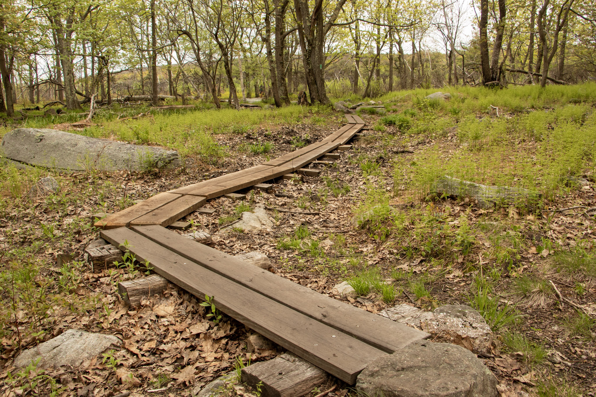
After packing up our gear, we headed toward the trailhead. Walking around the gate took us on the main trail, Loop Road. There is an intersection almost immediately to choose from, veering right will take you to Sam’s Point. The other option is the Huckleberry Pickers’ shacks. Tempting but we will pass on that. Heading up the fragmented road, there is a slight incline as altitude gains up the switchbacks. In short time, we came up to a massive rock with a cliff above, which we learned later is the top of Sam’s Point. At about a half mile, the first view was on our left on top of a rocky platform.
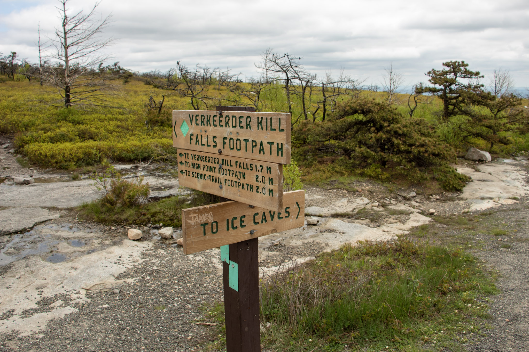
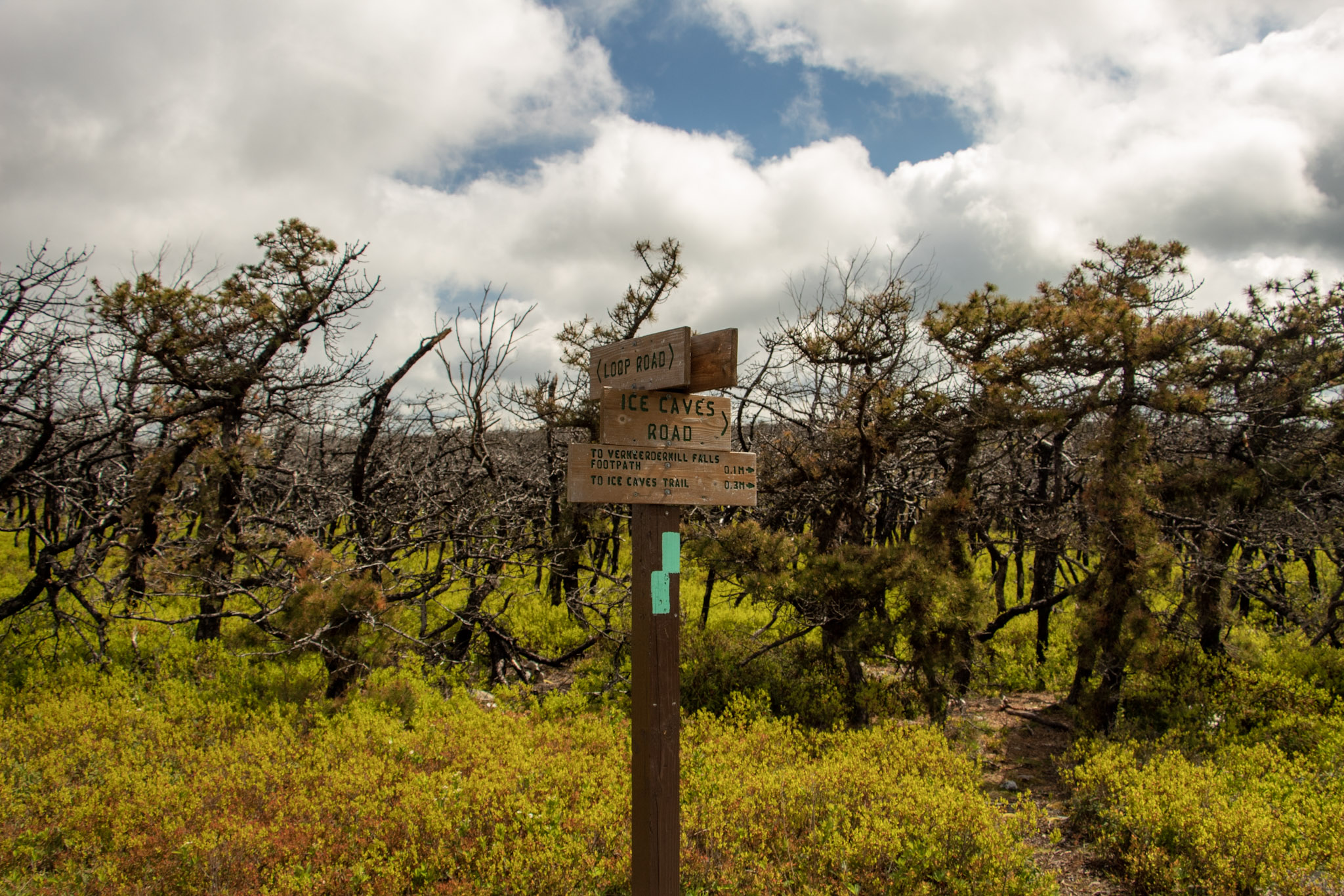
Loop Road will even out and we had an option to keep straight toward the waterfall or turn left toward the short trail to check out the view from Sam’s Point. It was pretty crowded and I just wanted to beat everyone to the waterfall so we saved Sam’s Point for the end. A short distance off Loop Road, we saw signs on our left to head toward Verkeerderkill Falls on the aqua blazed trail. If you wanted to check out the Ice Caves, continue straight from here. We couldn’t fit those in today, so we headed toward the waterfall.
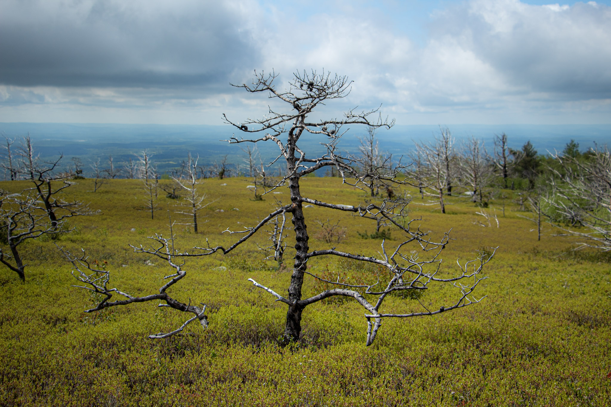
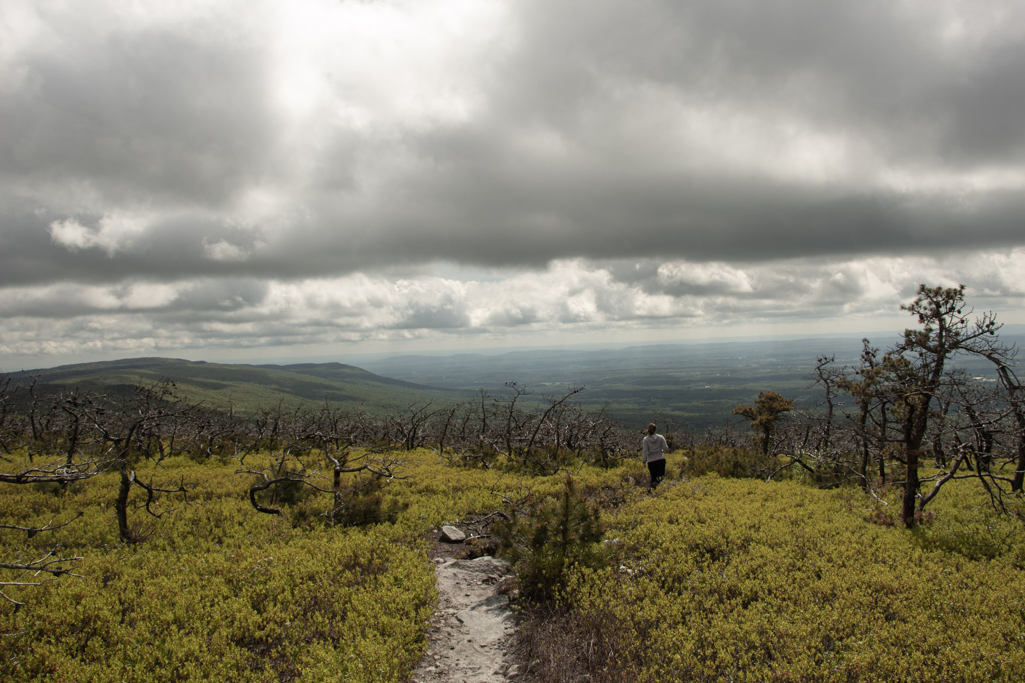
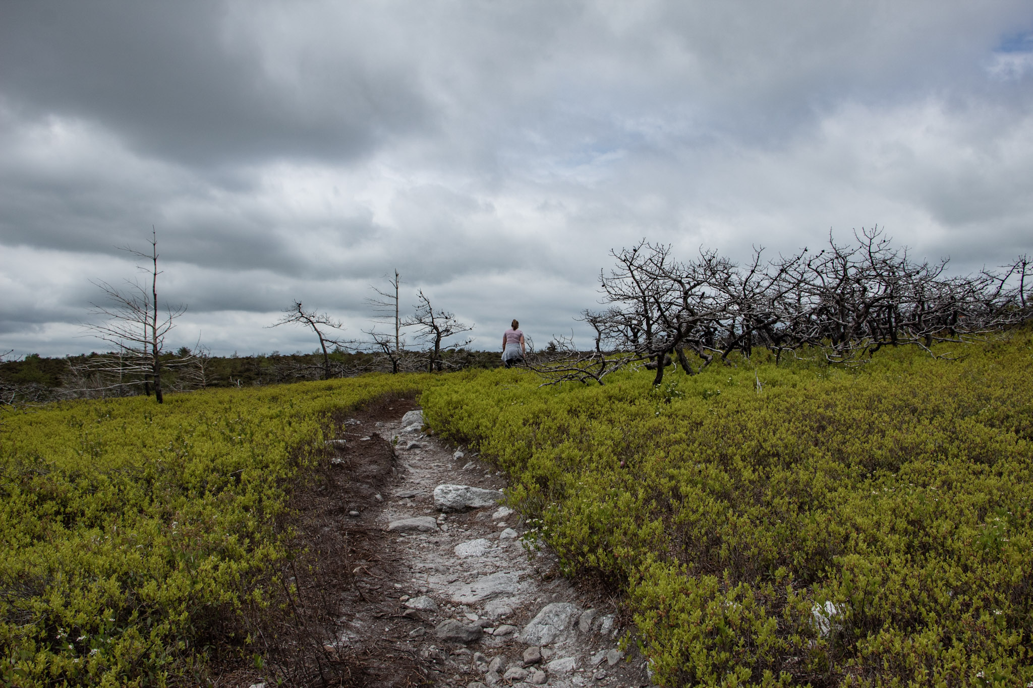
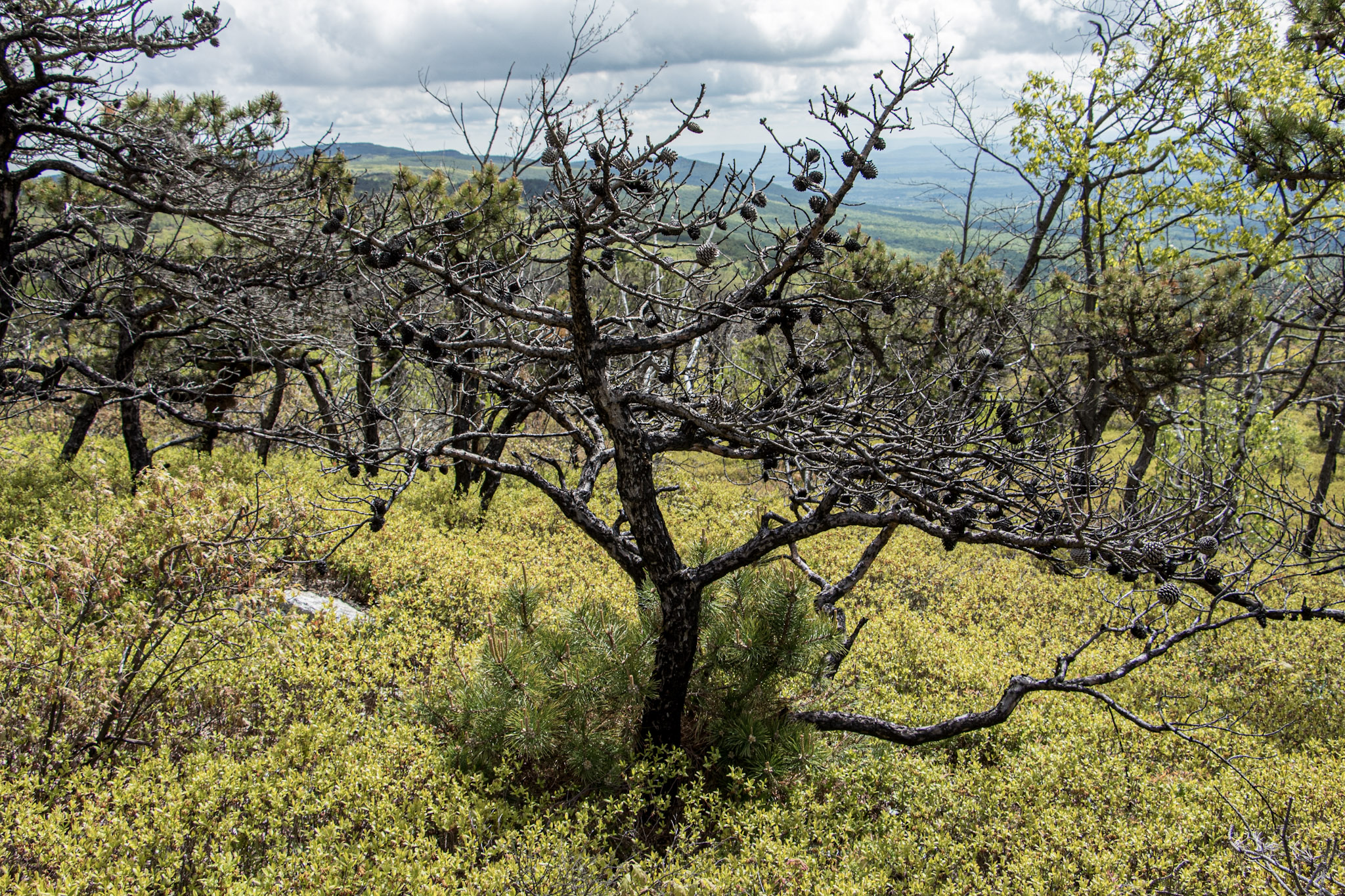
I did not anticipate the cool landscape we would be hiking through on this hike. Strolling along the trail you will the see rare dwarf pine trees offering very unique scenery. In addition, there are wide views of the Northern Shawangunk Ridge along this part of the trail. The trail will head downhill slightly. This isn’t terrible but the fact that it gets rockier, makes it a bit more challenging. As you get closer to the waterfall, there is a steep descend down.
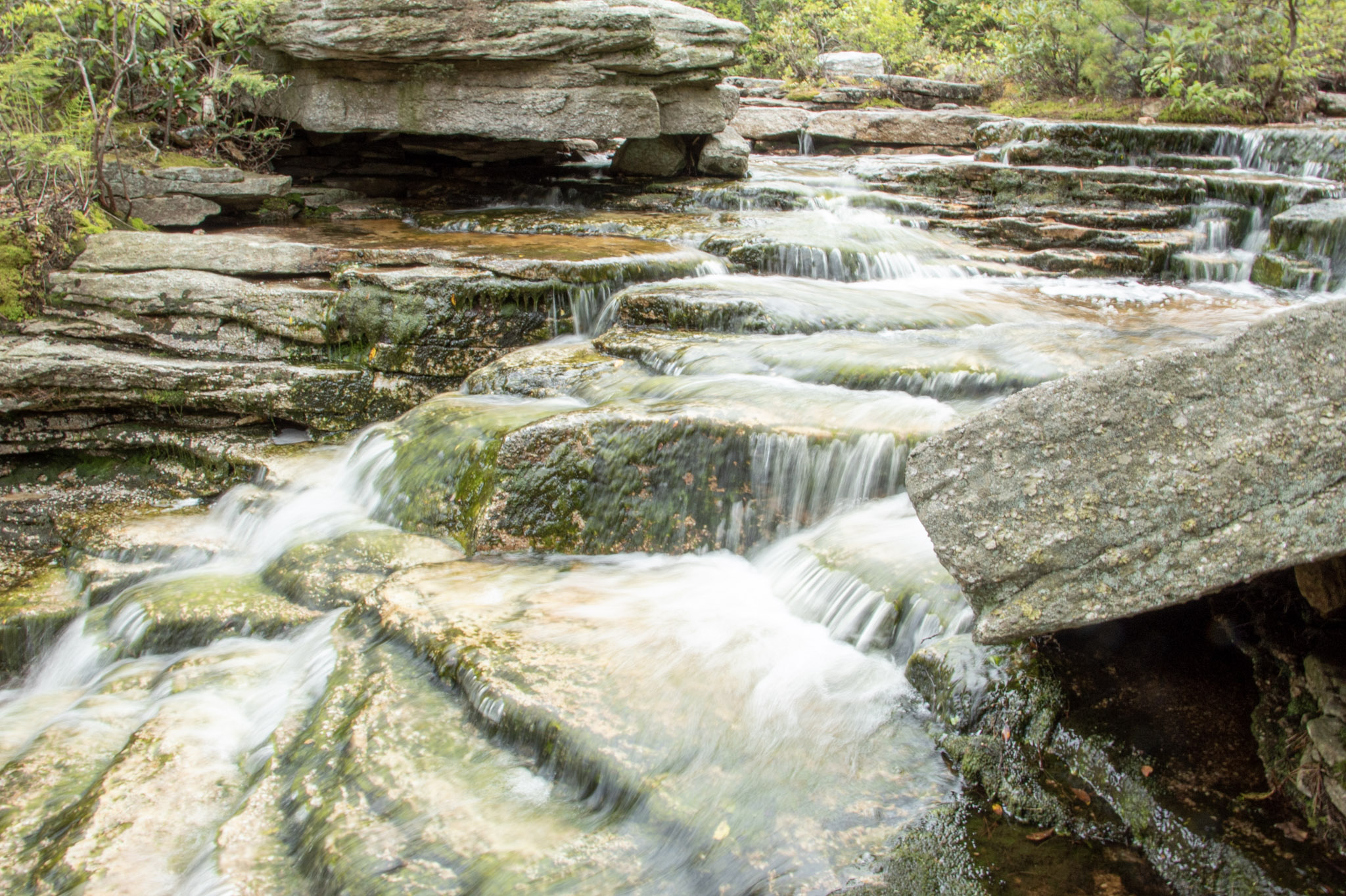
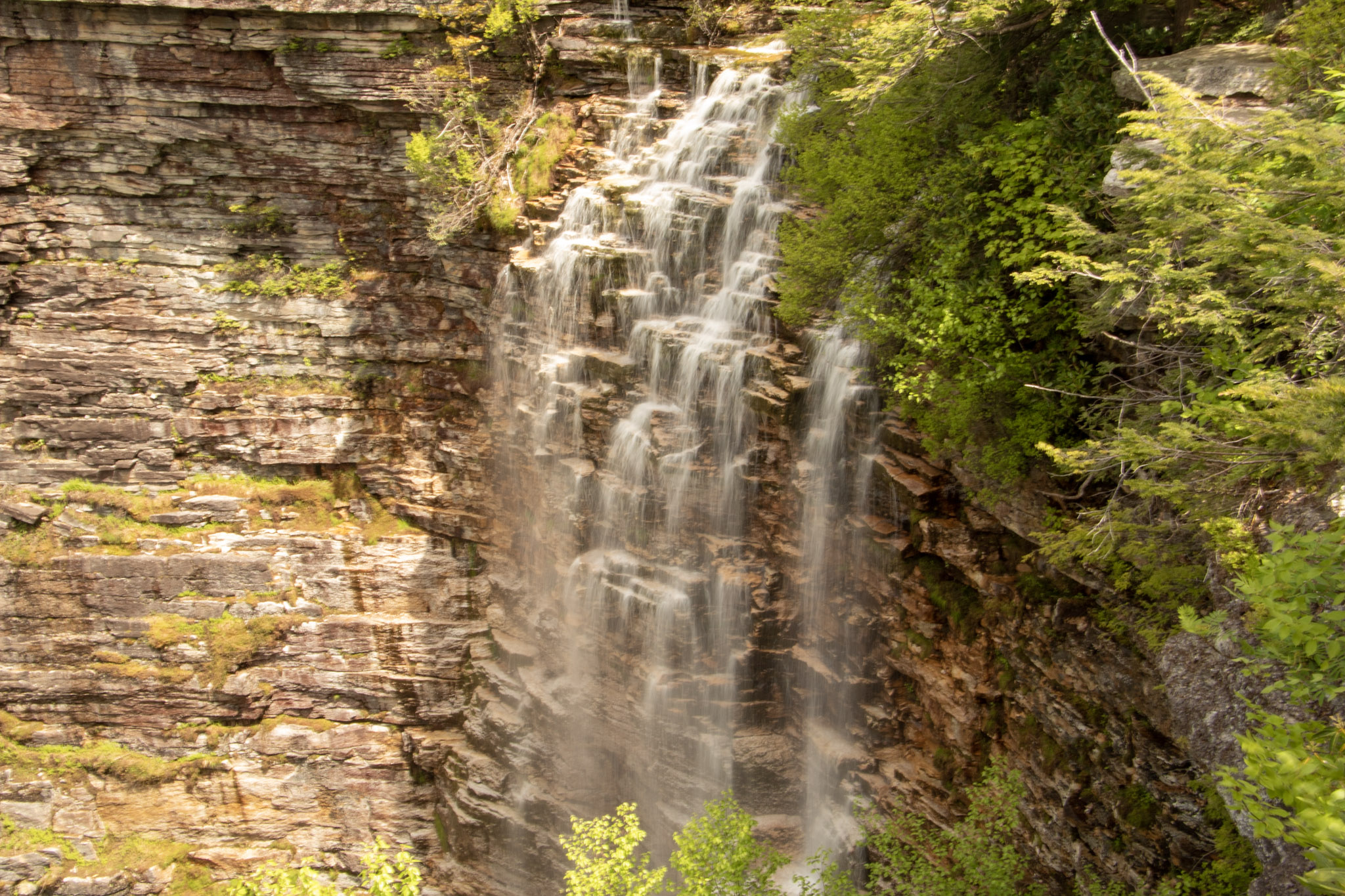
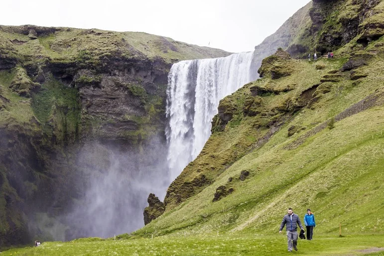
Eventually, we came upon a stream above the falls. Depending how high the water is on a given day, you may have to follow upstream to cross. We made our way to the cliff overlook and we were greeted with a large crowd. Then, I turned around and saw the amazing view of Verkeerderkill Falls! The water was flowing pretty well on this day. This is nice spot to take a break and relax. However with the crowd and popularity of the hike, we absorbed the fall briefly and started retracing our steps back.
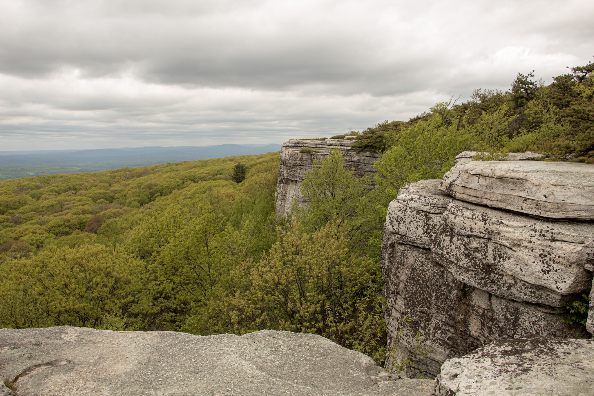
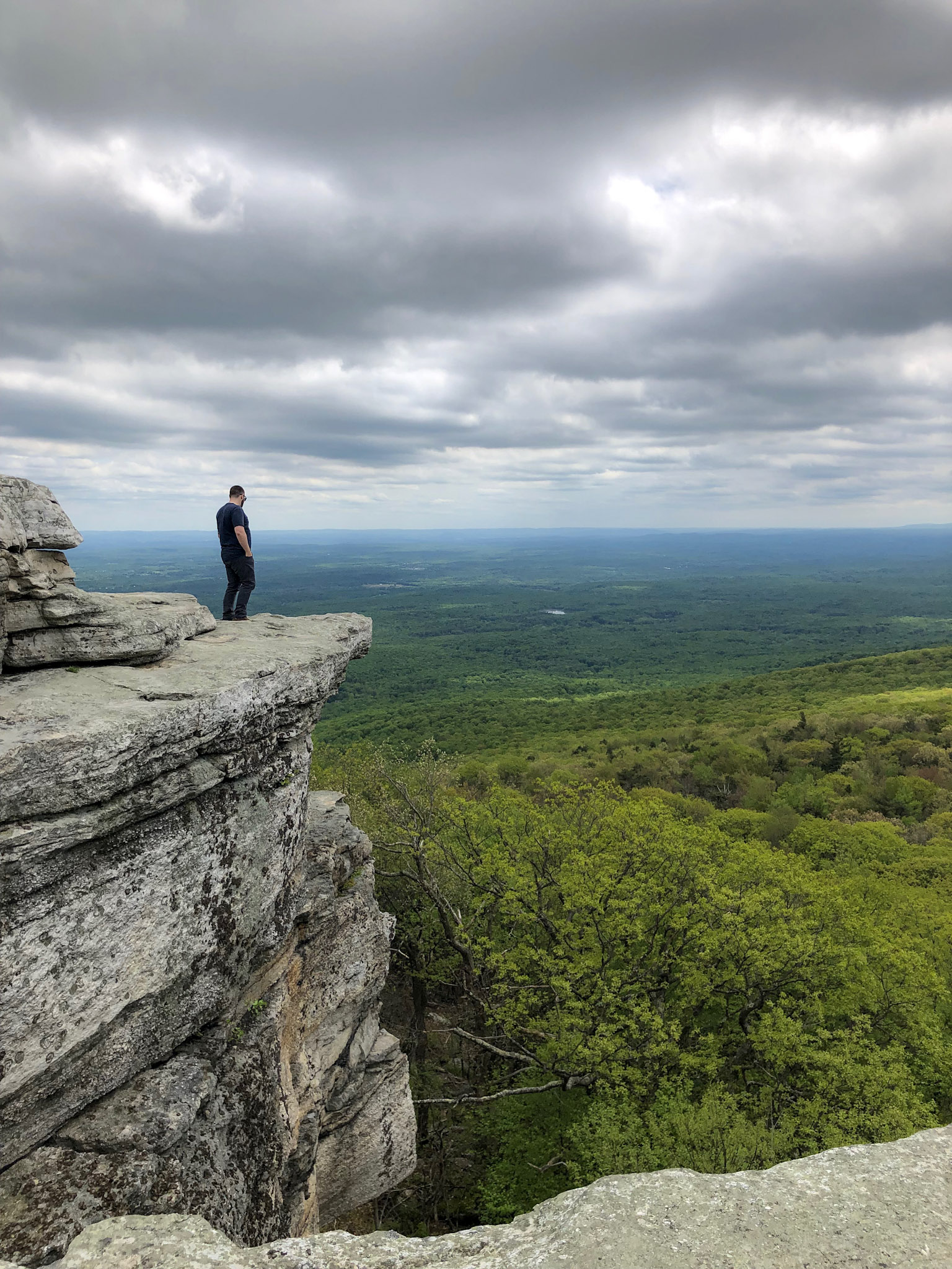
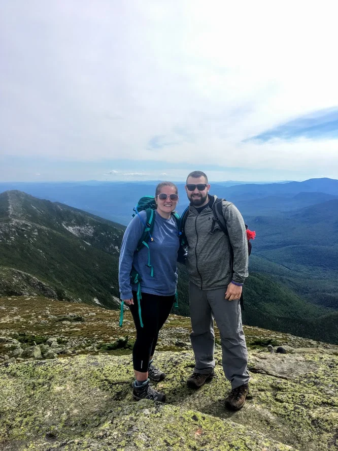
We finally made our way over to Sam’s Point. The views are outstanding. From the cliffs, you can see the Shawangunk Ridge and Wallkill Valley. Lots of space to take in all the scenery, grab a snack, or take a selfie. There were lots of selfies going on around us. Before we left, I had one thing left to do. I was waiting for the perfect moment. Mostly, I was waiting out the 20 plus Cub Scout group that were yelling and running around. In addition, there was this one kid (like in his 20s) with his mom who kept taking selfies and would NOT leave until he got the perfect one for Instagram. Come on dude. Once they left, I saw my opening and proposed to my amazing girlfriend! Even though I made her trek 6 miles on her birthday and endure 20 minutes of freezing wind atop Sam’s Point, she said yes. I didn’t realize how packed this overlook would be at all times. Sorta risky move. No backup plan. But in the end, everything went as planned. Then, we joyously made our way back down to the parking lot.
This hike has a lot of meaning for me going forward but this was a dynamite hike. When you can explore different landscapes and come across multiple features that this trail offers, there is not much more you can ask for in a hike. This is a great place to visit to spend the day.
MORE PICTURES BELOW:

HIKING FOR DONUTS
Hi, I’m Mark. I live in Connecticut. I take new trips every change I get. A good trip has a great hike, great food, and something fun to do. My goal is to search out new trips and share them to inspire others to try something new and exciting.
If you are looking for posts in a particular place, search City or State here.
SEE OTHER POSTS IN ARCHIVE
Archive
RECOMMENDED POSTS


RECENT POSTS


See the latest on Instagram and follow @HIKINGFORDONUTS


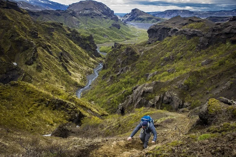
Hiking in Iceland: Thórsmörk
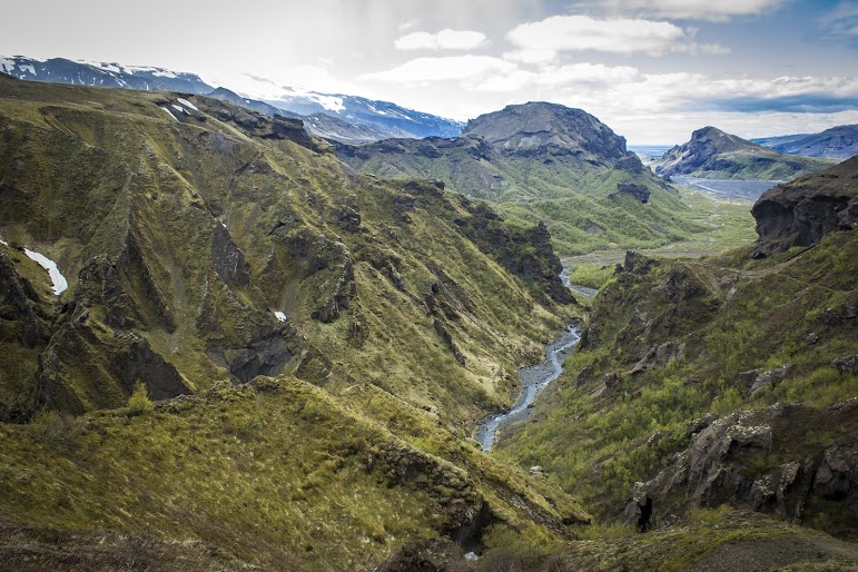
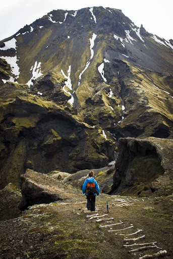
In 2010, a Volcano erupted in Southern Iceland. This eruption occurred near a popular hiking path from Skógar to Thórsmörk. Luckily, during my trip, the hiking route was opened. The terrain was difficult and cut the hike short but the views along the way were mesmerizing.
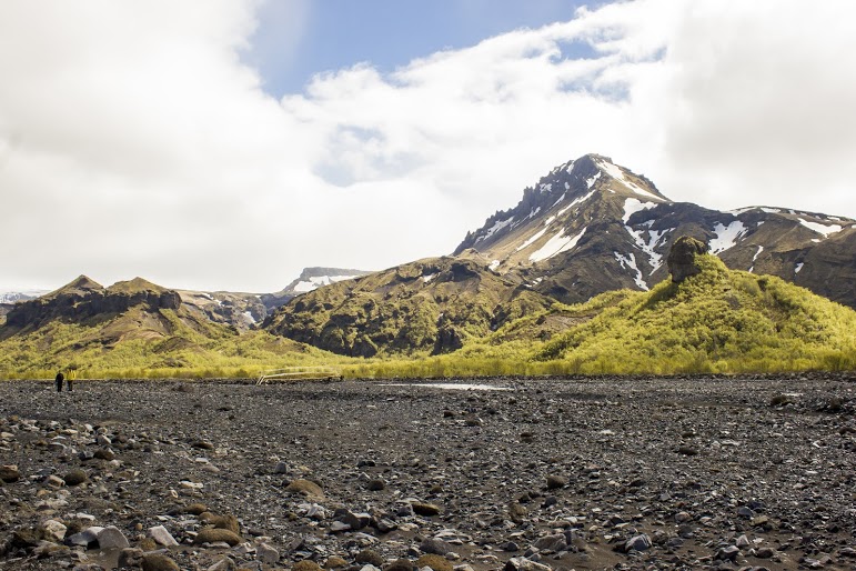
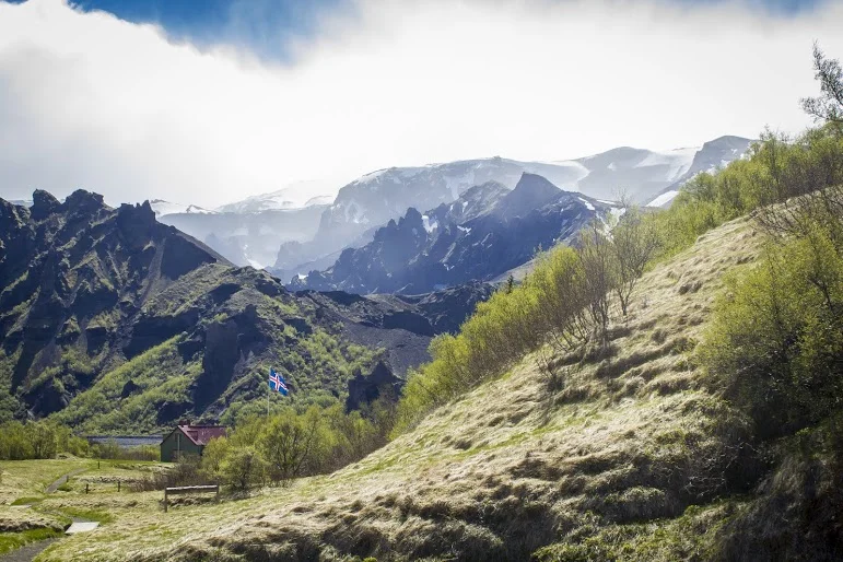
On my eight hour flight to Iceland, there was a lot of time to spare. The movie selection wasn’t great. And, then I saw the film, “The Secret Life of Walter Mitty.” Ben Stiller was in it and I figured it had to be decent. I started watching and realized, hey this is in Iceland. I turned to Corey and was like did you know this? And, he responded, yes I told you 10 times about this movie…..I’m not a good listener. As I watched, I would pause the movie every 20 minutes and say is this where we are going?!?!?! There was one scene where a volcano erupted and had Ben Stiller’s character running for cover. Pause again, I turn to Corey, are we going to see this? And he said, uh, we are hiking this. Oh snap. It’s about to go down. Eyjafjallajökull, you read that right, is a small ice cap located in Southern Iceland. In March, 2010, thousands of earthquakes were detected and caused an eruption in Fimmvörðuháls, the area of a popular hiking route from Skógar to Thórsmörk, which was then proceeded by a much more violent eruption at the top of the volcano, beneath the glacier. This second eruption caused massive floodwater to pour down the side of the volcano. Over 800 people were evacuated and Iceland’s Glacial Lagoons were destroyed. This even caused a stir with air traffic in Europe, which was paused for numerous days. Four years later, the devastation was still visible and lava was still smoking on the side of the volcano. As luck would have it, the hiking trails were opened and hikers can travel the route and take in these new views. And, that is what we planned to do if the weather permitted. We booked a night at the Volcano Huts in Thórsmörk, which was an awesome experience even if we didn’t attempt a hike. We had to take an hour long bus ride into Thórsmörk, crossing streams and passing glacier tongues.

The initial plan was to hike the entire trail close to 16 miles, see some lava. As we got closer, we realized there was no way we could safely make it to the Fimmvörðuháls pass. However, we like exploration and adventure. We decided to continue with our bold plan until we just couldn’t go on. Try to see as much as we can. You never know if you will be back.


After speaking with the guide at the hut, we started our trek onto the beginning of the Fimmvörðuháls pass. The trail began with small brooks through a woodsy path. And, just like that we were exposed to a large field and a visual of glacial capped mountains. The next section of the hike was an enormous, rocky flood plain that we had to cross. There was a mobile bridge positioned at the end of the rocky terrain where the river was currently running through. We made our way across the bridge to the base of the snowy mountain on the opposite end of the valley where we started. We began our accent up the mountain and the terrain quickly transformed as snow began to appear. We crossed paths with our first hiker of the day heading the opposite direction. We made sure we were going in the right direction and were informed that the terrain was going to get dicey. And, there were currently blizzard conditions farther up the trail. We had packed for the worst, tents, extra clothing and food, so we continued on. Goals of lava steaming were still in sight.


As we made our way up the side of the mountain, patches of snow turned into thick layers of snow. And, this is where things got interesting. There weren’t any prior footprints to just step in as no one had dared to travel this far. We had to carefully, side step along the along the ridge line. Or else we were going sledding down the side of the mountain and……goodbye. We passed multiple sections of pure snow/ice drifts on this very steep mountain slope. Definitely one of the times I had some actual fear and wanting to maybe just turn around. But, persistence always prevails. Eventually we reached the top of the ridge trail and proceeded onto flat land covered in volcanic ash, mud, and rocks. We continued to trek across the this plain until we reached the cliff on the opposite side of the mountain.


At this point, the remainder of the trail looked too risky. As we would need to descend down between the mountains and ascend back up. After what we just did along the ridge line, we called it at this point. We regrouped and chomped on treats to refuel. Then, Corey noticed smoke on the side of the mountain and realized that it was cooling lava. We have attained our goal of seeking lava! The scene was remarkable. The experience was epic. This is what HikingforDonuts is all about. Push yourself, go beyond your comfort zone, and discover what’s out there. .....Then eat a donut ☺.


HIKING FOR DONUTS
A blog for the outdoors foodie enthusiast
Hi, I’m Mark. I live in Connecticut. I take new trips every chance I get. A good trip has a great hike, great food, and something fun to do. My goal is to search out new trips and share them to inspire others to try something new and exciting.
If you are looking for posts in a particular place, search by city or state here.
EXPLORE OTHER POSTS IN THE ARCHIVE
Archive
RECOMMENDED POSTS

MOST RECENT POSTS
See where I have been recently on Instagram. Follow @HIKINGFORDONUTS

Mount Lafayette, New Hampshire
The White Mountains in New Hampshire is one of my favorites areas to hike. On this day, I conquered Mount Lafayette. What a hike!
Trail Description: Mount Lafayette is the highest peak in the Franconia Ridge at 5,260 feet. The summit offers amazing 360 views of the Pemigewasset Wilderness Area.
Trail Info:
Where: Lincoln, NH Distance: 8.0 miles (7-8 hrs) Difficulty: Hard Trail Type: Out and Back Features: Views, Peaks, Mountains, Greenleaf Hut
How to get there:
The parking lot for this hike is located in Franconia Notch on I-93. You can park on either side of the Interstate. Traveling north, you can park in the trailhead lot for the Falling Waters and Old Bridle Path trails. Traveling south, take exit 34b at Lafayette Place Campground. Follow the foot tunnel that goes under I-93 to the parking lot the opposite side of the highway to start the trail.
Hiking Tips
Bring lots of water, wear your best boots, hiking poles, and pack snacks.
Suggest doing the loop version of this hike along the Franconia Ridge trail to see Mount Lincoln and Little Haystack for more views.
Due to the popularity, the trail can be very crowded.
The White Mountains in New Hampshire are one of my favorite areas to visit and go hiking. It is one of the coolest areas in the Northeast and makes me feel like I’m in a different part of Unites States. It has a pacific coast mountainous look. I try to do a few hikes a year in New Hampshire. A large group of my friends rent houses in the area a few times a year to hang out. Even better, my best friend recently purchased a vacation home close to this area, about 15 minutes from Franconia. I bought new hiking boots and figured I wanted to do a fun, difficult hike in the White Mountains. More specifically, a hike I have not done. The one hike I really wanted to do was the Mount Lafayette summit. My friend said it was “easier” than Mount Washington but still hard. Lies. It was really freakin’ difficult. And, a terrible decision to wear new boots.
By the time we got there, it was near 11am and my friend suggested shaving a mile off the hike by skipping the trails where you would see Mt Lincoln and Little Haystack. I was against this decision but I was overruled. Disclaimer: This is a very popular hike. One of the best New England has to offer. There were cars lined up the side of the roads and the lots were full. This created a very tight hiking path. There was a lot of stopping and waiting for other hikers as the paths can be very narrow. For a summer hike, the weather was perfect, mid-70s and the skies were sunny and clear. We made our way to the trail which begins to the right of the information sign (there are bathrooms as well). Most hikers choose to go up the Falling Waters Trail as it is recommended by the trail guides. Another reason we chose to go up the Old Bridle Path as this was less crowded. After a good 1.5 miles into the trail you will seeing some great scenic views.


This path is 2.9 miles that will lead you to the AMC Greenleaf Hut. The hut is where hikers can use the restroom, eat, and enjoy the views. The hut also has some lodging options for those hikers who choose to do so.

From here, you will begin the rocky assent for another 1.1 miles to the top of Mount Lafayette, about 5,260 feet above elevation. We came down the same way we went up. The total hike was 8 miles.


Unfortunately for myself, the trail down wasn’t too fun as I sprained my ankle pretty bad. This hike is no joke and I would recommend using caution. For the inexperienced, I would prepare for a 8-9 hour hike. With my ankle issue, the hike took us over 8 hours. I would suggest using hiking poles, good boots and bring lots of H2O. I saw a couple wearing sandals. I can’t tell you how bad an idea that is. You will keep asking yourself, this isn’t a mile, 2, 3, 4? Given the incline, the hike will feel a lot longer. It was well worth it. The views are awesome. It leaves a very good sense of accomplishment. I will definitely go back another year to complete the Franconia Ridge Trail.

Review:
Bridle Path to Mount Lafayette Summit Trail (Franconia, NH, 8 miles): 5 out of 5!!!

HIKING FOR DONUTS
A blog for the outdoors, foodie enthusiast
Hi, I’m Mark. I live In Connecticut. I take new trips every chance I get. A good trip has a great hike, great food, and something fun to do. My goal is to search out new trips and share them to inspire others to try something new and exciting.
If you are trying to find posts about a particular place, search by city or state here.
Explore other posts in the archive
Archive
RECOMMENDED POSTS


RECENT POSTS
See where I’ve been recently on Instagram. Follow @HIKINGFORDONUTS.