


Pine Knob Loop Trail, Sharon, CT
Trail Description: The Pine Knob Loop Trail is located in Housatonic Meadows State Park and Housatonic State Forest. This short, challenging trail connects to the Appalachian Trail. The hike will bring you to a beautiful vista view of rolling hills over the Housatonic River valley.
Trail Info:
Where: Sharon, CT Distance: 2.8m (2 hours) Difficulty: Moderate Trail Type: Loop Features: Views, Mountains, Valley, River
How to get there:
By google mapping, “Pine Knob Loop Trail” this should lead you to the trail parking area. Link below.
https://goo.gl/maps/36Fa5oy7HjjrHTZP9
You will see the parking lot located on the left coming from Route US-7 N. There is a visible sign as well. The lot can fit 15-20 cars.
Hiking Tips
Go counter clockwise if you like your knees!
Not great phone service, so make sure to screenshot a map. Or my guide!
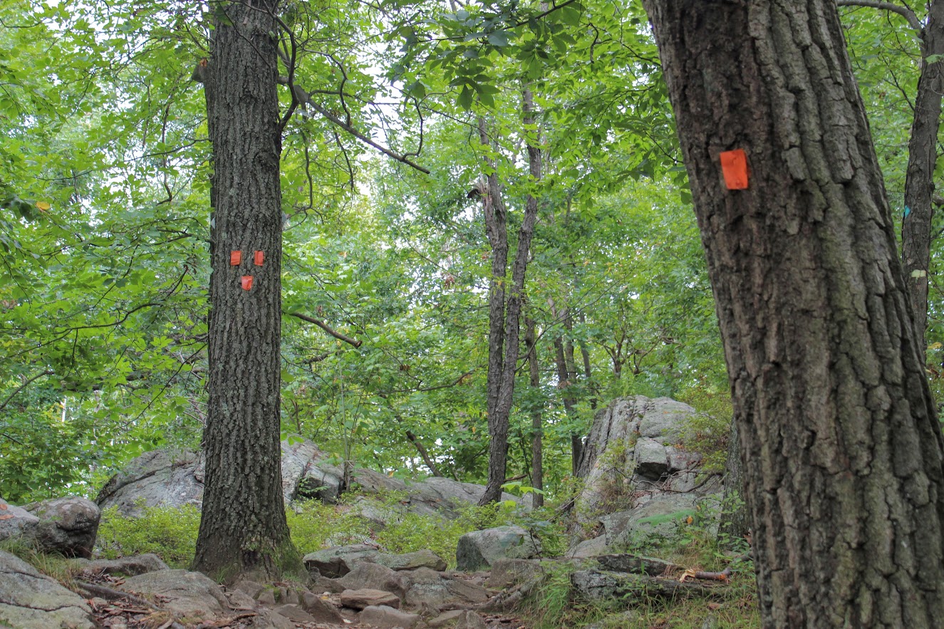
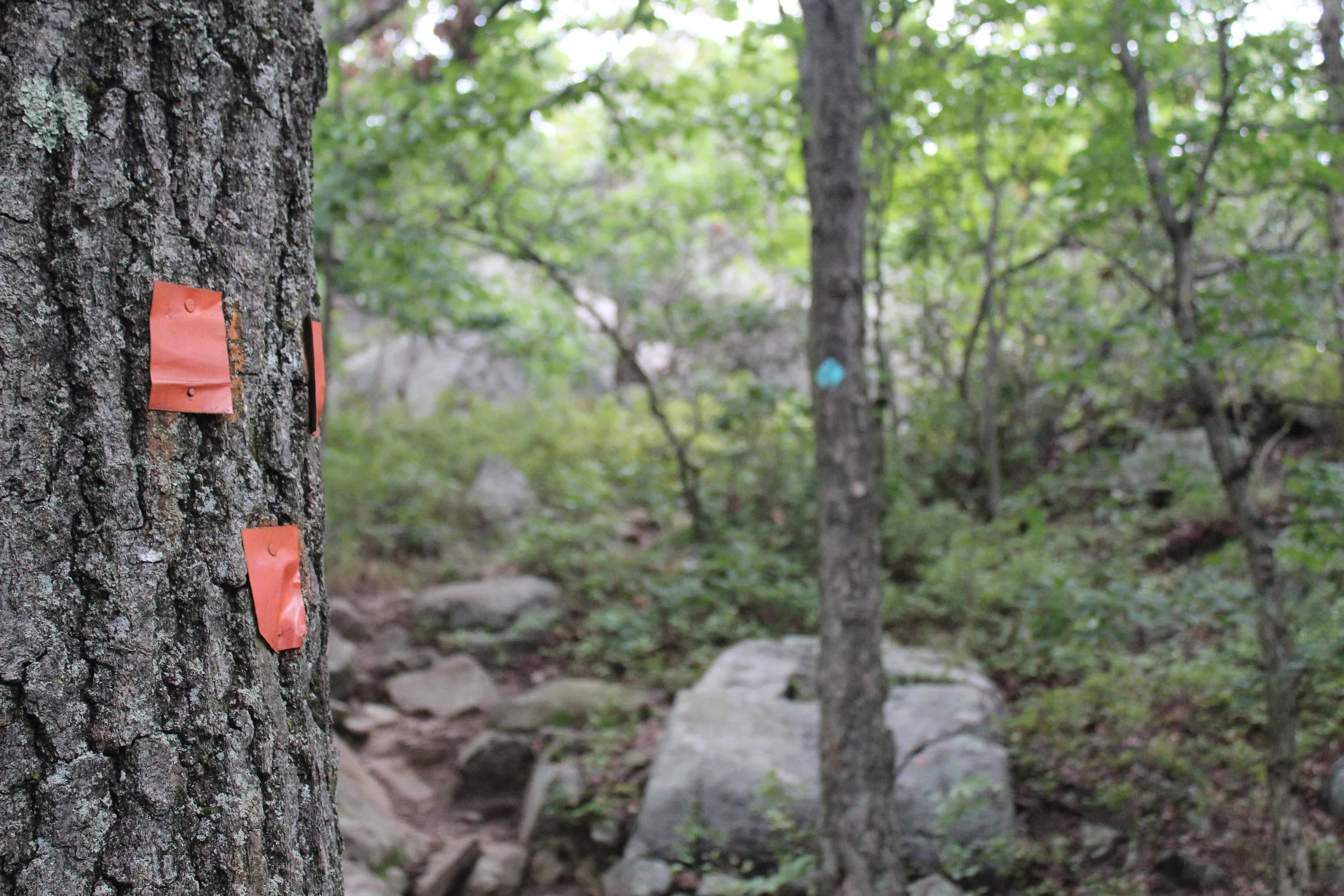
Due to storms, some trees are down with trail markings. Just make sure to keep an eye out.
The Hike
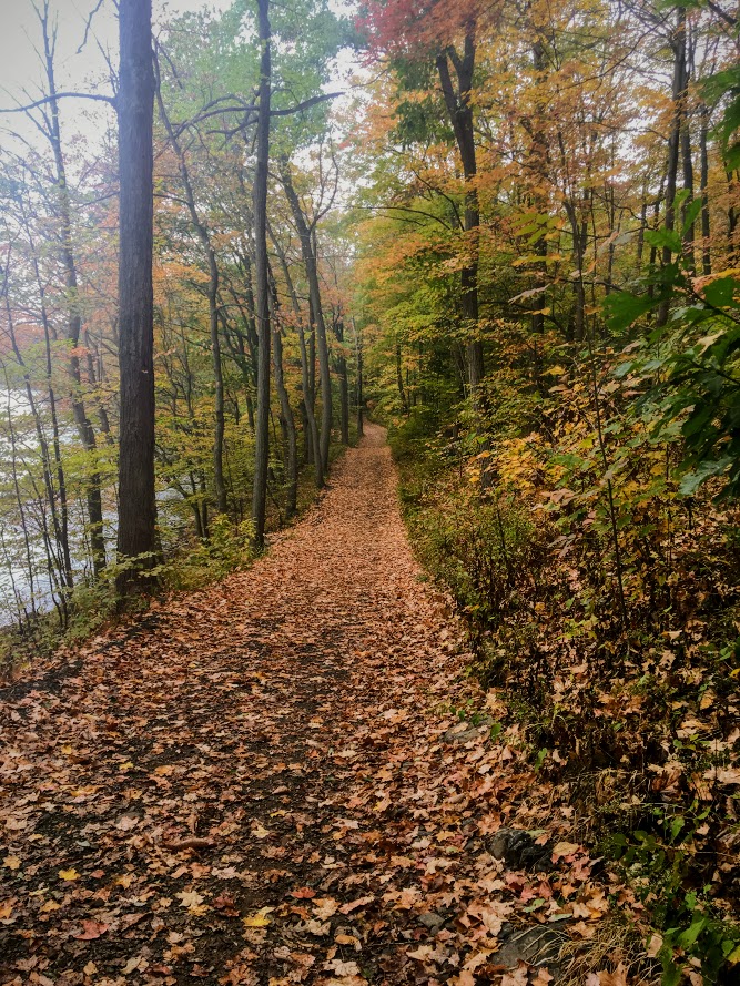
Beginning the hike, the trail leads directly into the woods. There is a small brook to cross that leads to the fork of the start of the trail, where you will see the blue blazed trail sign. Prior to the hike, my wife and I did some research and counterclockwise was recommended based on our findings. We prefer to go up an incline & scramble then come down on a steep decline. This is the knee friendly option and safer in my opinion (lessons learned). Also, I like to get the hard stuff out of the way. Staying straight at the fork on the blue blaze trail is how we started. The steep incline starts gradually about 0.4m into the hike. Really get the blood flowing out the gate.
The terrain will be a bit of a strenuous incline then leveling off with a small decline and then right back to steady uphill climb. Nothing your average hiker can’t handle.
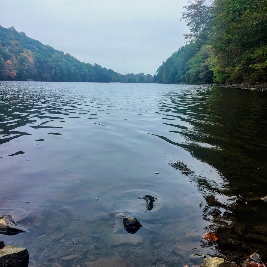
At 1.1m, this is the time to catch your breath when you reach the first sneak peek of views. Then it is all worth it when you see the spectacular vista view of the hills and mountains of the North West valley of Connecticut. From here you can see Bald Mountain, Bread Loaf Mountain, Woodbury Mountain, DudleyHill, and Whitecomb Hill. Really impressive view.

After absorbing the stunning views, continue back onto the blue trail until this connects with the Appalachian Trail that is the white trail marking at about 1.3m.
Connecticut has had a plethora of storms lately so there are many trees down. Some had trail markings on them so be mindful of that. Otherwise, this is an amazingly marked trail and easy to follow. At 1.7m, you will see the rolling hills view again from the east. This view is blocked by some trees but is still amazing nonetheless.
At 2.1m, the blue and white trail will go separate ways. Turn left on the blue trail to finish the loop. We noticed a hatch brook that appears to have water cascading down on certain days but it has been dry lately. Nothing to see on this day. The rest of the hike was a fairly easy stroll through the trees and forest.
The Northwest part of Connecticut is unexplored territory for me. Based on my research, this area of CT offers many great hiking trails. The Pine Knob Loop Trail was my first experience in the area. And, I was not disappointed. The trail was not busy at all. We saw more people once we connected to the Appalachian Trail portion. I would highly suggest hiking poles for this trail. The hike offered various degrees of difficulty and an amazing summit view. This would be a great fall foliage hike. Also, there are two wineries within 15 minutes from the hike if you need to persuade a hiking companion. Looking for something different, check this one out!

HIKING FOR DONUTS
Hi, I’m Mark. I live in Connecticut. I take new trips every change I get. A good trip has a great hike, great food, and something fun to do. My goal is to search out new trips and share them to inspire others to try something new and exciting.
If you are looking for posts in a particular place, search City or State here.
SEE OTHER POSTS IN ARCHIVE
Archive
RECOMMENDED POSTS


RECENT POSTS


See the latest on Instagram and follow @HIKINGFORDONUTS


Sam’s Point and Verkeerderkill Falls Trail, New York
Trail Description: Sam’s Point Reserve offers panoramic views of the Shawangunk Ridge along with exploring a 180 foot waterfall.
Trail Info:
Where: Ellenville, NY Distance: 6.2 miles (3-4 hours) Difficulty: Moderate Trail Type: Out and Back Features: Views, Mountains, Valley, Waterfall, Ice Caves (optional)
How to get there:
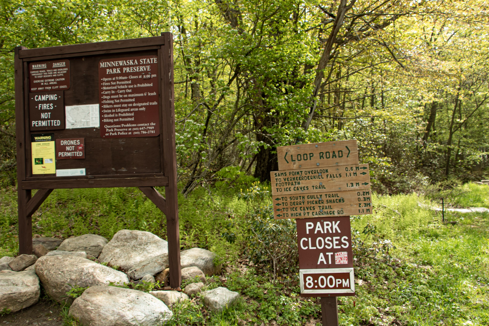
400 Sams Point Rd Cragsmoor, NY 12420
This will take you right to the parking lot. Parking costs $10. There is a kiosk to pay near the visitor center.
Hiking Tips
Parking lot opens at 9am. If parking lot is full, you have to wait until someone leaves. Plan accordingly as parking is limited.
Did not include the Ice Caves on this day. Would add an additional 1.1 miles to the hike.
Use bug spray for ticks and sunscreen when sun is out. Most of the hike is the open.
The Hike
The next hike in the Hudson Valley to check off my list is Sam’s Point. I anticipated great views but there was much more to this hike than I thought. Until I researched recently, I didn’t realize a waterfall was part of the hike. Veerkeerderkill Falls is the tallest waterfall in the Shawangunk Mountains at 180 feet. And, there are even ice caves on this trail. Sam’s Point is part of Minnewaska State Park, but the parking is located at a different location than the park’s entrance. We left early in time to beat the 9am opening and there were already quite a few cars in line. Once parked, there is a kiosk to pay for parking and there is a visitor center at this lot, where there are 2 restrooms.
After packing up our gear, we headed toward the trailhead. Walking around the gate took us on the main trail, Loop Road. There is an intersection almost immediately to choose from, veering right will take you to Sam’s Point. The other option is the Huckleberry Pickers’ shacks. Tempting but we will pass on that. Heading up the fragmented road, there is a slight incline as altitude gains up the switchbacks. In short time, we came up to a massive rock with a cliff above, which we learned later is the top of Sam’s Point. At about a half mile, the first view was on our left on top of a rocky platform.
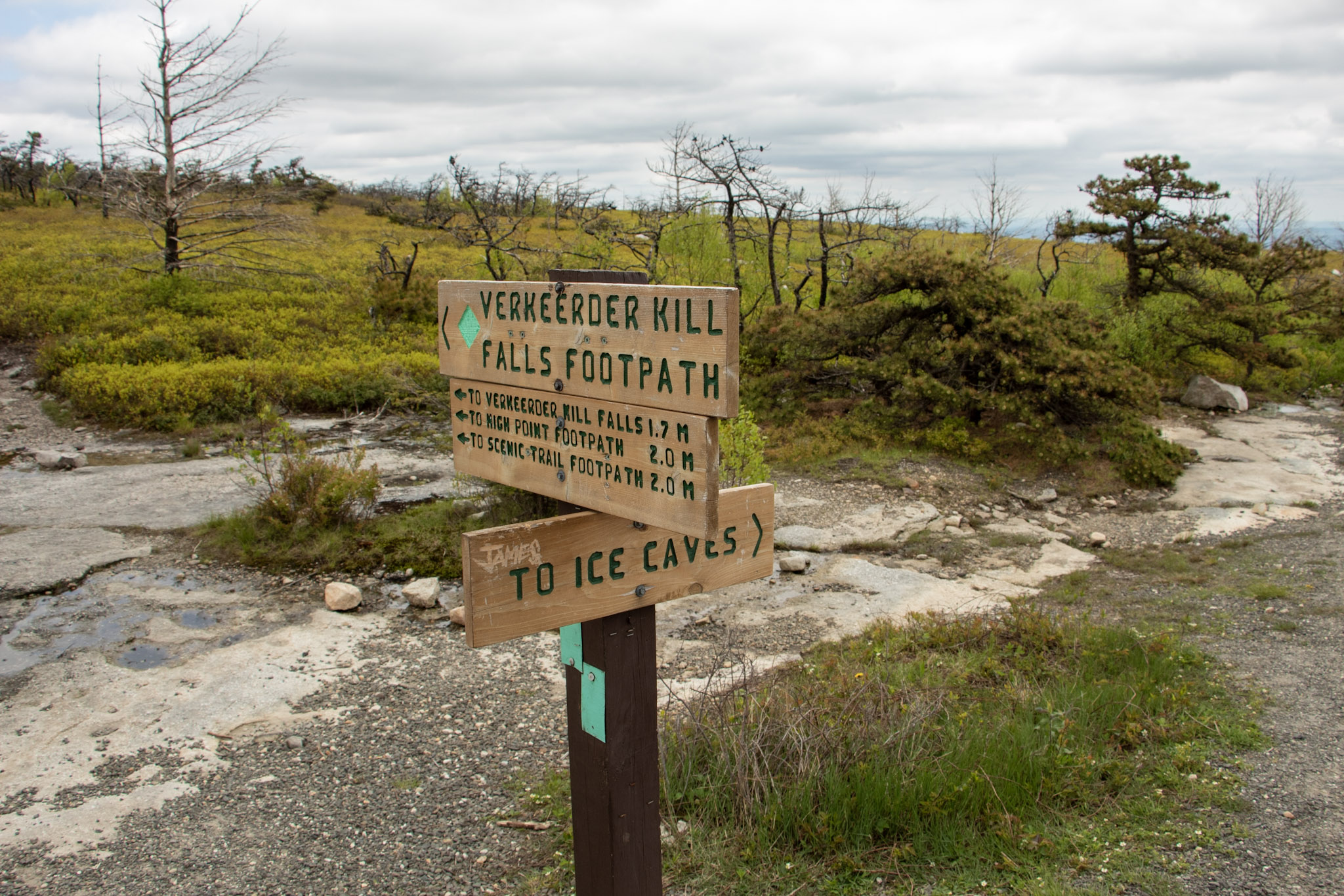
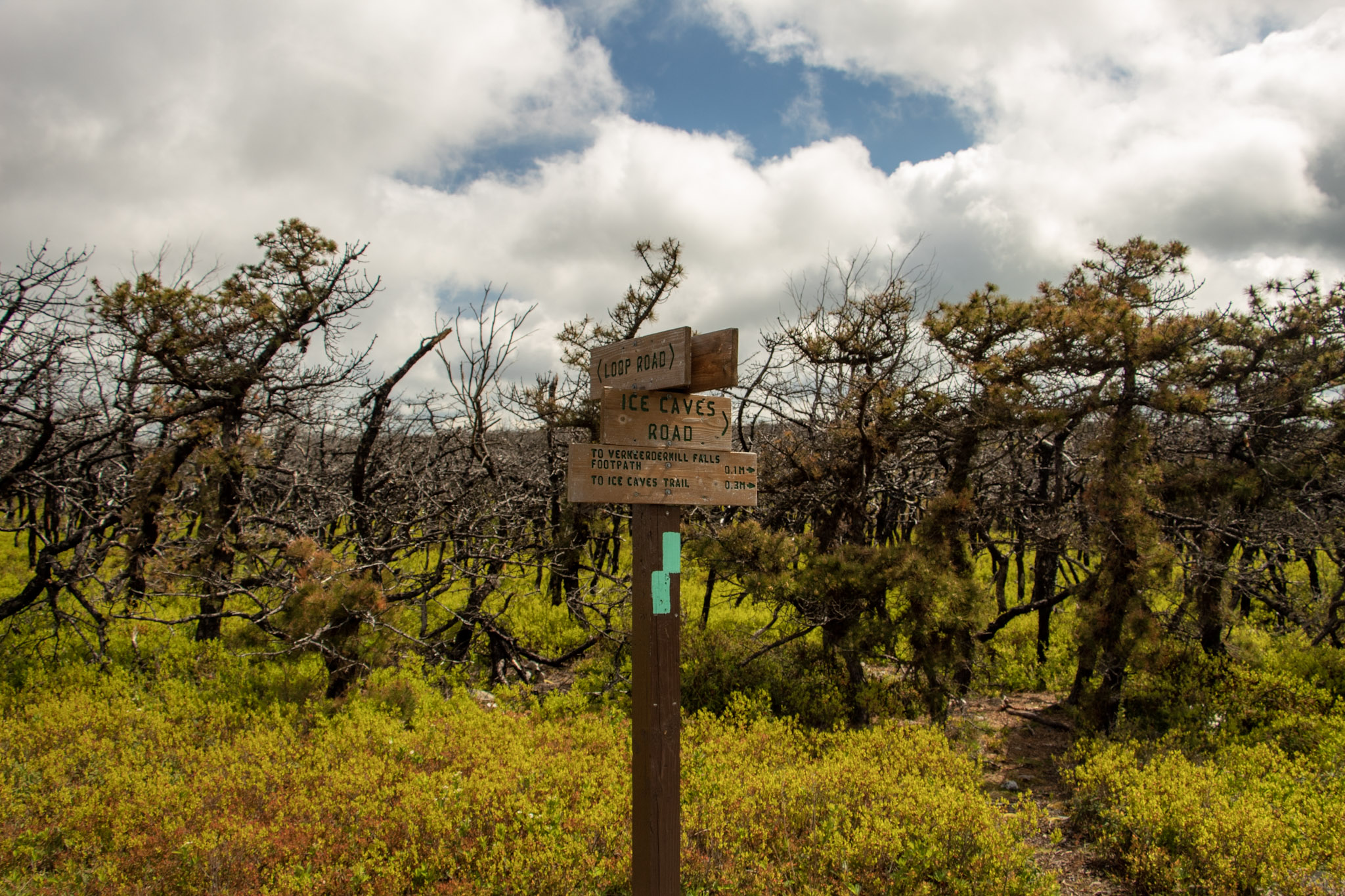
Loop Road will even out and we had an option to keep straight toward the waterfall or turn left toward the short trail to check out the view from Sam’s Point. It was pretty crowded and I just wanted to beat everyone to the waterfall so we saved Sam’s Point for the end. A short distance off Loop Road, we saw signs on our left to head toward Verkeerderkill Falls on the aqua blazed trail. If you wanted to check out the Ice Caves, continue straight from here. We couldn’t fit those in today, so we headed toward the waterfall.
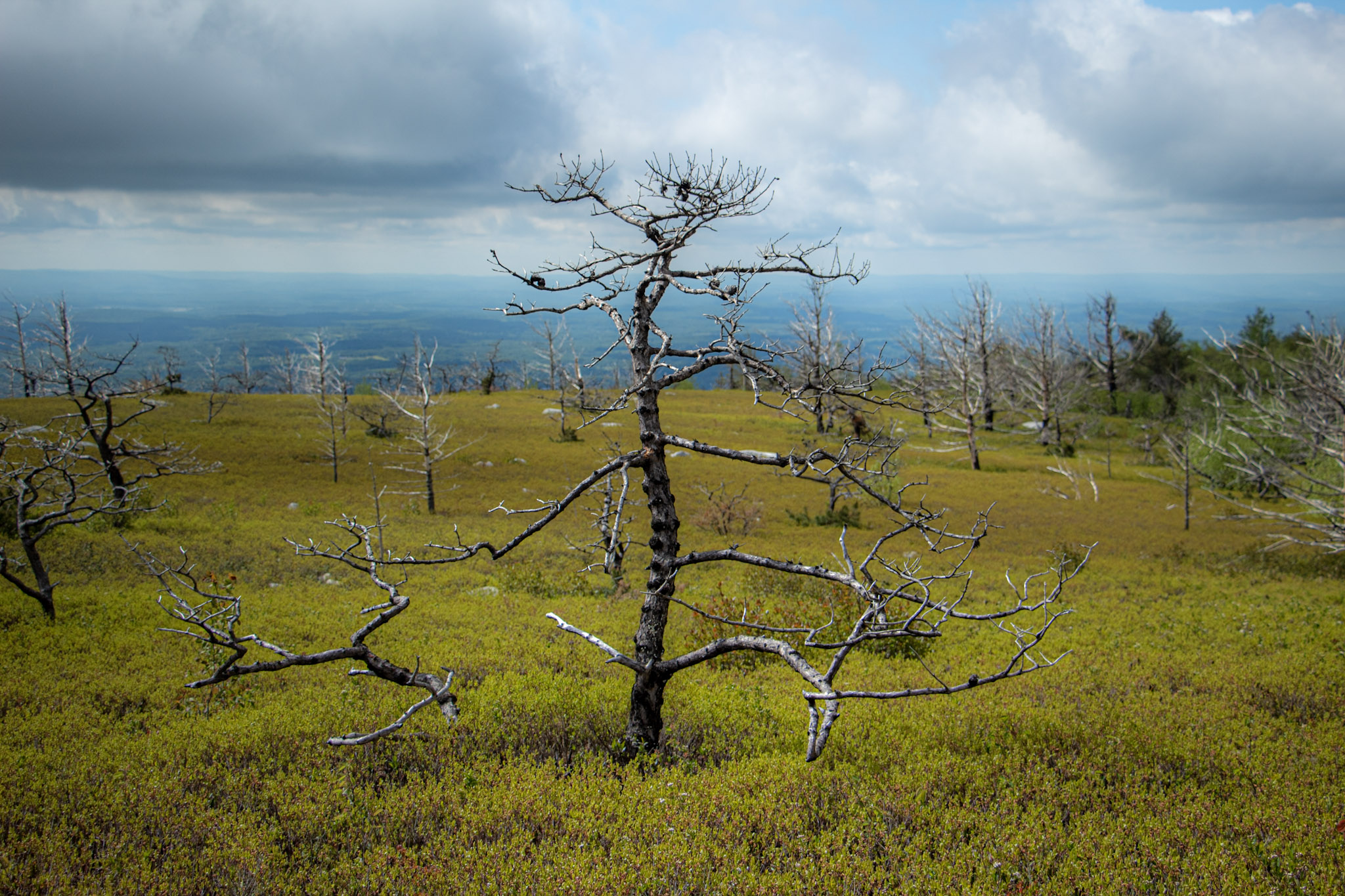
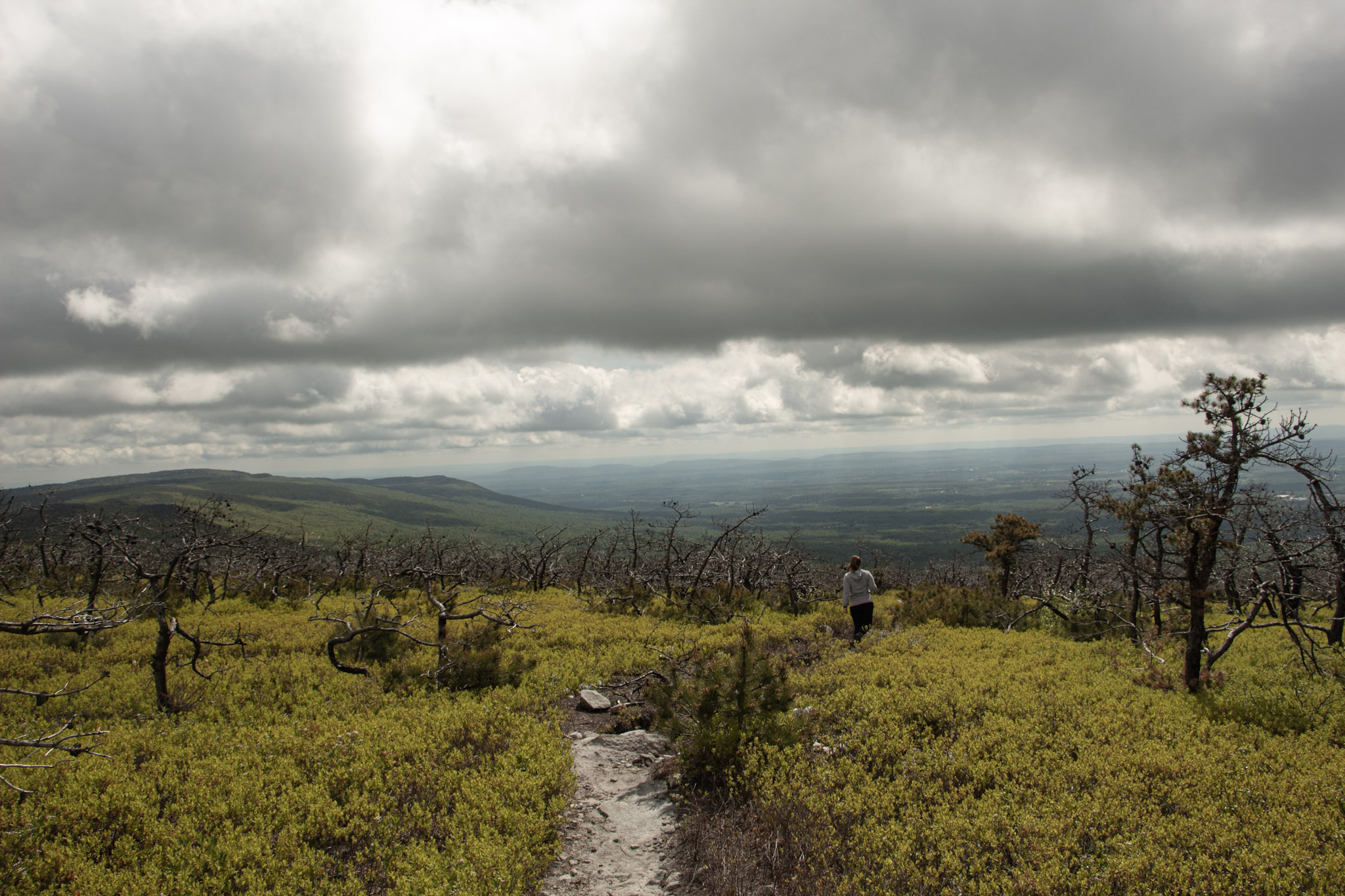
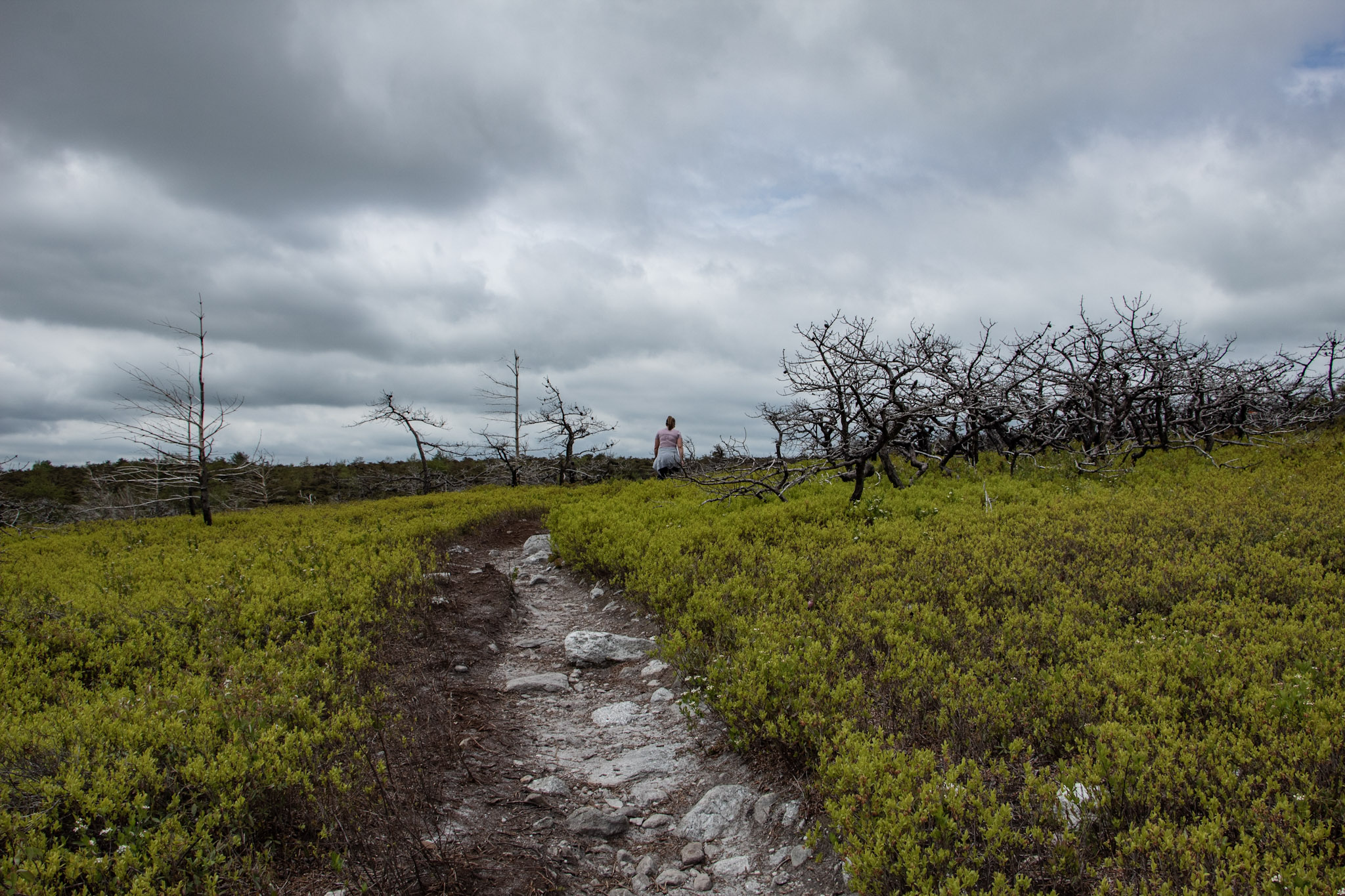
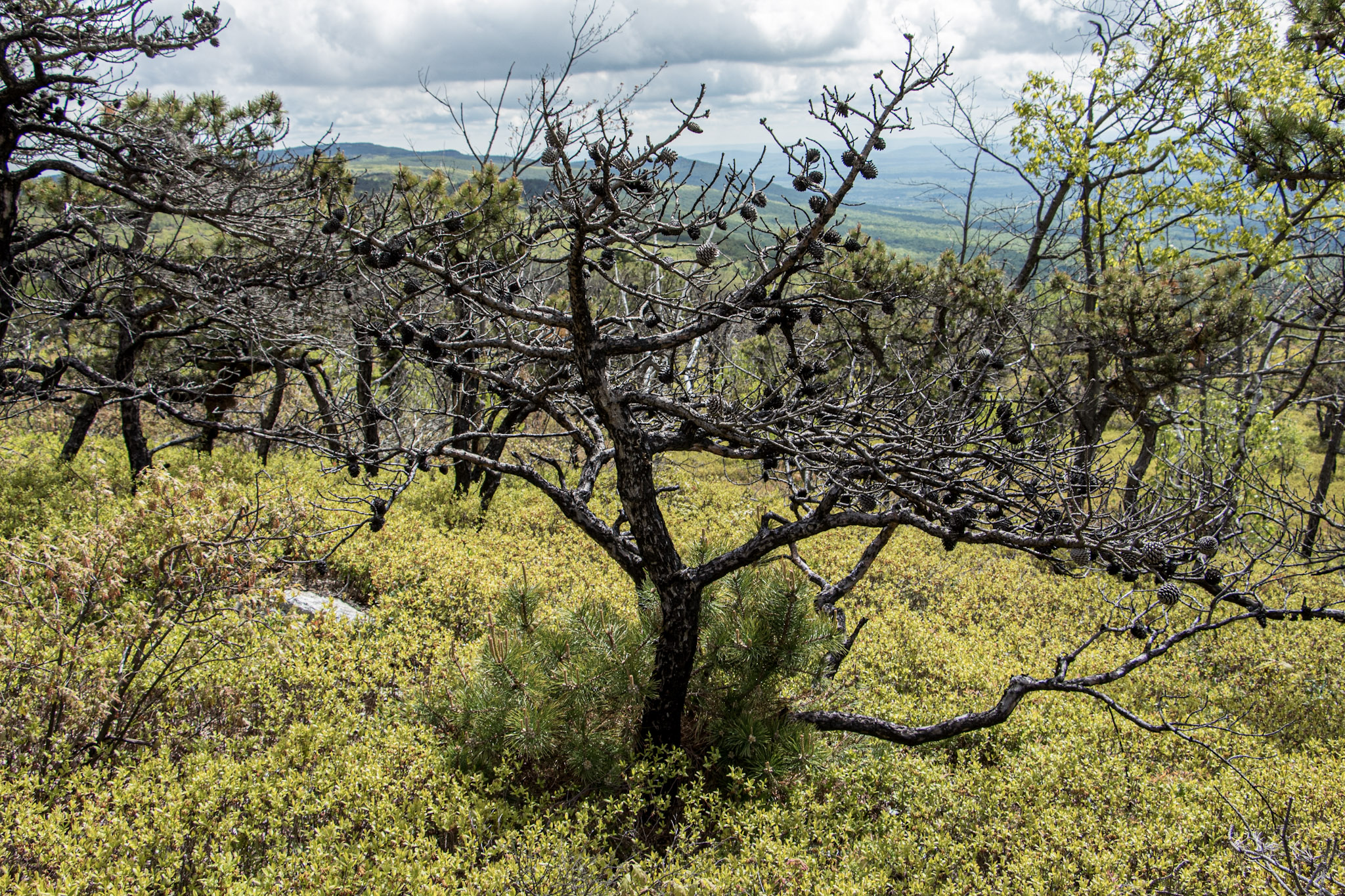
I did not anticipate the cool landscape we would be hiking through on this hike. Strolling along the trail you will the see rare dwarf pine trees offering very unique scenery. In addition, there are wide views of the Northern Shawangunk Ridge along this part of the trail. The trail will head downhill slightly. This isn’t terrible but the fact that it gets rockier, makes it a bit more challenging. As you get closer to the waterfall, there is a steep descend down.
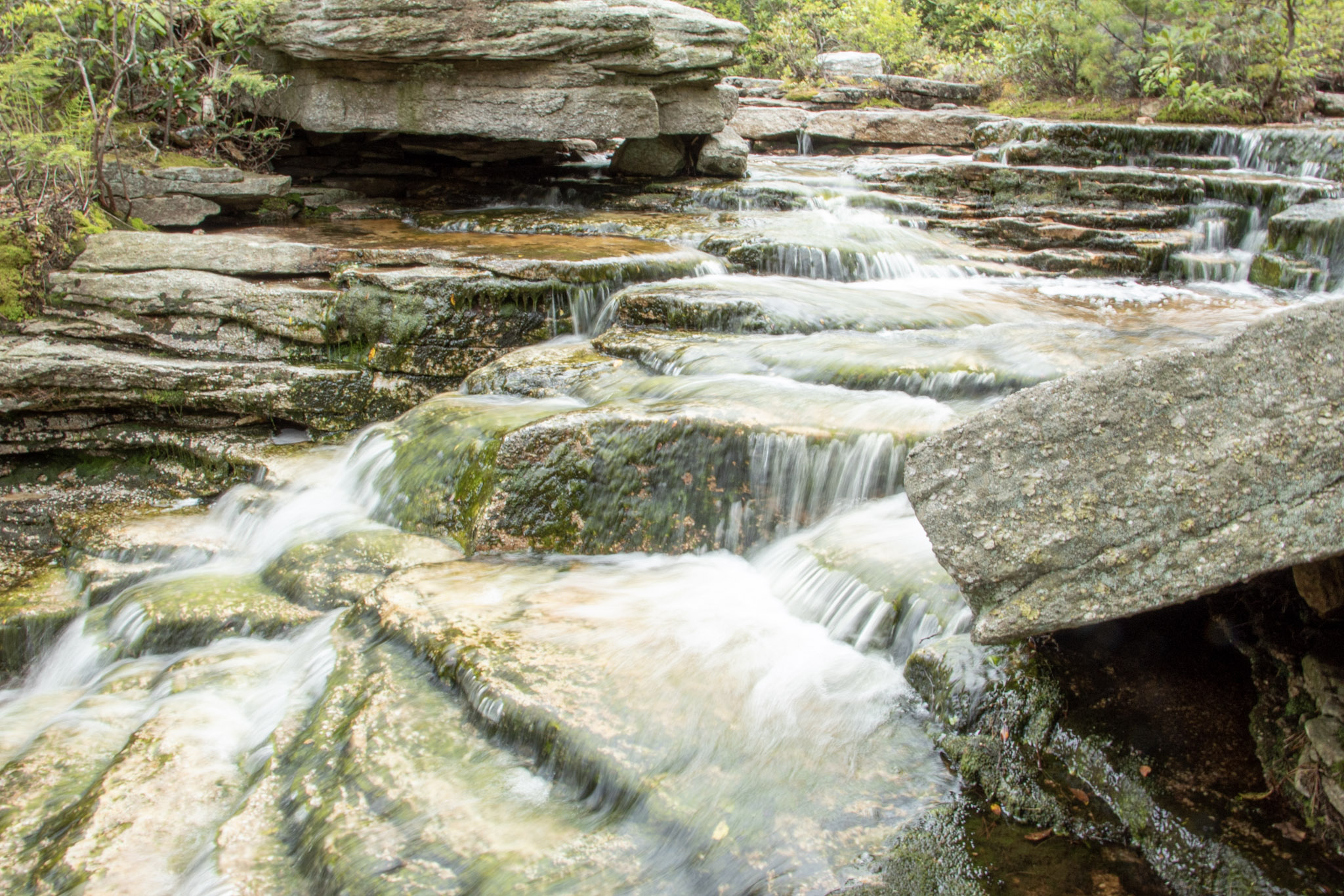
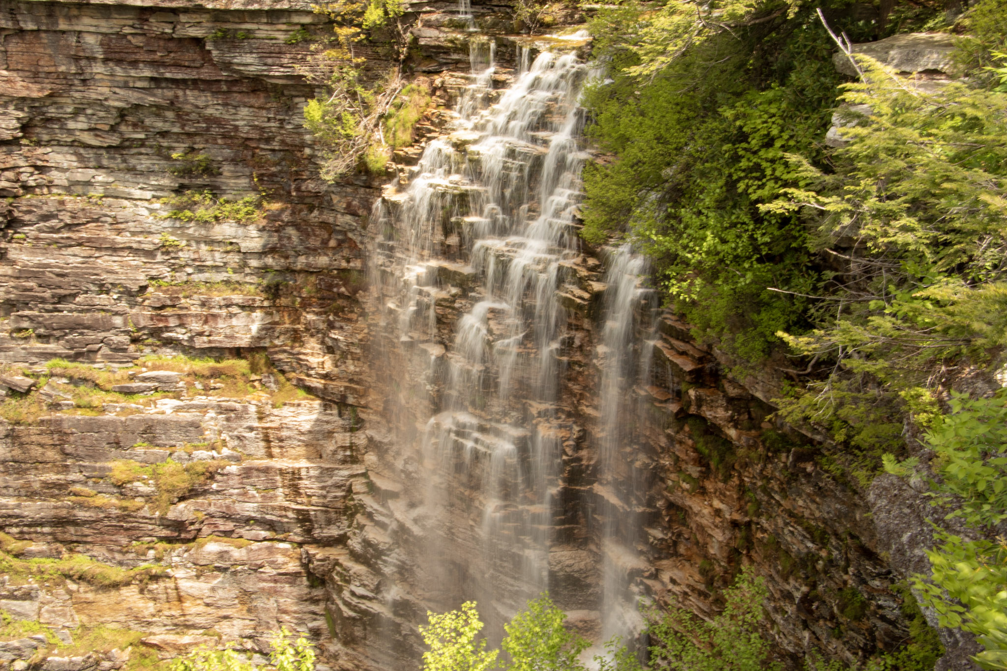
Eventually, we came upon a stream above the falls. Depending how high the water is on a given day, you may have to follow upstream to cross. We made our way to the cliff overlook and we were greeted with a large crowd. Then, I turned around and saw the amazing view of Verkeerderkill Falls! The water was flowing pretty well on this day. This is nice spot to take a break and relax. However with the crowd and popularity of the hike, we absorbed the fall briefly and started retracing our steps back.
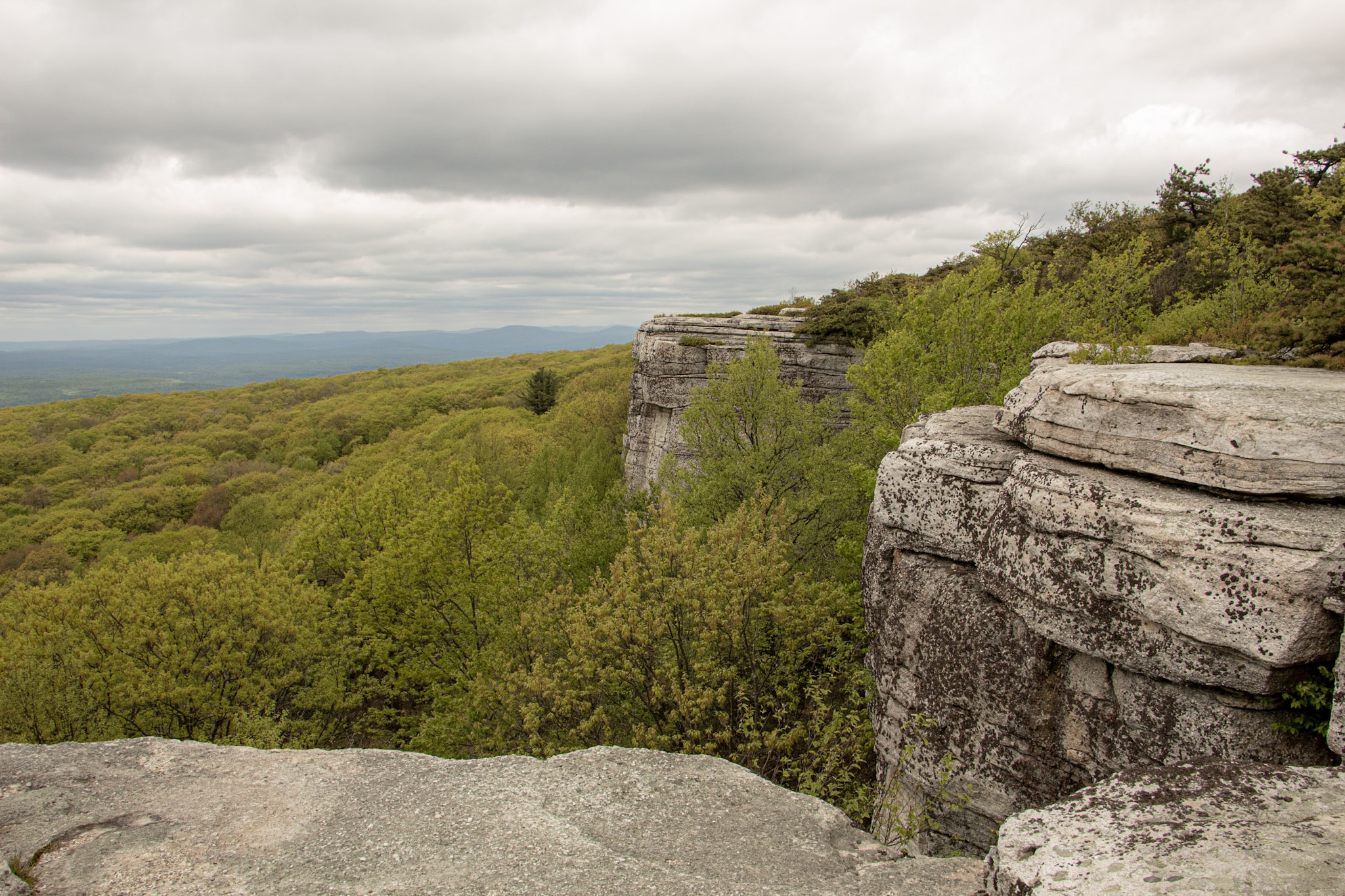
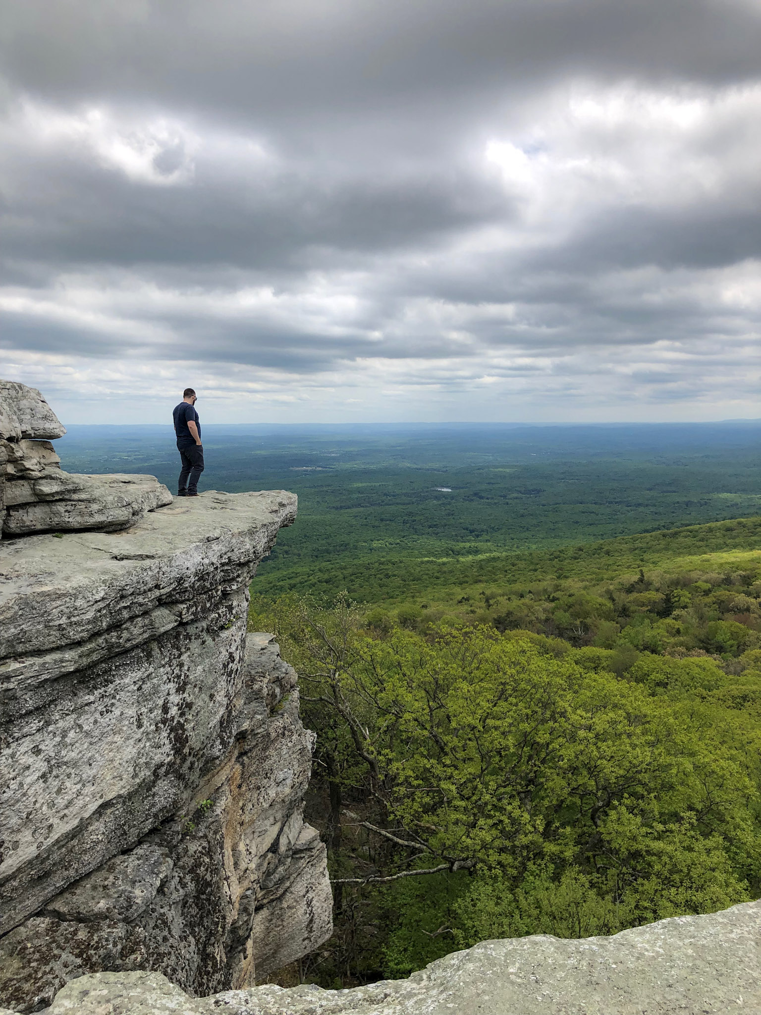
We finally made our way over to Sam’s Point. The views are outstanding. From the cliffs, you can see the Shawangunk Ridge and Wallkill Valley. Lots of space to take in all the scenery, grab a snack, or take a selfie. There were lots of selfies going on around us. Before we left, I had one thing left to do. I was waiting for the perfect moment. Mostly, I was waiting out the 20 plus Cub Scout group that were yelling and running around. In addition, there was this one kid (like in his 20s) with his mom who kept taking selfies and would NOT leave until he got the perfect one for Instagram. Come on dude. Once they left, I saw my opening and proposed to my amazing girlfriend! Even though I made her trek 6 miles on her birthday and endure 20 minutes of freezing wind atop Sam’s Point, she said yes. I didn’t realize how packed this overlook would be at all times. Sorta risky move. No backup plan. But in the end, everything went as planned. Then, we joyously made our way back down to the parking lot.
This hike has a lot of meaning for me going forward but this was a dynamite hike. When you can explore different landscapes and come across multiple features that this trail offers, there is not much more you can ask for in a hike. This is a great place to visit to spend the day.
MORE PICTURES BELOW:
HIKING FOR DONUTS
Hi, I’m Mark. I live in Connecticut. I take new trips every change I get. A good trip has a great hike, great food, and something fun to do. My goal is to search out new trips and share them to inspire others to try something new and exciting.
If you are looking for posts in a particular place, search City or State here.
SEE OTHER POSTS IN ARCHIVE
Archive
RECOMMENDED POSTS


RECENT POSTS
See the latest on Instagram and follow @HIKINGFORDONUTS

Storm King Mountain, New York
Storm King Mountain State Park Trail Guide (Cornwall-On-Hudson, NY)
If you are looking for a great hike with awesome views in the Hudson Valley, Storm King Mountain is one of the best hikes in the area. The trail will get your heart pumping but you will be amazed at the summit view from the top.
Trail Description: Storm King Mountain offers one of best views in the Hudson Valley. The hike includes an initial steep hike to the top of Butter Hill, but the gratifying views at the top are worth the effort.
Trail Info:
Where: Storm King Mountain, Cornwall, NY Distance: 2.7 miles (2.5-3 hours) Difficulty: Moderate to Difficult Trail Type: Loop Features: Ruins, Mountains, Views, River, Views, Bridge
How to get there:
Heading south on Rt 9W from Newburgh, cross under the overpass for Angola Road. You will begin climbing a hill (in your car!) and on your left you will the parking lot for the Storm King Mountain. However, you can’t make a left here because it is an illegal turn. Continue driving a few miles until reaching the exit at Rt 218/Rt 293. Get back on Rt 9W and circle back to the parking lot. If you type in this address: 1750 US Rte 9W, Cornwall=on-Hudson, NY 12518, this should sufficient enough for the GPS.
Hiking Tips
Get there early for a less crowded trail.
Start on the orange trail in the beginning (not the white trail).
Pay close attention to when markers change colors
Bring hiking poles
THE HIKE
During the summer, I made a list of hikes I wanted to accomplish by the end of the year. Somehow, some way I was going to make them happen. I wanted to end the year hiking awesome and challenging trails. Storm King Mountain was high on my list. I came across this hike first on Instagram, of course. The pictures looked stunning. Since I do frequently travel to the Hudson Valley area, all I had to do was make the time. The hike does look intimidating but it wasn’t that bad. I would have liked better weather on this day, as it was a tad cloudy with overcast. But, the hike was really fun and awesome views nonetheless.
View from the parking lot.
This hike is really popular. Get there earlier or try a weekday if you can. There were already a lot of cars and a shuttle bus of tourists by 930am. After we got our gear ready, the trailhead was to our left facing the woods. We saw the white trail on our right. I read hopping on the orange trail was the way to go. And, that was 100% accurate. It is more difficult in the beginning but I rather have fresher legs climbing up. The orange trail starts off steep right away. I found this part super fun. It was strictly a steep incline climbing up. The rocky path was taking us up to Butter Hill. Looking back, we witnessed some cool views of the highway as it started to disappear.


First of many views on the hike.
Model climber.
Once all the climbing was done, we reached some small ruins. Keeping the orange markers in our sights, we continued up toward Butter Hill. A little more views started to appear. There is an important decision to be made on the trail. The Orange Trail abruptly ends as the blue Yellow Trail markings appear (you will see blue marking first) . Turning right at this junction, lead us on the correct path. I have read this is a point in the hike where people take a left and get lost. One more time, turn RIGHT when the Orange Trails ends or your day hiking will be regretful.
Ruins.
highway overlook.
We reached Butter Hill in about a half an hour from the start of the hike. This is the highest point of the hike at 1,375 feet. Continuing forward there still was some uphill stretches as the blue/yellow trail moseys across the mountain. There are intersections where the blue/red marked trail is on your left. However, you want to turn right on the blue/yellow trail you will see a small cairn. It is easy to get off track with all the intersecting trails. You will see a blue-blazed, don’t fall for it. Just stick to blue/yellow trails at this point.
Continuing around the mountain….
turn right toward the yellow blue trail.
From here, the hike took us to the northern end of Storm King Mountain. Not quite the money shot view. Just a little tease of what it is next .
almost there.
A little bit past this spot, we reached a rocky field in the open and BOOM. Stunning landscape. There are wide views of Newburgh Bay, Bannerman’s Castle, and the Newburgh-Beacon Bridge. On a clear day, the Catskills are visible. We could see some sail boats in the Hudson River as well. A very cool summit view.
newburgh bay.
this is why you hike this trail.
After taking an excessive amount of pictures, we hopped back on the blue/yellow trail. Going down, we noticed some more cool overlooks on our left looking at the town of Cold Spring and getting a smaller glimpse of the summit view. I recommend taking a look. Shortly after the awesome view, the White Trail markers will appear. Taking a sharp left around the mountain with a U-turn, we started on the White Trail. And soon after, the trail will be blazed with blue and white markers. BUT, then the blue markers will fade and this goes back to only white markers. And now, the white markers will take you back to the parking lot. There is one last steep uphill climb before the parking lot to give you a nice good-bye and keep your heart pumping.
Views of cold spring as you hike down.


That's what I call a bang for your buck hike. The hike was very challenging, the hike wasn't too long, and there a multiple magnificent views for photo opportunities. And, I had a blast hiking it. The trail route we took was about 2.7 miles and took us under 3 hrs, including probably 30 mins of me taking pics. There are some very steep inclines but nothing your average hiker can't overcome. As long as you start the hard way first, the hike ain't so bad. This is one of the best hikes in the Hudson Valley hands down. I am happy to check this off the list, but now I want to go back!
Amazing.

HIKING FOR DONUTS
A blog for the outdoors foodie enthusiast
Hi, I’m Mark. I live in Connecticut. I take new trips every chance I get. A good trip has a great hike, great food, and something fun to do. My goal is to search out new trips and share them to inspire others to try something new and exciting.
If you are looking for posts in a particular place, search by city or state here.
EXPLORE OTHER POSTS IN THE ARCHIVE
Archive
RECOMMENDED POSTS


MOST RECENT POSTS
See where I have been recently on Instagram. Follow @HIKINGFORDONUTS

Dennings Point, Long Dock Park, Beacon, NY
Lock Dock Park Beacon, New York: Klara Sauer Trail to Dennings Point Trail
Trail Description: The Klara Sauer Trail is a flat walk until you meet up with the Dennings Point Trail along the shoreline. There are short access trails for views of the Hudson River and a beach with mountainous lookouts, where kayakers will often stop by onshore.
Trail Info:
Where: Long Dock Park, Beacon, NY Distance: 2.8 miles (1.5-2 hrs) Difficulty: Easy Trail Type: Out and Back Features: Bridge, Water, Mountains, Beach, River
How to get there:
GPS this address below. Easy to find.
23 Long Dock Rd Beacon, NY 12508
Hiking Tips:
At the time of my hike, storm damage caused trees to block the trail paths. If this is the case, turn around and go back the same way.
Make sure to stop at all access trails for additional views. Including the beach!
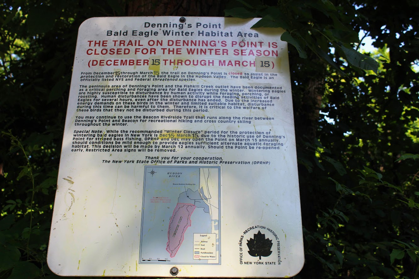
Denning’s Point Trail is closed December 15th to March 18th.
The Hike
Sometimes it is good to go for a nice leisurely walk, with an awesome view. The Hudson Valley is full of satisfying and challenging hiking trails with beautiful views. I am learning more and more about the area. There is a lot to offer if you are looking for outdoor activities. Short on time and looking for something easy, my girlfriend introduced me to a very cool spot located in Beacon, NY, called Long Dock Park.
path from the parking lot to the pier.
Upon arriving, I could see the fantastic view of the Hudson River as we parked. There is a good amount of parking but I can see this area being very busy. As we walked toward the pier, you will see trail maps within the park. Many people we saw were jogging, bike riding, and walking their dogs on the trails. You can also rent a kayak or paddleboard for the day. We walked out to the dock which is to the right of the parking lot. There are stools and fishing rod holders. A few fishermen were out bright and early on this day. From the dock, you get a fantastic view of the town across the river, including the bridge Beacon to Newburgh. This would be a good location to see the sunrise or sunset. The park has a very relaxing atmosphere.

Newburgh bridge from beacon.

View from the pier across the river.
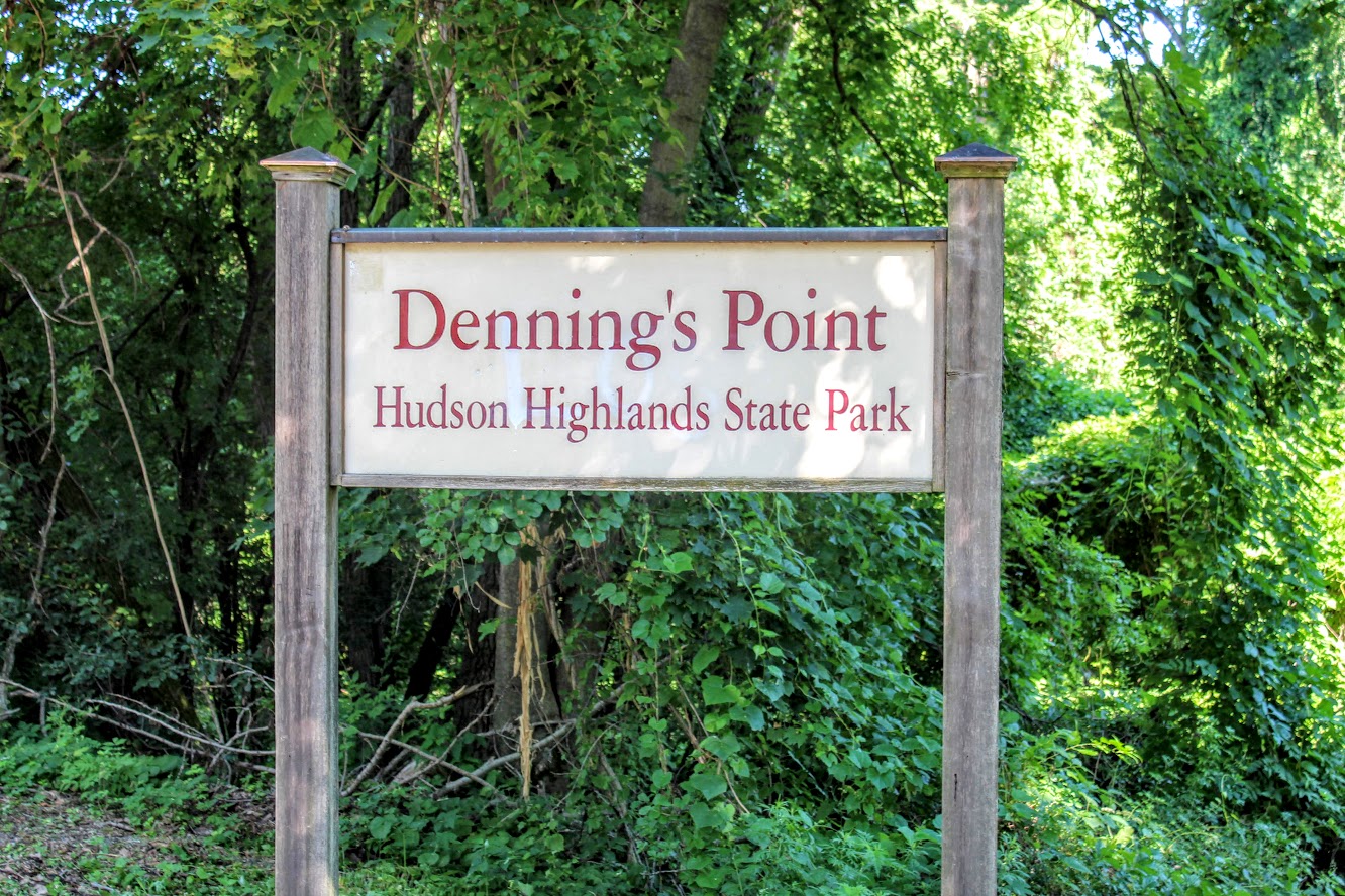
Long Dock Park is connected to the Hudson Highlands State Park by a train track turned trail. Dennings Point is the northernmost area of the Hudson Highlands State Park, and is a peninsula that extends out in the Hudson River. That was our goal destination of the day. After checking out the views from the dock, we started our walk on the Klara Sauer Trail. This flat and easy trail will lead along the shoreline of Dennings Point. There are access trails to venture and see better views of the river along the way. Some lookouts were muddy so I am glad I had my hiking boots on.
Views from some of the access point along the klara sauer trail.
Ducklings going for a swim.
Hudson river view with some mountains.
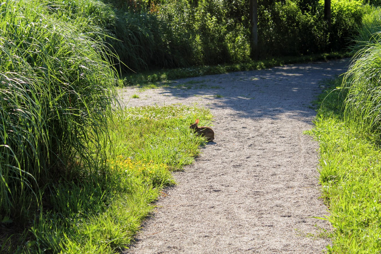
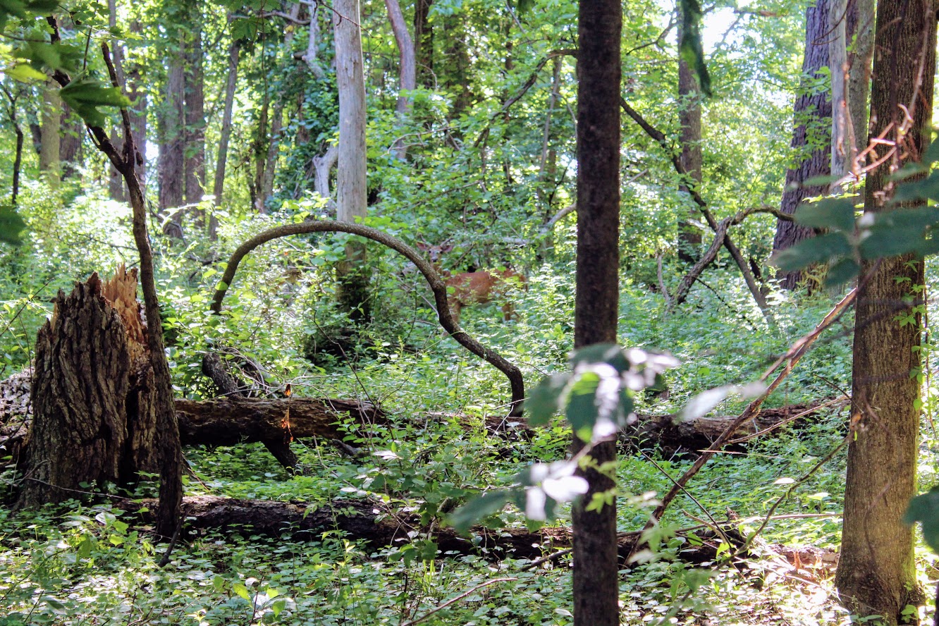
Unexpectedly, we did see more wildlife than anticipated. Peter Rabbit and Bambi made appearances.
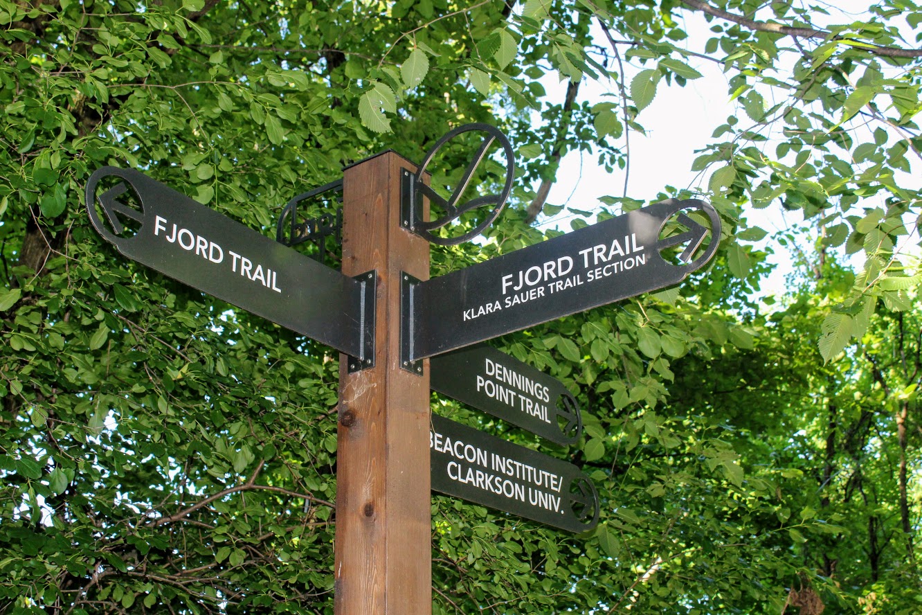
At the end of the Klara Sauer trail, we saw signs for the Dennings Point trail at the T intersection. Dennings Point trail was to our right. We did take a detour to our left on the Fjord trail to see the railroads tracks and caught a train going by under the bridge.
Railroads track if you veer on the trail to look for a train passing.
We circled back to follow the Dennings Point trail into the woods. We passed an abandoned building covered in tree branches where there was a brick factory many years ago. There will be a beach area path, where kayakers will stop for breaks, on your right. The beach front offered some impressive mountain views. Note, this trail is typically a loop but we reached an area that says to turn around due to the recent storm damage. We just turned around went back the same way.
when you run into this turn around the way you came!
views of kayakers and mOuntains.
views from the beach area of dennings point.
Great views.
This was a nice break from intense hiking. This was still great exercise. I would definitely come back. We walked about 2.8 miles and took us under 90 minutes. We got to see some great views. Long Dock Park is a great spot to kayak the Hudson River, do some fishing (may need a license), or just picnic with the friends and family.
love the views of the woods. trees down from storms on Dennings Point trail.

HIKING FOR DONUTS
A blog for the outdoors foodie enthusiast
Hi, I’m Mark. I live in Connecticut. I take new trips every chance I get. A good trip has a great hike, great food, and something fun to do. My goal is to search out new trips and share them to inspire others to try something new and exciting.
If you are looking for posts in a particular place, search by city or state here.
EXPLORE OTHER POSTS IN THE ARCHIVE
Archive
RECOMMENDED POSTS
MOST RECENT POSTS
See where I have been recently on Instagram. Follow @HIKINGFORDONUTS

Chauncey Peak Trail, Giuffrida Park, Meriden, CT
It is leaf peeper season here in the Northeast. There is no better time to go hiking than in the fall. I am going to attempt as many hikes as I can get in. Here's the first of many! And, one of my favorites.
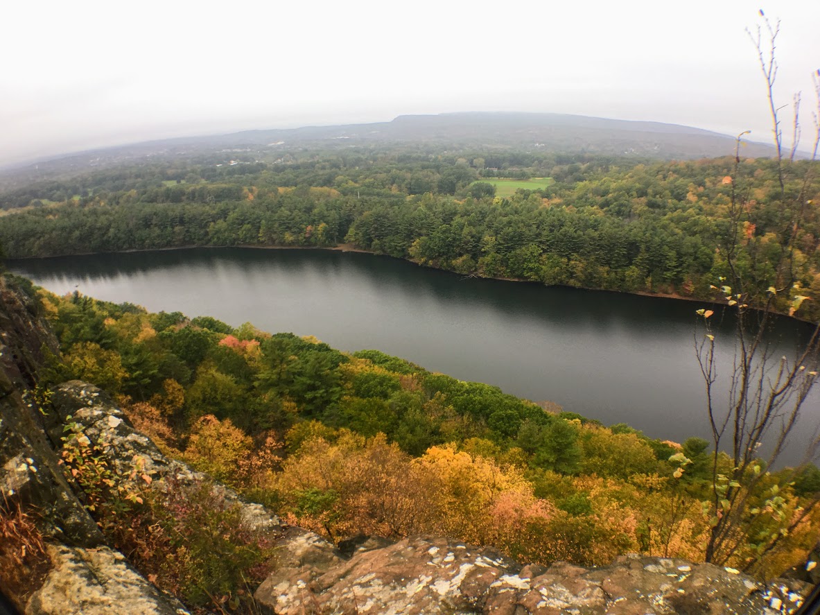
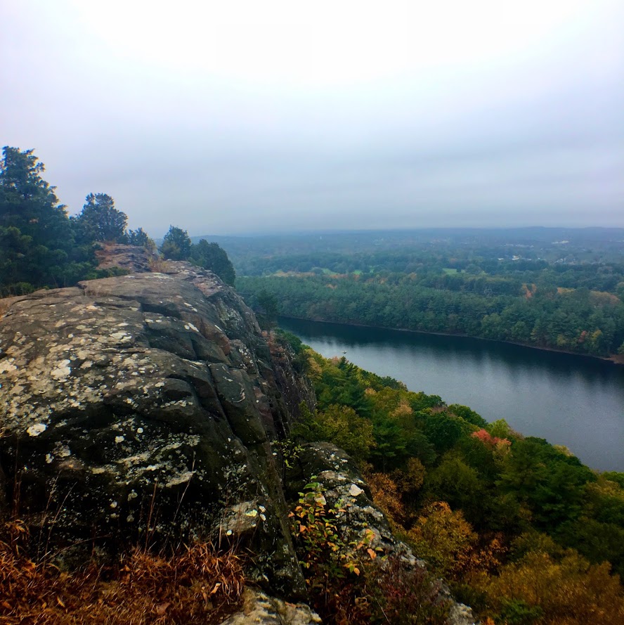
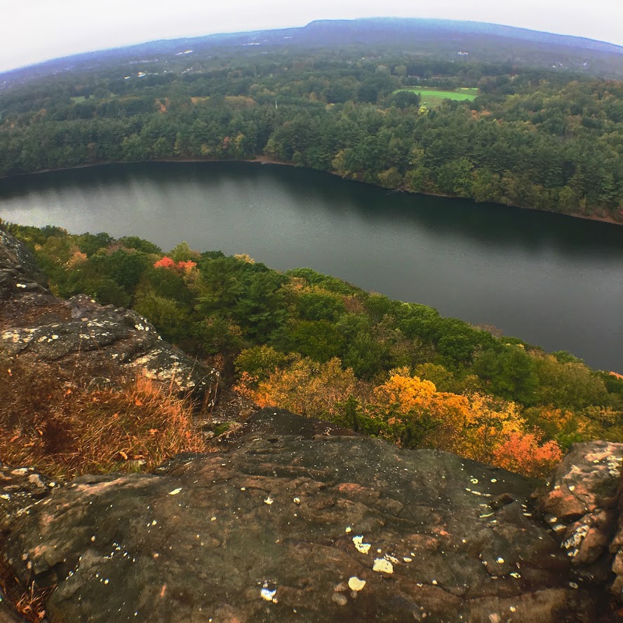
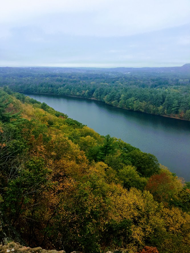
Trail Description: Located in Guiffrida Park, the Chauncey Peak Trail offers a scenic hike with beautiful ridge line views of Bradley Hubbard Reservoir.
Trail Info:
Where: Guiffrida Park, Meriden, CT Distance: 2.8 miles (2-2.5 hrs) Difficulty: Moderate Trail Type: Loop Features: Views, Reservoir, Lake, Peak
How to get there:
This is fairly easy. Just GPS Guiffrida Park and the address should be 800 Westfield Rd, Meriden, CT 06450. Once you pull in, you will see the parking lot.
Hiking Tips
Start the hike to the right of the parking lot into the forest. Much easier route going up and down.
The trail has been updated and re-routed. Be sure to follow the blue trail around Chauncey Peak and past the landfill. Look for the Blue markings.
There are many great views from the ridge line, be sure to take them all in.
The Hike
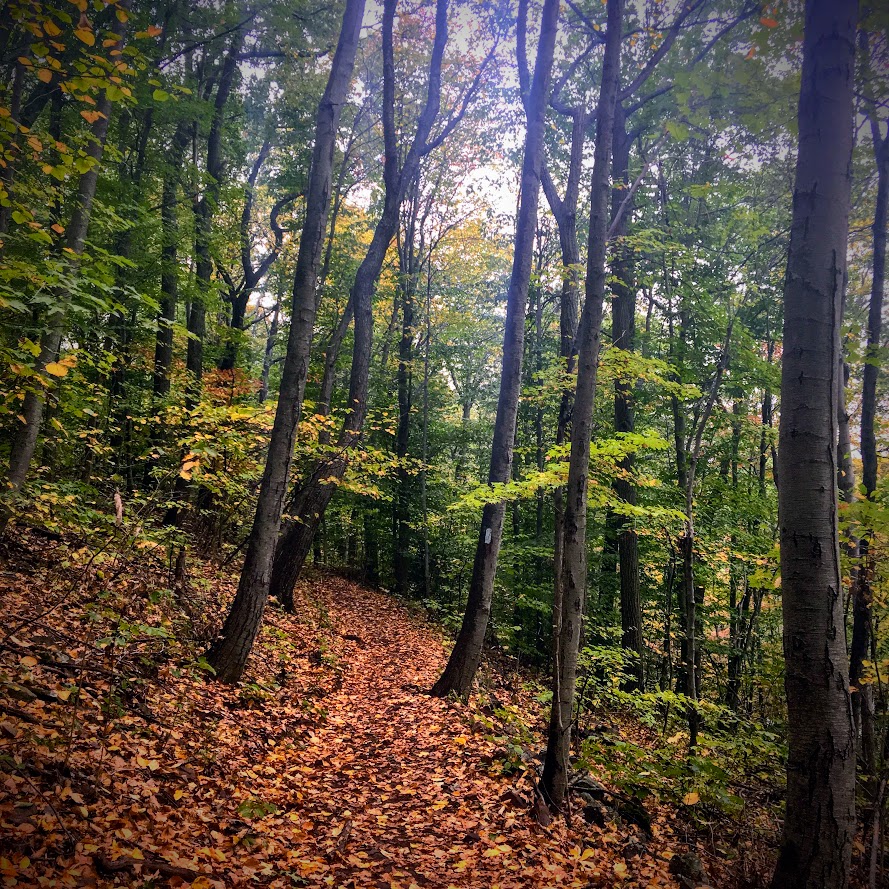
It is officially fall. It is chilly in the morning, the leaves are changing, and it is getting darker out earlier. Time to get out there and be a leaf peeper. Sounds kind of sketchy…..But seriously, fall hikes are the best. I slacked a little bit this summer with hiking, but I intend to take advantage of the fall weather.
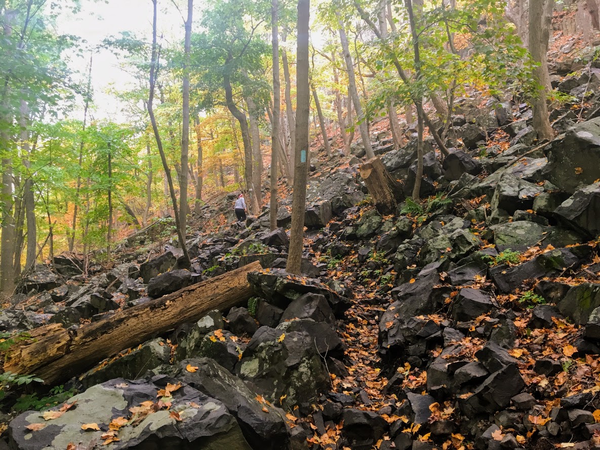
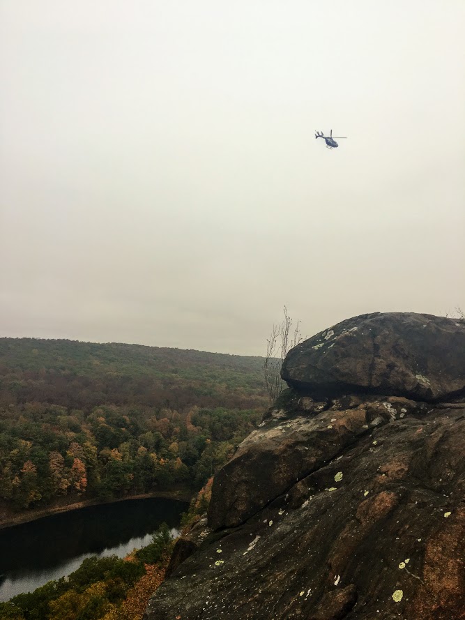
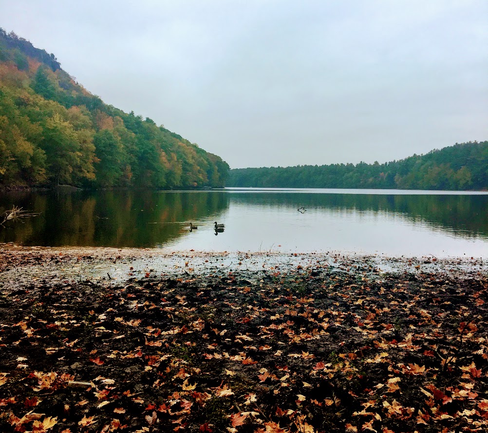
For my first fall hike, I chose the Chauncey Peak Trail at Giuffrida Park in Meriden, CT. This is my favorite hike in the Hartford area, hands down. I have hiked this trail multiple times and I enjoy it just as much each time. This is a very fun hike with great scenic views and a variety of terrains overlooking Bradley Hubbard Reservoir. Unfortunately, due to the fog on this day, it was tough to get that view in. I like to start the hike veering to the right under the trees into the woods on the Blue trail. You will get the strenuous part of the hike done in the beginning. You will immediately be on the incline ascent up the peak, this will be steep and rocky stretch. This won’t last too long. Once you get to the top, you will keep following the blue trail and this will bring you to the ridge line for great panoramic views. Once you are done taking hundreds of pictures, you will descend down until you meet a footbridge that takes you to the bottom of the reservoir. You will follow out the blue trail to the white trail along the water’s edge to the parking lot. This part will be flat and serves as a nice cool down.
The trail is well marked. They are taking great care of it. When I hiked this originally I got lost but since then the markings have greatly improved.I would consider this a moderate hike. You need hiking boots. Depending on the weather, it can be very slippery. I was slipping on the leaves and loose rocks myself due to some wetness. I finished hiking under 2 hrs. If you want a nice short day hiking with challenge and rewarding views, I highly recommend this trail.
Review:
Chauncey Peak Trail, 2.8m (Meriden, CT): 4.5 out of 5

HIKING FOR DONUTS
A blog for the outdoors foodie enthusiast
Hi, I’m Mark. I live in Connecticut. I take new trips every chance I get. A good trip has a great hike, great food, and something fun to do. My goal is to search out new trips and share them to inspire others to try something new and exciting.
If you are looking for posts in a particular place, search by city or state here.
EXPLORE OTHER POSTS IN THE ARCHIVE
Archive
RECOMMENDED POSTS


MOST RECENT POSTS
See where I have been recently on Instagram. Follow @HIKINGFORDONUTS