


South Mountain Loop Trail in Berlin, CT: Reservoir Views and a Hidden Ridgeline
South Mountain Trail, Berlin CT: Complete Hiking Guide
Hike the South Mountain Loop from Chamberlain Highway in Berlin, Connecticut, for views of Merimere Reservoir, Mine Island, East Peak, and downtown Meriden.
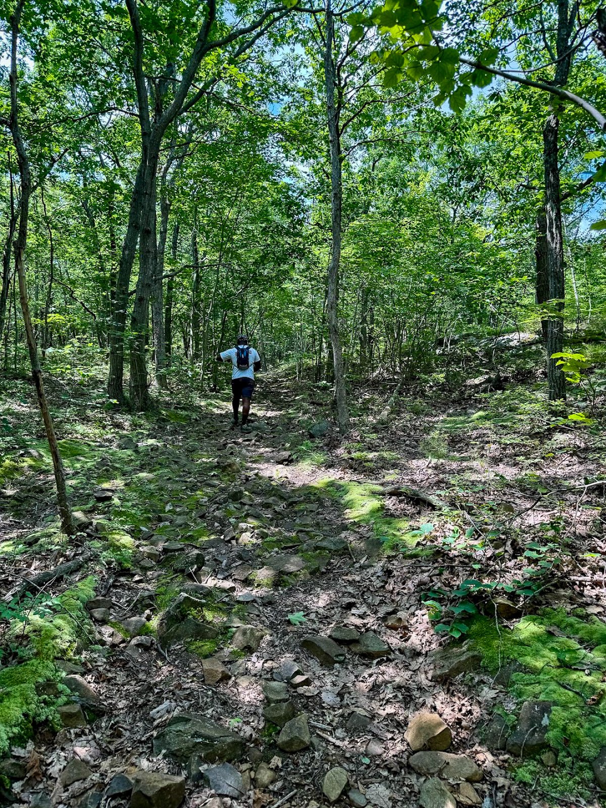
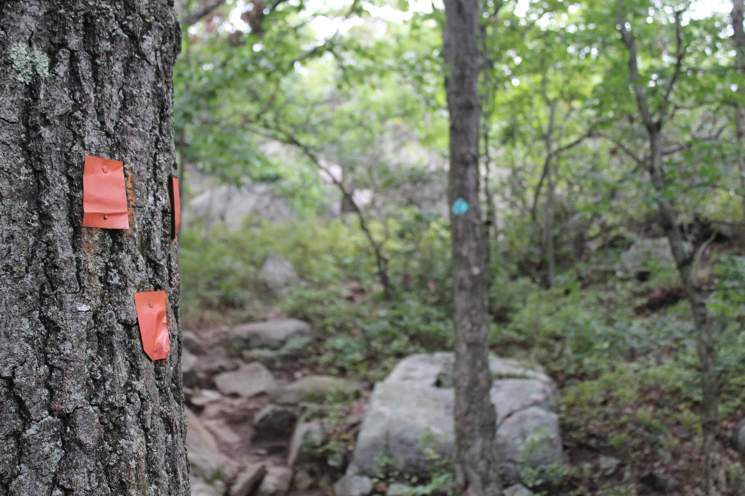
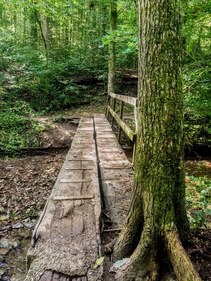
South Mountain is a hidden gem to me. I don’t see this mentioned too often online so exposing it I am conflicted. However, I also want my fellow hikers and followers to know this awesome hike resides in CT! With that said, hikers etiquette as always and leave not trace behind please. I would have never thought a hike like this existed off the side of a road. This trails begins aside Chamberlain Highway that initially feels more like a walk through the woods than a scenic mountain hike.
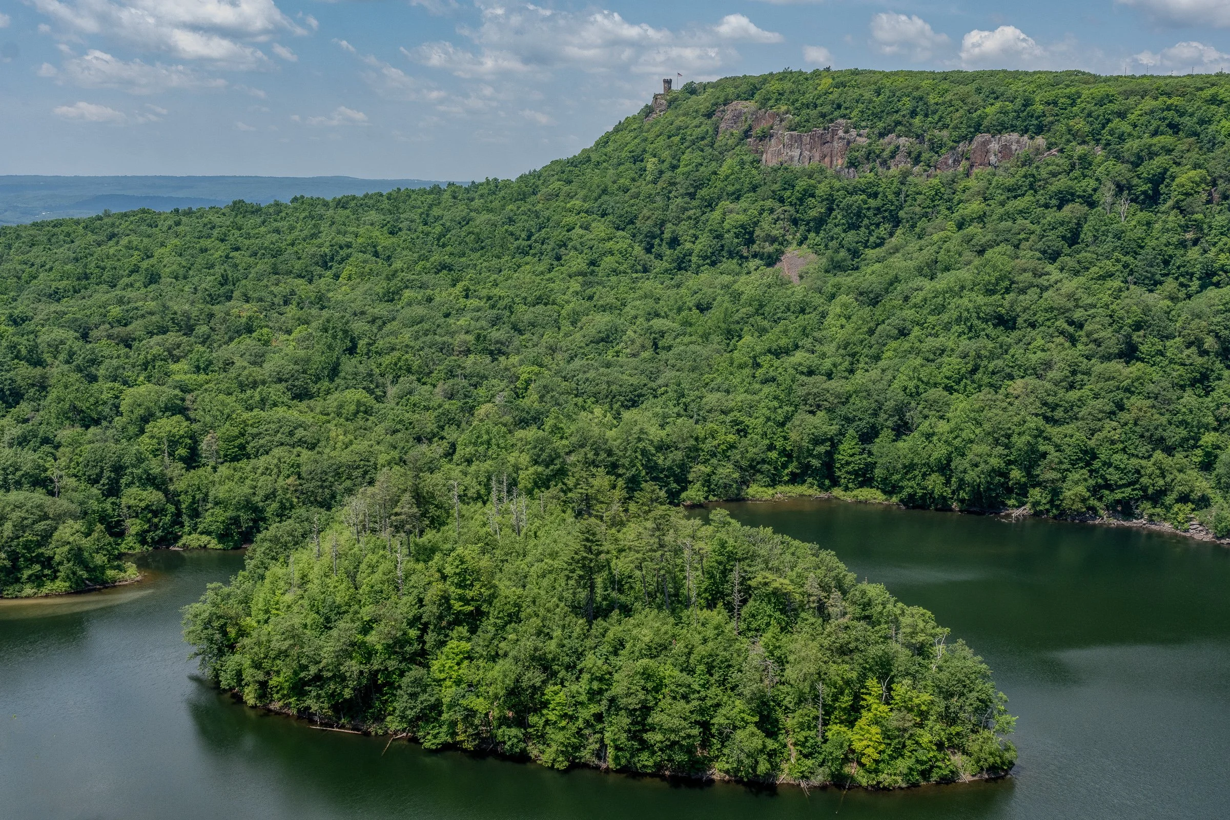
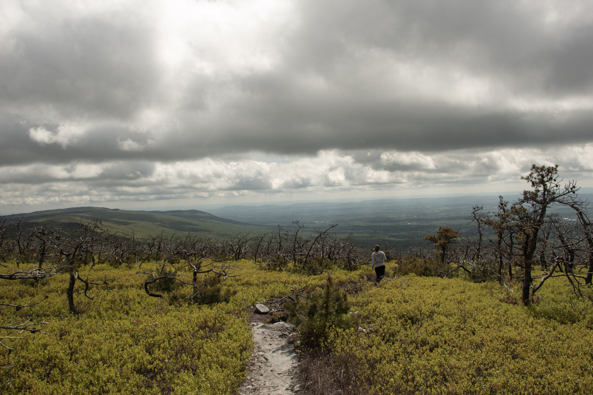
Once you reach the ridgeline, South Mountain delivers some seriously impressive views. The highlights include Merimere Reservoir, Mine Island, East Peak, Castle Craig, downtown Meriden, and the surrounding traprock hills.
This loop also feels much quieter than the more popular trails inside Hubbard Park. The parking area can be difficult to spot and parts of the route are poorly marked, but the views make the extra navigation effort worth it.
South Mountain connects with the blue-blazed Metacomet Trail, a 62-mile trail that follows Connecticut’s traprock ridges from the Hanging Hills north to the Massachusetts border. The Metacomet is also part of the larger New England National Scenic Trail.
Trail Description: The South Mountain Loop is a moderate hike that passes Elmere Reservoir before gradually climbing South Mountain. Several overlooks along the ridgeline provide views of Merimere Reservoir, Mine Island, East Peak, Castle Craig, downtown Meriden, and the commercial area near Interstate 691.
Trail Info:
Location: Berlin, CT (See link below)
Distance: Approximately 3.6 miles
Difficulty: Moderate
Trail Type: Loop
Highlights: Reservoir views, traprock cliffs, Mine Island, Castle Craig, and downtown Meriden
Dog Friendly: Yes
Best Season: Fall, Spring, Summer
How to get there:
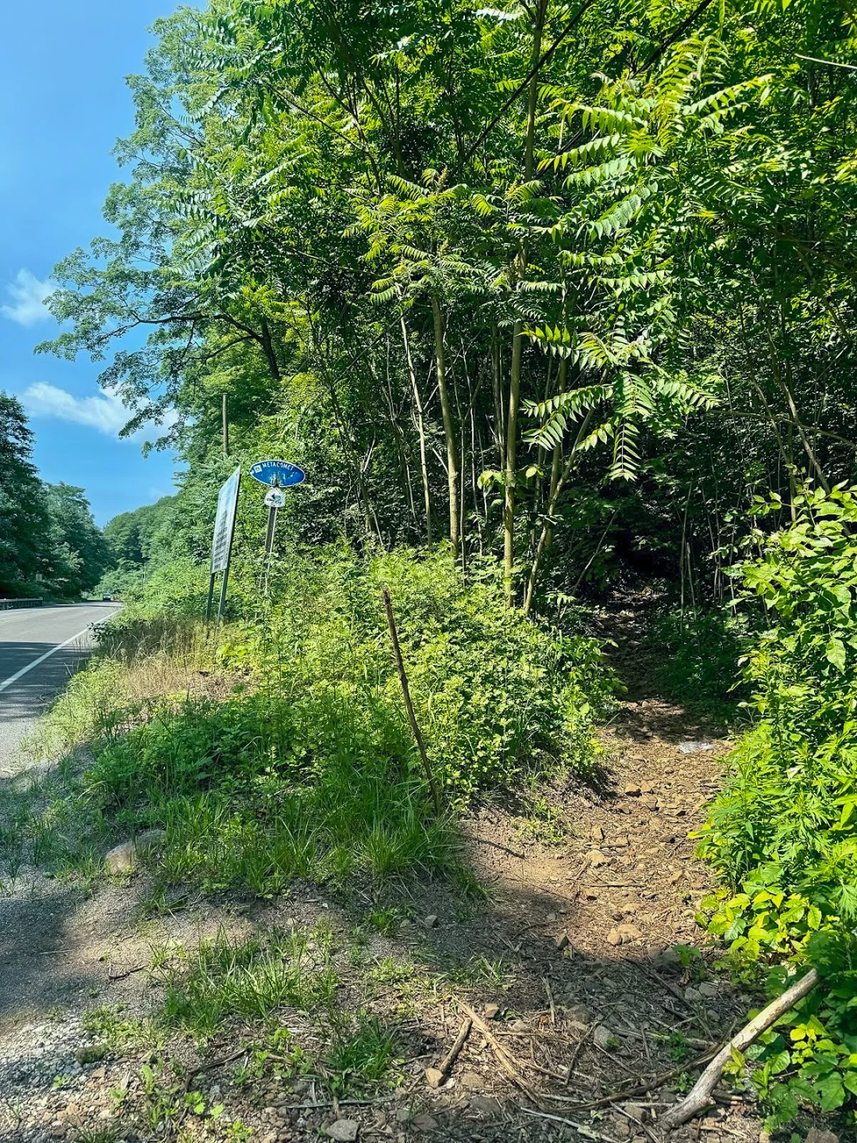
The trail begins where the blue-blazed Metacomet Trail crosses Chamberlain Highway, also known as Route 71, in Berlin.
Parking coordinates: 41.562803, -72.809665
This is not a traditional trailhead parking lot. There are only a few roadside spaces near the trail crossing, and the entrance can be easy to miss while driving along Route 71. Slow down as you approach and look for blue trail blazes on both sides of the road.
Do not block the roadway or park in the travel lane. When the closest spaces are occupied, additional roadside parking may be available a short distance south of the trail crossing.
Hiking Tips
Download park map, click here.
Parking is extremely limited, so an early start is a good idea on weekends.
Pay close attention at every major intersection. There are several unofficial or unblazed trails in the area, including routes toward Anderson Pond.
Nearby Things to Do:
Yellow Trail: Longer 1.8 Mile Hike (starts at the beginning of park road at the gate entrance)
Nearby Hikes: Litchfield County area has some great short hikes you could pair with this one.
Post Hike Brews: NorBrook Farm Local Brewery

Panoramic Views
Parking Information
Drive slow as approaching this area as the parking area is small and can be missed.
South Mountain Trailhead
The Hike
From Chamberlain Highway, enter the woods and begin following the blue blazes of the Metacomet Trail.
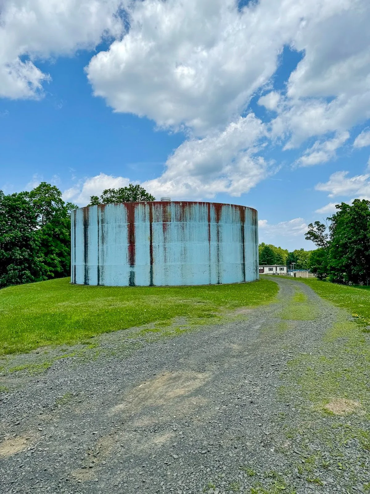
The opening section is relatively easy. You will soon pass a large water tank before arriving at Elmere Reservoir. It is not the dramatic mountain scenery you came for, but the reservoir provides a peaceful start to the hike.
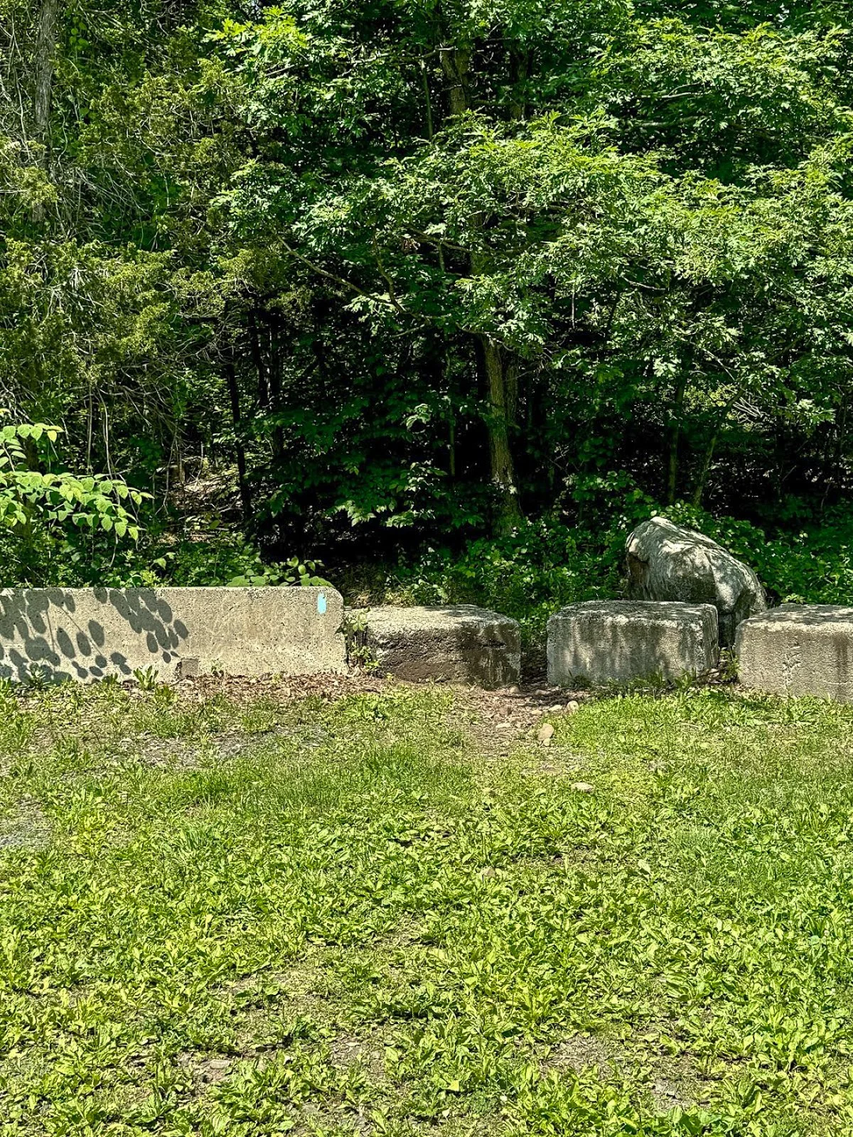
Continue beyond the reservoir and climb a small embankment near several concrete blocks. You will reach an intersection with an unblazed woods road. One direction leads toward Anderson Pond, while the other will eventually become your return route from the South Mountain cliffs.
For this route, remain on the blue-blazed trail.
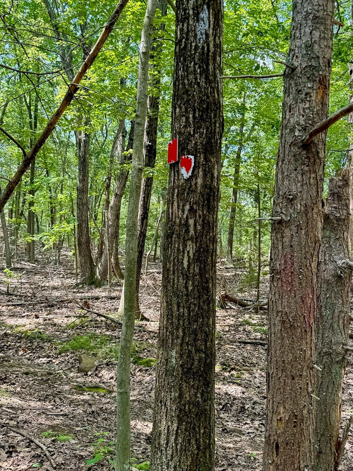
The trail may be rocky or wet through this section. Continue for a short distance until reaching another obvious intersection with a woods road on the left. Look carefully for faded or occasional red blazes.
Turn left here.
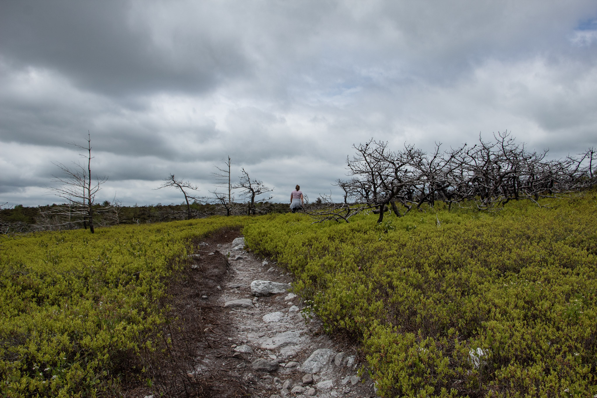
Climbing South Mountain
The red-blazed woods road begins a steady but manageable climb toward South Mountain. The incline is gradual rather than brutally steep, but it is enough to get the heart going.
The trail markings become less reliable as you gain elevation. Stay on the most established woods road and check your map whenever you reach a questionable intersection.
As you approach the top, watch for a poorly marked side trail on the right. This short path leads to one of the best viewpoints on the entire hike.
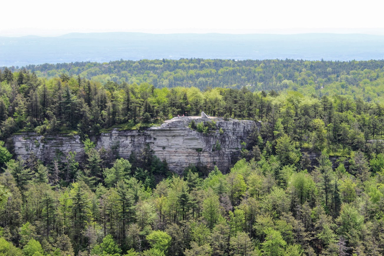
Merimere Reservoir Overlook
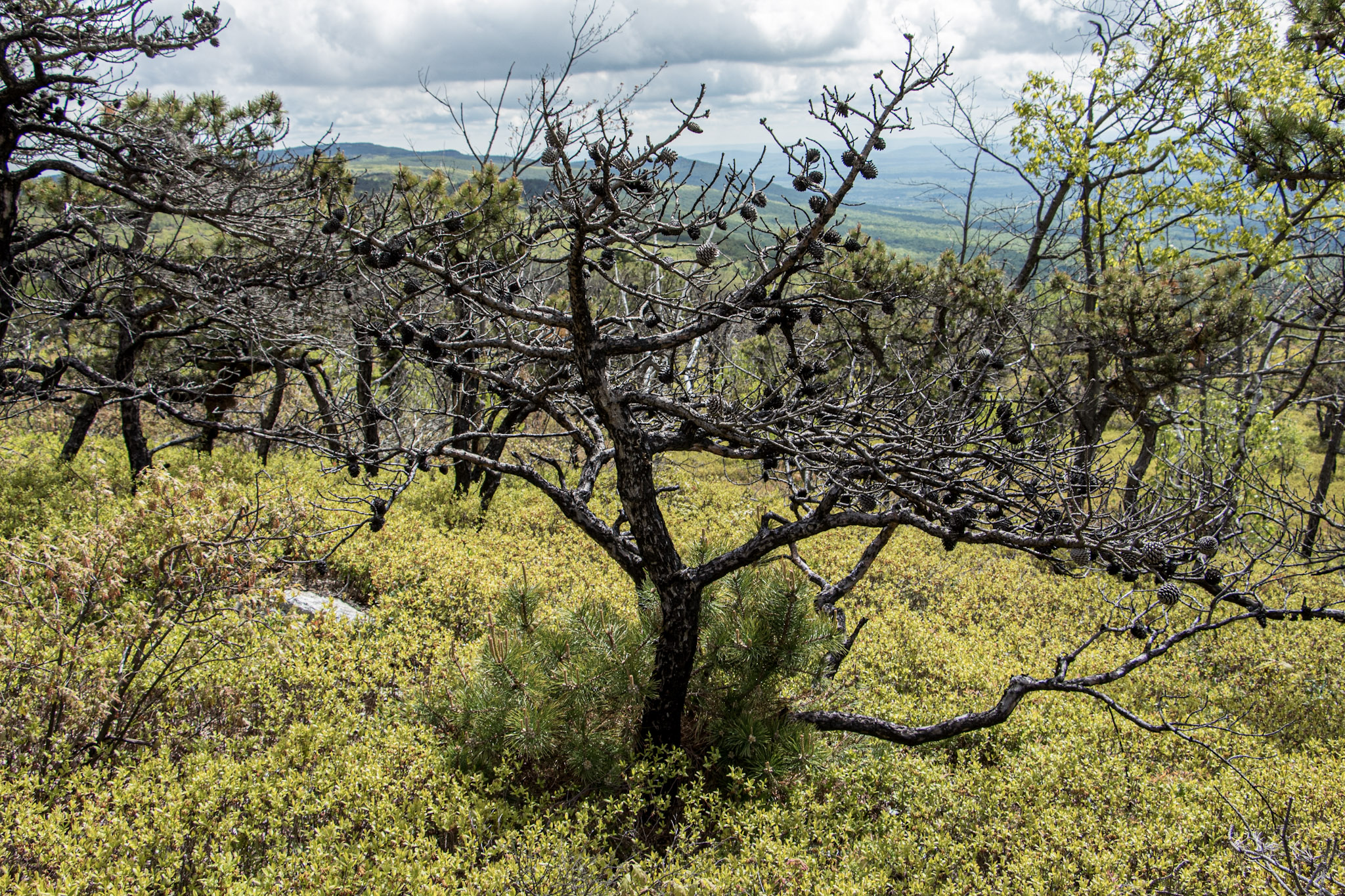
The first major overlook provides a gorgeous view across Merimere Reservoir.
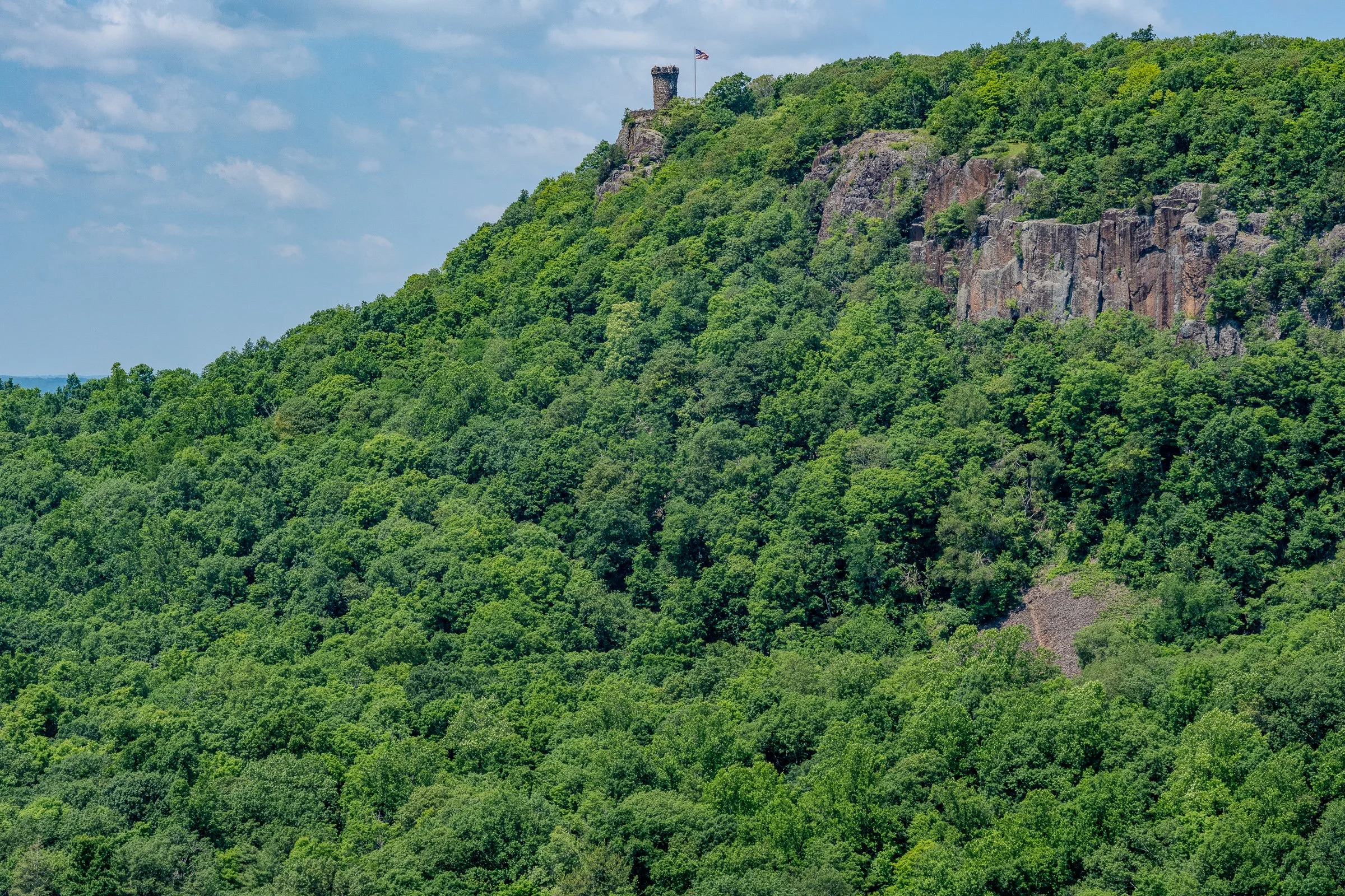
Mine Island sits prominently in the water, with East Peak rising behind it. Castle Craig may also be visible along the ridgeline. This is the money-shot view of the hike and a great place to stop, catch your breath, and take a ridiculous number of pictures.
The open ridgeline provides a wide view across the reservoir and surrounding Hanging Hills. It feels like a much bigger mountain experience than you might expect from central Connecticut.
South Mountain rises to approximately 767 feet, while the reservoir and surrounding valleys sit several hundred feet below the cliffs.

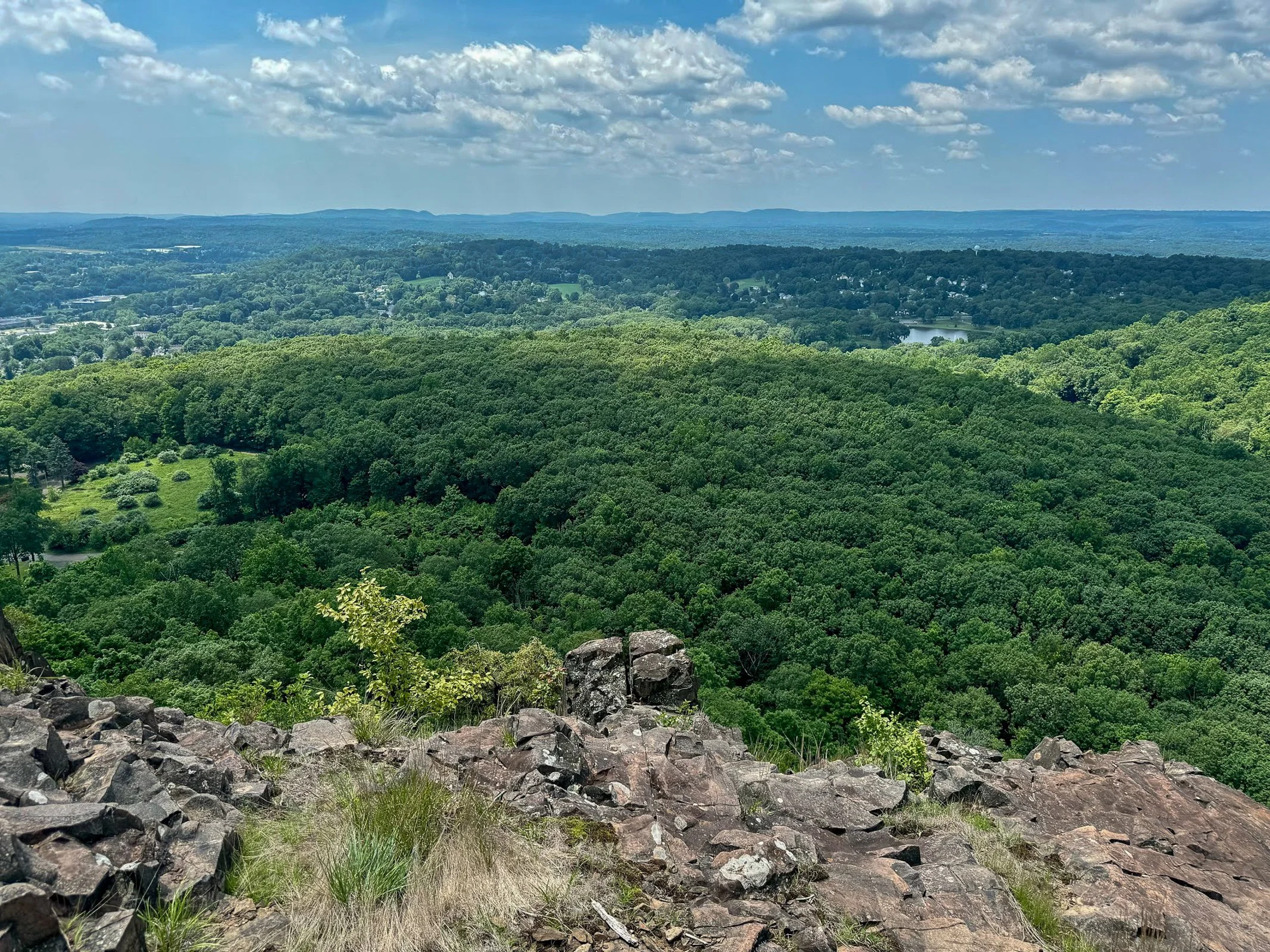
Downtown Meriden Overlook
After taking in the reservoir views, return to the main loop trail and continue along the ridge.
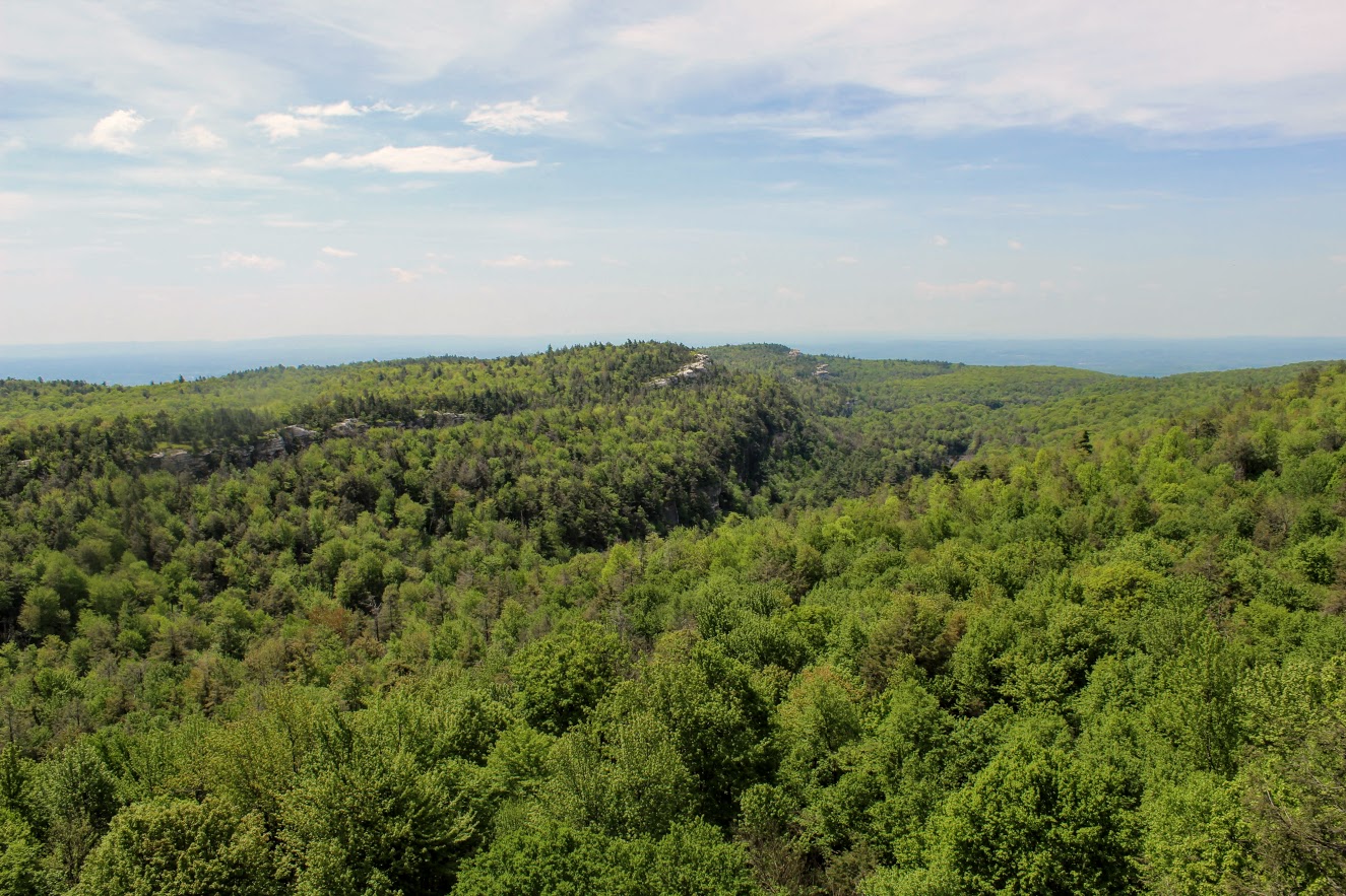
The woods road dips and climbs gently before reaching another open viewpoint. This side of South Mountain provides a dramatic look toward downtown Meriden and the developed areas surrounding Hubbard Park.
The contrast is interesting. One minute you are looking across a quiet reservoir toward Castle Craig, and the next you are standing above the city.
Continue following the ridgeline through the open woods. Trail markings may still be inconsistent, but the main route is usually easy enough to identify.
Target View and the Return Route
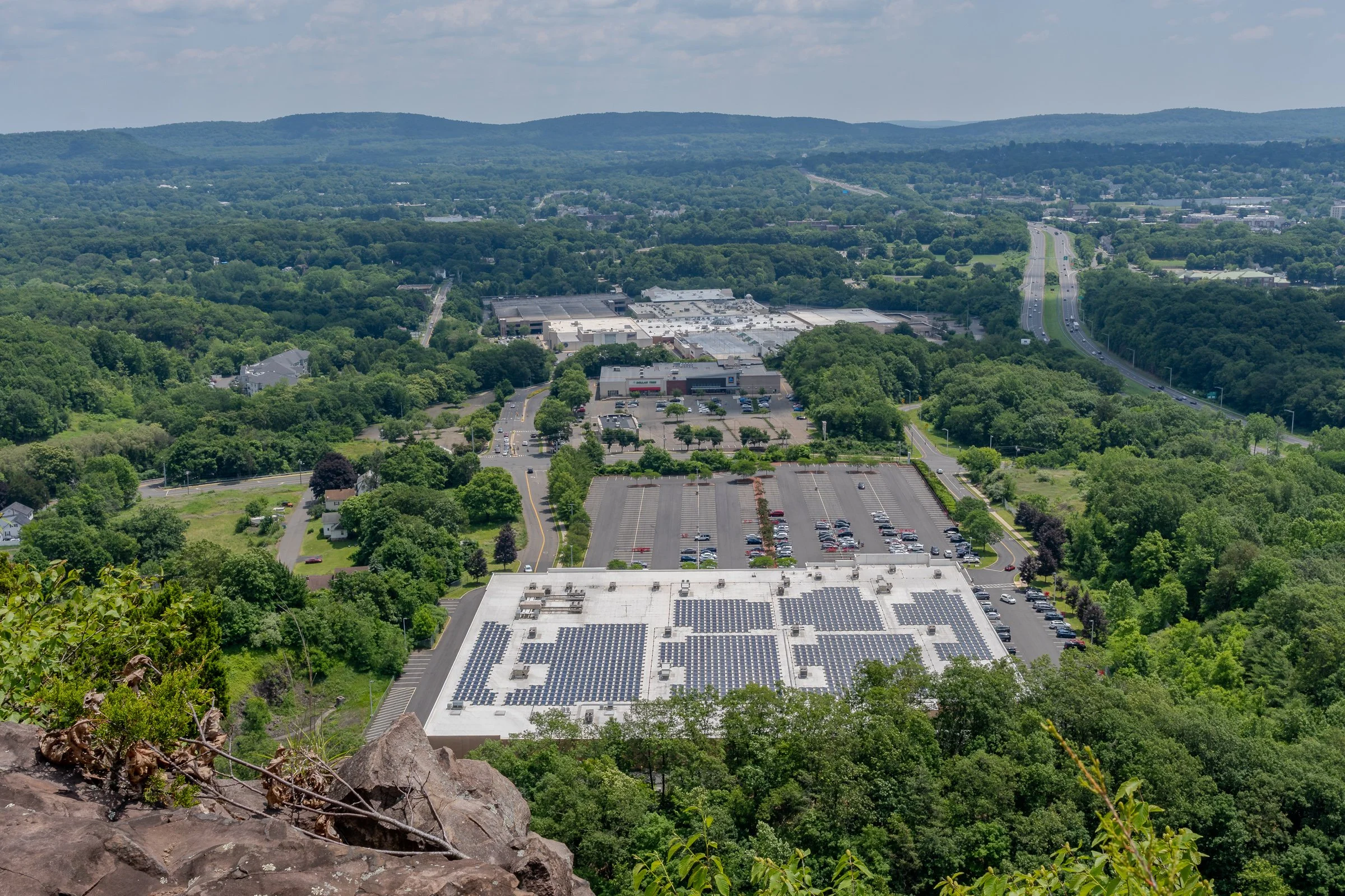
As the trail curves around the mountain, you will reach the east-facing cliffs sometimes referred to as the Target View. The shopping area sits directly below, with Interstate 691 and several additional traprock ridges visible in the distance.
It may not be the classic wilderness view, but it shows just how suddenly South Mountain rises above the surrounding city.
Continue descending on the woods road. This portion completes the loop and eventually returns to the earlier intersection near Elmere Reservoir.
Once you reconnect with the blue-blazed Metacomet Trail, turn right and retrace the opening section of the hike. Pass Elmere Reservoir and the water tank before returning to Chamberlain Highway.
Nearby Things to Do
It would not be Hiking for Donuts without a post-hike treat. Swiches & Coffee Donuts is a good option in town. After this hike, me and my buddy went to the local brewery, Coles Road Brewing. Also, Kensington Pizza is a big spot locally. Downtown Berlin has been getting new restaurants so be sure to stop in town.
Neil’s Donuts in Wallingford is a solid option as well after exploring South Mountain. It is not too far away for some amazing donuts.
Other Connecticut Hikes Nearby
Looking for more scenic Connecticut hikes?
Follow Hiking For Donuts on Instagram for more New England hiking adventures.

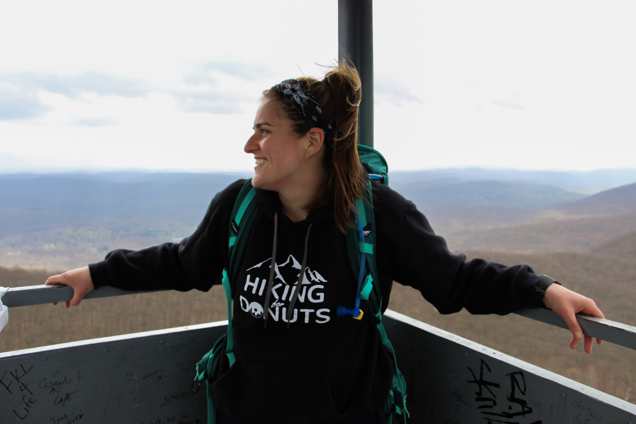
HIKING FOR DONUTS
Hi, I’m Mark. I live in Connecticut. I take new trips every chance I get. A good trip has a great hike, great food, and something fun to do. My goal is to search out new trips and share them to inspire others to try something new and exciting.
If you are looking for posts in a particular place, search City or State here.
SEE OTHER POSTS IN ARCHIVE
Archive
RECOMMENDED POSTS


RECENT POSTS


See the latest on Instagram and follow @HIKINGFORDONUTS

Haystack Mountain Trail, Connecticut: Fire Tower Hike With Epic Views
Haystack Mountain State Park Trail Guide (Norfolk, CT)
Haystack Mountain State Park might be one of Connecticut's best "bang for your buck" hikes. Less than a mile round trip gets you to a stone fire tower with sweeping views across four states.
Haystack Mountain State Park in Norfolk, Connecticut is one of the best short hikes in New England. This quick out-and-back trail leads to a historic stone fire tower with sweeping 360-degree views into Connecticut, Massachusetts, New York, and Vermont.
At less than a mile round trip from the upper parking area, this is an excellent beginner-friendly hike with a huge scenic payoff. If you’re looking for an easy Connecticut hike with mountain views, this trail deserves a spot on your list.
Trail Description: Haystack Mountain Trail contains an impressive stone fire tower with stunning views of the mountains in Connecticut, Massachusetts, New York, and Vermont.
Trail Info:
Location: Norfolk, CT (See link below)
Distance: 0.8 mile (30-45 min) Round Trip
Difficulty: Moderate
Trail Type: Out and Back
Highlights: Views, Mountains, Valley, Fire Tower, Panoramic Views
Dog Friendly: Yes
How to get there:
Haystack Mountain State Park - On Rte. 272 Norfolk, CT 06058
Trailhead parking location here.
Easy to find off Route 272. The road goes halfway up Haystack Mountain to a parking lot, where the shortest trail starts. The parking lot can hold about 10 cars.
Hiking Tips
Download park map, click here.
Cell phone service is spotty. Hike carefully.
There can be seasonal closures of the park.
Nearby Things to Do:
Yellow Trail: Longer 1.8 Mile Hike (starts at the beginning of park road at the gate entrance)
Nearby Hikes: Litchfield County area has some great short hikes you could pair with this one.
Post Hike Brews: NorBrook Farm Local Brewery

Panoramic Views
Haystack Mountain Trail Guide
Haystack Mountain State Park in Norfolk, Connecticut is one of the best short hikes in New England.
At less than a mile round trip from the upper parking area, this is an excellent beginner-friendly hike with a huge scenic payoff. If you’re looking for an easy Connecticut hike with mountain views, this trail deserves a spot on your list.
This guide will be for the shortest trail route at 0.8 miles from the top parking lot of Haystack Mountain. These days my time is a bit limited and the best bang for your buck is what is more appealing. If you want to make it a longer hike, there is the Yellow Trail that starts near the beginning of park road at the gate entrance. This will be 1.8 miles, out and back. Both of these options will be great hikes to get to the main attraction, the amazing tower views.
Trail Overview

Haystack Mountain Trailhead
Parking Information
Once you have parked at the top parking, which is about a mile once you enter the park, the trail is to the left to begin the summit.

Haystack Mountain Trail
The Hike to the Fire Tower
This trail is fairly straightforward. It is well-maintained and clearly marked. The first 0.2 miles are flat and easy breezy. The next 0.2 miles will get your heart pumping as the trail bends to the left and starts a quick incline with 200 feet of elevation. Those quads might be on fire but it is all worth it once you see the bad ass tower at the top.
Check out my Instagram reel for a video walkthrough of the Haystack Mountain Trail and the fire tower views here.

Haystack Mountain Trail Incline
Now, it’s time to climb the 34 foot stone tower up to the top for the 360 views at 1,683 feet of elevation.
Tower Views and What You’ll See

Haystack Mountain Fire Tower
Definitely some of the best views you will have in Connecticut. It was a bit overcast and cloudy for me, but still impressive views nonetheless. On a clear day, there is visibility of the Riga Plateau in Northwest Connecticut, the Berkshires in Massachusetts, the Catskills in New York, and the Green Mountains of Vermont. That is quite a combination of views.

View at the Top

Haystack Mountain Trail Views
Nearby Breweries and Things to Do
This would be great to pair with some other short hikes in the Litchfield County area. In addition, there are great local breweries as well such as NorBrook Farm for post hike brews.
Things to Do Nearby:
Yellow Trail: Longer 1.8 Mile Hike (starts at the beginning of park road at the gate entrance)
Nearby Hikes: Litchfield County area has some great short hikes you could pair with this one.
Post Hike Brews: NorBrook Farm Local Brewery
Other Connecticut Hikes Nearby
Looking for more scenic Connecticut hikes? Check out these links to other trail guides for hikes in Litchfield County:
Follow Hiking For Donuts on Instagram for more New England hiking adventures.
HIKING FOR DONUTS
Hi, I’m Mark. I live in Connecticut. I take new trips every chance I get. A good trip has a great hike, great food, and something fun to do. My goal is to search out new trips and share them to inspire others to try something new and exciting.
If you are looking for posts in a particular place, search City or State here.
SEE OTHER POSTS IN ARCHIVE
Archive
RECOMMENDED POSTS
RECENT POSTS
See the latest on Instagram and follow @HIKINGFORDONUTS

Ferncliff Forest Fire Tower, Rhinebeck, NY
Trail Description: This is a short hike that brings you to a fire tower with stunning panoramic views of the Catskill Mountains.
Trail Info:
Where: Rhinebeck, NY Distance: 1.4 miles (1 hour) Difficulty: Easy Trail Type: Out & Back Features: Views, Mountains, Water, Pond, River, Fire Tower
How to get there:
68 Mt. Rutsen Road Rhinebeck, NY 12572
https://goo.gl/maps/cXzcj8ZLTL8BxYBh7
Hiking Tips
A busy spot for nice weather and fall foliage.
There are multiple hiking trails in this park, plan your route.

The Hike
From the parking lot, there is a kiosk where you can view the trail map. The yellow-blazed trail starts past the gate. Proceed with the yellow-blazed trail as it inclines gradually along the gravel road. The signage is pretty good on this trail and there are signs to the fire tower.

In about 5 minutes, the trail reaches a pond and there will be a cabin with a sign marked “TOWER” .


And, once you pass the cabin, there is a lean-to that points to the right to continue on the yellow-blazed trail marked “TOWER”. That is the trail you want to be on.

The path continues to climb slowly. There will be another lean-to on the trail and at about another 0.6 miles, the fire tower will be on the left. There are multiple paths that lead to the tower. This is the shortest route. Once my wife and I arrived, there was already a line to go up to the tower. Only 10 people can fit at a time and even that is a stretch. Only family and friend groups were going up.

Once we got up to the top, the panoramic views were amazing! Views of the Hudson River, Catskills, and the Kingston-Rhinecliff Bridge. The fall colors were really popping. This is a great spot for sunset or sunrise. We didn’t get to spend as much time as we wanted up top as we wanted to be considerate to others waiting in line. We returned the same way we came but you could get back to the parking lot a different way.


HIKING FOR DONUTS
Hi, I’m Mark. I live in Connecticut. I take new trips every chance I get. A good trip has a great hike, great food, and something fun to do. My goal is to search out new trips and share them to inspire others to try something new and exciting.
If you are looking for posts in a particular place, search City or State here.
SEE OTHER POSTS IN ARCHIVE
Archive
RECOMMENDED POSTS


RECENT POSTS
See the latest on Instagram and follow @HIKINGFORDONUTS


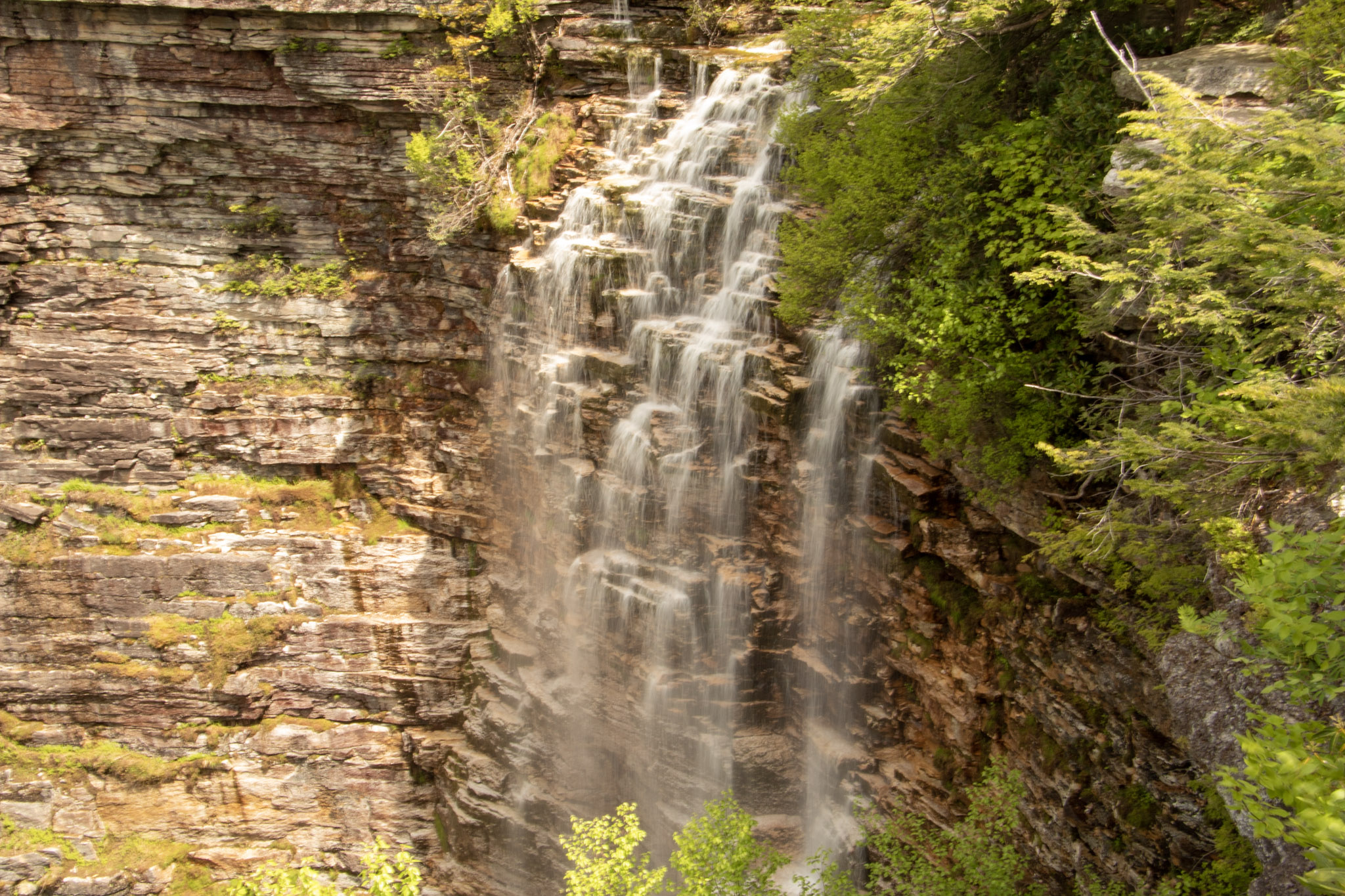
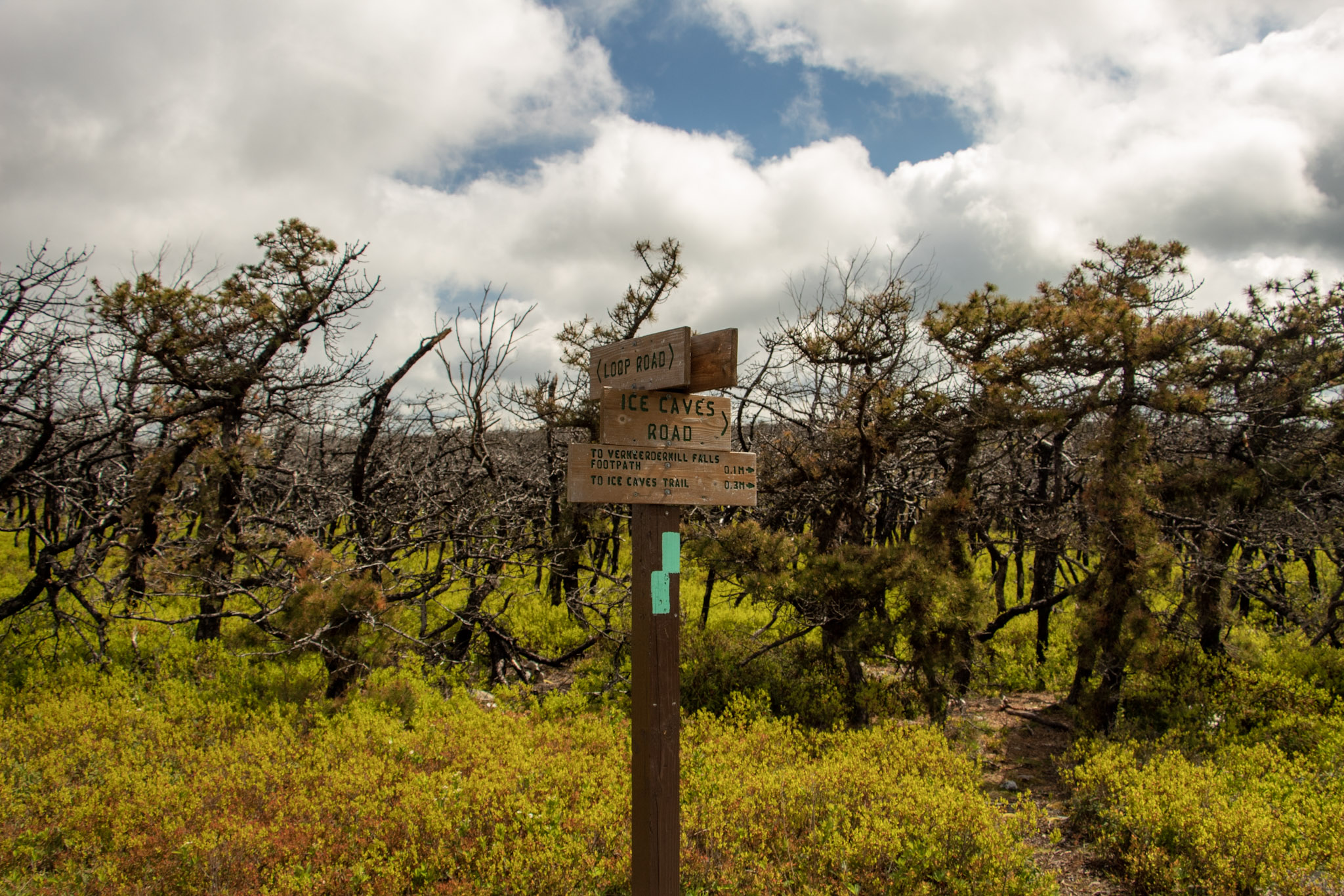
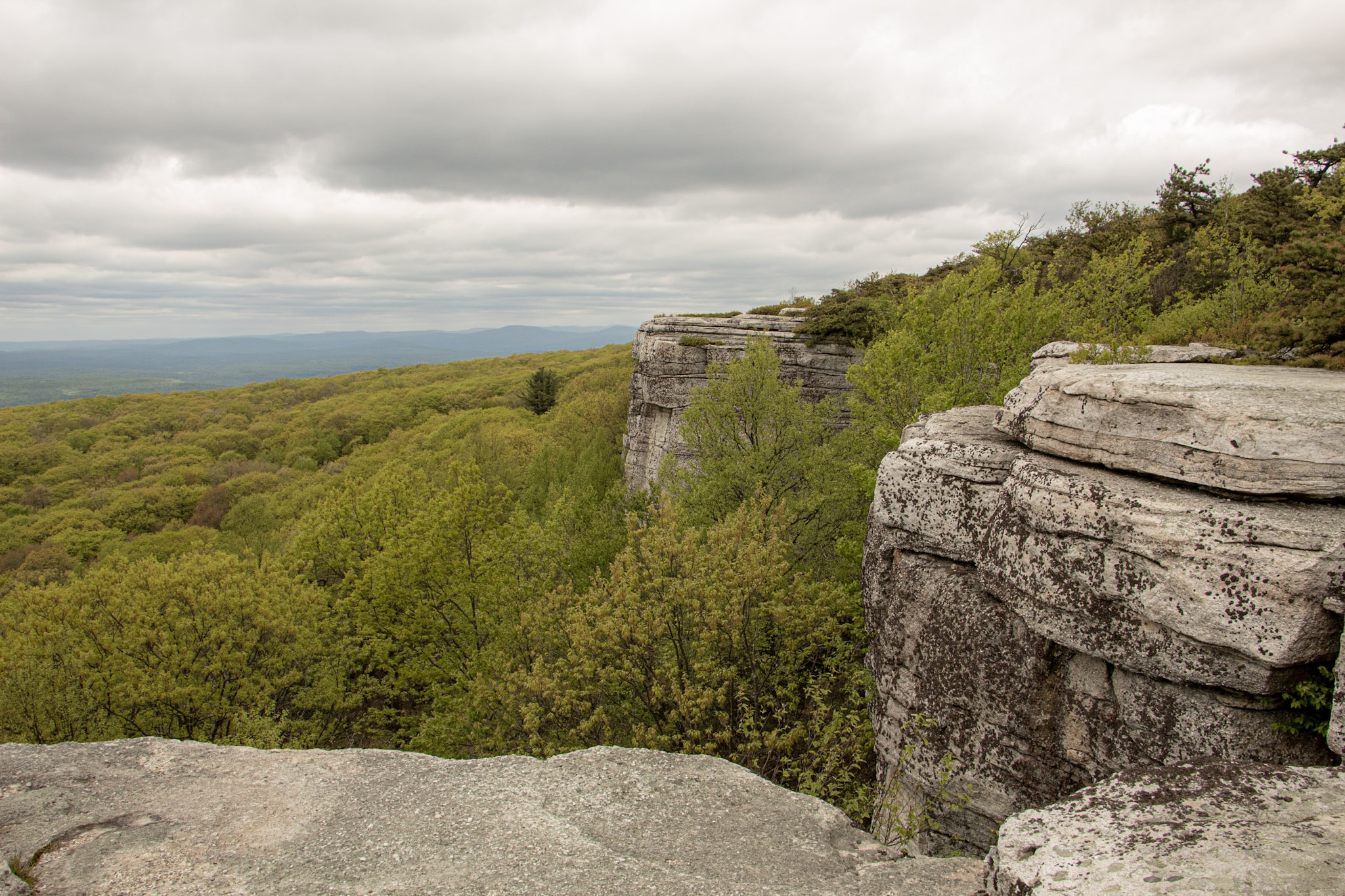
Sam’s Point and Verkeerderkill Falls Trail, New York
Trail Description: Sam’s Point Reserve offers panoramic views of the Shawangunk Ridge along with exploring a 180 foot waterfall.
Trail Info:
Where: Ellenville, NY Distance: 6.2 miles (3-4 hours) Difficulty: Moderate Trail Type: Out and Back Features: Views, Mountains, Valley, Waterfall, Ice Caves (optional)
How to get there:
400 Sams Point Rd Cragsmoor, NY 12420
This will take you right to the parking lot. Parking costs $10. There is a kiosk to pay near the visitor center.
Hiking Tips
Parking lot opens at 9am. If parking lot is full, you have to wait until someone leaves. Plan accordingly as parking is limited.
Did not include the Ice Caves on this day. Would add an additional 1.1 miles to the hike.
Use bug spray for ticks and sunscreen when sun is out. Most of the hike is the open.
The Hike
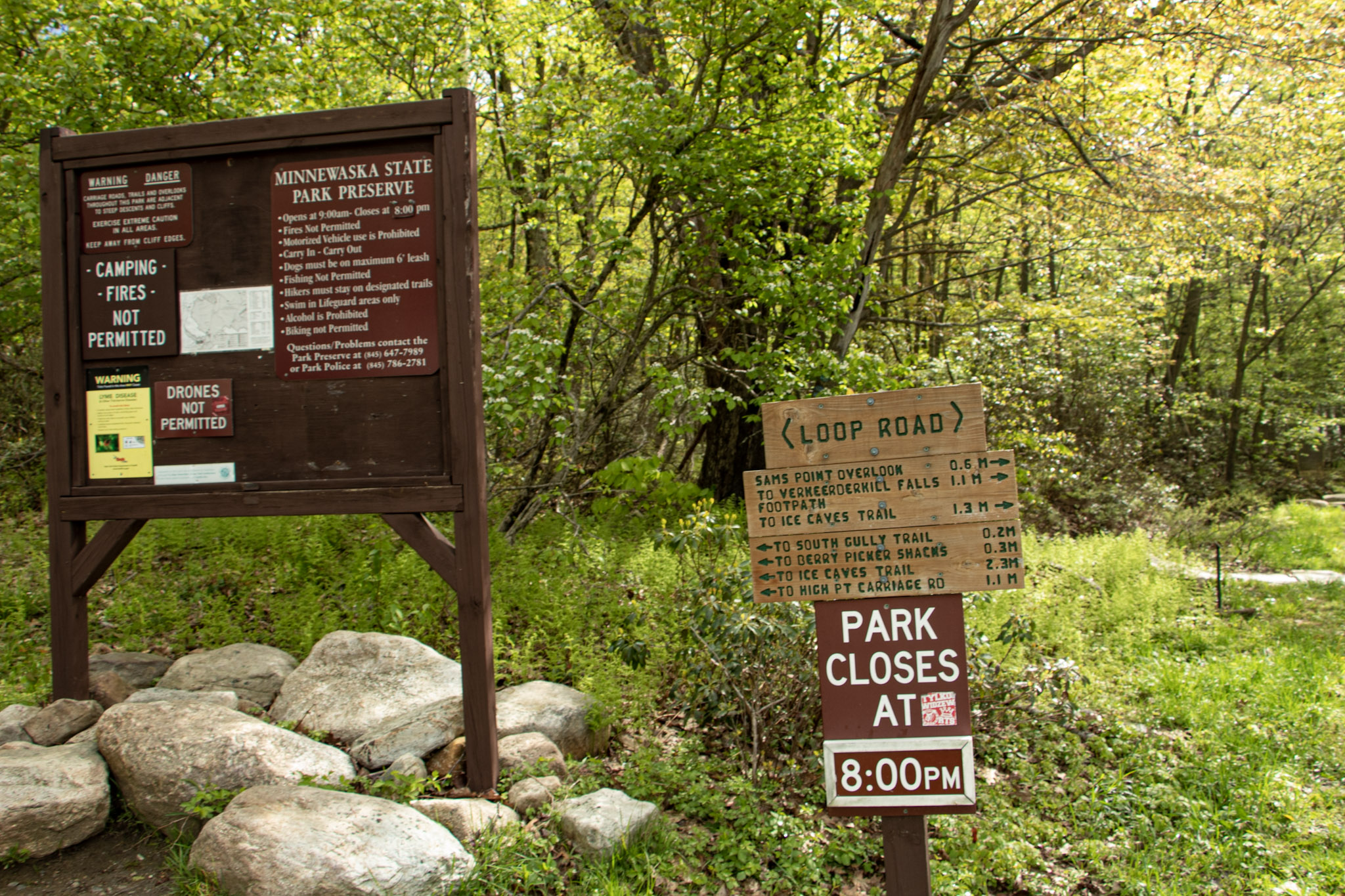
The next hike in the Hudson Valley to check off my list is Sam’s Point. I anticipated great views but there was much more to this hike than I thought. Until I researched recently, I didn’t realize a waterfall was part of the hike. Veerkeerderkill Falls is the tallest waterfall in the Shawangunk Mountains at 180 feet. And, there are even ice caves on this trail. Sam’s Point is part of Minnewaska State Park, but the parking is located at a different location than the park’s entrance. We left early in time to beat the 9am opening and there were already quite a few cars in line. Once parked, there is a kiosk to pay for parking and there is a visitor center at this lot, where there are 2 restrooms.
After packing up our gear, we headed toward the trailhead. Walking around the gate took us on the main trail, Loop Road. There is an intersection almost immediately to choose from, veering right will take you to Sam’s Point. The other option is the Huckleberry Pickers’ shacks. Tempting but we will pass on that. Heading up the fragmented road, there is a slight incline as altitude gains up the switchbacks. In short time, we came up to a massive rock with a cliff above, which we learned later is the top of Sam’s Point. At about a half mile, the first view was on our left on top of a rocky platform.
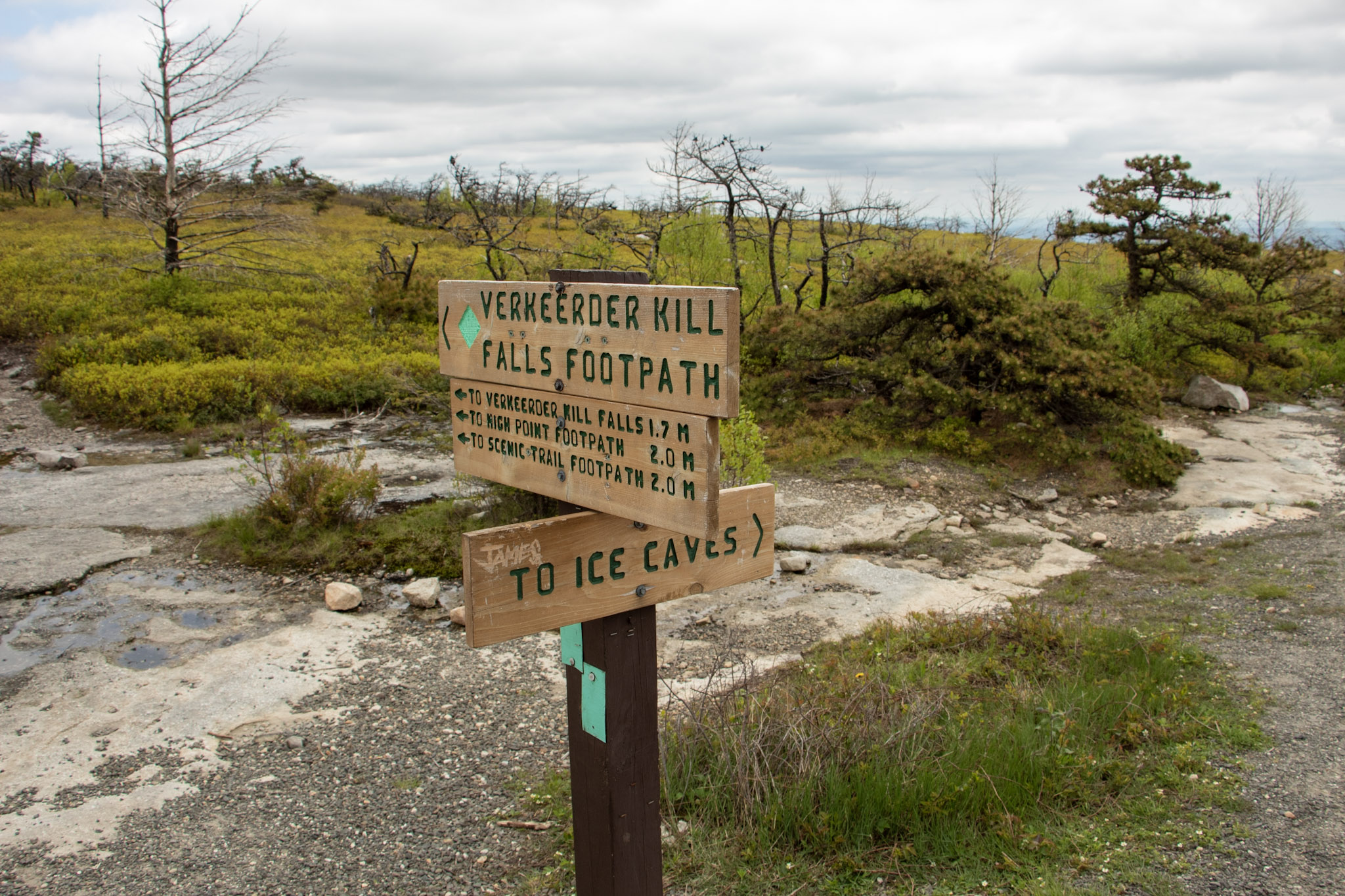
Loop Road will even out and we had an option to keep straight toward the waterfall or turn left toward the short trail to check out the view from Sam’s Point. It was pretty crowded and I just wanted to beat everyone to the waterfall so we saved Sam’s Point for the end. A short distance off Loop Road, we saw signs on our left to head toward Verkeerderkill Falls on the aqua blazed trail. If you wanted to check out the Ice Caves, continue straight from here. We couldn’t fit those in today, so we headed toward the waterfall.
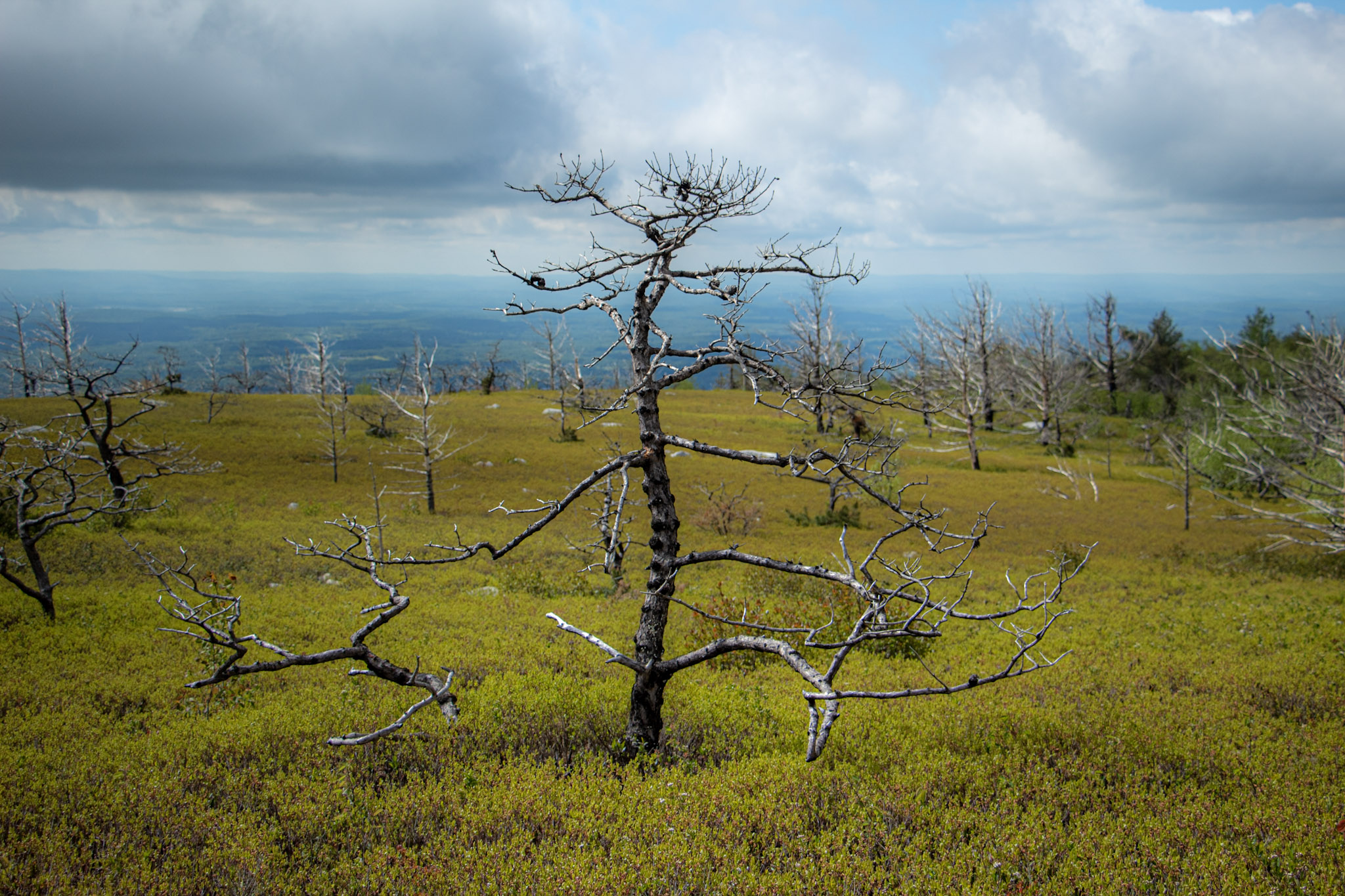
I did not anticipate the cool landscape we would be hiking through on this hike. Strolling along the trail you will the see rare dwarf pine trees offering very unique scenery. In addition, there are wide views of the Northern Shawangunk Ridge along this part of the trail. The trail will head downhill slightly. This isn’t terrible but the fact that it gets rockier, makes it a bit more challenging. As you get closer to the waterfall, there is a steep descend down.
Eventually, we came upon a stream above the falls. Depending how high the water is on a given day, you may have to follow upstream to cross. We made our way to the cliff overlook and we were greeted with a large crowd. Then, I turned around and saw the amazing view of Verkeerderkill Falls! The water was flowing pretty well on this day. This is nice spot to take a break and relax. However with the crowd and popularity of the hike, we absorbed the fall briefly and started retracing our steps back.
We finally made our way over to Sam’s Point. The views are outstanding. From the cliffs, you can see the Shawangunk Ridge and Wallkill Valley. Lots of space to take in all the scenery, grab a snack, or take a selfie. There were lots of selfies going on around us. Before we left, I had one thing left to do. I was waiting for the perfect moment. Mostly, I was waiting out the 20 plus Cub Scout group that were yelling and running around. In addition, there was this one kid (like in his 20s) with his mom who kept taking selfies and would NOT leave until he got the perfect one for Instagram. Come on dude. Once they left, I saw my opening and proposed to my amazing girlfriend! Even though I made her trek 6 miles on her birthday and endure 20 minutes of freezing wind atop Sam’s Point, she said yes. I didn’t realize how packed this overlook would be at all times. Sorta risky move. No backup plan. But in the end, everything went as planned. Then, we joyously made our way back down to the parking lot.
This hike has a lot of meaning for me going forward but this was a dynamite hike. When you can explore different landscapes and come across multiple features that this trail offers, there is not much more you can ask for in a hike. This is a great place to visit to spend the day.
MORE PICTURES BELOW:
HIKING FOR DONUTS
Hi, I’m Mark. I live in Connecticut. I take new trips every change I get. A good trip has a great hike, great food, and something fun to do. My goal is to search out new trips and share them to inspire others to try something new and exciting.
If you are looking for posts in a particular place, search City or State here.
SEE OTHER POSTS IN ARCHIVE
Archive
RECOMMENDED POSTS
RECENT POSTS
See the latest on Instagram and follow @HIKINGFORDONUTS

Mount Beacon Fire Tower, Beacon, NY
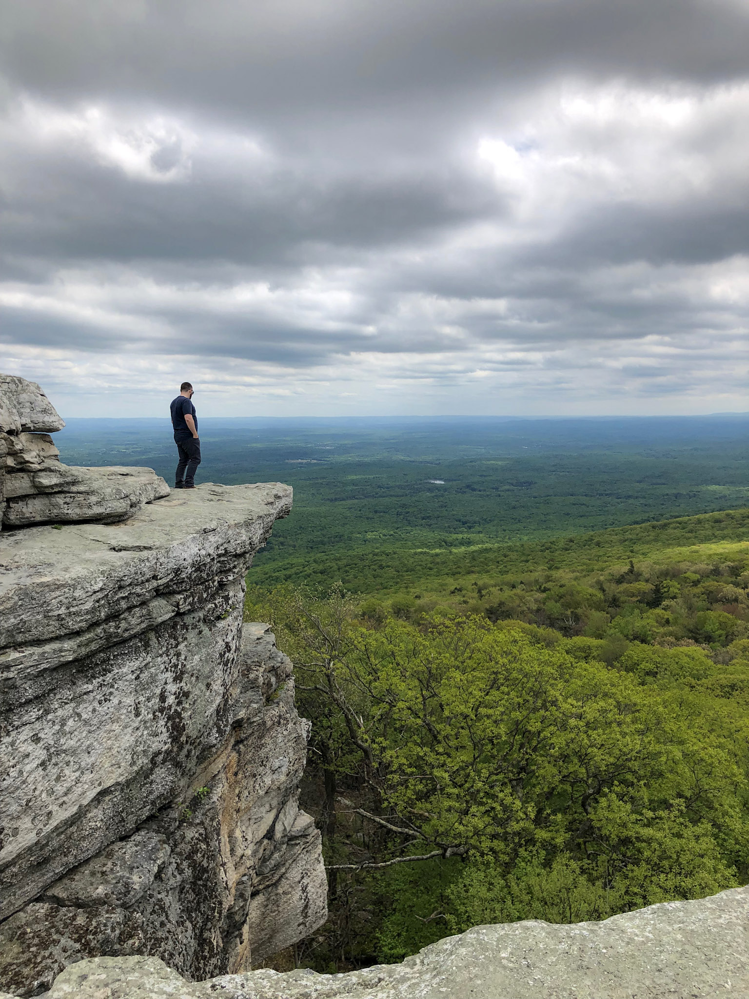
Mount Beacon is one of the most popular trails along the Hudson River. It offers different terrain for a good workout, old railway landmarks, and incredible views of the Hudson Valley as well as the Catskills and NYC on a clear day. Most people will hike to the top of the mountain overlooking Beacon. However, adding the fire tower to this hike is worth it. Check out the blog for details and pictures!
Trail Description: Mount Beacon offers gorgeous views of the Hudson Valley and you can see as far as NYC and the Catskills from the fire tower.
Trail Info:
Where: Beacon, NY Distance: 4.4 miles (3-3.5 hours) Difficulty: Moderate Trail Type: Out and Back Features: Views, Hudson River, Fire Tower, Mountains, Valley, Reservoir, Railway
How to get there:
788 Wolcott Ave Beacon, NY 12508
You will see the parking lot located the intersection of Route 9D and Howland Avenue in the City of Beacon. Parking can be limited here. For more info, https://www.scenichudson.org/mountbeacon.
Hiking Tips
Get there early for parking on weekends.
First half mile is the toughest. After that, it’s a breeze. Keep going!
Once you reach the white-blazed trail, take that up to fire tower. The White Trail is not marked as well as the Red Trail, look for faded markings on the rocks.
The Hike
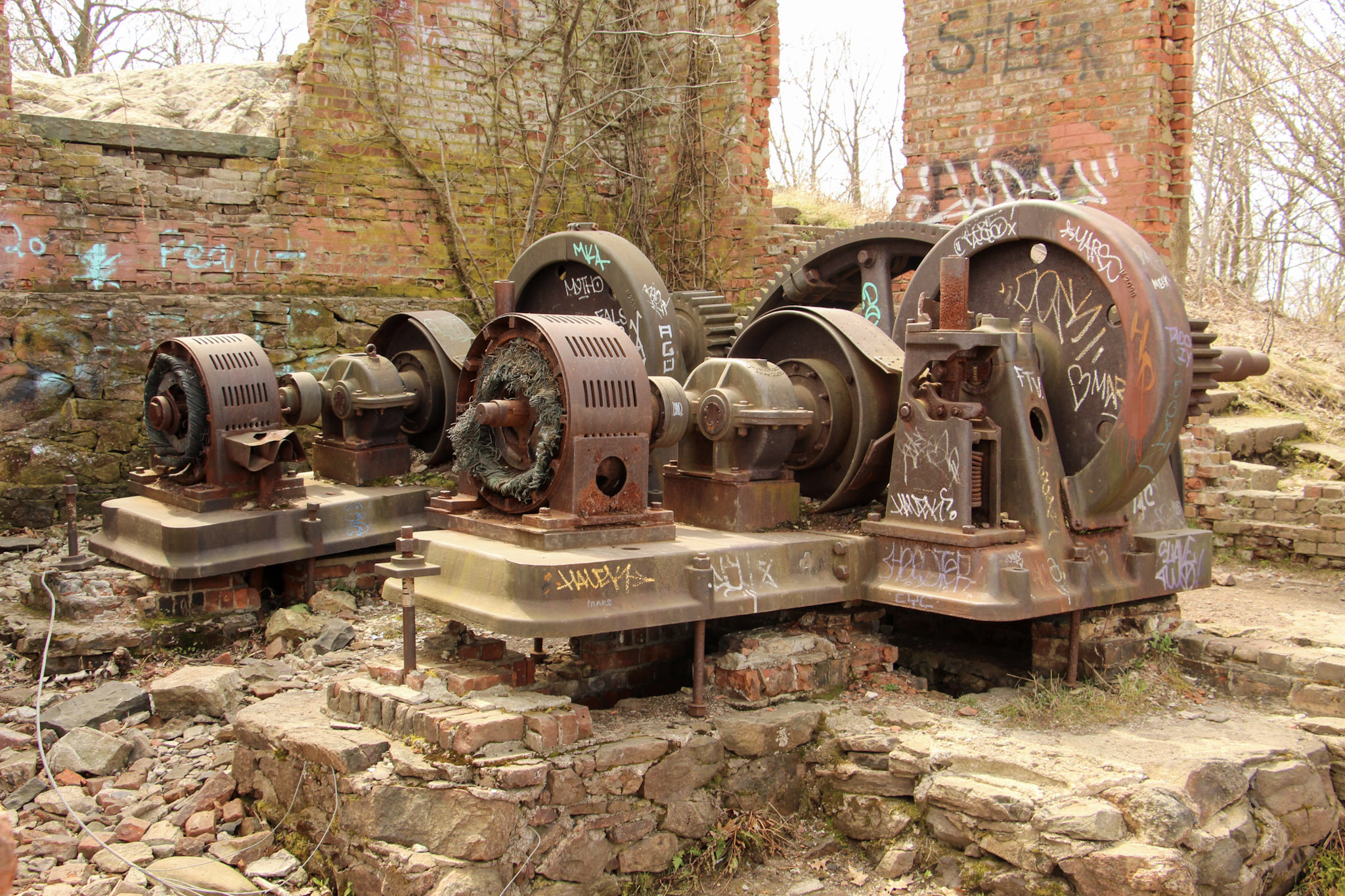
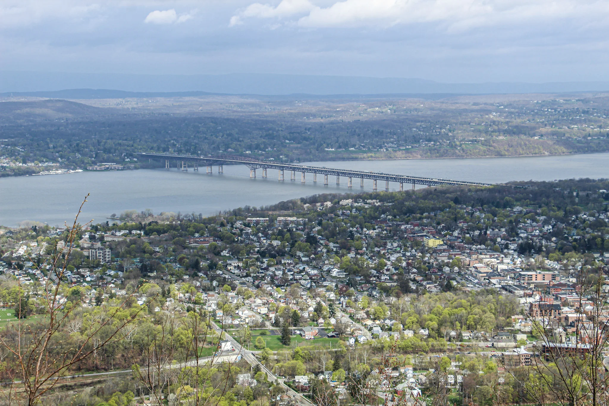
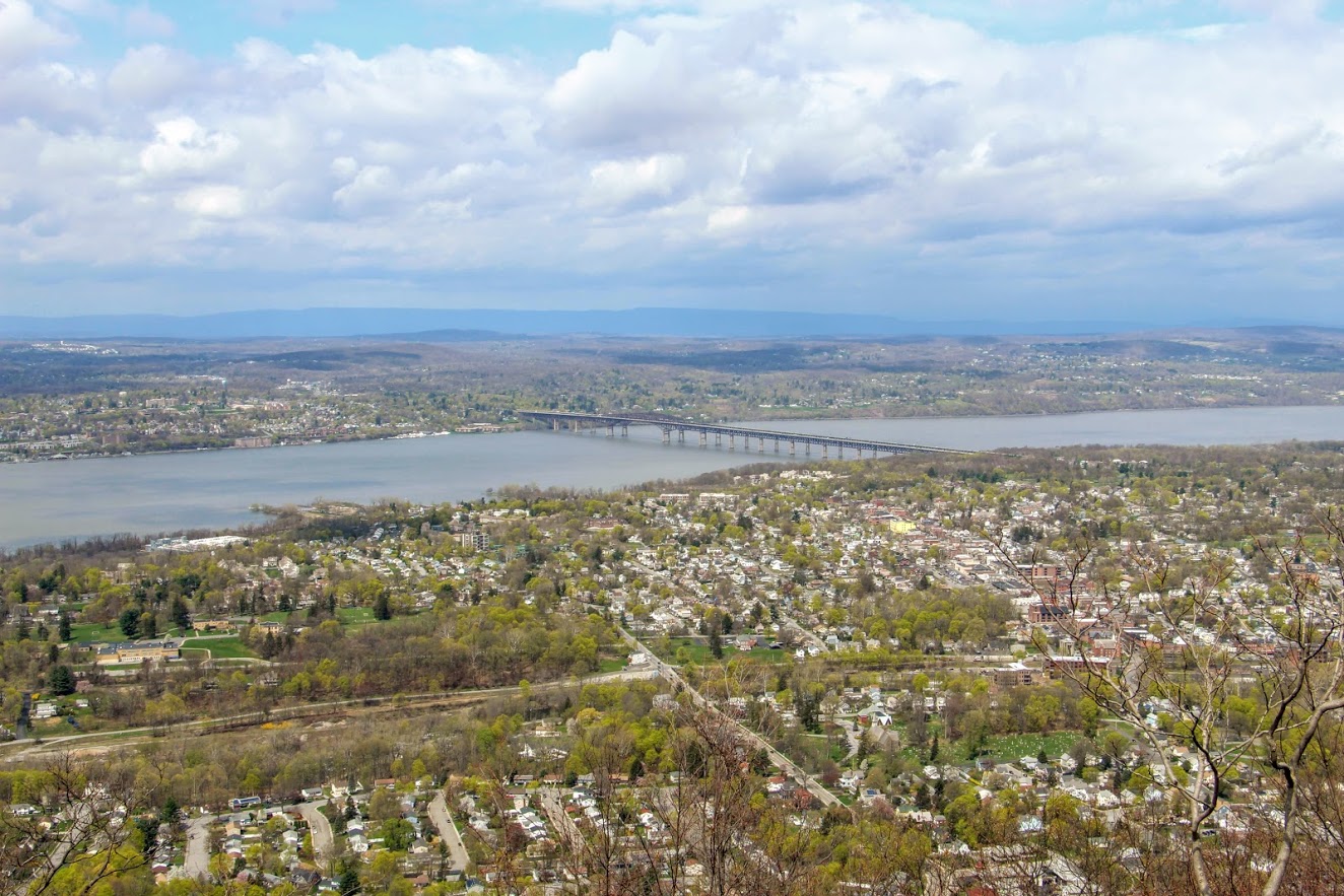
Mount Beacon is one of the most popular trails along the Hudson River. It offers different terrain for a good workout, old railway landmarks, and incredible views. The trail head starts at the parking lot where we found the information kiosk. From here, walk past the wooden gate and proceed along the gravel path on the red-blazed Casino Trail. We arrived at the ruins of the Mount Beacon Incline Railway. The railway was used as a tourist attraction for the views of the Hudson River as well as visiting a Casino Hotel at the top of the mountain in the early 1900s. This was the steepest railway in the world during its operation. Pretty wild! If you want to know more historic details, click here. After passing the ruins, we started making our way up the metal staircase continuing onto the red-blaze trail.
The tough part begins here, only for about a half mile. This is where you see happy faces coming down and not so happy faces going up. The hike will slowly begin to ascend up the mountain following the switchbacks. There may be areas that look unmarked but keep your eyes on the red markings. Eventually, the terrain will become rockier and even steeper uphill. Huffing and puffing our way up, the first glimpse of a view appears as we came up on the first landmark. The motor house of the railway has brick walls still standing and there you will find huge rusted gears and the motor. Past the motor house lies the foundation of what used to be the casino, which is where the first scenic view of the hike can be seen. The view from Mount Beacon stretches across the Hudson with stunning views overlooking Beacon. It is awesome that you can get this view only after hiking just over a mile. The hike started with overcast but amazingly the sky started opened up once we reached the overlook.
It was time to head toward the fire tower. We turned around from the look out, walked across the old casino ground toward the tower. Eventually, we noticed a red marking on a tree and followed that dirt road through two metal poles and continued on the red-blaze trail. We passed what looks to be a door or frame of an old car or truck on the trail. Additional steep climbing ensued for about 10-15 minutes until there is a clearing with a view of the fire tower. Shortly after, we arrived to the White trail. Before we reached the White Trail, we did notice an unmarked trail leading up the hill toward the fire tower but thanks to research we did not take that path. About 15 minutes later, we found ourselves making our way up the fire tower. This fire tower is pretty high. I was actually getting a bit nervous going up. By this time, the sky opened up completely and the views were an unbelievable 360 view. From the top, you will see Beacon Reservoir and Catskills to your northwest, the Newburgh-Beacon Bridge and Shawangunk Ridge to the west, and, to the south, the southern Hudson Highlands. Even as far down as NYC. And, probably more stuff I don’t even know! My girlfriend had to pry me off the tower. It was super windy but I just kept saying, “This is awesome”. Very fortunate to be able to have access to great hikes like this in the Hudson Valley. Oh, and there’s a donut shop 5 minutes away that is amazing for post hike donuts (Glazed Over Donuts blog post). I cannot recommend this hike enough!
More pics of the hike:


HIKING FOR DONUTS
Hi, I’m Mark. I live in Connecticut. I take new trips every change I get. A good trip has a great hike, great food, and something fun to do. My goal is to search out new trips and share them to inspire others to try something new and exciting.
If you are looking for posts in a particular place, search City or State here.
SEE OTHER POSTS IN ARCHIVE
Archive
RECOMMENDED POSTS
RECENT POSTS
See the latest on Instagram and follow @HIKINGFORDONUTS

People State Forest, Barkhamsted, CT
Located in Northwest Connecticut, the Jessie Gerard Trail is one of many exciting trails that wander through the 3000-acre Peoples State Forest. This fairly unknown hike is challenging with various terrain and magnificent views of Grand Vista Overlook and Chaugham Lookout. A great hike in the fall for amazing views.
Trail Description: The Jessie Gerard Trail is one of many exciting trails that wander through the 3000-acre Peoples State Forest. This fairly unknown hike is challenging with various terrain and magnificent views of Grand Vista Overlook and Chaugham Lookout.
Trail Info:
Where: People State Forest, Barkhamsted, CT Distance: 3.3 miles (2.5-3 hours) Difficulty: Moderate Trail Type: Loop Features: Waterfall, Valley, Views
How to get there:
Typing in Jessie Gerard Trail in your GPS will lead you to East River Road, Barkhamsted, CT. Once you get onto East River Road, drive a few miles and you will see a small parking lot on your left. The trail starts directly across from the lot.
Hiking Tips:
Take a DEEP People State Forest map at the kiosk in the beginning. This will be very useful.
Start with the Falls Cut Off Trail to your left (blue/red marked trail). Much easier to go up this section (than down). If it rained recently, the first 0.1m will be slippery up the rocks.
Pay attention to the markers changing colors

The Hike
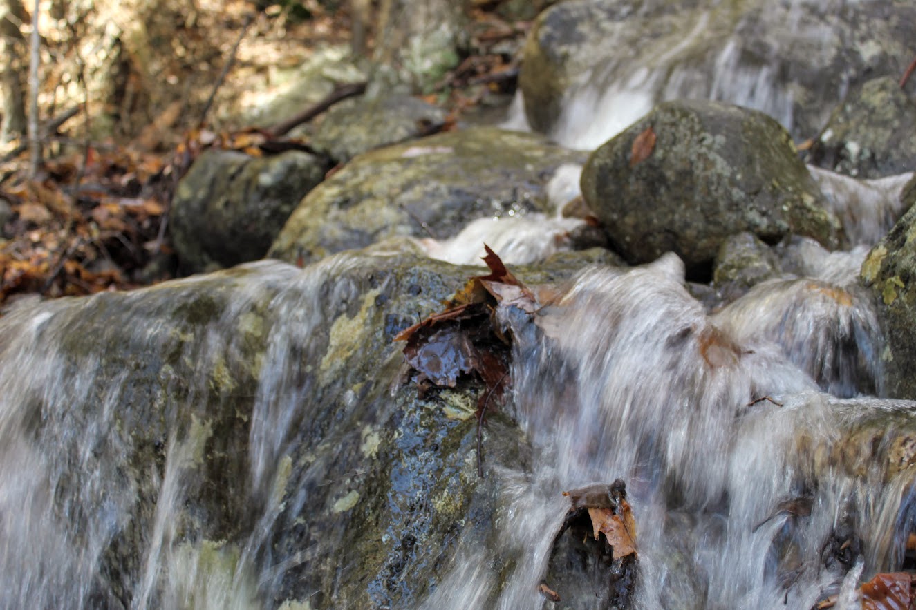
The hike begins up the Falls Cut Off Trail (blue/red markers) on the left. The beginning of the trail is difficult and there is an immediate steep incline up past the falls. The beginning of the trail is difficult and there is an immediate steep incline up past the falls. There was a huge rain storm the day before so the waterfalls were roaring. An awesome visual after 10 minutes into the hike. Though, the rocks were really slippery. Once reaching the top of the falls, turn left on the double marked Blue and Blue/Yellow markers, which is the Jessie Gerard Trail. Continuing straight ahead on the Blue/Yellow,do not veer toward Warner Road. After another half mile, boom shakalaka we emerged into the Grand Vista outlook. Magnificent views with all the fall colors. We continued following the Blue/Yellow for another half mile to the Chaughum Lookout for more awesome views.
From here, stay on the Blue/Yellow Trail. We went between the 2 Veeder glacial erratics aka big boulder rocks. Shortly after, take a right onto Greenwoods Road. This is where the Jessie Gerard Trail ends. Then turn left on the Charles Pack Trail, also Blue/Yellow markings.
Another half mile later, turn onto Beaver Brook Road. This is where things got interesting. Following the road, the map says turn right onto the Blue/Orange, Agnes Bowen Trail, on your right after a half mile. When we came up to this, it was nothing but forest. No sign of a trail. We walked up and down and this was the spot. However, I don’t know where the trail would connect. We decided to keep walking up Beaver Brook Road and take a right up the road. Eventually, we caught up with the Blue/Orange trail where we would have come out to the road.
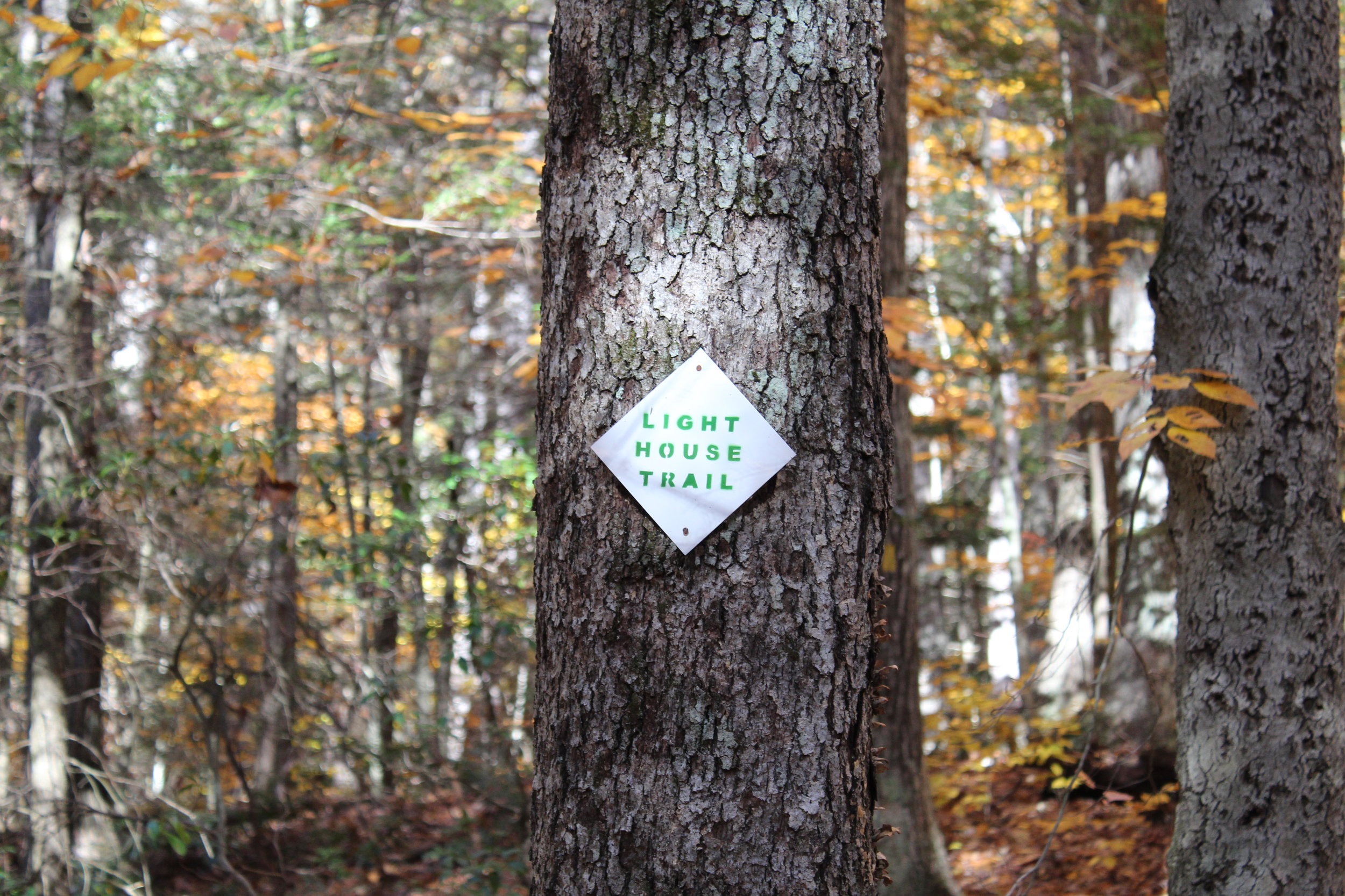
We jumped on the Blue/Orange to the left until we reached the Robert Ross Trail (Blue markers). Turn right here onto the Blue. The trail we will begin to ascend and descend. A tough part of the hike but way better than going down the other way. Keep your eye out on the colors on the trees. We got a little stumped here as the Blue/Yellow connects with the Blue. However, staying straight on the Blue the trail switchbacks downhill to the Lighthouse Trail (Yellow). Of course, another trail. Fortunately, this was the home stretch. We passed a few kiosks with educational info but we were ready for the post hike meal. This will take you back to the Blue/Red and right to the parking lot.


HIKING FOR DONUTS
A blog for the outdoors foodie enthusiast
Hi, I’m Mark. I live in Connecticut. I take new trips every chance I get. A good trip has a great hike, great food, and something fun to do. My goal is to search out new trips and share them to inspire others to try something new and exciting.
If you are looking for posts in a particular place, search by city or state here.
EXPLORE OTHER POSTS IN THE ARCHIVE
Archive
RECOMMENDED POSTS


MOST RECENT POSTS
SEE THE LATEST ON INSTAGRAM AND FOLLOW @HIKINGFORDONUTS

Storm King Mountain, New York
Storm King Mountain State Park Trail Guide (Cornwall-On-Hudson, NY)
If you are looking for a great hike with awesome views in the Hudson Valley, Storm King Mountain is one of the best hikes in the area. The trail will get your heart pumping but you will be amazed at the summit view from the top.
Trail Description: Storm King Mountain offers one of best views in the Hudson Valley. The hike includes an initial steep hike to the top of Butter Hill, but the gratifying views at the top are worth the effort.
Trail Info:
Where: Storm King Mountain, Cornwall, NY Distance: 2.7 miles (2.5-3 hours) Difficulty: Moderate to Difficult Trail Type: Loop Features: Ruins, Mountains, Views, River, Views, Bridge
How to get there:
Heading south on Rt 9W from Newburgh, cross under the overpass for Angola Road. You will begin climbing a hill (in your car!) and on your left you will the parking lot for the Storm King Mountain. However, you can’t make a left here because it is an illegal turn. Continue driving a few miles until reaching the exit at Rt 218/Rt 293. Get back on Rt 9W and circle back to the parking lot. If you type in this address: 1750 US Rte 9W, Cornwall=on-Hudson, NY 12518, this should sufficient enough for the GPS.
Hiking Tips
Get there early for a less crowded trail.
Start on the orange trail in the beginning (not the white trail).
Pay close attention to when markers change colors
Bring hiking poles
THE HIKE
During the summer, I made a list of hikes I wanted to accomplish by the end of the year. Somehow, some way I was going to make them happen. I wanted to end the year hiking awesome and challenging trails. Storm King Mountain was high on my list. I came across this hike first on Instagram, of course. The pictures looked stunning. Since I do frequently travel to the Hudson Valley area, all I had to do was make the time. The hike does look intimidating but it wasn’t that bad. I would have liked better weather on this day, as it was a tad cloudy with overcast. But, the hike was really fun and awesome views nonetheless.
View from the parking lot.
This hike is really popular. Get there earlier or try a weekday if you can. There were already a lot of cars and a shuttle bus of tourists by 930am. After we got our gear ready, the trailhead was to our left facing the woods. We saw the white trail on our right. I read hopping on the orange trail was the way to go. And, that was 100% accurate. It is more difficult in the beginning but I rather have fresher legs climbing up. The orange trail starts off steep right away. I found this part super fun. It was strictly a steep incline climbing up. The rocky path was taking us up to Butter Hill. Looking back, we witnessed some cool views of the highway as it started to disappear.


First of many views on the hike.
Model climber.
Once all the climbing was done, we reached some small ruins. Keeping the orange markers in our sights, we continued up toward Butter Hill. A little more views started to appear. There is an important decision to be made on the trail. The Orange Trail abruptly ends as the blue Yellow Trail markings appear (you will see blue marking first) . Turning right at this junction, lead us on the correct path. I have read this is a point in the hike where people take a left and get lost. One more time, turn RIGHT when the Orange Trails ends or your day hiking will be regretful.
Ruins.
highway overlook.
We reached Butter Hill in about a half an hour from the start of the hike. This is the highest point of the hike at 1,375 feet. Continuing forward there still was some uphill stretches as the blue/yellow trail moseys across the mountain. There are intersections where the blue/red marked trail is on your left. However, you want to turn right on the blue/yellow trail you will see a small cairn. It is easy to get off track with all the intersecting trails. You will see a blue-blazed, don’t fall for it. Just stick to blue/yellow trails at this point.
Continuing around the mountain….
turn right toward the yellow blue trail.
From here, the hike took us to the northern end of Storm King Mountain. Not quite the money shot view. Just a little tease of what it is next .
almost there.
A little bit past this spot, we reached a rocky field in the open and BOOM. Stunning landscape. There are wide views of Newburgh Bay, Bannerman’s Castle, and the Newburgh-Beacon Bridge. On a clear day, the Catskills are visible. We could see some sail boats in the Hudson River as well. A very cool summit view.
newburgh bay.
this is why you hike this trail.
After taking an excessive amount of pictures, we hopped back on the blue/yellow trail. Going down, we noticed some more cool overlooks on our left looking at the town of Cold Spring and getting a smaller glimpse of the summit view. I recommend taking a look. Shortly after the awesome view, the White Trail markers will appear. Taking a sharp left around the mountain with a U-turn, we started on the White Trail. And soon after, the trail will be blazed with blue and white markers. BUT, then the blue markers will fade and this goes back to only white markers. And now, the white markers will take you back to the parking lot. There is one last steep uphill climb before the parking lot to give you a nice good-bye and keep your heart pumping.
Views of cold spring as you hike down.


That's what I call a bang for your buck hike. The hike was very challenging, the hike wasn't too long, and there a multiple magnificent views for photo opportunities. And, I had a blast hiking it. The trail route we took was about 2.7 miles and took us under 3 hrs, including probably 30 mins of me taking pics. There are some very steep inclines but nothing your average hiker can't overcome. As long as you start the hard way first, the hike ain't so bad. This is one of the best hikes in the Hudson Valley hands down. I am happy to check this off the list, but now I want to go back!
Amazing.

HIKING FOR DONUTS
A blog for the outdoors foodie enthusiast
Hi, I’m Mark. I live in Connecticut. I take new trips every chance I get. A good trip has a great hike, great food, and something fun to do. My goal is to search out new trips and share them to inspire others to try something new and exciting.
If you are looking for posts in a particular place, search by city or state here.
EXPLORE OTHER POSTS IN THE ARCHIVE
Archive
RECOMMENDED POSTS


MOST RECENT POSTS
See where I have been recently on Instagram. Follow @HIKINGFORDONUTS

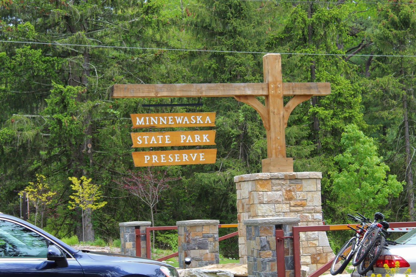
Minnewaska State Park Reserve
Minnewaska State Park Reserve Trail Guide (Kerhonkson, NY)
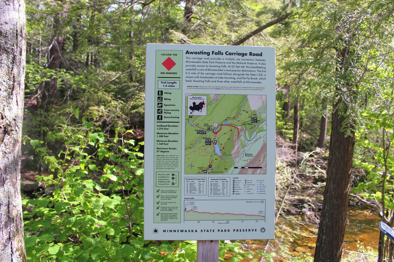
Minnewaska State Park Reserve is located in Kerhonkson, NY on the Shawangunk Ridge. The park is full of numerous awesome hiking trails to spend hours exploring. This post will cover Awosting Falls, Lake Minnewaska, and Kempton Ledge. Great picturesque views through out the hiking trails. A great visit visit to Minnewaska State Park reserve. Hiking for Donuts approved.
Trail Description: Minnewaska State Park Preserve is situated on the Shawangunk Mountain ridge. This park offers a variety of intersecting hiking trails that offer magnificent views. A great day hike consists of capturing Awosting Falls to cliff views off Kempton Ledge and back around Lake Minnewaska. This will offer best landscapes of the park.
Trail Info:
Where: Minnewaska State Park Reserve, Kerhonkson, NY Distance: 5.5 miles (4 hours) Difficulty: Moderate Trail Type: Loop Features: Views, Waterfall, Mountains, Lake, Cliffs, Views
How to get there:
The park is easy to find and it’s a cool drive. The address for the GPS is:
5281 Route 44-55, Kerhonkson, NY 12446
Once entering the park, you will pay the $10 parking fee at the guard shack. For this hike, pull straight ahead into the Awosting Falls parking lot.
Hiking Tips:
Get there early for a less crowded trail. It can be chaos.
There are no signs for the Kempton Ledge but there will be a big opening off the cliff ledge with a big open view. If you keep your eyes out, you won’t pass it.
The trails are well marked but there are areas that are not as obvious. Having a map will be handy.
The Hike
Finally getting around to some hikes I did in the summer! I have seen amazing pictures online of Lake Minnewaska. My girlfriend has told me memories of her hiking in this park and how much there is to offer. On this past Memorial Day Weekend, we decided to head to Minnewaska State Park Reserve in Kerhonkson, NY located on the Shawangunk Ridge. The park is full of many trails and provides some spectacular views of Lake Minnewaska and overlooks the Catskill Mountains. You can spend hours exploring or just come for a quick hike. The one downfall I was warned about it how unbelievably crowded this park can be. And, that was definitely the case. There are many parking lots in walking distance to pretty nice views and picnic table areas hence there will be lots of families. And, the trails are not that difficult. They are mostly carriage roads and can be flat. As one blog I read on this hike stated, you will find more peace and quiet at Walmart. However, the exploring of this park is completely worth it and there are many trails that are less trafficked.

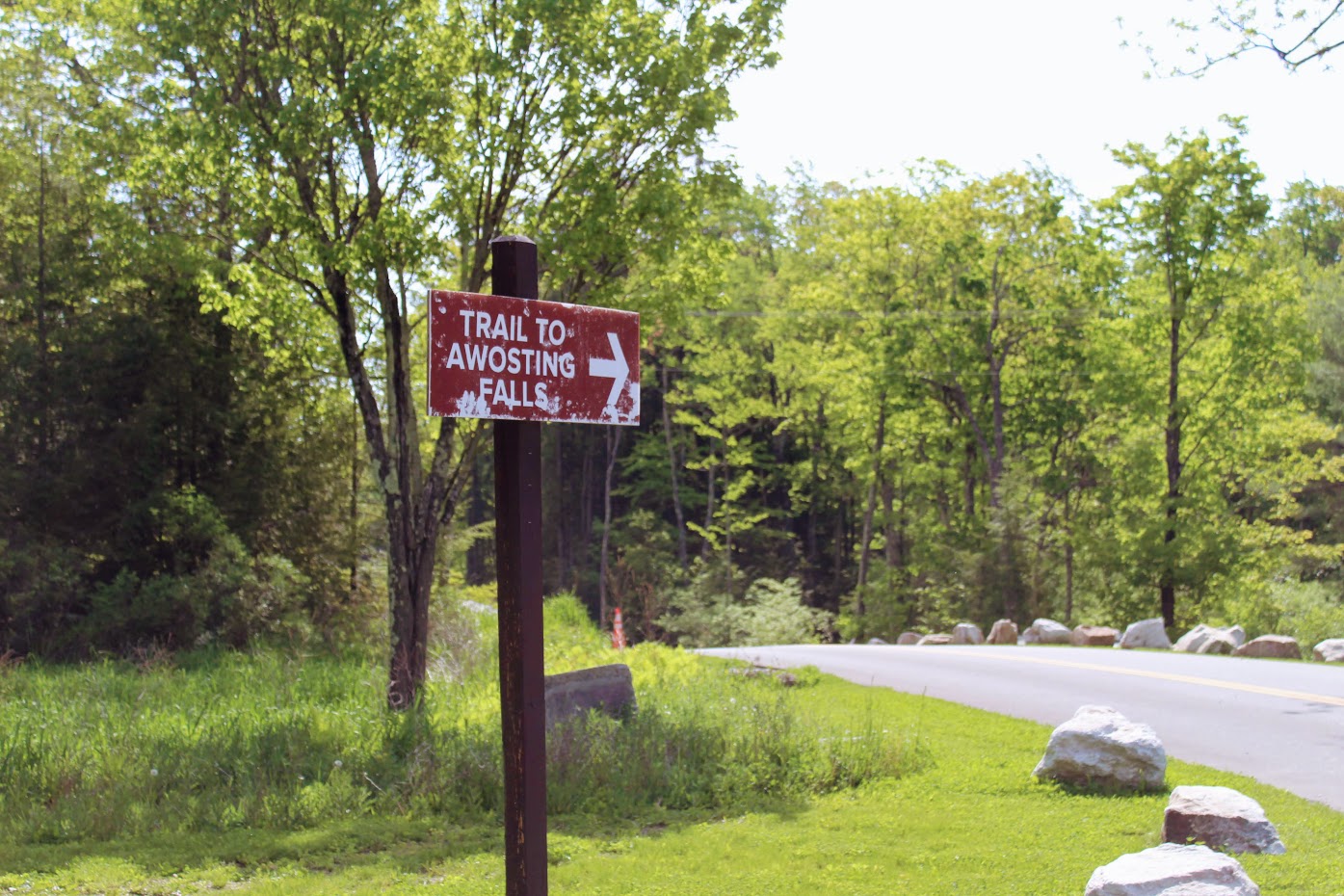
Given the knowledge of the potential crowds, we started our drive toward Minnewaska early and got there as the park opened at 9am. Note, parking will cost $10 inside the park. Not bad in my opinion. Once you enter the park, you will pay at the guard shack. There are many lots to park. Since there weren’t many people there yet, we pulled straight ahead into the Awosting Falls parking lot. The busier it gets, the further you will have to park from the guard shack. Our agenda for this day was to check out Awosting Falls, Kempton Ledge, and finish with trail around Lake Minnewaska. Once parked, we followed the signs to the Awosting Falls Trail.
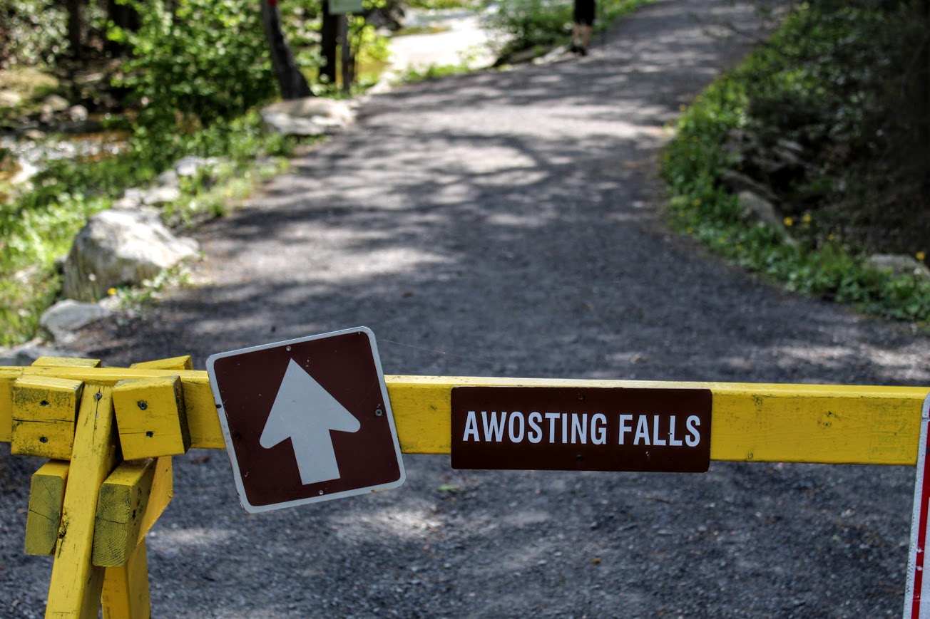
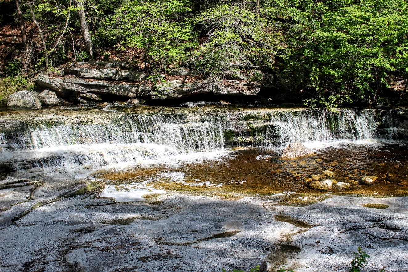
About a half mile from the parking lot, we found ourselves descending 60 feet into a wide open view of the falls. This is actually a decent size waterfall and there are multiple different viewpoints. You can climb the rocks up on the side of it and get close like I did. Meanwhile, Nichole got stuck videoing an engagement proposal. She was like did you see that? Not a chance, there was a waterfall in front of me!


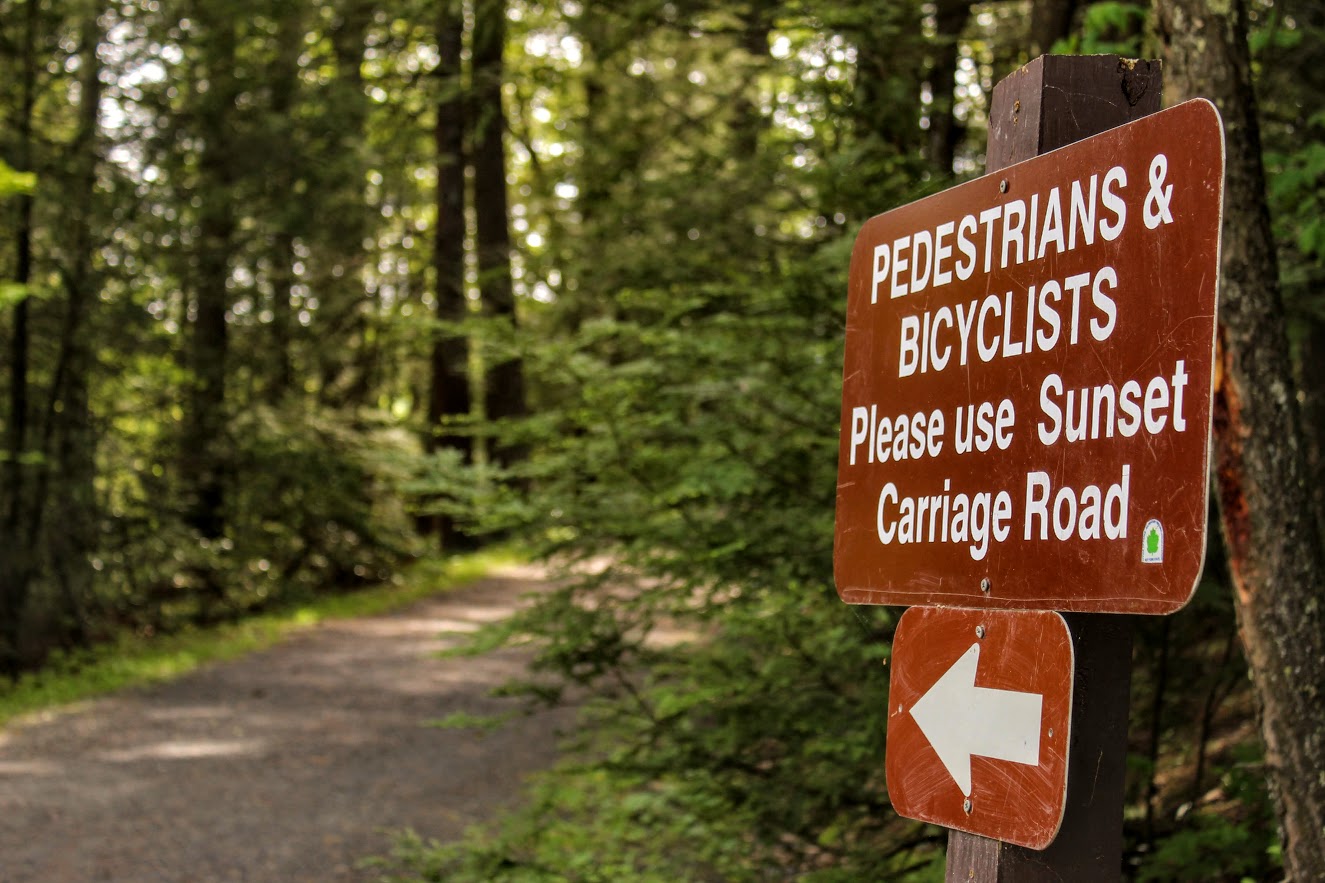
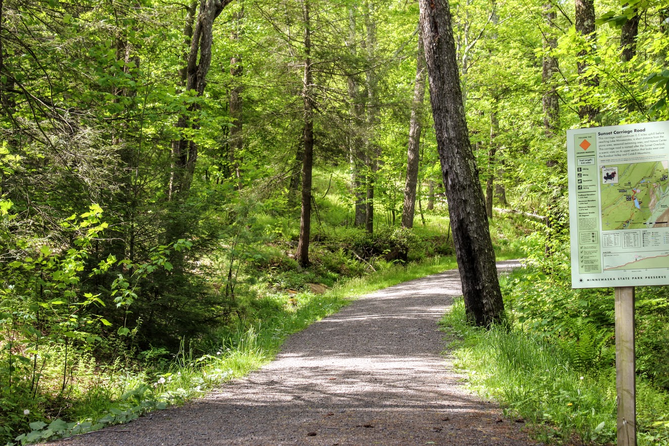
At this time, there was no one really at the falls so I took advantage of it. After taking a half hour of pics, Nichole was ready to get this hike moving along. We headed back the same way we came. We found the orange blazed Sunset Carriageway on our left as we approached the road. We started taking the trail up the switchbacks. As we got closer to Lake Minnewaska, we noticed the parking lot to our left. This is where you would park if you didn’t want to hike the fun way. We kept on the trail and started following the red blazed trail labeled “Minnewaska Lake Loop.” There is a pretty awesome lookout right away of the lake and the cliffs.

Continuing on the red trail, we passed the swimming beach that gave another gorgeous view of the lake. After that, we came up to the bathroom facility. Then we noticed the sign for the blue blazed Castle Point Carriageway on our right. That is what we needed to get to Kempton Ledge. After about 30 minutes, you will arrive at Kempton Ledge. There is no sign for it but once you see the ledge, you will know. There is an amazing view.


We headed back the way we came and took the first right you can to the Hamilton Carriage Road (will see sign). We kept going straight ignoring the merging trails. Eventually, this road led us back onto the red blazed Lake Minnewaska Loop and right down to the edge of the water. Here you will get great views across the lake. This is where you find all those who parked at the top. This can be a crowded section on a busy day.


The red trail continues and becomes a little steeper. We noticed a viewpoint to our right that will display the Skytop Tower at Mohonk Mountain House. The skies weren’t as clear as we hoped this day but still a great view. After this, we kept climbing at the fork toward the white cliffs.

There was a wide open picnic area as we approached the top. We walked across the grass toward the cliffs and views of the lake. We decided to take a quick lunch as the views were beautiful. And, there was some solitude at this particular time.


After absorbing the views, we headed back around the lake staying as close to the lake as we could. The trails become less marked around this area. Looking for more red markings, we passed some private property and porto-potties. Taking the middle road to the left of the porto-potties, we walked by an open field of many picnic tables and families. This path gave us one last look of Lake Minnewaska before we reached the parking lot again. The orange trial (Sunset Carriageway) was on our right and we took that the same way we came up down the hill back out to the road. Following the signs to Awosting Falls parking lot, we made our way back to the car.


I had a blast on this hike. Minnewaska State Park Reserve has so much to offer. You can choose your trail and go as far as you like. There are so many awesome views to see. Yes, it can be crowded but I would just plan accordingly. I suggest going early because we didn’t hit the crowds much. And, you will know which trails will have more traffic, closer to the lake and the waterfall. The hiking paths are really wide and flat. Our hike on this day was just around 5.5 miles. This took us about 4 hours but I also was a photo whore so you can knock off 30-45 min from that. I would say it was easy to moderate only because of the mileage. I look forward to coming back to this park. Afterwards, we drove into the downtown area of New Paltz, NY that was about 10 minutes away from the park. And there were cool shops, restaurants, donuts, and a brewery. That is what I’m talking about! Hopefully I will be exploring more of what the Hudson Valley has to offer.


HIKING FOR DONUTS
A blog for the outdoors foodie enthusiast
Hi, I’m Mark. I live in Connecticut. I take new trips every chance I get. A good trip has a great hike, great food, and something fun to do. My goal is to search out new trips and share them to inspire others to try something new and exciting.
If you are looking for posts in a particular place, search by city or state here.
EXPLORE OTHER POSTS IN THE ARCHIVE
Archive
RECOMMENDED POSTS

MOST RECENT POSTS
See where I have been recently on Instagram. Follow @HIKINGFORDONUTS
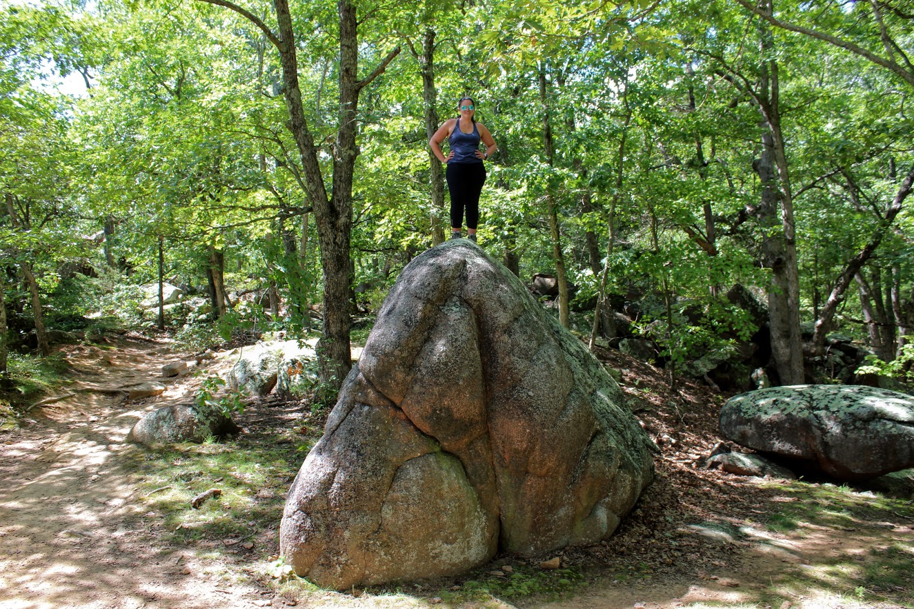
Elephant Rocks State Park
Elephant Rock State Park
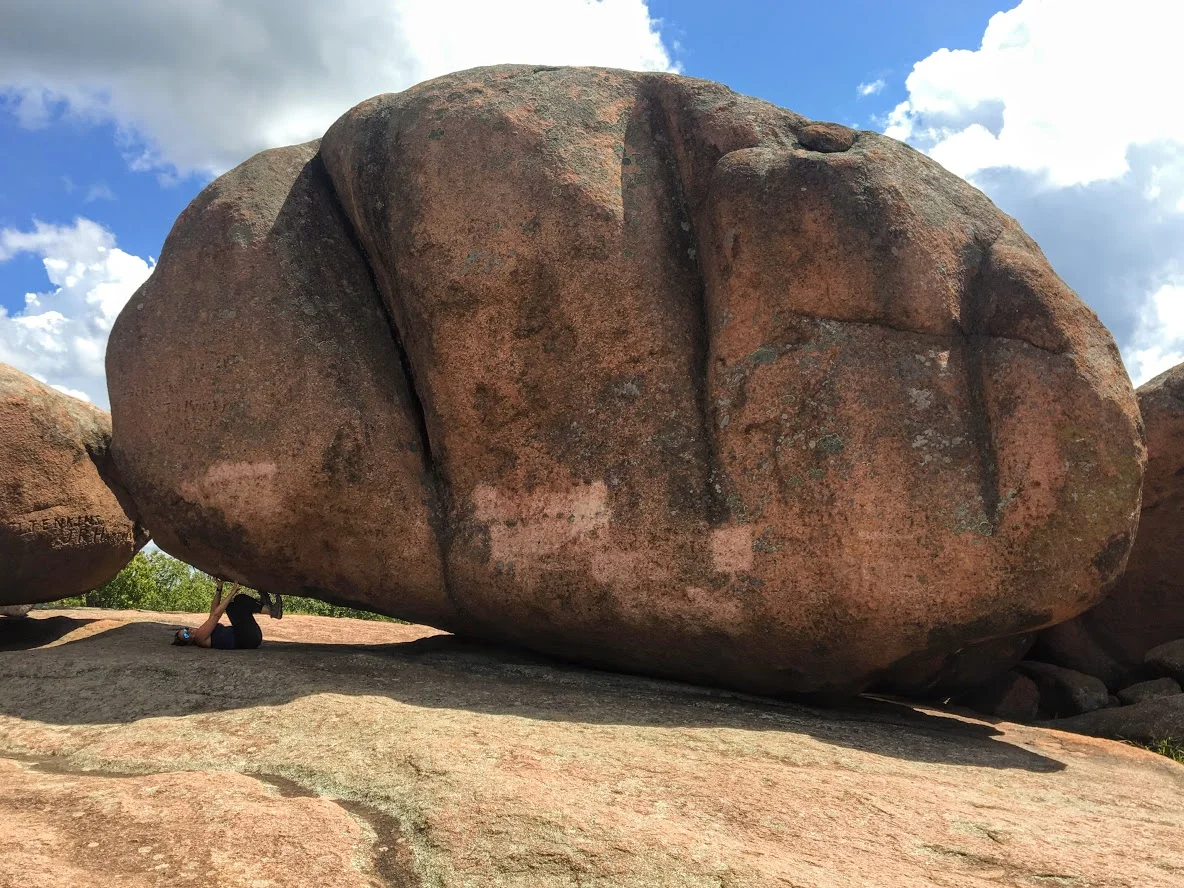
Trail Description: Located in Southeast Missouri, Elephants Rocks State Park has a unique attraction. The trail will lead you to large granite boulders which resemble a train of pink circus elephants.
Trail Info:
Where: Elephant Rocks State Park, Belleview, MO Distance: 1.4 miles (1 hour or until you are done exploring) Difficulty: Easy Trail Type: Out and Back Features: Boulders, Water, Quarry
How to get there:
The park was easy to find via GPS. However, you may lose cell signal nearby so make sure your map is up already. Here’s the address to put in your GPS:
7406 MO-21, Belleview, MO 63623
Hiking Tips:
This is a very popular destination. Prepare for crowds.
The Engine House Ruins Trail is less crowded and worth hiking.
The Hike
My trip to Missouri continued to mystify my original thoughts of the state. Prior to my visit to St. Louis, I stumbled upon online Elephant Rocks State Park. The main attraction for this park is there is the line of giant, 1.5 billion year old granite boulders that stand end-to-end, like a train of circus elephants. The pics looked intriguing online.This is a 2 hour drive south from St. Louis. I wasn’t sure if it was worth the drive. However, it just so happens, I chose another hike nearby and figured why not throw this in afterwards. Smart decision, always go all in on exploring in new areas. This park did not disappoint me.
Park entrance sign.
Elephant Rocks State Park is located in the St. Francois Mountains in Belleview, Missouri. The park was easy to find via GPS. Being labor day weekend, the park was packed. There is ample parking for lots of people. Picnic tables are scattered before the trail begins. There are bathroom facilities. Families can have picnics, enjoy the outside, and take their kids for some fun exploring the boulders. This is definitely a tourist hotspot.
Parking area , Boulders, And aMerica.
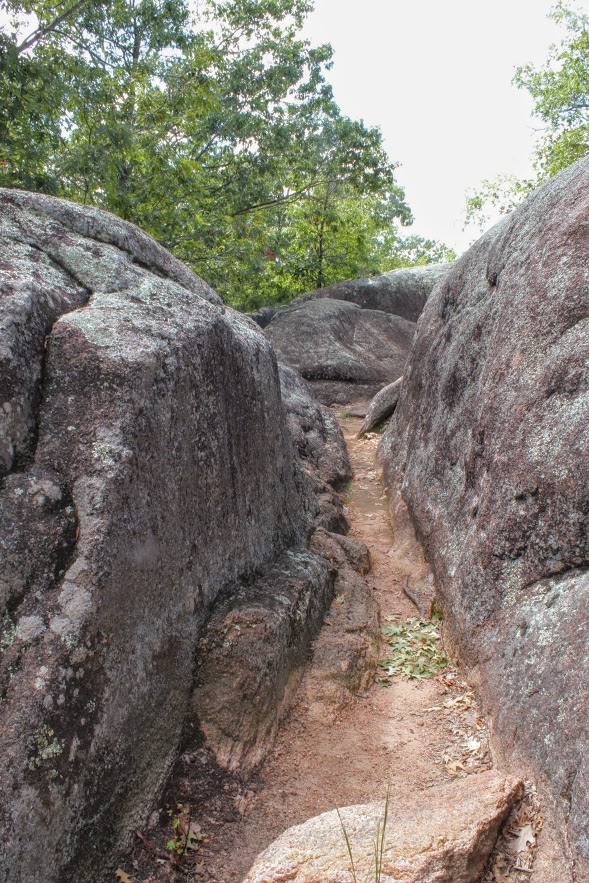
There are two trails to explore through the park. The main trail is called the Braille Trail. This is a self-guiding trail that winds among the rocks and takes you throughout the park. This is paved and accessible for people with disabilities, physical or visual. At different areas of the trail, we noticed interpretive signage with information of the landscape and the history of the park. The trail is one mile and marked as red. There are various viewpoints and we kept walking off the trail to explore more of the boulders.
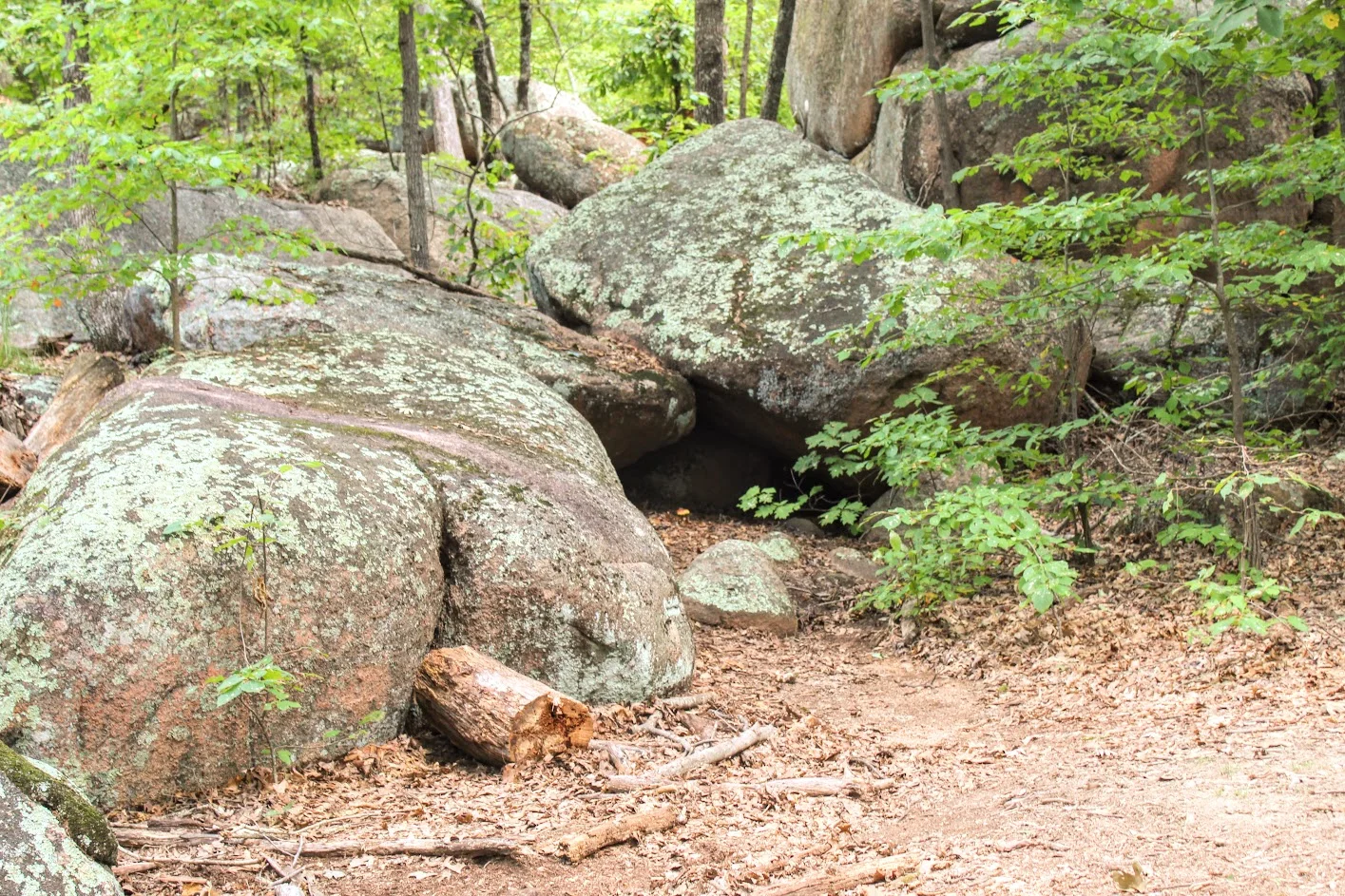


Once we reached the old engine ruin house, we noticed the blue marker trail to our left for the Engine House Ruins Trail. The terrain is more rugged but still easy. This added another 0.4 miles, which leads around the back side of the old quarry that connected us back to the Braille Trail. We followed the blue arrows on the trees and did our thing. There is some fun climbing that can be done on this section. Along with views beyond the bluff. Not many people tend to add this section of the hike so it was a nice break from the crowd.
old engine ruin house


pretty cool, this is in the middle of the park.
views from the top.
taking it all in. the best part.
After connecting back to the Braille Trail, we slithered through the rocks and made our way to the giant boulders. Once I got the full view, I understood where the name of the park was derived. I could see the elephant like figure. Due to the crowd, it was tough to capture how breathtaking it was in person. Everyone was climbing between the boulder and snapping selfies. Children are fascinated by the size of the boulders as they enjoyed climbing. I found myself scaling the boulders and didn’t want to leave!


Trying to get a good picture amongst the crowd.
The elephant’s trunk rock.
rocks.
more exploring.
We ended up spending about an hour and half enjoying the park. That is about all you need. Very easy, go at your own pace and enjoy type of hike. And, if you want, you can throw in some climbing. When I booked a trip to St. Louis, did I anticipate incredible landscapes and geological boulders in the heart of Missouri? Heck no. But I am sure glad I got to experience them. The fun part about traveling is finding gems like Elephant Rock State Park.
Wow so strong!
Well….hello there. Just doin’ some climbing.

HIKING FOR DONUTS
A blog for the outdoors foodie enthusiast
Hi, I’m Mark. I live in Connecticut. I take new trips every chance I get. A good trip has a great hike, great food, and something fun to do. My goal is to search out new trips and share them to inspire others to try something new and exciting.
If you are looking for posts in a particular place, search by city or state here.
EXPLORE OTHER POSTS IN THE ARCHIVE
Archive
RECOMMENDED POSTS
MOST RECENT POSTS
See where I have been recently on Instagram. Follow @HIKINGFORDONUTS
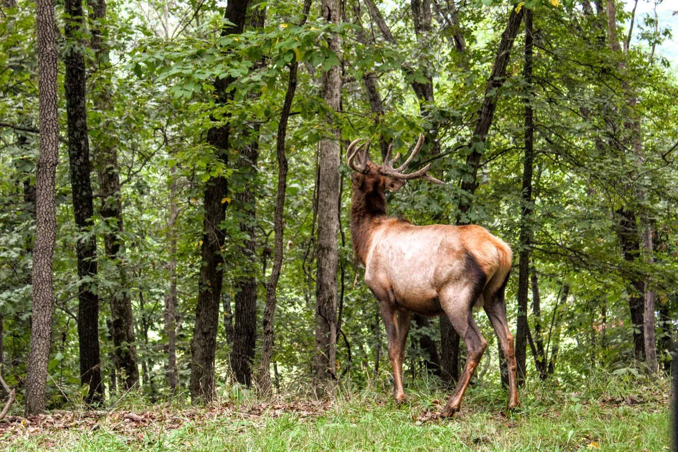
Lone Elk Park, St. Louis County, Missouri
Lone Elk Park is located in St. Louis County, Missouri. This park is only 35 minutes from downtown St. Louis and is a must visit bucket list. This park offers you a great nature adventure without needing to get out of your car. I never thought I would find elks and bison roaming in Missouri. This was an fun and exciting adventure. Read more about this in my latest blog!
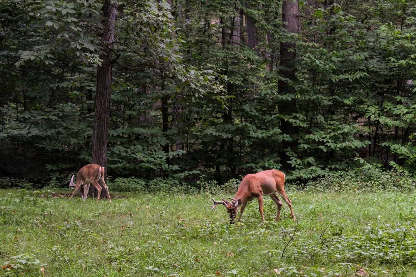
I bet if I were to tell you, within a 35 minute drive from downtown St. Louis you would find a park that was reminiscent of Yellowstone National Park; you would think I am out of my mind. Lone Elk Park gives you that type of experience. Don’t get me wrong, it is nowhere near the size of Yellowstone, it is pretty small in comparison (only 2600 acres). Nor does it offer any of the landscape of Yellowstone. However, being able to drive among wild animals in nature from your car is a very cool experience that reminded me of when I was in Yellowstone. Again, at a very smaller scale. But come on, this is in Missouri!!! Who would of thought? As the name of the park states, you will see a huge elk population roaming. In addition, you will see bison, wild turkey, waterfowl, and deer. Essentially, you drive a loop around the park that takes about 30 minutes and hope to see some animals walking around. And, the park is totally free!
Entrance to the park. Veer left.
The park is tucked away in Valley Park, around Hwy 44 and Hwy 141. It is very easy to get to via gps. The park opens around 7am in the summer and *am in the winter. After doing some research online, I read the best time to see animals out is early in the morning or late at night before the park closes (sunset). Pretty good advice.
ELk butt.
We drove in from our hotel and got there around 8am. We pulled up to the park entrance. There is a bird sanctuary to your right if that is what you like. You will see the caution signs to stay in your car. Within the first 20 seconds of driving in, Nichole says to me, “Umm…is that fake?” And I responded, “Oh snap. That is as real as it gets”. The first animal we see in the middle of the road was a massive male elk with huge antlers. It honestly did look like a statue from far away. We crawled slowly past the elk and it was almost arm’s length away from the car. We made sure not to make to make it angry. We had a small rental car and this guy would tear it up.
this is real. First Elk we saw. Massive.


Great view of the lake and ELk.
As we proceeded, we saw more elk in the woods and a herd to our left as we saw a full view of the lake. We continued to drive along the loop and we started seeing more deer and wild turkeys. The deer here were big guys. We passed the lake and once that was behind us, we started to enter the bison area. You we see more signs here as they want to make sure no one gets out of the car. On this morning, we did catch a few bison out in the fields but they were further away. Not as close as the elks. After that, there isn’t much to the drive and the exit was upon us.


The great thing about this park is you can keep driving around as many times as you want. We wanted to take one more loop to see if more animals came out. Unfortunately, they moved further away the second time. But worth a shot. Also, the park does have hiking trails where you can be out in the open and potentially cross paths with the animals. On your feet or in your car, be careful. Bison and elk will gore you or your car.
Second time around the elk went to down the water. The model stayed put.
That’s where they went.
MOre of the big elk in the lake.
This was first time Nichole has seen wildlife like this so close. It was a cool experience. Note, if you want pictures, make sure you are driver side. I went in the back seat. No way was I driving, too excited! Definitely glad we came across this place in our research and made the drive. If you are visiting, this is a must add to your list. It is a great opportunity to get in touch with nature and you don’t even have to leave your car.
Lake views from the top of the hill.
I don’t trust turkeys.

HIKING FOR DONUTS
A blog for the outdoors foodie enthusiast
Hi, I’m Mark. I live in Connecticut. I take new trips every chance I get. A good trip has a great hike, great food, and something fun to do. My goal is to search out new trips and share them to inspire others to try something new and exciting.
If you are looking for posts in a particular place, search by city or state here.
EXPLORE OTHER POSTS IN THE ARCHIVE
Archive
RECOMMENDED POSTS
MOST RECENT POSTS
See where I have been recently on Instagram. Follow @HIKINGFORDONUTS

Black Pond via Mattabesett Trail, Middlefield, CT
The Mattabesett Trail extends through the state of Connecticut. Along this trail, there are great views. Black Pond has an amazing view from Besek Mountain. Check out the blog for pics and helpful info!


The Mattabesett Trail extends over 50 miles throughout the state of Connecticut. The first half of this horseshoe like trail follows high trap rock ridges of the Metacomic Ridge, from Guilford south to Meriden. The second part extends extends north from Guilford to Middletown where it ends at the Connecticut River. There are multiple areas throughout the state to hop on the trails. You will find numerous picturesque views along the way. One of my favorites spots to check out is Black Pond in Middlefield. I came across this trail a few years ago and the views are spectacular.
For the directions, the trail starts on Baileyville Road (RT 147) that intersects Meriden Road (RT 66). I always gps the restaurant Guida’s across from the trail. I park there and cross the street or there is a little parking area off the side of the road, where you will find the Mattabesett Trail blue-blazed marker.

Once we saw the marker, we headed into the woods to begin the trail. The trail is well maintained and marked pretty well. Thus, just follow the blue markers on this one. Nothing too tricky on this trail. Due to the storms recently, we saw quite a bit of trees down throughout the hike. And there are areas of rock formations where snakes may be hiding. Be on the lookout, I almost stepped on one.


About three-quarters of a mile into the hike, we came out to an open field that led us under power lines. We could see Route 66 highway from here, as the trail runs parallel to the highway. We then passed a brick and stone chimney along the way.
From here, the trail will begin to ascend up the mountain.

Until I was researching the area, I wasn’t aware this was called Besek Mountain. And, there is a ski area next to it, Powder Ridge. Once you reach the cliffs, you see the stunning view of Black Pond and Mount Higby in the distance as well. You can continue the trail from here and follow the blue-blazed trail further past the ski area chair lifts and the true summit of Besek Mountain. And you can go all the way to Guilford. However, this is where we stopped and turned around. We had our fun taking pics and checking out the view.


The loop was roughly 2.8 miles. The hike was moderate difficulty. The terrain was easy in the beginning but had some up and down sections. The hardest part may be finding the trail. This is a great morning weekend type hike with a rewarding view. Be sure to add this to your list, especially if you are local.

The Review
Black Pond via Mattabesett, 2.8M (Middlefield, CT) - 4 out of 5

HIKING FOR DONUTS
A blog for the outdoors foodie enthusiast
Hi, I’m Mark. I live in Connecticut. I take new trips every chance I get. A good trip has a great hike, great food, and something fun to do. My goal is to search out new trips and share them to inspire others to try something new and exciting.
If you are looking for posts in a particular place, search by city or state here.
EXPLORE OTHER POSTS IN THE ARCHIVE
Archive
RECOMMENDED POSTS
MOST RECENT POSTS
See where I have been recently on Instagram. Follow @HIKINGFORDONUTS

Winter is here...in the Basin
Fun weekend back in New Hampshire. This time I made a trip back to Franconia Notch State Park and hiked to the Basin. A pretty, cool spot that is very accessible.

It was time for another trek up to New Hampshire. After a few brewery stops, we finally made it up to my friend’s house. And, there was snow on the ground! Even though weather was in 20s, we still wanted to enjoy the outdoors New Hampshire has to offer. My friend decided The Basin in Franconia Notch State Park would be a good “jaunt” for the 5 of us and our friend’s puppy. The trail and parking lot is right off the highway off I-93. We parked at the visitor center and just hopped on the trail towards the Basin. This trail was mostly flat but due to the snow and ice, it was more tricky. In nicer weather, this is a very easy walk, paved most of the way and offers handicapped accessible viewing as well. We walked over a few bridges and eventually came across some cool waterfalls. We then made our way to The Basin, which offers rushing waters that has eroded the rock into a smooth, circular cave-like formation. After seeing that we walked a little further before the Pemi Trail and started our way back to the cars. Our hike was roughly 3.5 miles. Even though it was quite cold, it was a beautiful day to be outside. We enjoyed our mascot keeping us on our toes. Always fun to see a pup’s first time in the snow. Another reminder to get out there and enjoy time with friends!


HIKING FOR DONUTS
A blog for the outdoors foodie enthusiast
Hi, I’m Mark. I live in Connecticut. I take new trips every chance I get. A good trip has a great hike, great food, and something fun to do. My goal is to search out new trips and share them to inspire others to try something new and exciting.
If you are looking for posts in a particular place, search by city or state here.
EXPLORE OTHER POSTS IN THE ARCHIVE
Archive
RECOMMENDED POSTS


MOST RECENT POSTS
See where I have been recently on Instagram. Follow @HIKINGFORDONUTS

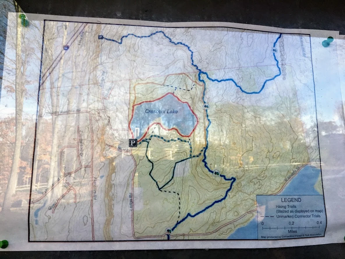
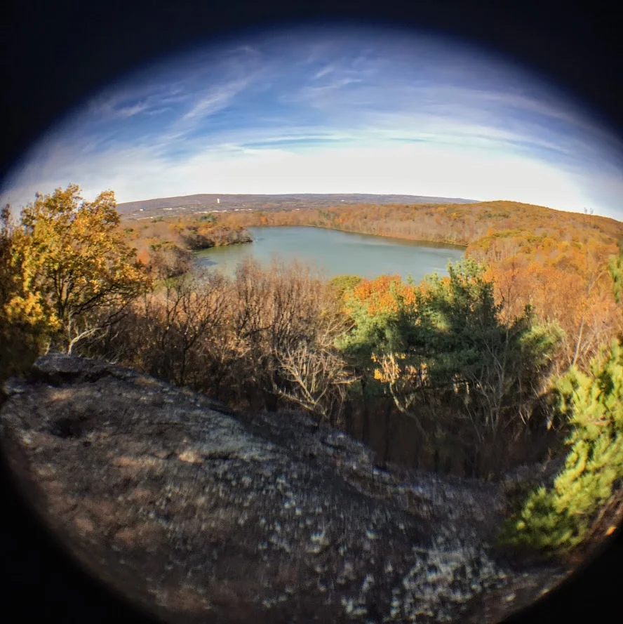
Sunset Rock State Park, Crescent Lake, Southington, CT
Check out the Crescent Lake trail in Southington, CT. This was a confusing trail but well worth the views. Enjoy!
Trail Description: Sunset Rock State Park offers a scenic hike around Crescent Lake that connects to the Metacomet Trail.
Trail Info:
Where: Southington, CT Distance 3.2 miles (2-2.5 hrs) Difficulty: Easy to Moderate Trail Type: Loop Features: Views, Lake, Water
How to get there:
Address to GPS: 357 Shuttle Meadow Rd, Plainville, CT 06062. Parking lot is easy to find.
Hiking Tips
Three trails to choose from. The Blue to Orange trail takes you above the lake and is rockier and steeper. Much better views.
Be mindful if you lose the trail markings or end up on a different trail. There is a lack of trail markings. And, some confusing areas where trail markers change colors.
The Hike
On this brisk fall weekend, we decided to hike the Crescent Lake Trail in Southington, CT. This is one of those trails that there isn’t the best information online and it is poorly marked. I will do my best explaining but my advice is always have the map handy and make sure someone is good at directions!
The parking lot is easy to get to, it is off Shuttle Meadow Road. Once you park you will see the lake right in front of you and potentially some people fishing. There are 3 trails. The Red trail is the lower level trail which is mostly flat. This is to your far left from the lot. This is roughly 2m. The blue -orange trails takes you the upper levels to get good views above the lake and this is rockier and steeper. This trail is to your right from the lot. This is about 3.2m and this connects to the Red at the end once you descend down. There is also a green trail, but not sure where that takes you. It appeared to be just a woodsy hike.
We got lost a few times but Nichole is really good with reading trail maps. The issue is lack of markings/incorrect markings. And, the Metacomet Trail connects so you have to be very careful when the colors change. We took the upper trail followed blue-orange markers until we saw just orange then to red. There we were some tough sections where you could choose 3 directions but there are big orange arrows on trees along the way so be mindful of those. There is also an intersection where you see trail arrows for the Metacomet at the top, keep going toward the blue orange and you will pass a camp fire pit. Minus the confusion, it was a cool hike and the view was awesome from the top. I could of took pictures for an hour….luckily, Nichole stopped me. The upper trail I would suggest hiking boots. It was a moderate hike for beginner to intermediate. Some of the inclines got our hearts beating and needing some water. I think this would be a good spot to snowshoe. I hope to keep the fall hikes going. Another local spot in the books, glad we decided to try it even though the reviews were suspect.
Review:
Cresent Lake Trail, 3.2m (Southington, CT): 4 out of 5


HIKING FOR DONUTS
A blog for the outdoors foodie enthusiast
Hi, I’m Mark. I live in Connecticut. I take new trips every chance I get. A good trip has a great hike, great food, and something fun to do. My goal is to search out new trips and share them to inspire others to try something new and exciting.
If you are looking for posts in a particular place, search by city or state here.
EXPLORE OTHER POSTS IN THE ARCHIVE
Archive
RECOMMENDED POSTS

MOST RECENT POSTS
See where I have been recently on Instagram. Follow @HIKINGFORDONUTS
Honky Tonk Hiking in Nashville, TN!
Spent the long labor day weekend hiking in Nashville, TN! Aside from bars, music & food, I was able to enjoy some great outdoor activities. Got a hike in and explored a lake. Nashville hikes.

It has been a busy month….and a very busy summer. The last trip on my agenda for the summer was Nashville, TN. I have never been there before and I hear lots of great things. My girlfriend, Nichole, has been there 4 times now. She was tasked with showing me the ropes. Aside from the food and the bars, we made time for some outdoors activities and adventuring. I did some research found some cool parks nearby such as The Warner Parks. We decided to rent a car for the day and made our trek ready to sweat off the beers, biscuits, and hot chicken.
We stayed in downtown Nashville and made the 20 minute drive to Edwin Warner Park first. Here is where we started with a nice refreshing hike. The weather held up for us and was perfect. The park was easy to get to and there is ample parking. There is a nature center for water and bathrooms also.

We decided to take the Harpeth Woods Trail, which was roughly a 2.5 mile loop. There are three trailheads in Edwin Warner Park which access the trail: Owl Hollow, Natchez Trace Trailhead, or the Nature Center Trailhead. We walked further down from the Nature Center and started at the Natchez Trace Trailhead. The Harpeth Woods Trail is the blue trail. The trail is very well marked, all we needed to do is follow the blue arrows. Please note, this is a very popular park. We were there on Labor Day but there isn’t a lot of options in the metro Nashville area.


This particular hike was a typical woodsy trail. No scenic views but a good hike. There were some cool rocks formations and bridges to cross. There was a small part of the hike that was a nice incline but that was maybe 1/10 of a mile. In my opinion, this was an easy hike based on my abilities. I wore Nike training shoes and have a bum ankle still. However, I can see this being moderate for others. I did my best to take unique pics.


After the hike, we decided to venture to Percy Warner Park as well since it was only a mile away. At this location, there is a cool landmark known as the Percy Warner Park Stairs. This gives you a nice burn going up and a view from the top from where the trail heads start.


The last stop was Radnor Lake. This location was only 20 minutes from the Warner Parks. Since we had the rental car, we figured we would try to get in as much as possible. This area was very, very busy and parking was an issue. There are two parking entrances. One lot was completely full. However, it is was a really nice ride to both entrances. We got to see pretty nice houses and scenic views. Nichole even questioned some houses, "I wonder if someone famous lives here." Once we got a parking space, we just quickly perused the lake and went on the bridge to see some views. It’s cool for the area and I understand the traffic. This sums up our labor day in Nashville. I didn’t anticipate getting this much outdoors in so close to the city.


HIKING FOR DONUTS
A blog for the outdoors foodie enthusiast
Hi, I’m Mark. I live in Connecticut. I take new trips every chance I get. A good trip has a great hike, great food, and something fun to do. My goal is to search out new trips and share them to inspire others to try something new and exciting.
If you are looking for posts in a particular place, search by city or state here.
EXPLORE OTHER POSTS IN THE ARCHIVE
Archive
RECOMMENDED POSTS
MOST RECENT POSTS
See where I have been recently on Instagram. Follow @HIKINGFORDONUTS