


Rattlesnake Mountain to Pinnacle Rock via Metacomet Trail, Farmington, CT
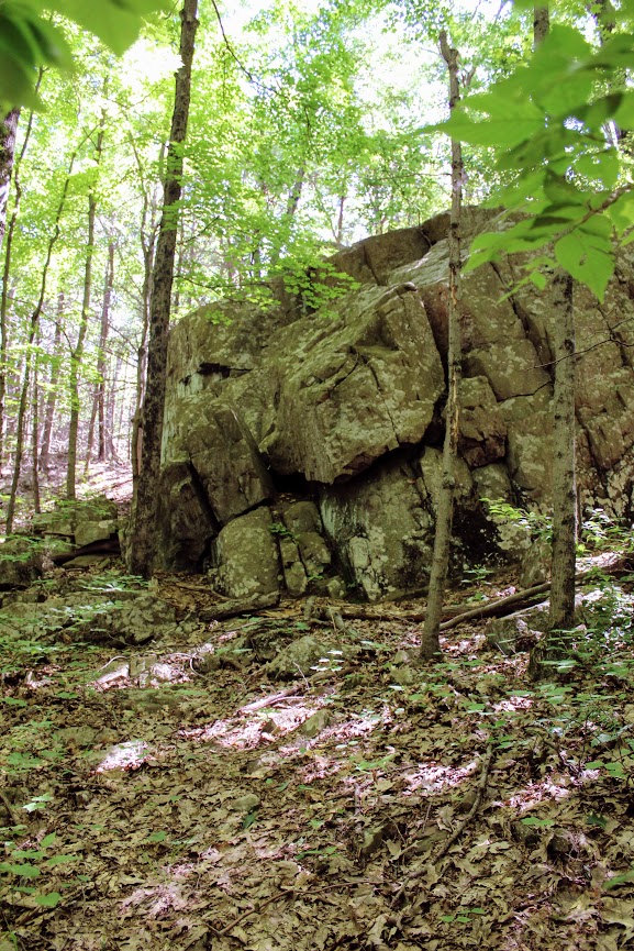
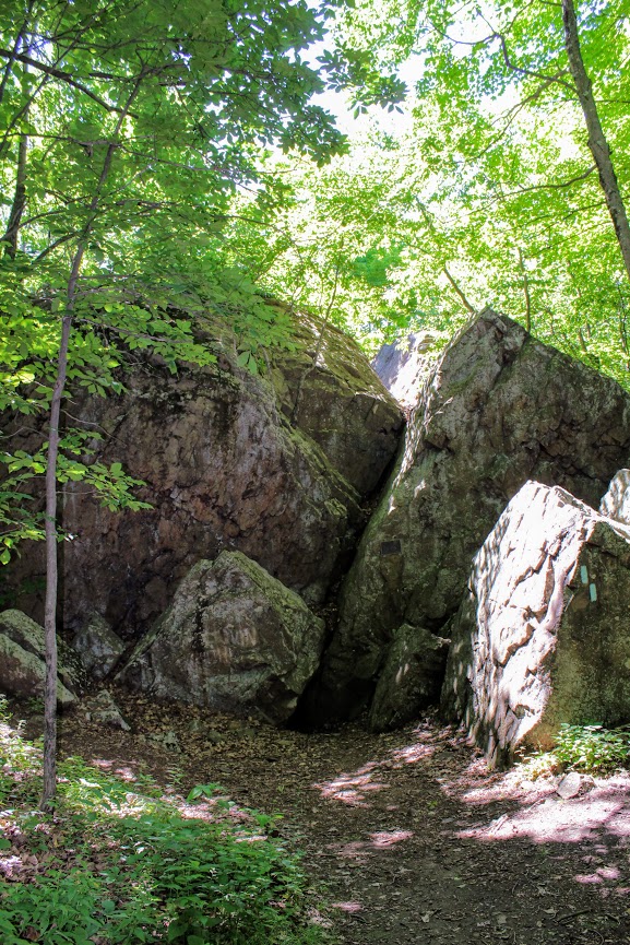
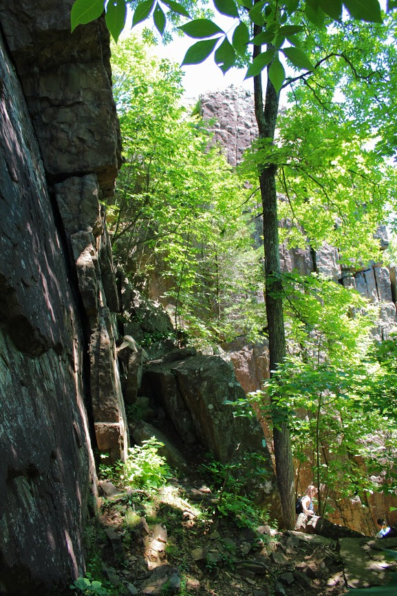
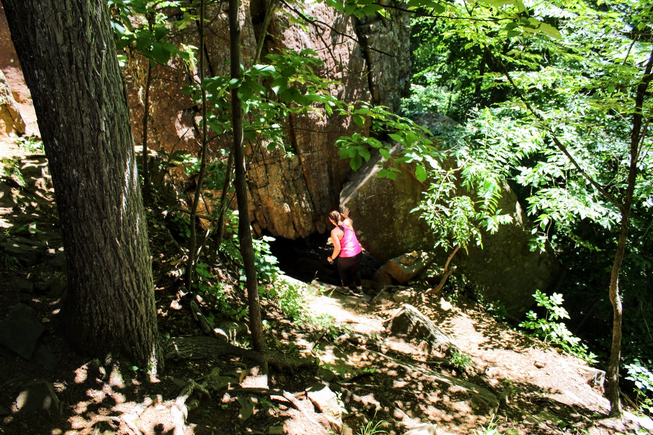
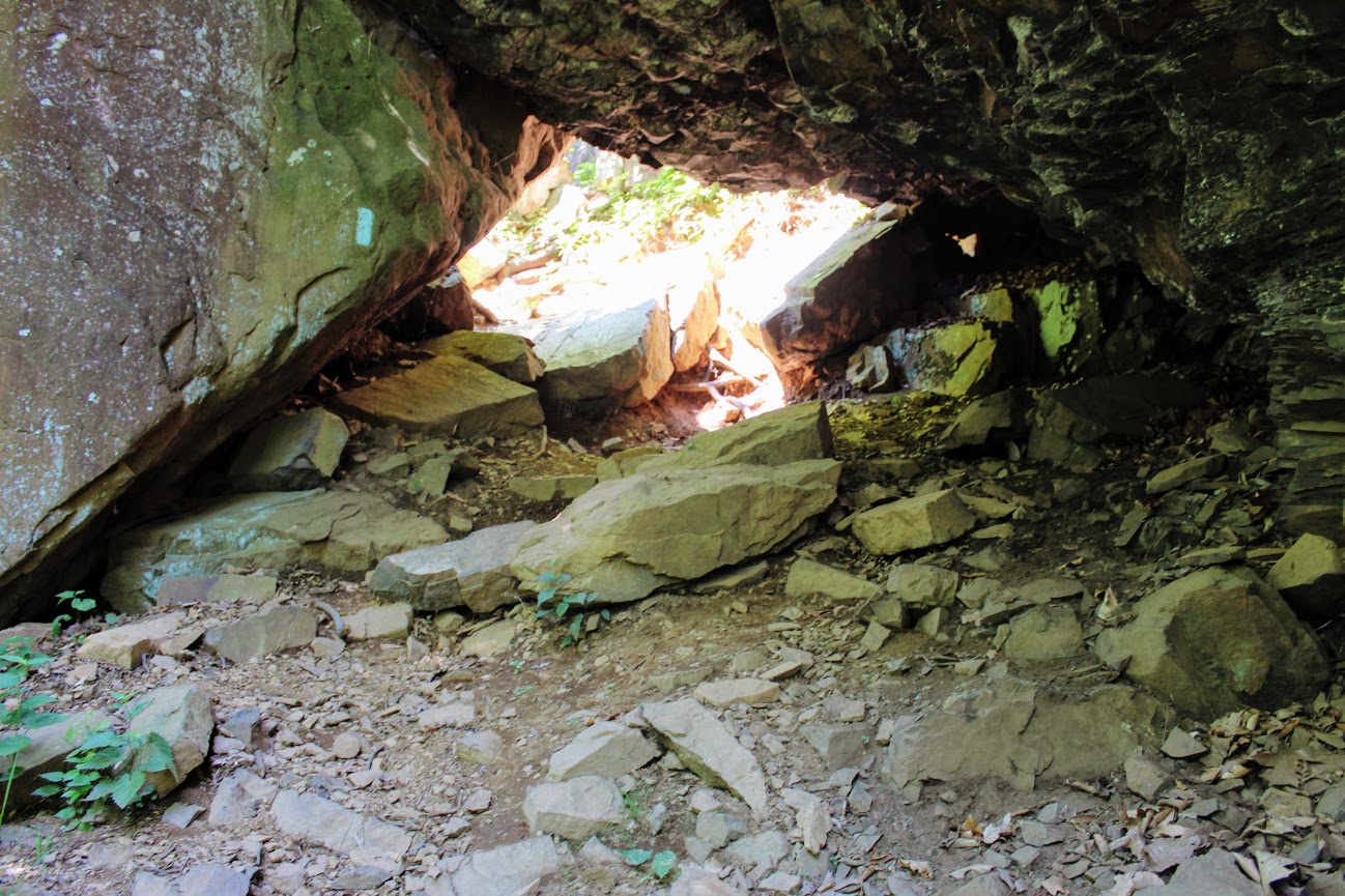
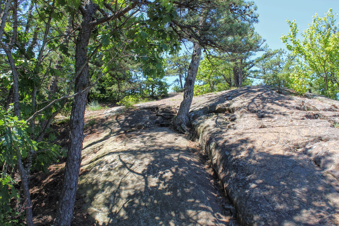
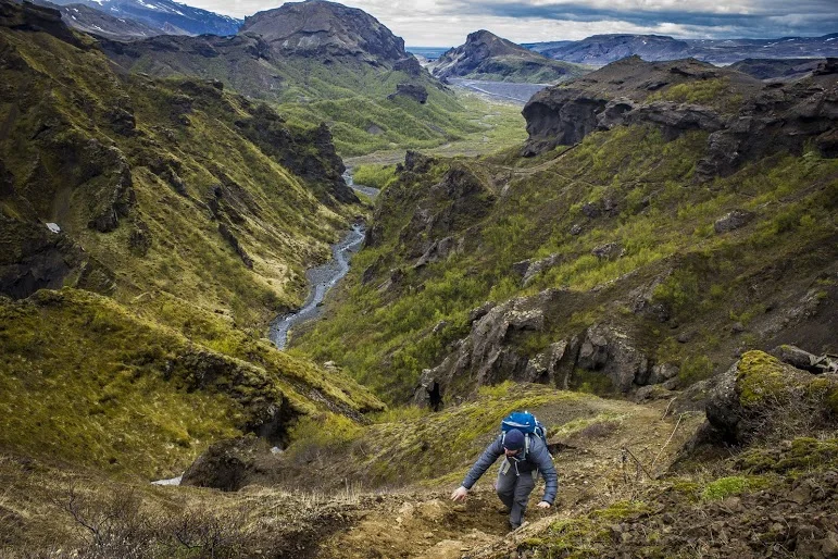
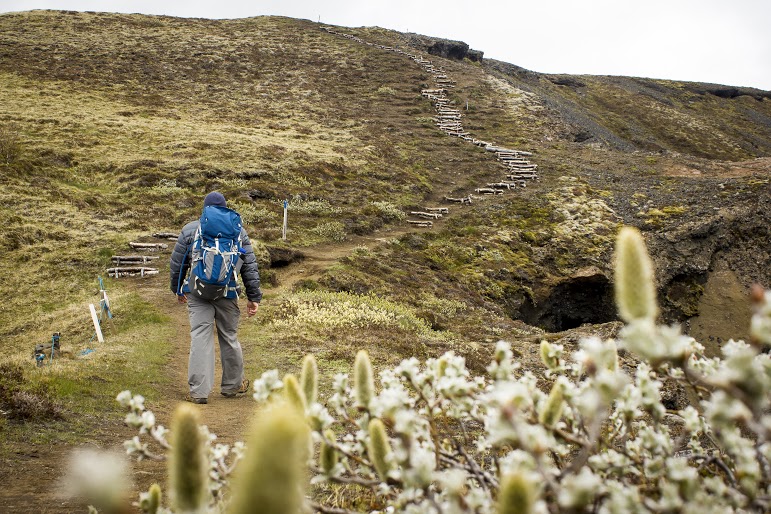
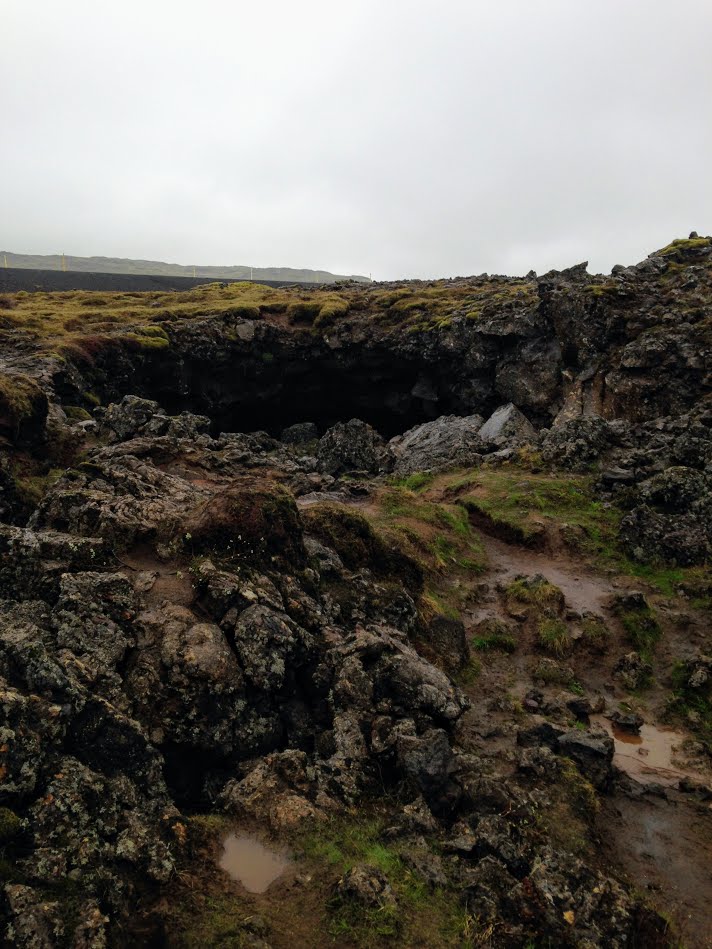
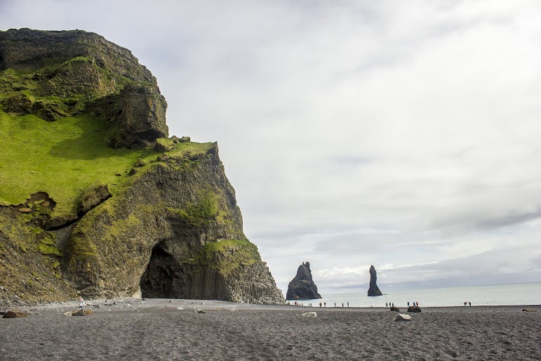
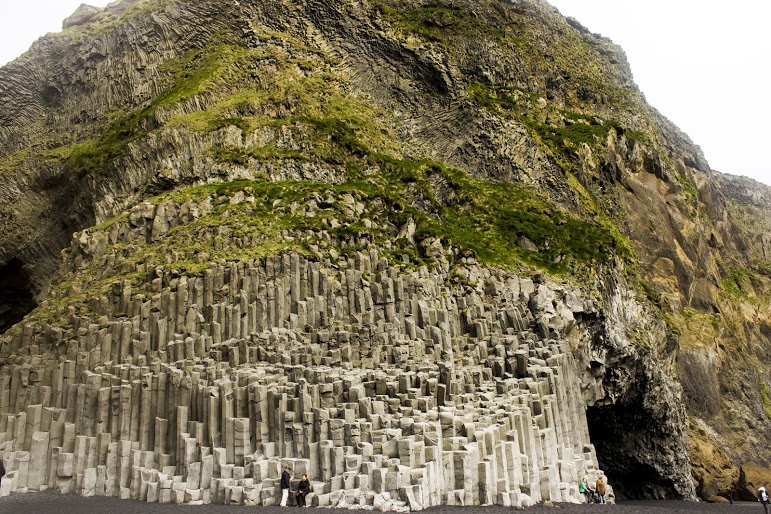
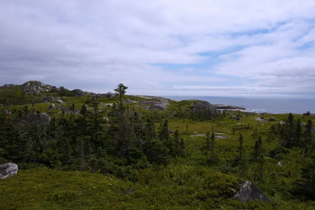
We headed on the trail to our left toward the Rattlesnake Cliffs. The trail starts out flat then begins to switchback up the side of the mountain. After a half mile in, the trail will ascend uphill and the terrain is rockier. We passed lots of large rock boulders as we got closer to the cliffs. This particular trail was very well-marked. We eventually came across the boulder rock cave known as Will Warren’s Den, which I later found out was a historical site.
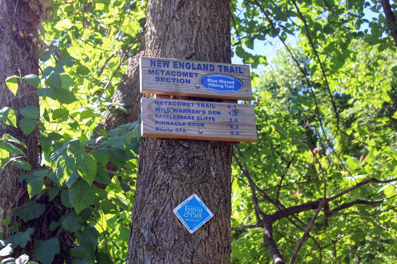
Looking for a good hike in Connecticut? Well, I stumbled upon a hidden gem right under my nose. Rattlesnake Mountain to Pinnacle Rock trails are located in Farmington, CT and crosses over to Plainville, CT. This is part of the New England/Metacomet Trail. Finding the parking area can be tricky. There are 2 areas where you could start. Blue trail markers can be accessed from Pinnacle Street in Plainville. The GPS wasn’t picking this option up so my girlfriend and I chose to drive on RT 6 in Farmington. There is a small parking area on your right where the trail starts. If you GPS 200 Colt Hwy Farmington, CT 06032, that should find it.


Parking area off route 6.
From here, you can hike to the Rattlesnake Cliffs, which is a 2.6m out and back loop. Or you can continue to hike another 2 miles out and back to Pinnacle Rock. Thus, it will be 4.6m total for this hike.
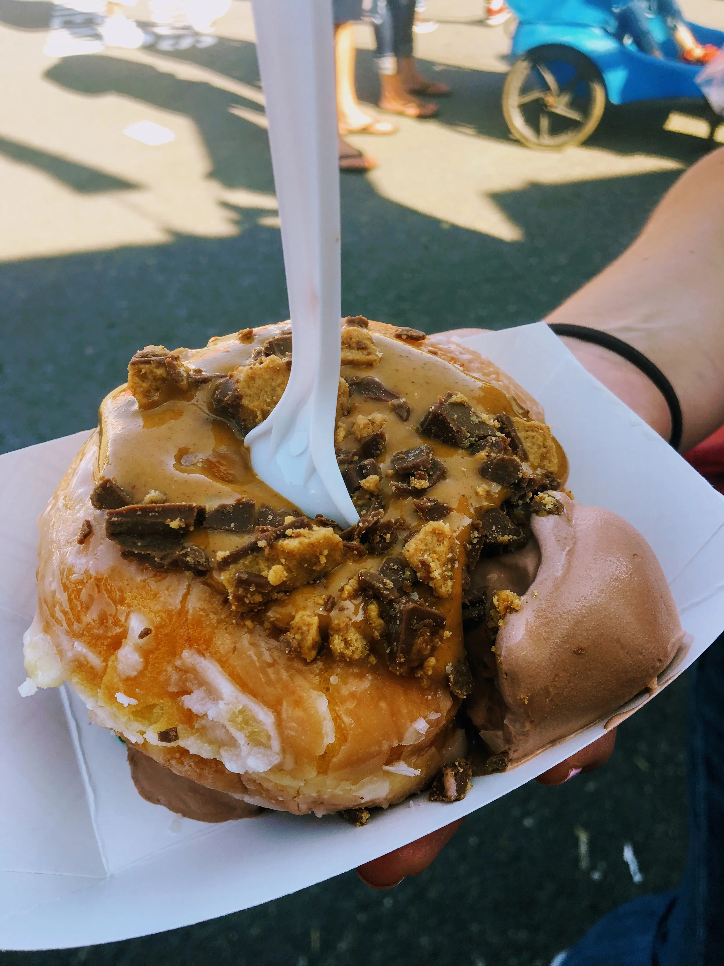
HIKING FOR DONUTS
A blog for the outdoors foodie enthusiast
Hi, I’m Mark. I live in Connecticut. I take new trips every chance I get. A good trip has a great hike, great food, and something fun to do. My goal is to search new trips and share them to inspire others to try something new and exciting.
If you are looking for posts in a particular place, search by City or State here.
Explore other posts in the archive.
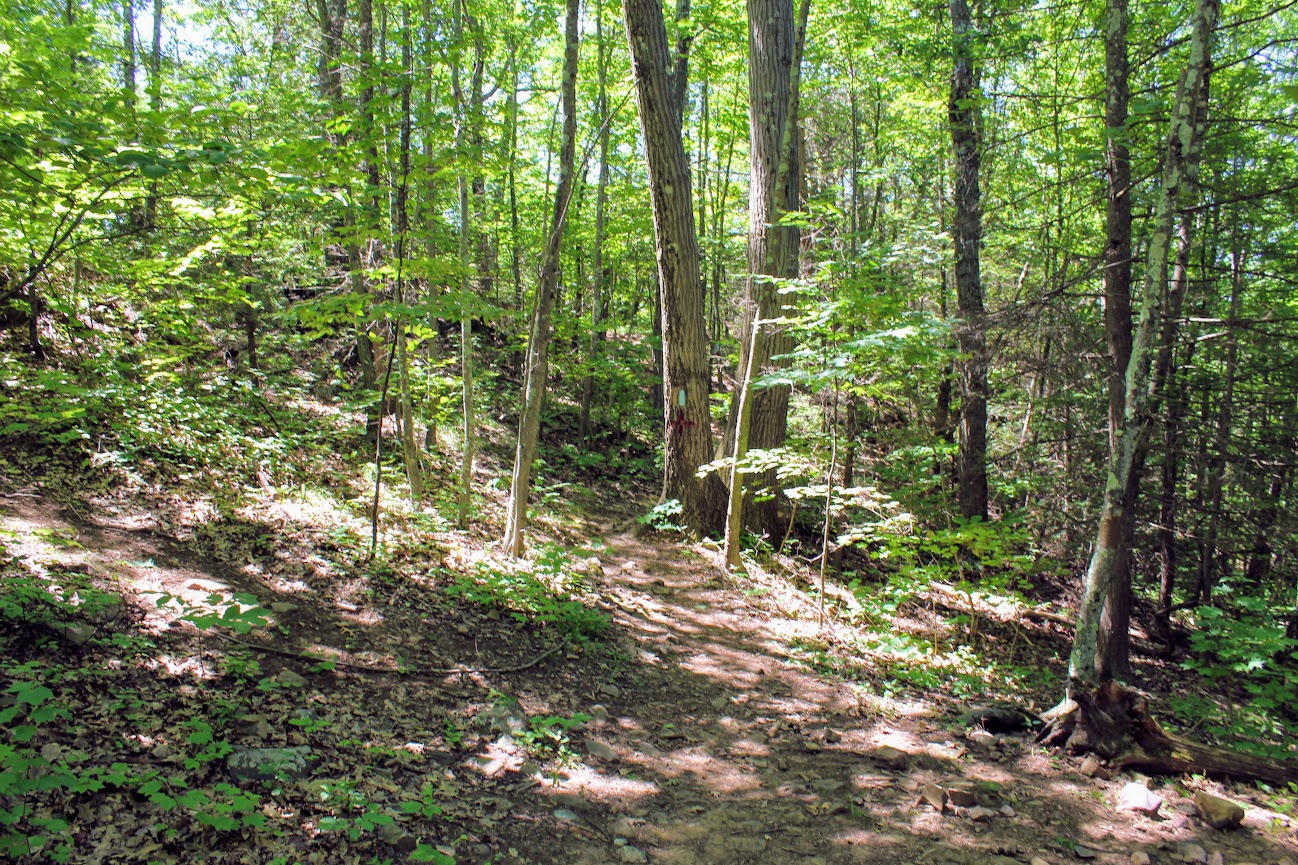
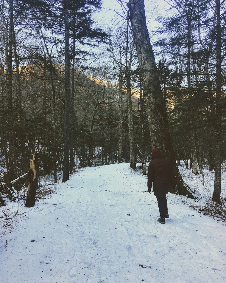
Start of trail
Once parked, we headed on the trail to our left toward the Rattlesnake Cliffs. The trail starts out flat then begins to switchback up the side of the mountain. After a half mile in, the trail will ascend uphill and the terrain is rockier. We passed lots of large rock boulders as we got closer to the cliffs. This particular trail was very well-marked. We eventually came across the boulder rock cave known as Will Warren’s Den, which I later found out was a historical site.
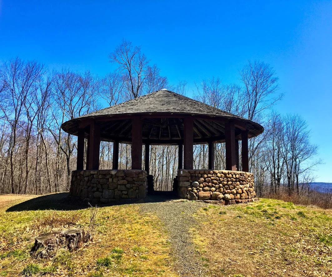
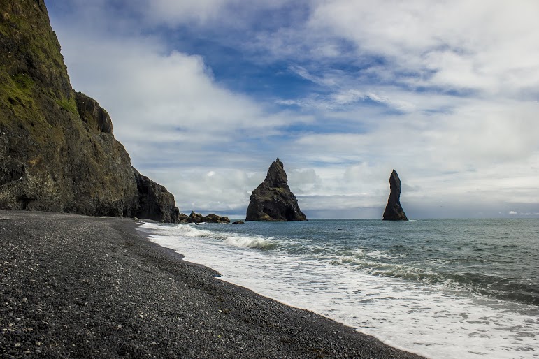
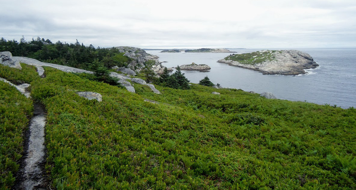
Not long after this, we reached the Rattlesnake Cliffs. Wow, what a spectacular view. I was absolutely stunned. On our left, we could see as far as the city of Hartford. And the sky was clear, so we could visibly see the biggest buildings in downtown Hartford. On our right, we could see the East and West Peak at Hubbard Park in Meriden and the Pinnacle Rock in Plainville. Great views all around. How did I not know this view existed? If this was all we did, I would have still ranked this hike very high on my list of CT hikes.

Views from Rattlesnake Cliffs.

hartford views to the left from the cliffs.

On your RIght from the cliffs.....

PANO VIEW FROM RATTLESNAKE MOUNTAIN CLIFFS.
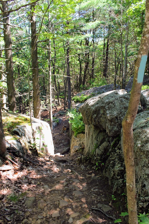
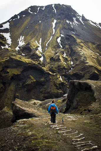
We hopped back on the blue trail down Pinnacle Rock and started making a steep descent. We witnessed other hikers take a wrong turn here by going straight down. We were able to stay on track. We continued hiking along the bottom of Rattlesnake Mountain and noticed a small tunnel formed by the rocks. We decided to climb through and found ourselves blue markers on the other side. Note, this is how you to get to Pinnacle Rock. There is a quite a bit of climbing on and over rocks for this section.
And, this trail is not as well-marked. There were areas we lost the blue markers. Sometimes the blue marker was faded on rocks and we didn’t notice until we got closer. If you do not come across blue after 5 min or so, I suggest turning around.

If you can't find blue markers, they may be on the rocks.
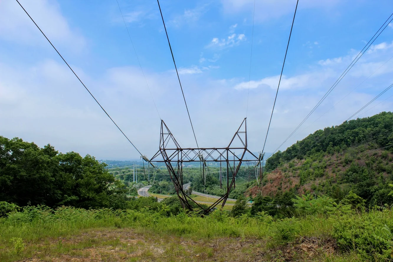
We reached the bottom and crossed an area under power lines that led us climbing up to the other side. We reached a dirt paved road and we saw a tree marked with blue and red. This took us to the final section before we reached Pinnacle Rock. You will be going uphill and start climbing the rock on your right to the peak of Pinnacle Rock.
The view of Pinnacle Rock is nice. But Rattlesnake Mountain has a higher wow factor. The view from Pinnacle Rock is not as appealing as you will see mostly homes. This is a big rock climber’s paradise and I did see a few people doing so. I will hike all day. But climbing isn’t for me.
RECOMMENDED POSTS

RECENT POSTS


See where I’ve been recently on Instagram, follow @HIKINGFORDONUTS


Crazy guy climbing up pinnacle rock.

VIew from the pinnacle Rock summit.

Top of pinnacle Rock with railings and rock seating to enjoy the views.
We headed back the same way we came. Took another peek from the Rattlesnake Cliffs before we headed back to the car. Such a great view. That is one of best views in CT. I was very impressed by this hike. This is easily one of my favorites now. It is very challenging. I would say it’s a moderate hike. Lots of different terrain and some climbing. Round trip is 4.6 miles but I feel like it’s closer to 5 miles. Definitely suggest hiking boots and a pack for this one. This took us about 3 hours. This is one New Englanders should add to their hiking list!
The review:
Rattlesnake MT to Pinnancle rock (farmington, CT), ~4.6m: 4.5 out of 5.

Black Pond via Mattabesett Trail, Middlefield, CT
The Mattabesett Trail extends through the state of Connecticut. Along this trail, there are great views. Black Pond has an amazing view from Besek Mountain. Check out the blog for pics and helpful info!


The Mattabesett Trail extends over 50 miles throughout the state of Connecticut. The first half of this horseshoe like trail follows high trap rock ridges of the Metacomic Ridge, from Guilford south to Meriden. The second part extends extends north from Guilford to Middletown where it ends at the Connecticut River. There are multiple areas throughout the state to hop on the trails. You will find numerous picturesque views along the way. One of my favorites spots to check out is Black Pond in Middlefield. I came across this trail a few years ago and the views are spectacular.
For the directions, the trail starts on Baileyville Road (RT 147) that intersects Meriden Road (RT 66). I always gps the restaurant Guida’s across from the trail. I park there and cross the street or there is a little parking area off the side of the road, where you will find the Mattabesett Trail blue-blazed marker.

Once we saw the marker, we headed into the woods to begin the trail. The trail is well maintained and marked pretty well. Thus, just follow the blue markers on this one. Nothing too tricky on this trail. Due to the storms recently, we saw quite a bit of trees down throughout the hike. And there are areas of rock formations where snakes may be hiding. Be on the lookout, I almost stepped on one.


About three-quarters of a mile into the hike, we came out to an open field that led us under power lines. We could see Route 66 highway from here, as the trail runs parallel to the highway. We then passed a brick and stone chimney along the way.
From here, the trail will begin to ascend up the mountain.

Until I was researching the area, I wasn’t aware this was called Besek Mountain. And, there is a ski area next to it, Powder Ridge. Once you reach the cliffs, you see the stunning view of Black Pond and Mount Higby in the distance as well. You can continue the trail from here and follow the blue-blazed trail further past the ski area chair lifts and the true summit of Besek Mountain. And you can go all the way to Guilford. However, this is where we stopped and turned around. We had our fun taking pics and checking out the view.


The loop was roughly 2.8 miles. The hike was moderate difficulty. The terrain was easy in the beginning but had some up and down sections. The hardest part may be finding the trail. This is a great morning weekend type hike with a rewarding view. Be sure to add this to your list, especially if you are local.

The Review
Black Pond via Mattabesett, 2.8M (Middlefield, CT) - 4 out of 5

HIKING FOR DONUTS
A blog for the outdoors foodie enthusiast
Hi, I’m Mark. I live in Connecticut. I take new trips every chance I get. A good trip has a great hike, great food, and something fun to do. My goal is to search out new trips and share them to inspire others to try something new and exciting.
If you are looking for posts in a particular place, search by city or state here.
EXPLORE OTHER POSTS IN THE ARCHIVE
RECOMMENDED POSTS
MOST RECENT POSTS
See where I have been recently on Instagram. Follow @HIKINGFORDONUTS

Old Furnace State Park, Killingly, CT
Old Furnace State Park is located in Killingly near Rhode Island. This is a great park for hiking, biking, and fishing. Exploring new areas is always fun, even if you get lost on the trails. Check out the blog to make sure you stay on the trails!


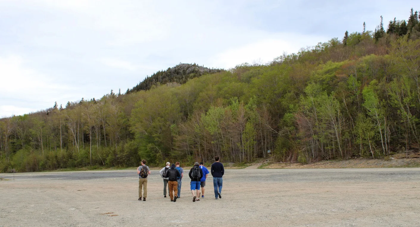
Scrolling through the list of the 2018 Sky’s Limit Hiking Challenge in Connecticut, I wanted to explore unknown parts of the state that would be new to me. I haven’t spent much time in the Windham County area, neighboring Rhode Island. I really had no idea where I was going and there was not too much info on the park online. But, I convinced my girlfriend to drive over an hour with a promise of beers and off we went.
Old Furnace State Park is located in Killingly, CT. You will find the park entrance off Route 6 via Route 395. Ross Pond State Park is fairly close so my GPS took me there instead. If yours does the same, just keep going past that until you can take a left onto South Frontage Road and the park will be there on your left. The blue-blazed trail of this park runs about 3 miles. This particular hiking challenge calls for 2 miles round trip until you reach the overlook from the cliffs at 200 feet over Half Hill Pond. With this view you get a great look of valley stretching into Rhode Island.

We finally found the parking lot and noticed there was mountain biking event going on. Apparently, this is a big mountain biking trail. I didn’t expect to see anyone. The hiking trail starts at the parking lot. I used the trail located at ct.gov here . The path instantaneously takes you into the woods.

As we began, we crossed a small brook that led us to crossing a small footbridge.


The trail was fairly wide open until we reached an unmarked section ducking through a brush of bushes. We found ourselves questioning our direction. Eventually, a blue marker did appear.


From here the ascent started to get steep. About a mile into the hike, we saw the path break into two. Unfortunately, we kept going straight and that was not correct and saw some brown marked trails.


Thus, we circled back and took the path to the left which was the ridge along the pond. And, finally we found ourselves at the cliffs overlooking Half Hill Pond. The pond was completely filled with water lilies.


We stopped here because the trail was pretty buggy and I didn’t think the rest of the trail would offer much. But if you want to continue, this will lead you down to the parking lot and boat ramp at Ross Pond to Squaw Rock Road where you turn around and come back. If you are not from the area, the directions to the park could be difficult and the trail itself has areas that should be marked better. The hike itself was not hard. I would rate it easy. I would bring bug spray and pay very close attention for the blue markers. Looks like a good area to fish and maybe kayak as well. I’m sure this is a nice spot for locals but one time is probably enough for me.
The Review
Old Furnace State Park, Blue Trail, Killingly, CT (~2m): 2.5 out of 5.

HIKING FOR DONUTS
A blog for the outdoors foodie enthusiast
Hi, I’m Mark. I live in Connecticut. I take new trips every chance I get. A good trip has a great hike, great food, and something fun to do. My goal is to search out new trips and share them to inspire others to try something new and exciting.
If you are looking for posts in a particular place, search by city or state here.
EXPLORE OTHER POSTS IN THE ARCHIVE
RECOMMENDED POSTS
MOST RECENT POSTS
See where I have been recently on Instagram. Follow @HIKINGFORDONUTS

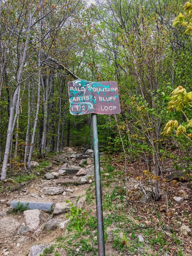
Artists Bluff Trail, Franconia Notch State Park
Artists Bluff is one of my favorite trails in the White Mountains of New Hampshire located in Franconia Notch State Park. This trail checks off all boxes for a great hike. The views are spectacular. Check it out!
Trail Description: The Artists Bluff Trail is a short hike that offers some of the best views of Cannon Mountain and Franconia Notch.
Trail Info:
Where: Franconia Notch State Park, Franconia, NH Distance: 1.5 miles (1-1.5 hrs) Difficulty: Easy to Moderate Trail Type: Out and Back Features: Views, Valley, Lake, Forest
How to get there:
From I-93 (Franconia Notch Parkway) get off on Exit 34C toward the Cannon Mountain Ski Resort and head west on NH 18. Go up roughly a half mile where you see a large parking area on your right. Walking across the empty lot in front of you will lead to the signs for the Artists Bluff and Bald Mountain.
Hiking Tips
Shortly along the trail, there’s a fork in the path that not clear which direction to go. Stay to your right to follow the Artist Bluff Trail. The other option will take you on the Bald Mountain Trail and will take you longer to get to Artists Bluff.
Great fall hike with amazing foliage.
The Hike
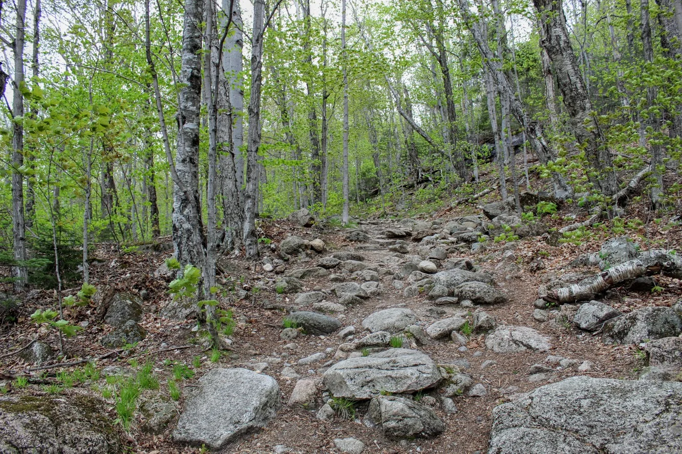
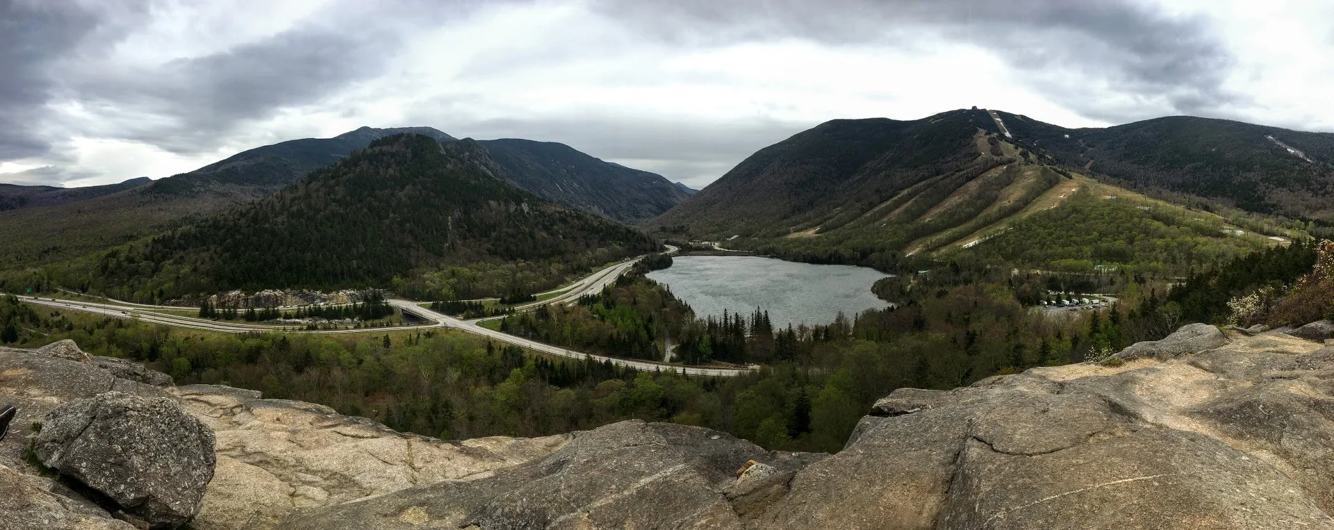
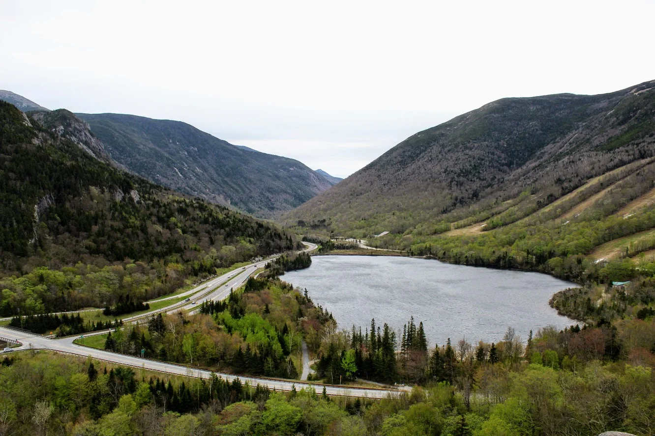
If you are looking for a great trail with amazing views that is relatively quick in New Hampshire, the Artists Bluff Trail in Franconia Notch State Park is exactly that. My friend owns a house close by and about 10 of us drove up for the weekend. After having too many beverages the night before, we wanted something relatively short on this morning. And, we wanted to beat the rain that was inevitable. We have hiked Artists Bluff in the past but it is a great hike and it is very satisfying. The loop is only 1.5 miles but it is challenging with steep sections. And, the trail will lead you to amazing views of Cannon Mountain and Franconia Notch.
Upon arriving we saw the parking lot off Route 18 on your right across from the Cannon Peabody slopes. We walked across the empty lot in front of us that led us to the signs of the start of trail for Artists Bluff and Bald Mountain.

We followed the Red marked trails to get to the bluffs. The trail starts off pretty easy then you have some steep inclines and declines as you get closer to the bluffs.


About .25 miles or so into the hike we saw split in the path to hike up to the summit of Bald Mountain on our left. This will add .5 miles to the hike. As we wanted to beat the rain, we stayed the course toward Artists Bluffs.

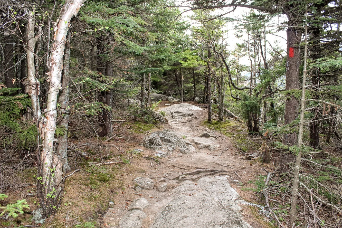
The trail eventually broke into the open and I saw views of Cannon Mountain. There was a storm recently in the Northeast and there were actually quite a bit of trees knocked down. I came across volunteers doing some maintenance to the trail and trying to clean up. After passing the volunteers, I came up to the rock that points to the direction of the bluffs.

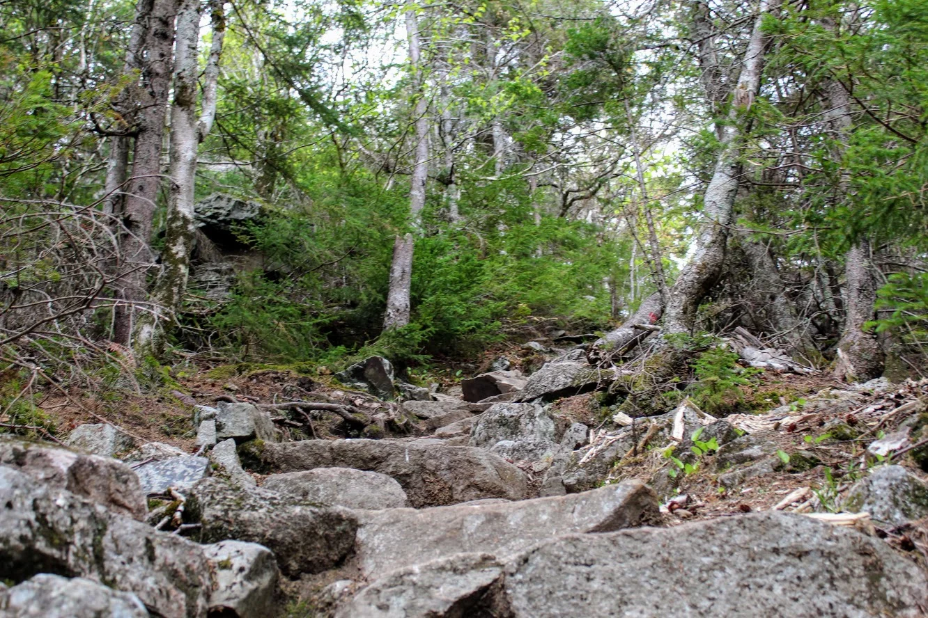
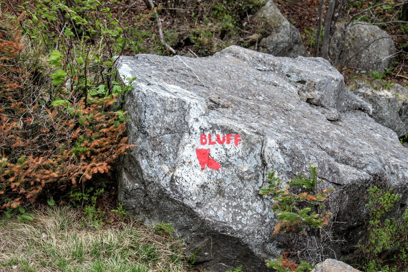
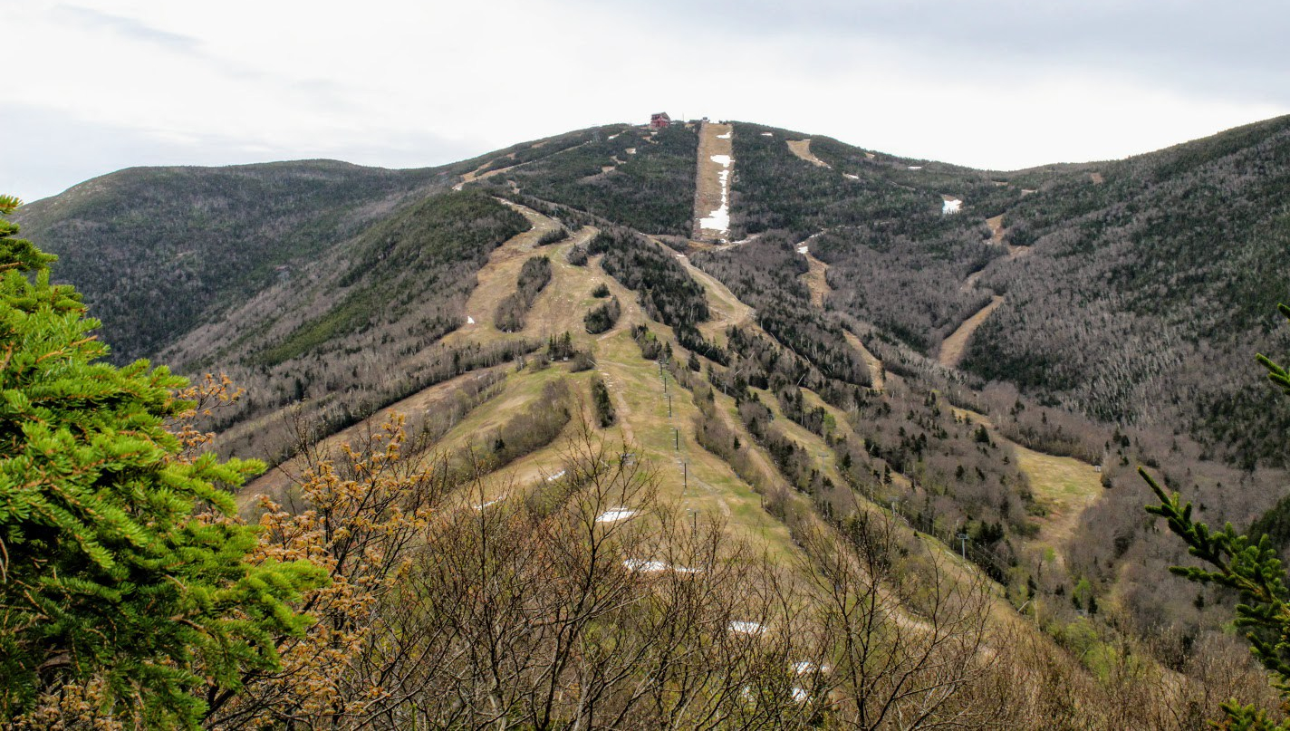
Artists Bluff stands at 2,368 feet high. The views at the top are amazing. You get a great outlook of the Franconia Notch. We hung out for about a half hour at the top reminiscing and questioning prior nights beverage consumption. And, then we decided to head back. The initial descend was pretty tough and rocky but the trail got easier as the path took us along Route 18 across from Echo Lake. And, this took us to where we originally started.

I would do this hike again and likely many more times. Each season of the year I am sure you get different views. Fall foliage would be the best. The trail is well marked and the forest is beautiful. Even though this is close to the highway, it is still far enough away and quiet as you hike. For a hike in the White Mountains, I would say this was an easy level hike. However, I could see this trail being moderate for others due to some the steeper sections. The hike will only take about an hour. But you will always add 20-30 minutes at the top taking in the views. The only thing that would have made this better is if I had some donuts with me!

HIKING FOR DONUTS
A blog for the outdoors foodie enthusiast
Hi, I’m Mark. I live in Connecticut. I take new trips every chance I get. A good trip has a great hike, great food, and something fun to do. My goal is to search out new trips and share them to inspire others to try something new and exciting.
If you are looking for posts in a particular place, search by city or state here.
EXPLORE OTHER POSTS IN THE ARCHIVE
RECOMMENDED POSTS


MOST RECENT POSTS
See where I have been recently on Instagram. Follow @HIKINGFORDONUTS

Arches National Park, Utah
Utah is filled of awesome and cool areas to explores. Especially, if you want to see some arches. Check out my blog on some must see landmarks in Utah!
Summer time is approaching and all I can think of is the endless possibilities to explore. A friend of mine recently went out West and sparked my memories of the trips I have taken. One of those trips was in Utah. In general, Utah is an underrated state. There is so much to do and so many cool national parks.
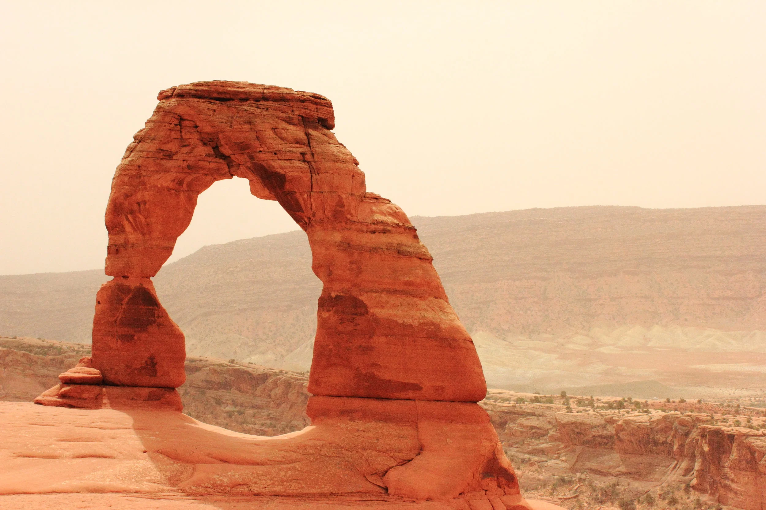
One thing about Utah, you can find many arches. You know…the rock sculptures that form natural bridges. There are over 2000 natural stone arches in Arches National Park alone, not counting the myriad of those found throughout Utah. After about 20 arches, you get the idea. You see so many in one area over and over you become a little too familiar. But they are awesome to see. You have to snap out of it and realize that you don’t see this type of scenery ever. With that said, my friends and I had a plan to hike to three very different arches that a each had a different and unique perspective. First, we would hike to Delicate Arch in Arches National Park, the most popular to visit in Utah. Second a hike to Corona Arch, just outside of Canyonlands National Park, this is popularly known for adventure junkies that try to rope swing through the arch. There are many vids on YouTube, check this out. You could not pay me enough. And finally, Mesa Arch, located in Canyonlands National Park's Island in the Sky District.

The first stop was Arches National Park for the Delicate Arch. The hike was about 3 miles round trip over exposed open rock that was quite slick. The trail begins at a large parking area near Wolfe Ranch. On this day, the wind gusts were up to 55 mph as you got closer to the arch. Not a smart decision to wear a hat. In addition, debris, sand, sunglasses, you name it was flying around. This is a very popular hike so the top was super crowded. Due to the popular photos you can take here, this will be a populated area most of the time. We had to wait in line in order to get a picture in front of the arch. For the view, it was definitely worth it. The trail is well marked with cairns. The hike isn’t that difficult and it’s a must when you are in the area.

Next on the arches list was the Corona Arch. The trail head of this hike was on the bank of the Colorado River. This hike was far more desolate. We may have seen a hand full of people on the trail. This is a very cool hike with some fun parts of climbing as you approached the arch. Round trip you are looking at about 3 miles also. As I mentioned above, some people actually climb the arch and will rope swing through it. We got lucky that day and ran into a group of crazies from Seattle who were doing just that. It was pretty intense to see in person. I would have never expected to actually see this in person. We had a chance to speak with them and they mentioned they tested the rope with a bag of rocks and the rope didn’t work. Yet, they went ahead and did it anyways! My buddy Corey actually filmed some one of the swings and swapped contact info with guy who did it. The west is indeed wild.


Lastly, we set out to see the Mesa Arch. Most people who visit Canyonlands National Park make the 0.5 mile hike out to the Arch, especially around sunrise. However, we were slackers on this day and got there around sunset time. The arch is off the edge of a 500 foot cliff, part of a 1,200 foot drop into Buck Canyon. Not much to say about the hike since it was so short. It is fairly easy, well-marked and the terrain is slickrock. Nevertheless, the views at the Mesa were incredible. You can get a keyhole view of White Rim country. Endless pictures were taken for sure. Utah has an unbelievable amount of must see landmarks and countless outdoors space to discover. If you make it out west to Utah, make sure you check out some arches. You won’t be disappointed.


HIKING FOR DONUTS
A blog for the outdoors foodie enthusiast
Hi, I’m Mark. I live in Connecticut. I take new trips every chance I get. A good trip has a great hike, great food, and something fun to do. My goal is to search out new trips and share them to inspire others to try something new and exciting.
If you are looking for posts in a particular place, search by city or state here.
EXPLORE OTHER POSTS IN THE ARCHIVE
RECOMMENDED POSTS
MOST RECENT POSTS
See where I have been recently on Instagram. Follow @HIKINGFORDONUTS
River Highlands State Park, Cromwell, CT
This is the first hiking trail review on the Connecticut hiking challenge trails. Check out the blog to learn more about the challenge!
Trail Description: A view 150 feet up of the Connecticut River can be seen from the White Blazed Trail in the River Highlands State Park. In addition, there is water front with picnic tables to enjoy.
Trail Info:
Where: River Highlands State Park, Cromwell, CT Distance 1.5 miles (1 hr) Difficulty: Easy Trail Type: Loop Features: Views, River, Water
How to get there:
Directions in detail can be found here,https://www.ct.gov/deep/cwp/view.asp?a=2716&q=434748&deepNav_GID=1650.
River Highlands State Park, Field Rd, Cromwell, CT 06416
Hiking Tips
Good beginner hike or weekday hike after work.
Super buggy area. Bring bug spray.

The Hike
Finding good hikes in Connecticut is becoming less a challenge. And, that is a good thing. Most people just dismiss how much is truly out there. Recently my friend told me there is a hiking challenge in CT. I can’t believe I haven’t come across this. Of course, I googled and found Sky’s the Limit Hiking Challenge by the CT Department of Electric & Environment Protection (DEEP). They list 14 lesser known trails to encourage more hiking in CT state parks. There are rules and info here. You can win some prizes too. I think it is a great idea. I haven’t heard of most of the trails. I smell some new blog material. I am definitely on-board and will be joining in on the fun.
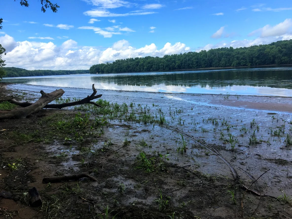
With that said, here in my very first hike of the Sky’s the Limit challenge. A rare weekday hike but if it is 90 degrees in May in CT, you get outside. Nichole and I went to River Highlands State Park in Cromwell, CT. This was an easier and quick hike. The hike offers views of the Connecticut River from 150 feet above the water. I would use this link for the trail maps. Directions can be found on the CT DEEP link above.


The park consists of multiple color trails. You can go multiple different directions. The biggest loop will take you about 2 miles but you can connect to many different trails and adventure as much as you want. The trails are very well marked and the terrain is pretty level. Maybe one or 2 short, steep sections. We chose the white trail from the parking lot. This takes you directly to the high bluffs overlooking the Connecticut River.

More river views.
From there we took the yellow trail down to the camping site. Typically, you can go to the bottom and walk out to get more views of the river. However, due to all the rain we had recently, the water was really high. Trees and picnic tables were covered. It is probably best to do this hike in the summer. Luckily, I did this a few years ago when the water was low.


After trying to snap some good IG pics, we continued to follow the yellow trail out to the parking lot. There are quite a bit of small bridges to cross over. And, this particular area is swampy and gets very buggy. Tons of mosquitoes. I suggest Deep Woods spray for this hike.


We did do some adventuring off the trails mentioned but it shouldn’t be more than 1.5 miles if you use the white to yellow marked trails. Barely took us an hour. This is a very good beginner hike. You don’t need boots but it is a wetlands area so it can be very muddy. It’s a good, quick hike for those locally.

HIKING FOR DONUTS
A blog for the outdoors foodie enthusiast
Hi, I’m Mark. I live in Connecticut. I take new trips every chance I get. A good trip has a great hike, great food, and something fun to do. My goal is to search out new trips and share them to inspire others to try something new and exciting.
If you are looking for posts in a particular place, search by city or state here.
EXPLORE OTHER POSTS IN THE ARCHIVE
RECOMMENDED POSTS
MOST RECENT POSTS
See where I have been recently on Instagram. Follow @HIKINGFORDONUTS

Castle Craig and East Slope Trail, Meriden, CT
Castle Craig is a popular destination in Meriden, CT. There are awesome views from the top. Hiking the East Slope Trail, check out my review!
Spring is finally here to stay. Another beautiful weekend for outdoors. This weekend’s hike was an oldie but goodie. I have hiked up to Castle Craig a few times in the past. The hiking trails are pretty good and there are excellent views at the top. Also, there is an actual castle/tower, which can be climbed via stairs to the top inside the tower. Castle Craig is located in Hubbard Park in Meriden, CT. The park itself is fairly nice, covered with gorgeous daffodils and a large pond with fountains. There are various trails that take you up to the Castle Craig tower. This particular blog will be on the East Peak using the white/red/blue trails. The trail map I used can be found here.
Upon arriving at Hubbard Park, we drove straight until we saw a small lot to our left where the trail head starts.

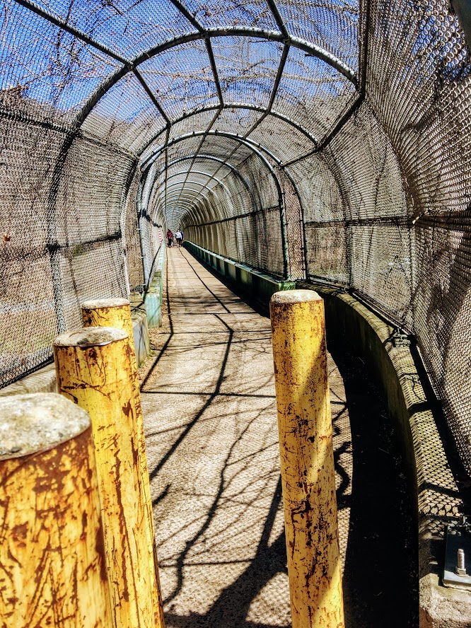
From here we followed the white blazed trail through the walking tunnel over I-691.
Shortly after, we reached the small foot bridge that passes over a creek.

Continuing on the white trail led us to the Beehive Spring landmark.

From here we continued straight on the red blazed trail for a short distance until we saw the first blue blazed trail. This part of the hike got pretty steep.

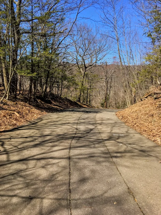
The end of the steep ascend took us to the paved road. You have options here. Use the paved road up to the peak or continue along the blue trail to see overlooks of the town and cross the parking lot. We just went up the road.
At the end of the road, we reached our destination of the East Peak. Castle Craig tower sits atop the East Peak at 976 feet. The skies were absolutely clear and the views were spectacular. We reached the top to only find a few people but within minutes the peak began to fill out, which is typical.


After making more donut eating boomerang videos, climbing the stairs to the top of the tower, and taking as many pics as possible, we made our descend down the East Peak following the white trail. The downhill is steep at first but then becomes flat. I will say, I was disappointed to find a ton of broken glass at this section of the hike. This is a good hike. And, many families include young children and dogs frequently travel the trails. Take care of the trails! Who would smash bottles?!???! Not cool.

Eventually, the white trail led us down carriage road to the Halfway House.
We passed this landmark and continued to follow the white trail to Merimere Reservoir. Again, the skies were clear and got another great view. We continued alongside of the reservoir until we reached the pave road. We took a right walking down the paved road and took another right on the next road, Notch Road. Passing under 691, this lead us back to where we parked.


Hubbard Park is a great area. The park is generally very populated. On nice days, the hiking trails can be crowded. We had pretty good timing on our hike but did get overwhelmed once we reached the peak. I would suggest doing this during the week, after work if possible. If not, this is still worth the hike when crowded. The Castle Craig tower is unique and the views are fulfilling. I would rate this hike moderate for the average hiker. If you are not use to steep uphill, you may need some breaks. Like most Connecticut hikes, gym shoes are probably ok but hiking boots are best. This hike took my group about just over 2 hours and was 3.5 miles based on the way we took. I have done this hike 4x so far. Definitely recommend for a good Connecticut hike.
Hiking Trail Review
Castle Craig and East Slope,~3.5m (Meriden, CT): 3.5 out of 5

HIKING FOR DONUTS
A blog for the outdoors foodie enthusiast
Hi, I’m Mark. I live in Connecticut. I take new trips every chance I get. A good trip has a great hike, great food, and something fun to do. My goal is to search out new trips and share them to inspire others to try something new and exciting.
If you are looking for posts in a particular place, search by city or state here.
EXPLORE OTHER POSTS IN THE ARCHIVE
RECOMMENDED POSTS
MOST RECENT POSTS
See where I have been recently on Instagram. Follow @HIKINGFORDONUTS

Hancock Brook Trail, Waterbury, CT
Spring weather is finally upon us. As summer approaches, I look forward to finding new hiking trails. I came across Hancock Brook on Instagram and the hike surprised me. And, no it's not closed. Read up on my advice to make sure you complete this trail!


It has been a long, very long winter in the Northeast. The weather finally felt like spring and that means it was time to find some new trails to hike. I came across the Hancock Brook Trail in Waterbury, CT on Instagram from some fellow CT hikers I follow. I never heard of it and the views looked cool. However, my research displayed this trail was closed including sites like Alltrails. After seeing recent posts and finding one actual site with directions on this trail, I felt comfortable enough to give it a go. And, I can confirm the trail is NOT closed. People are giving up too easily. Yes, there is a rotted bridge but the trail can be accessed elsewhere. For directions, plug into your GPS: Sheffield St., Waterbury, CT, 060704. Drive all the way down until you hit the quarry and there is a small parking lot to your right.
The Hancock Brook Trail is a blue-blaze trail along the edge of the Mattatuck State Forest. This hike is a 2.8 mile loop. The terrain does get quite rocky, which includes steep uphill and downhill portions and some climbing. The trail was covered in leaves on this day and was quite slippery because of that. I would consider this a moderately difficult hike for the average hiker.

Onto to the infamous bridge I kept reading about. Ignore the bridge.

From the parking area, you will start walking up the side of the quarry and look for the first Blue marker. Upon entering the woods, the trail splits and the trail to the right with one blue marker will take you along Hancock Brook. The first half mile or so will give views of the stream and its rapids. The trail is fairly narrow and gets unpleasant as you reach the inclines where the bushes have grown into the trail.


You will reach a spot in the trail where you hear lots of trucks and work on the quarry. There will be a sign to stay on the blazed trail on a tree with the Blue marker.

Continue this direction and go straight. This is a tricky part of the trail. The markings are not great until you reach the peak. You will want to veer right but that will take you the wrong way. There is a like a raised branch signaling not to go this way. If not, you will reach a small pond and you will see a very sketchy trailer. Do not go there. That is not part of the trail. You will be too close for comfort. Turn around. I just envisioned all the crazy TV shows I saw with a crazy dude coming out of a trailer and chasing me.

If you went the right way, you will reach the pond and see the trailer across far enough away. You need to make an abrupt left into the woods to start the incline. Once you do not see blue markings, stop and just turn around. We walked by it as well. I took pictures for guidance. The blue marker was covered by trees.
The trail will get tougher at this stage as you enter a pine forest. There is a mini pond with a bunch of trees down as you get closer to the ascend uphill. Keep an eye out for the blue markings. They are a little too far apart in this area. Once you pass this pond, the steep uphill will begin and there will be some switchbacks.

This tough stretch will be worth it as you will reach a beautiful lookout spot for views. The rock formation is called Lion Head and is the peak at 660 feet. This is a great spot to stop and soak in nature. Have a snack and fuel up on water. Maybe eat a donut.


The climb down was tough at first but got pretty easy as we kept going. And, the trail markings were way better. The spots where they were too far apart, I suggest going the way that made sense and you will find them. You will pass a few more lookout points to enjoy more views along the way.


At the end of trail, there will be a steep downhill section before you reach the quarry where you started. And, somehow we completely missed the waterfall coming in, or the water started to come down from melting while we hiked. Before we left, we took a closer look at what is called Hancock Cascades. This was to the left at the end of the final descend.


This was a surprisingly good hike. This took us about 2 hours and that is with stopping for 20 minutes. I don’t think I would have found it without Instagram. The hike was fun and didn’t take too much time. I would just be careful of the markers. There were times where it was lacking and you really had to keep an eye out. And, stay away from the Breaking Bad looking trailer!
Trail Review:
Hancock Brook Trail, Waterbury, CT (2.8m): 3 out of 5


HIKING FOR DONUTS
A blog for the outdoors foodie enthusiast
Hi, I’m Mark. I live in Connecticut. I take new trips every chance I get. A good trip has a great hike, great food, and something fun to do. My goal is to search out new trips and share them to inspire others to try something new and exciting.
If you are looking for posts in a particular place, search by city or state here.
EXPLORE OTHER POSTS IN THE ARCHIVE
RECOMMENDED POSTS
MOST RECENT POSTS
See where I have been recently on Instagram. Follow @HIKINGFORDONUTS

Hiking the Rockies: Hallett Peak
If you want to try a challenging hike in Colorado, this post is for you. Check out my Hallett Peak hike and advice not getting lost like me!
In the summer of 2013, I decided to take my first trip to Colorado. I was looking for a new destination to explore and adventure. As far as in the U.S., Colorado was at the top of my list. My buddy Corey devised a plan as per usual, which was all it took for me to say yes. We had never been there and the Rocky Mountains were calling our names.
Three months later we landed in Denver and got right on the hiking trails. At the time, we were younger and in better shape so the altitude didn’t affect us too much. With that said, my conditioning was tested on a challenging, mammoth hike, which at the time was highest elevation I had ever been. And, that trail was Hallett Peak.

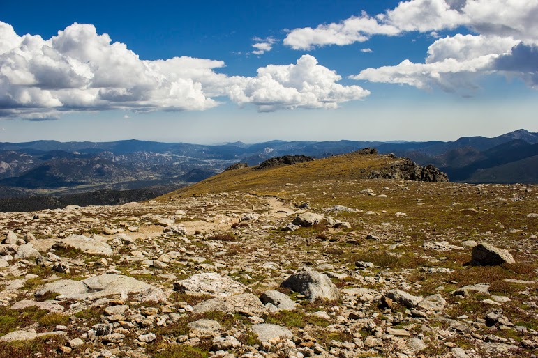
Hallett Peak lies along the Continental Divide, the point at which water on the western slope flows towards the Pacific Ocean, and water on the eastern slope flows towards the Atlantic Ocean. Hallet Peak stands at 12,713 feet tall. The highest mountain I have hiked up to this point was Mount Washburn in Yellowstone a few months earlier at over 7,000 feet.
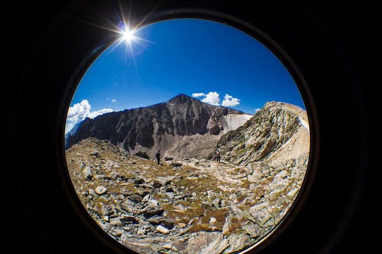

The hike begins at the Bear Lake Trailhead, and then follows the signs toward Flattop Peak. Most of the hike is above tree line as it switchbacks up the side of Flattop Mountain. The trail had some steep uphill moments. The altitude was starting to get to me as we got higher. I had to stop every so often and catch my breathe. This gave us a chance to see wildlife, mostly little critters, and the abundant wildflowers along the way. Once you arrive at the summit you must identify the unnamed trail leading south toward Hallet Peak. Be careful, as we got lost and added an additional two miles by missing the trail. Although, the views were amazing so adding more to the hike was a bonus. Around the top of the of Tyndall Glacier, the last half mile of the hike involves ascending up the slippery, rocky slopes toward the summit by connecting short trails marked by cairns. We reached the top as storm clouds began to appear.

Love me some cairns.


Before we headed back to beat any possible storms, we ate lunch and drank some well-deserved beers. The total round trip for this trail is 10.3 miles. With our detour, we trekked just over 12 miles. This trail was absolutely awesome with remarkable views. The trail was really, really tough but I would do it all over again. I definitely felt like I was on top of the Rockies. John Denver was not full of……


HIKING FOR DONUTS
A blog for the outdoors foodie enthusiast
Hi, I’m Mark. I live in Connecticut. I take new trips every chance I get. A good trip has a great hike, great food, and something fun to do. My goal is to search out new trips and share them to inspire others to try something new and exciting.
If you are looking for posts in a particular place, search by city or state here.
EXPLORE OTHER POSTS IN THE ARCHIVE
RECOMMENDED POSTS
MOST RECENT POSTS
See where I have been recently on Instagram. Follow @HIKINGFORDONUTS
How to spend a weekend in Burlington, VT: Food & Breweries
Burlington, VT is a great long weekend destination. Lots of food and breweries in walking distance. Check out my blog post on the best food and drink spots in Burlington, VT.
My first trip to Burlington, VT was a few years ago. I couldn't believe I hadn't made a trip to this great city. There are lots of breweries, food, and outdoor activities. You could walk pretty much everywhere. In the summer, there are farmers markets and food trucks. I really enjoyed my stay but it was short. My girlfriend, Nichole, had never been and I thought it was a great weekend trip idea. Also, I have been wanting to stay at Hotel Vermont and they have a sweet black friday deal. And, it is a perfect location to walk around and Lake Champlain is across the street. Hotel Vermont was only a mile or two from everywhere we went, it was a great central location to stay. If you read the blog, you know we really get after it when we travel to new cities. And, Burlington was no different. We went to as many breweries as possible and ate our faces off. I did all the work for you! Here is a list of the best places to eat and drink in Burlington. If I missed any, please comment. I will be back.
The Food
Farmhouse Tap & Grill was the first meal we had in Burlington. This was the typical fancier local restaurant. It is always super busy. We had to wait over an hour for a table, given it was a Friday night. They have a great beer menu. The food is actually pretty good, especially the burgers. However, it is a bit pricey to me. There is a big farm to table presence in Burlington and that drives the price up.


The Swingin' Pinwheel Café Bakery was the surprise of the weekend. Do not pass up this breakfast when you walk by. The hostess was hilarious and friendly. The menu has so many good options. It is a smaller spot so be mindful. The decor definitely had that western and cowboy feel. They are known for their Wafflini, which is a waffle made with pastry dough and pressed like a panini, and they have multiple types. We had to get one and it was phenomenal. We started with a popover and ate it so fast, I didn't even get a picture!


Red Onion was recommended to me by someone from the area. They told me, the sandwiches sound weird but go with it. It was quite an interesting little spot on Church Street (main area for shops/restaurants). I ordered the Red Onion sandwich, which consisted of turkey, vt cheddar, red onion, granny smith apple slices, and sun-dried tomato mayo on honey oat bread. The bread was like an inch thick! Nichole got the spinach melt. This consisted of a TON of fresh baby spinach, mushrooms, red onions, sharp cheddar, and garlic mayo on honey oat. They were both delicious. If you need a quick bite, I definitely would suggest the Red Onion.

There is surprisingly a fair amount of Mexican dishes and restaurants in Burlington. For that reason we were craving Mexican and chose El Cortijo Taqueria Y Cantina as it was the closest with the best ratings. And, they were a sister company of the Farmhouse Tap & Grill. This is a very small location. Luckily, we got seated right away but the dinner crowd hit and the front of the restaurant was overly crowded and flowed near the tables. It was a bit uncomfortable eating with people on top of you waiting to be called. And, the food was just ok. Nichole enjoyed her margarita but the rest was less memorable.
And you know we hit up Ben & Jerry's for dessert.

Monarch and the Milkweed was another great breakfast find. This was a quaint, trendy shop in the town center that fits maybe 15-20 people. One of the reasons I chose there was because they make donuts, mini but I don't discriminate. The donuts were ehh but the breakfast was awesome. I had the fried chicken sandwich with gruyère cheese, red onions, and some aoli that reminded me of Big Mac sauce. Nichole had the pancake stack and they were really good and cooked perfectly.
Fortunately, on the way home, we made a surprising delicious stop, only 20 minutes outside of Burlington. We mentioned to some people we met along the way, we were going to Fiddlehead Brewing. Every person said you have to go to the pizza place next door, and that was Folino's Wood Fire Pizza. No one has to twist my arm to have some pizza. This place gets really packed from the Fiddlehead crowd. You will be seated by someone but you have to do everything else, get your own plates, order at the cashier, etc. Aside from that tidbit, the pizza was awesome. Maybe the best buffalo chicken pizza I have ever had. Everything just worked. Make this part of your to-do list.
The Breweries
On the way up from CT, our first beer stop was at Burlington Beer Company. This was only 20 minutes or so outside of Burlington. This was in a cool industrial location. The inside was cool and trendy. They had old school video game systems. They offer a lengthy list of beers, including IPAs, Porters, and Stouts. The beer was good. A little hoppier for my taste but I see why they are popular. They fit into the craft beer scene perfectly.
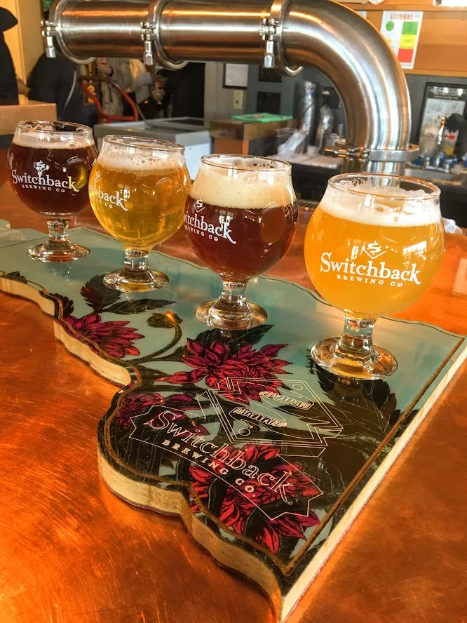
Switchback Brewery was first on the list of our brewery crawl and the furthest, 2 mile walk but it actually wasn't bad. I have been before and really like their beers. Their Connector IPA is my favorite. The inside is pretty nice and feels inviting. And, the world's largest filing cabinet is on the way! Seriously, it exists.


Queen City Brewery was our favorite brewery. I don't recall seeing it last time I was here. It was tucked away behind a local printing business. It is close to Zero Gravity. They had a big wall of beers and there was an old truck on the the very top of the bar once inside. They had 13 beers to choose from and I liked most of them. My favorite was a tripel Belgian named Monk of Underhill. This isn't a place if you want hoppy beers. They had mostly porters, stouts, and lagers. I am not even a porter guy and I enjoyed their version of that. The bartender was really nice and it was just a good atmosphere.


This isn't a brewery but a cidery counts. Citizen Cider is one of my favorite ciders. Last time I came here, I had a blast. They had quite a bit of options as usual to try out. I really like what they do with their ciders. They aren' t just sweet and one taste. Definitely a staple to visit when in Burlington.


Ah, the new popular guy. Foam Brewery wasn't opened last time I was here. Since then, I have heard a lot about this brewery from friends. We made our way there as the last stop and the location is great. It is right off the water. In warmer weather, it must be even more busy than it was. However, they do not have flights of beers as an option and the beer was pricier than other breweries. And, the beer was super hoppy...almost too much. Again, that is not for me. I preferred other breweries.
The weekend of breweries was not quite over yet. The last stop on the ride home was Fiddlehead Brewery. I had their beers before and really enjoyed them. I had to stop in and check it out. At this location in Shelburne, VT, you can only buy beer that is canned, sample what they have available that day and get growlers. It is very small and can get crowded quick. We went as it opened and the lot quickly filled up and cars were coming and going. I liked what they had on tap and I ended up getting a growler and buying cans. We did make a few other stops for beverages.
Vermont Pub & Brewery was pretty average. It is really big and they have basic food options to please the generic eater. Seems like the place all tourists go when other places are busy. And, the beer wasn't great. They are a bit behind the other breweries in the beer department. The other bar we did go to was Archives. This was a bar filled with arcade games and a pretty good beer, cocktails, and wine menu. If you are into old video games like pacman, street fighter, pin ball, and other oldies, this is the spot for you.
Bonus: A Winery?
Not only did Fiddlehead Brewery have an awesome pizza spot next door but there was also a Winery across the street! By far, the happiest Nichole was all weekend as she likes wine way more than beer. Of course, we kept the ball rollin' at Shelburne Winery and did a tasting. This consisted of 10 wines and they were not shy with the pours. I also liked they gave a list of the wine with a marker so you could keep track of what you liked and they had a funny comment & description about each wine. I do not like wine that much but I did like a few of the white wines and a red that had chocolate in it. Nichole ended up buying two bottles. This was a great way to the end the trip. Beer, wine, & pizza. We accomplished a lot and I think we did a good job finding some good go to spots. I hope you enjoyed reading and will try out some of my suggestions. Cheers to beers & delicious food!


HIKING FOR DONUTS
A blog for the outdoors foodie enthusiast
Hi, I’m Mark. I live in Connecticut. I take new trips every chance I get. A good trip has a great hike, great food, and something fun to do. My goal is to search out new trips and share them to inspire others to try something new and exciting.
If you are looking for posts in a particular place, search by city or state here.
EXPLORE OTHER POSTS IN THE ARCHIVE
RECOMMENDED POSTS

MOST RECENT POSTS
See where I have been recently on Instagram. Follow @HIKINGFORDONUTS
Hiking in Iceland: Thórsmörk
In 2010, a Volcano erupted in Southern Iceland. This eruption occurred near a popular hiking path from Skógar to Thórsmörk. Luckily, during my trip, the hiking route was opened. The terrain was difficult and cut the hike short but the views along the way were mesmerizing.
On my eight hour flight to Iceland, there was a lot of time to spare. The movie selection wasn’t great. And, then I saw the film, “The Secret Life of Walter Mitty.” Ben Stiller was in it and I figured it had to be decent. I started watching and realized, hey this is in Iceland. I turned to Corey and was like did you know this? And, he responded, yes I told you 10 times about this movie…..I’m not a good listener. As I watched, I would pause the movie every 20 minutes and say is this where we are going?!?!?! There was one scene where a volcano erupted and had Ben Stiller’s character running for cover. Pause again, I turn to Corey, are we going to see this? And he said, uh, we are hiking this. Oh snap. It’s about to go down. Eyjafjallajökull, you read that right, is a small ice cap located in Southern Iceland. In March, 2010, thousands of earthquakes were detected and caused an eruption in Fimmvörðuháls, the area of a popular hiking route from Skógar to Thórsmörk, which was then proceeded by a much more violent eruption at the top of the volcano, beneath the glacier. This second eruption caused massive floodwater to pour down the side of the volcano. Over 800 people were evacuated and Iceland’s Glacial Lagoons were destroyed. This even caused a stir with air traffic in Europe, which was paused for numerous days. Four years later, the devastation was still visible and lava was still smoking on the side of the volcano. As luck would have it, the hiking trails were opened and hikers can travel the route and take in these new views. And, that is what we planned to do if the weather permitted. We booked a night at the Volcano Huts in Thórsmörk, which was an awesome experience even if we didn’t attempt a hike. We had to take an hour long bus ride into Thórsmörk, crossing streams and passing glacier tongues.

The initial plan was to hike the entire trail close to 16 miles, see some lava. As we got closer, we realized there was no way we could safely make it to the Fimmvörðuháls pass. However, we like exploration and adventure. We decided to continue with our bold plan until we just couldn’t go on. Try to see as much as we can. You never know if you will be back.


After speaking with the guide at the hut, we started our trek onto the beginning of the Fimmvörðuháls pass. The trail began with small brooks through a woodsy path. And, just like that we were exposed to a large field and a visual of glacial capped mountains. The next section of the hike was an enormous, rocky flood plain that we had to cross. There was a mobile bridge positioned at the end of the rocky terrain where the river was currently running through. We made our way across the bridge to the base of the snowy mountain on the opposite end of the valley where we started. We began our accent up the mountain and the terrain quickly transformed as snow began to appear. We crossed paths with our first hiker of the day heading the opposite direction. We made sure we were going in the right direction and were informed that the terrain was going to get dicey. And, there were currently blizzard conditions farther up the trail. We had packed for the worst, tents, extra clothing and food, so we continued on. Goals of lava steaming were still in sight.


As we made our way up the side of the mountain, patches of snow turned into thick layers of snow. And, this is where things got interesting. There weren’t any prior footprints to just step in as no one had dared to travel this far. We had to carefully, side step along the along the ridge line. Or else we were going sledding down the side of the mountain and……goodbye. We passed multiple sections of pure snow/ice drifts on this very steep mountain slope. Definitely one of the times I had some actual fear and wanting to maybe just turn around. But, persistence always prevails. Eventually we reached the top of the ridge trail and proceeded onto flat land covered in volcanic ash, mud, and rocks. We continued to trek across the this plain until we reached the cliff on the opposite side of the mountain.


At this point, the remainder of the trail looked too risky. As we would need to descend down between the mountains and ascend back up. After what we just did along the ridge line, we called it at this point. We regrouped and chomped on treats to refuel. Then, Corey noticed smoke on the side of the mountain and realized that it was cooling lava. We have attained our goal of seeking lava! The scene was remarkable. The experience was epic. This is what HikingforDonuts is all about. Push yourself, go beyond your comfort zone, and discover what’s out there. .....Then eat a donut ☺.


HIKING FOR DONUTS
A blog for the outdoors foodie enthusiast
Hi, I’m Mark. I live in Connecticut. I take new trips every chance I get. A good trip has a great hike, great food, and something fun to do. My goal is to search out new trips and share them to inspire others to try something new and exciting.
If you are looking for posts in a particular place, search by city or state here.
EXPLORE OTHER POSTS IN THE ARCHIVE
RECOMMENDED POSTS
MOST RECENT POSTS
See where I have been recently on Instagram. Follow @HIKINGFORDONUTS
Exploring Iceland, Part 1
Iceland is one of the more popular destinations for travel right now. Back in 2014, my college friends and I explored 10 days and 1400 miles. It was the most adventurous trip I have ever been on. Here are some of the sights and destinations of that trip.
Iceland is one of my favorite travel destinations. My trip consisted of 10 days of nonstop adventure. This was before it was the "cool thing to do". Iceland travel is everywhere on social media right now. I come across one person a month who has gone or is going. And, rightly so. Iceland is a great country and there is so much exploring. Back in 2014, my friend, Corey, brought up the idea of Iceland. I thought he was a bit whacky and told him to give me more details. As per usual, Corey was able to persuade myself and our other traveling friend, Nancy. This would be the first big exploration in another country. Corey spent over 3 months vehemently planning and creating the ultimate itinerary. And, he succeeded. I just sat back and looked at pictures for months. As the time came close, I was really excited. We had plans of driving all over the country, lots of hiking, hot spring swimming, eating different food, and taking in the culture. This post will focus on some areas of the trip. I will post the hikes separately because they were so awesome. I want to provide a small peek of what Iceland can offer. A new country can be daunting but the risk is worth the reward.
Raufarholshellir Lava Tube Cave
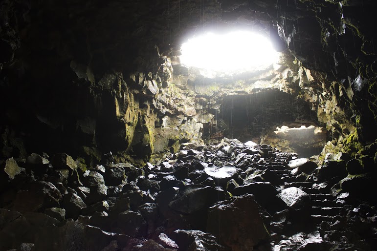
We flew into Reykjavík, picked up our tiny rental car and packed it to the brim. Seriously, the smallest rental I have had and it needed to fit 3 people plus 6 bags. Side note, the best decision we made was renting a car. We drove over 1400 miles and it was amazing. As I digress….we arrived 1am their time and went right to bed. Our trip was in June and it is light 24 hours a day during that time frame. Needless to say, we didn’t sleep much. In addition, we were welcomed with wind and rain that morning but that didn’t stop us from our exploration of Iceland. The objective of this day was to find a lava tube cave, explore, and save $200 not using a guide. Lava tubes are formed by flowing lava which moves beneath the hardened surface of a lava flow. Some are active and will drain lava from a volcano. Some are extinct where the lava flow has stopped, cooled the rock, and left behind a long cave. We were definitely looking for an extinct one. Corey did quite a bit of research to even find information on where to locate one. This info is kept under wraps as most tour guides will not give this out in order to charge for the services. However, we are bad asses. We brought our own helmets and lighting. After driving up and down roads, we eventually found the Raufarholshellir lava cave, which ranks as the third largest in the country at 1360 meters long. Parking was located in a big, rocky lava field. Ironically, the only other vehicle in the lot was an Extreme Iceland tour van.
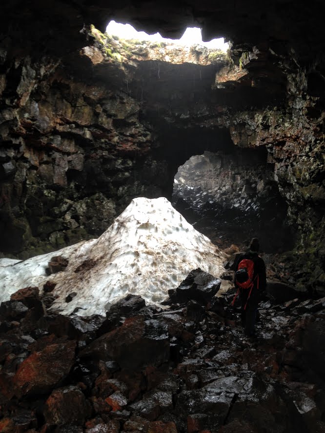
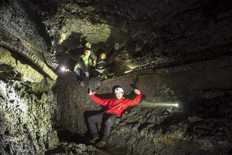
The beginning of the cave was pretty open with large spotlights where the roof had collapsed. As we descended down, it became more cave like. The ceiling was dripping water as the rain was able to get through. We eventually cross paths with the tour group and the tour guide reassured us of our path. As we went further, it got darker and darker. At one point, we all decided to turn our lights off. It was the darkest setting I have ever been in. It was surreal.

The terrain got more difficult as we reached the end of the tunnel. There was supposed to be a waterfall at the end but it was more of a fossilized cliff of the lava rock near the hole of the ceiling. We made our way back but not without a little scare. There were two tunnels to go down. We only went down one?!?!? I am horrible with directions. Nancy…is Nancy. That left Corey to make the decision. Even though we were concerned as some features seemed different, he made the right decision and we survived. Close call. Always be mindful of your surroundings, especially in a cave.
United States Navy plane crash
Our next adventure was a real surprise. Corey planned everything for the trip. I just handed over money and got on a plane. He took us to the middle of nowhere looking at map coordinates only. We parked the car on the side of the road, packed up our bags, and he said just walk this way. I had no idea where were going. After an hour had passed, we continued to walk through the black sand and I could barely see our car. I saw 4x4 tire tracks so I knew we were close to our destination. I saw the ocean. Then out of nowhere, there was an empty wrecked plane that had crashed resting in the black sand. There were other tourists groups there taking photos and touring the plane.

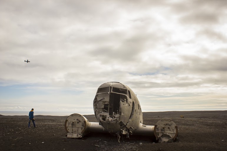
This was the remains of United States Navy plane. The Douglas Super DC-3 made a crash landing on November 24, 1973. The crew survived and left the wreckage behind and was abandoned. I know this tidbit now. Of course, I ran toward the scene with excitement and accidentally ruined the tourist’s pictures. We ended up taking pictures and exploring the inside for about an hour before we made our trek back to the car. This was an awesome experience and never did I anticipate it would happen in Iceland.


Seljalandsfoss
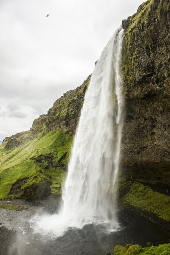
We did our best hitting every attraction and destination we could fit in our schedule through 10 days from Höfn to Grundarfjördur. I felt like I was in a different country each day. We went from gray volcano ash scenery to beautiful bright green landscape to clear blue water and beaches to mountains and glaciers.What an amazing country. And, if you like waterfalls, Iceland is the place for you. I imagine I seen more in 10 days than my entire life. The first one we came across was Seljalandsfoss. This waterfall was awesome from the road and even more amazing up close. This was the biggest waterfall I have seen. And, you can walk under the waterfall into a small cave.


Skógafoss
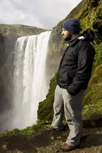
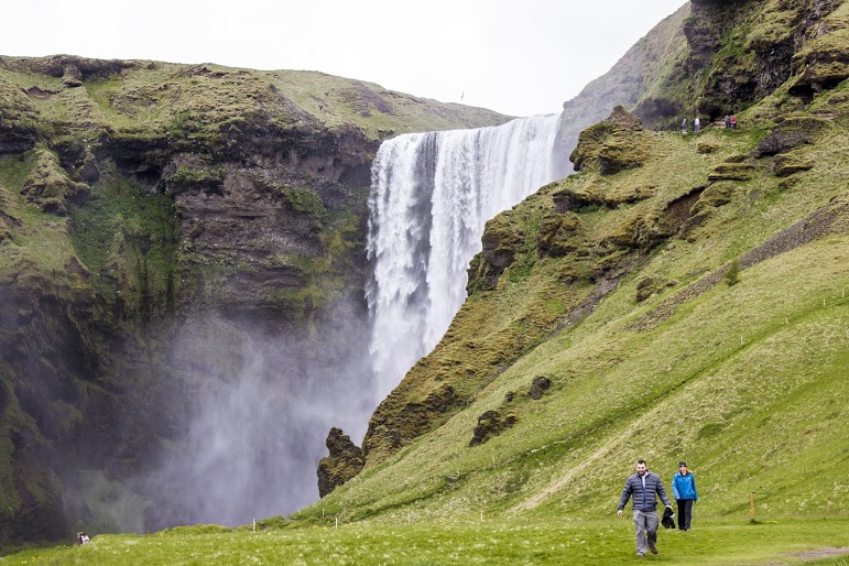
The next waterfall we came across was Skógafoss, one of the biggest waterfalls in the country. This waterfall is notorious for the visibility of rainbows on sunny days.

Reynisdrangar
The first black sand beach we visited was Reynisdrangar. I couldn't believe this existed in Iceland. I continued to be awestruck over the landscape of the country. And, this is barely 1/4 of the trip. More to come soon....#Icelandisawesome.


HIKING FOR DONUTS
A blog for the outdoors foodie enthusiast
Hi, I’m Mark. I live in Connecticut. I take new trips every chance I get. A good trip has a great hike, great food, and something fun to do. My goal is to search out new trips and share them to inspire others to try something new and exciting.
If you are looking for posts in a particular place, search by city or state here.
EXPLORE OTHER POSTS IN THE ARCHIVE
RECOMMENDED POSTS
MOST RECENT POSTS
See where I have been recently on Instagram. Follow @HIKINGFORDONUTS

Grand Prismatic Springs & Geysers, Yellowstone National Park
Yellowstone National Park is one of the most popular national parks in the U.S. There is so much to explore. This post will focus on some of the sights such as Old Faithful and Grand Prismatic Springs. A must visit.

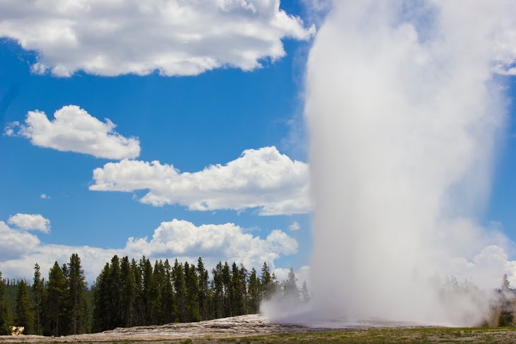
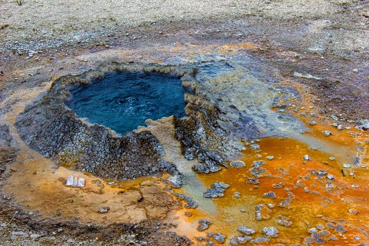
In the summer of 2013, my best friends from college, Nancy and Corey, and myself decided to take our adventures out West and visit Yellowstone National Park. This was one of 3 national park we visited on this particular trip. We gave ourselves 3 days to explore Yellowstone. Once we arrived, we knew were going to see lots of wildlife. Buffaloes are everywhere! But don’t be that person who stops every 5 minutes to take a picture. You will have many chances, don’t start traffic. Before we got more familiar with the park and tested our luck with the animals, we got the more touristy stops out of the way. Old Faithful, Grand Prismatic Springs, and the Geyser basins are pretty cool and must visits. Mammoth Hot Springs was another great spot if you want to see more hot springs.

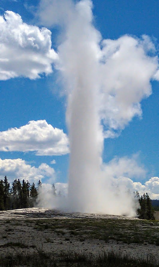
Old Faithful
If you want to see geysers, go to the Old Faithful Visitor Center. You can tour the Geyser basins and watch Old Faithful geyser erupt. Once you get there is a schedule when Old Faithful will erupt, which is between every 60-90 minutes. It’s one of those things you have to see but it was mostly anti climatic. This was by far the most crowded area of the park.
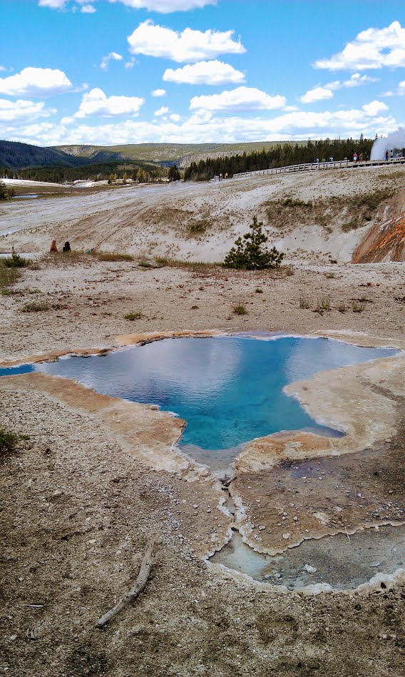
Grand Prismatic Spring
Geysers and hot springs can get old quick, but Grand Prismatic Springs is absolutely beautiful. This is the largest hot spring in the U.S located at Midway Geyser Basin. The colors are fascinating. It is one of those visuals you see online or on TV and once you get there, it actually lives up to your expectations and more.


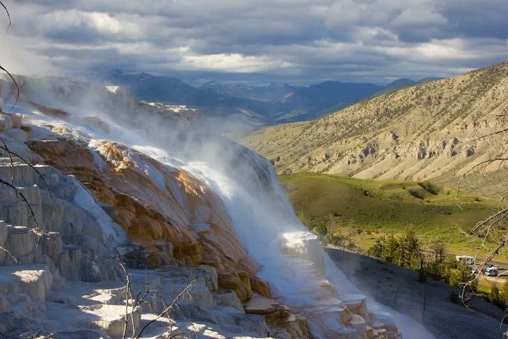
Mammoth Hot Springs
As if we couldn’t see anymore hot springs, the last stop was Mammoth Hot Springs. These hot springs were different than all the rest. You walk up a few flights of stairs that bring you to boardwalks above the steaming hydrothermal springs. The views were very different as the hot springs were located on a hill of a travertine.


HIKING FOR DONUTS
A blog for the outdoors foodie enthusiast
Hi, I’m Mark. I live in Connecticut. I take new trips every chance I get. A good trip has a great hike, great food, and something fun to do. My goal is to search out new trips and share them to inspire others to try something new and exciting.
If you are looking for posts in a particular place, search by city or state here.
EXPLORE OTHER POSTS IN THE ARCHIVE
RECOMMENDED POSTS
MOST RECENT POSTS
See where I have been recently on Instagram. Follow @HIKINGFORDONUTS

Canada is underrated
My first real hiking trip took place in Canada of all places. Me and my buddy jumped in a car and drove up to very unique areas of Canada. We some saw great sights and hiked unfamiliar terrain. Take a read and you will learn some of what Canada has to offer. And.....it's awesome.
Back in 2011, I have never really been anywhere. I was in my mid 20s and I haven’t experienced much outside of the Northeast. I went on a cruise in college but cruises aren’t that adventurous. My best friend, Corey, would try his best talking me into hikes and trips. Generally, my response was “hell no”. He knew he could eventually wear me down and had to say just enough to intrigue me, which will continue to be a theme the next few years of my life. The idea presented to me was a road to trip to Canada but nowhere near Montreal, the only area I knew of back then. This also included camping and hiking. The camping part did not interest me but the idea of going to a unique part of Canada and driving peaked my interest. I really had no idea what I was in for but I have never been to Canada and trusted Corey’s planning and outdoorsy knowledge. The main destinations of the trip involved the Bay of Fundy, Nova Scotia, and New Brunswick. Yeah, completely random. Leaving from Massachusetts we made our way up through the tippy top Northwest of Maine to the boarder. I have never been this far up. It was wild. Once we got close, towns in Maine no longer had names, they were just route numbers. I remember clear as day, for like 100 miles, I saw 2 blueberry stands, a gun shop, and a truck bed shop. Where the heck was I??? 8 ½ hours later, we crossed the border. A simple car ride took us to another country. I couldn’t believe it. Everything looked so different. I was in for a life altering experience.
Our first stop was Saint John, New Brunswick. We started and ended the trip there. We were greeted with very rainy, foggy weather the entire trip. We checked into our hotel and walked around the city the first night. We were right off the water and we could see the cruise ship lines taking off. There was quite a bit to do here for food and drinks. There were lots of Americanized spots and unfortunately we ate at one. It wasn’t good. It is almost better to be more adventurous eating in other countries. The language barrier wasn’t an issue as this was a very tourist area of Canada. We were noob travelers and paid with our credit cards. And, we didn’t have time to exchange at the banks. I would suggest to handle that prior to your trip. With that said, this was a beautiful city. At the time, I wasn’t a big photographer but Corey was. Here is a cool photo he took.

The next few days consisted of exploring the Bay of Fundy. This bay has the highest tidal range in the world, meaning the low tide and high tide difference are dramatic. When we were there, the tide was in. It was crazy how far out it was and where I was standing. Just to think that when high tide comes, you would be in over your head. We visited Fundy National Park and camped in Alma, New Brunswick. One of the more popular attractions in the Bay of Fundy is the Hopewell Rocks. Here is where I realized what a tourist environment looked like. Sooo many people. Too many. We didn’t see many others until this point. I truly like taking in my environment and enjoy what I am seeing. It was tough because people were almost on top of each other. Could have been the fact we went during the busy season. There is an entry fee and there is a trail leading you down to the rocks, which is about a mile. With that said, Hopewell Rocks is pretty awesome. The rocks stand 40-70 feet tall. At that time, definitely something I had seen in my life.


After spending some time outdoors, we made our way to Halifax, Nova Scotia. Now, I really felt in another country. Most people here spoke French. The city was a really good experience. There were tourists here but not as many as the other areas. This felt true to the country. I remember having a phenomenal meal at this pub and we sat outdoors just taking in our surroundings. The best part of Nova Scotia was taking a ride to Peggy’s Cove. This was a small community on the eastern shore of St. Margaret’s Bay. This is also a massive tourist attraction to the popular lighthouse and the scenic area of the village. This was brutal with the amount of people but it was just too beautiful not to enjoy. There were many old fishing huts and houses. Definitely a fisherman village. However, all buses and tourist stuff like ice cream shops took away from the old fishermen village vibe. And, yeah I totally had ice cream. We explored around the lighthouse for a little bit, which is the biggest attraction. I was in awe of the ocean views. We decided to take a hike off a beaten path two minutes down the road recommended by a guide at the visitor center. Parked on the side of the road and prayed for the best following the trail toward the bay. The terrain was different than anything I seen. We hiked with boulder to climb over and cliffs to scale along the coast. I got stuck in bushes. I was crapping my pants dangling over rocks above the ocean. I had sneakers on and a crappy book bag. I pretty angry with Corey how far we kept going. We were not prepared nor a clue where we were going but this ended up being a pivotal moment for me. We just kept exploring. This would be one of my first real hikes and first taste of exploration. I was glad to have this experience. If you have the chance, visit Peggy’s Cove.


In conclusion, Canada is friggin awesome. Go to Canada. There are so many cool things to do including hikes, sights, food, and beers. Road tripping through Canada and seeing all the different landscape. Experiencing a completely different culture. I would do it all over again and probably 10x better. This was first big time trip involving outdoors & nature. I was completely hooked! As will you see, as you hopefully continue reading the blog, this has been just the beginning.
HIKING FOR DONUTS
A blog for the outdoors foodie enthusiast
Hi, I’m Mark. I live in Connecticut. I take new trips every chance I get. A good trip has a great hike, great food, and something fun to do. My goal is to search out new trips and share them to inspire others to try something new and exciting.
If you are looking for posts in a particular place, search by city or state here.
EXPLORE OTHER POSTS IN THE ARCHIVE
RECOMMENDED POSTS
MOST RECENT POSTS
See where I have been recently on Instagram. Follow @HIKINGFORDONUTS
Day Trip to New York City
NYC has so much to do. And, sooo much more to eat. Here is what a day in NYC looks like for me. I was able to get around quite a bit and stuff my face the entire way! Do you agree with my foodie picks?
I haven’t visited New York City much in my life until recently. New York City can be so crowded and overwhelming. However, there are so many great places to visit, see, and eat. I went this past May and I became more intrigued to go back. Nichole and myself wanted to go during the holiday season but time did not permit until after Christmas. We hoped it would be less crowded and would still be able to enjoy the holiday décor. Even with the temperatures in the teens, we made our way to the train station and hopped on to Grand Central. We had a lot of sights in mind, but let’s be honest this trip was more for the food.
Once we got off the train, we went to Rockerfeller Center first and went to look at the Christmas tree. Most people go to the city just for that purpose. I took one obligatory picture and I was set. I was more into all the buildings and other décor around that area. Since we were close by, we walked over to Times Square to get some more sightseeing in and checked out the Hershey's store. It’s cool to see the massive candy bars but that place is way overpriced.
From there, we went to the Bryant Park Winter Village which includes 176 vendors, an ice skating rink and merry-go-round. Many popular restaurants and food trucks set up shop for the holiday season, bring lots of deliciousness to one spot! The scenery is surreal with the feel of a small village in the middle of one of the busiest cities in the world. This was my type of spot to say the least,


First up, Wafels & Dinges. Their specialty was Belgian waffles with various toppings and flavors to choose from. So many decisions but we went with the S’mores waffle which consisted of marshmallows, speculoos spread and Belgian chocolate fudge. This was a splendid first treat/breakfast.
Once we got breakfast in our bellies, we walked around Bryant Park a bit more and Nichole found our next must have...mini donuts! I can’t pass up on some mini donuts. Doughtnuttery was on my donut list for NYC. They have pretty intriguing flavors. Each donut was tossed in sugary goodness. While the flavors didn’t really taste like what they said, they were still pretty good. The flavors we got consisted of vanilla, lavender, & pistachio and rosemary, roasted cornmeal, & fig.


The Flatiron District was our main destination for the afternoon. After ubering around, I was ready for more donuts. Number one on my donut research was Dough. Fortunately, they did have a location in the Flatiron District. Needless to say, Dough was phenomenal. Some of the best donuts I have had. Definitely blog worthy. If you want see more, check out my previous blog post, here.
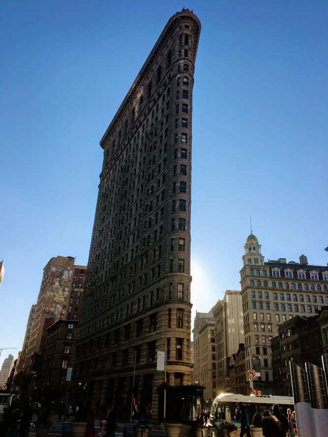
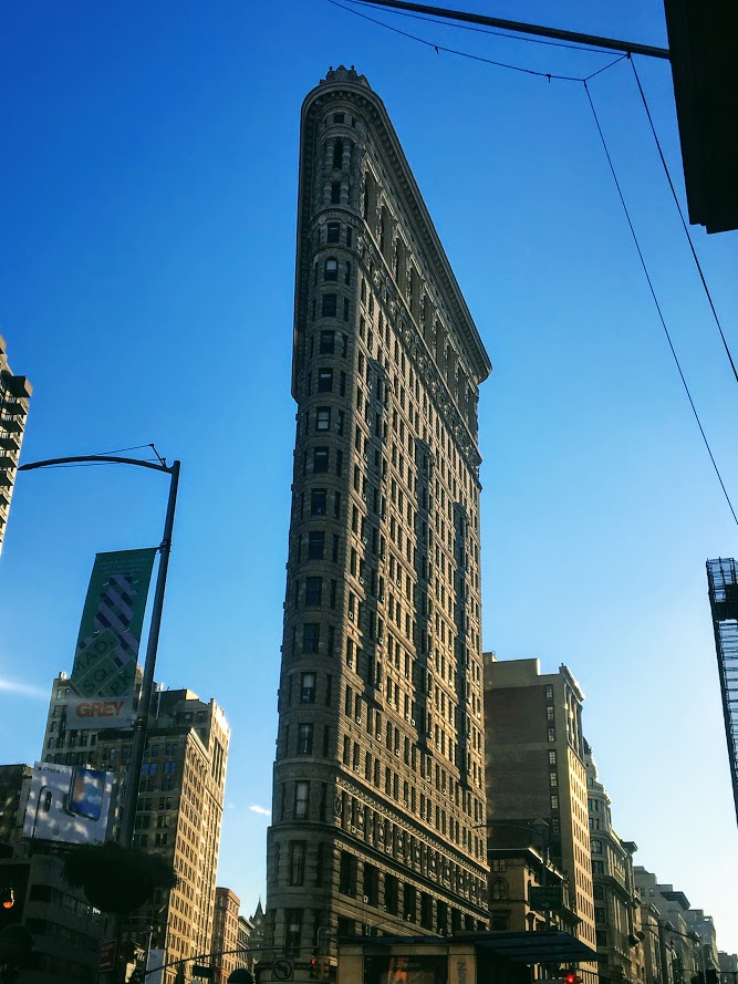
The buildings and skyscrapers in NYC are breathtaking. The Flatiron Building is a triangular 22 story steel-framed building in Manhattan. My hands were frozen, my phone kept shutting off, I couldn’t stop taking pictures. You don’t see buildings like that every day. If you get a chance, go see it!
A late lunch was in store as the donuts wore off. Eataly was our food destination of choice. This large marketplace consisted of a variety of restaurants, bakeries, retail shops to buy fresh pasta & cheese, Nutella cafe, and even a cooking school. Everything Italian. You name it, they had it. You could get yourself a fresh cannoli, a lean cut of meat, or a drink at the bar.


Prior to the trip, we noticed there was a pop up restaurant on the 14th floor of Eataly, called Baita. This was an Italian Alps themed restaurant. I was sold on that. Once we were seated, I noticed the retractable roof and the intricate heaters throughout to keep that cozy vibe. There was a view of the city skyline depending where you sat. A lot of the décor resembled what you would find in a ski lodge. I liked the idea behind it. However, the menu wasn’t the best. And, the food was really pricey. I saw the portion sizes people were eating and they were pretty small. Ordering just appetizers was our best bet. Polenta was a popular item on the menu so we tried their “Zucca” which consisted of polenta, squash, thyme & parmesan reggiano. The other intriguing items we ordered were wagyu beef skewers seasoned in olive oil and the beer battered fried piave cheese. The beef skewers were awesome. The Polenta was just okay and the fried cheese was pretty greasy so I stopped eating them not to get sick. In hindsight, we should have just had a drink at the bar. The atmosphere wasn’t worth the disappointing meal. We were still hungry!


The great part about NYC is that food is literally everywhere. The bad meal didn’t hold us down. I had to find a can’t miss bite. Who doesn’t like grilled cheese!?!?! There was a Melt Shop nearby and this hit the spot. Me and Nichole shared a pepper jack buffalo chicken grilled cheese and a wonderful milkshake. We couldn’t decide what flavor so the server just combined both for us, Nutella and Oreo. Absolute heaven.


For the cherry on top, you can’t leave New York City without a slice of pizza. Before we hopped back on the train at Grand Central, we stopped at Previti’s Pizza. The reviews were not lying. Great slice of pizza. That was a nice way to end our adventurous and gluttonous day in the city. And, our last trip of 2017. I can’t wait for more adventures and exploration in 2018.

HIKING FOR DONUTS
A blog for the outdoors foodie enthusiast
Hi, I’m Mark. I live in Connecticut. I take new trips every chance I get. A good trip has a great hike, great food, and something fun to do. My goal is to search out new trips and share them to inspire others to try something new and exciting.
If you are looking for posts in a particular place, search by city or state here.
EXPLORE OTHER POSTS IN THE ARCHIVE
RECOMMENDED POSTS
MOST RECENT POSTS
See where I have been recently on Instagram. Follow @HIKINGFORDONUTS

Winter is here...in the Basin
Fun weekend back in New Hampshire. This time I made a trip back to Franconia Notch State Park and hiked to the Basin. A pretty, cool spot that is very accessible.

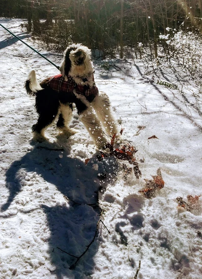
It was time for another trek up to New Hampshire. After a few brewery stops, we finally made it up to my friend’s house. And, there was snow on the ground! Even though weather was in 20s, we still wanted to enjoy the outdoors New Hampshire has to offer. My friend decided The Basin in Franconia Notch State Park would be a good “jaunt” for the 5 of us and our friend’s puppy. The trail and parking lot is right off the highway off I-93. We parked at the visitor center and just hopped on the trail towards the Basin. This trail was mostly flat but due to the snow and ice, it was more tricky. In nicer weather, this is a very easy walk, paved most of the way and offers handicapped accessible viewing as well. We walked over a few bridges and eventually came across some cool waterfalls. We then made our way to The Basin, which offers rushing waters that has eroded the rock into a smooth, circular cave-like formation. After seeing that we walked a little further before the Pemi Trail and started our way back to the cars. Our hike was roughly 3.5 miles. Even though it was quite cold, it was a beautiful day to be outside. We enjoyed our mascot keeping us on our toes. Always fun to see a pup’s first time in the snow. Another reminder to get out there and enjoy time with friends!


HIKING FOR DONUTS
A blog for the outdoors foodie enthusiast
Hi, I’m Mark. I live in Connecticut. I take new trips every chance I get. A good trip has a great hike, great food, and something fun to do. My goal is to search out new trips and share them to inspire others to try something new and exciting.
If you are looking for posts in a particular place, search by city or state here.
EXPLORE OTHER POSTS IN THE ARCHIVE
RECOMMENDED POSTS
MOST RECENT POSTS
See where I have been recently on Instagram. Follow @HIKINGFORDONUTS

Sunset Rock State Park, Crescent Lake, Southington, CT
Check out the Crescent Lake trail in Southington, CT. This was a confusing trail but well worth the views. Enjoy!
Trail Description: Sunset Rock State Park offers a scenic hike around Crescent Lake that connects to the Metacomet Trail.
Trail Info:
Where: Southington, CT Distance 3.2 miles (2-2.5 hrs) Difficulty: Easy to Moderate Trail Type: Loop Features: Views, Lake, Water
How to get there:
Address to GPS: 357 Shuttle Meadow Rd, Plainville, CT 06062. Parking lot is easy to find.
Hiking Tips
Three trails to choose from. The Blue to Orange trail takes you above the lake and is rockier and steeper. Much better views.
Be mindful if you lose the trail markings or end up on a different trail. There is a lack of trail markings. And, some confusing areas where trail markers change colors.
The Hike
On this brisk fall weekend, we decided to hike the Crescent Lake Trail in Southington, CT. This is one of those trails that there isn’t the best information online and it is poorly marked. I will do my best explaining but my advice is always have the map handy and make sure someone is good at directions!
The parking lot is easy to get to, it is off Shuttle Meadow Road. Once you park you will see the lake right in front of you and potentially some people fishing. There are 3 trails. The Red trail is the lower level trail which is mostly flat. This is to your far left from the lot. This is roughly 2m. The blue -orange trails takes you the upper levels to get good views above the lake and this is rockier and steeper. This trail is to your right from the lot. This is about 3.2m and this connects to the Red at the end once you descend down. There is also a green trail, but not sure where that takes you. It appeared to be just a woodsy hike.
We got lost a few times but Nichole is really good with reading trail maps. The issue is lack of markings/incorrect markings. And, the Metacomet Trail connects so you have to be very careful when the colors change. We took the upper trail followed blue-orange markers until we saw just orange then to red. There we were some tough sections where you could choose 3 directions but there are big orange arrows on trees along the way so be mindful of those. There is also an intersection where you see trail arrows for the Metacomet at the top, keep going toward the blue orange and you will pass a camp fire pit. Minus the confusion, it was a cool hike and the view was awesome from the top. I could of took pictures for an hour….luckily, Nichole stopped me. The upper trail I would suggest hiking boots. It was a moderate hike for beginner to intermediate. Some of the inclines got our hearts beating and needing some water. I think this would be a good spot to snowshoe. I hope to keep the fall hikes going. Another local spot in the books, glad we decided to try it even though the reviews were suspect.
Review:
Cresent Lake Trail, 3.2m (Southington, CT): 4 out of 5
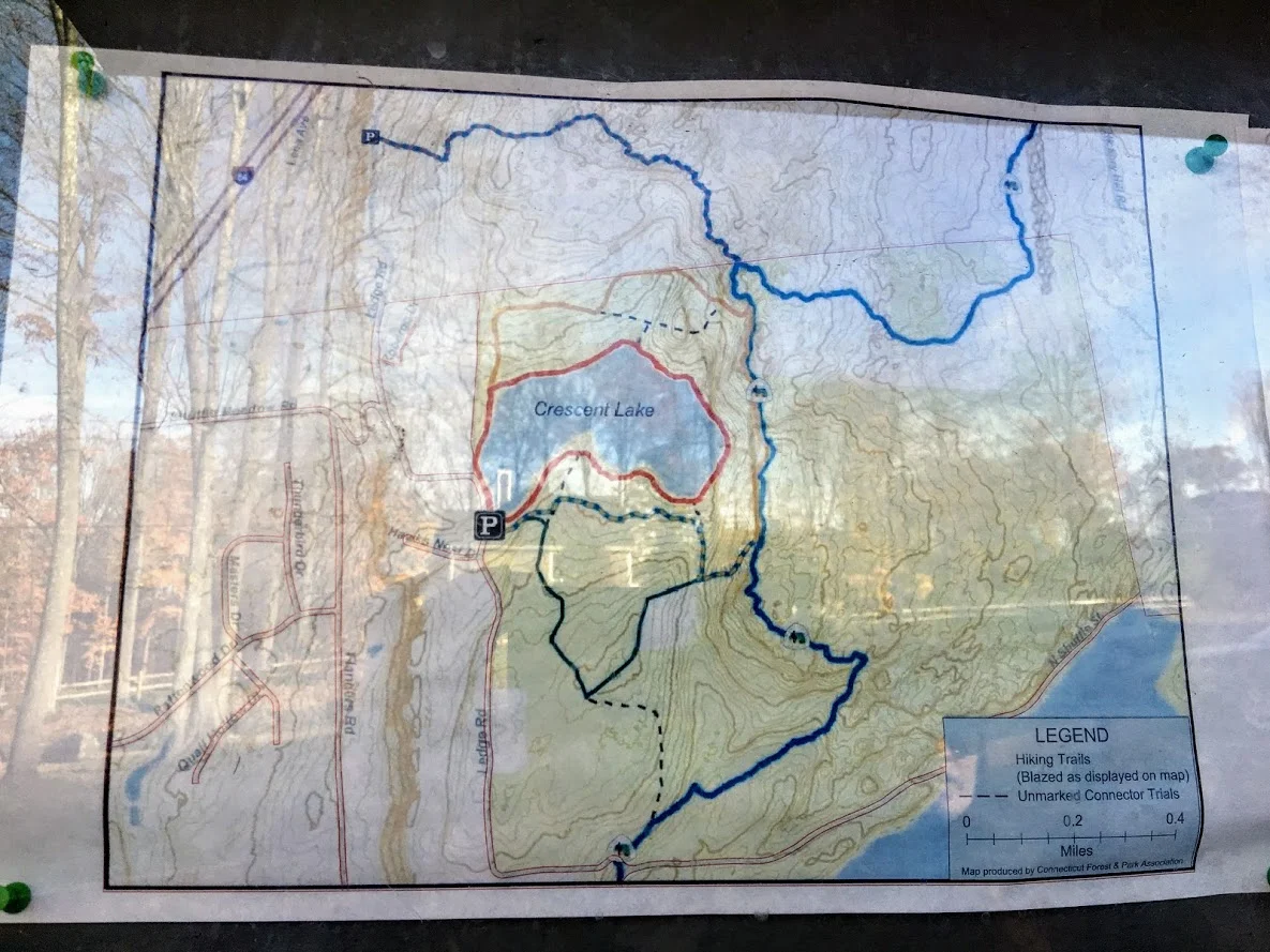


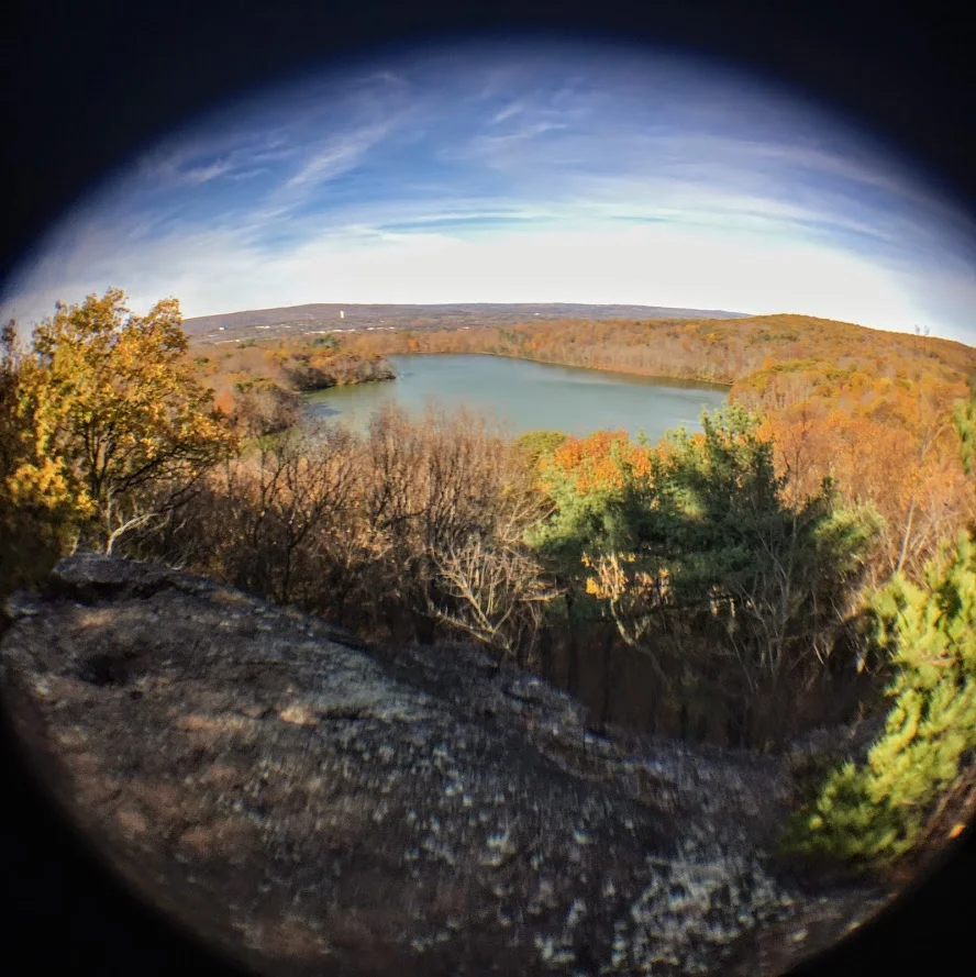


HIKING FOR DONUTS
A blog for the outdoors foodie enthusiast
Hi, I’m Mark. I live in Connecticut. I take new trips every chance I get. A good trip has a great hike, great food, and something fun to do. My goal is to search out new trips and share them to inspire others to try something new and exciting.
If you are looking for posts in a particular place, search by city or state here.
EXPLORE OTHER POSTS IN THE ARCHIVE
RECOMMENDED POSTS
MOST RECENT POSTS
See where I have been recently on Instagram. Follow @HIKINGFORDONUTS

Mine Hill Preserve Trail, Roxbury, CT
More fun fall hikes in CT! The fall colors are really showing now. I decided to hike a new trail this time. I chose Mine Hill Reserve Trail in Roxbury, CT. The trail was unique and offered cool historic features. Check it out for great leaf peeper pics.
Trail Description: The Mine Hill Preserve trail is part of the Roxbury Land Trust as a national historical landmark. Venturing on this trail will take you through scenic woodlands, rocky terrain, mine tunnels, bat caves, and old furnace structures from the 19th century.
Trail Info:
Where: Roxbury, CT
Distance 3.6 miles (2 hrs)
Difficulty: Easy to Moderate
Trail Type: Loop
Features: Water, Bat Caves, Quarry, Bridge, Mine Tunnels, Old Furnaces
How to get there:
6 Mine Hill Road, Roxbury, CT 06783
The GPS lost signal as I got on Mine Hill Road, but just follow the signs on the gravel road to the parking lot.
Hiking Tips
Download a map of the trail, http://www.roxburylandtrust.org/MapMineHill.pdf.
Veer left to start with the more difficult section toward the Donkey Trail. The latter part of the trail is more like a brisk nature walk on flat ground.
The Hike
This past weekend’s hike was recommended by a friend. Nichole and I took a ride out to Roxbury, CT to the Mine Hill Preserve Trail. This trail offers some unique features where you will see various mines and old furnace stoves from the 19th century. This is definitely off the beaten path. There is a very small parking lot where the trail heads start. There are only two trails here. There is a 3.6m loop (blue trail- Mine Hill Preserve) and an additional 2m loop can be added (red trail – Carter Reserve). Due to time constraints, we just did the blue trail loop. The maps online for this area are very helpful too. I would suggest downloading here prior to the hike. The trails are a short walk from the parking lot. If you really wanted to just see the old furnace structures, this is only a 10 minute walk from the start if you veer right. Prior to hiking, I read the veering to the left would get the difficult portion of the hike done and that is what we chose.

In this direction, you pass a small pond to your right.

The main loop ascends up the Donkey Trail and here you will pass two mine tunnels.


The terrain was pretty interesting and varied. This side of the loop was by far the most challenging. It was very rocky and had some steep uphill areas. As you keep hiking , you will cross paths with multiple bat cages that serve as entry ways for the caves inside them.

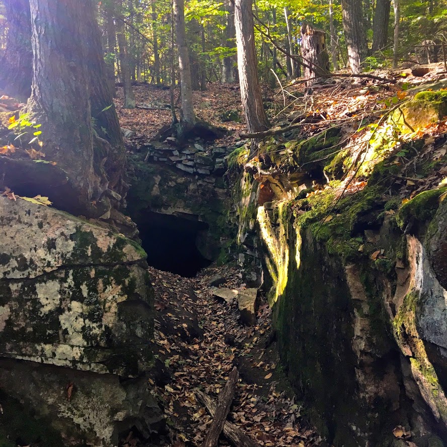
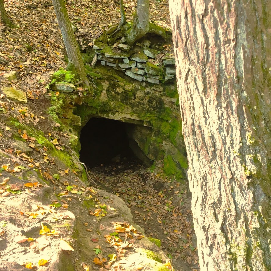

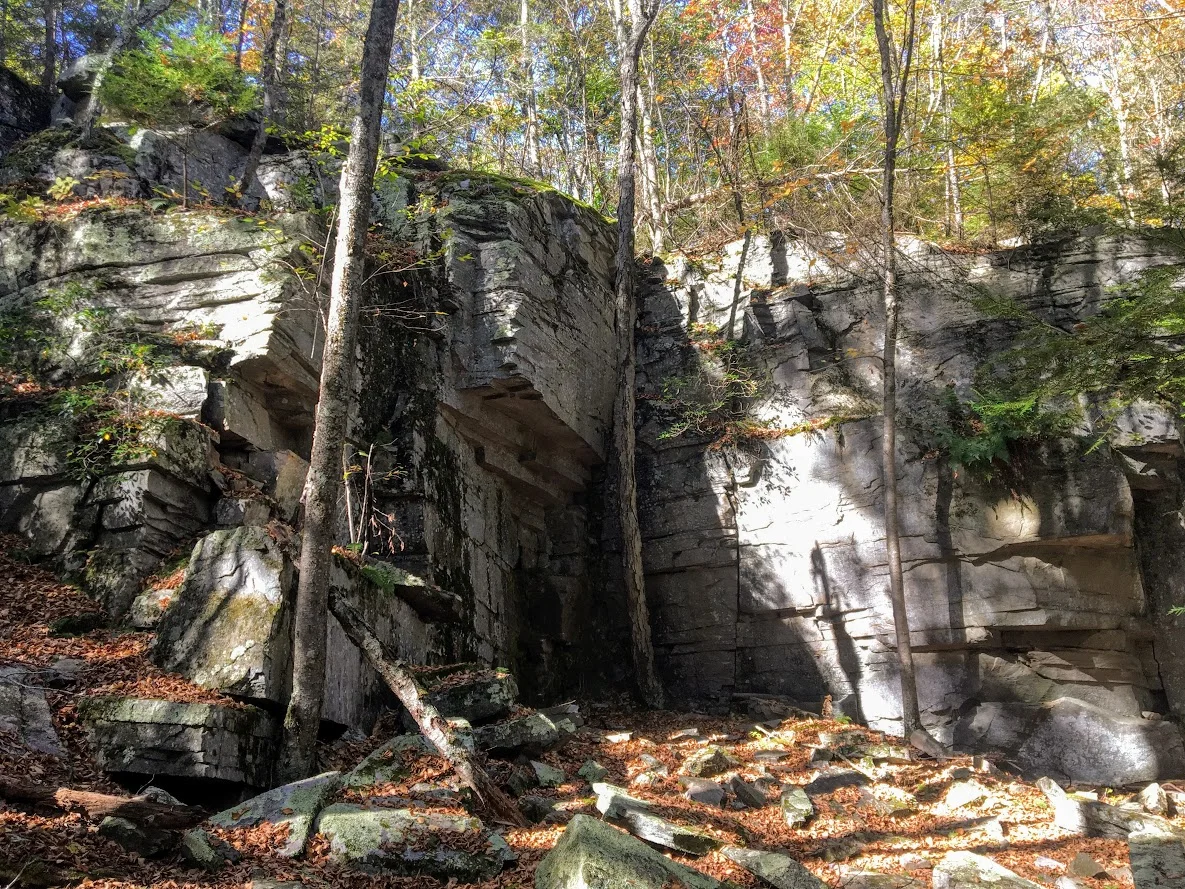
The trails begins to descend and you will meet at the Old Quarry bridge which joins a dirt road that will lead you to the other side of the loop. The other side of the loop was more of a nature path. It was flat the whole way, roughly 1.5m. This was less interesting until the end where you will find the old forge site. The fall colors kept me attentive along the way.
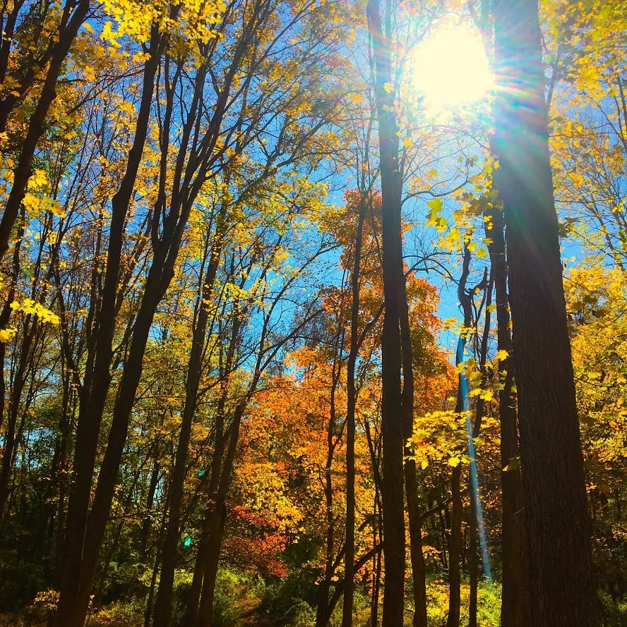


Overall, the historic points of the trail offered a different features you don’t get on hikes generally. The trail was very maintained and marked well. The hike would be good for anyone beginner to advanced. I would recommend hiking boots since the terrain can be rocky. The loop didn’t take us too long, about 1 hr 45 min. Next time, I would leave more time and add the additional 2m loop. Pretty good recommendation!
Review:
Mine Hill Reserve Trail, 3.6m (Roxbury, CT): 3.5 out of 5

HIKING FOR DONUTS
A blog for the outdoors foodie enthusiast
Hi, I’m Mark. I live in Connecticut. I take new trips every chance I get. A good trip has a great hike, great food, and something fun to do. My goal is to search out new trips and share them to inspire others to try something new and exciting.
If you are looking for posts in a particular place, search by city or state here.
EXPLORE OTHER POSTS IN THE ARCHIVE
RECOMMENDED POSTS
MOST RECENT POSTS
See where I have been recently on Instagram. Follow @HIKINGFORDONUTS

Chauncey Peak Trail, Giuffrida Park, Meriden, CT
It is leaf peeper season here in the Northeast. There is no better time to go hiking than in the fall. I am going to attempt as many hikes as I can get in. Here's the first of many! And, one of my favorites.
Trail Description: Located in Guiffrida Park, the Chauncey Peak Trail offers a scenic hike with beautiful ridge line views of Bradley Hubbard Reservoir.
Trail Info:
Where: Guiffrida Park, Meriden, CT Distance: 2.8 miles (2-2.5 hrs) Difficulty: Moderate Trail Type: Loop Features: Views, Reservoir, Lake, Peak
How to get there:
This is fairly easy. Just GPS Guiffrida Park and the address should be 800 Westfield Rd, Meriden, CT 06450. Once you pull in, you will see the parking lot.
Hiking Tips
Start the hike to the right of the parking lot into the forest. Much easier route going up and down.
The trail has been updated and re-routed. Be sure to follow the blue trail around Chauncey Peak and past the landfill. Look for the Blue markings.
There are many great views from the ridge line, be sure to take them all in.
The Hike
It is officially fall. It is chilly in the morning, the leaves are changing, and it is getting darker out earlier. Time to get out there and be a leaf peeper. Sounds kind of sketchy…..But seriously, fall hikes are the best. I slacked a little bit this summer with hiking, but I intend to take advantage of the fall weather.
For my first fall hike, I chose the Chauncey Peak Trail at Giuffrida Park in Meriden, CT. This is my favorite hike in the Hartford area, hands down. I have hiked this trail multiple times and I enjoy it just as much each time. This is a very fun hike with great scenic views and a variety of terrains overlooking Bradley Hubbard Reservoir. Unfortunately, due to the fog on this day, it was tough to get that view in. I like to start the hike veering to the right under the trees into the woods on the Blue trail. You will get the strenuous part of the hike done in the beginning. You will immediately be on the incline ascent up the peak, this will be steep and rocky stretch. This won’t last too long. Once you get to the top, you will keep following the blue trail and this will bring you to the ridge line for great panoramic views. Once you are done taking hundreds of pictures, you will descend down until you meet a footbridge that takes you to the bottom of the reservoir. You will follow out the blue trail to the white trail along the water’s edge to the parking lot. This part will be flat and serves as a nice cool down.
The trail is well marked. They are taking great care of it. When I hiked this originally I got lost but since then the markings have greatly improved.I would consider this a moderate hike. You need hiking boots. Depending on the weather, it can be very slippery. I was slipping on the leaves and loose rocks myself due to some wetness. I finished hiking under 2 hrs. If you want a nice short day hiking with challenge and rewarding views, I highly recommend this trail.
Review:
Chauncey Peak Trail, 2.8m (Meriden, CT): 4.5 out of 5
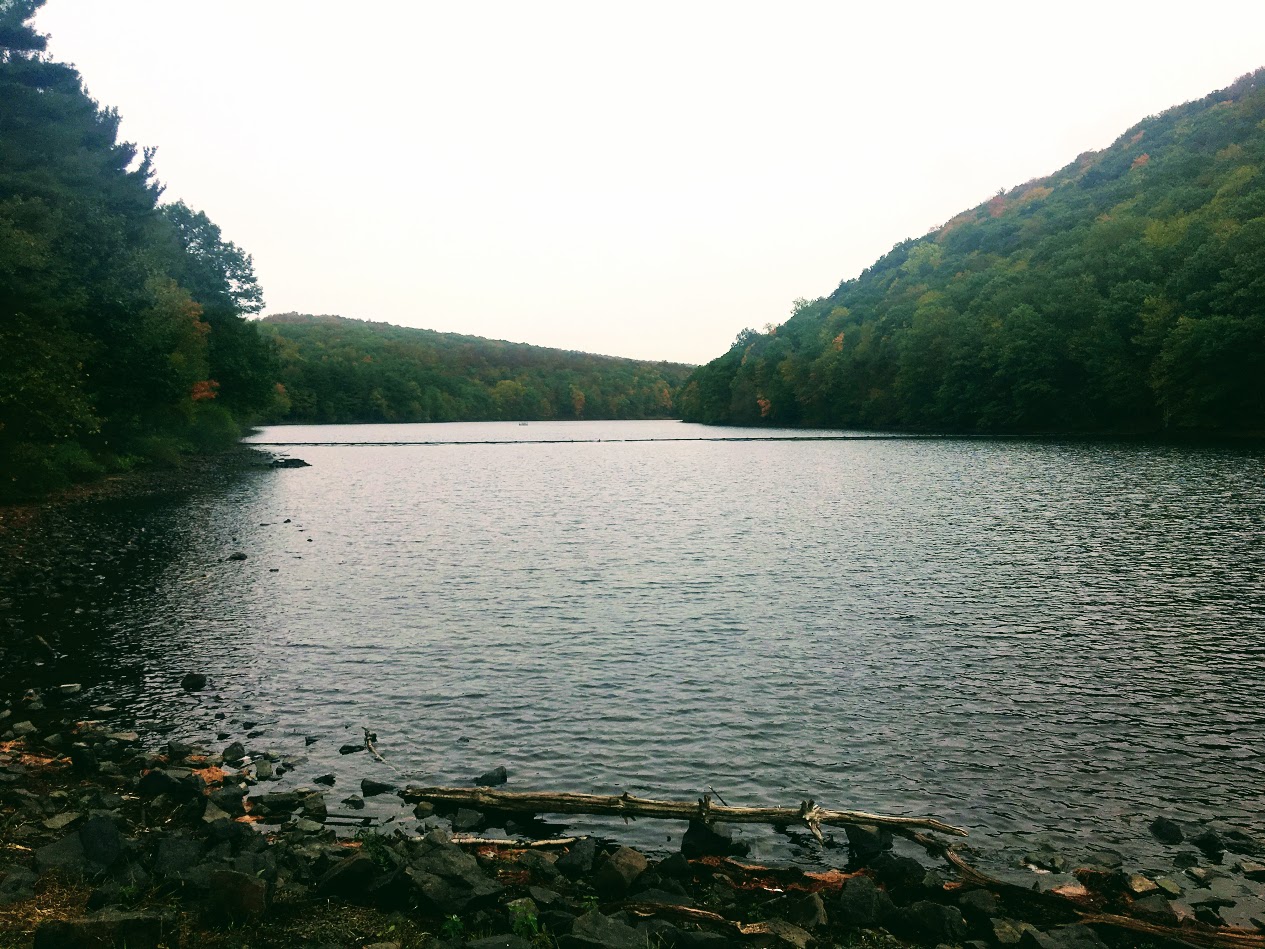
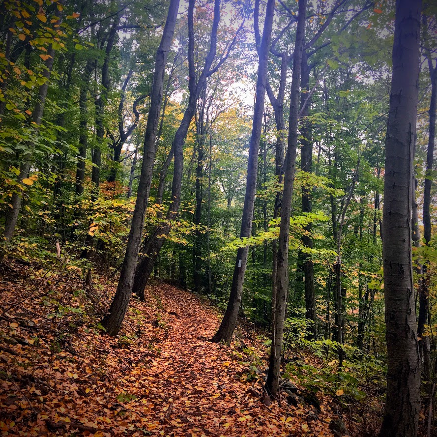
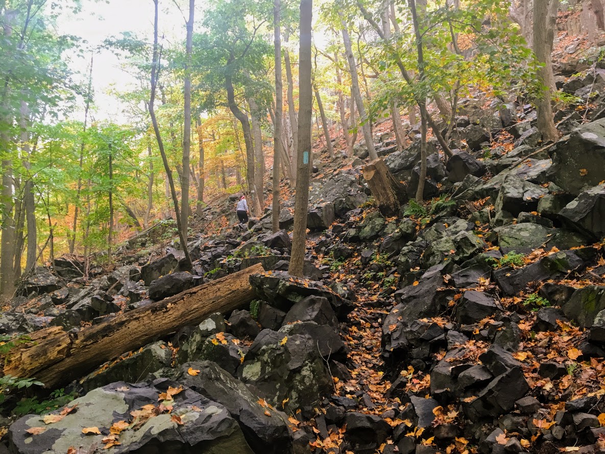
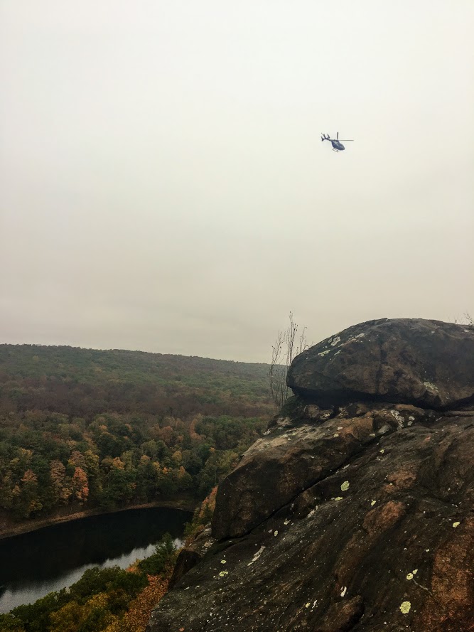
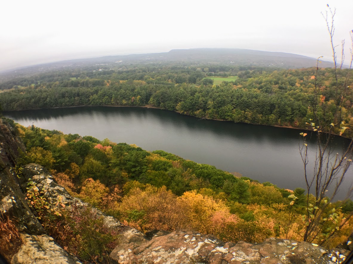
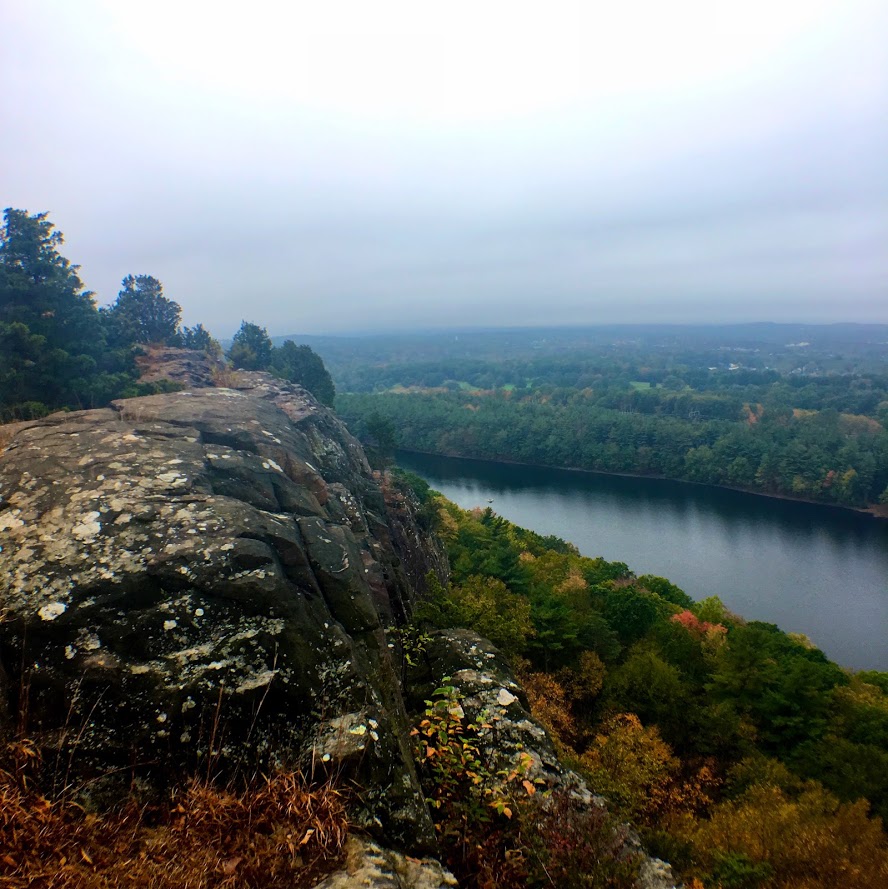
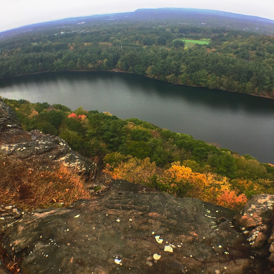
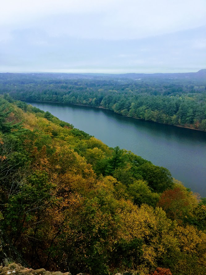
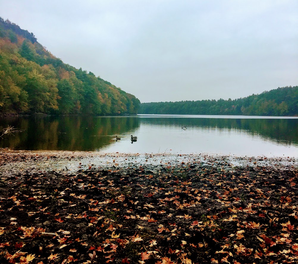
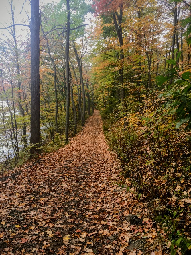
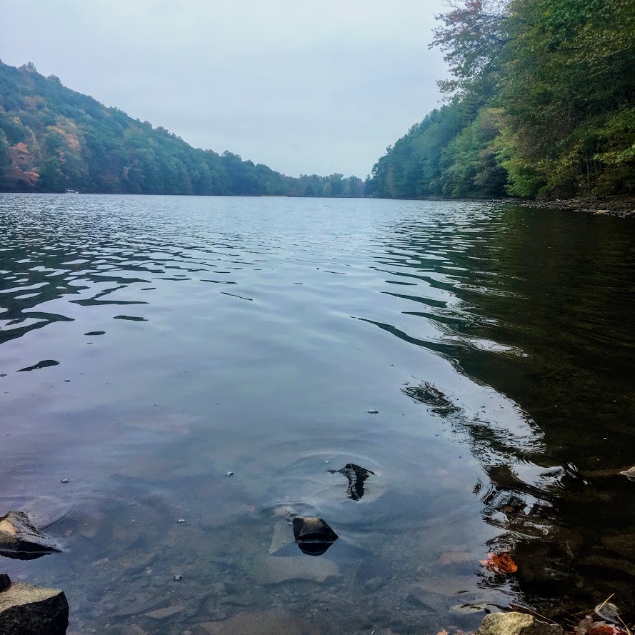

HIKING FOR DONUTS
A blog for the outdoors foodie enthusiast
Hi, I’m Mark. I live in Connecticut. I take new trips every chance I get. A good trip has a great hike, great food, and something fun to do. My goal is to search out new trips and share them to inspire others to try something new and exciting.
If you are looking for posts in a particular place, search by city or state here.
EXPLORE OTHER POSTS IN THE ARCHIVE
RECOMMENDED POSTS
MOST RECENT POSTS
See where I have been recently on Instagram. Follow @HIKINGFORDONUTS
Best places to eat in Nashville, TN
Nashville is a really fun and vibrant city. Full of music and history. Aside from that, I was excited to try some Nashville food. I tried to find really good local spots. Enjoy my reviews!
Aside from the bar hopping downtown and exploring a new state, I looked forward to eating in Nashville. It was an interesting trip food wise.. I have never been to a heavy, southern food area. I am not the best with spicy food but I was open to trying what Nashville had to offer. It was Labor Day weekend so it was packed everywhere. Also, we had a group of 8 so waiting in lines less than 30 minutes just wasn’t happening.
Like everyone else in Nashville, we wanted to try Biscuit Love. This was by far the most popular brunch spot in the area. Unfortunately, the line was insane.

However, when one door closes, another opens. Browsing to see what brunch places were nearby and calling to see who would accommodate 8 of us, we came across Party Fowl. Yes, you read that correctly. And, it was a great find. The group was really about the boozy brunch and this spot was it. They had various drink specials including spicy Bloody Mary’s. I am not a fan but everyone else was on board with it. As for the food, this was the best place to have Nashville hot chicken and biscuits. The biscuits were so good and they served them as appetizers with this awesome apple butter. Everyone at the table ordered the “Loaded Chicken Biscuit”, which consisted of an open-faced buttermilk biscuit topped with hot chicken (southern fried, mild, medium, Nashville Hot, or Poultrygeist), sawmill gravy, two eggs prepared your way, and lyonnaise potatoes. I didn’t mess around and I went southern fried. And, that was spicy to me. Nichole had to be the only one get something different but it was damn good! She got the smoked chicken frittata. This consisted pulled smoked chicken & caramelized onion frittata topped with melted gruyere cheese.


The trip wouldn’t have been complete without a Waffle House late night feeding. We don’t have them in the Northeast and I have never been to one. It took us two different locations to find one open (not 24 hours...lies). The meal was as expected. It wasn’t bad but it was sketchy….and the roach I noticed crawling around on the floor tied my experience with a bow. Check that off the list.

The Loveless Cafe is a pretty popular location. It is about 30 minutes outside of downtown Nashville on Highway 100. This was a motel converted into shops, markets, and a restaurant. It is like it’s own little mini mall. It is definitely cool. However, it is really crowded. The wait was almost 2 hours! Luckily, Nichole found out we can just get take out and eat on the benches and picnic tables. The food was so good. We got a little of everything. We got the pulled pork, fried green tomato with pimento cheese, and fried chicken biscuit sliders along with a side of mac & cheese and hashbrown casserole. And, a slice of coconut pie. The fried green tomato and pimento cheese combo was by the far the best. The biscuits were on point too. This was worth the price of the rental car.
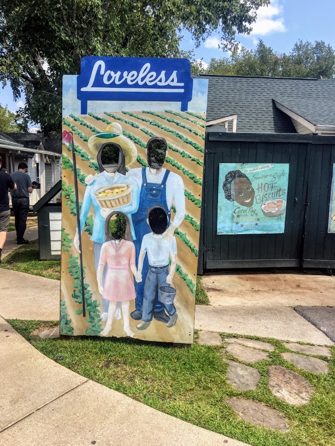


The other noteworthy place we ate was in the Indigo Hotel called The District Bar & Kitchen. The menu looked good and we were spot on with our choice. For starters, we had a buffalo chicken egg roll and fried green tomatoes with pimento cheese and five pepper jelly. This combo blew my mind the whole trip. Would've never expected fried green tomatoes plus pimento cheese to be absolute heaven...lesson learned. For the entree, I had the Indigo wrap which consisted of pulled pork, country ham, swiss cheese, dijon, bread & butter pickles. Nichole got a good eye. She went with a dish called the Four Way. This was a bed of rigatoni with cheddar cheese covered with tortilla chips and chili. Another good find in downtown Nashville.


Lastly, I can't forget about the ice cream. On the last night, we went to Mike's Ice Cream in the downtown area. They had many ice cream options and a variety of cone options. I got a scoop of red velvet and a scoop of butter pecan in a chocolate chip cookie cone. Oh yea...pure gluttonous.

We got to eat in popular locations and some unknown locations. All in all, another successful trip of eating. There is a lot more food in Nashville to try. Until next time!

HIKING FOR DONUTS
A blog for the outdoors foodie enthusiast
Hi, I’m Mark. I live in Connecticut. I take new trips every chance I get. A good trip has a great hike, great food, and something fun to do. My goal is to search out new trips and share them to inspire others to try something new and exciting.
If you are looking for posts in a particular place, search by city or state here.
EXPLORE OTHER POSTS IN THE ARCHIVE
RECOMMENDED POSTS
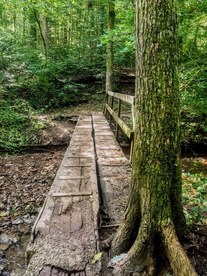
MOST RECENT POSTS
See where I have been recently on Instagram. Follow @HIKINGFORDONUTS