


Mount Beacon Fire Tower, Beacon, NY
Mount Beacon is one of the most popular trails along the Hudson River. It offers different terrain for a good workout, old railway landmarks, and incredible views of the Hudson Valley as well as the Catskills and NYC on a clear day. Most people will hike to the top of the mountain overlooking Beacon. However, adding the fire tower to this hike is worth it. Check out the blog for details and pictures!
Trail Description: Mount Beacon offers gorgeous views of the Hudson Valley and you can see as far as NYC and the Catskills from the fire tower.
Trail Info:
Where: Beacon, NY Distance: 4.4 miles (3-3.5 hours) Difficulty: Moderate Trail Type: Out and Back Features: Views, Hudson River, Fire Tower, Mountains, Valley, Reservoir, Railway
How to get there:
788 Wolcott Ave Beacon, NY 12508
You will see the parking lot located the intersection of Route 9D and Howland Avenue in the City of Beacon. Parking can be limited here. For more info, https://www.scenichudson.org/mountbeacon.
Hiking Tips
Get there early for parking on weekends.
First half mile is the toughest. After that, it’s a breeze. Keep going!
Once you reach the white-blazed trail, take that up to fire tower. The White Trail is not marked as well as the Red Trail, look for faded markings on the rocks.
The Hike
Mount Beacon is one of the most popular trails along the Hudson River. It offers different terrain for a good workout, old railway landmarks, and incredible views. The trail head starts at the parking lot where we found the information kiosk. From here, walk past the wooden gate and proceed along the gravel path on the red-blazed Casino Trail. We arrived at the ruins of the Mount Beacon Incline Railway. The railway was used as a tourist attraction for the views of the Hudson River as well as visiting a Casino Hotel at the top of the mountain in the early 1900s. This was the steepest railway in the world during its operation. Pretty wild! If you want to know more historic details, click here. After passing the ruins, we started making our way up the metal staircase continuing onto the red-blaze trail.
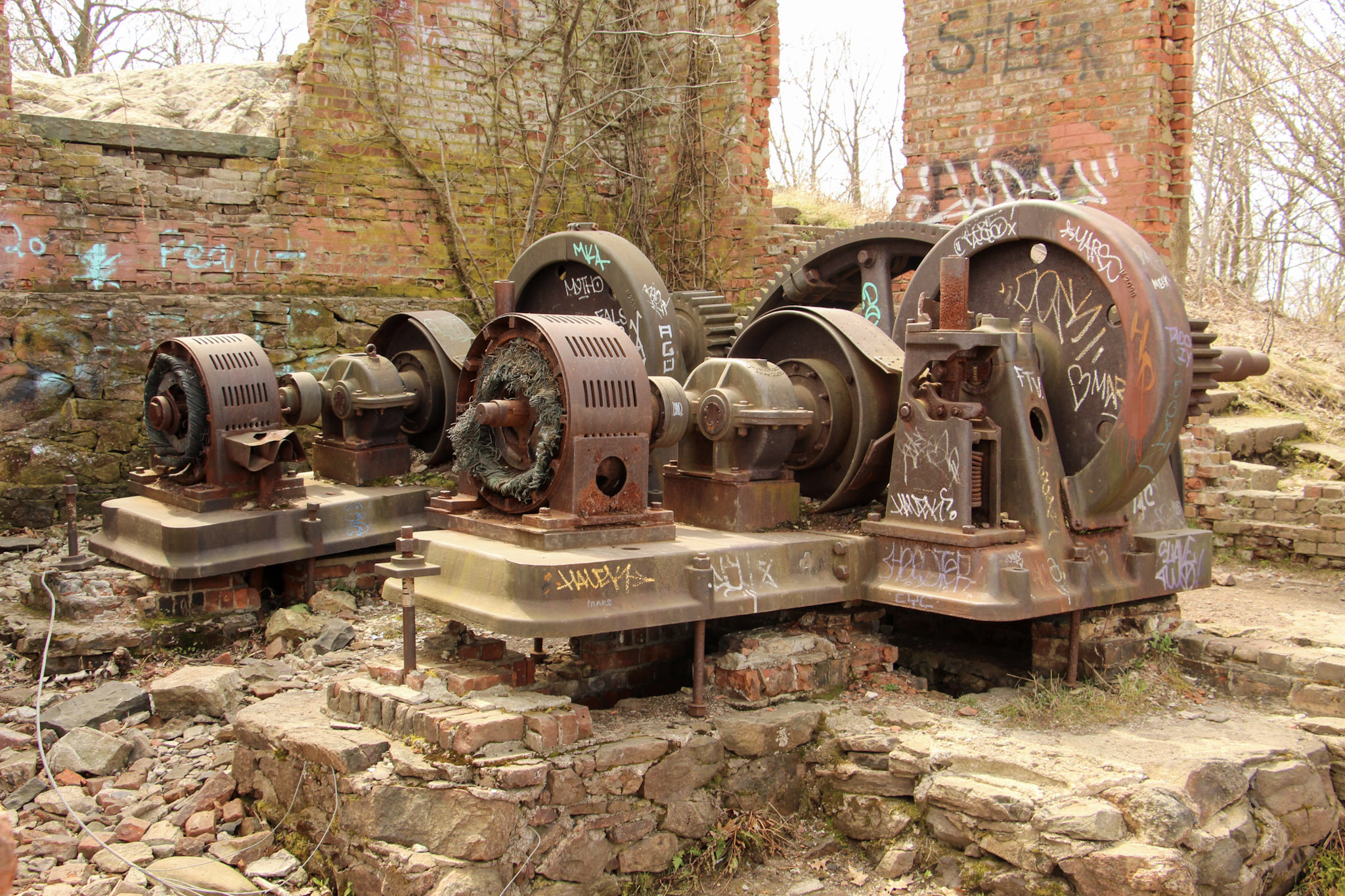
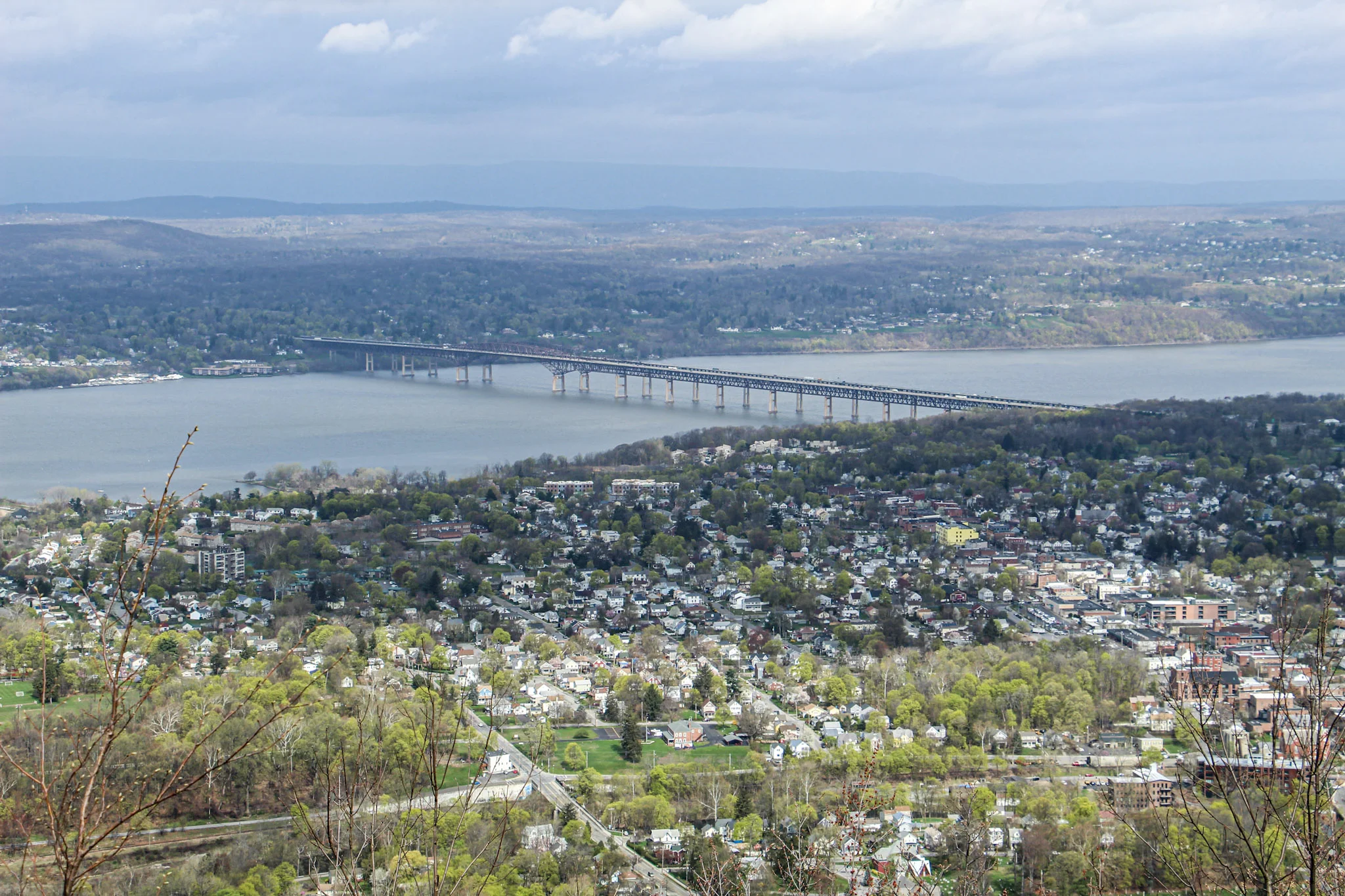
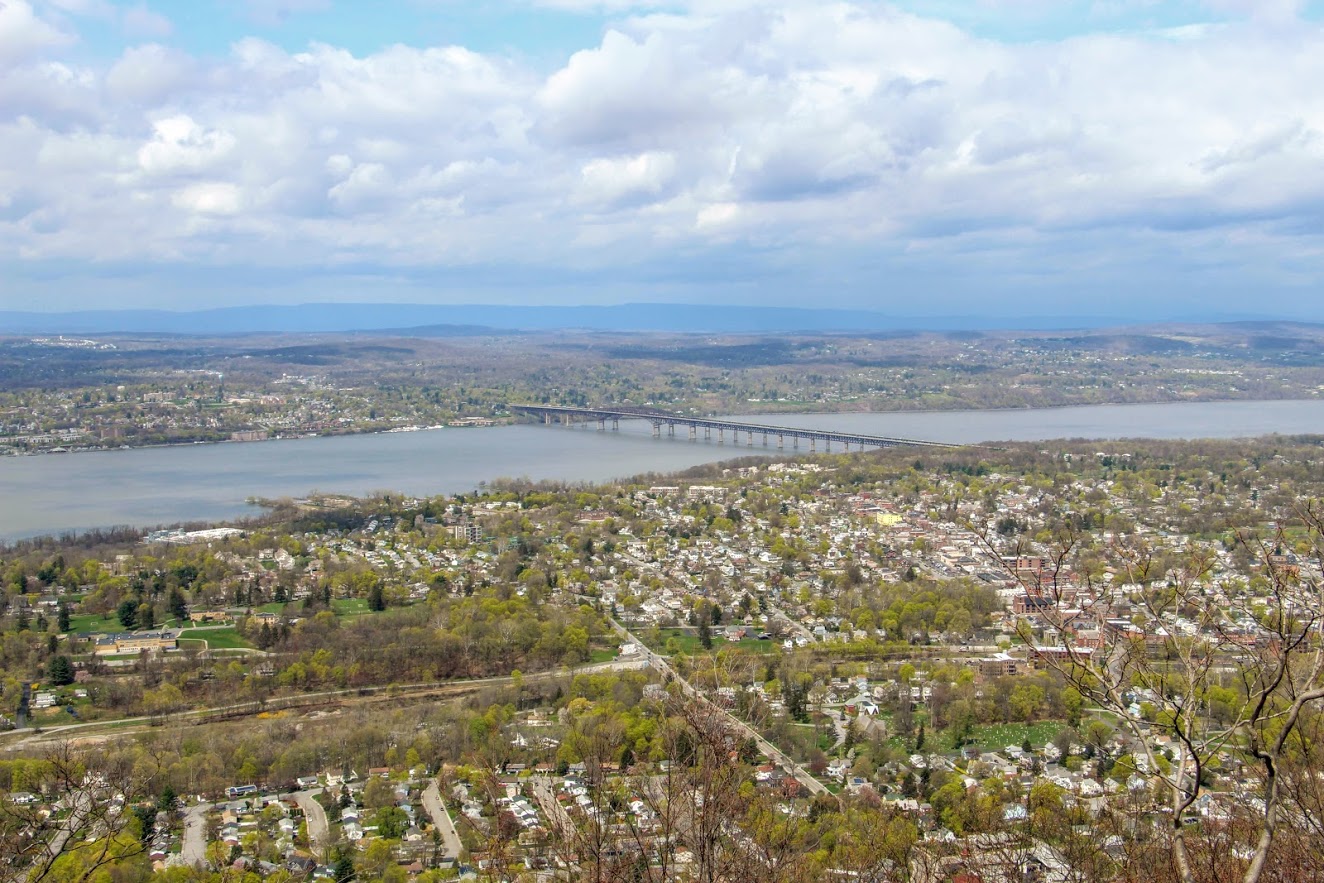
The tough part begins here, only for about a half mile. This is where you see happy faces coming down and not so happy faces going up. The hike will slowly begin to ascend up the mountain following the switchbacks. There may be areas that look unmarked but keep your eyes on the red markings. Eventually, the terrain will become rockier and even steeper uphill. Huffing and puffing our way up, the first glimpse of a view appears as we came up on the first landmark. The motor house of the railway has brick walls still standing and there you will find huge rusted gears and the motor. Past the motor house lies the foundation of what used to be the casino, which is where the first scenic view of the hike can be seen. The view from Mount Beacon stretches across the Hudson with stunning views overlooking Beacon. It is awesome that you can get this view only after hiking just over a mile. The hike started with overcast but amazingly the sky started opened up once we reached the overlook.
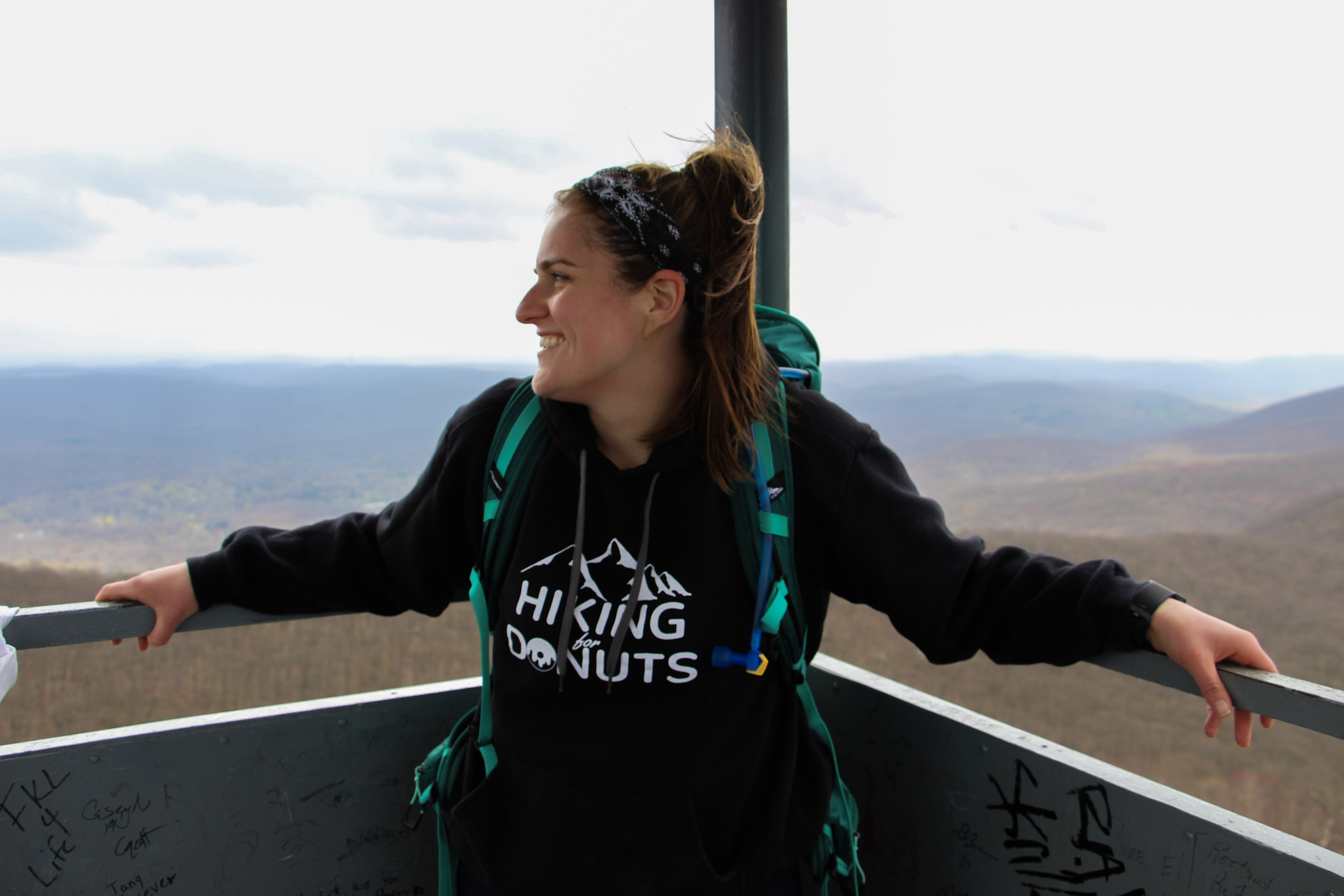
It was time to head toward the fire tower. We turned around from the look out, walked across the old casino ground toward the tower. Eventually, we noticed a red marking on a tree and followed that dirt road through two metal poles and continued on the red-blaze trail. We passed what looks to be a door or frame of an old car or truck on the trail. Additional steep climbing ensued for about 10-15 minutes until there is a clearing with a view of the fire tower. Shortly after, we arrived to the White trail. Before we reached the White Trail, we did notice an unmarked trail leading up the hill toward the fire tower but thanks to research we did not take that path. About 15 minutes later, we found ourselves making our way up the fire tower. This fire tower is pretty high. I was actually getting a bit nervous going up. By this time, the sky opened up completely and the views were an unbelievable 360 view. From the top, you will see Beacon Reservoir and Catskills to your northwest, the Newburgh-Beacon Bridge and Shawangunk Ridge to the west, and, to the south, the southern Hudson Highlands. Even as far down as NYC. And, probably more stuff I don’t even know! My girlfriend had to pry me off the tower. It was super windy but I just kept saying, “This is awesome”. Very fortunate to be able to have access to great hikes like this in the Hudson Valley. Oh, and there’s a donut shop 5 minutes away that is amazing for post hike donuts (Glazed Over Donuts blog post). I cannot recommend this hike enough!
More pics of the hike:


HIKING FOR DONUTS
Hi, I’m Mark. I live in Connecticut. I take new trips every change I get. A good trip has a great hike, great food, and something fun to do. My goal is to search out new trips and share them to inspire others to try something new and exciting.
If you are looking for posts in a particular place, search City or State here.
SEE OTHER POSTS IN ARCHIVE
Archive
RECOMMENDED POSTS


RECENT POSTS


See the latest on Instagram and follow @HIKINGFORDONUTS


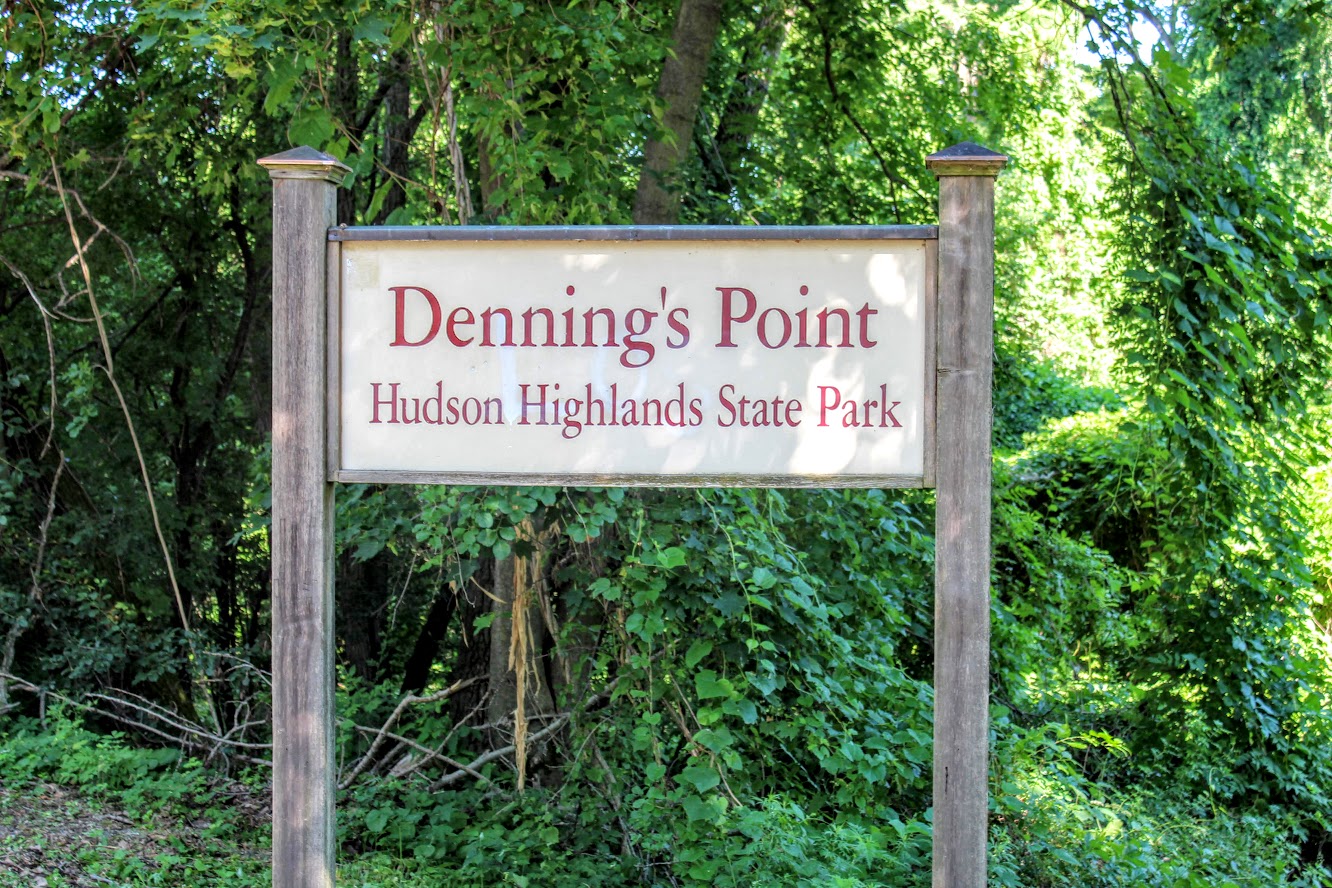
Dennings Point, Long Dock Park, Beacon, NY
Lock Dock Park Beacon, New York: Klara Sauer Trail to Dennings Point Trail
Trail Description: The Klara Sauer Trail is a flat walk until you meet up with the Dennings Point Trail along the shoreline. There are short access trails for views of the Hudson River and a beach with mountainous lookouts, where kayakers will often stop by onshore.
Trail Info:
Where: Long Dock Park, Beacon, NY Distance: 2.8 miles (1.5-2 hrs) Difficulty: Easy Trail Type: Out and Back Features: Bridge, Water, Mountains, Beach, River
How to get there:
GPS this address below. Easy to find.
23 Long Dock Rd Beacon, NY 12508
Hiking Tips:
At the time of my hike, storm damage caused trees to block the trail paths. If this is the case, turn around and go back the same way.
Make sure to stop at all access trails for additional views. Including the beach!
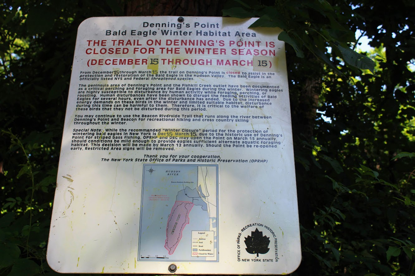
Denning’s Point Trail is closed December 15th to March 18th.
The Hike
Sometimes it is good to go for a nice leisurely walk, with an awesome view. The Hudson Valley is full of satisfying and challenging hiking trails with beautiful views. I am learning more and more about the area. There is a lot to offer if you are looking for outdoor activities. Short on time and looking for something easy, my girlfriend introduced me to a very cool spot located in Beacon, NY, called Long Dock Park.
path from the parking lot to the pier.
Upon arriving, I could see the fantastic view of the Hudson River as we parked. There is a good amount of parking but I can see this area being very busy. As we walked toward the pier, you will see trail maps within the park. Many people we saw were jogging, bike riding, and walking their dogs on the trails. You can also rent a kayak or paddleboard for the day. We walked out to the dock which is to the right of the parking lot. There are stools and fishing rod holders. A few fishermen were out bright and early on this day. From the dock, you get a fantastic view of the town across the river, including the bridge Beacon to Newburgh. This would be a good location to see the sunrise or sunset. The park has a very relaxing atmosphere.

Newburgh bridge from beacon.

View from the pier across the river.
Long Dock Park is connected to the Hudson Highlands State Park by a train track turned trail. Dennings Point is the northernmost area of the Hudson Highlands State Park, and is a peninsula that extends out in the Hudson River. That was our goal destination of the day. After checking out the views from the dock, we started our walk on the Klara Sauer Trail. This flat and easy trail will lead along the shoreline of Dennings Point. There are access trails to venture and see better views of the river along the way. Some lookouts were muddy so I am glad I had my hiking boots on.
Views from some of the access point along the klara sauer trail.
Ducklings going for a swim.
Hudson river view with some mountains.
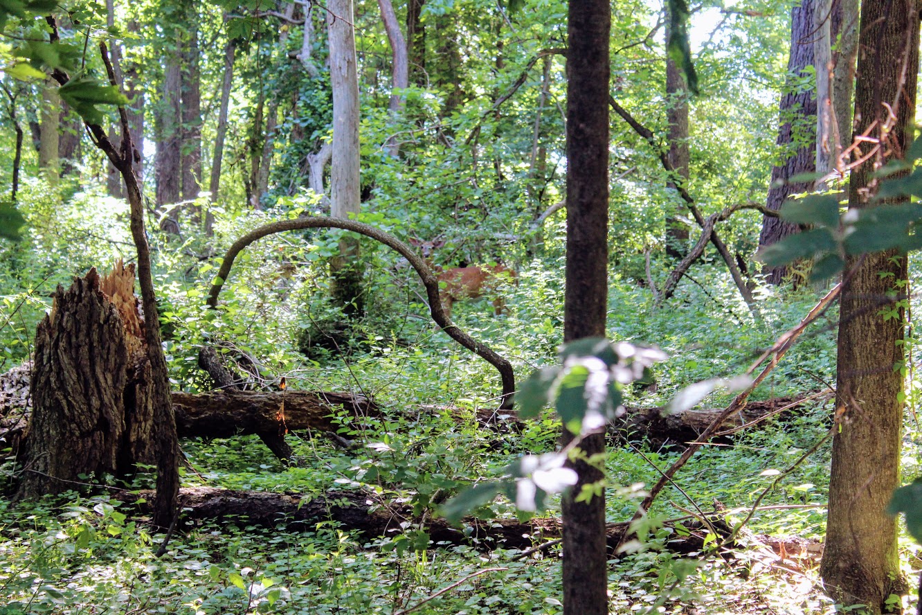
Unexpectedly, we did see more wildlife than anticipated. Peter Rabbit and Bambi made appearances.

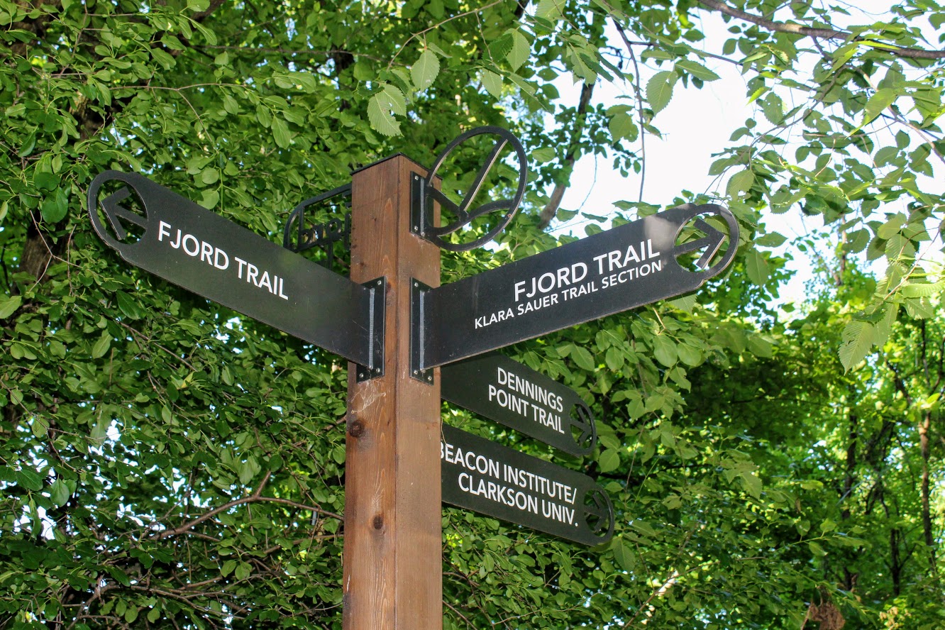
At the end of the Klara Sauer trail, we saw signs for the Dennings Point trail at the T intersection. Dennings Point trail was to our right. We did take a detour to our left on the Fjord trail to see the railroads tracks and caught a train going by under the bridge.
Railroads track if you veer on the trail to look for a train passing.
We circled back to follow the Dennings Point trail into the woods. We passed an abandoned building covered in tree branches where there was a brick factory many years ago. There will be a beach area path, where kayakers will stop for breaks, on your right. The beach front offered some impressive mountain views. Note, this trail is typically a loop but we reached an area that says to turn around due to the recent storm damage. We just turned around went back the same way.
when you run into this turn around the way you came!
views of kayakers and mOuntains.
views from the beach area of dennings point.
Great views.
This was a nice break from intense hiking. This was still great exercise. I would definitely come back. We walked about 2.8 miles and took us under 90 minutes. We got to see some great views. Long Dock Park is a great spot to kayak the Hudson River, do some fishing (may need a license), or just picnic with the friends and family.
love the views of the woods. trees down from storms on Dennings Point trail.

HIKING FOR DONUTS
A blog for the outdoors foodie enthusiast
Hi, I’m Mark. I live in Connecticut. I take new trips every chance I get. A good trip has a great hike, great food, and something fun to do. My goal is to search out new trips and share them to inspire others to try something new and exciting.
If you are looking for posts in a particular place, search by city or state here.
EXPLORE OTHER POSTS IN THE ARCHIVE
Archive
RECOMMENDED POSTS

MOST RECENT POSTS
See where I have been recently on Instagram. Follow @HIKINGFORDONUTS