


Garden of the Gods Hiking Guide
Garden of the Gods can be explained in one word: majestic. Colorado is one of my favorite states to travel to and explore. At one time, I visited 3 times out of 4 years. Mostly spending time in Denver, Boulder, and Rocky Mountain National Park. I wanted to see more of the state and my research came across Garden of the Gods. I had to go. And, I immediately included it on my next trip. The park is filled with red rock formations, big and small, overlooking Pike’s Peak and the southern Front Range of the Rockies. It is one of those parks, you have to step your foot in and explore all its beauty. It is 100% percent worth planning your trip around visiting.
About Garden of the Gods
The stunning rock formations throughout the park were created during a geological disruption millions of years ago. The look of the rock you see today is due to subsequent erosion and glaciation. Adding to the park’s distinctiveness, it is also one of the only places in Colorado where you can find red sandstone and Pikes Peak granite together.
Garden of the Gods can be explored by foot, car, or biking with hiking trails and bike lanes throughout the park. There are some wheelchair accessible trails. There are 16 hiking trails that range from 0.25 miles to 6 miles. Most of the trails are relatively easy, but there are a few trails with rockier terrains. And, they connect pretty easily. Rock climbing is another popular activity here as well. There is truly something for everyone at the park.
The visitor center is across from the park itself and is worth a visit to speak to rangers, grab a map, and check out displays and history of the park.
Best of all, the park is FREE. The original owner of the park land, Charles Perkins, wanted to share the experience with everyone. After his passing, his family donated the park to the city to fulfill his wishes. The park is open from dawn until dusk. Check their website for specific hours for the time you are visiting.
How to Get to Garden of the gods
Garden of the Gods is located in Colorado Springs, CO. It is only about 5-10 minutes from the Interstate highway and close to downtown, hotels, shopping, and dining. Traveling from the popular city of Denver will only take just over an hour, which would also make for a great day trip visit. For most out of state explorers, flying into Denver is the best bet and then driving to the park. It is pretty easy to find using your gps.
When to Visit Garden of the gods
The beautiful rock formations and visuals of this park really make any time of the year a feasible time to visit. I went in early May and it was snowing! It was not as warm as expected but the snow made everything look pretty cool. As one would expect, the summer is the busiest time of the year. There is a decent amount of parking but I could see that being filled up by afternoon in the summer/fall time.
Park Entrance
Hiking trails at the Garden of the Gods
There are many hiking trails in the Garden of the Gods. You can’t go wrong with the paths you choose. The park may seem small but you can spend an entire day hiking in the park. The trail system totals up to 15 miles. Here are some of the more popular hikes that offer great sights.
1) The Perkins Central Garden Trail is an easy, 1.5 mile round trip path with minimal elevation. This trail is in the heart of the Park at the base of the highest rock formations. This trail is right near the North Main Parking lot.

Perkins Central Garden path
2) The Ridge Trail is a moderate, 1/2 mile loop with less than a 100 feet in elevation. This trail starts at South Garden Parking Lot and head towards the Sleeping Giant formation to hop on the trail.
3) The Siamese Twins Trail is an easy 1-mile round trip, with less than 150 feet in elevation. On a clear day, there is a fascinating view of Pikes Peak through the natural window of the Siamese Twins. This can be found near the southwest entrance of the park.
Siamese Twins
No views of Pike Peak on this day!
4) The Scotsman/Buckskin Charlie Trail are moderate trails located in the Central Valley of the park that loop through the park. There is a small parking lot to join the Scotsman Loop. It is best to start hiking from the main parking lot and connect to this trail. This area is more open and you can see distant views of the Central Garden formations.
5) The Palmer Trail is a rocky trail that runs along the north and west sides of the park from the North Main Parking Lot to the middle of the Siamese Twins hiking trail. On this trail, there will be more greenery to see and elevated views overlooking Gateway Rock. This is one of the longer hiking trails in the park.
Views from Palmer Trail
6) Choose multiple trails and make your own hiking adventure. It is very easy to connect trails at the park. When I arrived at the park, I went to the visitor center, spoke with a ranger, and grabbed a map. The ranger said the most popular hike in the park to get as many views as possible was taking the 2.7 mile loop starting on the Palmer Trail behind the North Main Parking Lot. From here, you will reach the Siamese Twins Trail and explore this area. Then cross Juniper Way at the Scotsman Picnic Area and hop on the Scotsman Trail. This will lead to the Perkins Central Garden Trail to finish the loop up to the North Main Parking Lot. That is what I did on my visit and I was able to see all the popular rock formations. And, it was a fun and awesome experience exploring amidst all the rock formations.
Hiking Tips: Due the elevation, bring lots of water and keep hydrated to avoid any affects. On those sunny days, be sure to bring sunscreen as there is no shade here. Lastly, as you would expect, come early to visit the park or try the off-season.


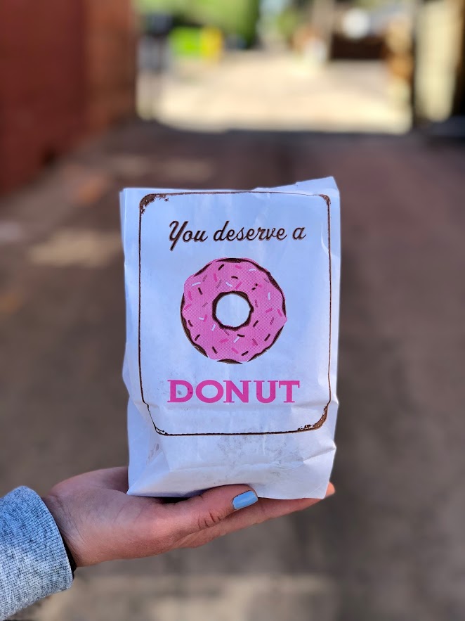
Bonus: Post Hike Donuts
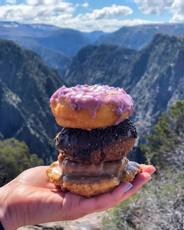
It’s called Hiking for Donuts, so it would be a disservice if I did not include a post hike donut shop to visit after the hike. Fortunately, there is a fantastic donut shop in Colorado Springs about 20 minutes from the park called Amy’s Donuts. No exaggeration, they had over 40 different flavors/topping to choose from, which is a very tough decision to make. Flavors from Butterfinger to Fluffer Nutter to Nutella Crumb to all the standard donuts. And, the jelly donuts are filled fresh to order! Great donut shop find.

HIKING FOR DONUTS
Hi, I’m Mark. I live in Connecticut. I take new trips every chance I get. A good trip has a great hike, great food, and something fun to do. My goal is to search out new trips and share them to inspire others to try something new and exciting.
If you are looking for posts in a particular place, search City or State here.
SEE OTHER POSTS IN ARCHIVE
RECOMMENDED POSTS

RECENT POSTS


RECENT POSTS
See the latest on Instagram and follow @HIKINGFORDONUTS
Colorado Road Trippin’ for Donuts
In my years of traveling, Colorado has been my favorite state to visit for the food, the beer, and the outdoors/hiking. I still have barely scrapped the surface. On my third visit this spring, I drove over 1000 miles and visited 7 cities. My prior trips did not consist of too much donut research. Hence, there were many donut shop visits along the way on this trip. This is not a best of list by any means. There are lots of donut shops in Colorado. In this post, I will be sharing my experiences of the donut shops I visited during my trip. SPOILER ALERT, Colorado has some great donuts shops.
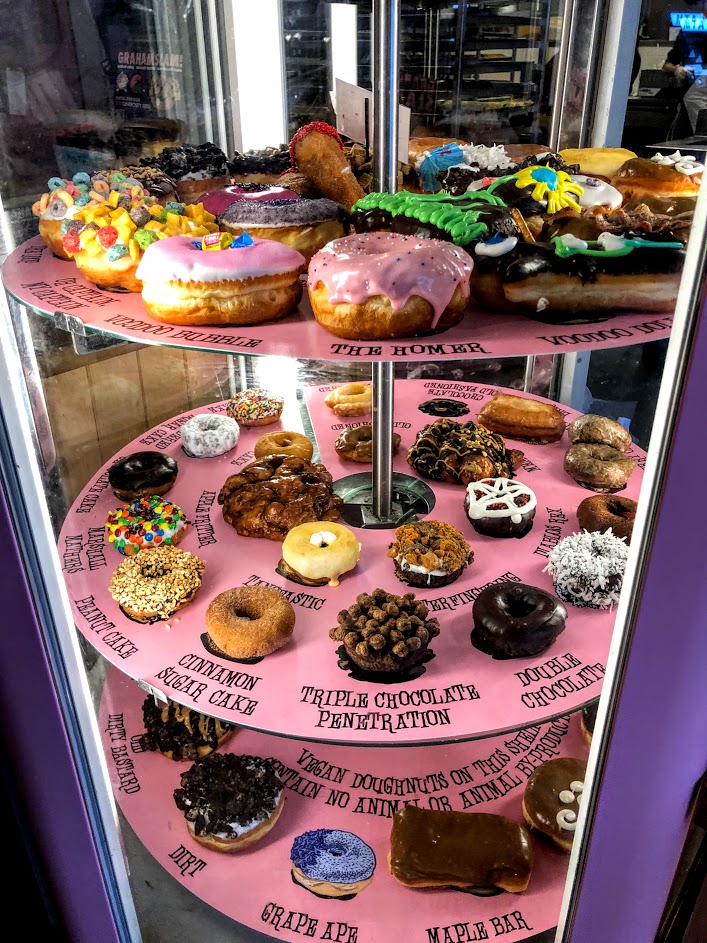
Voodoo Donuts Denver, CO
The first stop off the plane was Voodoo Donuts. The popularity of this donut shop makes it a must try. Once you walk in, you see and feel how different this is than a standard donut shop. There is a hip and fun vibe going on. There’s a big selection of unique flavors and types of donuts. They are known for a raspberry filled donut shaped and decorated like a Voodoo Doll and their wittiness. The crazy options I chose were the Chuckles, chocolate frosting dipped in hot chocolate cocoa powder with peanuts and caramel and chocolate drizzle, and the ODB, chocolate frosting with Oreo cookies and peanut butter. In addition, I had to the get the Voodoo Doll, Plain Glazed, Double Chocolate Cake, and Maple Bar.

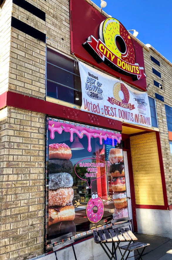
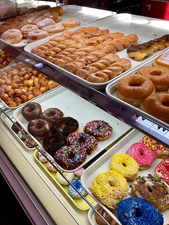
City Donuts, Denver, CO
City Donuts has a few locations spread out through Colorado near the Denver area. This was your standard old school donut shop. The customer service was fantastic. The person working went into detail on how their donuts were made and the history of the company. Appreciated it because it gave me time to decide what I wanted. Unfortunately, I was pretty full from breakfast but I settled on the Maple Glaze and Chocolate Frosted with sprinkles. Super fluffy and tasted homemade. Pretty big sized donut as well. And, they hooked me up with some free donut holes. The bag the donuts came in was a great touch.
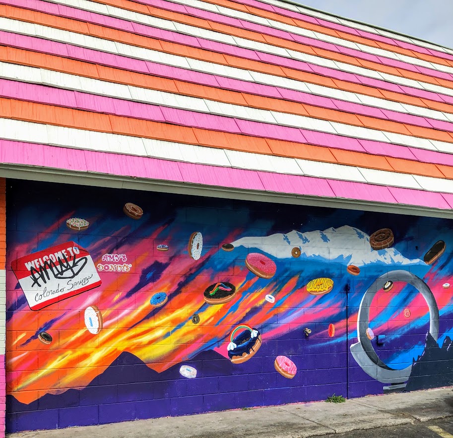
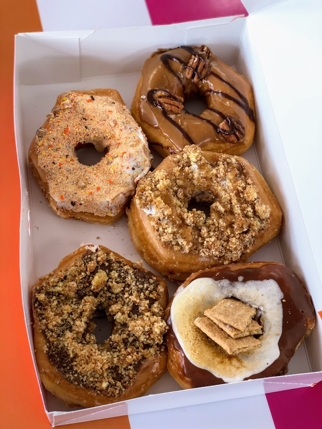
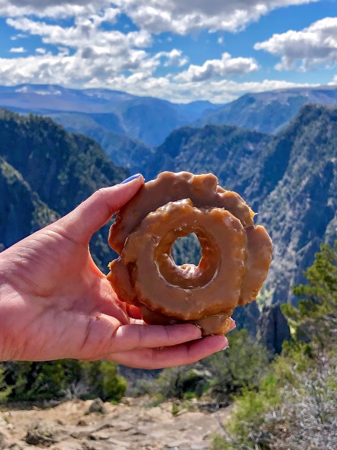
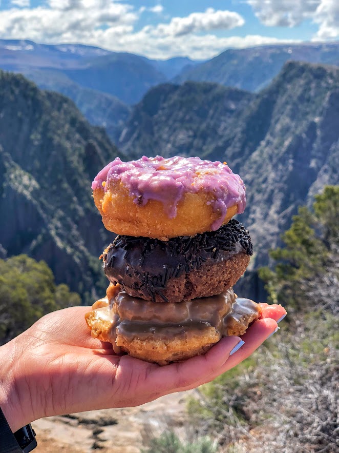
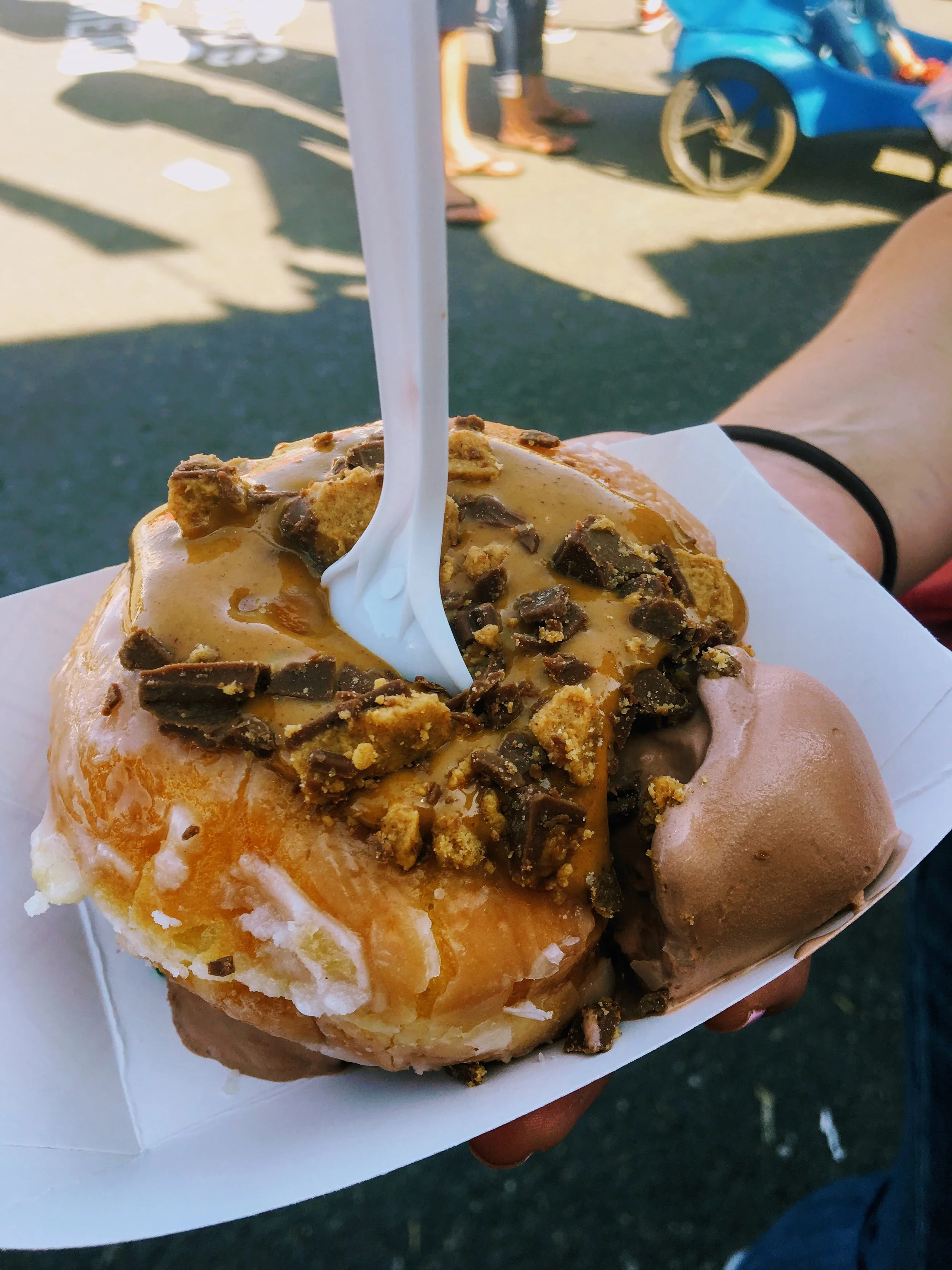
Amy’s Donuts, Colorado Springs, CO
The stand out donut shop in Colorado Springs has to be Amy’s Donuts. This shop had my head on a swivel. Not even over exaggerating, there were over 50 different flavor combinations. To narrow it down was a tough task. They covered the basics but then went over the top with wild toppings and flavor combinations like Almond Banana Caramel, Butterfinger, and Maple Bacon Fudge. The final decision was the Maple Turtle, Reese’s Pieces, Nutella Crumb, Bizmallow Caramel, and S’mores. And, a Raspberry filled glazed bar to complete the spectrum of donuts. They will pipe in the jelly fresh when you order. Big fan of that. The verdict, the Maple Turtle was amazing as it sounds.
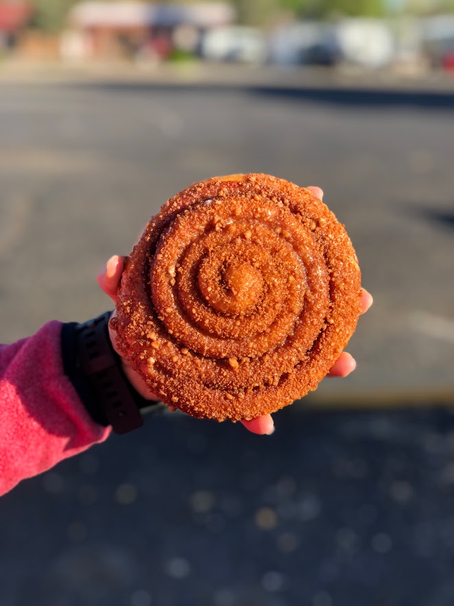
Montrose Donuts and Deli, Montrose, CO
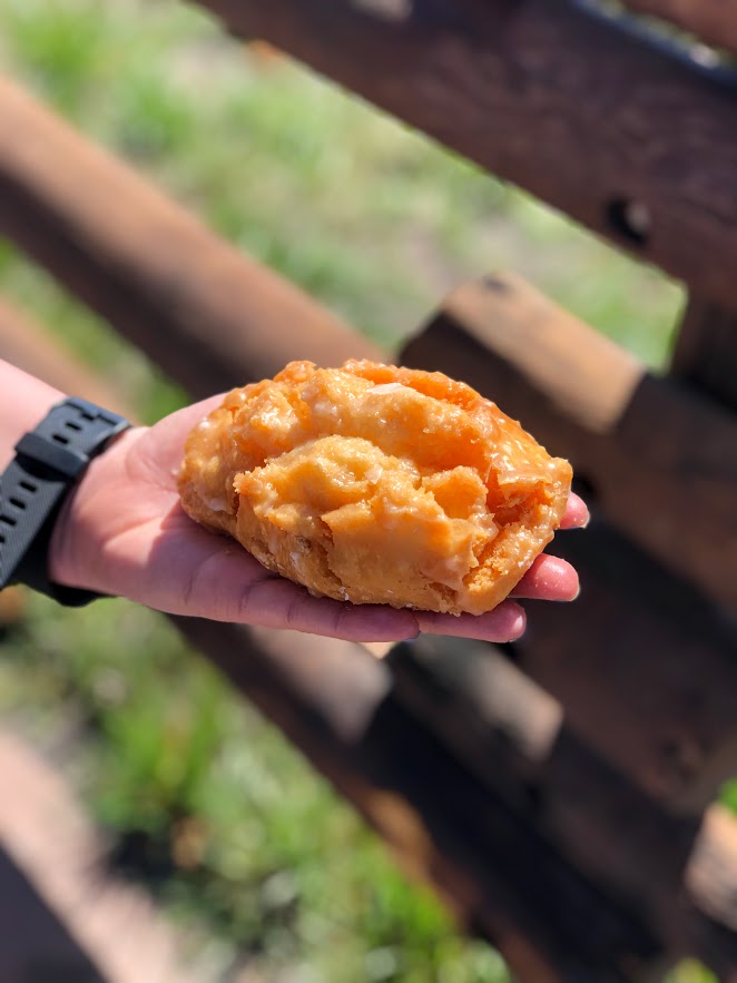
The perfect hiking for donuts location. Located 15 minutes outside of the Black Canyon of the Gunnison National Park, you must visit Montrose Donuts and Deli. When I walked in, I was delighted to see all the options. They had bear claws, old fashion, cake, yeast, cinnamon bun, bow tie, cruller, French cruller, fritter, bars, and filled donuts along with muffins and more baked goods. And, a glazed buttermilk bar. What?!? I had to try this. Best donut of the trip. Tasted like a delicious and sugary glazed biscuit. Along with the glazed buttermilk bar, I also tried the chocolate cake sprinkle, bow tie glazed, blueberry glaze cake, cinnamon crumb, old fashion maple, and cinnamon crumb glaze fritter. The donuts were all pretty delicious. Highly recommend for your hiking for donut needs.
OMG Donuts, Arvada, CO
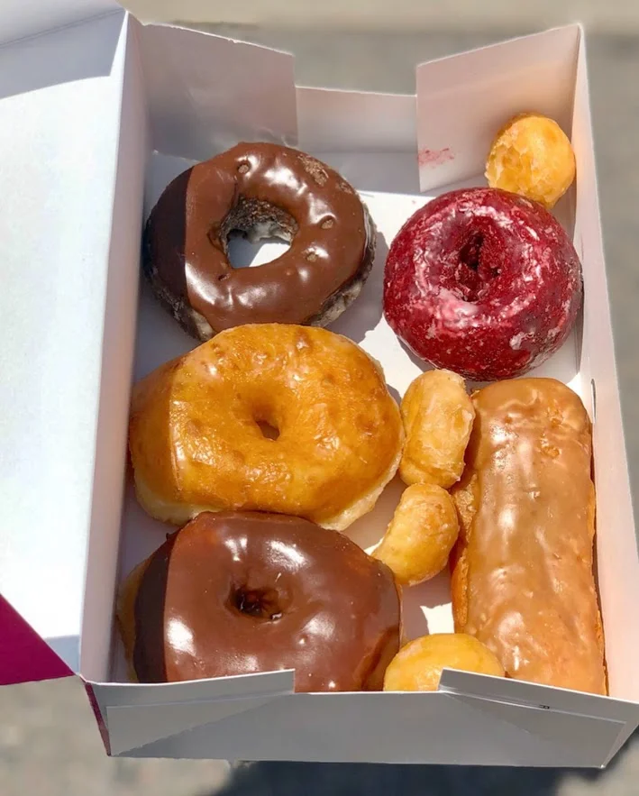
Located in a small plaza driving through Arvada, I found myself at OMG Donuts. This is another small business, old school shop cranking out the classics. Very friendly. I got there late afternoon and they still had some good options. I went with the Plain Glazed, Double Chocolate Cake, Maple Bar, Chocolate Frosted and Red Velvet. The red velvet cake stood out to me for some reason and that was the best decision I made. One of the best cake donuts I have EVER had. Wow, super moist and the flavor was on point. The chocolate cake was good also, super chocolaty almost like eating a chocolate cake. The yeast donuts were fluffy and light. This was a great donut shop find.

HIKING FOR DONUTS
Hi, I’m Mark. I live in Connecticut. I take new trips every change I get. A good trip has a great hike, great food, and something fun to do. My goal is to search out new trips and share them to inspire others to try something new and exciting.
If you are looking for posts in a particular place, search City or State here.
SEE OTHER POSTS IN ARCHIVE
RECOMMENDED POSTS
RECENT POSTS


See the latest on Instagram and follow @HIKINGFORDONUTS


24 Hours in the Black Canyon at the Gunnison National Park
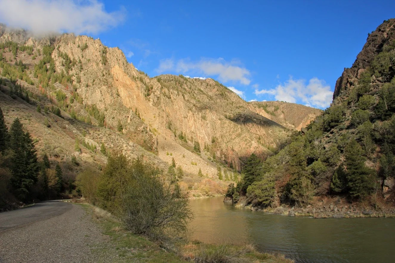
The Black Canyon of the Gunnison National Park is one of the least known national parks and that is a travesty. I admit, I wasn’t too familiar with this park myself. Located in western Colorado, the Black Canyon of the Gunnison did not gain National Park status until 1999, making it the second youngest national park in the U.S. The Black Canyon is named so because the walls are often covered in shadows making them appear black. These steep walls were formed over 1.7 billion years ago. Another awesome note on this park is that it contains 12 out of the 48 mile-long canyon of the Gunnison River.
For most national park or outdoors enthusiast, you want to experience as much as possible in your travels. Planning trips can be difficult and offer time restraints. Exploring most national parks you need anywhere from 3 days to two weeks. On my recent Colorado road trip, I planned for one day at the Black Canyon of the Gunnison National Park. There is a North and South Rim. This guide will be for the South Rim only. This rim is more developed and accessible. Can you explore the entire South Rim in 24 hours? The answer is yes. The best time to visit is April to November. We stayed in Montrose, which is about 15 minutes from the park. The downtown is pretty cool. Oh, and there is an amazing donut shop, Montrose Donut and Deli Shop. The best donuts I had in Colorado. Get the biscuit donut. I digress…..
The South Rim is comprised of a modest 7 mile loop with 12 spectacular overlooks. I suggest to stop at each overlook. A lot of the overlooks do require walking a short trail but nothing strenuous. I would not miss out on Painted Wall, Cedar Point and Sunset View. There are multiple hikes on the South Rim. I went out of my way to do them all and to be honest, if you are stressing for time, skip the hikes. If camping is your thing, there are campgrounds here. Lastly, do NOT leave the park without driving down East Portal Road. I cannot recommend that enough. There is no crowd concern at this park. I counted maybe 30 people on a Friday in mid-May. I read the peak of the visitors stroll through in July. There are even less visitors on the North Rim, which is a 3 hour drive from the South Rim. However, the views are even more dramatic from the North Rim. The scenic driving was amazing. This park should be way more popular. The views were ridiculous. One of the best experiences I had in a national park. Here’s my guide to the South Rim of the Black Canyon of the Gunnison.
How to get there
Black Canyon’s South Rim is about 14 miles from Montrose and 63 miles from Gunnison. To get there from Montrose, travel 7 miles north on CO Highway 347 from the intersection with U.S. Highway 50 east of the city.
Viewpoints (South Rim)
The first viewpoint that visitors will see entering the park is Tomichi Point. This is right off the side of the road, no hiking needed. The second viewpoint, Gunnison Point, is located right behind the visitor center. A short path down some steps leads views of the canyon facing northwards. The view is more vivid than Tomichi Point and there is sneak peak of the ravine.


The next viewpoint is about two miles down the road at Pulpit Rock Overlook. There is a 134 yard trail leading to this area. The canyon really opens here with the river in view as it curves around a 90 degree bend. Cross Fissure View offers a different a unique look at the canyon. The river is not visible and most of the canyon is hidden. There is a view of overlapping ridges and crevasses from multiple angles. This viewpoint is a 357 yard walk.


Rock Point is a less traveled path at 294 yards. The longer the path the less visitors you will see. Devils Lookout is the longest path at 607 yards. This path goes right the edge of the rims for great views including the river and the valley. Both this and Rock Point lie above the narrowest part of the entire canyon.


Chasm View is one of those jaw dropping views. This is a very short path off the road above the steepest part of the whole canyon. Painted Wall View is almost adjacent to Chasm View. This may be the most well-known viewpoint. Painted Wall is the highest cliff in Colorado at 2,250 feet and a half mile across.


Every viewpoint from here on is a must see. Cedar Point is a 303 yard path overlooking the lower canyon. This is a spectacular view as you can see 1.5 miles of the river, flowing rapids, and some greenery below. Next up, Dragon Point offers very similar views. The widening ravine enclosing colorful waters of the river. This can be reached by a path of 300 yards.


Sunset View was one of my favorites. This is the westernmost viewpoint along the South Rim road. There is large parking area along with restrooms and picnic tables. This a great place to soak in amazing views of the canyon. This is the longest stretch of V shaped canyon. The last viewpoint is another mile down the road, High Point. There’s not much to this but you have to pass this in order to turn around and head back.


The Hikes (South Rim)
At the end of South Rim road, there is a parking lot where the Warner Point Trail begins. This a 1.5 mile out and back that takes you to the furthest overlook on the South Rim. The trail starts flat with views of green fields 1,000 feet above Bostwick Park. The trail begins to climb slowly then drops and ascends again before reaching the final viewpoint. This overlook offers stunning views of the San Juan Mountains, West Elk Mountains, Uncompahgre Valley, and the canyon. If you choose a hike in the South Rim, this would be the one I suggest.
Warner Point
The Oak Flat Loop begins by the visit center. The trail is narrow and traverses down a steep slope. This offers a peek at the landscape below the canyon’s rim. This is the most challenging hike in the South Rim with steep uphill and downhill portions. In total, the loop is 2 miles.
Rim Rock Nature Trail starts at the visit center or the Campground Loop C entrance. You can even hop on this trail from Tomichi Point. This relatively flat hike takes you along the rim of the canyon for views of the Gunnison River and sheer walls of the gorge below. This can be between 1-2 miles.


East Portal Road River Access
Located right at the entrance/exit to the park, you will see the access for East Portal Road. This is a 5 mile road with a significant decline (16% grade) with hairpin turns taking your car to the base of Black Canyon. This is the only way to get down into the canyon. Once arriving at the bottom, the views from down below are gorgeous. The picturesque surroundings of the beautiful lake and the cliff walls of the canyon from up above are majestic. By far the coolest experience I had in the park. I was just in awe. I read a lot of things online and it made it sound dramatic and dangerous to drive down. Any car/van can handle it. Vehicles with an overall length (including trailer) greater than 22 feet are prohibited. Trailers may be left unhitched and left at a parking area at the campground entrance. This road is closed in the winter. Just be smart about driving down. It took us about 30 minutes. This is a bucket list type event. Don’t chicken out!
The drive down into the canyon.


HIKING FOR DONUTS
Hi, I’m Mark. I live in Connecticut. I take new trips every change I get. A good trip has a great hike, great food, and something fun to do. My goal is to search out new trips and share them to inspire others to try something new and exciting.
If you are looking for posts in a particular place, search City or State here.
SEE OTHER POSTS IN ARCHIVE
RECOMMENDED POSTS

RECENT POSTS
See the latest on Instagram and follow @HIKINGFORDONUTS

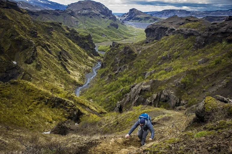
Hiking the Rockies: Hallett Peak
If you want to try a challenging hike in Colorado, this post is for you. Check out my Hallett Peak hike and advice not getting lost like me!
In the summer of 2013, I decided to take my first trip to Colorado. I was looking for a new destination to explore and adventure. As far as in the U.S., Colorado was at the top of my list. My buddy Corey devised a plan as per usual, which was all it took for me to say yes. We had never been there and the Rocky Mountains were calling our names.
Three months later we landed in Denver and got right on the hiking trails. At the time, we were younger and in better shape so the altitude didn’t affect us too much. With that said, my conditioning was tested on a challenging, mammoth hike, which at the time was highest elevation I had ever been. And, that trail was Hallett Peak.

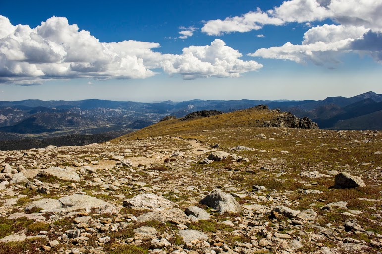
Hallett Peak lies along the Continental Divide, the point at which water on the western slope flows towards the Pacific Ocean, and water on the eastern slope flows towards the Atlantic Ocean. Hallet Peak stands at 12,713 feet tall. The highest mountain I have hiked up to this point was Mount Washburn in Yellowstone a few months earlier at over 7,000 feet.
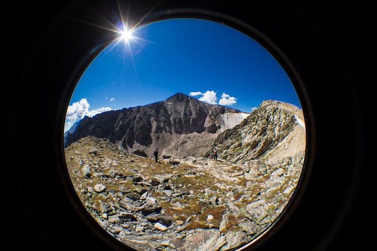

The hike begins at the Bear Lake Trailhead, and then follows the signs toward Flattop Peak. Most of the hike is above tree line as it switchbacks up the side of Flattop Mountain. The trail had some steep uphill moments. The altitude was starting to get to me as we got higher. I had to stop every so often and catch my breathe. This gave us a chance to see wildlife, mostly little critters, and the abundant wildflowers along the way. Once you arrive at the summit you must identify the unnamed trail leading south toward Hallet Peak. Be careful, as we got lost and added an additional two miles by missing the trail. Although, the views were amazing so adding more to the hike was a bonus. Around the top of the of Tyndall Glacier, the last half mile of the hike involves ascending up the slippery, rocky slopes toward the summit by connecting short trails marked by cairns. We reached the top as storm clouds began to appear.

Love me some cairns.


Before we headed back to beat any possible storms, we ate lunch and drank some well-deserved beers. The total round trip for this trail is 10.3 miles. With our detour, we trekked just over 12 miles. This trail was absolutely awesome with remarkable views. The trail was really, really tough but I would do it all over again. I definitely felt like I was on top of the Rockies. John Denver was not full of……


HIKING FOR DONUTS
A blog for the outdoors foodie enthusiast
Hi, I’m Mark. I live in Connecticut. I take new trips every chance I get. A good trip has a great hike, great food, and something fun to do. My goal is to search out new trips and share them to inspire others to try something new and exciting.
If you are looking for posts in a particular place, search by city or state here.
EXPLORE OTHER POSTS IN THE ARCHIVE
RECOMMENDED POSTS
MOST RECENT POSTS
See where I have been recently on Instagram. Follow @HIKINGFORDONUTS
Taking the plunge!
Welcome to my blog! It is time to share my travels, hikes, foodie problems, and everything else awesome. Enjoy!
My name is Mark. I love traveling and exploring. Nothing gets me excited like a new adventure. I have been fortunate enough to travel to 27 States and 5 Countries. I have traveled through Canada, hiked all over Iceland (before it was popular and cool), and backpacked in Switzerland. And, I am a huge foodie. ..BIG TIME! I love all types of foods, especially donuts! I enjoy seeking out new and interesting places to eat locally and wherever I travel. I am generally the food guy of the group. That is my one true job. Find the most dynamite place to eat. So far, I have only really failed once and that was in Missoula, Montana. I deserve a pass on that one.
I can’t count how many times I have been asked about a city, hike, or restaurant and I say, “Haven’t been there. I hear it’s nice.” Or…”I think I have been there, but can’t remember.” And, one of my friends or my girlfriend will chime in, “Yeah, we did that.” I guess it’s a good problem that I have been to so many cool places. I just have a hard time keeping up! That leads to me to the blog. I have been thinking about a blog for years now. I figured what better way to look back at my memories than to start a blog, all while describing my trips, adding some food insights, and showing the pictures I take along the way. You may see any other awesome explorations whether it be a craft brewery on the weekend or trip to a new baseball stadium.
Denver biscuit company
My other main purpose for this blog is to help others find new places to eat, travel, and explore. There are places I never anticipated to travel but wanted to learn more. I hope this blog helps increase reader’s curiosity of exploration. I spend hours and hours and days researching trips, food, and hikes. I want to be able to enhance that research for others, offering my experiences and thoughts. I hope this will spark interest in others to enjoy new unexpected experiences with their eyes and bellies. If you don’t mind my interesting way of conversing and not the best grammar, please follow along and enjoy.
Donut Haus in Estes Park, CO

HIKING FOR DONUTS
A blog for the outdoors foodie enthusiast
Hi, I’m Mark. I live in Connecticut. I take new trips Every chance I get. A good trip has a great hike, great food, and something fun to do. My goal is to search out new trips and Share them to inspire others to try something new and exciting.
If you are looking for posts in a particular place, search by City Or State Here.
EXPLORE OTHER POSTS IN THE ARCHIVE
RECOMMENDED POSTS


RECENT POSTS
See where I’ve been recently on Instagram and follow @HIKINGFORDONUTS