


Kaaterskill Falls Trail, The Catskills, New York
Trail Description: The Kaaterskill Falls Trail is short hike to a stunning waterfall in the Catskills.
Trail Info:
Where: Haines Falls, NY Distance: 2.3m (1.5-2 hours) Difficulty: Moderate Trail Type: Out and Back Features: Views, Mountains, Waterfall
How to get there:
Note, you will lose service as you get closer. I put in my GPS:
103 Laurel House Road, Palenville, NY 12463
Depending which direction you are coming from, you will turn onto N Lake Rd off RT 23A and follow up to Laurel House Road. In roughly 2 miles, turn right on Laurel House Road where you will find the upper trail parking lot.
Hiking Tips
Start at the upper parking lot.
Make sure to check out the views from the platform.
Summer water levels may be low and rainy periods may be muddy.
Be safe. Multiple people have got hurt jumping in the falls, or worst, fallen off the top of the fall and died.
The Hike
A trip to the Catskill Mountains in New York has been on my immediate bucket list. The abundance of hikes and mountain peaks to be seen caught my eye. Since this is not a long drive for my fiancé and me, we picked a weekend, laced our boots, and hiked until we couldn’t any longer. The one obvious choice to hike is the ever popular Kaaterskill Falls Trail. Being mid-July and not much rain, the fall wasn’t going to be as cool as in the rain season. But this was the only weekend we could go and it was still worth the hike. I always do my research ahead of time and noticed there were multiple parking lots. The more popular lot seems to be the lower which looked like a train wreck. We drove by it. The parking is miserable with tons of cars in the highway on a narrow strip parked in the road. I would be concerned walking back to my car. The better option is the upper falls lot off Laurel House Road, where there is a platform you can see the falls from above. As long you can there before 10-11am on the weekend, there should be enough parking. The other thing in my mind was the crowd. I suggest doing this hike very early on weekends or if you can on a weekday. The lower falls are popular for swimming in summers. We started this around 9am and it was pretty crowded, especially at the lower trail.


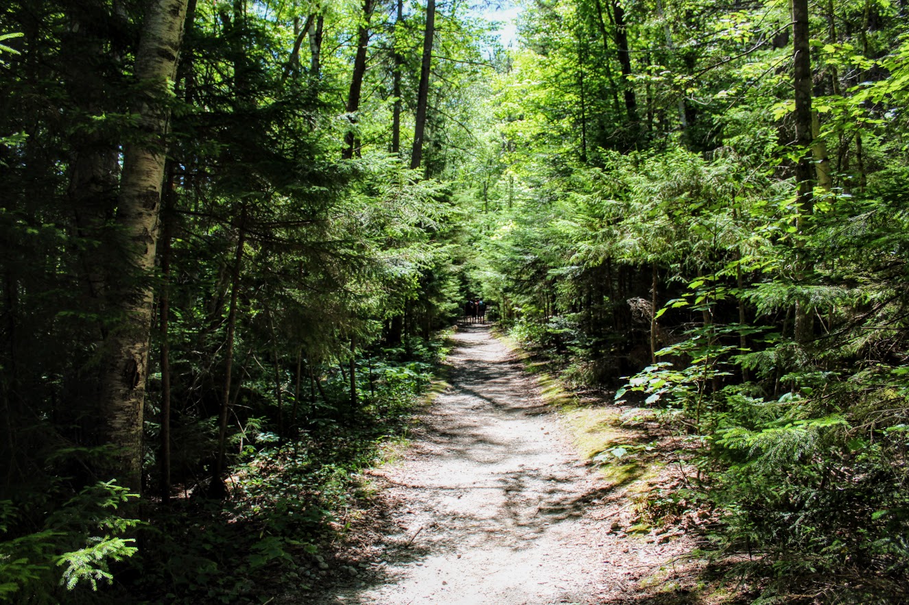
Once we parked in the lot on Laurel House road, there is a gravel path to the kiosk of trail info where the hike begins. From here, we proceeded to take the Yellow Trail on our left. In short time, the Blue Trail will be on the left. We continued on the Yellow Trail to the right heading to upper platform for views of the falls. This portion of trail was developed and improved in 2016 to make it safer for everyone to hike. While this may be manmade, I think that was essential for this trail. If not for all the new steps and paths, people would get hurt and there is way more to offer on this trail for everyone. And, the platform offers a new perspective with remarkable views of Kaaterskill Falls. I am glad I did not start from the lower trail!
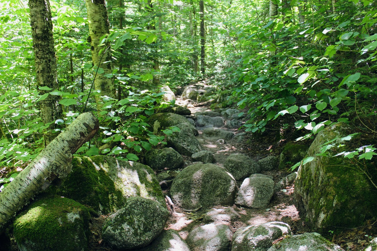
After checking out the platform, we retraced our steps back to find the intersection for the Blue Trail. This will lead to a bridge crossing that will lead to another intersection. From here, turn right toward the Lower Falls. This is where difficulty of the trail increases but not too bad. To proceed along to the Lower Falls, we proceeded to head on the Yellow Trail. There will be more signposts to veer onto other trails if you want to adventure but we just wanted to see the falls. As we descended closer to waterfall, you can hear the crowd of people below as you get closer on this hot summer day. There was a side trail venturing to our right where the falls are up close. You could actually get in the water and take a picture under them.


We returned back to the fork and proceeded to descend down the steps to lower part of the waterfall. Once we reached the bottom, you can see both sections of Kaaterskill Falls. We climbed up on some rocks to get closer. And, of course I hiked with a donut. Hence, obligatory donut and waterfall shot. We stopped at a local donut shop about 10 minutes away from
The crowd was a lot to deal with. We headed back retracing our steps back onto the Yellow Trail until we reached the bridge again. Then take the path toward the parking lot. As I mentioned previously, this was non-rain season so the fall was not as robust. However, it is one of the must hike locations in the Catkskills. I ensured my first trip included Kaaterskill Falls.

HIKING FOR DONUTS
Hi, I’m Mark. I live in Connecticut. I take new trips every change I get. A good trip has a great hike, great food, and something fun to do. My goal is to search out new trips and share them to inspire others to try something new and exciting.
If you are looking for posts in a particular place, search City or State here.
SEE OTHER POSTS IN ARCHIVE
Archive
RECOMMENDED POSTS


RECENT POSTS


See the latest on Instagram and follow @HIKINGFORDONUTS


People State Forest, Barkhamsted, CT
Located in Northwest Connecticut, the Jessie Gerard Trail is one of many exciting trails that wander through the 3000-acre Peoples State Forest. This fairly unknown hike is challenging with various terrain and magnificent views of Grand Vista Overlook and Chaugham Lookout. A great hike in the fall for amazing views.
Trail Description: The Jessie Gerard Trail is one of many exciting trails that wander through the 3000-acre Peoples State Forest. This fairly unknown hike is challenging with various terrain and magnificent views of Grand Vista Overlook and Chaugham Lookout.
Trail Info:
Where: People State Forest, Barkhamsted, CT Distance: 3.3 miles (2.5-3 hours) Difficulty: Moderate Trail Type: Loop Features: Waterfall, Valley, Views
How to get there:
Typing in Jessie Gerard Trail in your GPS will lead you to East River Road, Barkhamsted, CT. Once you get onto East River Road, drive a few miles and you will see a small parking lot on your left. The trail starts directly across from the lot.
Hiking Tips:
Take a DEEP People State Forest map at the kiosk in the beginning. This will be very useful.
Start with the Falls Cut Off Trail to your left (blue/red marked trail). Much easier to go up this section (than down). If it rained recently, the first 0.1m will be slippery up the rocks.
Pay attention to the markers changing colors

The Hike
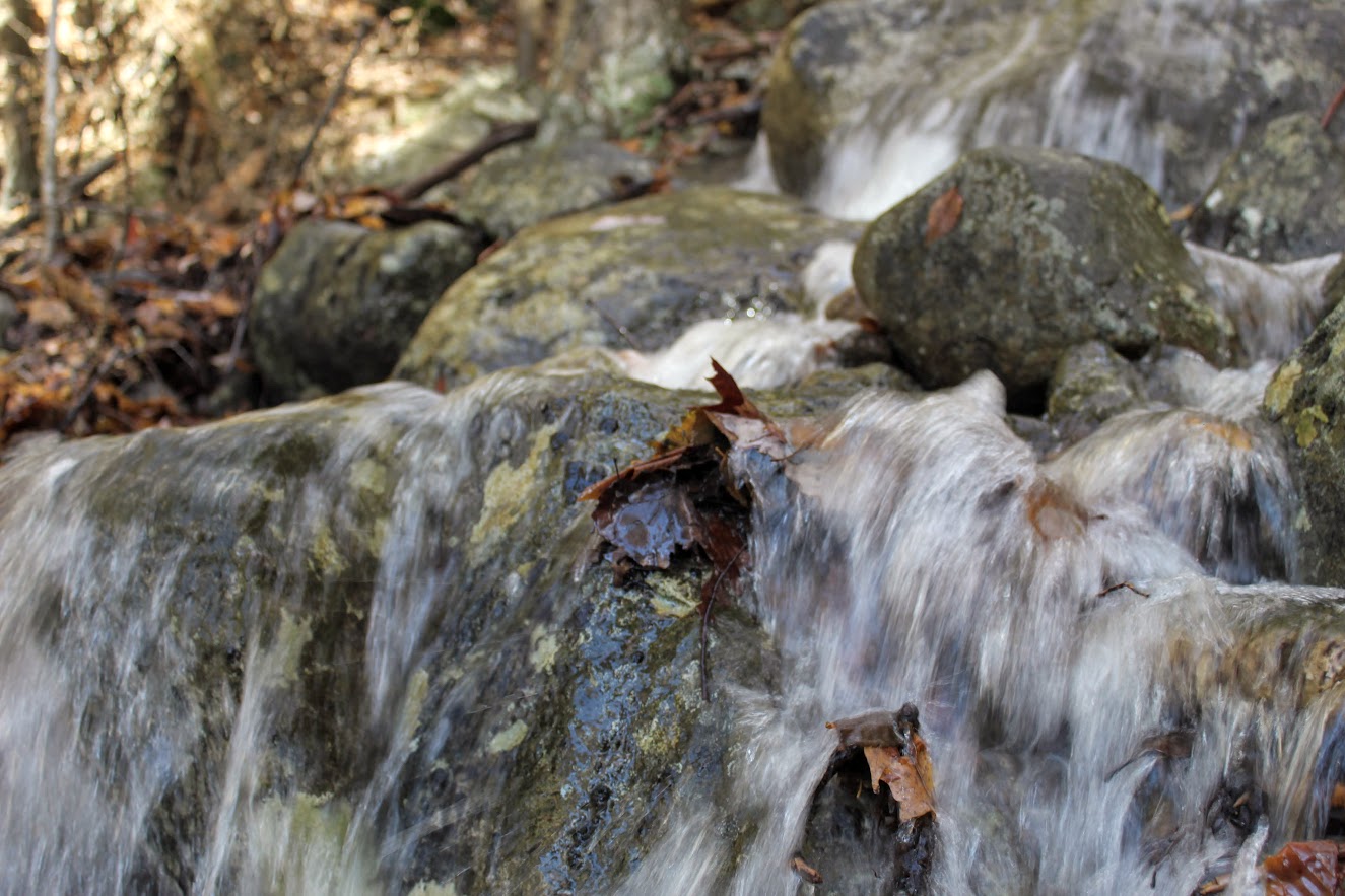
The hike begins up the Falls Cut Off Trail (blue/red markers) on the left. The beginning of the trail is difficult and there is an immediate steep incline up past the falls. The beginning of the trail is difficult and there is an immediate steep incline up past the falls. There was a huge rain storm the day before so the waterfalls were roaring. An awesome visual after 10 minutes into the hike. Though, the rocks were really slippery. Once reaching the top of the falls, turn left on the double marked Blue and Blue/Yellow markers, which is the Jessie Gerard Trail. Continuing straight ahead on the Blue/Yellow,do not veer toward Warner Road. After another half mile, boom shakalaka we emerged into the Grand Vista outlook. Magnificent views with all the fall colors. We continued following the Blue/Yellow for another half mile to the Chaughum Lookout for more awesome views.
From here, stay on the Blue/Yellow Trail. We went between the 2 Veeder glacial erratics aka big boulder rocks. Shortly after, take a right onto Greenwoods Road. This is where the Jessie Gerard Trail ends. Then turn left on the Charles Pack Trail, also Blue/Yellow markings.
Another half mile later, turn onto Beaver Brook Road. This is where things got interesting. Following the road, the map says turn right onto the Blue/Orange, Agnes Bowen Trail, on your right after a half mile. When we came up to this, it was nothing but forest. No sign of a trail. We walked up and down and this was the spot. However, I don’t know where the trail would connect. We decided to keep walking up Beaver Brook Road and take a right up the road. Eventually, we caught up with the Blue/Orange trail where we would have come out to the road.
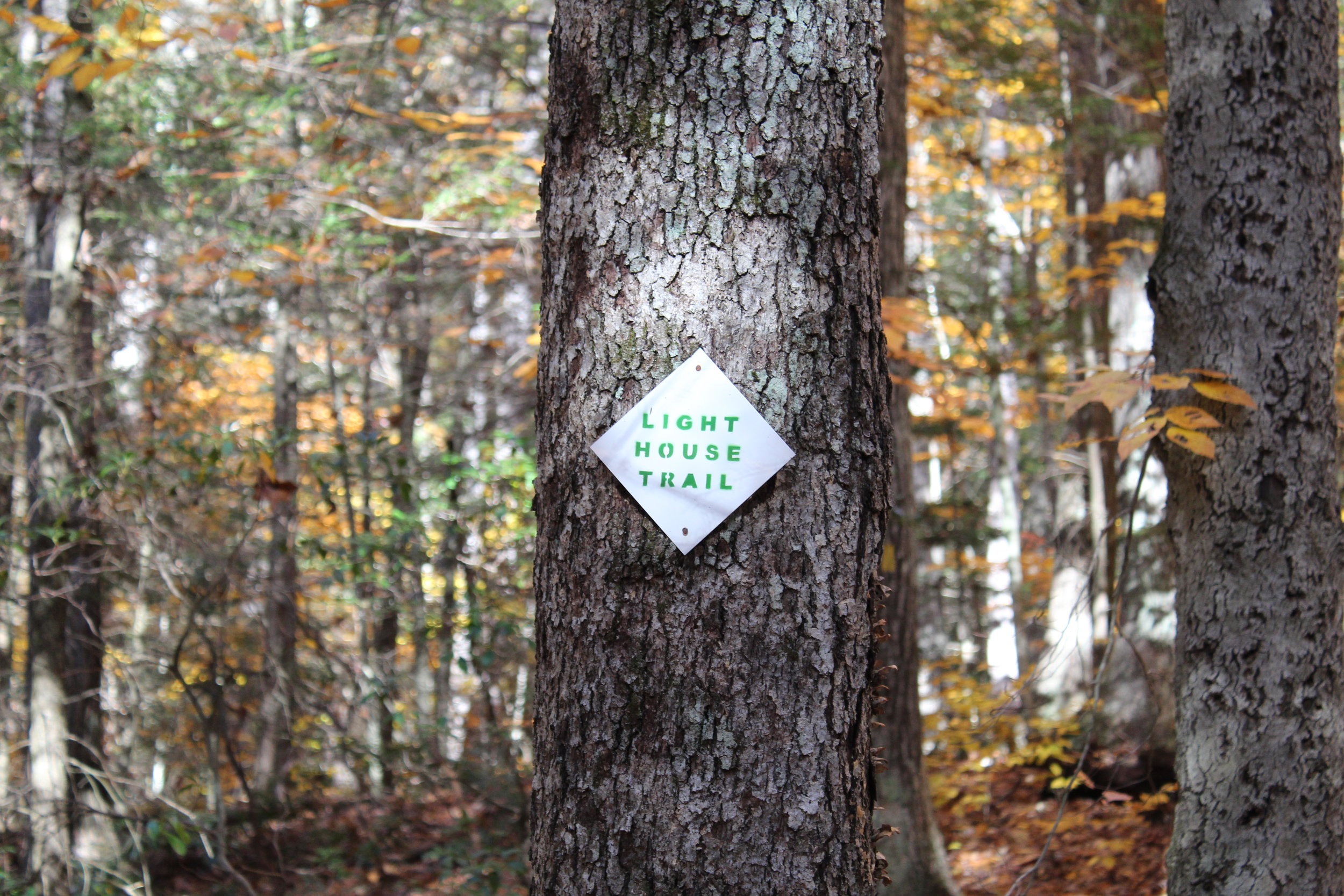
We jumped on the Blue/Orange to the left until we reached the Robert Ross Trail (Blue markers). Turn right here onto the Blue. The trail we will begin to ascend and descend. A tough part of the hike but way better than going down the other way. Keep your eye out on the colors on the trees. We got a little stumped here as the Blue/Yellow connects with the Blue. However, staying straight on the Blue the trail switchbacks downhill to the Lighthouse Trail (Yellow). Of course, another trail. Fortunately, this was the home stretch. We passed a few kiosks with educational info but we were ready for the post hike meal. This will take you back to the Blue/Red and right to the parking lot.


HIKING FOR DONUTS
A blog for the outdoors foodie enthusiast
Hi, I’m Mark. I live in Connecticut. I take new trips every chance I get. A good trip has a great hike, great food, and something fun to do. My goal is to search out new trips and share them to inspire others to try something new and exciting.
If you are looking for posts in a particular place, search by city or state here.
EXPLORE OTHER POSTS IN THE ARCHIVE
Archive
RECOMMENDED POSTS


MOST RECENT POSTS
SEE THE LATEST ON INSTAGRAM AND FOLLOW @HIKINGFORDONUTS

Zealand Falls Hut to Zeacliffs, New Hampshire
Zealand Hut Trail to Zeacliffs Trail Guide (Bethelum, NH)
Check out the new blog post an epic day hike in the White Mountains of New Hampshire. This hike follows the Zealand Trail to the Zealand Fall Hut, and eventually to the Zeacliffs overlook. From here, there are incredible views of Zealand Notch and the Pemigewasset Wilderness.
Trail Description: The Zealand Falls Hut Trail will lead you through the forest up to the AMC hut. Along the way you will pass various wetlands. Hiking beyond the hut to the Zeacliffs, there is a stunning view of the Pemigewasset Wilderness.
Trail Info:
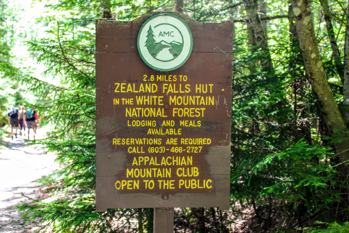
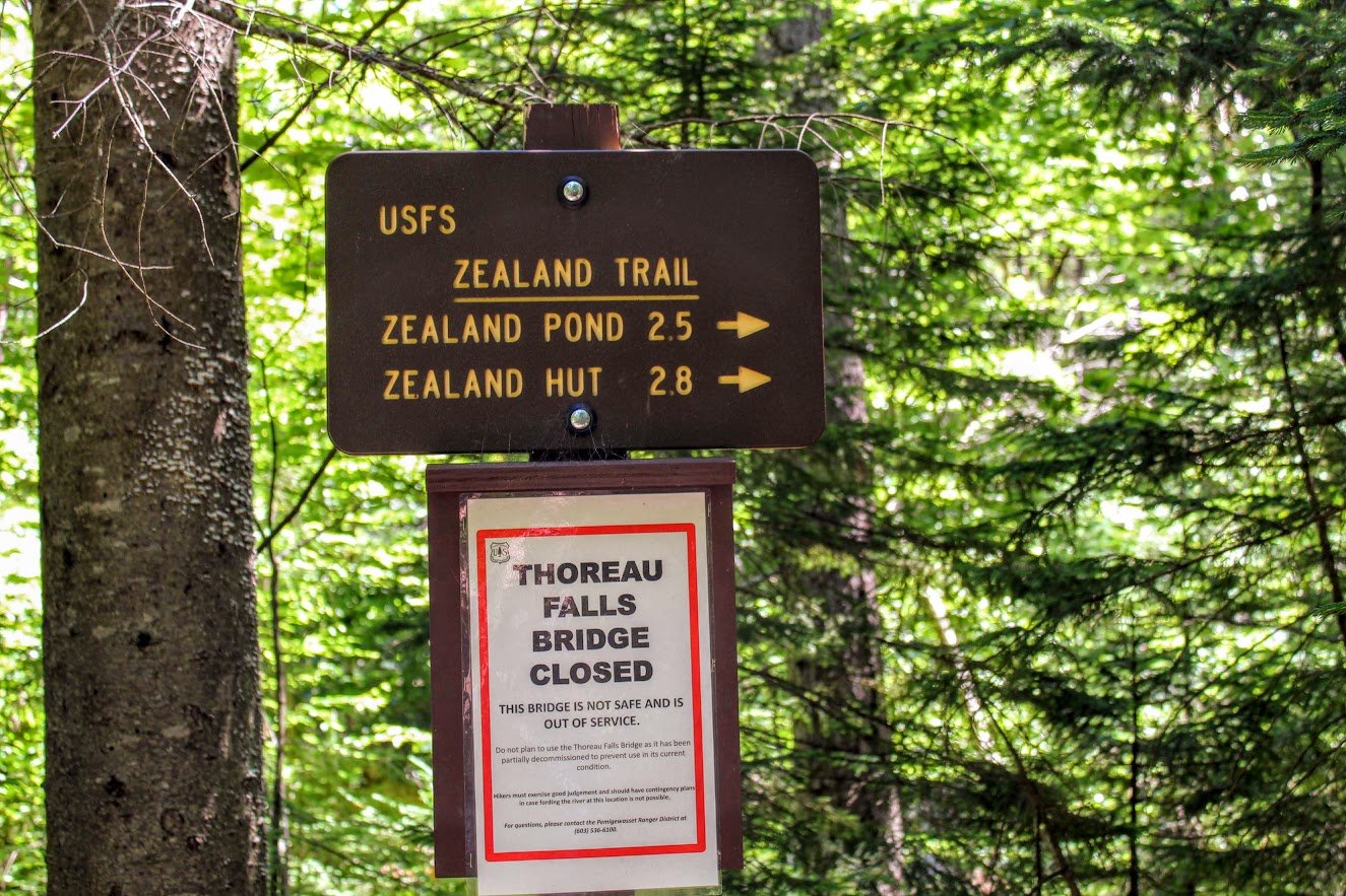
Where: Zealand Trail, Bethlehem, NH Distance: 8.2 miles (5-6 hours) Difficulty: Difficult Trail Type: Out and back Features: Wetlands, River, Brook, Pond, Waterfall, AMC Hut, Zeacliff Outlook, Mountain
How to get there:
Trailhead and parking area are located at the end of Zealand Road, Bethlehem, NH. That is what we put in the GPS. Zealand Road will be off Rt 302. Drive about 3.5 miles all way down the road until you see the parking area on the left. The parking lot is small but there is additional parking off to the right.
Hiking Tips
Be careful hiking on the rocks (may be wet)
Bring lots of water and lunch for the view at the top
The Hike
Hiking in New Hampshire is quite an experience. Every time I hike in or around the White Mountains, I never feel like I am in the northeast. The landscape is so unique and breathe taking. The views truly put you in a state of euphoria. I try to hike a few times a year in New Hampshire. One of best friends, Corey, has a place out there now, so that’s pretty convenient. On my last visit, Corey decided to lead a group of our friends on a day hike. Now, I’ve known Corey for almost 15 years. We have hiked all over together. I know when he says 3 miles it will NOT be 3 miles. While discussing our hike options, we decided for a longer hike in the 5-6 mile range. He mentioned reading about the Zealand Trail and how there are awesome views off cliffs right before Zealand Mountain. Although I was skeptical of his mileage number, I knew that Corey would lead us to some great views. Located in Bethlehem, NH, the hike follows the Zealand Trail to the Zealand Fall Hut, and eventually to the Zeacliffs overlook. From here, there are incredible views of Zealand Notch and the Pemigewasset Wilderness.


From the parked area, we saw the Zealand Falls Hut sign and began our way up the Zealand Trail using the blue-blazed trail. The trail starts off easy with good footing as it follows an old rail road bed. Soon after, we were thrown into the forest and the terrain became extremely rocky. Ah, those New Hampshire trails.
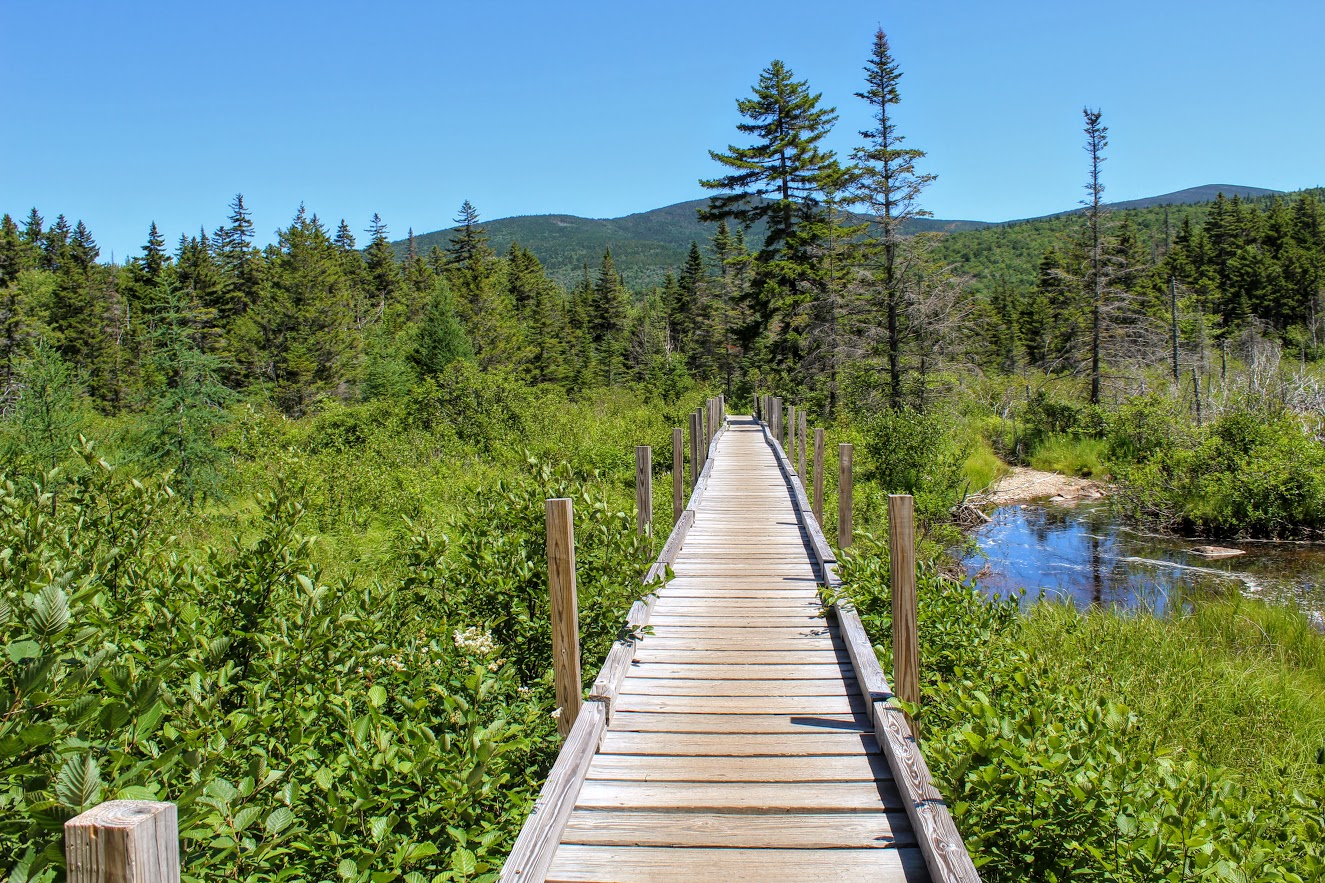
The first mile or so offers a few brooks and streams to cross leading up to the Zealand River. The trail is a gradual climb from the woods to a beaver pond and marsh area. This where we reached a sturdy wooded boardwalk (formerly known as the Z-bridge) crossing the wetland area.
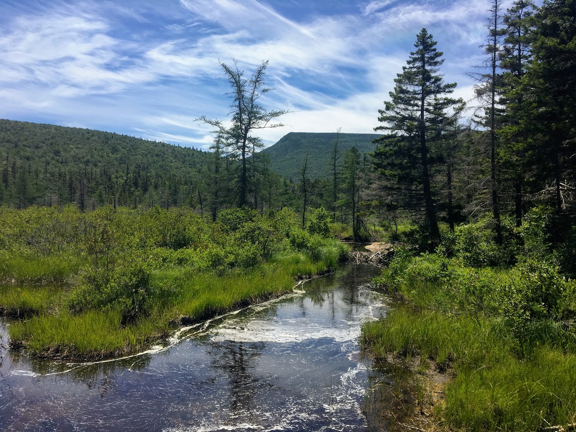
A half-mile after this section, the trail veers to the left; continuing on the Zealand Trail. The trail flattens out and we crossed another footbridge over Zealand Pond. After a few paces, the trail brought us to the shoreline of the pond at a small opening in the trees.

I lost my friends as I typically do to stop for pictures. I was marching along by myself and I saw a white creature appear from the grassy meadow. Of course, my only reaction was that’s definitely a dire wolf from Game of Thrones. Unfortunately, I was incorrect. Two big dogs were ahead of their group. I was like “Cool dogs” and they were “Hey, cool shirt. We love donuts.” This was the first hike I wore my Hiking for Donuts shirt and I got a lot of reactions to it. The shirt is a great conversation starter. Lots of fun banter. My friends actually had a pretty serious donut debate for 30 minutes at one point in the hike. If you see my shirt on the trails, say hello!

tell me you don’t think that’s ghost from Game of thrones at a quick glance!
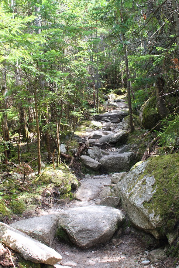
Hiking further just beyond this point, the Zealand Trail ends as it becomes the Twinway Trail (part of the Appalachian Trail). This was around 2.5 miles into the hike. And, now the really tough stuff begins. The ascent is real. The terrain will kick it up a notch. It was a pretty hot day and I haven’t hiked in this terrain in a while. I was struggling a bit. However, I like the challenge. And, I had goals of amazing views so I pushed ahead slow and steady. I could hear the falls. Five minutes later, I saw the sign for the Zealand Falls. This detour will be on your left and I highly suggest taking a view of the 25 foot falls. Given this was during the summer, the falls didn’t have much water but still impressive.
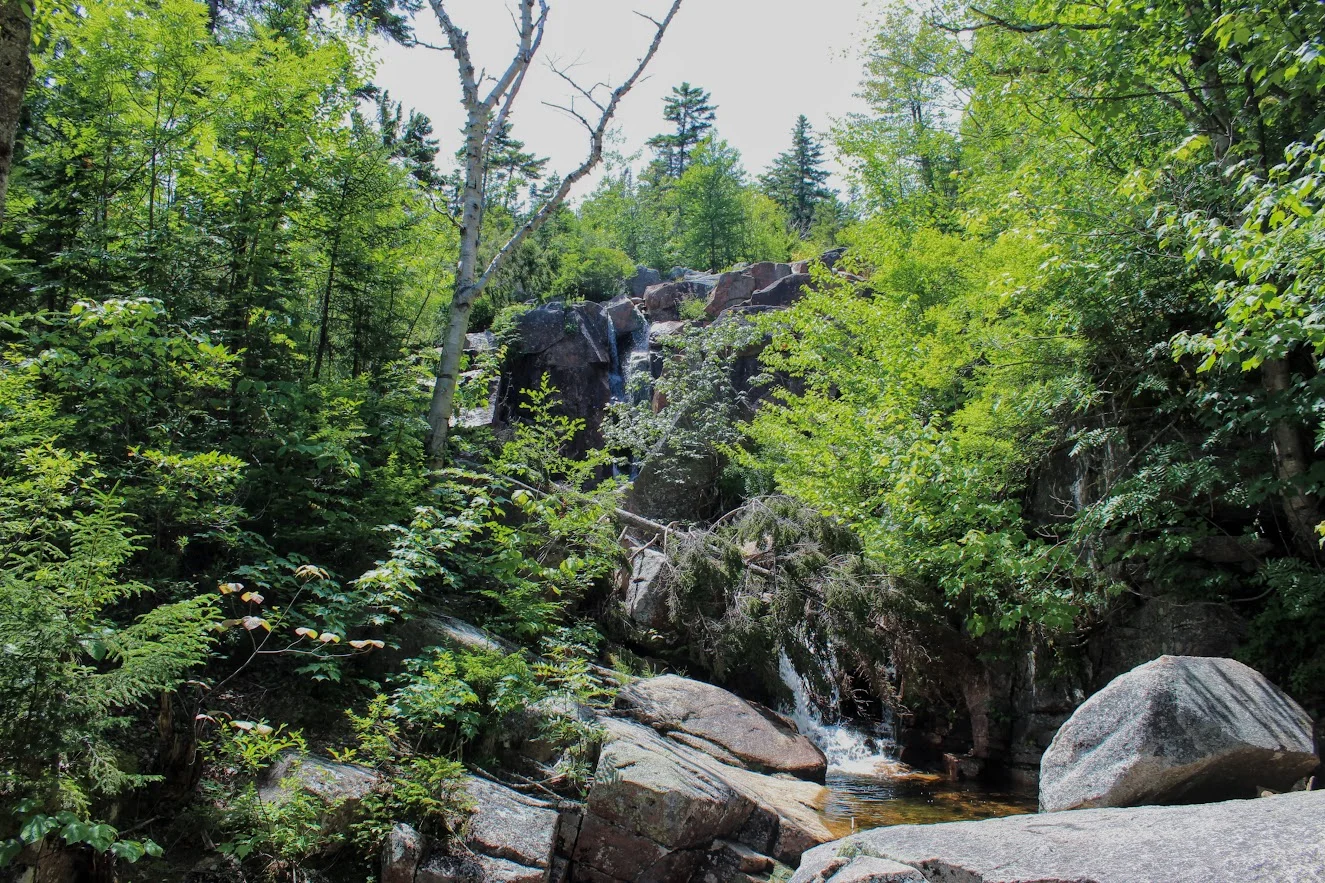
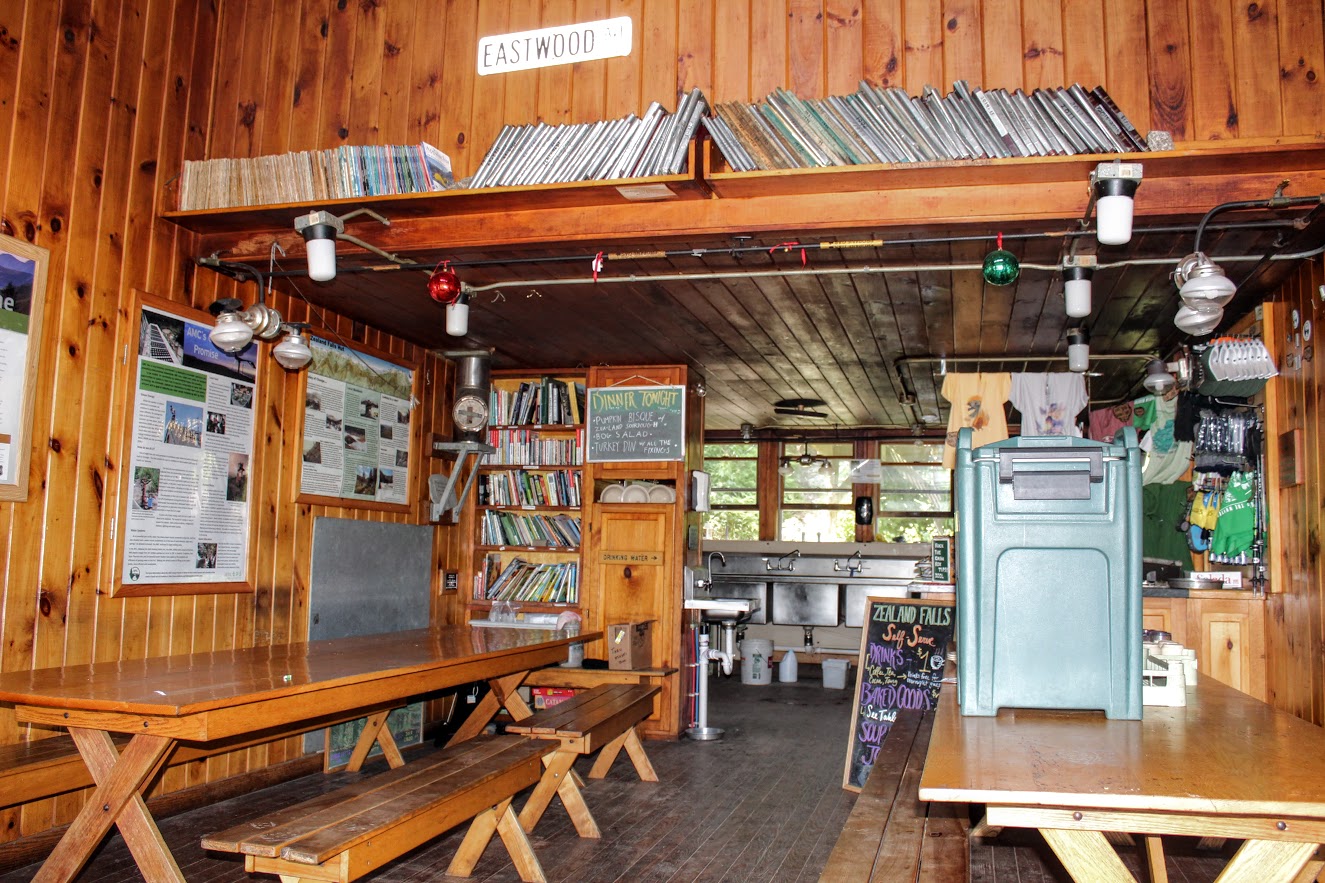
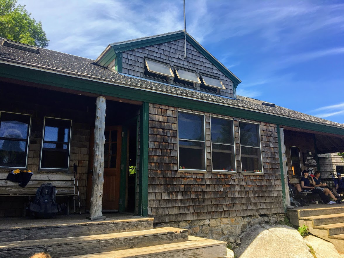
Not long after, I followed main path up the stone steps and caught up with my group at the hut. The hut is hidden by the woods. Once I reached the top, the hut just appeared. I can see my friends sitting on steps. I turned around and was welcomed with panoramic views. As with most AMC huts, this one is pretty cool. This hut sits hillside with a medium size stream bedside it that flows down to the falls. The inside is nice and can accommodate 36 people year round. This was a nice little break to enjoy the views from all angles.
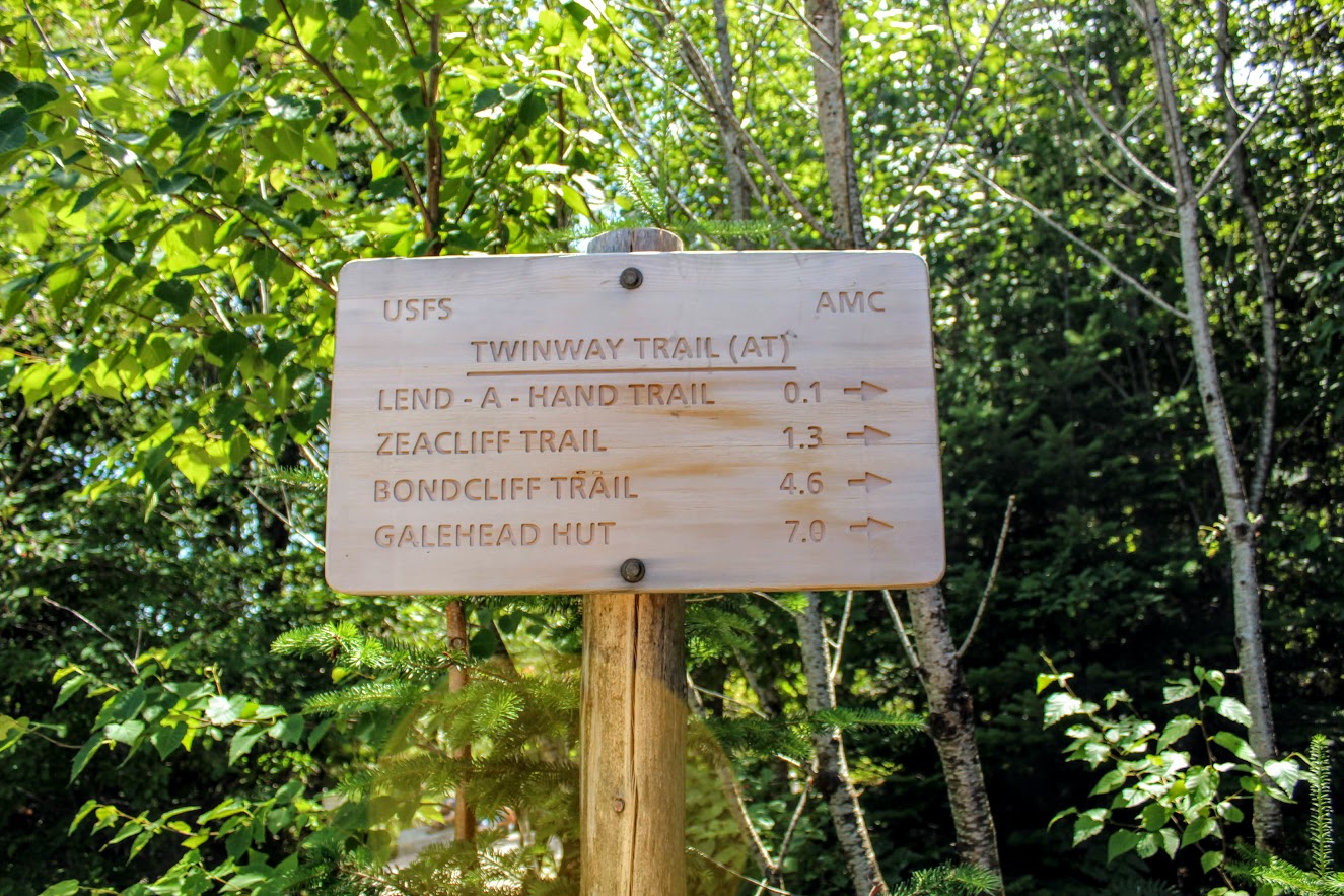
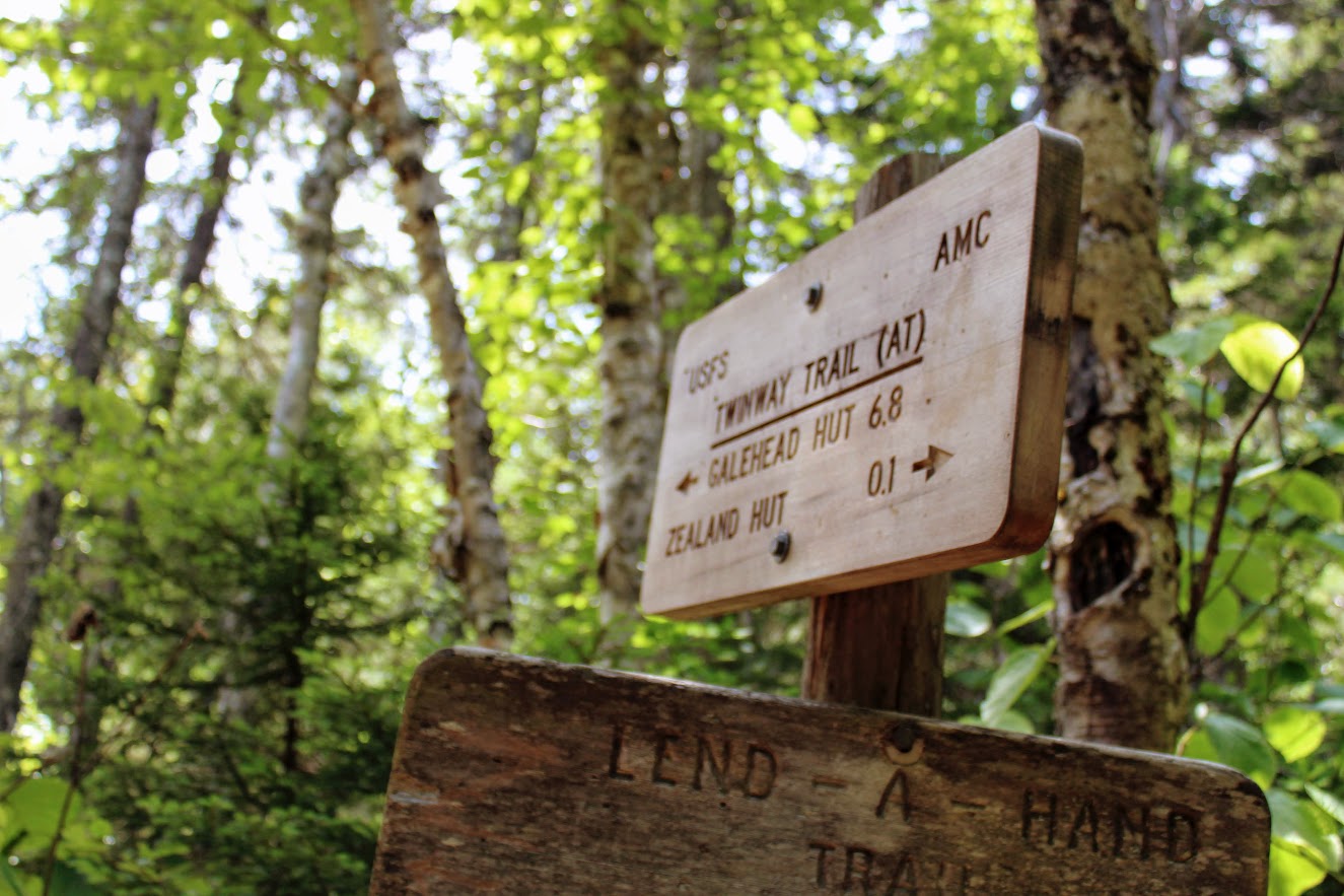
here is a sign by the stream that shows another 1.3 miles to the Zeacliffs. And, accordingly to my calculations, the hike will be 8.2 miles long. I was duped again by Corey. Heading away from the hut, turn left when arriving at the Lend-A-Hand Trail junction to stay on the Twinway Trail. The steep ascend continues from the Zealand Hut. We heard some odd noise ahead about 100 yards from the hut. We discovered the noise was from a water pump that drew water from the Whitewall Brook down to the hut.
As the 1.3 mileage got closer, we all were urgently asking, “Are we there yet?” Finally, the trail leveled off and we saw a small sign on the left labeled , “View”. We made it! And, boy was it completely worth it. The sweeping vista over the Pemigewasset Wilderness was spectacular. The area was pretty crowded but we waited out for the prime spot to take pictures and take a lunch break. I was truly in awe and the skies were clear as day.
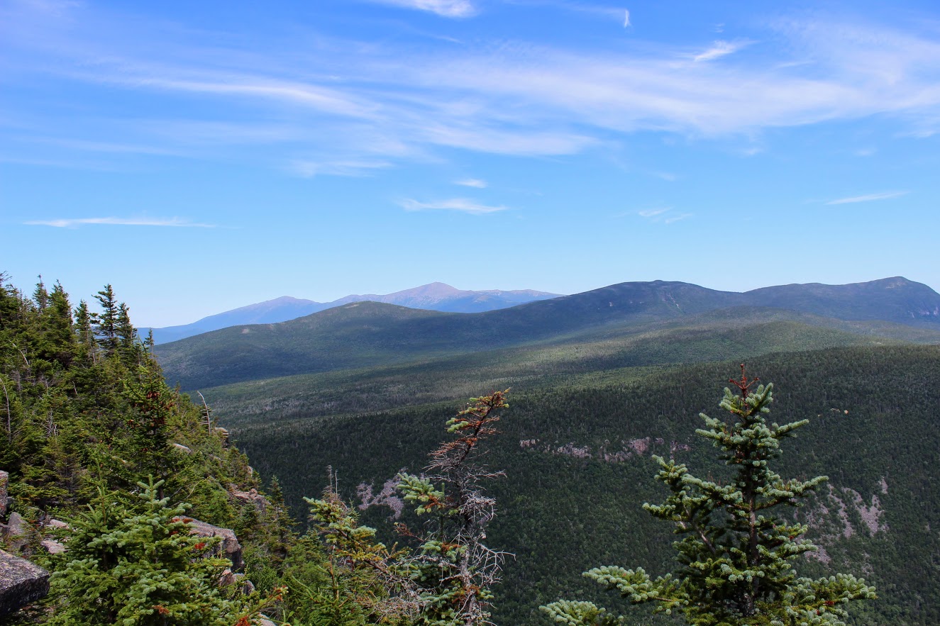

The Zeacliffs are the best views I have seen in the White Mountains to date. After soaking in all the views, it was time to go. We had another 4.1 miles to get back to the cars. If you wanted to reach the summit of Zealand Mountain, that would be another 1.6 miles from this spot. I read the views there are not as good but it would count towards the 48 4K footers. We were all ready to head back.

The descent on the way down was difficult until the path evened out. I took a tumble myself, fell right on my right buttocks, and my camera went flying. No one happened to catch that Kodak moment. Some rocks were very slippery. Always be cautious with a rocky environment. I would bring hiking poles for this hike and wear your best boots. And, keep a mental note of your surroundings. I was in the back of the group mostly on this hike by myself. A few times I came across some decisions that were questionable, but here I am writing this post today. Toward the very end, you will need to decide between two paths. I did not remember which one we took going up. Fortunately, they both take you to the parking lot.

The Zealand Trail to the Zeacliffs offers many types of scenery such as brooks, ponds, waterfalls, AMC hut, marshes, and some outstanding mountain views. Definitely one of my favorite New Hampshire hikes. The round trip took us about 6 hours. The trail was definitely crowded. But, the trails were wide enough where you wouldn’t be on top of other hikers. As I mentioned, this particular hike is 7.8 miles. Corey hoodwinked us yet again on the mileage but he did not disappoint with the hike. I would do it over again in a heartbeat. The challenging hikes stand out more and offer the best memories.

HIKING FOR DONUTS
A blog for the outdoors foodie enthusiast
Hi, I’m Mark. I live in Connecticut. I take new trips every chance I get. A good trip has a great hike, great food, and something fun to do. My goal is to search out new trips and share them to inspire others to try something new and exciting.
If you are looking for posts in a particular place, search by city or state here.
EXPLORE OTHER POSTS IN THE ARCHIVE
Archive
RECOMMENDED POSTS


MOST RECENT POSTS
See where I have been recently on Instagram. Follow @HIKINGFORDONUTS

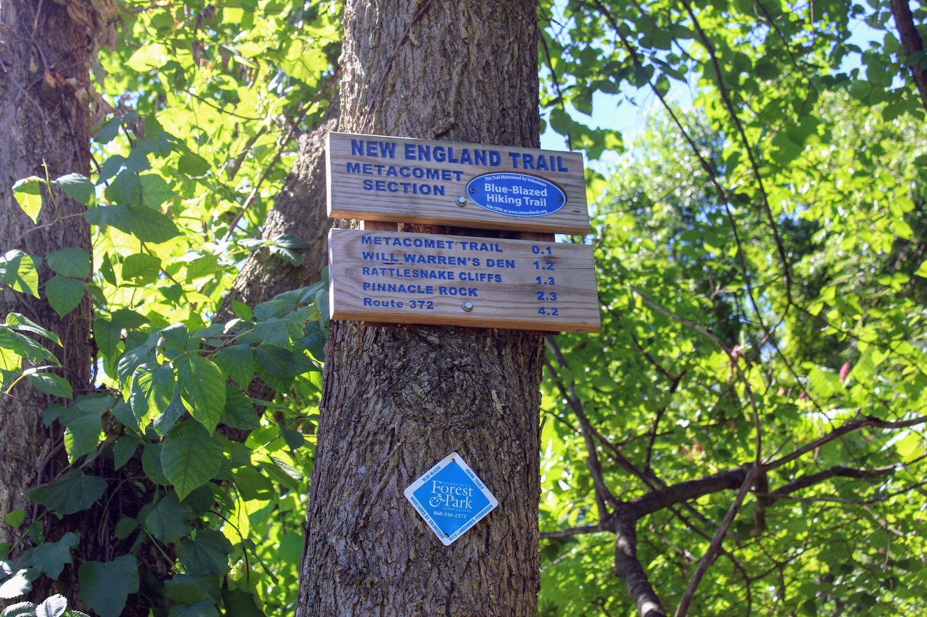
Rattlesnake Mountain to Pinnacle Rock via Metacomet Trail, Farmington, CT
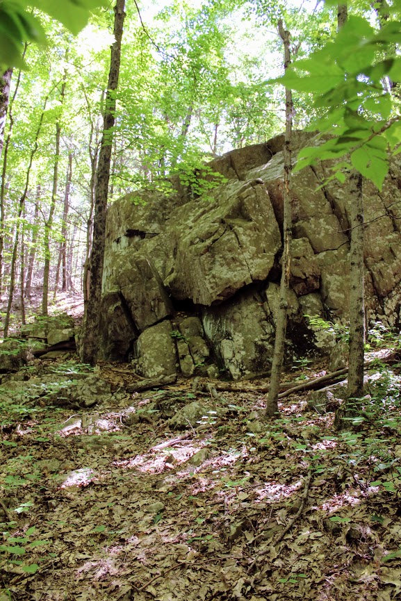
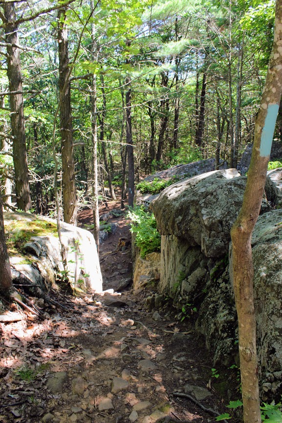
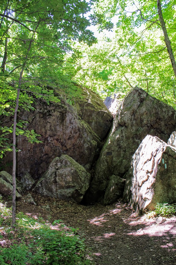
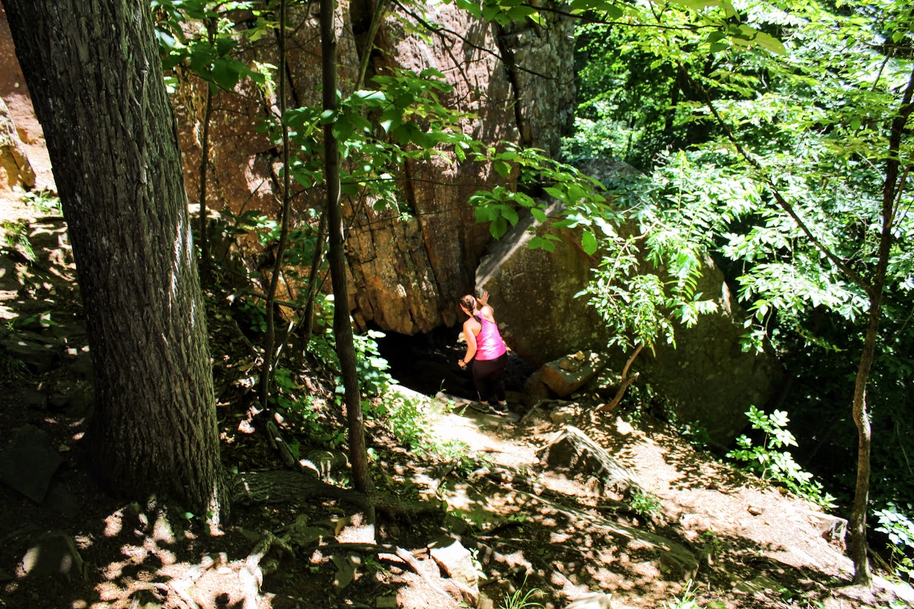
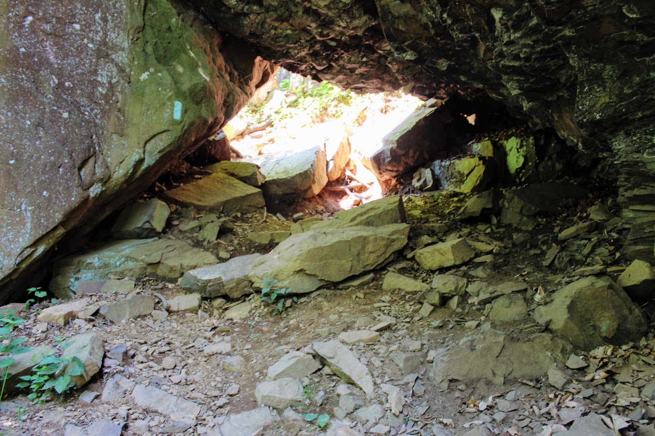
We headed on the trail to our left toward the Rattlesnake Cliffs. The trail starts out flat then begins to switchback up the side of the mountain. After a half mile in, the trail will ascend uphill and the terrain is rockier. We passed lots of large rock boulders as we got closer to the cliffs. This particular trail was very well-marked. We eventually came across the boulder rock cave known as Will Warren’s Den, which I later found out was a historical site.
Looking for a good hike in Connecticut? Well, I stumbled upon a hidden gem right under my nose. Rattlesnake Mountain to Pinnacle Rock trails are located in Farmington, CT and crosses over to Plainville, CT. This is part of the New England/Metacomet Trail. Finding the parking area can be tricky. There are 2 areas where you could start. Blue trail markers can be accessed from Pinnacle Street in Plainville. The GPS wasn’t picking this option up so my girlfriend and I chose to drive on RT 6 in Farmington. There is a small parking area on your right where the trail starts. If you GPS 200 Colt Hwy Farmington, CT 06032, that should find it.


Parking area off route 6.
From here, you can hike to the Rattlesnake Cliffs, which is a 2.6m out and back loop. Or you can continue to hike another 2 miles out and back to Pinnacle Rock. Thus, it will be 4.6m total for this hike.
HIKING FOR DONUTS
A blog for the outdoors foodie enthusiast
Hi, I’m Mark. I live in Connecticut. I take new trips every chance I get. A good trip has a great hike, great food, and something fun to do. My goal is to search new trips and share them to inspire others to try something new and exciting.
If you are looking for posts in a particular place, search by City or State here.
Explore other posts in the archive.
Archive
Start of trail
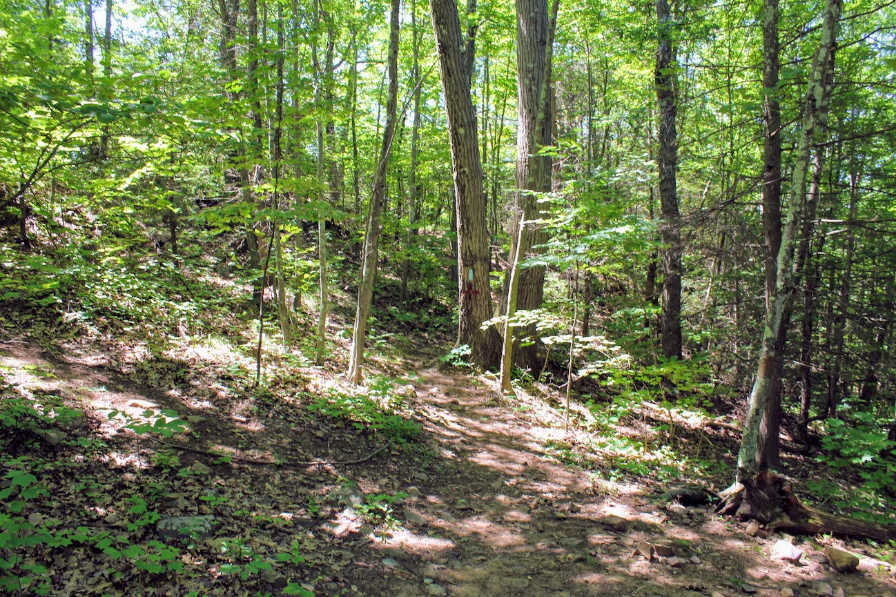
Once parked, we headed on the trail to our left toward the Rattlesnake Cliffs. The trail starts out flat then begins to switchback up the side of the mountain. After a half mile in, the trail will ascend uphill and the terrain is rockier. We passed lots of large rock boulders as we got closer to the cliffs. This particular trail was very well-marked. We eventually came across the boulder rock cave known as Will Warren’s Den, which I later found out was a historical site.
Not long after this, we reached the Rattlesnake Cliffs. Wow, what a spectacular view. I was absolutely stunned. On our left, we could see as far as the city of Hartford. And the sky was clear, so we could visibly see the biggest buildings in downtown Hartford. On our right, we could see the East and West Peak at Hubbard Park in Meriden and the Pinnacle Rock in Plainville. Great views all around. How did I not know this view existed? If this was all we did, I would have still ranked this hike very high on my list of CT hikes.

Views from Rattlesnake Cliffs.

hartford views to the left from the cliffs.

On your RIght from the cliffs.....

PANO VIEW FROM RATTLESNAKE MOUNTAIN CLIFFS.
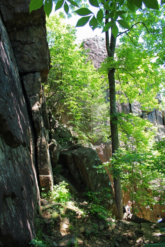
We hopped back on the blue trail down Pinnacle Rock and started making a steep descent. We witnessed other hikers take a wrong turn here by going straight down. We were able to stay on track. We continued hiking along the bottom of Rattlesnake Mountain and noticed a small tunnel formed by the rocks. We decided to climb through and found ourselves blue markers on the other side. Note, this is how you to get to Pinnacle Rock. There is a quite a bit of climbing on and over rocks for this section.
And, this trail is not as well-marked. There were areas we lost the blue markers. Sometimes the blue marker was faded on rocks and we didn’t notice until we got closer. If you do not come across blue after 5 min or so, I suggest turning around.

If you can't find blue markers, they may be on the rocks.
We reached the bottom and crossed an area under power lines that led us climbing up to the other side. We reached a dirt paved road and we saw a tree marked with blue and red. This took us to the final section before we reached Pinnacle Rock. You will be going uphill and start climbing the rock on your right to the peak of Pinnacle Rock.
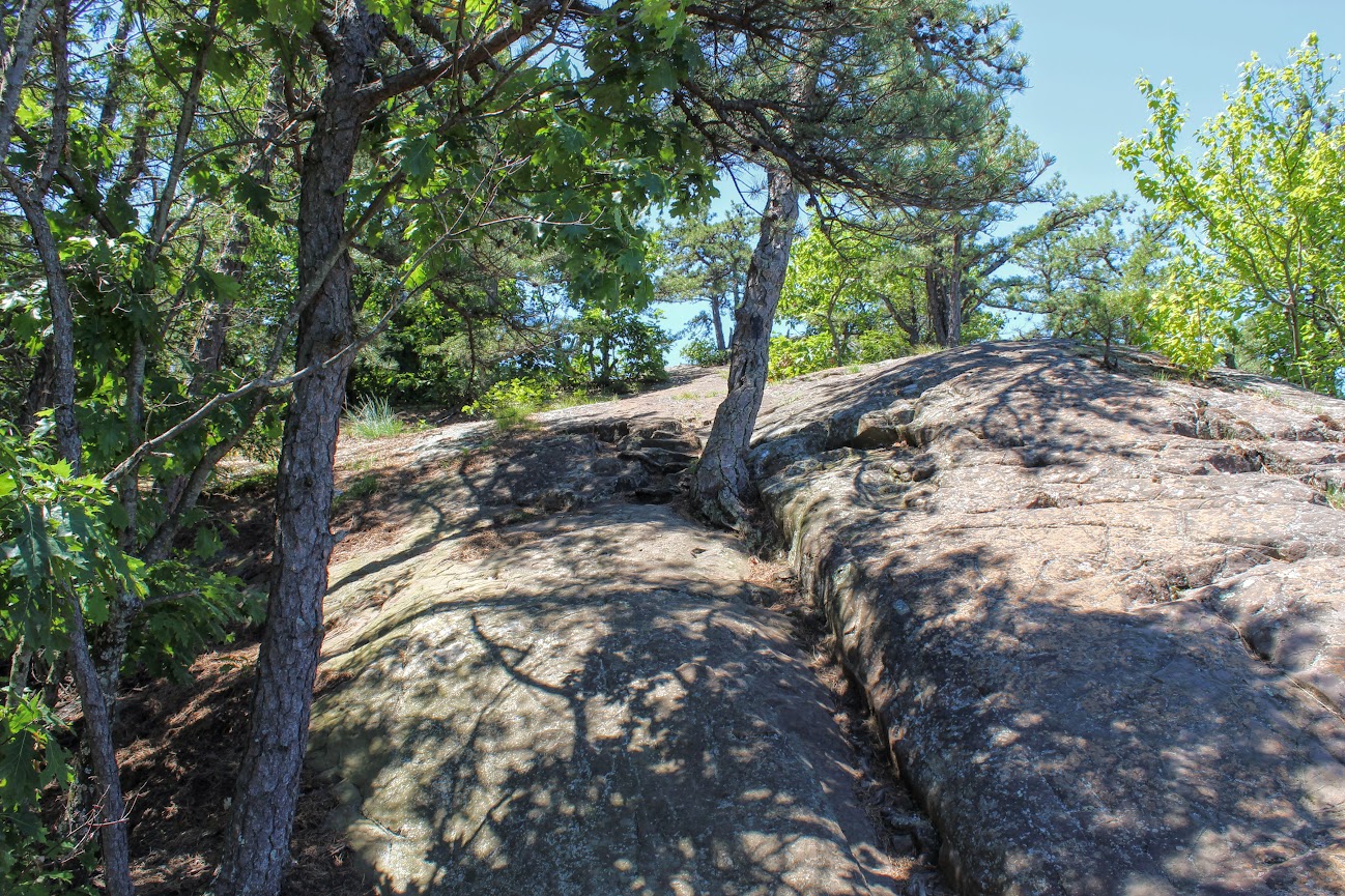
The view of Pinnacle Rock is nice. But Rattlesnake Mountain has a higher wow factor. The view from Pinnacle Rock is not as appealing as you will see mostly homes. This is a big rock climber’s paradise and I did see a few people doing so. I will hike all day. But climbing isn’t for me.
RECOMMENDED POSTS

RECENT POSTS
See where I’ve been recently on Instagram, follow @HIKINGFORDONUTS

Crazy guy climbing up pinnacle rock.

VIew from the pinnacle Rock summit.

Top of pinnacle Rock with railings and rock seating to enjoy the views.
We headed back the same way we came. Took another peek from the Rattlesnake Cliffs before we headed back to the car. Such a great view. That is one of best views in CT. I was very impressed by this hike. This is easily one of my favorites now. It is very challenging. I would say it’s a moderate hike. Lots of different terrain and some climbing. Round trip is 4.6 miles but I feel like it’s closer to 5 miles. Definitely suggest hiking boots and a pack for this one. This took us about 3 hours. This is one New Englanders should add to their hiking list!
The review:
Rattlesnake MT to Pinnancle rock (farmington, CT), ~4.6m: 4.5 out of 5.