


South Mountain Loop Trail in Berlin, CT: Reservoir Views and a Hidden Ridgeline
South Mountain Trail, Berlin CT: Complete Hiking Guide
Hike the South Mountain Loop from Chamberlain Highway in Berlin, Connecticut, for views of Merimere Reservoir, Mine Island, East Peak, and downtown Meriden.
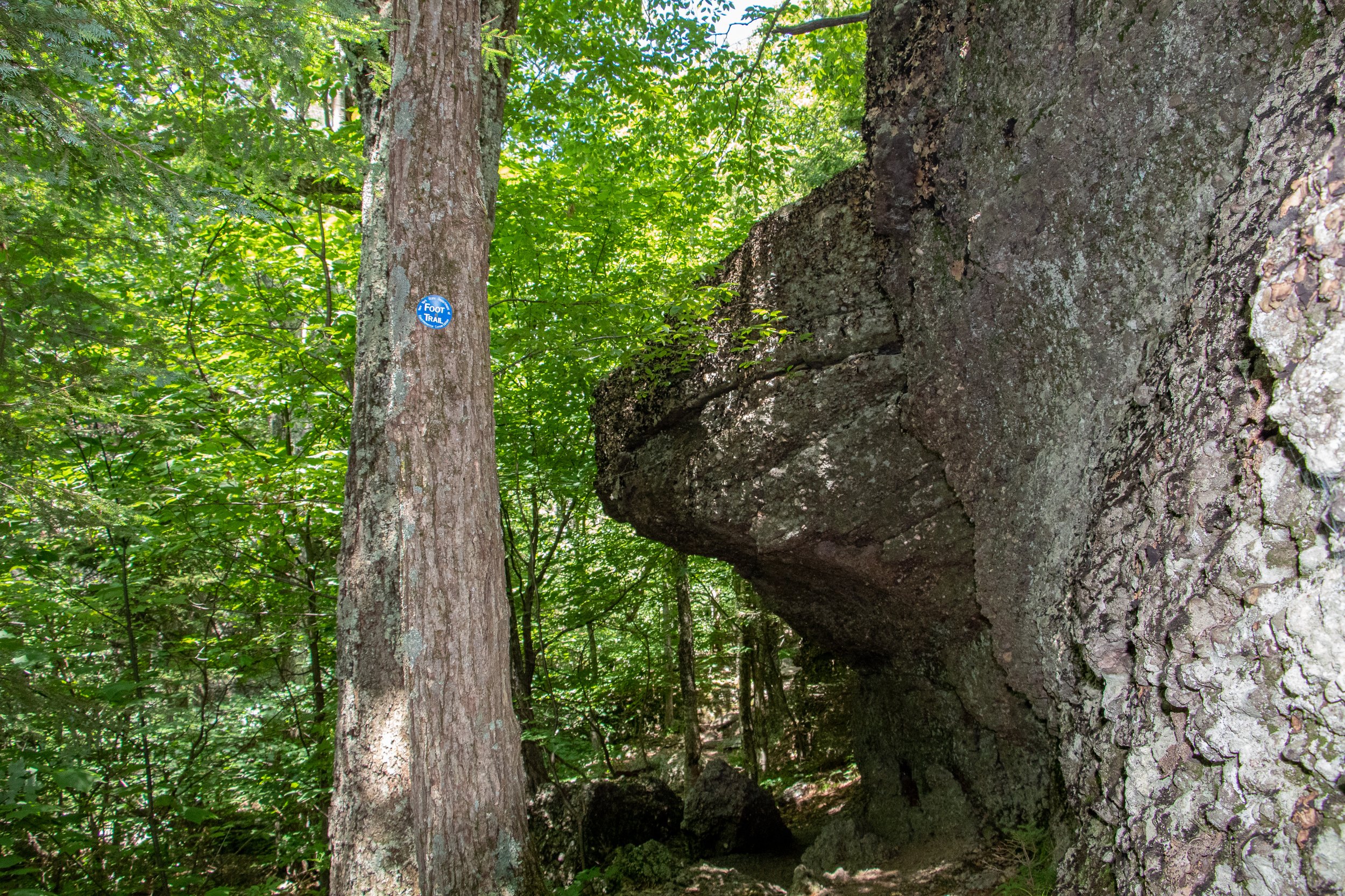
South Mountain is a hidden gem to me. I don’t see this mentioned too often online so exposing it I am conflicted. However, I also want my fellow hikers and followers to know this awesome hike resides in CT! With that said, hikers etiquette as always and leave not trace behind please. I would have never thought a hike like this existed off the side of a road. This trails begins aside Chamberlain Highway that initially feels more like a walk through the woods than a scenic mountain hike.
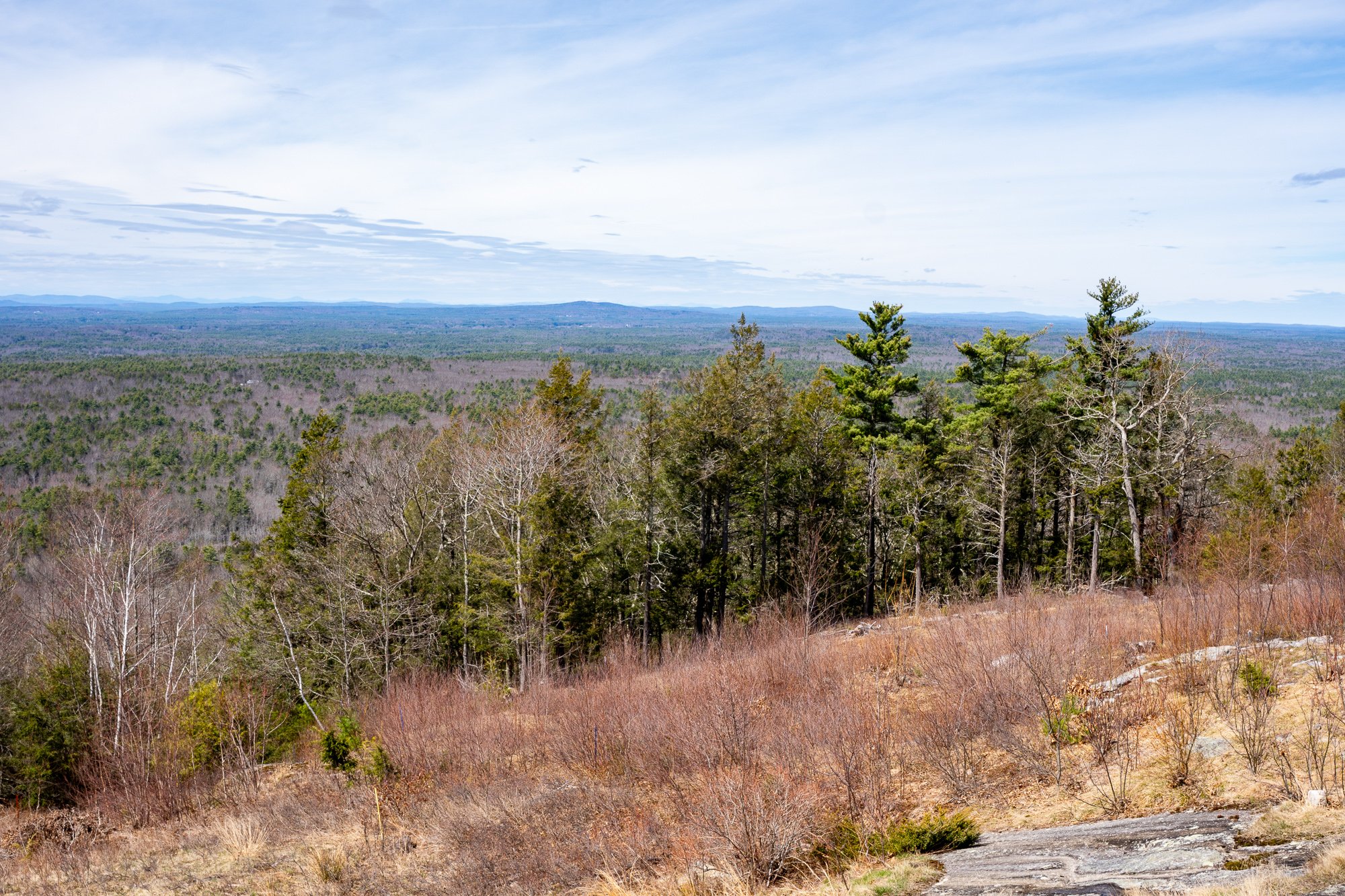
Once you reach the ridgeline, South Mountain delivers some seriously impressive views. The highlights include Merimere Reservoir, Mine Island, East Peak, Castle Craig, downtown Meriden, and the surrounding traprock hills.
This loop also feels much quieter than the more popular trails inside Hubbard Park. The parking area can be difficult to spot and parts of the route are poorly marked, but the views make the extra navigation effort worth it.
South Mountain connects with the blue-blazed Metacomet Trail, a 62-mile trail that follows Connecticut’s traprock ridges from the Hanging Hills north to the Massachusetts border. The Metacomet is also part of the larger New England National Scenic Trail.
Trail Description: The South Mountain Loop is a moderate hike that passes Elmere Reservoir before gradually climbing South Mountain. Several overlooks along the ridgeline provide views of Merimere Reservoir, Mine Island, East Peak, Castle Craig, downtown Meriden, and the commercial area near Interstate 691.
Trail Info:
Location: Berlin, CT (See link below)
Distance: Approximately 3.6 miles
Difficulty: Moderate
Trail Type: Loop
Highlights: Reservoir views, traprock cliffs, Mine Island, Castle Craig, and downtown Meriden
Dog Friendly: Yes
Best Season: Fall, Spring, Summer
How to get there:
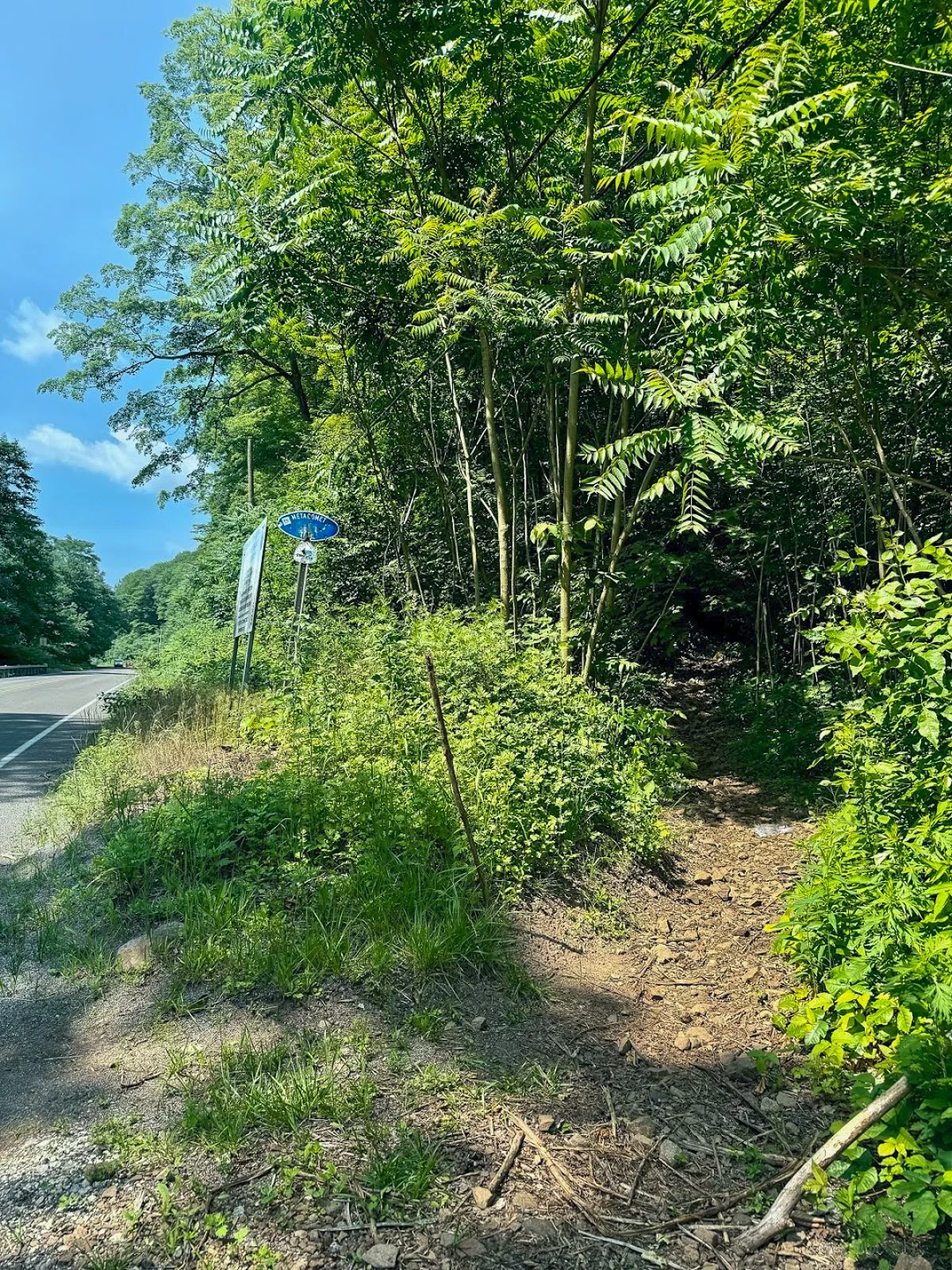
The trail begins where the blue-blazed Metacomet Trail crosses Chamberlain Highway, also known as Route 71, in Berlin.
Parking coordinates: 41.562803, -72.809665
This is not a traditional trailhead parking lot. There are only a few roadside spaces near the trail crossing, and the entrance can be easy to miss while driving along Route 71. Slow down as you approach and look for blue trail blazes on both sides of the road.
Do not block the roadway or park in the travel lane. When the closest spaces are occupied, additional roadside parking may be available a short distance south of the trail crossing.
Hiking Tips
Download park map, click here.
Parking is extremely limited, so an early start is a good idea on weekends.
Pay close attention at every major intersection. There are several unofficial or unblazed trails in the area, including routes toward Anderson Pond.
Nearby Things to Do:
Yellow Trail: Longer 1.8 Mile Hike (starts at the beginning of park road at the gate entrance)
Nearby Hikes: Litchfield County area has some great short hikes you could pair with this one.
Post Hike Brews: NorBrook Farm Local Brewery

Panoramic Views
Parking Information
Drive slow as approaching this area as the parking area is small and can be missed.
South Mountain Trailhead
The Hike
From Chamberlain Highway, enter the woods and begin following the blue blazes of the Metacomet Trail.
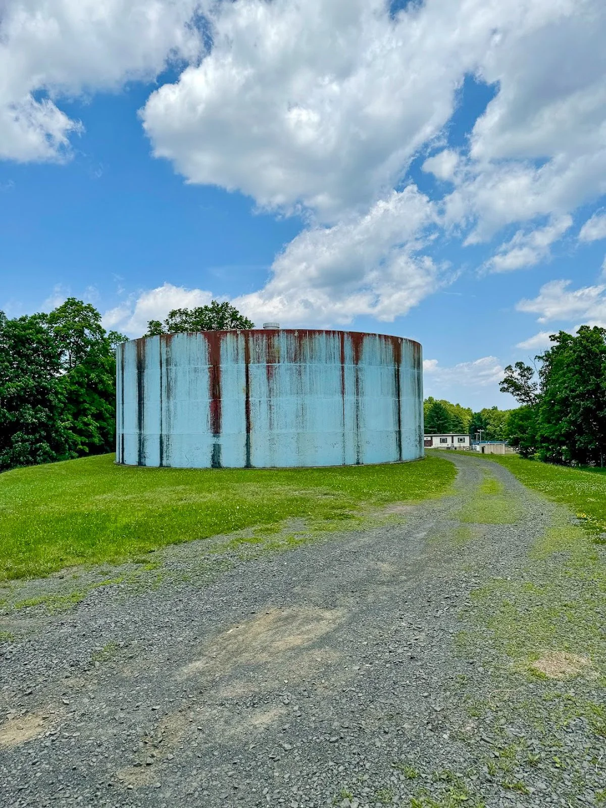
The opening section is relatively easy. You will soon pass a large water tank before arriving at Elmere Reservoir. It is not the dramatic mountain scenery you came for, but the reservoir provides a peaceful start to the hike.
Continue beyond the reservoir and climb a small embankment near several concrete blocks. You will reach an intersection with an unblazed woods road. One direction leads toward Anderson Pond, while the other will eventually become your return route from the South Mountain cliffs.
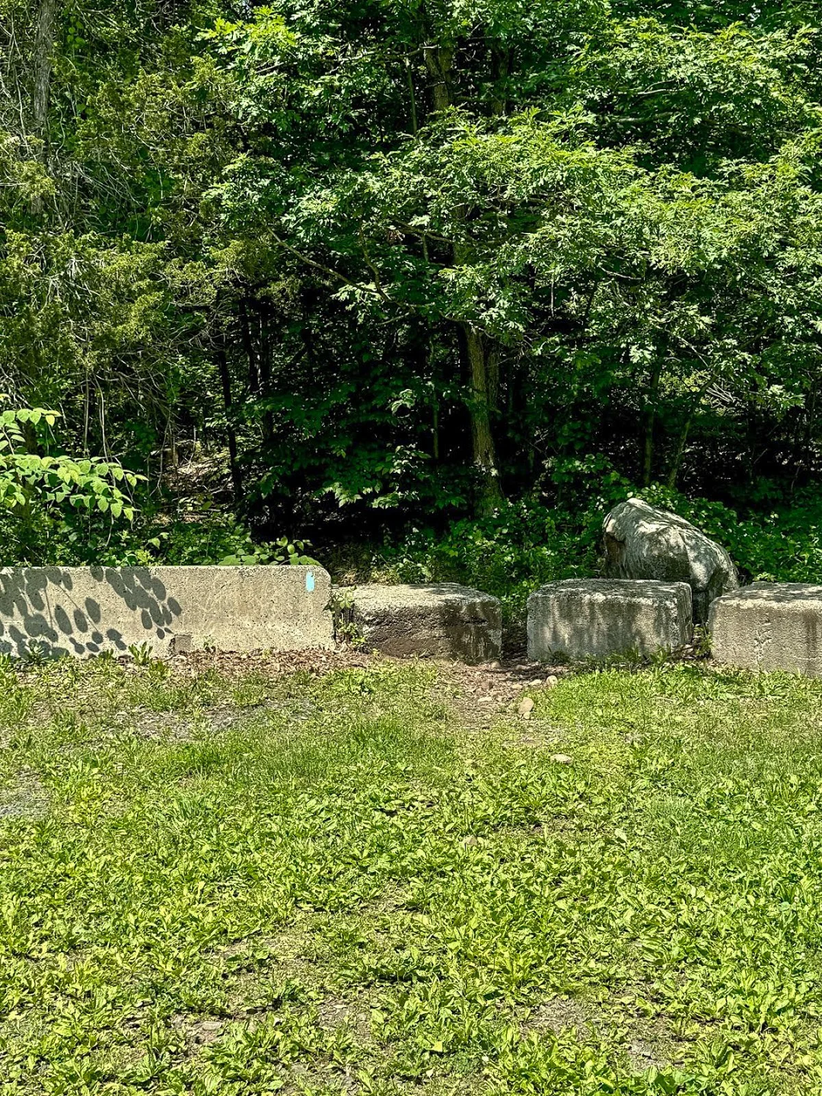
For this route, remain on the blue-blazed trail.
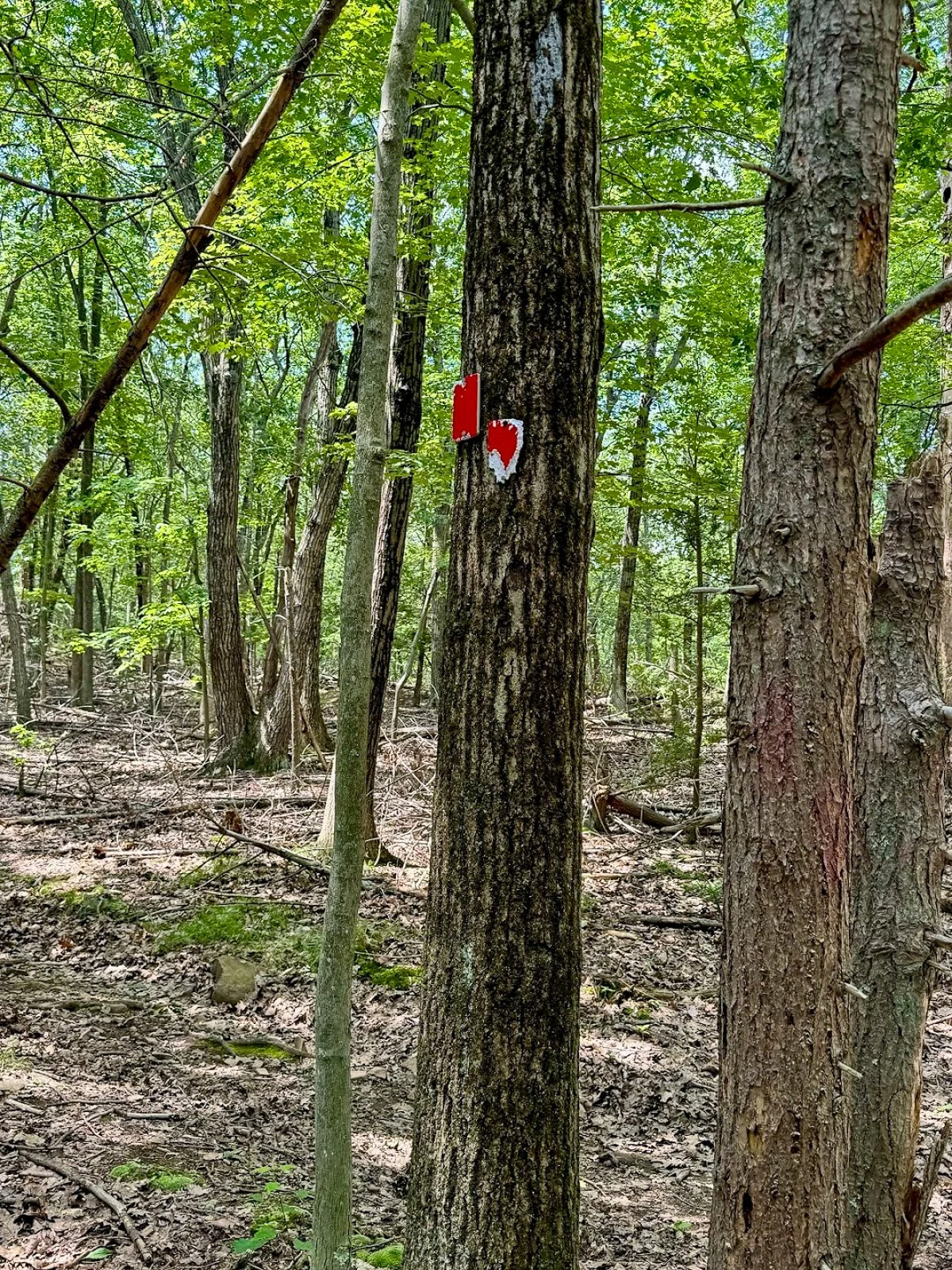
The trail may be rocky or wet through this section. Continue for a short distance until reaching another obvious intersection with a woods road on the left. Look carefully for faded or occasional red blazes.
Turn left here.
Climbing South Mountain
The red-blazed woods road begins a steady but manageable climb toward South Mountain. The incline is gradual rather than brutally steep, but it is enough to get the heart going.
The trail markings become less reliable as you gain elevation. Stay on the most established woods road and check your map whenever you reach a questionable intersection.
As you approach the top, watch for a poorly marked side trail on the right. This short path leads to one of the best viewpoints on the entire hike.
Merimere Reservoir Overlook
The first major overlook provides a gorgeous view across Merimere Reservoir.
Mine Island sits prominently in the water, with East Peak rising behind it. Castle Craig may also be visible along the ridgeline. This is the money-shot view of the hike and a great place to stop, catch your breath, and take a ridiculous number of pictures.
The open ridgeline provides a wide view across the reservoir and surrounding Hanging Hills. It feels like a much bigger mountain experience than you might expect from central Connecticut.
South Mountain rises to approximately 767 feet, while the reservoir and surrounding valleys sit several hundred feet below the cliffs.

Downtown Meriden Overlook
After taking in the reservoir views, return to the main loop trail and continue along the ridge.
The woods road dips and climbs gently before reaching another open viewpoint. This side of South Mountain provides a dramatic look toward downtown Meriden and the developed areas surrounding Hubbard Park.
The contrast is interesting. One minute you are looking across a quiet reservoir toward Castle Craig, and the next you are standing above the city.
Continue following the ridgeline through the open woods. Trail markings may still be inconsistent, but the main route is usually easy enough to identify.
Target View and the Return Route
As the trail curves around the mountain, you will reach the east-facing cliffs sometimes referred to as the Target View. The shopping area sits directly below, with Interstate 691 and several additional traprock ridges visible in the distance.
It may not be the classic wilderness view, but it shows just how suddenly South Mountain rises above the surrounding city.

Continue descending on the woods road. This portion completes the loop and eventually returns to the earlier intersection near Elmere Reservoir.
Once you reconnect with the blue-blazed Metacomet Trail, turn right and retrace the opening section of the hike. Pass Elmere Reservoir and the water tank before returning to Chamberlain Highway.
Nearby Things to Do
It would not be Hiking for Donuts without a post-hike treat. Swiches & Coffee Donuts is a good option in town. After this hike, me and my buddy went to the local brewery, Coles Road Brewing. Also, Kensington Pizza is a big spot locally. Downtown Berlin has been getting new restaurants so be sure to stop in town.
Neil’s Donuts in Wallingford is a solid option as well after exploring South Mountain. It is not too far away for some amazing donuts.
Other Connecticut Hikes Nearby
Looking for more scenic Connecticut hikes?
Follow Hiking For Donuts on Instagram for more New England hiking adventures.

HIKING FOR DONUTS
Hi, I’m Mark. I live in Connecticut. I take new trips every chance I get. A good trip has a great hike, great food, and something fun to do. My goal is to search out new trips and share them to inspire others to try something new and exciting.
If you are looking for posts in a particular place, search City or State here.
SEE OTHER POSTS IN ARCHIVE
Archive
RECOMMENDED POSTS


RECENT POSTS


See the latest on Instagram and follow @HIKINGFORDONUTS

Haystack Mountain Trail, Connecticut: Fire Tower Hike With Epic Views
Haystack Mountain State Park Trail Guide (Norfolk, CT)
Haystack Mountain State Park might be one of Connecticut's best "bang for your buck" hikes. Less than a mile round trip gets you to a stone fire tower with sweeping views across four states.
Haystack Mountain State Park in Norfolk, Connecticut is one of the best short hikes in New England. This quick out-and-back trail leads to a historic stone fire tower with sweeping 360-degree views into Connecticut, Massachusetts, New York, and Vermont.
At less than a mile round trip from the upper parking area, this is an excellent beginner-friendly hike with a huge scenic payoff. If you’re looking for an easy Connecticut hike with mountain views, this trail deserves a spot on your list.
Trail Description: Haystack Mountain Trail contains an impressive stone fire tower with stunning views of the mountains in Connecticut, Massachusetts, New York, and Vermont.
Trail Info:
Location: Norfolk, CT (See link below)
Distance: 0.8 mile (30-45 min) Round Trip
Difficulty: Moderate
Trail Type: Out and Back
Highlights: Views, Mountains, Valley, Fire Tower, Panoramic Views
Dog Friendly: Yes
How to get there:
Haystack Mountain State Park - On Rte. 272 Norfolk, CT 06058
Trailhead parking location here.
Easy to find off Route 272. The road goes halfway up Haystack Mountain to a parking lot, where the shortest trail starts. The parking lot can hold about 10 cars.
Hiking Tips
Download park map, click here.
Cell phone service is spotty. Hike carefully.
There can be seasonal closures of the park.
Nearby Things to Do:
Yellow Trail: Longer 1.8 Mile Hike (starts at the beginning of park road at the gate entrance)
Nearby Hikes: Litchfield County area has some great short hikes you could pair with this one.
Post Hike Brews: NorBrook Farm Local Brewery

Panoramic Views
Haystack Mountain Trail Guide
Haystack Mountain State Park in Norfolk, Connecticut is one of the best short hikes in New England.
At less than a mile round trip from the upper parking area, this is an excellent beginner-friendly hike with a huge scenic payoff. If you’re looking for an easy Connecticut hike with mountain views, this trail deserves a spot on your list.
This guide will be for the shortest trail route at 0.8 miles from the top parking lot of Haystack Mountain. These days my time is a bit limited and the best bang for your buck is what is more appealing. If you want to make it a longer hike, there is the Yellow Trail that starts near the beginning of park road at the gate entrance. This will be 1.8 miles, out and back. Both of these options will be great hikes to get to the main attraction, the amazing tower views.
Trail Overview

Haystack Mountain Trailhead
Parking Information
Once you have parked at the top parking, which is about a mile once you enter the park, the trail is to the left to begin the summit.

Haystack Mountain Trail
The Hike to the Fire Tower
This trail is fairly straightforward. It is well-maintained and clearly marked. The first 0.2 miles are flat and easy breezy. The next 0.2 miles will get your heart pumping as the trail bends to the left and starts a quick incline with 200 feet of elevation. Those quads might be on fire but it is all worth it once you see the bad ass tower at the top.
Check out my Instagram reel for a video walkthrough of the Haystack Mountain Trail and the fire tower views here.

Haystack Mountain Trail Incline
Now, it’s time to climb the 34 foot stone tower up to the top for the 360 views at 1,683 feet of elevation.
Tower Views and What You’ll See

Haystack Mountain Fire Tower
Definitely some of the best views you will have in Connecticut. It was a bit overcast and cloudy for me, but still impressive views nonetheless. On a clear day, there is visibility of the Riga Plateau in Northwest Connecticut, the Berkshires in Massachusetts, the Catskills in New York, and the Green Mountains of Vermont. That is quite a combination of views.

View at the Top

Haystack Mountain Trail Views
Nearby Breweries and Things to Do
This would be great to pair with some other short hikes in the Litchfield County area. In addition, there are great local breweries as well such as NorBrook Farm for post hike brews.
Things to Do Nearby:
Yellow Trail: Longer 1.8 Mile Hike (starts at the beginning of park road at the gate entrance)
Nearby Hikes: Litchfield County area has some great short hikes you could pair with this one.
Post Hike Brews: NorBrook Farm Local Brewery
Other Connecticut Hikes Nearby
Looking for more scenic Connecticut hikes? Check out these links to other trail guides for hikes in Litchfield County:
Follow Hiking For Donuts on Instagram for more New England hiking adventures.
HIKING FOR DONUTS
Hi, I’m Mark. I live in Connecticut. I take new trips every chance I get. A good trip has a great hike, great food, and something fun to do. My goal is to search out new trips and share them to inspire others to try something new and exciting.
If you are looking for posts in a particular place, search City or State here.
SEE OTHER POSTS IN ARCHIVE
Archive
RECOMMENDED POSTS
RECENT POSTS
See the latest on Instagram and follow @HIKINGFORDONUTS

Hiking Mount Agamenticus, York, Maine
Trail Description: The Mount Agamenticus Conservation Region is located in Southern Maine. The Mount Agamenticus Loop is a popular trail that provides 360 degree views at the summit of the surrounding mountains in the distance.
Trail Info:
Where: York, ME Distance: 1.8m (1 hour) Difficulty: Easy toModerate Trail Type: Loop Features: Views, Mountains, Valley
How to get there:
Typing the location “Mount Agamenticus Trailhead” into Google Maps will take you to the parking lot. You can’t miss it. There is a lot of parking. It’s $2/hr to park and there is a barcode to scan for the app to use to pay. It was easy peasy in my opinion. And, worth the money based on how well they keep up with everything.
Coordinates: 43.21720438450835, -70.69198787482621
Link to google maps location here.
Hiking Tips
I suggest caution if it rained days prior. The trails in the forest are mostly roots and rock. Dry it’s no biggie but wet I don’t think it would be as enjoyable.
Download a copy of the trail map here.
There are multiple trail options. This guide is for the loop via Blueberry Bluff, Witch Hazel, and Ring Trail. The Big A trail has separate parking and is a 1 mile loop that’s mostly gravel & an easier option (stroller and wheelchair friendly).
The trail and parking lots are well maintained and great facilities. Nicest outhouse bathrooms I ever been in!

The Hike
Once parked at the Mountain Road parking lot, the beginning of the trail head is visible with markers at end of the parking lot.

There will be trail signs promptly upon starting the hike at a fork. Stay right and hop on the Ring Trail, which is the white marked trail.

As stated prior, the trail is very well marked. However, the trail is mostly rocks and roots. I saw some reviews mentioning that it was muddy and unpleasant after a rainstorm. And, I totally understand what they meant. The rocks and roots could be slippery. For us, it was dry and there were no issues.

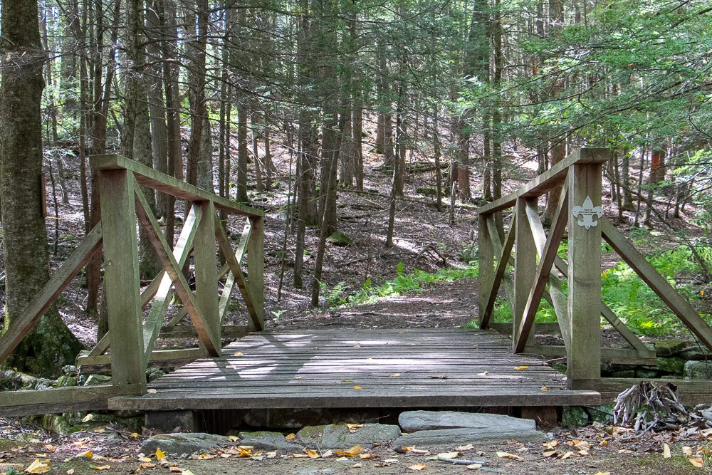
There isn’t much of an elevation gain, only about 340 feet. But there is a small incline as you make your way to the top. Hiking along the Ring Trail, at almost 0.7m, there will be a small foot bridge with a path to the left at the end. This is the Witch Hazel trail. I did not see signs but based on the trail map, this was the way to go.

The Witch Hazel trail is brief. Only a few minutes to reach the Big A Trail. There will also be a small foot bridge.

And following the Big A trail at the top is where the first lookout platform is to take in all the views.

There is another lookout platform with stairs where you can see even higher out into the valley. There is also a fire tower, but it is fenced out and cannot be climbed.


Follow the Big A Trail out until it connects to the Blueberry Bluff, which is marked red. There is also an additional viewpoint here before the Blueberry Bluff.

Continue down the Blueberry Bluff back to the Ring Trail. Take a left at the sign back to the parking lot. You will cross the road at the end to get back to your car.

Southern Maine is tracking to be one of our favorite areas to visit and this was a great first hike in the area. Good hike to get the heart going and see some cool views. The platforms are a cool feature for viewing on the summit. And, the trails and parking lots are so well maintained. I cannot speak highly enough on that. I was not able to find a great guide with details for this hike so I am hopeful this will be helpful for others. It’s also good to see directions/steps before you go to get comfortability. Not a hard hike to follow but I understand where folks can get tripped up. I still do it many times. Luckily, my wife is always the voice of direction.
POST HIKE ACTIVITIES: The fun doesn’t have to stop here. Lots to do in the area. We stopped by the 90s themed brewery, Odd by Nature Brewing, for some post hike beers and nosh, which is about 8 minutes from the trailhead. And, the Nubble Lighthouse is roughly 15 minutes or so away. Definitely a trip to view. Cape Neddick is really cool. Many restaurants in the area as well. No matter what you decide to do, there is a lot to plan for a great weekend or day trip.

HIKING FOR DONUTS
Hi, I’m Mark. I live in Connecticut. I take new trips every chance I get. A good trip has a great hike, great food, and something fun to do. My goal is to search out new trips and share them to inspire others to try something new and exciting.
If you are looking for posts in a particular place, search City or State here.
SEE OTHER POSTS IN ARCHIVE
Archive
RECOMMENDED POSTS


RECENT POSTS
See the latest on Instagram and follow @HIKINGFORDONUTS

North-South Lake, North Point, The Catskills, NY
Trail Description: This great day hike in the Catskills at North-South Lake utilizing multiple trails offers stunning views such as Artists Rock, Sunset Rock, Newmans Ledge, and North Point. Also, some popular features such as Ashley Falls, Badmans Cave, and more.
Trail Info:
Where: Haines Falls, NY Distance: 7.0m (4-5 hours) Difficulty: Difficult Trail Type: Loop Features: Views, Mountains, Valley, Lake, Water, Cave, Catksills, Hudson Valley
How to get there:
93 North Lake Road, Haines Falls, NY 12436
https://goo.gl/maps/9rUFAjK3PieRJY7U9
Put the address above in your GPS. You will need to drive through the state park to find the trail. As you get closer, you will pass Scutt Road on the right, then go past the guardhouse. Turn right onto the first fork around the lakes heading south. Follow this road passing a big parking lot on the left until you reach another big parking lot at a dead end, past the pavilions. Park in this area and the trail will start in the back corner.
Hiking Tips
Not great phone service, so make sure to screenshot a map. Or my guide!
Lots of signage throughout trail, but keep an eye on the trail markers.
The Hike
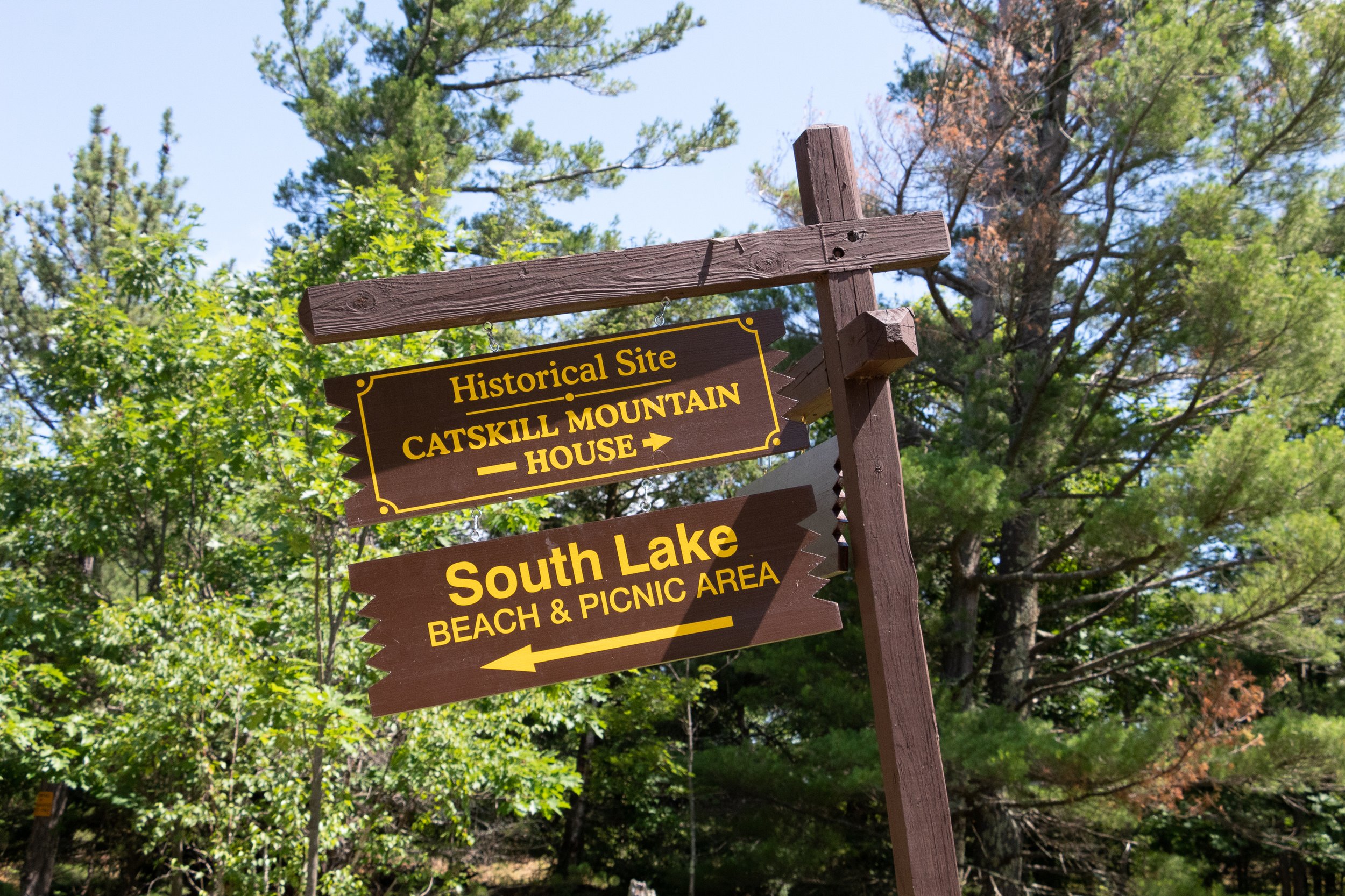
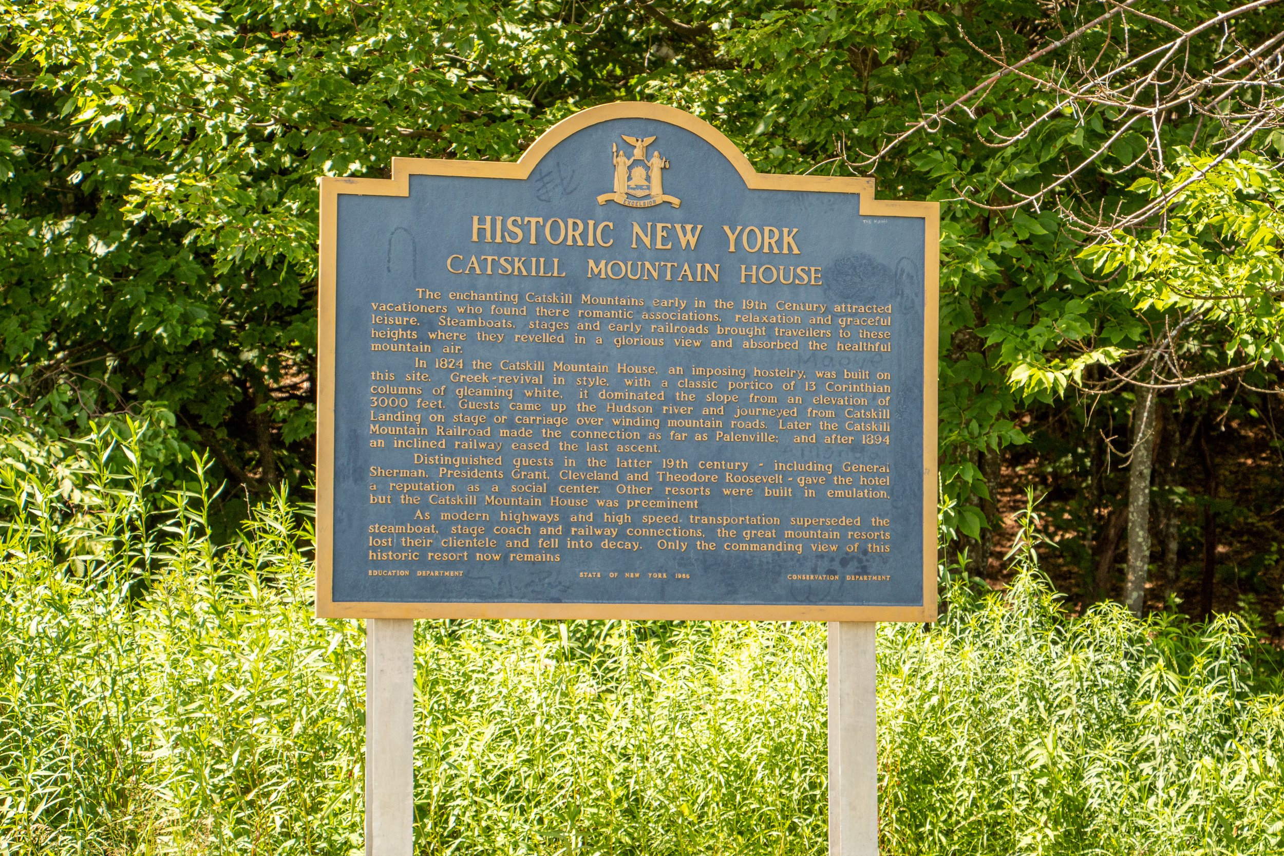
This is a long one folks. Make sure you have all the snacks and hydration necessary on this hike. Once you are ready to go, head to the back right corner of the parking lot for the start of the trail, away from the picnic pavilion and lake area. There will be a gate with a stop sign. Go around the gate and start your trek on the yellow trail toward the old Catskill Mountain House, the first of many sites and views on this hike.


There will be a junction with the blue trail. Continue to walk straight across the field at the area of the old Catskill Mountain House. Off the ledge of the field will be the first view of the hike overlooking the Hudson Valley.
Turn around and head back toward the junction across the field. Stick to the right and continue following the blue trail until you see the North Lake signage. Past the guardrail with a stop sign, cross another parking lot to re-enter the woods & head straight across to find the blue trail. I did not see a sign (could have missed it) but just keep an eye for the blue markers.
Pass the picnic tables and this will lead to walking along a chain link fence to the right. At the end of the fence, there is a view off a porch ledge. Keeping straight on blue, the next item to pass is a registration box.


From here, the hike will begin to have an incline. In about 10 minutes will be the first viewpoint, Artist’s Rock. The first of many views on this hike.
Continue on the blue trail as the trail gets steeper toward the next viewpoint, Sunset Rock. There will be a set of cliffs above on the right. Sunset Rock viewpoint sits above these cliffs. The trail will eventually get you there. There will be a sign to hop on the yellow trail for Sunset Rock in 0.2 miles.

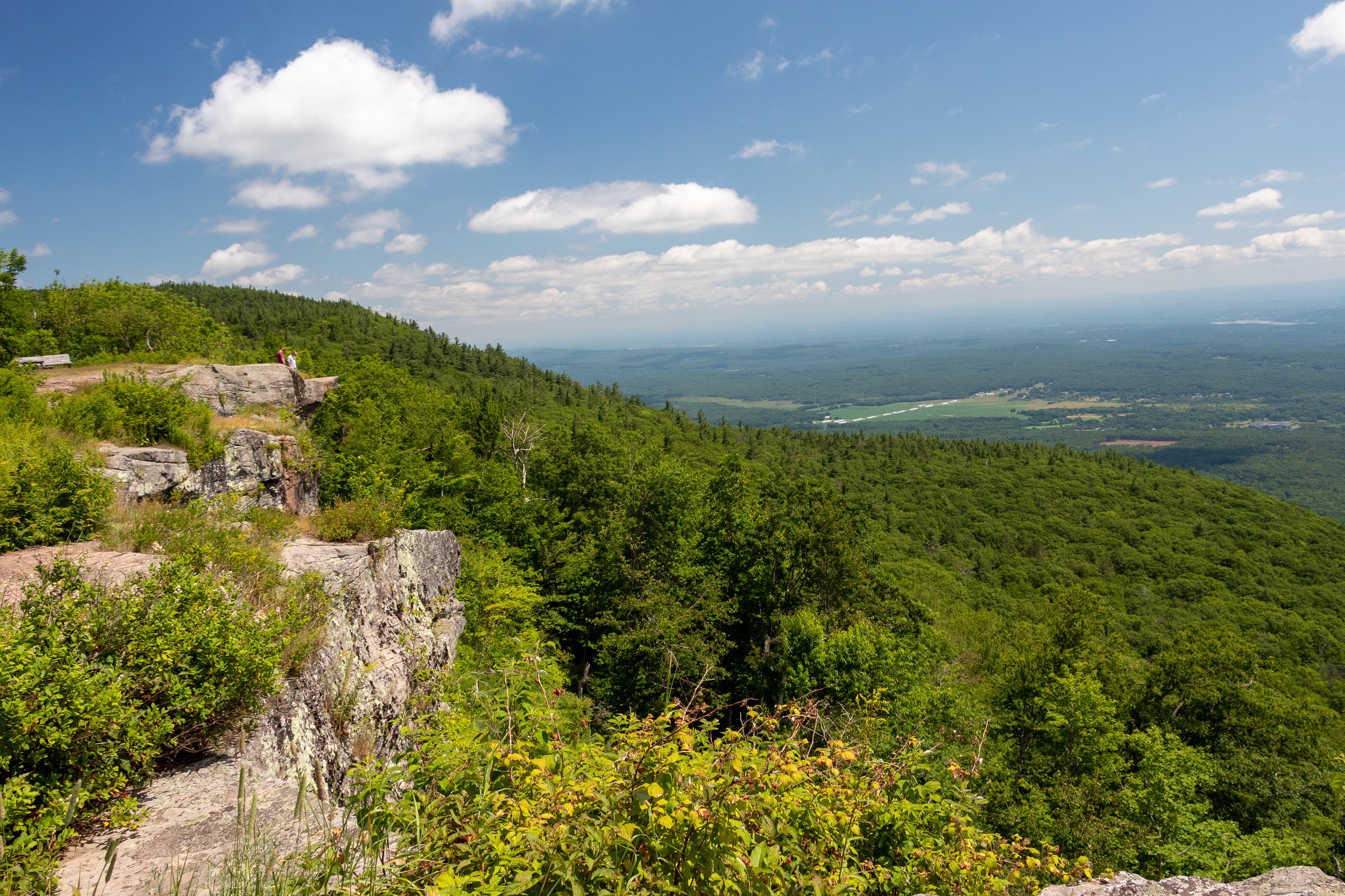
Keep a lookout for the markers, then turn right onto the yellow trail. The views will just open up and another incredible view will be had. But this isn’t Sunset Rock quite yet. Keep along the yellow trail and in a few minutes there will be a big rock to the right. I was actually too enamored with the view, I did not take a picture of the rock! But it will be pretty obvious & there is a sign. This area will have the best views of the hike. There will be views of North-South Lake with the Catskills in the background. Pretty jaw dropping in my opinion.
From here, retrace your steps from the yellow trail back to the blue trail. Turn right at the blue/yellow junction to rejoin the blue trail. There will be signage for Newman’s Ledge, 0.2 miles away, and North Point, 1.6 miles away. The trail will get steeper but in minutes you will reach more awesome views off of Newman’s Ledge.
In about 0.6 miles the next point of interest is Badman's Cave following the blue trail.
Continue on the blue trail as it becomes steep then levels out in an open area before re-entering the woods. In 0.6 miles there will be a junction with the red marked Mary Glen’s Trail. The red trail will need to be used but for now continue on the blue trail toward North Point. There will be a sign showing only 0.3 miles to North Point. The ascend for the next 0.3 miles is one of toughest in the hike. There will be a sign for North Point. The views will be beautiful as the Catskills will be right in your sight.
After you soak in the last of the amazing views, begin to head back toward the junction with the red trail. Take a right to hop on the red trail. This will be a rocky, steady decline as you eventually reach the sign for the North Lake Campsite, which will be another 0.6 miles. This will lead around the lakes onto the paved roads of the campsite. Continue to follow the red trail as you cross a footbridge over a stream. There will be a sign for Ashley Falls off the yellow trail if you wanted to take a look, it was very short but no waterfalls on this hot day in the middle of the summer.


Continue on the red and take a left on the road by the campsites. Then it will be almost a mile until you get back to the parking lot. At least it is a flat surface to end! Whew, what a hike. Tough but so many views.


HIKING FOR DONUTS
Hi, I’m Mark. I live in Connecticut. I take new trips every chance I get. A good trip has a great hike, great food, and something fun to do. My goal is to search out new trips and share them to inspire others to try something new and exciting.
If you are looking for posts in a particular place, search City or State here.
SEE OTHER POSTS IN ARCHIVE
Archive
RECOMMENDED POSTS


RECENT POSTS
See the latest on Instagram and follow @HIKINGFORDONUTS

Jones Mountain Preserve, New Hartford, CT
Trail Description: The Vista Trail is a red-blazed loop that circles the Jones Mountain Preserve. Most of the trail is an old carriage road that leads to summit views overlooking New Hartford and the Farming River to the north.
Trail Info:
Where: New Hartford, CT Distance: 2.5m (1.5 hours) Difficulty: Easy Trail Type: Loop Features: Views, Mountains, Valley
How to get there:
161 Steele Rd, New Hartford, CT 06057
You will see the parking lot located on the right coming from Route US-44W.
Hiking Tips
For trail map, click HERE.
Stay on the trails. Lots of hunting areas surrounding.
The Hike
Once entering the nature preserve from the parking lot, there is a footbridge crossing. There will be a fork for the start of the red blazed trail. This is the Vista Trail that loops around the preserve. Going right will lead you to the summit view. After about 0.3m there is a sign with an arrow toward the peak to follow.
This part of the hike is the most difficult. There is a gradual incline with an elevation gain of 367 feet as you make your way toward the carriage road. This will last for 15 minutes or so. Reaching the carriage road will occur at about 0.5m and it is fairly easy from here. At 0.9m there is another footbridge crossing.

This will bring you to the summit of Jones Mountain at 1.5m. The lookout is a splendid view of the Farmington Valley West to New Hartford.
Continue on the red loop for the rest of the trail. Due to storms, there is a road closure at the time of our hike. This forces you to hop onto the white trail inside the preserve. The white will lead back to the red and right to the parking lot.
Based on what I saw online, there are some monuments and mill ruins along other trails in the preserve if that interests anyone reading this. We chose to just tackle the summit view.
I am enjoying finding new hiking trails in Connecticut. This trail is fairly easy, has a good view, and will get your heart pumping a little bit. Any one looking to get into hiking or just need a break from a strenuous trail, I would suggest this. Fall is officially here as I write this post. This would be a good fall hike as well once the leaves change. Get hiking!
HIKING FOR DONUTS
Hi, I’m Mark. I live in Connecticut. I take new trips every change I get. A good trip has a great hike, great food, and something fun to do. My goal is to search out new trips and share them to inspire others to try something new and exciting.
If you are looking for posts in a particular place, search City or State here.
SEE OTHER POSTS IN ARCHIVE
Archive
RECOMMENDED POSTS

RECENT POSTS
See the latest on Instagram and follow @HIKINGFORDONUTS


Pine Knob Loop Trail, Sharon, CT
Trail Description: The Pine Knob Loop Trail is located in Housatonic Meadows State Park and Housatonic State Forest. This short, challenging trail connects to the Appalachian Trail. The hike will bring you to a beautiful vista view of rolling hills over the Housatonic River valley.
Trail Info:
Where: Sharon, CT Distance: 2.8m (2 hours) Difficulty: Moderate Trail Type: Loop Features: Views, Mountains, Valley, River
How to get there:
By google mapping, “Pine Knob Loop Trail” this should lead you to the trail parking area. Link below.
https://goo.gl/maps/36Fa5oy7HjjrHTZP9
You will see the parking lot located on the left coming from Route US-7 N. There is a visible sign as well. The lot can fit 15-20 cars.
Hiking Tips
Go counter clockwise if you like your knees!
Not great phone service, so make sure to screenshot a map. Or my guide!
Due to storms, some trees are down with trail markings. Just make sure to keep an eye out.
The Hike
Beginning the hike, the trail leads directly into the woods. There is a small brook to cross that leads to the fork of the start of the trail, where you will see the blue blazed trail sign. Prior to the hike, my wife and I did some research and counterclockwise was recommended based on our findings. We prefer to go up an incline & scramble then come down on a steep decline. This is the knee friendly option and safer in my opinion (lessons learned). Also, I like to get the hard stuff out of the way. Staying straight at the fork on the blue blaze trail is how we started. The steep incline starts gradually about 0.4m into the hike. Really get the blood flowing out the gate.
The terrain will be a bit of a strenuous incline then leveling off with a small decline and then right back to steady uphill climb. Nothing your average hiker can’t handle.
At 1.1m, this is the time to catch your breath when you reach the first sneak peek of views. Then it is all worth it when you see the spectacular vista view of the hills and mountains of the North West valley of Connecticut. From here you can see Bald Mountain, Bread Loaf Mountain, Woodbury Mountain, DudleyHill, and Whitecomb Hill. Really impressive view.

After absorbing the stunning views, continue back onto the blue trail until this connects with the Appalachian Trail that is the white trail marking at about 1.3m.
Connecticut has had a plethora of storms lately so there are many trees down. Some had trail markings on them so be mindful of that. Otherwise, this is an amazingly marked trail and easy to follow. At 1.7m, you will see the rolling hills view again from the east. This view is blocked by some trees but is still amazing nonetheless.
At 2.1m, the blue and white trail will go separate ways. Turn left on the blue trail to finish the loop. We noticed a hatch brook that appears to have water cascading down on certain days but it has been dry lately. Nothing to see on this day. The rest of the hike was a fairly easy stroll through the trees and forest.
The Northwest part of Connecticut is unexplored territory for me. Based on my research, this area of CT offers many great hiking trails. The Pine Knob Loop Trail was my first experience in the area. And, I was not disappointed. The trail was not busy at all. We saw more people once we connected to the Appalachian Trail portion. I would highly suggest hiking poles for this trail. The hike offered various degrees of difficulty and an amazing summit view. This would be a great fall foliage hike. Also, there are two wineries within 15 minutes from the hike if you need to persuade a hiking companion. Looking for something different, check this one out!
HIKING FOR DONUTS
Hi, I’m Mark. I live in Connecticut. I take new trips every change I get. A good trip has a great hike, great food, and something fun to do. My goal is to search out new trips and share them to inspire others to try something new and exciting.
If you are looking for posts in a particular place, search City or State here.
SEE OTHER POSTS IN ARCHIVE
Archive
RECOMMENDED POSTS


RECENT POSTS
See the latest on Instagram and follow @HIKINGFORDONUTS

People State Forest, Barkhamsted, CT
Located in Northwest Connecticut, the Jessie Gerard Trail is one of many exciting trails that wander through the 3000-acre Peoples State Forest. This fairly unknown hike is challenging with various terrain and magnificent views of Grand Vista Overlook and Chaugham Lookout. A great hike in the fall for amazing views.
Trail Description: The Jessie Gerard Trail is one of many exciting trails that wander through the 3000-acre Peoples State Forest. This fairly unknown hike is challenging with various terrain and magnificent views of Grand Vista Overlook and Chaugham Lookout.
Trail Info:
Where: People State Forest, Barkhamsted, CT Distance: 3.3 miles (2.5-3 hours) Difficulty: Moderate Trail Type: Loop Features: Waterfall, Valley, Views
How to get there:
Typing in Jessie Gerard Trail in your GPS will lead you to East River Road, Barkhamsted, CT. Once you get onto East River Road, drive a few miles and you will see a small parking lot on your left. The trail starts directly across from the lot.
Hiking Tips:
Take a DEEP People State Forest map at the kiosk in the beginning. This will be very useful.
Start with the Falls Cut Off Trail to your left (blue/red marked trail). Much easier to go up this section (than down). If it rained recently, the first 0.1m will be slippery up the rocks.
Pay attention to the markers changing colors

The Hike
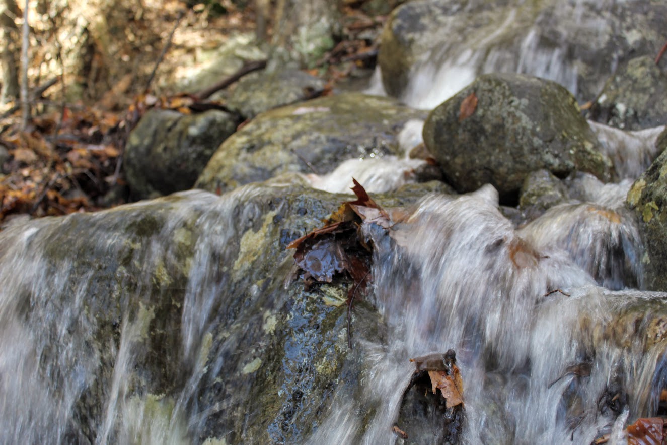
The hike begins up the Falls Cut Off Trail (blue/red markers) on the left. The beginning of the trail is difficult and there is an immediate steep incline up past the falls. The beginning of the trail is difficult and there is an immediate steep incline up past the falls. There was a huge rain storm the day before so the waterfalls were roaring. An awesome visual after 10 minutes into the hike. Though, the rocks were really slippery. Once reaching the top of the falls, turn left on the double marked Blue and Blue/Yellow markers, which is the Jessie Gerard Trail. Continuing straight ahead on the Blue/Yellow,do not veer toward Warner Road. After another half mile, boom shakalaka we emerged into the Grand Vista outlook. Magnificent views with all the fall colors. We continued following the Blue/Yellow for another half mile to the Chaughum Lookout for more awesome views.
From here, stay on the Blue/Yellow Trail. We went between the 2 Veeder glacial erratics aka big boulder rocks. Shortly after, take a right onto Greenwoods Road. This is where the Jessie Gerard Trail ends. Then turn left on the Charles Pack Trail, also Blue/Yellow markings.
Another half mile later, turn onto Beaver Brook Road. This is where things got interesting. Following the road, the map says turn right onto the Blue/Orange, Agnes Bowen Trail, on your right after a half mile. When we came up to this, it was nothing but forest. No sign of a trail. We walked up and down and this was the spot. However, I don’t know where the trail would connect. We decided to keep walking up Beaver Brook Road and take a right up the road. Eventually, we caught up with the Blue/Orange trail where we would have come out to the road.
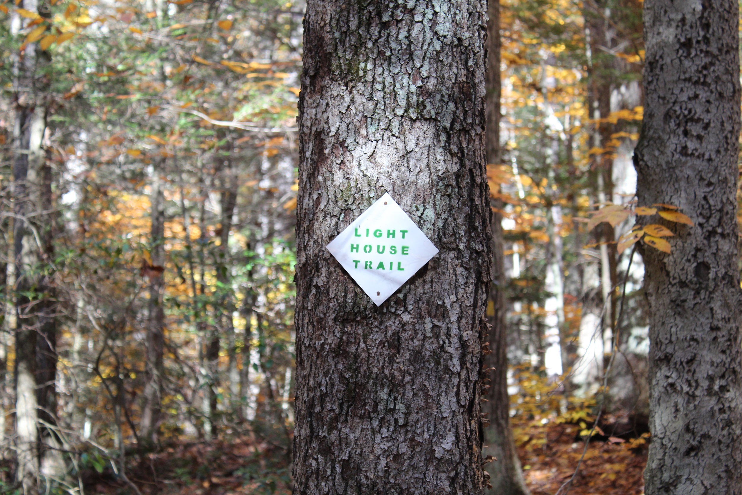
We jumped on the Blue/Orange to the left until we reached the Robert Ross Trail (Blue markers). Turn right here onto the Blue. The trail we will begin to ascend and descend. A tough part of the hike but way better than going down the other way. Keep your eye out on the colors on the trees. We got a little stumped here as the Blue/Yellow connects with the Blue. However, staying straight on the Blue the trail switchbacks downhill to the Lighthouse Trail (Yellow). Of course, another trail. Fortunately, this was the home stretch. We passed a few kiosks with educational info but we were ready for the post hike meal. This will take you back to the Blue/Red and right to the parking lot.


HIKING FOR DONUTS
A blog for the outdoors foodie enthusiast
Hi, I’m Mark. I live in Connecticut. I take new trips every chance I get. A good trip has a great hike, great food, and something fun to do. My goal is to search out new trips and share them to inspire others to try something new and exciting.
If you are looking for posts in a particular place, search by city or state here.
EXPLORE OTHER POSTS IN THE ARCHIVE
Archive
RECOMMENDED POSTS

MOST RECENT POSTS
SEE THE LATEST ON INSTAGRAM AND FOLLOW @HIKINGFORDONUTS